Maps
76
2,896
to
582
2,785
108
2,896
2,896
2,896
21
9
1
1
2,897
2,121
414
5
229
32
11
85
7
57
7
3
3
4
5
2
2,880
15
5
4
3
189
69
55
36
28
63
26
16
13
13
Maps For Sale
Period: 18th Century
Period: 17th Century
Period: 15th Century and Earlier
Period: 16th Century
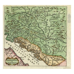
Antique Map of Pannonia and Illyria by Cluver, 1685
Located in Langweer, NL
Antique map titled 'Pannonia et Illyricum.' Charming miniature map of Pannonia and Illyria, from the pocket atlas 'Introductionis in Universam Geographiam tam Veterem quam novam .. A...
Category
17th Century Antique Maps
Materials
Paper
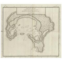
Antique Map of Christmas Island by Cook, C.1781
Located in Langweer, NL
Antique map Kiribati titled 'Christmas Island (..)'. Antique map of Christmas Island, also known as Kiritimati. Originates from an edition of Cook's Voyages.
Artists and Engravers: Engraved by Duff.
Condition: Good, some wear and age-related toning. Please study image carefully.
Date: c.1781
Overall size: 27.5 x 21.5 cm.
Image size: 20.5 x 18 cm.
We sell original antique maps to collectors, historians, educators and interior decorators all over the world. Our collection includes a wide range of authentic antique maps...
Category
18th Century Antique Maps
Materials
Paper
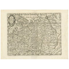
Antique Map of Russia by N. Sanson, 1705
Located in Langweer, NL
A strongly engraved map of European Russia showing its political divisions, major topographical features, cities and towns. Extends to the Sea of Azov and the tip of the Caspian Sea ...
Category
Early 18th Century Antique Maps
Materials
Paper
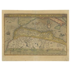
Antique Map of North Africa by Ortelius, c.1580
Located in Langweer, NL
Antique map titled 'Barbariae et Biledulgerid Nova Descriptio'. Original antique map of North Africa. The map covers the regions of Barbaria and Biledulgerid, essentially the territo...
Category
16th Century Antique Maps
Materials
Paper
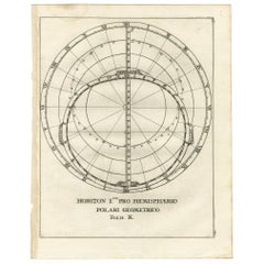
Antique Map Depiciting a Horizon or Hemisphere c.1703
Located in Langweer, NL
Antique map depiciting a horizon/hemisphere. Printed for Scherer's 'Atlas Novus' (1702-1710).
Artists and Engravers: Heinrich Scherer (1628-1704) was a Professor of Hebrew, Mathematics and Ethics at the University of Dillingen until about 1680. Thereafter he obtained important positions as Official Tutor to the Royal Princes...
Category
18th Century Antique Maps
Materials
Paper
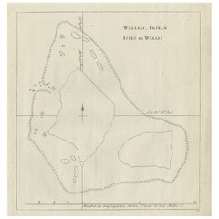
Antique Map of the Wallis and Futuna Islands, French Overseas Territory, 1778
Located in Langweer, NL
Antique map titled 'Walliss Inseln, Isles de Wallis'. Old map of the Wallis and Futuna Islands, officially Territory of the Wallis and Futuna Islands, French overseas territory. The ...
Category
18th Century Antique Maps
Materials
Paper
Antique Map of Coiba Island, Panama, South America, C.1740
Located in Langweer, NL
Antique map titled 'Plan de la partie orientale de l'Isle de Quibo'. Map of the eastside of Coiba Island (Quibo), Panama, showing the shoreline around Port de Dames indicating soft s...
Category
18th Century Antique Maps
Materials
Paper
Rare Antique Map of Yam Suph, Egypt and Red Sea, 1773
Located in Langweer, NL
Antique print with two maps titled 'Uittreksel van de Kaart van Egipten en de Roode Zee' and 'Uittreksel uit de Kaart van Chrysanthus'. The left image shows Yam Suph, the body of wat...
Category
18th Century Antique Maps
Materials
Paper
Scarce Antique Map of Greece, the Aegean, Crete and part of Asia Minor
Located in Langweer, NL
Original antique map titled 'Exactissima totius Archipelagi nec non Graeciae Tabula'. Visscher's scarce map of the Greek Islands, the Aegean, Crete and part of Asia Minor. Published circa 1680.
Among the many great Dutch map publishers active in the seventeenth century were the Visscher family; the firm was begun by Claes Jansz Visscher...
Category
Late 17th Century Antique Maps
Materials
Paper
Antique Map of the Beaujolais Region by Homann Heirs, 1762
Located in Langweer, NL
Antique map titled 'La Generalite Proprie Taire De Lyon (..) - Propriae Lugudunensis Generalitatis (..)'. Detailed regional map of the Beaujolais region including the cities of Lyon,...
Category
18th Century Antique Maps
Materials
Paper
Rare Map of Rama or Ramma 'Ramallah?' in Palestine or the Holy Land, ca.1730
Located in Langweer, NL
Antique map titled 'Rama'.
This maps shows a view of Ramma (Ramallah?) in Palestine or the Holy Land. With Dutch legend. Source unknown, to be determined.
Artists and Engraver...
Category
1730s Antique Maps
Materials
Paper
Antique Map of the Middle East by Mortier, 1700
Located in Langweer, NL
Antique map titled 'Carte de la Situation du Paradis Terrestre (..)'. Detailed map of the Holy Land and the Middle East, centered on the Garden of Eden and including a large Cyprus. ...
Category
18th Century Antique Maps
Materials
Paper
Very Rare Antique Print of the City of Nice in France, c.1700
Located in Langweer, NL
Antique print titled 'Nicaea Civitas'. Original antique print with a view of the city of Nice, France. Rare in this edition. Source unknown, to be determined.
Artists and Engraver...
Category
17th Century Antique Maps
Materials
Paper
Old Map of the Cook Islands Takutea, Atiu, Mangaiac and Tubuai, Polynesia, 1781
Located in Langweer, NL
Antique map titled 'Mangeea Island, Toobouai Island (..)'. Map of three of the Cook Islands: Wanooaette [i.e. Takutea] Island, Wateeoo [i.e. Tui or Atiu] ...
Category
18th Century Antique Maps
Materials
Paper
Antique Plan of the Harbour of Taloo by Cook, c.1781
Located in Langweer, NL
Antique map titled 'Sketch of the Harbours on the North Side of Eimeo (..)'. Plan of the harbour of Taloo in the Island of Moorea, one of the Society Islands, French Polynesia. Origi...
Category
18th Century Antique Maps
Materials
Paper
Antique Map of Port Pallisers & Kersmis by Cook, c.1781
Located in Langweer, NL
Antique map Kerguelen titled 'Sketch of Port Palliser on Kerguelen's Land (..)'. Antique map of Port Pallisers & Kersmis, Kerguelen or Desolation Islands. Originates from an edition ...
Category
18th Century Antique Maps
Materials
Paper
Original Antique Hand-Colored Print of Various Apples, 1758
Located in Langweer, NL
Antique print depicting apple variaties including Witte Kruid-Appel, Rode Somer-Calville, Rode Jopen, Witte Somer-Calville, Somer Citroen Appel, Somer Kroon, Engelse Carolyn, Roos-Ap...
Category
18th Century Antique Maps
Materials
Paper
Original Antique Engraving of the Creation of the World According to Mozes, 1725
Located in Langweer, NL
Antique map titled 'De Schepping der Wereldt volgens de Beschryving van Mozes' - This plate shows the creation of the world according to Moses. The upper depiction shows the world wi...
Category
18th Century Antique Maps
Materials
Paper
French Map of Paris, Musuem Carnavalet Rossingol University Map, 1576
Located in Gardena, CA
French Map of Paris, Musuem Carnavalet Rossingol University Map, 1576.
Map of Paris, France - English: Map of Paris (1576) / museum Carnavalet Rossignol, it is the true fortrict o...
Category
16th Century French Antique Maps
Materials
Paper
Antique Print of the Fortress at the Nile 'Damietta, Egypt' by C. Niebuhr, 1774
Located in Langweer, NL
Antique print titled 'Castelle an dem Ausflus des Nîls nicht weit von Damiât'. Translated: 'Fort at the estuary of the Nile near Damietta, Egypt'. This print originates from 'Reisebe...
Category
Late 18th Century Antique Maps
Materials
Paper
Antique Map of the Harbour of Tongatabu by Cook, C.1783
Located in Langweer, NL
Antique map titled 'Sketch of Tongataboo Harbour (..)'. Antique map of the harbour of Tongatabu, one of the Tonga Islands. Originates from an edition of Cook's Voyages.
Artists an...
Category
18th Century Antique Maps
Materials
Paper
1714 Henri Chatelain "Nouvelle Carte Des Etatas Du Grand.Duc De Mos Moscovie Eur
Located in Norton, MA
A 1714 Henri Chatelain map, entitled
"Nouvelle Carte Des Etatas Du Grand Duc De Moscovie En Europe,"
Ricb001
Henri Abraham Chatelain (1684-1743) was a Huguenot pastor of Parisi...
Category
Early 18th Century Dutch Antique Maps
Materials
Paper
Striking Antique Map Centered on the Malay Peninsula
Located in Langweer, NL
Antique map titled 'D'Indiaanze Landschappen Zeen en Eylanden, van Couchin af tot in de Moluccos (...)'. Striking map of the region from the Philippines and Formosa to India and the ...
Category
Early 18th Century Antique Maps
Materials
Paper
Antique Map Plan of Town and Mole of CAP D'agde & Fort De Brescou, France, 1759
Located in Langweer, NL
Antique Plan titled 'Plan of the Town and Mole of Agde with the Fort de Brescou'. Antique town plan of Agde, engraved for the Geographical Dictionary, by Rol...
Category
Mid-18th Century Antique Maps
Materials
Paper
Engraving of Tienen in the province of Flemish Brabant, in Flanders, Belgium
Located in Langweer, NL
Antique map titled 'Thienen'. Old map of Tienen showing the siege of Tienen in 1588. This map originates from 'La genealogie des illustres comtes de Nassau' by Jan Jansz. Orlers.
...
Category
17th Century Antique Maps
Materials
Paper
Antique Hand-Colored Print of the Labyrinth of Versailles, c.1720
Located in Langweer, NL
Antique print titled 'Le Serpent à plusieurs Testes: dans le Labyrinte de Versailles'. This print illustrates the fable 'The Snake with several heads' of the labyrinth of Versailles ...
Category
18th Century Antique Maps
Materials
Paper
Nicely Colored Antique Print of Guangzhou in China, 1748
Located in Langweer, NL
Antique print titled 'Vuë de Quang-Cheu-Fu ou Canton'. View of Guangzhou (Canton), China. This print originates from 'Histoire générale des voyages' by A. Prévost.
Artists and Engr...
Category
18th Century Antique Maps
Materials
Paper
Antique Hand-Colored Print of the Common Hazel, 1758
Located in Langweer, NL
Antique print of the common hazel. Originates from 'Pomologia' by J. H. Knoop.
Artists and Engravers: Published by Johann Hermann Knoop (c.1700-1769).
Condition: Good, general ...
Category
18th Century Antique Maps
Materials
Paper
Antique Hand-Colored Print of Currants, 1758
Located in Langweer, NL
Antique print of white, black and red currants. Originates from 'Pomologia' by J. H. Knoop.
Artists and Engravers: Published by Johann Hermann Knoop (c.1700-1769).
Condition: G...
Category
18th Century Antique Maps
Materials
Paper
Original Antique Engraving of the Eastern Hemisphere, c.1700
Located in Langweer, NL
Antique map titled 'Proiectio Optica Aequinoctia lis Hemishaerii Orientalis' - Map of the Eastern Hemisphere with Africa, Europe, Asia and Nova Hollandia...
Category
17th Century Antique Maps
Materials
Paper
Antique Map of Biblical Palestine with Inset of Israel's 12 Tribes, 1758
Located in Langweer, NL
Antique map titled 'De IIIde Landkaart 't land Kanaan en Gilead onder de XII stammen Israëls verdeelt.' Map of biblical Palestine. Inset map of the land of Israel divided in 12 tribes...
Category
18th Century Antique Maps
Materials
Paper
Antique Print of Gibraltar Showing the Spanish and English Fleet, 1782
Located in Langweer, NL
Antique print titled 'Perspective View of Gibraltar. With the the Disposition of the Spanish Attack, and Relief of the Garrison by the English Fleet under the command of Admiral Darby, 12 April 1781'. View of the island clearly showing the fortifications, during a bombardment, with the Spanish encampments on the left wing of the bay and a few Spanish ships...
Category
18th Century Antique Maps
Materials
Paper
Antique Map of North and East Asia, 1751
Located in Langweer, NL
Map 2: 'Carte des parties nord et est de L'Asie'. (Map of the Northern parts and East Asia.) Five maps on one sheet, showing California, Alaska and Siberia, Korea and Japan. South to...
Category
18th Century Antique Maps
Materials
Paper
Detailed Antique Map of Western Belgium and Eastern France by Coronelli, 1690
Located in Langweer, NL
Antique map titled 'Contado d'Hannonia (..)'. Map of western Belgium and eastern France, from south of Brussels (not shown) to Cambrai, France, generally centered around the towns of...
Category
17th Century Antique Maps
Materials
Paper
Original Hand-Colored Antique Print of Various Apples, 1758
Located in Langweer, NL
Antique print depicting apple variaties including the Borsdorsser Appel, Goud-Reinet, Krappe-Kruin, Nelguin, Reinette de Montbron, Caracter Appel, Soete Veentje, Courtpendu Rouge, An...
Category
18th Century Antique Maps
Materials
Paper
Antique Map of Brabant, the Netherlands, with Original Hand Coloring
Located in Langweer, NL
Original antique map titled 'Novissima et Accuratissima Brabantiae Ducatus Tabula'. Old map of Brabant, the Netherlands. North is to the right. Like all other maps of Brabantiae Duca...
Category
Mid-17th Century Antique Maps
Materials
Paper
Rare Antique Engraving of the University City of Leiden, The Netherlands, c.1625
Located in Langweer, NL
Antique print titled 'Leijden in Hollandt'. Old print of the city of Leiden, the Netherlands. This print originates from 'Thesaurus philopoliticus oder Politisches Schatzkästlein'. T...
Category
17th Century Antique Maps
Materials
Paper
Map Turkey in Europe & Hungary Thomas Kitchin, 1783
Located in BUNGAY, SUFFOLK
Thomas Kitchen (1718 - 1784) : Map of Turkey in Europe & Hungary 1783
Visible sheet within the cream mount 25.5cm., 10" height 20cm., 8"
In an ebonised frame length 33cm. 13", height 28cm., 11"
Kitchin, Thomas (1718 - 1784)
Thomas Kitchin (August 4, 1718 – June 23, 1784) was a London based engraver, cartographer, and publisher. He was born in London to a hat-dyer of the same name. At 14, Kitchin apprenticed under Emanuel Bowen, under whom he mastered the art of engraving. He married Bowen daughter, Sarah Bowen, and later inherited much of his preceptor's prosperous business. Their son, Thomas Bowen Kitchin, also an engraver joined the family business, which thereafter published in Thomas Kitchin and Son. From 1858 or so Kitchin was the engraver to the Duke of York, and from about 1773 acquired the title, 'Royal Hydrographer to King George III.' He is responsible for numerous maps published in the The Star, Gentleman's Magazine, and London Magazine, as well as partnering with, at various times, with Thomas Jefferys, Emmanuel Bowen, Thomas Hinton, Issac Tayor, Andrew Dury, John Rocque, Louis de la Rochette, and Alexander Hogg, among others. Kitchin passed his business on to his son, Thomas Bowen Kitchin, who continued to republish many of his maps well after his death. Kitchin's apprentices included George Rollos...
Category
18th Century English Georgian Antique Maps
Materials
Paper
Antique Print of Fort Brittenburg by Guiccardini, 1612
Located in Langweer, NL
Antique print titled 'Ruinarum Arcis Britannica Apud Batavos Typus.' Old print of the ruins of the Roman fortress Brittenburg near Katwijk, The Netherlands. Source unknown, to be det...
Category
17th Century Antique Maps
Materials
Paper
Antique Detailed Map of Jerusalem in Israël with Extensive Key and Scale, 1698
Located in Langweer, NL
Antique map titled 'Jerusalem.'
Plan of the ancient city of Jerusalem. With extensive key and scale. Source unknown, to be determined.
Artists and Engravers: Made by 'Cornelis de...
Category
17th Century Antique Maps
Materials
Paper
Map Holy Promise Land Canaan Richard Palmer Richard Blome 1687 Joseph Moxon
Located in BUNGAY, SUFFOLK
Canaan comonly called the Holy Land or the Land of Promise, being the Possesion of the Israelites & travelled through by Our Lord & Saviour Iesus Christ and his Apostles. Engraven by Richard Palmer for Richard Blome. 1687
Blome, Richard, 1641-1705. London. 283 x 452 mm. Copperplate.
Probably from an English Bible...
Category
17th Century British Baroque Antique Maps
Materials
Paper
Original Antique Map of Utrecht in the Netherlands by Blaeu, C.1645
Located in Langweer, NL
Antique map titled 'Ultraiectum Dominium'. Old map of the province of Utrecht, the Netherlands. This map originates from 'Theatrum Orbis Terrarum (..)'.
Artists and Engravers: Wi...
Category
17th Century Antique Maps
Materials
Paper
Antique Map of France by Tirion, c.1740
Located in Langweer, NL
Antique map titled 'Nieuwe Kaart van Frankryk.' - Attractive detailed map showing France. Title in block-style cartouche with a simple compass rose. Source unknown, to be determined....
Category
18th Century Antique Maps
Materials
Paper
Rare Original Antique Ptolemy Map of Ceylon, Present Day Sri Lanka
Located in Langweer, NL
Original antique map titled 'Tab XII Asiae Taprobanam (..)'. For this map of Toprobana (Sri Lanka), Ptolemy drew on the accounts of travelers and sailors and though the information was secondhand and often inaccurate, it represented the most advanced account of the world's geography at that time. This map depicts the island with the typical misconceptions of the period with the enlarged island straddling the Equator and nearly divided by a ridge of mountains. A small part of India is incorrectly shown in the northeast corner of the map and a spurious coastline labeled Gangem fills the upper right corner. The stipple engraved sea contains an oriental ship...
Category
Late 17th Century Antique Maps
Materials
Paper
Antique 17th Century Map of the Islands Near Ceylon or Sri Lanka, 1672
Located in Langweer, NL
Antique map titled 'Eyland Ceylon.' Map of the islands near Ceylon or Sri Lanka. Dutch text on verso. Source unknown, to be determined.
Artists and Engravers: Philip Baldaeus (1632-...
Category
17th Century Antique Maps
Materials
Paper
Old Antique Print showing a Rostral Column in Rome, Italy, 1704
Located in Langweer, NL
Antique print, titled: 'Basis Columnae Rostratae (?)' - This original old antique print shows a rostral column in Rome, Italy. It is a type of victory column, originating in ancient Greece and Rome where they were erected to commemorate a naval military victory. This original old antique print / plate originates from: 'Beschryving van Oud en Nieuw Rome. Verdeelt in drie Deelen. In 't Fransch beschreven door den Heer Francois Desseine. En in 't Nederduitsch vertaalt.', by Francois Desseine and published by Francois Halma in 1704, first published in French in 1690. Copies of this work are rarely complete as the maps and engravings are of high quality matching the work of Piranesi. Artists and Engravers: Made by 'P. Sluiter' after 'Jan Goeree'. Made by P. Sluiter after Jan Goeree. Jan Goeree (1670-1731) was a Dutch engraver and poet. He was the son of the Middelburg bookseller Willem Goeree. Born in Middelburg, but soon they moved to Amsterdam. Initially he focussed on painting, assumably a student of Gerard de Lairesse. But he is best known for his engraving skills, depicting mosttly emblematic and historic scenes. In 1705 he was commisioned by the Mayor of Amsterdam to design the drawings for the ceiling paintings for the grand hall of the old city hall...
Category
18th Century Antique Maps
Materials
Paper
Antique Map of the Tunquin River and Bay to Cacho, the Capital City, Siam, 1758
Located in Langweer, NL
Antique map titled ‘Kaart van den Loop der Rivier van Tonkin van Cacho tot aan de Zee / Carte du Cours de la Riviere de Tunquin Depuis Cacho jusqu'à la Mer J. v. Schley direx.’ Detailed map of the Tunquin River and Bay, extending north to Cacho, the capital...
Category
18th Century Antique Maps
Materials
Paper
Antique Map of Greece, Albania, Macedonia and Parts of Turkey and Cyprus, c.1745
Located in Langweer, NL
Antique map titled 'Accurata Totius Archipelagi Et Graeciae Universae Tabula'.
Detailed map of Greece. Includes Albania, Macedonia and parts of Turkey and Cyprus. With compass rose...
Category
18th Century Antique Maps
Materials
Paper
Old Map of the Kingdoms of Fez, Algiers, Segelmese, Tafilet and Morocco, ca.1760
Located in Langweer, NL
Antique map titled 'A Map of the Empire of Morocco Comprehending the Kingdoms of Fez, Morocco'.
Original antique map of the kingdoms of Fez, Algiers, Segelmese, Tafilet and Moroc...
Category
1760s Antique Maps
Materials
Paper
Old Map of the Mughal Empire, Persia in the West to Lake Chimay etc., ca.1685
Located in Langweer, NL
Antique map titled 'L'Empire du Grand Mogol'. Old map of India and Central Asia.
The map extends from Persia in the West to Lake Chimay and the Bay of Bengal...
Category
1680s Antique Maps
Materials
Paper
Antique Print of the Capital of Friesland Leeuwarden, The Netherlands, c.1670
Located in Langweer, NL
Antique print titled 'Lewarden.' A bird's eye view of Leeuwarden (Friesland, the Netherlands). Views of Jollain are scarse and sought after by collectors.
Artists and Engravers: M...
Category
17th Century Antique Maps
Materials
Paper
17th Century John Speed Map of Denbighshire, c.1610
By John Speed
Located in Royal Tunbridge Wells, Kent
Antique early 17th century British very rare and original John Speed, hand coloured map of Denbighshire, dated 1610, by John Sunbury and George Humble. John...
Category
17th Century British Antique Maps
Materials
Wood, Paper
Old Map Depicting Turkey, Persia, Arab and Black Sea Etc, 1778
Located in Langweer, NL
Antique map titled 'Turquie d'Asie, Arabie, Perse, Tartarie Independante'.
Old map of Turkey in Asia. The map shows all of Turkey and the Black Sea, and extends east to include t...
Category
1770s Antique Maps
Materials
Paper
Original Antique Map of Ancient Greece, Phocis, Gulf of Corinth, 1787
Located in St Annes, Lancashire
Great map of Ancient Greece. Showing the region of Phocis, including the Gulf of Corinth
Drawn by J.D. Barbie Du Bocage
Copper plate engraving by P.F Tardieu
Original hand c...
Category
1780s French Other Antique Maps
Materials
Paper
Striking Antique View of Kozhikode, also known as Calicut, in Kerala, India
Located in Langweer, NL
Antique print titled 'Calechut'. Wonderful, miniature copper engraving depicting Arion riding on a very cheerful looking sea monster in the important trading center of Calicut harbor...
Category
Mid-17th Century Antique Maps
Materials
Paper
Original Antique Map of Zuid-Holland in the Netherlands by Blaeu, C.1645
Located in Langweer, NL
Antique map titled 'Zuydhollandia stricte sumta'. Old map of the province of Zuid-Holland, the Netherlands. This map originates from 'Theatrum Orbis Terrarum (..)'.
Artists and E...
Category
17th Century Antique Maps
Materials
Paper
Antique Print of a Funeral on Ceylon 'Sri Lanka' is Asia, 1672
Located in Langweer, NL
Untitled print of the death of the prince heir, and his burial. Two prints, one with a long burial train including numerous horses, carrying the coffin, covered with cloth. The other...
Category
17th Century Antique Maps
Materials
Paper
Rare Handcolored Map of Isle de Juan Fernandes 'Robinson Crusoe Island', Chili
Located in Langweer, NL
Antique map titled 'Die Insel Iuan Fernandes in der Sudsee (..)'. This map depicts Robinson Crusoe, one of the Juan Fernández Islands.
Robinson Crusoe Island, formerly known as Más a Tierra, is the second largest of the Juan Fernández Islands. From 1704 to 1709, the island was home to the marooned sailor Alexander Selkirk, who at least partially inspired novelist Daniel Defoe's fictional Robinson Crusoe in his 1719 novel, although the novel is explicitly set in the Caribbean.
This was just one of several survival stories from the period of which Defoe would have been aware. To reflect the literary lore associated with the island and attract tourists, the Chilean government renamed the place Robinson Crusoe Island in 1966. This map originates from a German edition of 'Voyage around the World...
Category
Mid-18th Century Antique Maps
Materials
Paper
Recently Viewed
View AllMore Ways To Browse
Antique Sailing Map
Antique Sailing Maps
Bay Area Antique Furniture
West Coat Of Arms
Greek Asia Minor
Hemisphere World Map
Speed Map
Antique Maps Canada
Antique Map Canada
Canada Antique Map
Malaysian Antique
West Indies Map
Blaeu World Map
Charing Cross
Antique Maps Of Canada
Bali Map
Antique Portuguese Plates
Map Of Brazil
