Items Similar to Antique Map of the Region of Bouchain and Cambrai by Visscher 'circa 1680'


Want more images or videos?
Request additional images or videos from the seller
1 of 5
Antique Map of the Region of Bouchain and Cambrai by Visscher 'circa 1680'
$478.25
$597.8120% Off
£354.05
£442.5620% Off
€400
€50020% Off
CA$661.77
CA$827.2220% Off
A$729.59
A$911.9920% Off
CHF 381.70
CHF 477.1220% Off
MX$8,950.71
MX$11,188.3920% Off
NOK 4,804.82
NOK 6,006.0320% Off
SEK 4,493.27
SEK 5,616.5820% Off
DKK 3,046.95
DKK 3,808.6920% Off
About the Item
Antique map titled 'Carte Nouvelle des Environs de Bouchain & Cambray'. Uncommon map of the region of Bouchain and Cambrai (Cambray, France) showing the camps of two armies.
- Creator:Nicolaes Visscher II (Artist)
- Dimensions:Height: 18.71 in (47.5 cm)Width: 23.63 in (60 cm)Depth: 0.02 in (0.5 mm)
- Materials and Techniques:
- Period:Late 17th Century
- Date of Manufacture:circa 1680
- Condition:Original/contemporary hand coloring. Slightly wrinkled and creased. General age-related toning, blank verso. Please study images carefully.
- Seller Location:Langweer, NL
- Reference Number:Seller: BG-12390-511stDibs: LU3054318014072
About the Seller
5.0
Recognized Seller
These prestigious sellers are industry leaders and represent the highest echelon for item quality and design.
Platinum Seller
Premium sellers with a 4.7+ rating and 24-hour response times
Established in 2009
1stDibs seller since 2017
2,609 sales on 1stDibs
Typical response time: <1 hour
- ShippingRetrieving quote...Shipping from: Langweer, Netherlands
- Return Policy
Authenticity Guarantee
In the unlikely event there’s an issue with an item’s authenticity, contact us within 1 year for a full refund. DetailsMoney-Back Guarantee
If your item is not as described, is damaged in transit, or does not arrive, contact us within 7 days for a full refund. Details24-Hour Cancellation
You have a 24-hour grace period in which to reconsider your purchase, with no questions asked.Vetted Professional Sellers
Our world-class sellers must adhere to strict standards for service and quality, maintaining the integrity of our listings.Price-Match Guarantee
If you find that a seller listed the same item for a lower price elsewhere, we’ll match it.Trusted Global Delivery
Our best-in-class carrier network provides specialized shipping options worldwide, including custom delivery.More From This Seller
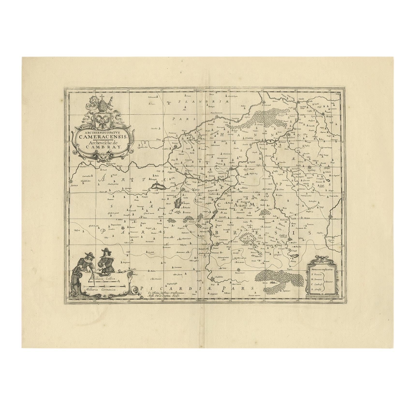
View AllAntique Map of the Cambrai Region by Pitt, circa 1680
Located in Langweer, NL
Antique map titled 'Archiepiscopatus Cameracensis - Archevesche de Cambray'. Decorative map of the Cambrai region of France. This map originates from 'The English Atlas' by Moses Pit...
Category
Antique Late 17th Century Maps
Materials
Paper

$573 Sale Price
20% Off
Antique Map of the Namur Region 'France' by F. de Wit, circa 1680
Located in Langweer, NL
Antique map titled 'Comitatus Namurci Tabula in Lucem Edita'. Large map of the Namur region, France. Published by F. de Wit, circa 1680.
Category
Antique Late 17th Century Maps
Materials
Paper

$547 Sale Price
20% Off
Antique Map of the Hainaut and Namur Region by Janssonius, 'circa 1640'
By Johannes Janssonius
Located in Langweer, NL
Antique map titled 'Comitatuum Hannoniae et Namurci Descriptio'. Old map of the region of Hainaut and Namur, France. Published by J. Janssonius, circa 1640.
Category
Antique Mid-17th Century Maps
Materials
Paper

$476 Sale Price
20% Off
Antique Map of the Hainaut Region 'France' by F. de Wit, circa 1680
Located in Langweer, NL
Antique map titled 'Comitatus Hannoniae et Episcopatus Cambresis Descriptio'. Large map of the Hainaut region, France. Published by F. de Wit, circa 1680.
Category
Antique Late 17th Century Maps
Materials
Paper

$549 Sale Price
20% Off
Antique Map of the Region of Touraine by Janssonius 'circa 1650'
By Johannes Janssonius
Located in Langweer, NL
Antique map of France titled 'Touraine - Turonensis Ducatus'. Decorative map of the Touraine region, France. It shows the cities of Tours, Amboise and others. Published by J. Jansson...
Category
Antique Mid-17th Century Maps
Materials
Paper

$430 Sale Price
20% Off
Antique Map of Belgium and Northern France by F. de Wit, circa 1680
Located in Langweer, NL
Antique map titled 'Belgii Regii Accuratissima Tabula Pluribus Locis Recens Emen'. Large map of Belgium and Northern France. Published by F. de Wit, circa 1680.
Category
Antique Late 17th Century Maps
Materials
Paper

$619 Sale Price
20% Off
You May Also Like
1635 Willem Blaeu Map of Northern France"Comitatvs Bellovacvm" Ric.a08
Located in Norton, MA
1635 Willem Blaeu map of northern France, entitled.
"Comitatvs Bellovacvm Vernacule Beavvais,"
Colored
Ric.a008
“COMITATVS BELLOVACVM…” Amsterdam: W...
Category
Antique 17th Century Unknown Maps
Materials
Paper

1640 Joan Bleau Map Entitled"Diocecese de rheims et le pais de rethel, " Eic.a011
Located in Norton, MA
1640 Joan Bleau map entitled
"Diocecese de rheims et le pais de rethel,"
Ric.a011
OAN BLAEU
Diocecese de Rheims, et le pais de Rethel.
Handcolored engraving, c.1640.
...
Category
Antique 17th Century Dutch Maps
Materials
Paper

1590 Ortelius Map of Calais and Vermandois, France and Vicinity Ric.a014
Located in Norton, MA
1590 Ortelius map of
Calais and Vermandois, France and Vicinity
Ric.a014
Two rare regional Abraham Ortelius maps on a single folio sheet. Left map, entitled Caletensium, depic...
Category
Antique 16th Century Dutch Maps
Materials
Paper

1643 Willem&Joan Blaeu Map NW Flanders "Flandriae Teutonicae Pars Prientalior
Located in Norton, MA
1643 Willem and Joan Blaeu map of northwest Flanders, entitled
"Flandriae Teutonicae Pars Prientalior,"
Ric0012
" Authentic" - Map of the northwest Fl...
Category
Antique 17th Century Dutch Maps
Materials
Paper

1620 Map of Artois Entitled "Artesia Comitatvs Artois, " by Bleau, Ric.a012
Located in Norton, MA
1640 map of Artois entitled
"Artesia Comitatvs Artois,"
by Bleau
Colored
A-012.
Detailed map of the northern province of Artois, France on the border with Belgium. Feature...
Category
Antique 17th Century Dutch Maps
Materials
Paper

1752 Vaugoundy Map of Flanders : Belgium, France, and the Netherlands, Ric.a002
Located in Norton, MA
Large Vaugoundy Map of Flanders:
Belgium, France, and the Netherlands
Colored -1752
Ric.a002
Description: This is a 1752 Didier Robert de Vaugondy map of Flanders. The map de...
Category
Antique 17th Century Unknown Maps
Materials
Paper

More Ways To Browse
Map Of Austria
Antique Maps Of Africa
Antique Map India
Antique Map Of The South Of France
Antique English Maps
Map Of Ireland
Map Of Great Britain
Miniature Maps
Ancient Maps
Iran Map
Antique Mining
Antique Maps Indonesia
Java Map
Antique Atlas Furniture
Map Railroad
China Map
Victorian Furniture 1920
Antique Maps Amsterdam