Items Similar to Detailed Map of Southern Holland, Incl the Hague, Rotterdam, Delft, Gouda, c1680


Want more images or videos?
Request additional images or videos from the seller
1 of 5
Detailed Map of Southern Holland, Incl the Hague, Rotterdam, Delft, Gouda, c1680
$972.32
$1,494.9634% Off
£717.31
£1,102.8734% Off
€813
€1,25034% Off
CA$1,346.03
CA$2,069.5434% Off
A$1,459.49
A$2,243.9834% Off
CHF 774.53
CHF 1,190.8634% Off
MX$17,975.44
MX$27,637.5234% Off
NOK 9,599.85
NOK 14,759.9134% Off
SEK 9,060.05
SEK 13,929.9634% Off
DKK 6,189.80
DKK 9,516.9134% Off
About the Item
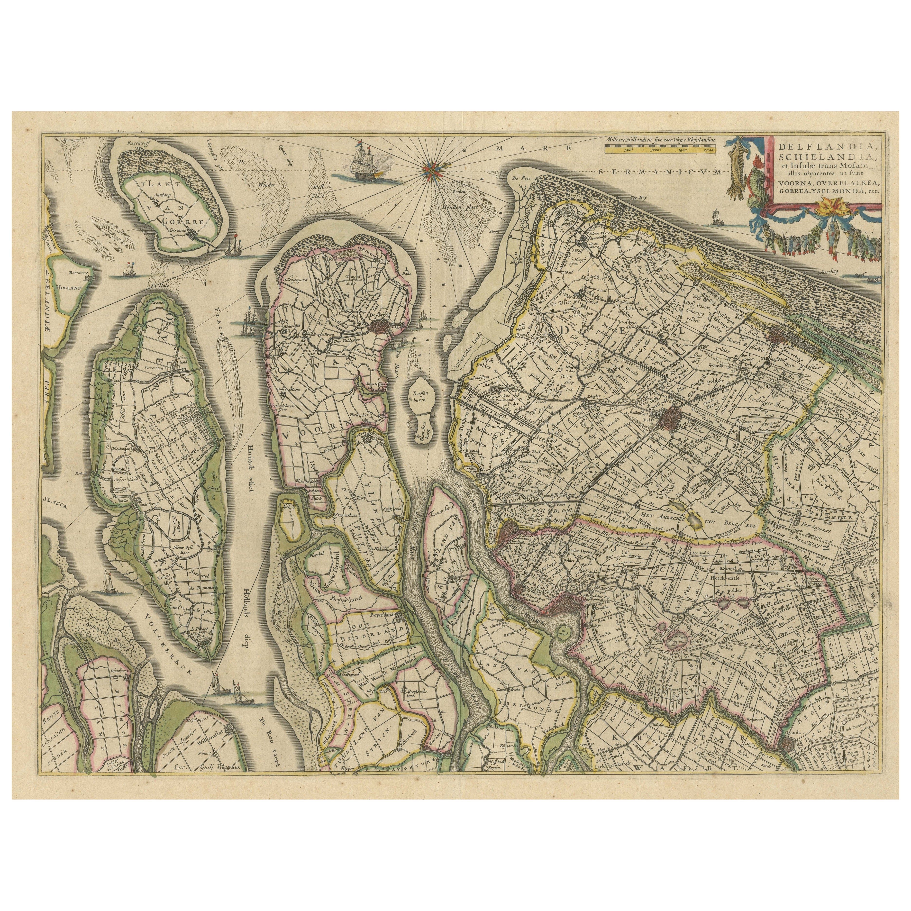
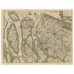
Antique map titled 'Delflandia, Schielandia et circumjacentes Insulae ut Voorna, Overflackea, Goerea, Yselmonda et aliae.'
Detailed map of Southern Holland, which includes the cities of The Hague ('s-Gravenhage), Rotterdam, Willemstad, Gouda and Delft. Ships and naval battles are shown throughout the ports and sea. A pretty decorative cartouche in the upper right corner, a coat of arms is in the lower left. "Atlas Contactus", published by Petrus Schenk Jr.
Artists and Engravers: Made by 'Nicolaes Visscher' after an anonymous artist. Nicolas Visscher I was born 1618 in Wenns, Austria. He died 1679 in Linz. After the death of Nicolas II, his widow passed the business to Pieter Schenk.
Condition: Good, given age. A few very small tears top edge. Middle fold as issued. Two soft vertical creases along the middle fold. General age-related toning and/or occasional minor defects from handling. Please study scan carefully.
- Dimensions:Height: 20.79 in (52.8 cm)Width: 24.14 in (61.3 cm)Depth: 0 in (0.02 mm)
- Materials and Techniques:
- Period:1680-1689
- Date of Manufacture:circa 1680
- Condition:A few very small tears top edge. Middle fold as issued. Two soft vertical creases along the middle fold. General age-related toning and/or occasional minor defects from handling. Please study scan carefully.
- Seller Location:Langweer, NL
- Reference Number:Seller: PC-58060 1stDibs: LU3054326822172
About the Seller
5.0
Recognized Seller
These prestigious sellers are industry leaders and represent the highest echelon for item quality and design.
Platinum Seller
Premium sellers with a 4.7+ rating and 24-hour response times
Established in 2009
1stDibs seller since 2017
2,622 sales on 1stDibs
Typical response time: <1 hour
- ShippingRetrieving quote...Shipping from: Langweer, Netherlands
- Return Policy
Authenticity Guarantee
In the unlikely event there’s an issue with an item’s authenticity, contact us within 1 year for a full refund. DetailsMoney-Back Guarantee
If your item is not as described, is damaged in transit, or does not arrive, contact us within 7 days for a full refund. Details24-Hour Cancellation
You have a 24-hour grace period in which to reconsider your purchase, with no questions asked.Vetted Professional Sellers
Our world-class sellers must adhere to strict standards for service and quality, maintaining the integrity of our listings.Price-Match Guarantee
If you find that a seller listed the same item for a lower price elsewhere, we’ll match it.Trusted Global Delivery
Our best-in-class carrier network provides specialized shipping options worldwide, including custom delivery.More From This Seller
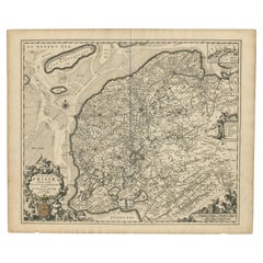
View AllAntique Map of the Province of Friesland in The Netherlands, 1718
Located in Langweer, NL
Antique map titled 'Frisiae Dominium vernacule Friesland (..)'.
Original antique map of Friesland, the Netherlands. Originates from 'Uitbeelding van de Heerlijkheid van Friesland...
Category
Antique 18th Century Maps
Materials
Paper

$717 Sale Price
20% Off
Antique Map of Friesland by De Wit, c.1690
Located in Langweer, NL
Antique map titled 'Tabula Comitatus Frisiae'.
Old map of the province of Friesland, the Netherlands. With a small inset map of the Wadden area. Third state of the map by Schotan...
Category
Antique 17th Century Maps
Materials
Paper

$784 Sale Price
20% Off
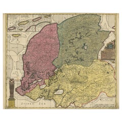
Antique Map of Delfland, Schieland and Islands of Zuid-Holland, the Netherlands
Located in Langweer, NL
Antique map titled 'Delflandia, Schielandia, et Insulae (..)'. Original antique map of Delfland, Schieland and islands of Zuid-Holland, the Netherlands. The 'Zuid-Hollandse Eilanden'...
Category
Antique Mid-17th Century Maps
Materials
Paper
$660 Sale Price
20% Off
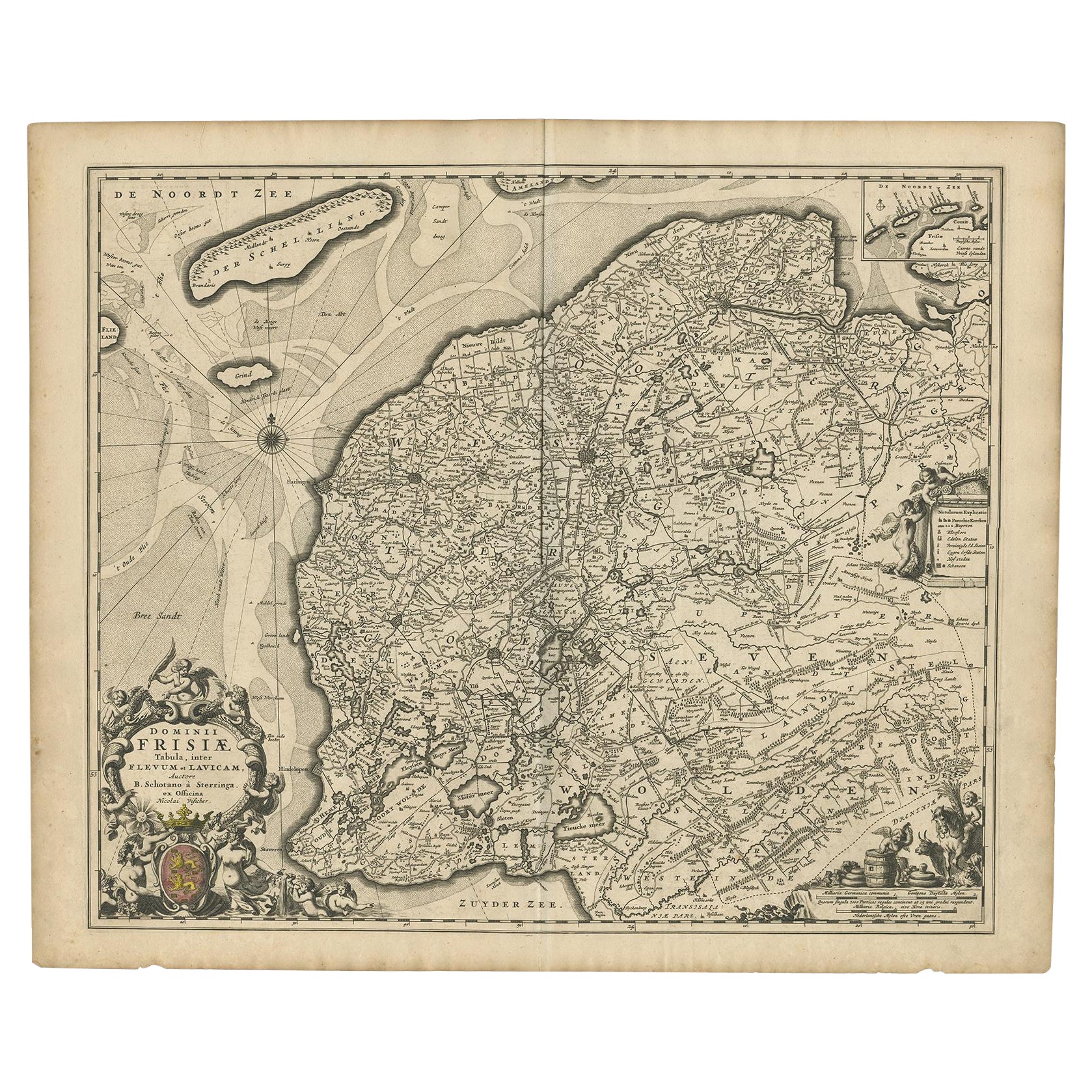
Beautiful First State Map of Friesland, the Netherlands, c.1665
Located in Langweer, NL
Antique map titled 'Dominii Frisiae Tabula, inter Flevum et Lavicam'. Beautiful first state map of Friesland, the Netherlands. With small inset map of the Frisian Wadden islands Vlie...
Category
Antique 17th Century Maps
Materials
Paper
$837 Sale Price
20% Off
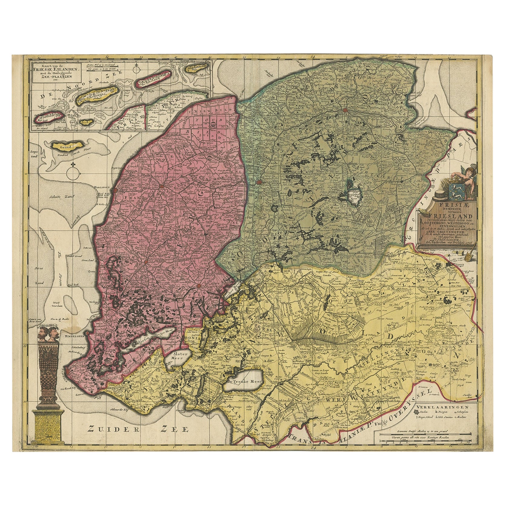
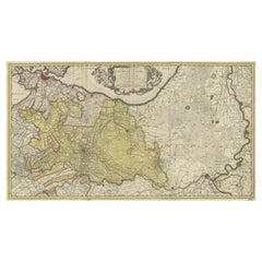
Detailed Map of Friesland, Groningen and Drenthe, The Netherlands, 1706
Located in Langweer, NL
Antique map tited 'Frisiae Dominium vernacule Friesland verdeeld met de hoofd-deelen van Oostergoo, Westergoo en Sevenwolden (..)'. Detailed map of Friesland, Groningen and Drenthe, ...
Category
Antique 18th Century Maps
Materials
Paper
$908 Sale Price
20% Off
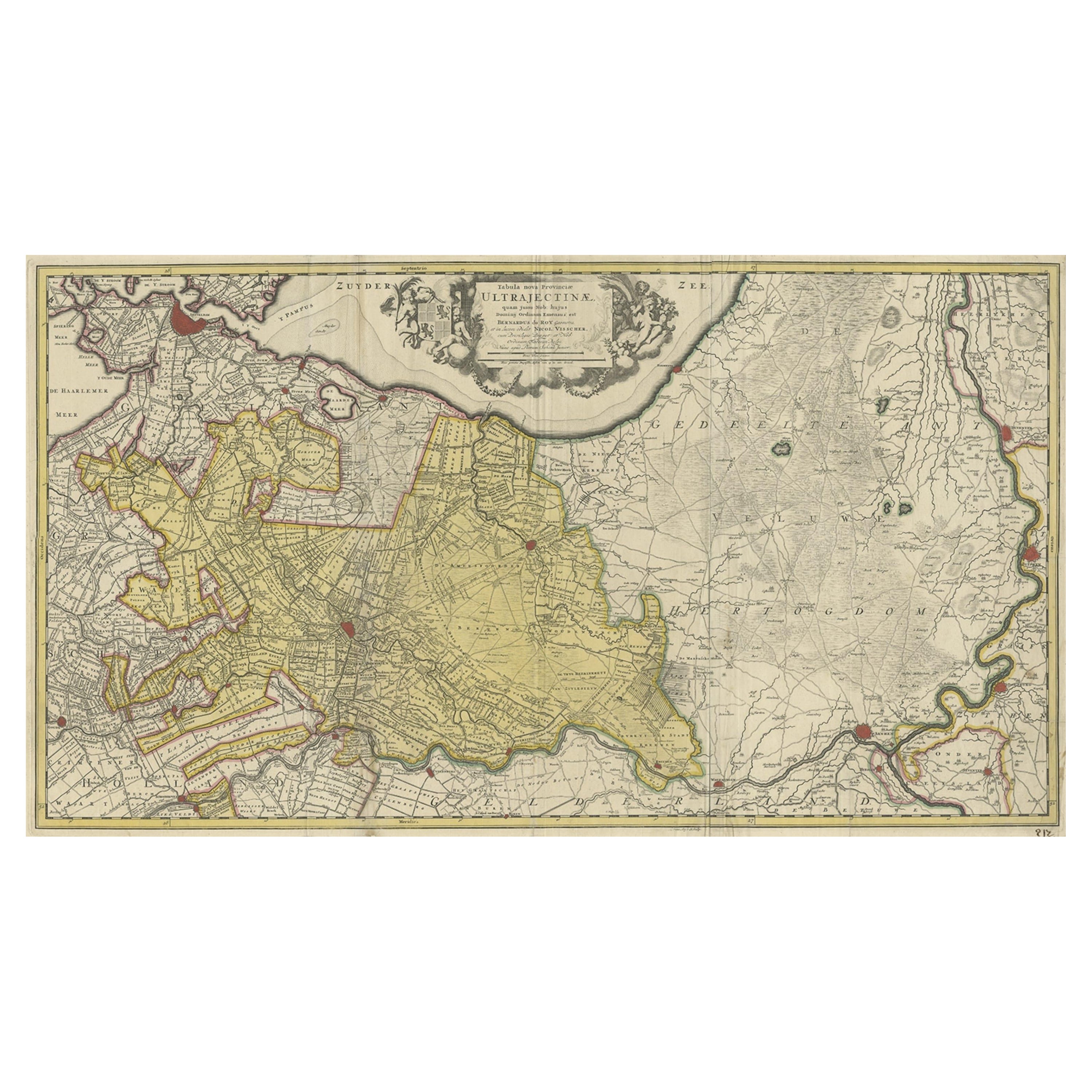
Original Antique Map of the Province of Utrecht, the Netherlands, ca.1720
Located in Langweer, NL
Antique map titled ‘Tabula Nova Provinciae Ultrajectinae (..)’.
Original antique map of the province of Utrecht, the Netherlands. It shows the region of Amsterdam, Utrecht, Gouda, ...
Category
Antique 1720s Maps
Materials
Paper
$755 Sale Price
20% Off
You May Also Like
1752 Vaugoundy Map of Flanders : Belgium, France, and the Netherlands, Ric.a002
Located in Norton, MA
Large Vaugoundy Map of Flanders:
Belgium, France, and the Netherlands
Colored -1752
Ric.a002
Description: This is a 1752 Didier Robert de Vaugondy map of Flanders. The map de...
Category
Antique 17th Century Unknown Maps
Materials
Paper

Rare Original Map of New Amsterdam (New York) – “Restitutio”, ca. 1674 –
Located in Dronten, NL
An exceptionally rare and original 17th-century engraving of New Amsterdam, now New York City, published by the renowned Amsterdam cartographer Carel (Carolus) Allard around 1674. Kn...
Category
Antique 17th Century Dutch Maps
Materials
Paper

1643 Willem&Joan Blaeu Map NW Flanders "Flandriae Teutonicae Pars Prientalior
Located in Norton, MA
1643 Willem and Joan Blaeu map of northwest Flanders, entitled
"Flandriae Teutonicae Pars Prientalior,"
Ric0012
" Authentic" - Map of the northwest Fl...
Category
Antique 17th Century Dutch Maps
Materials
Paper

1633 Map "La Souverainete De Sedan Et De Raucourt, Et La Prevoste Ric0011
Located in Norton, MA
1653 map entitled
"La Souverainete de Sedan et de Raucourt, et la Prevoste de Doncheri,"
Ric0011
Description:
Lovely map centered on Sedan and Doncheri and the Meuze River fr...
Category
Antique 17th Century Dutch Maps
Materials
Paper

Original Antique Map or City Plan of Amsterdam, Netherlands. Circa 1835
Located in St Annes, Lancashire
Nice map of Amsterdam
Drawn and engraved by J.Dower
Published by Orr & Smith. C.1835
Unframed.
Free shipping
Category
Antique 1830s English Maps
Materials
Paper

Southern Holland: An Original 17th C. Hand-colored Visscher Map "Hollandiae"
By Nicolaus Visscher
Located in Alamo, CA
This a beautiful framed hand colored 17th century map of the southern portions of Holland by Nicolaus (Nicolas) Visscher II entitled "Hollandiae pars Meridionalis, vulgo Zuyd-Holland", published in Amsterdam in 1678. The map shows the region between Breda, Heusden, Gornichem, Gouda, Dordrecht, and Willemstad. It includes a decorative cartouche in the lower left corner.
The map is presented in an attractive maple colored wood frame with gold trim and a fabric mat. There is a central vertical fold, as issued. There are small areas of discoloration consistent with age. The map is otherwise in very good condition.
The Visscher family were one of the great cartographic families of the 17th century. Begun by Claes Jansz Visscher...
Category
Late 17th Century Other Art Style Landscape Prints
Materials
Engraving

More Ways To Browse
Naval Ship
Battle Ship
Delft Ship
Australian Colonial
Bengal Map
Stanford Furniture
Tennessee Antique Furniture
Used Furniture Alabama
Used Office Furniture Maine
Ancient World Map
Antique Florida Map
Antique Map Chile
Antique Map Of Georgia
Antique Mississippi Furniture
Burgundy Map
John Speed Antique Maps
Malabar Map
Malaysia Map