Items Similar to Large Topographical and Geological Map of the Teshio Oil Field, '1936'
Want more images or videos?
Request additional images or videos from the seller
1 of 7
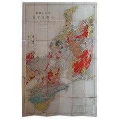
Large Topographical and Geological Map of the Teshio Oil Field, '1936'
$1,145.24
$1,431.5620% Off
£846.59
£1,058.2320% Off
€960
€1,20020% Off
CA$1,588.51
CA$1,985.6420% Off
A$1,731.83
A$2,164.7820% Off
CHF 915.06
CHF 1,143.8320% Off
MX$21,297.40
MX$26,621.7520% Off
NOK 11,378.08
NOK 14,222.6120% Off
SEK 10,710.96
SEK 13,388.7020% Off
DKK 7,309.91
DKK 9,137.3820% Off
About the Item
Topographical and geological map of the Teshio oil field. Shows location of oil well, oil sand, natural gas, coal, Sulphur spring, anticlinal axis, profile line, and fault line.
- Dimensions:Height: 72.64 in (184.5 cm)Width: 38.39 in (97.5 cm)Depth: 0.02 in (0.5 mm)
- Materials and Techniques:
- Period:
- Date of Manufacture:1936
- Condition:Large folding map mounted on linen. General age-related toning, minor wear. Please study images carefully.
- Seller Location:Langweer, NL
- Reference Number:Seller: BG-112081stDibs: LU3054321190502
About the Seller
5.0
Recognized Seller
These prestigious sellers are industry leaders and represent the highest echelon for item quality and design.
Platinum Seller
Premium sellers with a 4.7+ rating and 24-hour response times
Established in 2009
1stDibs seller since 2017
2,620 sales on 1stDibs
Typical response time: <1 hour
- ShippingRetrieving quote...Shipping from: Langweer, Netherlands
- Return Policy
Authenticity Guarantee
In the unlikely event there’s an issue with an item’s authenticity, contact us within 1 year for a full refund. DetailsMoney-Back Guarantee
If your item is not as described, is damaged in transit, or does not arrive, contact us within 7 days for a full refund. Details24-Hour Cancellation
You have a 24-hour grace period in which to reconsider your purchase, with no questions asked.Vetted Professional Sellers
Our world-class sellers must adhere to strict standards for service and quality, maintaining the integrity of our listings.Price-Match Guarantee
If you find that a seller listed the same item for a lower price elsewhere, we’ll match it.Trusted Global Delivery
Our best-in-class carrier network provides specialized shipping options worldwide, including custom delivery.More From This Seller
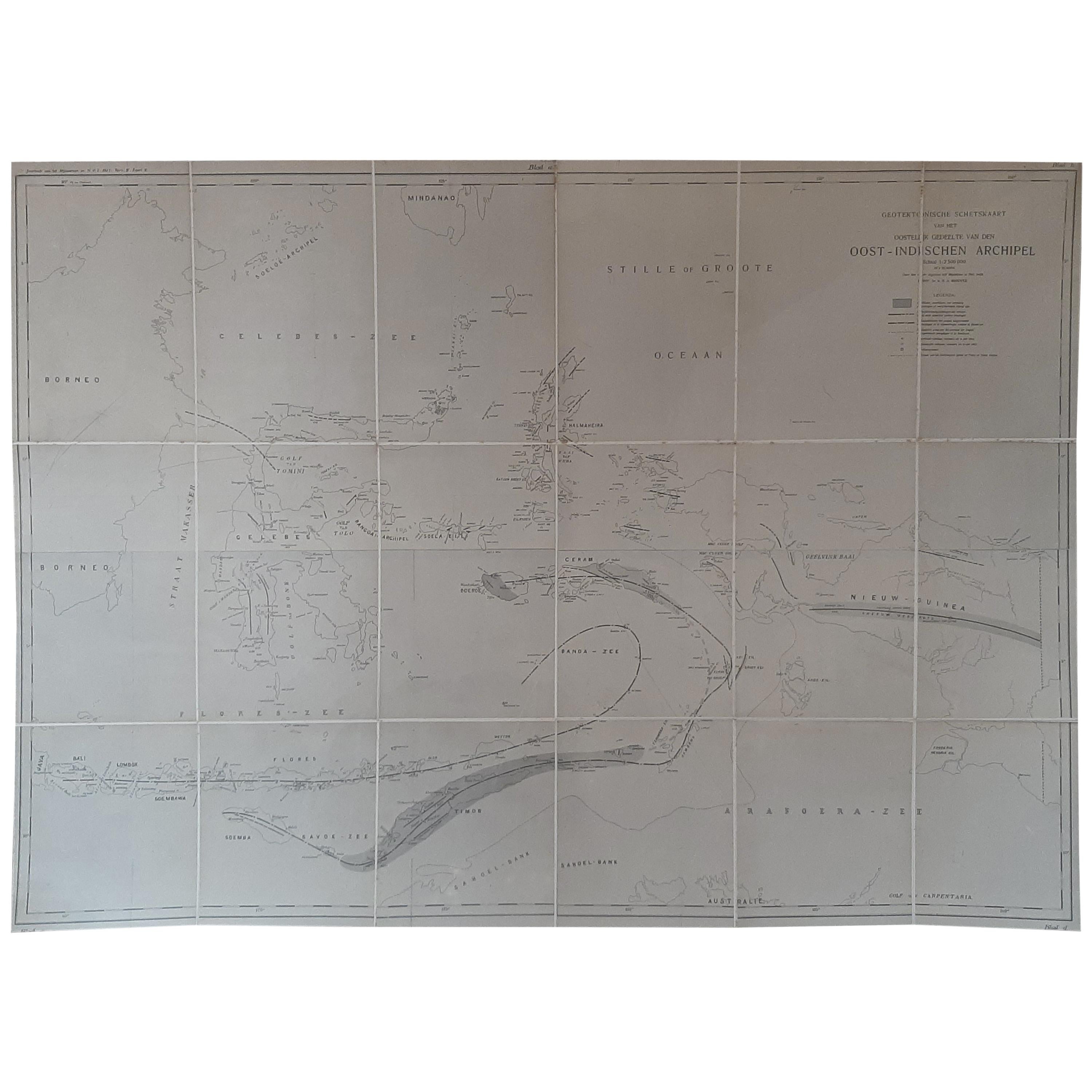
View AllAntique Map of the East Indies by Brouwer, 1917
Located in Langweer, NL
Antique map titled 'Geotektonische Schetskaart van het Oostelijk Gedeelte van den Oost-Indischen Archipel':
**Title**: Geotektonische Schetskaart van het Oostelijk Gedeelte van den ...
Category
Early 20th Century Maps
Materials
Canvas, Paper
$1,145 Sale Price
20% Off
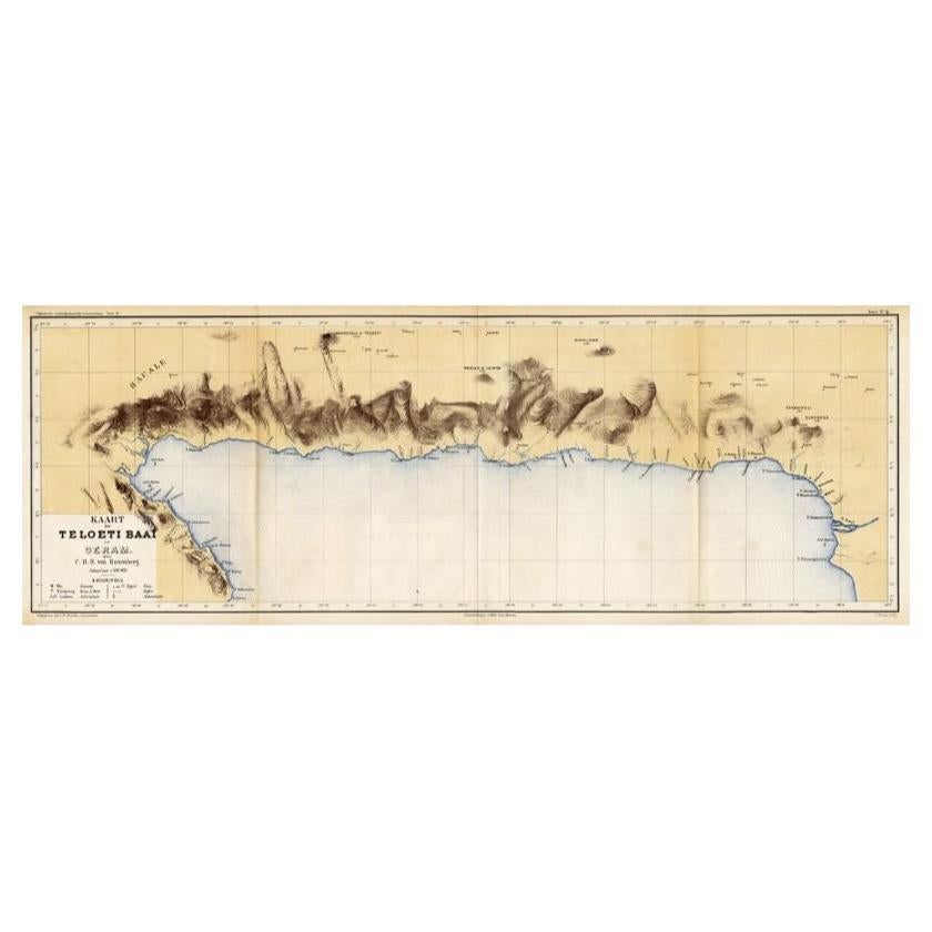
Antique Map of Taluti Bay by Stemler, C.1875
Located in Langweer, NL
Antique map titled 'Kaart der Teloeti Baai op Ceram.' This scarce map shows the Taluti Bay on the Moluccan island of Ceram. Originates from 'Tijdschrift Aardrijkskundig Genootschap',...
Category
Antique 19th Century Maps
Materials
Paper

$117 Sale Price
20% Off
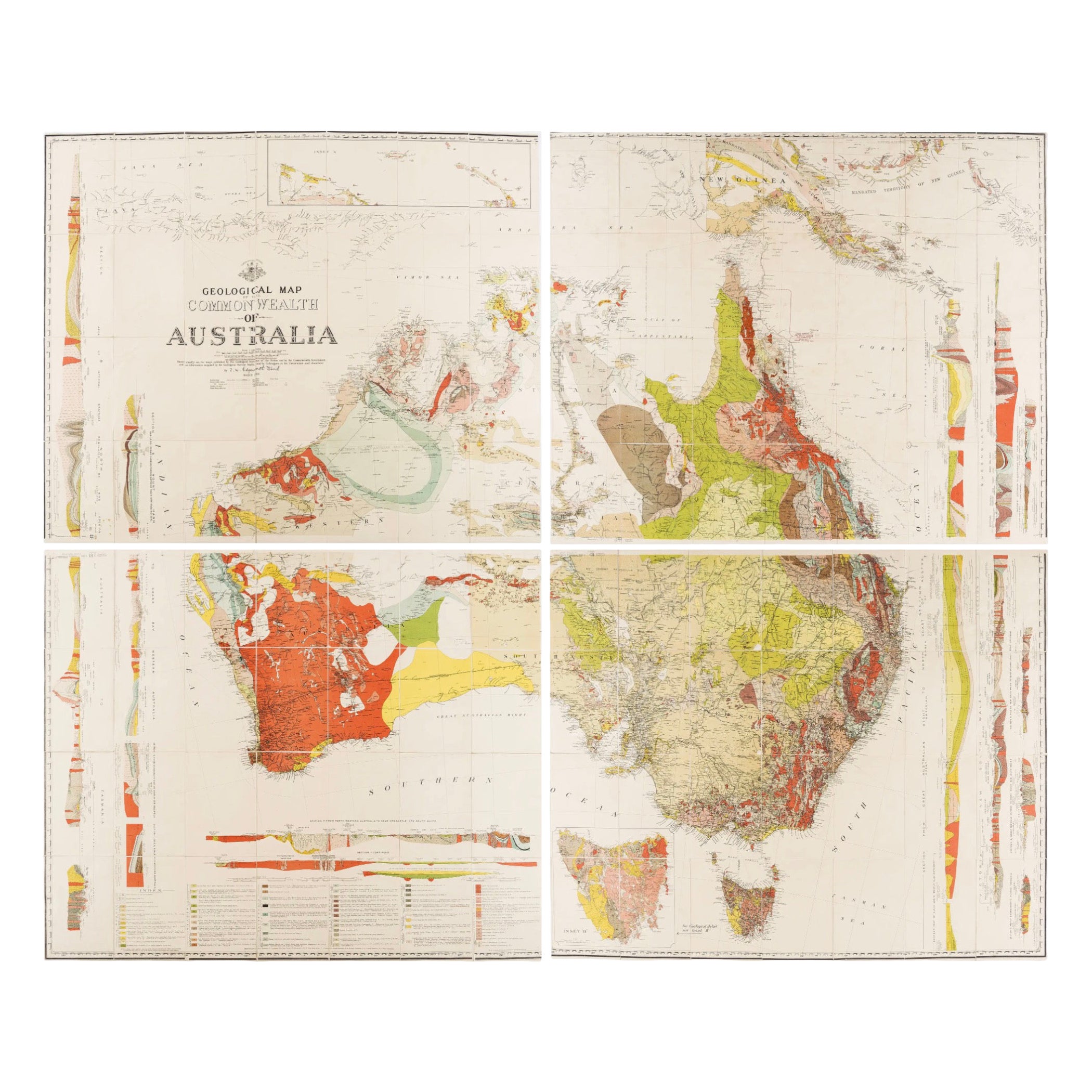
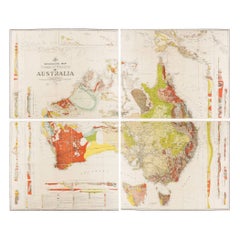
Impressive Geological Map of Australia – Rare Oversized Wall Display, 1931–32
Located in Langweer, NL
Geological Map of the Commonwealth of Australia by Sir Edgeworth David, 1931–32
Large and highly detailed geological map of the Commonwealth of Australia, compiled under the directi...
Category
Early 20th Century Australian Maps
Materials
Linen, Paper
Antique Map of the Region of Wakayama, Nara and Osaka 'Japan'
Located in Langweer, NL
Geological folding map of the area with Wakayama, Nara, Osaka, Mie, and Shiga in Japan, circa 1880:
This map is a geological folding map, which means it was designed to be portable ...
Category
Antique Late 19th Century Maps
Materials
Linen, Paper
$906 Sale Price
20% Off
Vintage Wall Chart of a Landscape and Geographic Map, circa 1955
Located in Langweer, NL
Vintage wall chart titled 'Kaart en Landschap'. This wall chart shows a mountain range and geographic map. Published by J.B. Wolters, circa 1955.
Category
Mid-20th Century Prints
Materials
Paper

$572 Sale Price
20% Off
Antique Map of the Mouth of the Amu Darya River by Reclus, 1881
Located in Langweer, NL
Antique map titled 'Bouches de L'Amou - Daria'. Original antique map showing the river mouth of the Amu Darya river in Central Asia. This original old antiqu...
Category
Antique 19th Century Maps
Materials
Paper
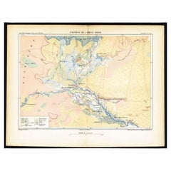
$84 Sale Price
20% Off
You May Also Like
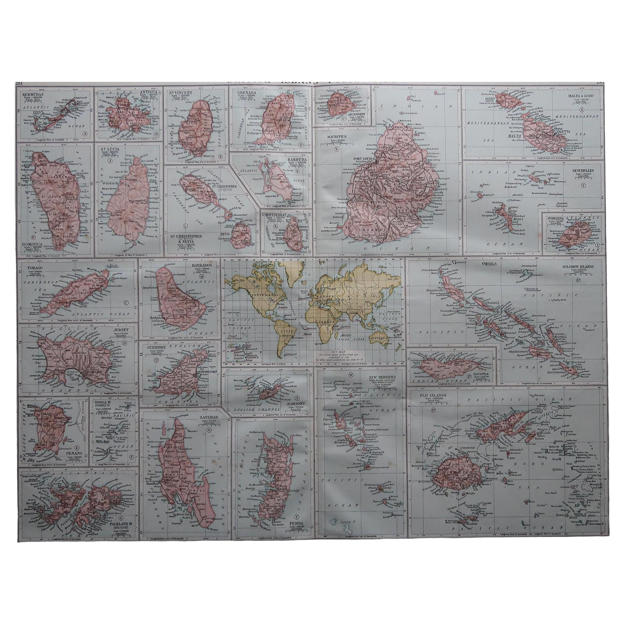
Large Original Vintage Map of British Island Possessions, circa 1920
Located in St Annes, Lancashire
Great map of British Island Possessions
Original color. Good condition
Published by Alexander Gross
Unframed.
Category
Vintage 1920s English Maps
Materials
Paper

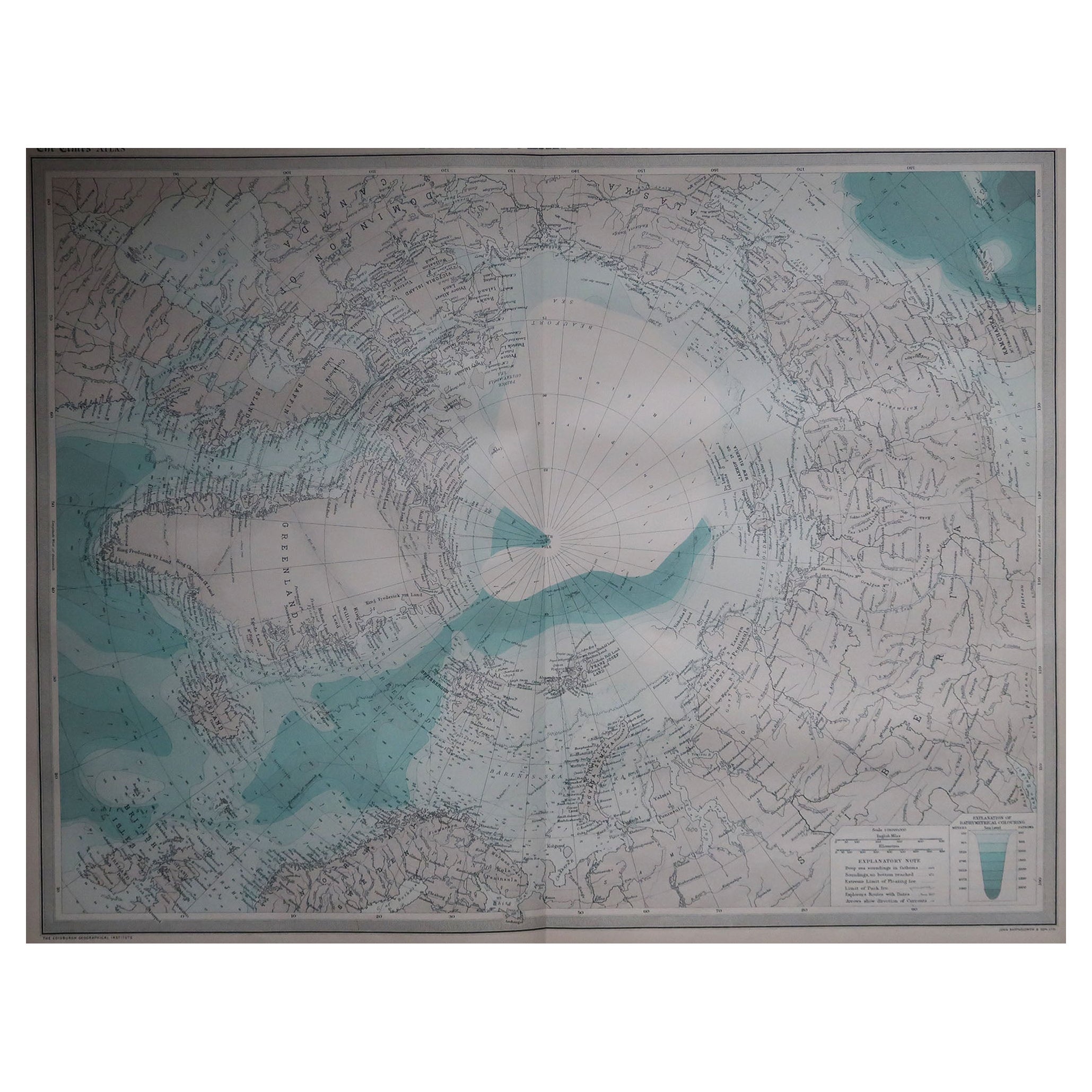
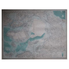
Large Original Vintage Map of The North Pole, circa 1920
Located in St Annes, Lancashire
Great maps of The North Pole.
Unframed.
Original color.
By John Bartholomew and Co. Edinburgh Geographical Institute.
Published, circa 1920.
Free shipp...
Category
Vintage 1920s British Maps
Materials
Paper
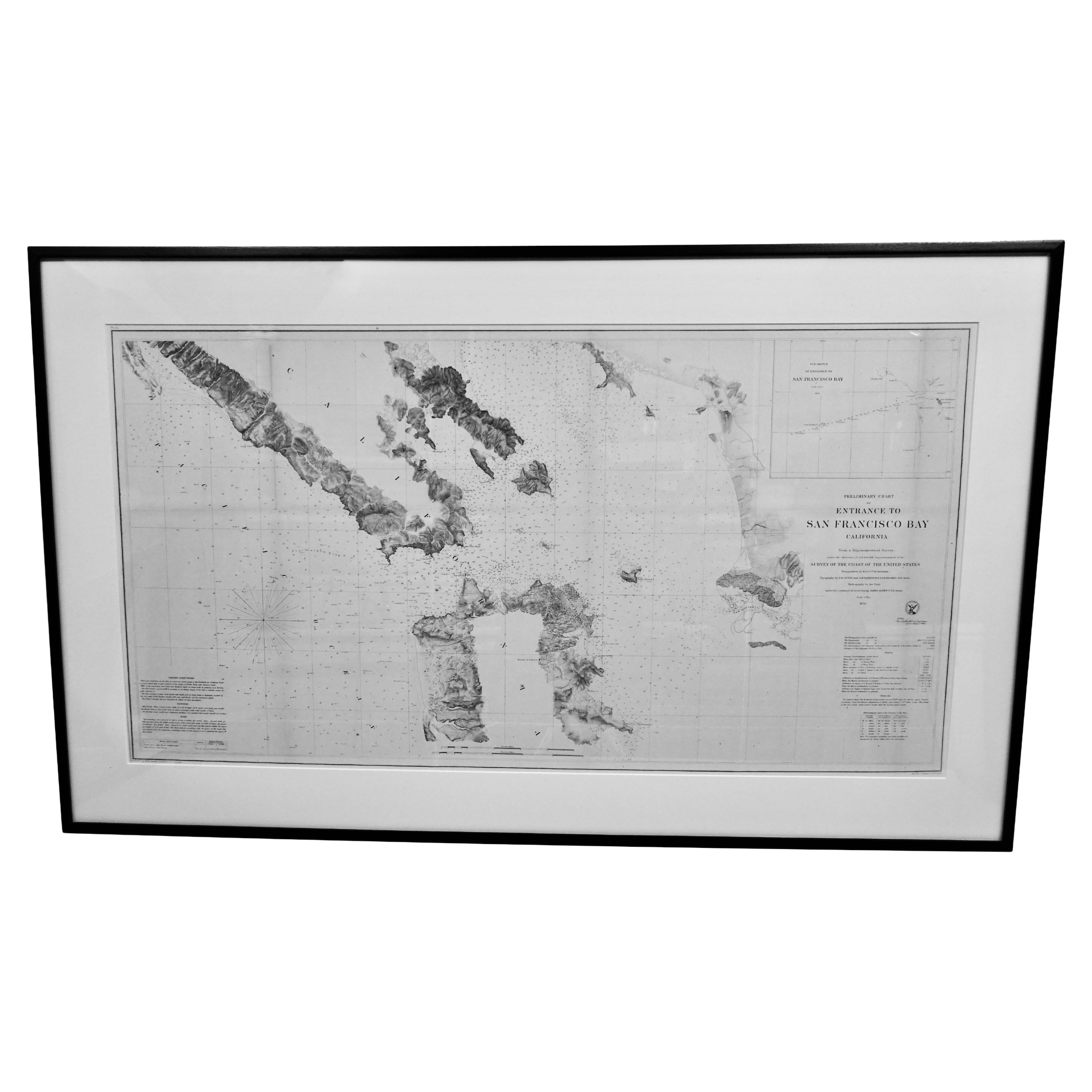
Scarce U.S. Coast Survey Map Depicting Entrance to San Francisco Bay Dated 1856
Located in San Francisco, CA
A fine example of the 1856 U.S. Coast lithographic survey nautical chart of the entrance to San Francisco bay and the city. Published in 1856 by the Office of the Coast Survey the of...
Category
Antique Mid-19th Century American Maps
Materials
Paper

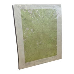
Vintage Central Oregon Geological Topographical State Map.Circa 1955.
Located in Seattle, WA
This Map was made by the US Department of the Interior as a Geological Survey. Green background
With Topographical markings. Made in 1955 as stated at the bottom. Vintage Condition ...
Category
Vintage 1950s Mid-Century Modern Contemporary Art
Materials
Paper
Large Original Vintage Map of Israel, circa 1920
Located in St Annes, Lancashire
Great map of Israel
Original color.
Good condition
Published by Alexander Gross
Unframed.
Category
Vintage 1920s English Edwardian Maps
Materials
Paper

Antique Maritime Chart of East Coast Virginia to Nova Scotia
Located in Norwell, MA
1920 nautical chart of the East Coast of the United States from Virginia to Maine, New Brunswick, and Nova Scotia. The chart shows Cape Cod, Long Island, the Connecticut coast, Jersey Shore, Maine, New Hampshire, etc. Very detailed, showing ports, lighthouses, shoals, depths, etc. The chart is by famous cartographer George W. Eldridge, compiled from surveys of the United States government, British Admiralty, George Eldridge, and others. First authorized by George Eldridge, published in 1916 by Wilfred O. White with a merchant's stamp of Charles Hutchinson...
Category
Vintage 1920s North American Maps
Materials
Paper
