Items Similar to Navigational Chart of Mexico's Coast, with Acapulco and Port Marquis, 1748

Want more images or videos?
Request additional images or videos from the seller
1 of 5
Navigational Chart of Mexico's Coast, with Acapulco and Port Marquis, 1748
$134.05
$167.5620% Off
£98.88
£123.6020% Off
€112
€14020% Off
CA$185.73
CA$232.1620% Off
A$201.67
A$252.0920% Off
CHF 106.80
CHF 133.5020% Off
MX$2,471.88
MX$3,089.8520% Off
NOK 1,321.67
NOK 1,652.0920% Off
SEK 1,248.91
SEK 1,561.1420% Off
DKK 852.64
DKK 1,065.8020% Off
About the Item
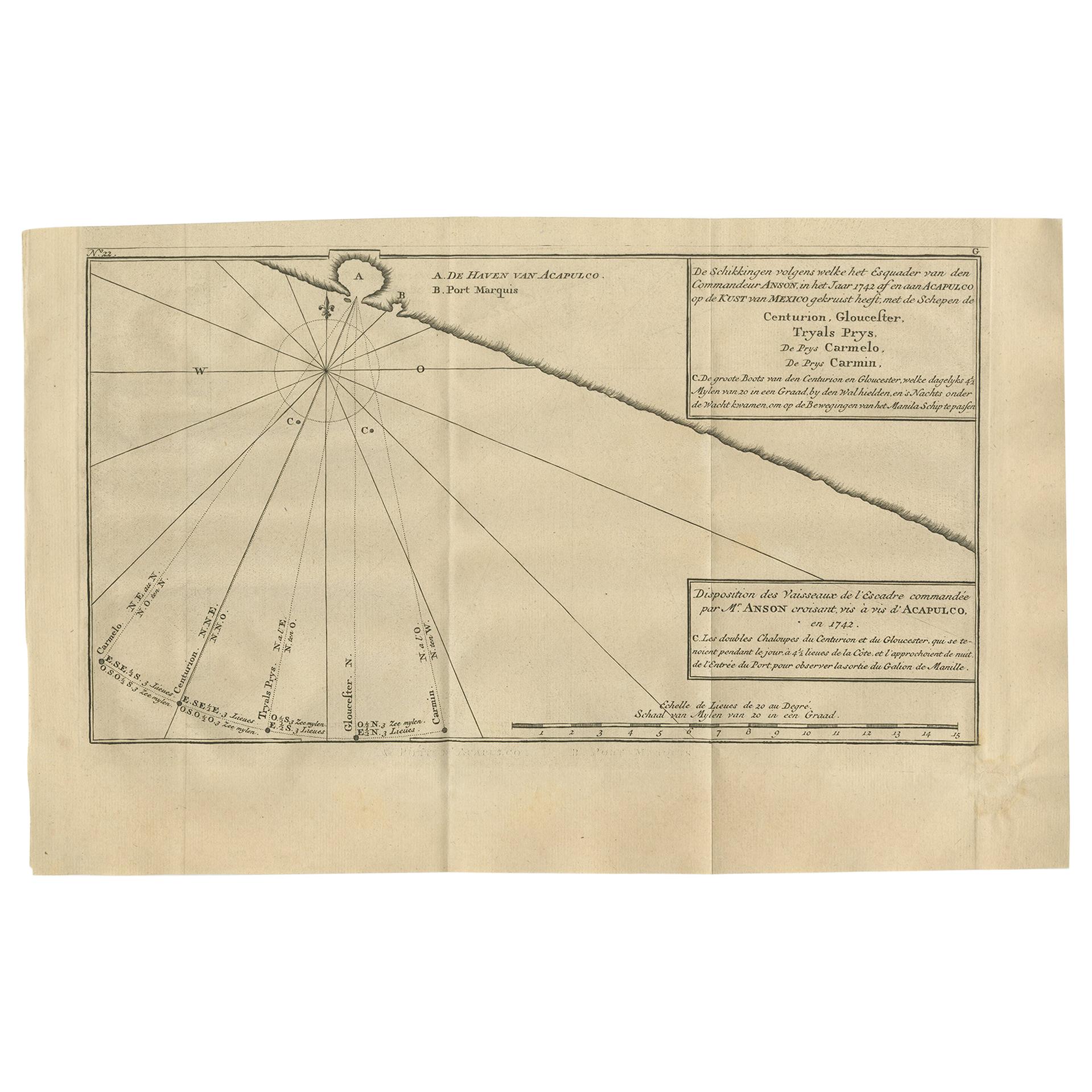
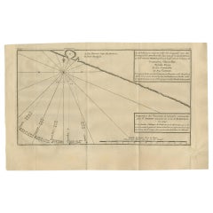
Antique map titled 'The Form of cruising off Acapulca on the Coast of Mexico in the South Seas in the Year 1742. by His Majesty's Ships, Centurion, Gloucester, Tryall Prize, Carmila Prize, Carmin Prize.' -
A navigational chart of the coast of Mexico, with the harbours Acapulco and Port Marquis (Puerto del Marques) indicated. From George Anson's "A Voyage round the world in the years MDCCXL, I, II, II, IV." London: J. and P. Knapton, 1748. Great Britain was at war with Spain in 1740. Admiral of the Fleet George Anson, 1st Baron Anson PC, FRS, RN (1697 -1762) was a British admiral and a wealthy aristocrat, noted for his circumnavigation of the globe and his role overseeing the Royal Navy during the Seven Years' War. Anson commanded the small British squadron sent at the beginning of the war with Spain to harass the Spaniards on the west coast of South America and cut off their supplies of wealth from the Pacific. Disasters and hardships plagued the expedition; most of the ships were lost around Cape Horn, and on the Chilean coast, and of a crew of 960, less than 350 survived. Eventually the Centurion alone was left, but Anson persevered and succeeded in capturing a gold-laden Spanish galleon near Manila. The prize he earned as a result settled his fortune for life. This is the official account of his voyage of circumnavigation, compiled from Anson's journals by Richard Walter, chaplain on board the Centurion, and revised by Benjamin Robins.
Artists and Engravers: Made by 'J. Mason' after 'George Anson'. No engraver given on the map. Some source attribute the maps in this work to J. Mason.
Condition: Good, given age. Original folds, as issued. Offsetting from letterpress text on the opposite page in the book. Small stains in the left edge of the image. Soiling in the top right corner. A faint dampstain in the top left image corner. Creasing in the right margin and lower left corner. Minimal paper separation in the lower edge of the folds (backed with acid-free archival tape). General age-related toning and/or occasional minor defects from handling. Please study scan carefully.
- Dimensions:Height: 9.81 in (24.9 cm)Width: 17.52 in (44.5 cm)Depth: 0.01 in (0.2 mm)
- Materials and Techniques:
- Period:1740-1749
- Date of Manufacture:1748
- Condition:Additions or alterations made to the original: Minimal paper separation in the lower edge of the folds (backed with acid-free archival tape). General age-related toning and/or occasional minor defects from handling. Please study scan carefully. Wear consistent with age and use. Original folds, as issued. Offsetting from letterpress text on the opposite page in the book. Small stains in the left edge of the image. Soiling in the top right corner. A faint dampstain in the top left image corner. Creasing in the right margin.
- Seller Location:Langweer, NL
- Reference Number:Seller: PCT-56789 1stDibs: LU3054326922022
About the Seller
5.0
Recognized Seller
These prestigious sellers are industry leaders and represent the highest echelon for item quality and design.
Platinum Seller
Premium sellers with a 4.7+ rating and 24-hour response times
Established in 2009
1stDibs seller since 2017
2,623 sales on 1stDibs
Typical response time: <1 hour
- ShippingRetrieving quote...Shipping from: Langweer, Netherlands
- Return Policy
Authenticity Guarantee
In the unlikely event there’s an issue with an item’s authenticity, contact us within 1 year for a full refund. DetailsMoney-Back Guarantee
If your item is not as described, is damaged in transit, or does not arrive, contact us within 7 days for a full refund. Details24-Hour Cancellation
You have a 24-hour grace period in which to reconsider your purchase, with no questions asked.Vetted Professional Sellers
Our world-class sellers must adhere to strict standards for service and quality, maintaining the integrity of our listings.Price-Match Guarantee
If you find that a seller listed the same item for a lower price elsewhere, we’ll match it.Trusted Global Delivery
Our best-in-class carrier network provides specialized shipping options worldwide, including custom delivery.More From This Seller
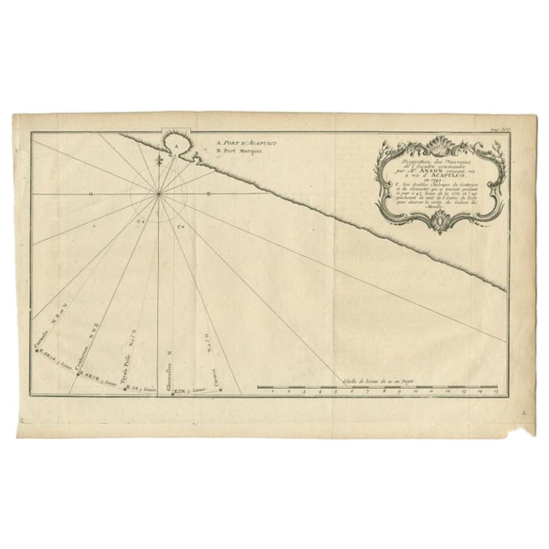
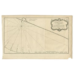
View AllAntique Map of the Coast of Acapulco by Anson, 1749
Located in Langweer, NL
Antique map titled 'Disposition des Vaisseaux de l'Escadre commandée par Mr. Anson croisant vis à vis d'Acapulco en 1742'. This map depicts the coast of Acapulco in Mexico with a decorative cartouche and windrose. Acapulco and its port were important to the mission of Commodore George Anson, who captured a Spanish treasure...
Category
Antique Mid-18th Century Prints
Materials
Paper
$172 Sale Price
42% Off
Antique Map of the Coast of Acapulco by Anson, c.1740
Located in Langweer, NL
Antique map titled 'Disposition des Vaisseaux de l'Escadre commandée par Mr. Anson croisant vis à vis d'Acapulco en 1742'. This map depicts the coast of Acapulco in Mexico with a decorative cartouche and windrose. Acapulco and its port were important to the Mission of Commodore George Anson, who captured a Spanish treasure...
Category
Antique 18th Century Maps
Materials
Paper
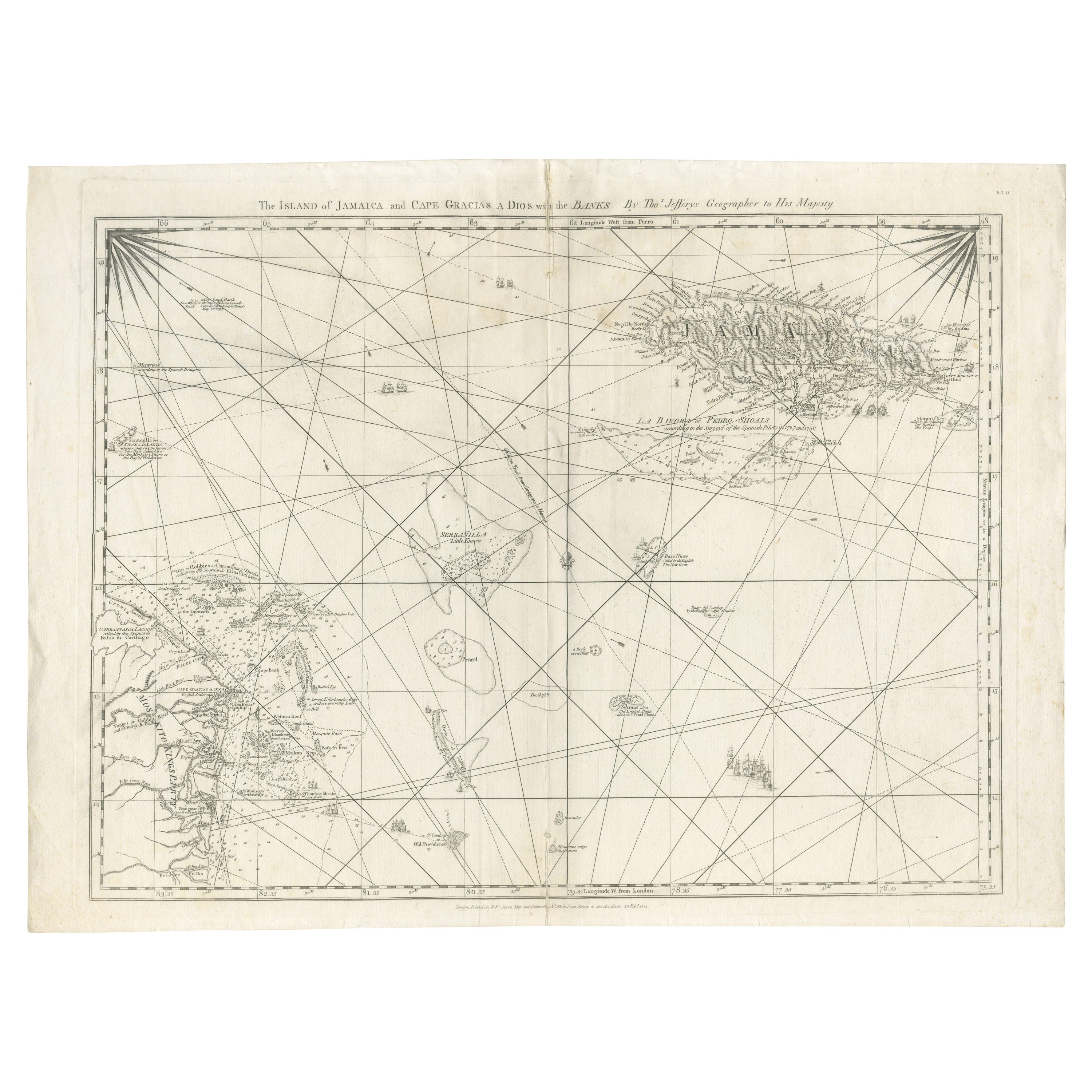
Navigational Chart of Jamaica, Cape Gracias a Dios, and the Mosquito Coast, 1775
Located in Langweer, NL
The map titled "The Island of Jamaica and Cape Gracias a Dios with the Banks (Shows Moskito Kings Party)" illustrates a significant historical period marked by shifting colonial infl...
Category
Antique 1770s Maps
Materials
Paper

$1,005 Sale Price
30% Off
Free Shipping
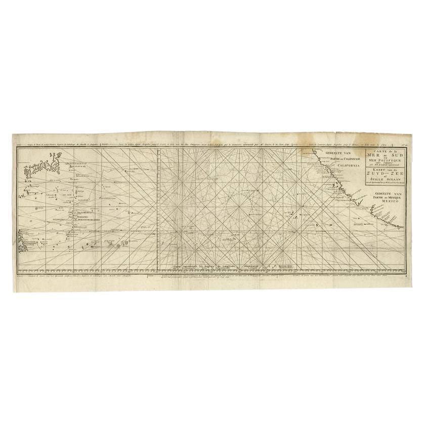
Antique Map of the Pacific Ocean by Anson, 1765
Located in Langweer, NL
Antique map titled 'Carte de la Mer du Sud ou Mer Pacifique - Kaart van de Zuyd-Zee of stille oceaan (..)'. Nautical chart of the Pacific Ocean depicting the trade routes used by Spanish Galleons from Acapulco in Mexico to Manila in the Philippines. In particular this chart depicts the voyages of the Spanish Nostra Seigniora de Cabadonga and the British Navy Commodore George Anson. Anson succeed in capturing the Spanish treasure...
Category
Antique 18th Century Maps
Materials
Paper

$943 Sale Price
20% Off
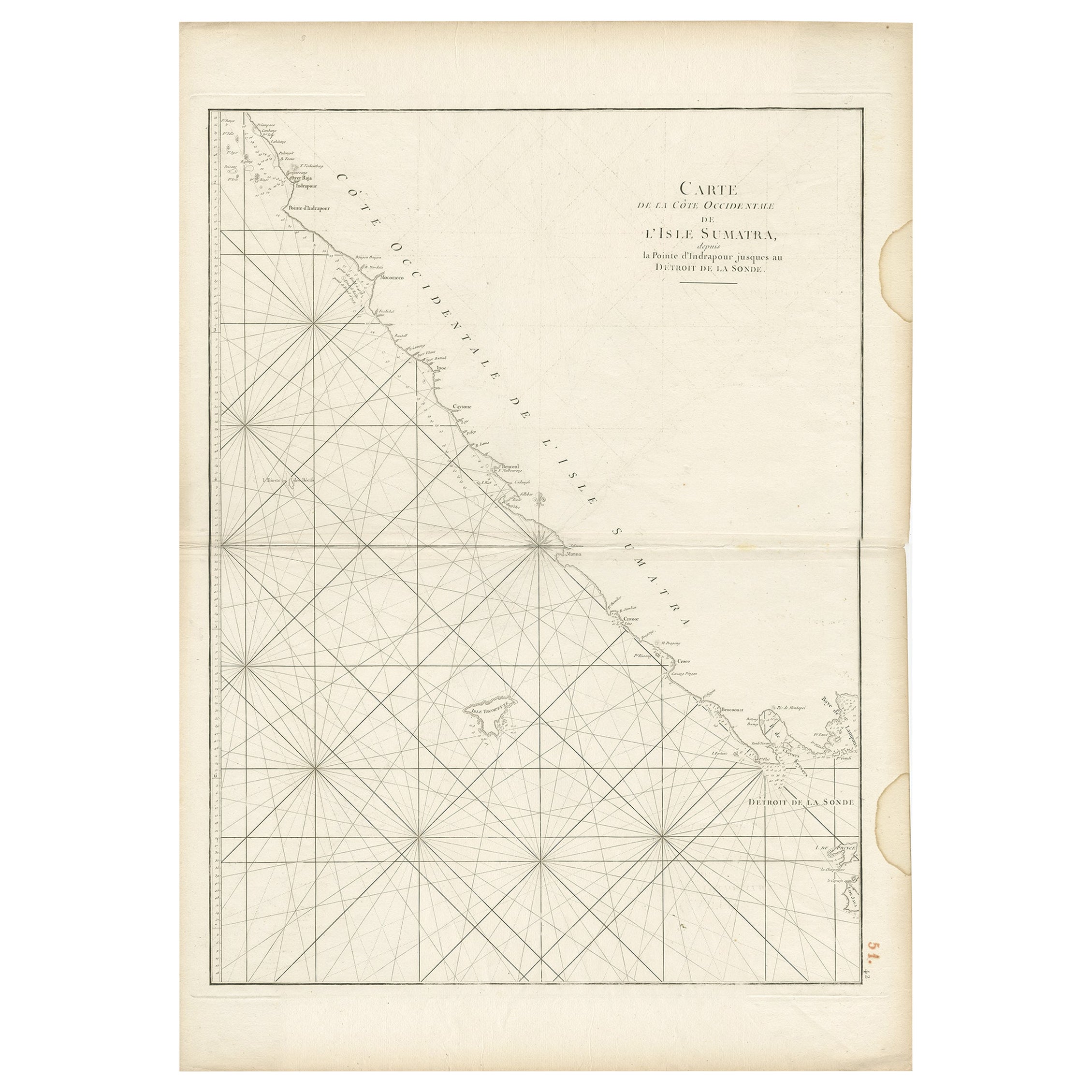
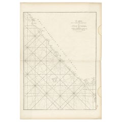
Antique Sea Chart of the Coast of Sumatra, Indonesia, circa 1775
Located in Langweer, NL
Antique map titled 'Carte de la Côte Occidentale de l'Isle Sumatra'. Sea chart of the part of the south-western coast of Sumatra with the Nassau (Nias) and Fortune isles.
Artists ...
Category
Antique 18th Century Maps
Materials
Paper
$517 Sale Price
20% Off
Sea Chart of Part of the Southwestern Coast of Sumatra & Nias, Indonesia, C1775
Located in Langweer, NL
Antique map titled 'Carte de la Côte Occidentale de l'Isle Sumatra'. Sea chart of the part of the south-western coast of Sumatra with the Nassau (Nias) and Fortune isles.
Artists ...
Category
Antique 1770s Maps
Materials
Paper

$484 Sale Price
25% Off
You May Also Like
1776 Navigational chart/map of the Delaware bay and river including Philadelphia
Located in Philadelphia, PA
JOSHUA FISHER
(AMERICAN, EIGHTEENTH CENTURY)
A Chart of Delaware Bay and River, 1776
Printed for John Bennet and Robert Sayer, London
Engraving on pape...
Category
1770s Realist Landscape Prints
Materials
Paper, Engraving

19th Century Nautical Chart of Martinique
Located in Norwell, MA
Original map of Martinique from 1887 with chartered waters around the island. Prepared from a French survey, completed in 1825, showing town, ports, rivers and tributaries. Published...
Category
Antique 19th Century Nautical Objects

Large U.S. Coast and Geodetic Survey Chart A of the Atlantic Coast, 1877
Located in Nantucket, MA
Large U.S. Coast and Geodetic Survey Chart A of the Atlantic Coast, 1877, re-issued in February 1881, a printed paper laid down on linen navigational chart of the U.S. Atlantic coast...
Category
Antique 1880s American Other Maps
Materials
Linen

Engraving on Copper Print from the Volume Navigazione Nautical Subject 1790
Located in Milan, IT
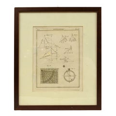
Print by engraving on copper plate Tav III TIX fig. 17-22 from the volume Navigazione; with frame 28 x 33. Some calculations are depicted. Very good condition.
Shipping is insured by...
Category
Antique 1790s Italian Nautical Objects
Materials
Paper
Long Island Chart from 1828
Located in Norwell, MA
Rare original chart of Long Island Sound by E + G Blunt of New York, 179 Water St. "Surveyed in the years 1828, 29 & 30" Exceedingly rare and early chart, titled Long Island Sound fr...
Category
Antique 1830s Nautical Objects
Materials
Paper

Old Map Depicting the Entire Earth's Surface Divided into Six Parts France 1850
Located in Milan, IT
Map depicting the entire earth's surface divided into six parts which depicts the position of peoples on Earth based on the assumption that it is impossible for each people to have t...
Category
Antique Mid-19th Century French Maps
Materials
Glass, Wood, Paper

More Ways To Browse
Spanish Galleon
George Fleet
George Mason
Ship Horn
Tennessee Antique Furniture
Used Furniture Alabama
Used Office Furniture Maine
Ancient World Map
Antique Florida Map
Antique Map Chile
Antique Map Of Georgia
Antique Mississippi Furniture
Burgundy Map
John Speed Antique Maps
Malabar Map
Malaysia Map
Map Of Syria
Taiwan Map