Items Similar to Original Antique Map of the Coast of Part of Greece, with Athens and Thebes

Want more images or videos?
Request additional images or videos from the seller
1 of 7
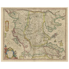
Original Antique Map of the Coast of Part of Greece, with Athens and Thebes
$420.67
$525.8420% Off
£311.42
£389.2820% Off
€352
€44020% Off
CA$582.10
CA$727.6320% Off
A$641.66
A$802.0720% Off
CHF 335.74
CHF 419.6820% Off
MX$7,872.91
MX$9,841.1420% Off
NOK 4,226.36
NOK 5,282.9520% Off
SEK 3,952.31
SEK 4,940.3920% Off
DKK 2,680.13
DKK 3,350.1620% Off
About the Item
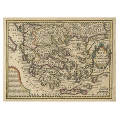
Original antique map titled 'Achaia quae et Hellas hodie Livadia'. Detailed map of the coast of part of Greece. With inset maps of Athens and Thebes. This map originates from 'Philippi Cluveri Introductionis in universam geographiam (..)' by P. Clüver. Published 1729.
Philipp Clüver was an Early Modern German geographer and historian. Cluver's Geography was one of the most enduring works of the 17th & 18th Centuries, issued by several different publishers with many different sets of maps over nearly 200 years.
- Dimensions:Height: 9.77 in (24.8 cm)Width: 14.38 in (36.5 cm)Depth: 0.02 in (0.5 mm)
- Materials and Techniques:Paper,Engraved
- Period:
- Date of Manufacture:1729
- Condition:Wear consistent with age and use. General age-related toning. Original folding lines. Defect left margin. Minor wear, blank verso. Please study images carefully.
- Seller Location:Langweer, NL
- Reference Number:Seller: BG-13199-11stDibs: LU3054331113722
About the Seller
5.0
Recognized Seller
These prestigious sellers are industry leaders and represent the highest echelon for item quality and design.
Platinum Seller
Premium sellers with a 4.7+ rating and 24-hour response times
Established in 2009
1stDibs seller since 2017
2,613 sales on 1stDibs
Typical response time: <1 hour
- ShippingRetrieving quote...Shipping from: Langweer, Netherlands
- Return Policy
Authenticity Guarantee
In the unlikely event there’s an issue with an item’s authenticity, contact us within 1 year for a full refund. DetailsMoney-Back Guarantee
If your item is not as described, is damaged in transit, or does not arrive, contact us within 7 days for a full refund. Details24-Hour Cancellation
You have a 24-hour grace period in which to reconsider your purchase, with no questions asked.Vetted Professional Sellers
Our world-class sellers must adhere to strict standards for service and quality, maintaining the integrity of our listings.Price-Match Guarantee
If you find that a seller listed the same item for a lower price elsewhere, we’ll match it.Trusted Global Delivery
Our best-in-class carrier network provides specialized shipping options worldwide, including custom delivery.More From This Seller
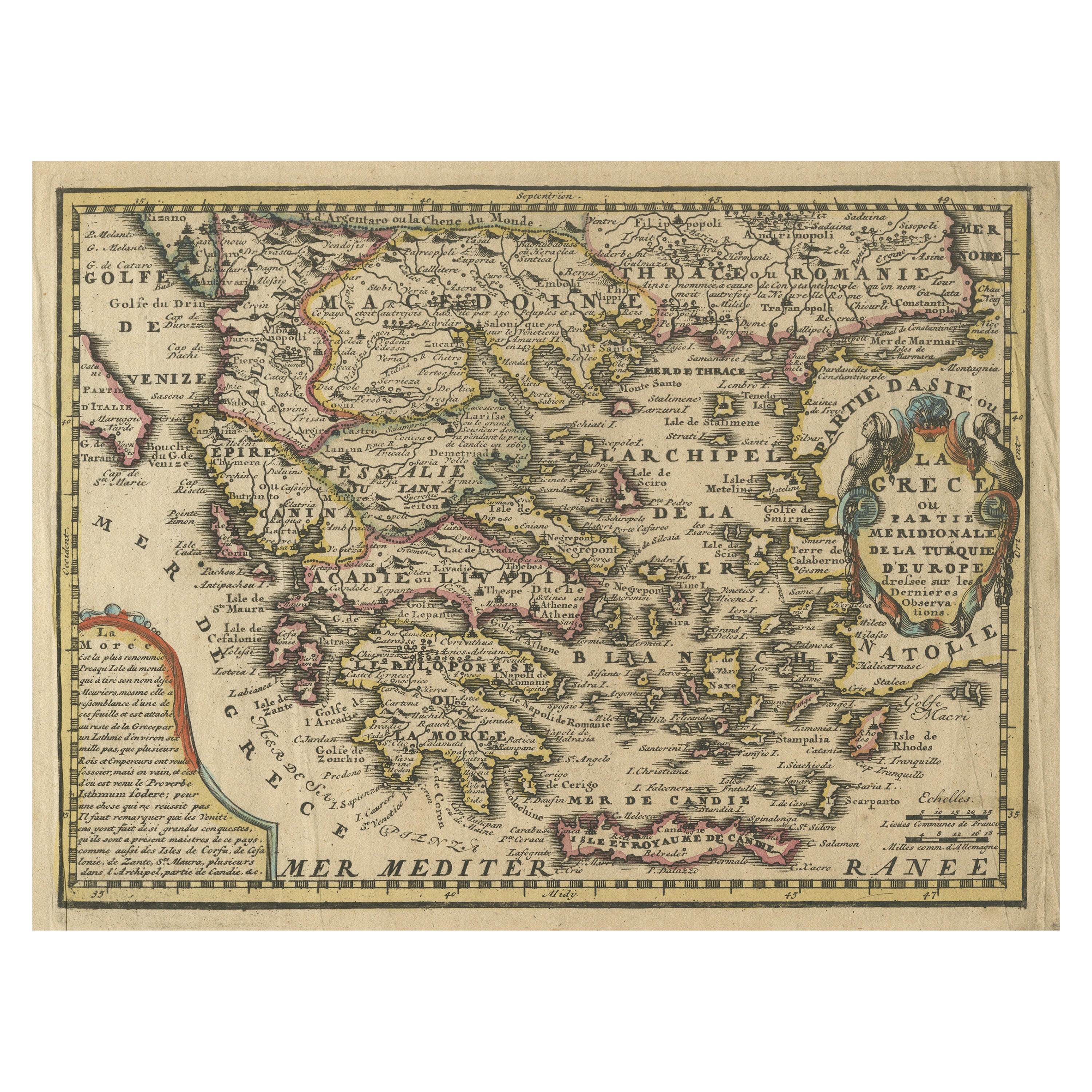
View AllOriginal Antique Map of Greece and part of Turkey
Located in Langweer, NL
Original antique map titled 'La Grece ou partie meridionale de la Turquie d'Europe'. Small map of Greece and part of Turkey. This map originates from 'Le nouveau et curieux Atlas Geo...
Category
Antique Early 18th Century Maps
Materials
Paper
$363 Sale Price
20% Off
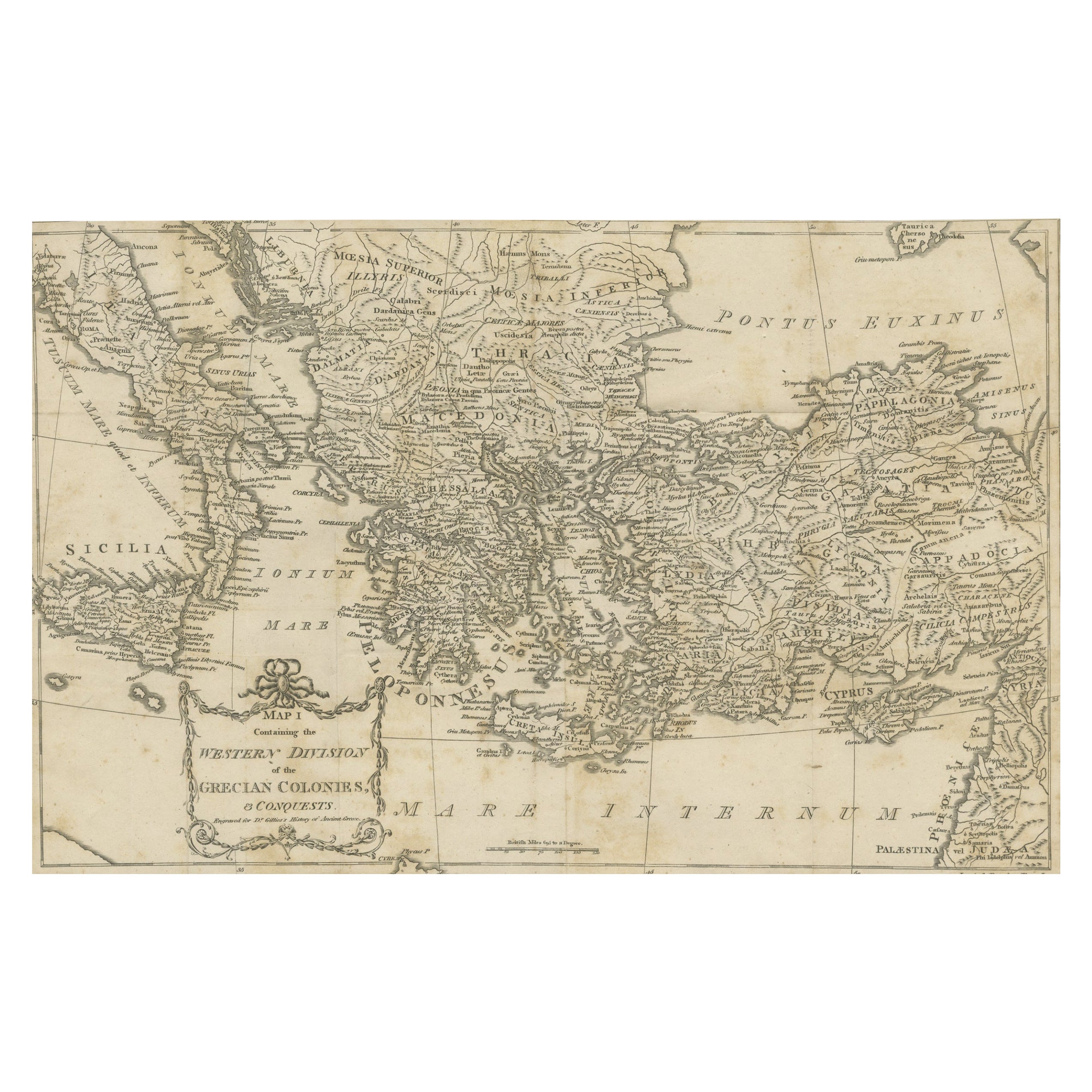
Antique Map of the Ancient Greek Colonization
Located in Langweer, NL
Antique map titled 'Map I containing the Western Division of the Grecian Colonies & Conquests'. Original antique map of the ancient Greek colonization. Frontispiece map of 'The Histo...
Category
Antique Late 18th Century Maps
Materials
Paper
$172 Sale Price
20% Off
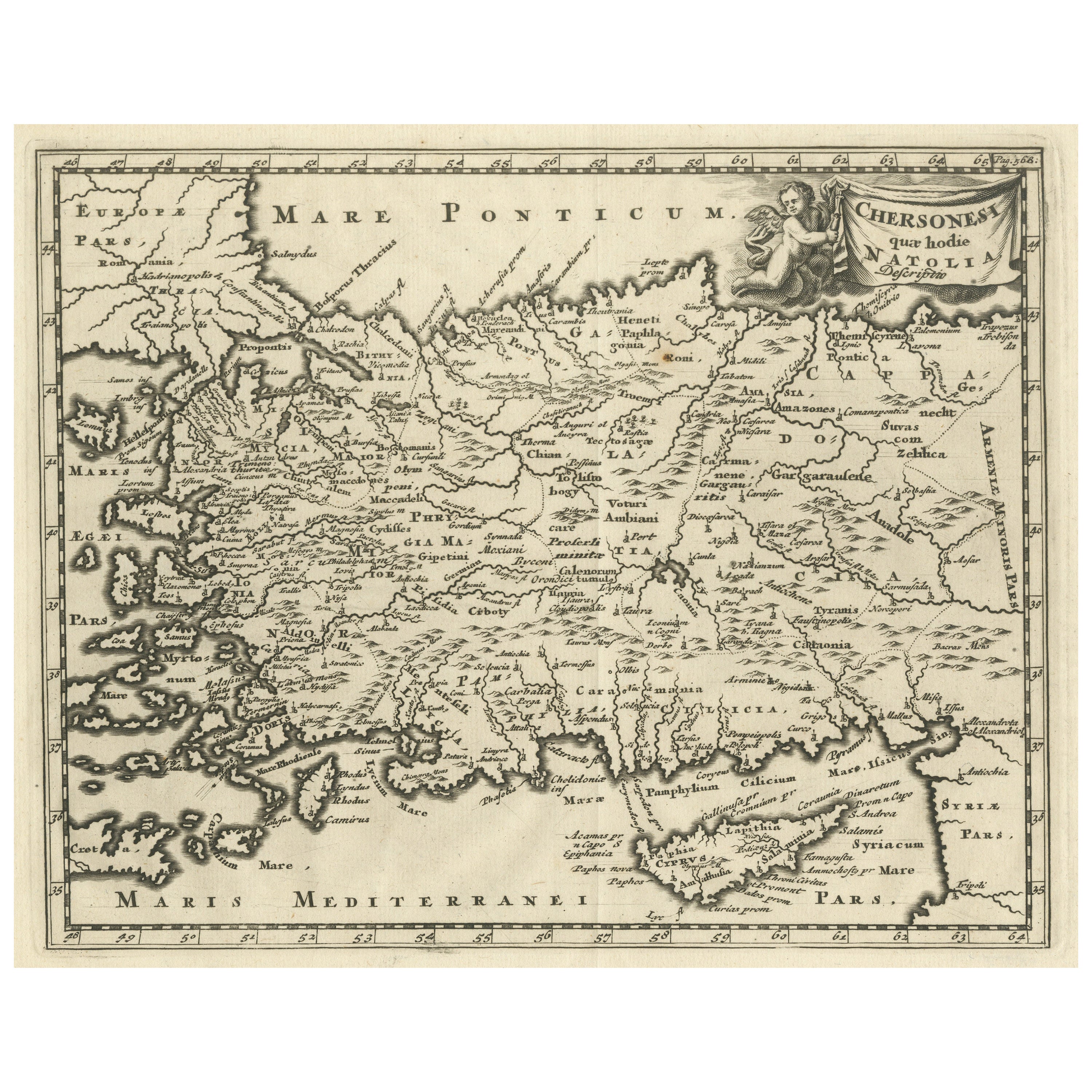
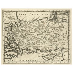
Antique Map of Asia Minor including part of the Greek Archipelago and Cyprus
Located in Langweer, NL
Antique map titled 'Chersonesi quae hodie Natolia Descriptio'. Decorative, smaller map of Asia Minor including part of the Greek Archipelago and Cyprus. The drape-style title cartouc...
Category
Antique Mid-18th Century Maps
Materials
Paper
$325 Sale Price
20% Off
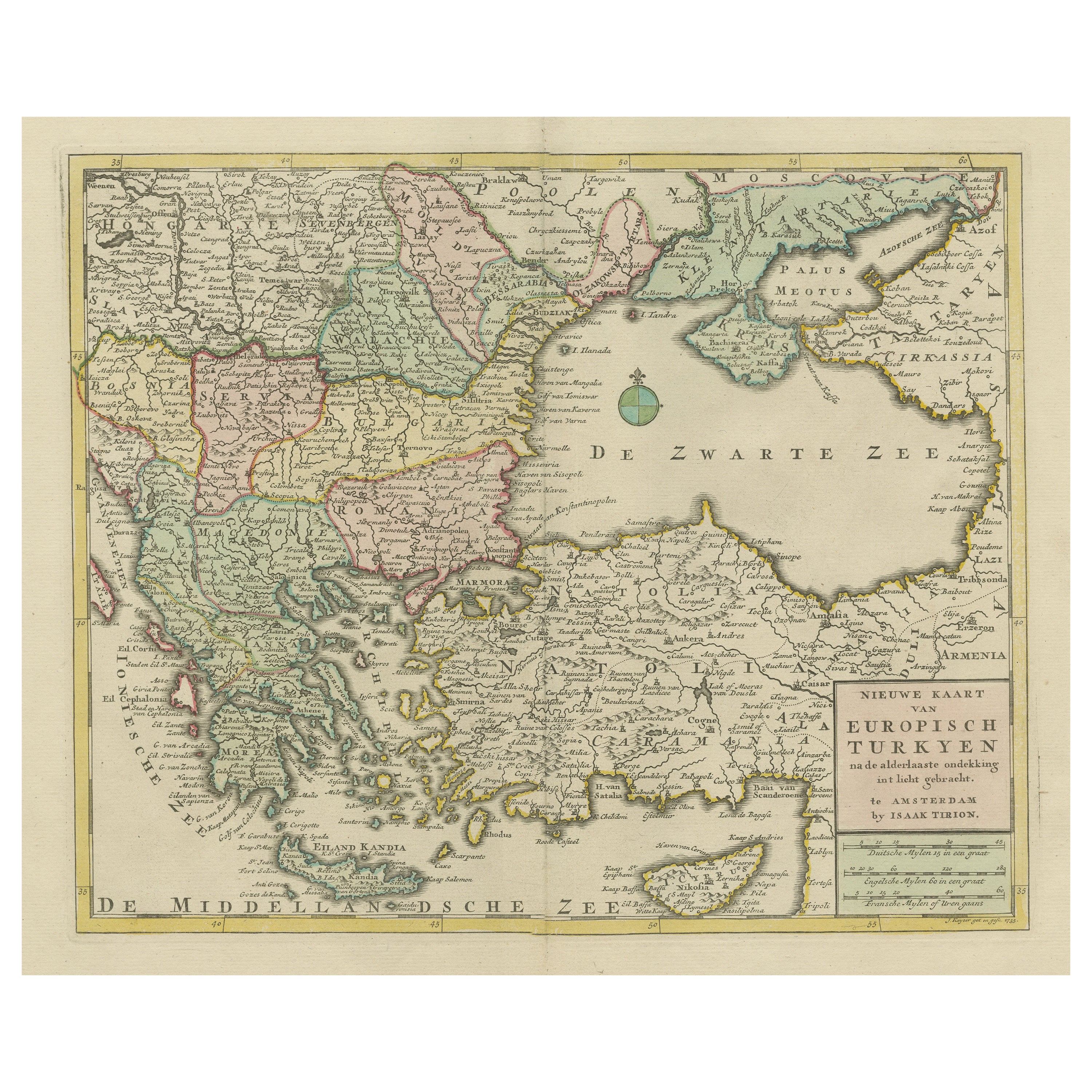
Antique Map of Greece, Turkey and surroundings with original coloring
Located in Langweer, NL
Antique map titled 'Nieuwe Kaart van Europisch Turkyen na de alderlaatste ontdekking in t licht gebracht'. Antique map of Greece with Crete and Cyprus, Turkey and the Black Sea. Publ...
Category
Antique Mid-18th Century Maps
Materials
Paper

$659 Sale Price
20% Off
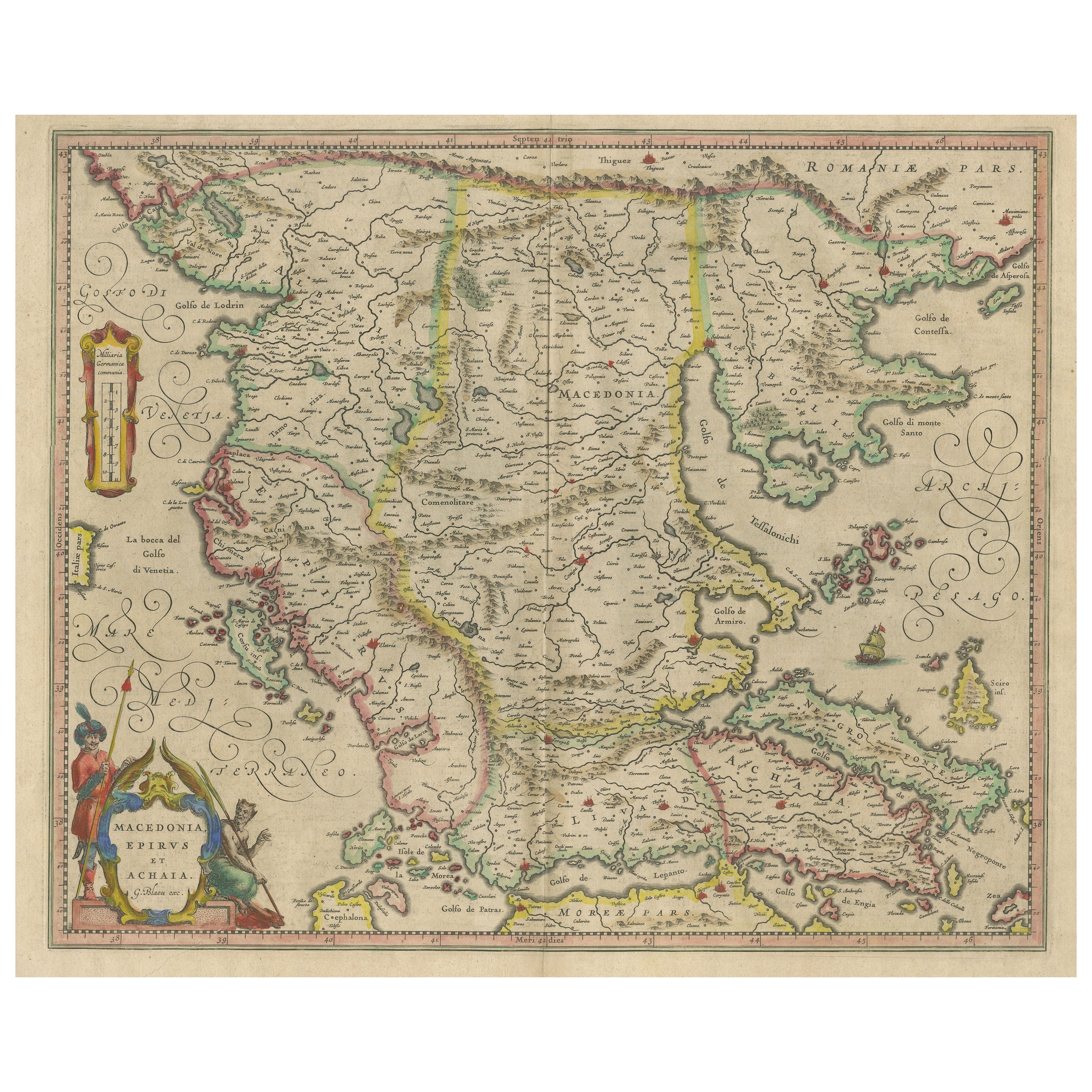
Antique Map of Macedonia, Northern Greece and part of Turkey in Europe
Located in Langweer, NL
Antique map titled 'Macedonia Epirus et Achaia'. Original old map of Macedonia, northern Greece, and part of Turkey in Europe. Published by W.J. Blaeu, circa 1640.
Willem Janszoon ...
Category
Antique Mid-17th Century Maps
Materials
Paper
$764 Sale Price
20% Off
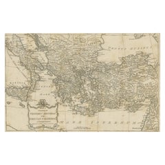
Antique Map of Greece, Albania, Macedonia and Parts of Turkey and Cyprus, c.1745
Located in Langweer, NL
Antique map titled 'Accurata Totius Archipelagi Et Graeciae Universae Tabula'.
Detailed map of Greece. Includes Albania, Macedonia and parts of Turkey and Cyprus. With compass rose...
Category
Antique 18th Century Maps
Materials
Paper

$813 Sale Price
20% Off
You May Also Like
Original Antique Map of Ancient Greece, Achaia, Corinth, 1786
Located in St Annes, Lancashire
Great map of Ancient Greece. Showing the region of Thessaly, including Mount Olympus
Drawn by J.D. Barbie Du Bocage
Copper plate engraving by P.F Tardieu
Original hand color...
Category
Antique 1780s French Other Maps
Materials
Paper

Original Antique Map of Ancient Greece- Boeotia, Thebes, 1787
Located in St Annes, Lancashire
Great map of Ancient Greece. Showing the region of Boeotia, including Thebes
Drawn by J.D. Barbie Du Bocage
Copper plate engraving by P.F T...
Category
Antique 1780s French Other Maps
Materials
Paper

Map of Greece - Etching on Paper 19th Century
Located in Roma, IT
Image dimensions: 22.2 x 27.8 cm.
Grecia is an interesting hand-colored etching on paper, realized by an anonymous artist in the first half of the XIX century.
With the inscriptions in Italian, this original print describes the geography of Greece with the great charisma of the antique maps.
In very good conditions, except for a usual yellowing of the paper at the edges and minor defects and signs of the time, and some light yellow strips...
Category
19th Century Modern Figurative Prints
Materials
Etching

1718 Ides & Witsen Map "Route D'amsterdam a Moscow Et De La Ispahan Et Gamron
Located in Norton, MA
1718 Ides & Witsen map, entitled
"Route D'Amsterdam A Moscow Et De La Ispahan Et Gamron,"
Ric.b005
Subject: Eastern Europe and Central Asia
Period: 1718 (published)
Publicati...
Category
Antique Early 18th Century Dutch Maps
Materials
Paper

17th Century Nicolas Visscher Map of Southeastern Europe
Located in Hamilton, Ontario
A beautiful, highly detailed map of southeastern Europe by Nicolas Visscher. Includes regions of Northern Italy (showing the cities Bologna, Padua, and Venice), Bohemia, Austria (sho...
Category
Antique 17th Century Dutch Maps
Materials
Paper

$1,350 Sale Price
38% Off
Map of Greece - Original Etching by Antonio Zatta - 18th Century
Located in Roma, IT
This Map of Greece is an etching realized by Antonio Zatta, Cartographer, publisher and typographer.
The state of preservation of the artwork is good except for the worn paper and t...
Category
1780s Figurative Prints
Materials
Etching

More Ways To Browse
Used Furniture Athens Greece
Athens Furniture
Antique Copper Australia
Antique Furniture Pondicherry
Antique Map Of Cornwall
Antique Maps Dublin
Antique Maps Of Malta
Antique Saudi Arabia
Armenia Map
Cambodia Antique Map
Charles Hutchinson
Coronelli Globe
Denoyer Geppert Anatomy
E Fletcher
Framed Africa Maps
Gabon Antique Map
Hudson River Map
Mauritius Antique Map