Items Similar to Original and Colourful Map of Northern India with Surrounding Regions, 1783
Want more images or videos?
Request additional images or videos from the seller
1 of 5
Original and Colourful Map of Northern India with Surrounding Regions, 1783
$545.20
$681.5020% Off
£403.61
£504.5220% Off
€456
€57020% Off
CA$754.42
CA$943.0320% Off
A$831.73
A$1,039.6720% Off
CHF 435.14
CHF 543.9220% Off
MX$10,203.81
MX$12,754.7720% Off
NOK 5,477.50
NOK 6,846.8720% Off
SEK 5,122.32
SEK 6,402.9120% Off
DKK 3,473.53
DKK 4,341.9120% Off
About the Item
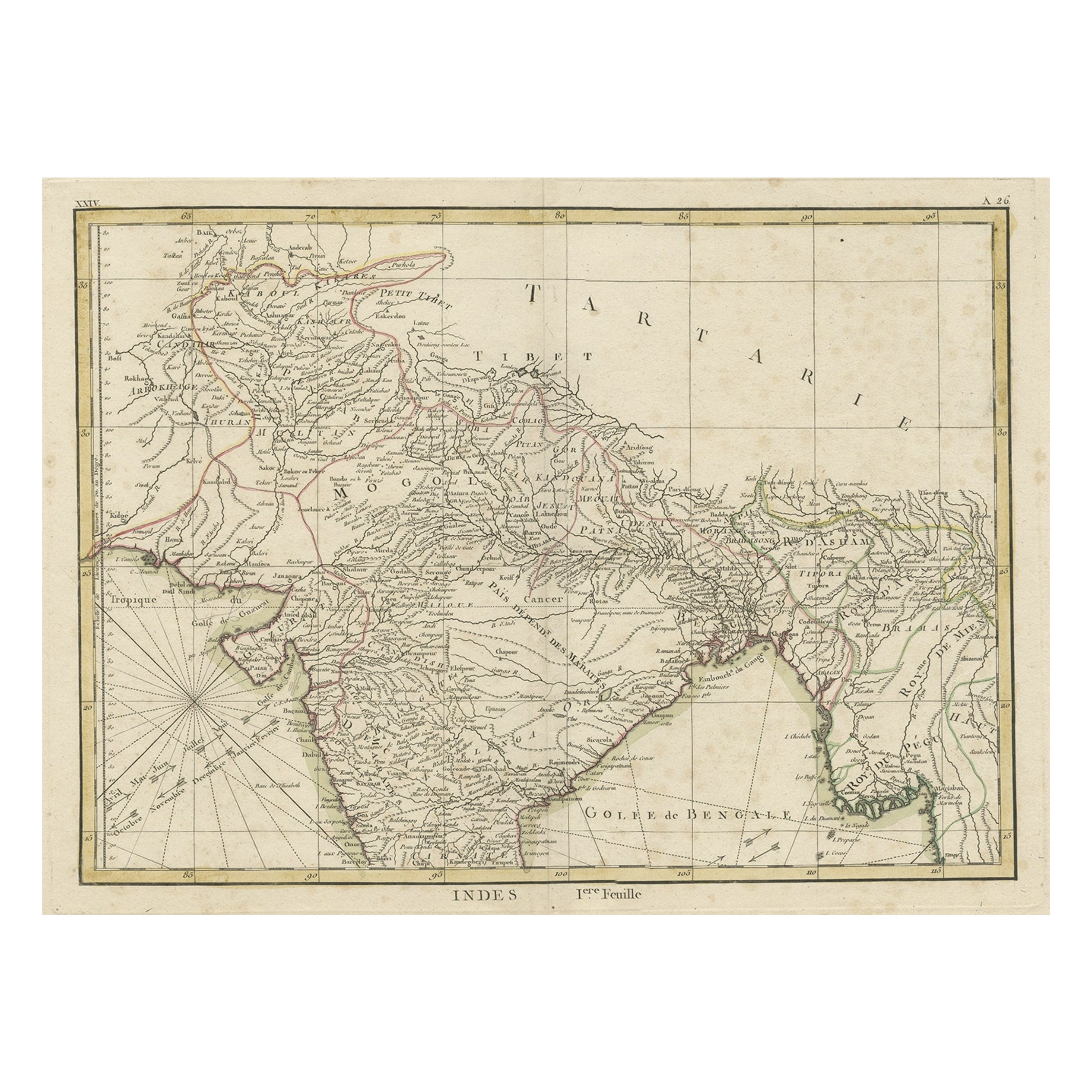
Antique map titled 'Indes'. A map of Northern India with surrounding regions. From Lattre's 'Atlas moderne ou collection de cartes sur toutes les parties du globe terrestre' published in Paris, 1783.
Artists and engravers: Jean Lattré was a Paris based bookseller, engraver, globe maker, calligrapher, and map publisher active in the mid to late 18th century.
- Dimensions:Height: 14.57 in (37 cm)Width: 19.57 in (49.7 cm)Depth: 0 in (0.02 mm)
- Materials and Techniques:
- Period:1780-1789
- Date of Manufacture:1783
- Condition:Wear consistent with age and use. Condition: Very good, given age. Original middle fold, as issued. Six tiny wormholes and one in lower middle fold, reinforced using paper. Two stains in margin. General age-related toning and/or occasional minor defects from handling. Please study im.
- Seller Location:Langweer, NL
- Reference Number:Seller: PCT-52253 1stDibs: LU3054326956502
About the Seller
5.0
Recognized Seller
These prestigious sellers are industry leaders and represent the highest echelon for item quality and design.
Platinum Seller
Premium sellers with a 4.7+ rating and 24-hour response times
Established in 2009
1stDibs seller since 2017
2,613 sales on 1stDibs
Typical response time: <1 hour
- ShippingRetrieving quote...Shipping from: Langweer, Netherlands
- Return Policy
Authenticity Guarantee
In the unlikely event there’s an issue with an item’s authenticity, contact us within 1 year for a full refund. DetailsMoney-Back Guarantee
If your item is not as described, is damaged in transit, or does not arrive, contact us within 7 days for a full refund. Details24-Hour Cancellation
You have a 24-hour grace period in which to reconsider your purchase, with no questions asked.Vetted Professional Sellers
Our world-class sellers must adhere to strict standards for service and quality, maintaining the integrity of our listings.Price-Match Guarantee
If you find that a seller listed the same item for a lower price elsewhere, we’ll match it.Trusted Global Delivery
Our best-in-class carrier network provides specialized shipping options worldwide, including custom delivery.More From This Seller
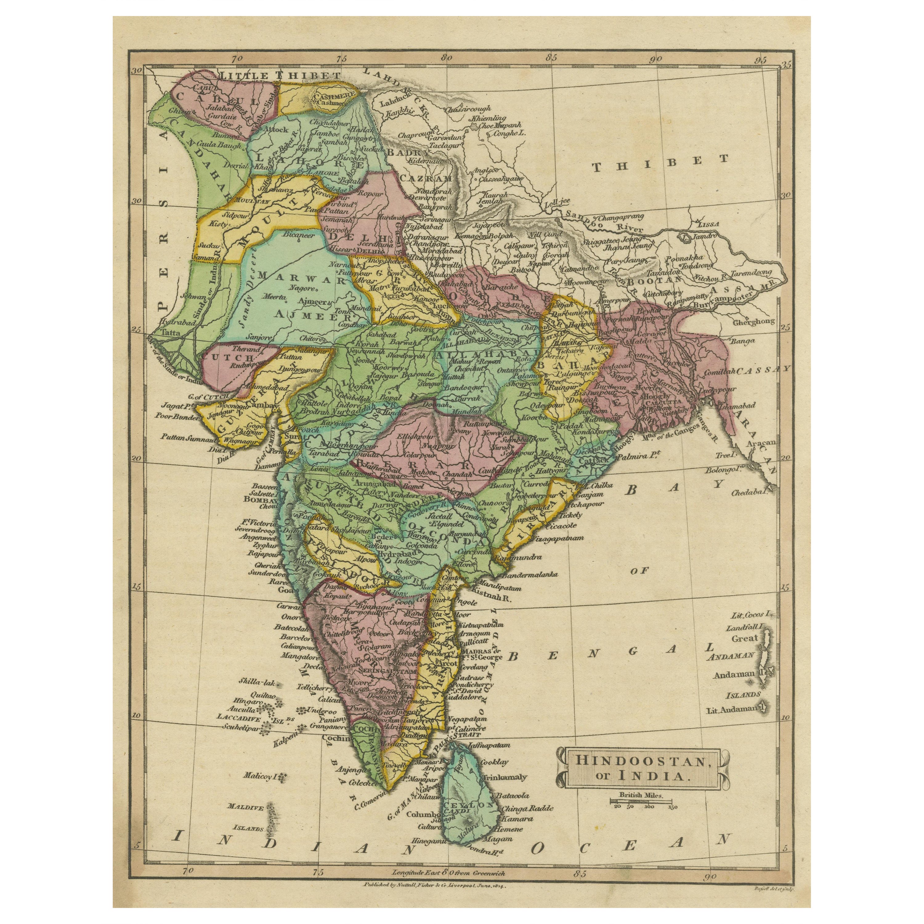
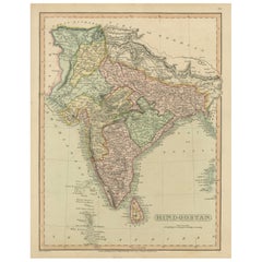
View AllAntique Map of Hindustan, or India
Located in Langweer, NL
Antique map titled 'Hindoostan, or India'. Original antique map of India (Hindustan) and Sri Lanka (Ceylon). Engraved by Russell. Published by Nuttall, Fisher & Co, 1814.
Category
Antique Early 19th Century Maps
Materials
Paper

$277 Sale Price
20% Off
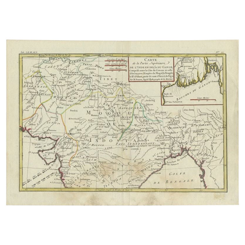
Antique Map of Northern India by Bonne, 1780
Located in Langweer, NL
Antique map titled 'Carte de la partie Supérieure de l'Inde (..)'. A fine example of Rigobert Bonne and Guilleme Raynal?s 1780 map of northern India. Covers the northern part of Indi...
Category
Antique 18th Century Maps
Materials
Paper
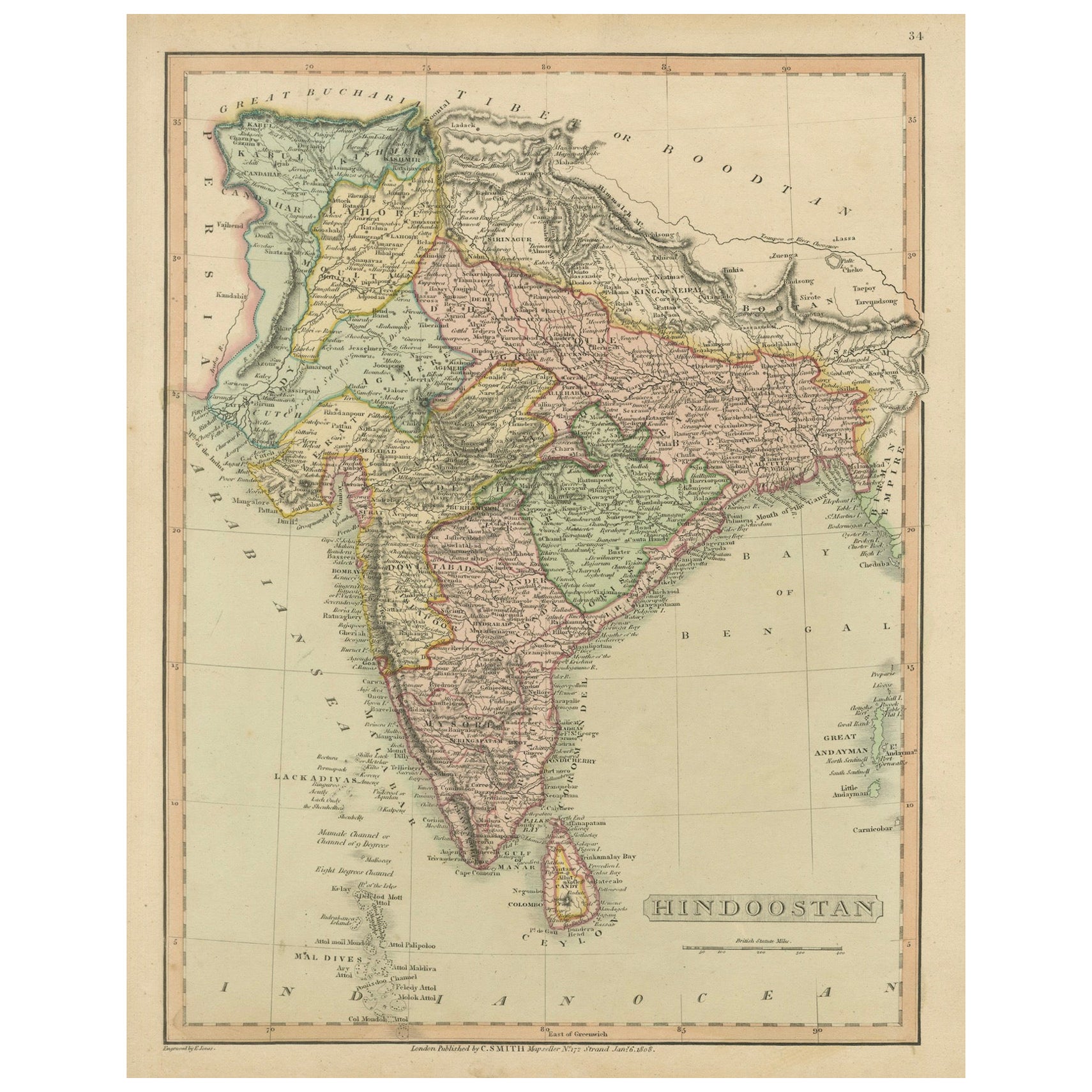
1808 C. Smith Map of Hindoostan – British India with Intricate Details
Located in Langweer, NL
Title: 1808 C. Smith Map of Hindoostan – British India with Intricate Details
This map, titled "Hindoostan," was published by C. Smith, a prominent London map seller, on January 6, ...
Category
Antique Early 1800s Maps
Materials
Paper
$373 Sale Price
20% Off
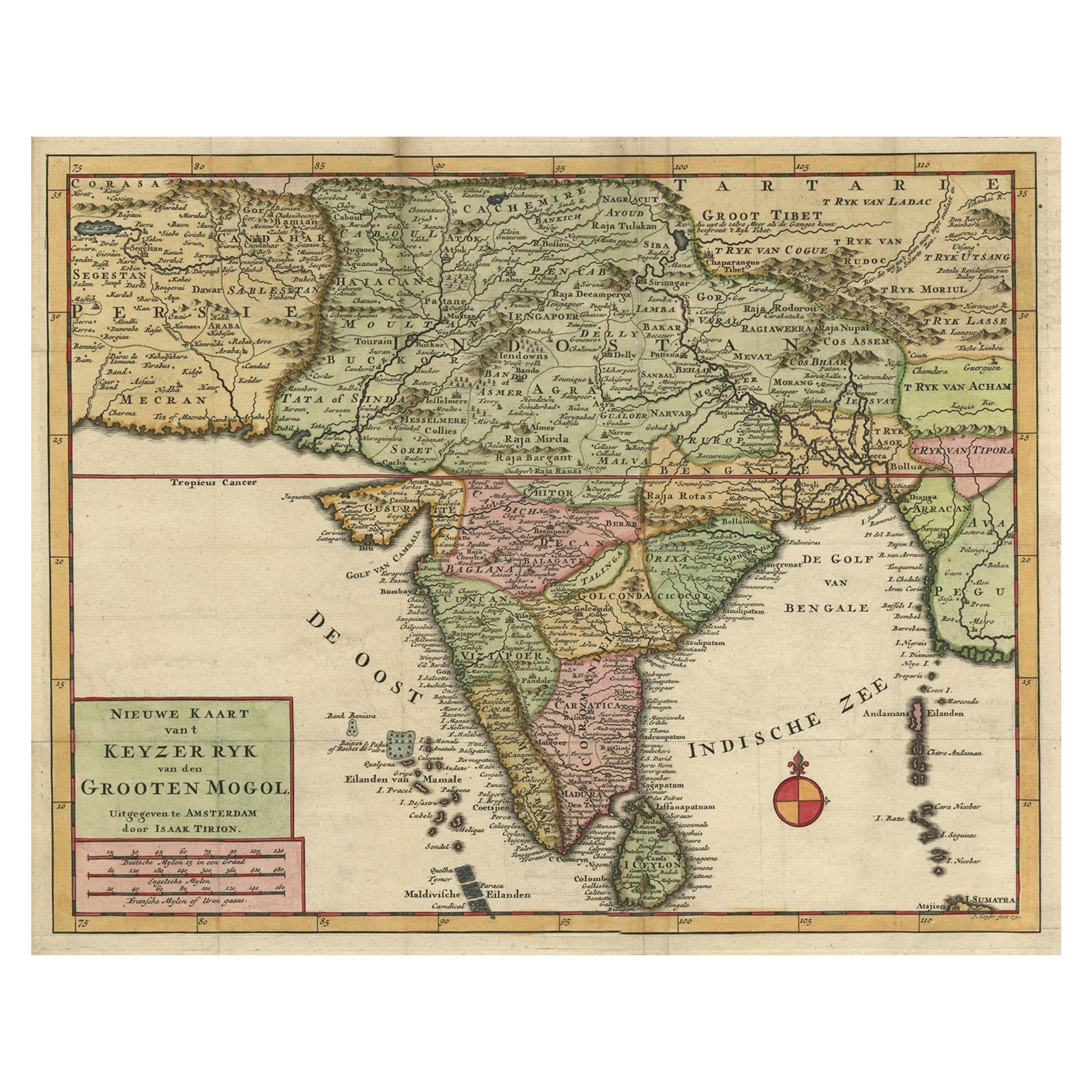
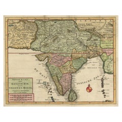
Attractive Detailed Map of the Empire of the Great Mogul, Incl India, 1731
Located in Langweer, NL
Antique map titled 'Nieuwe Kaart van t Keyzer Ryk Grooten Mogol.'
Attractive detailed map of the Empire of the Great Mogul, which included India, Sri Lanka, Pakistan and Banglade...
Category
Antique 1730s Maps
Materials
Paper
$899 Sale Price
20% Off
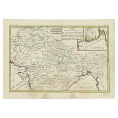
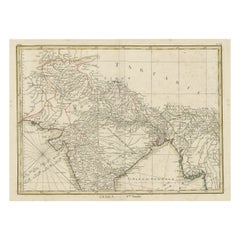
Old Map of North India From Kandahar East to Burma 'Pegu' and South to Goa, 1776
Located in Langweer, NL
Description: Antique map titled 'Indes Iere Feuille'.
Old map of northern India. Covers the subcontinent from Kandahar east as far as Burma (Pegu) and south to just past Goa. Names...
Category
Antique 1770s Maps
Materials
Paper
$353 Sale Price
20% Off
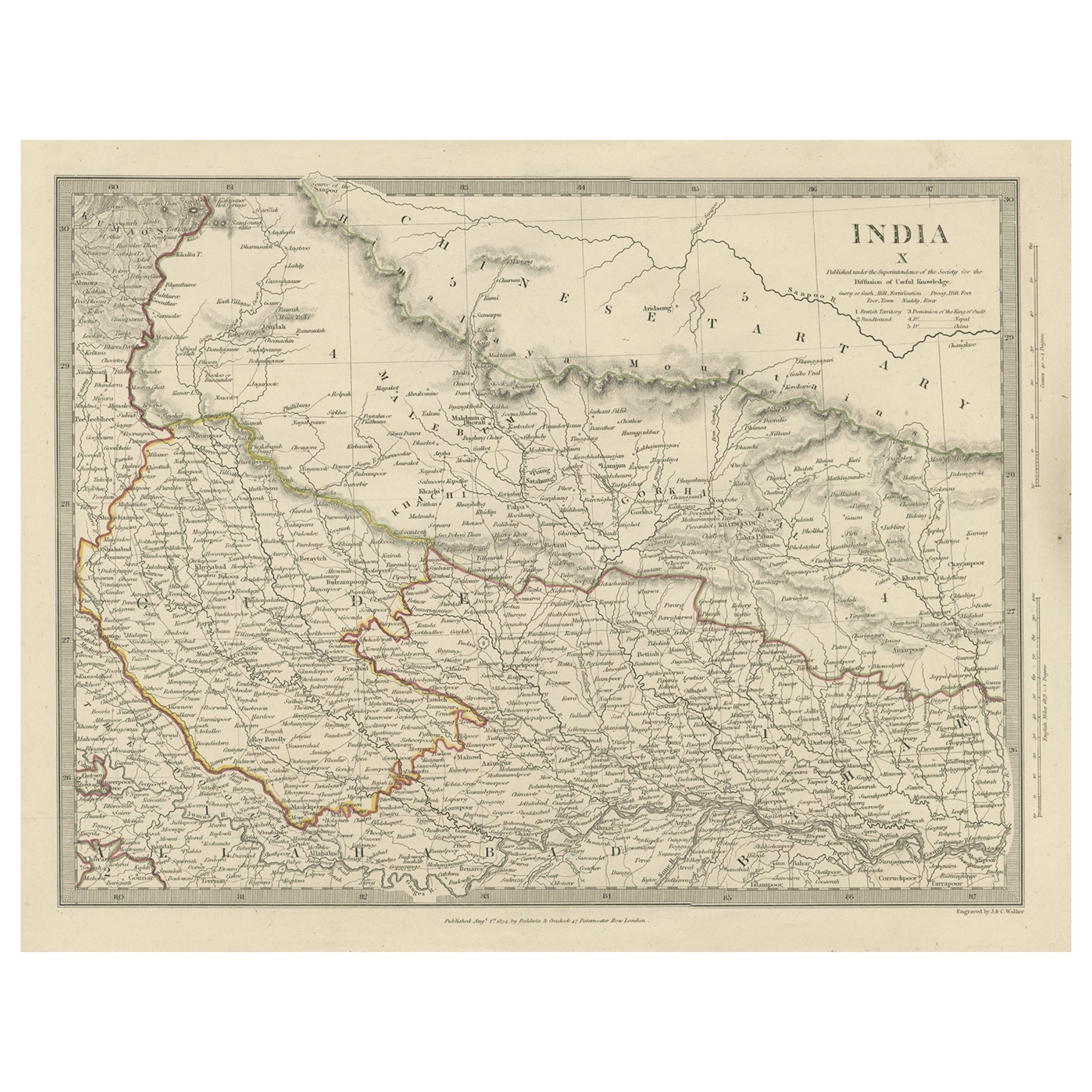
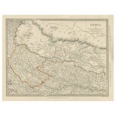
Original Antique Map of Part of the Bahar Region (India), 1834
Located in Langweer, NL
Antique map titled 'India X'. Old steel engraved map of part of the Bahar region, it also shows part of Nepal.
Artists and Engravers: Engraved by J. & C. Walker. Published under th...
Category
Antique 19th Century Maps
Materials
Paper
$277 Sale Price
20% Off
You May Also Like
Original Antique Map of India by Dower, circa 1835
Located in St Annes, Lancashire
Nice map of India
Drawn and engraved by J.Dower
Published by Orr & Smith. C.1835
Unframed.
Free shipping
Category
Antique 1830s English Maps
Materials
Paper

Large Original Vintage Map of India, circa 1920
Located in St Annes, Lancashire
Great map of India
Original color.
Good condition / repair to some minor damage just above Sri Lanka. Shown in the last image.
Published by Alexander Gross
Unframed.
Category
Vintage 1920s English Maps
Materials
Paper

Antique French Map of Asia Including China Indoneseia India, 1783
Located in Amsterdam, Noord Holland
Very nice map of Asia. 1783 Dedie au Roy.
Additional information:
Country of Manufacturing: Europe
Period: 18th century Qing (1661 - 1912)
Condition: Overall Condition B (Good Used)...
Category
Antique 18th Century European Maps
Materials
Paper

$648 Sale Price
20% Off
Antique 1803 Italian Map of Asia Including China Indoneseia India
Located in Amsterdam, Noord Holland
Antique 1803 Italian Map of Asia Including China Indoneseia India
Very nice map of Asia. 1803.
Additional information:
Type: Map
Country of Manufacturing: Europe
Period: 19th centu...
Category
Antique 19th Century European Maps
Materials
Paper

$584 Sale Price
20% Off
Map Of India - Original Lithograph - 19th Century
Located in Roma, IT
Map of India is an original lithograph artwork realized by an Anonymous engraver of the 19th Century.
Printed in the series of "France Pittoresque".
Titled "France Pittoresque".
...
Category
19th Century Modern Figurative Prints
Materials
Lithograph

India (Southern Sheet), English antique map by Alexander Keith Johnston, 1901
Located in Melbourne, Victoria
'India (Southern Sheet)', antique lithographic map by Keith Johnston.
Inset maps of 'Bombay Island & Town', 'Madras & Environs', and 'South-Eastern Provinces of India'.
Central vertical fold as issued.
495mm by 625mm (sheet)
Alexander Keith...
Category
Early 20th Century Victorian More Prints
Materials
Lithograph

More Ways To Browse
Antique Mississippi Map
Celestial Map
Nevada Antique Map
17th Century American Furniture
Afghanistan Map
Antique Celestial Maps
Antique Maps Virginia
Hand Drawn Map
Map Of Puerto Rico
Sicily Map
Used Durham Furniture
Antique Maps Of Israel
Antique Maps Of Russian Empire
Cyprus Antique Maps
Kolkata Antique Furniture
Afghanistan Antique Map
Antique Furniture Delaware
Antique Furniture Wisconsin