17th Century Maps
to
763
907
62
970
10
1
2,936
2,181
476
3
289
34
10
127
7
35
9
2
5
4
4
2
969
10
9
2
2
91
43
30
18
14
970
970
970
63
12
11
10
6
Period: 17th Century
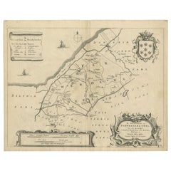
Antique Map of the Region of Ferwerderadeel by Schotanus, 1664
Located in Langweer, NL
Antique map titled 'De Grietenye van Ferwerdera-Deel (..)'. Map of the Grietenij of Ferwerderadeel, Friesland, The Netherlands. Originates from "Beschrijvinge ende nieuwe caerten van...
Category
Antique 17th Century Maps
Materials
Paper
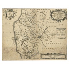
Antique Map of the Region of Wonseradeel by Schotanus, 1664
By B. Schotanus
Located in Langweer, NL
Antique map titled 'De Grietenije van Wonsera-deel (..).' Map of the Grietenij of Wonseradeel, Friesland, The Netherlands. Multiple cartouches, key and coat of arms. "Beschrijvinge e...
Category
Antique 17th Century Maps
Materials
Paper
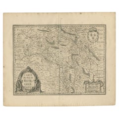
Antique Map of the Region of Rethel by Janssonius, 1657
Located in Langweer, NL
Antique map of France titled 'Carte du Pais de Retelois'. Detailed map of the region of Rethel in the north east of France. Showing the city of Rethel, Moncornet en Tirache, Beaumont...
Category
Antique 17th Century Maps
Materials
Paper
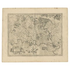
Antique Map of the Region of Brie by Janssonius, 1657
Located in Langweer, NL
Antique map of France titled 'Le Pais de Brie'. Old map of the Brie Region, to the east of Paris, between the Marne and the Seine Rivers. This map originates from 'Atlas Novus, Sive ...
Category
Antique 17th Century Maps
Materials
Paper
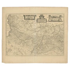
Antique Map of the Region of Picardy by Janssonius 'c.1650'
Located in Langweer, NL
Antique map of France titled 'Picardia vera et inferior'. Detailed map of the Picardy region of France. Shows the cities of Calais, Abbeville, St. Quentin, Rethel and others.
Ar...
Category
Antique 17th Century Maps
Materials
Paper
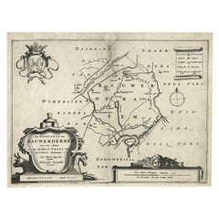
Antique Map of the Region of Rauwerderhem, Friesland, The Netherlands, '1664'
By B. Schotanus
Located in Langweer, NL
Antique map titled 'De Grietenije van Rauwerderhem (..).' Map of the Grietenij of Rauwerderhem, Friesland, The Netherlands. Multiple cartouches, key and coat of arms. This map orgini...
Category
Antique 17th Century Maps
Materials
Paper
Antique Map of the Region of Zevenwouden, Friesland, The Netherlands, 1660
Located in Langweer, NL
Antique map titled 'De Zeeven Wolden'. Map of the region of Zevenwouden (or Zevenwolden) in Friesland, the Netherlands.
This region include the villages of Langweer, Echtenerbrug...
Category
Antique 17th Century Maps
Materials
Paper
Antique Map of the Region of Dantumadeel by Schotanus, 1664
Located in Langweer, NL
Antique map titled 'De Grietenye van Dantumadeel (..)'. Map of the Grietenij of Dantumadeel, Friesland, The Netherlands. Originates from "Beschrijvinge ende nieuwe caerten van de Hee...
Category
Antique 17th Century Maps
Materials
Paper
Antique Map of the Provinces of Gelderland and Overijssel by Kaerius, 1617
Located in Langweer, NL
Antique map titled 'Geldria et Transysulana'. Scarse map by Kaerius of the provinces Gelderland and Overijssel in the Netherlands. Large cartouche with coat of arms and sailing ship ...
Category
Antique 17th Century Maps
Materials
Paper
Antique Map of the Region of Aire-sur-L'Adour by Janssonius, 1657
Located in Langweer, NL
Antique map of France titled 'L'Evesche d'Aire'. Decorative map of the Aire-sur-L'Adour region, a commune in the Landes department in Nouvelle-Aquitaine in southwestern France. This ...
Category
Antique 17th Century Maps
Materials
Paper
Antique Map of the City of Sneek by Blaeu, 1652
Located in Langweer, NL
Antique map titled: 'Sneeck.' Bird's-eye view plan of Sneek, Friesland, The Netherlands. From a Latin edition of the town atlas 'Toneel der Steden', published by Joan Blaeu, Amsterda...
Category
Antique 17th Century Maps
Materials
Paper
Antique Map of the City of Zutphen, c.1650
Located in Langweer, NL
Antique map titled 'Zutphen'. Uncommon original antique map of the city of Zutphen, the Netherlands. Source unknown, to be determined.
Artists and Engravers: Anonymous.
Conditi...
Category
Antique 17th Century Maps
Materials
Paper
Antique Map of the City of Stavoren by Merian, 1659
Located in Langweer, NL
Antique map titled 'Staveren'. Original antique map of the city of Stavoren, Friesland, the Netherlands. This map originates from 'Topographia Germania Inferioris' by C. Merian. Publ...
Category
Antique 17th Century Maps
Materials
Paper
Antique Map of the City of Oudewater by Merian, 1659
Located in Langweer, NL
Antique map titled 'Oudewater'. Plan of the city of Oudewater, the Netherlands. This map originates from 'Topographia Germania Inferioris' by C. Merian, 1659.
Artists and Engraver...
Category
Antique 17th Century Maps
Materials
Paper
Antique Map of the Coast of Artois by Janssonius, 1657
Located in Langweer, NL
Antique map of France titled 'Descriptio Boloniae, Pontieu'. Detailed map of the coast of Artois featuring the fortified cities of St. Valery-sur-Somme, Le Crotoy, Rue, Estaples, and...
Category
Antique 17th Century Maps
Materials
Paper
Antique Map of the City of Sint-Maartensdijk by Smallegange, c.1696
Located in Langweer, NL
Antique map titled 'St. Maertensdyk'. Original antique map of the city of Sint-Maartensdijk, the Netherlands. Source unknown, to be determined.
Artists and Engravers: Published b...
Category
Antique 17th Century Maps
Materials
Paper
Antique Map of the City of Oldenzaal by Orlers, 1615
Located in Langweer, NL
Antique map depicting the Siege of Oldenzaal, the Netherlands. The Siege of Oldenzaal was a short siege that took place during the Eighty Years' War and the Anglo–Spanish War by a Du...
Category
Antique 17th Century Maps
Materials
Paper
Antique Map of the City of Muiden by Merian, 1659
Located in Langweer, NL
Antique map titled 'Muyden'. Original antique map of the city of Muiden, the Netherlands. This map originates from 'Topographia Germania Inferioris' by C. Merian. Published 1659.
...
Category
Antique 17th Century Maps
Materials
Paper
Antique Map of the City of Sneek by Blaeu, 1649
Located in Langweer, NL
Antique map Friesland titled 'Sneeck'. Bird's-eye view plan of Sneek, the Netherlands. This map originates from 'Toneel der Steeden' published by Joan Blaeu, 1649.
Artists and Eng...
Category
Antique 17th Century Maps
Materials
Paper
Antique Map of the City of Leeuwarden by Merian, 1659
Located in Langweer, NL
Antique map titled 'Leurwaerden'. This print depicts the city of Leeuwarden (Friesland, The Netherlands). This print originates from 'Topographia Germaniae Inferioris (..)' by C. Mer...
Category
Antique 17th Century Maps
Materials
Paper
Antique Map of the City of Tiel by Blaeu, 1649
Located in Langweer, NL
Antique map titled 'Tyel'. Beautiful map of the city of Tiel, The Netherlands. With a coat of arms and key of various locations. Originates from 'Toneel der Steeden' published by Joa...
Category
Antique 17th Century Maps
Materials
Paper
Handcolored Rare Map of Leeuwarden, Capital of Friesland, The Netherlands, 1622
Located in Langweer, NL
Antique map titled 'Leeuwerden de Hooftstadt van Vrieslandt'. Rare and old map of the city of Leeuwarden, Friesland.
Artists and Engravers: Published by Pieter Feddes van Harlingen...
Category
Antique 17th Century Maps
Materials
Paper
Antique Map of the City of Leeuwarden by Merian, 1659
Located in Langweer, NL
Antique map titled 'Leurwaerden'. This print depicts the city of Leeuwarden (Friesland, The Netherlands). This print originates from 'Topographia Germaniae Inferioris (..)' by C. Mer...
Category
Antique 17th Century Maps
Materials
Paper
Antique Map of the Course of the Elbe River by Janssonius, c.1650
Located in Langweer, NL
Antique map titled 'Nobilis Flubius Albis (..)'. Old map of the course of the Elbe river, large inset view of the city of Hamburg. Source unknown, to be determined.
Artists and En...
Category
Antique 17th Century Maps
Materials
Paper
Antique Map of the Islands of Schiatti and Scopoli, Greece, 1687
Located in Langweer, NL
Antique map titled 'Schiatti - Scopoli.' This original antique map shows the islands Schiatti and Scopoli in Greece. Source unknown, to be determined.
Artists and Engravers: Made by...
Category
Antique 17th Century Maps
Materials
Paper
Antique Map of the Empire of the Assyriens by Mallet, 1683
Located in Langweer, NL
Antique map titled 'Empire des Assyriens' and 'Assyrie Chaldee et Mesopotamie selon les Anciens'. Two maps on one sheet, the upper sheet showing the Empire of the Assyriens and the second showing the region of the Tigres and Euphrates Rivers. This map originates from Alain Manesson Mallet's 'Description de l 'Univers'.
Artists and Engravers: Alain Manesson Mallet (1630–1706) was a French cartographer and engineer. He started his career as a soldier in the army of Louis XIV, became a Sergeant-Major in the artillery and an Inspector of Fortifications. He also served under the King of Portugal, before returning to France, and his appointment to the court of Louis XIV. His military engineering and mathematical background led to his position teaching mathematics at court. His major publications were Description de L'Univers (1683) in 5 volumes, and Les Travaux de Mars ou l'Art de la Guerre (1684) in 3 volumes. His Description de L'Universe contains a wide variety of information, including star maps...
Category
Antique 17th Century Maps
Materials
Paper
Antique Map of the Low Countries and Surroundings in Europe, 1685
By Philipp Clüver
Located in Langweer, NL
Antique map titled 'Germaniae Cisrhenanae ut ineter I Caesaris et Traiani Suit imperia Scaldis Item Mose ac Rheni.' Miniature map of the Low Countries and part of Germany and France....
Category
Antique 17th Century Maps
Materials
Paper
Antique Map of the Old Land of Batavia and FriesLand, The Netherlands, 1697
Located in Langweer, NL
Antique map Friesland titled 'Descriptio veteris Agri Batavi et Frisii (..)'. Old map of Friesland, the Netherlands. Depicts the old land of Batavia and Friesland. This map originate...
Category
Antique 17th Century Maps
Materials
Paper
Antique Map of the Island of Kyra Panagia by Dapper, 1688
Located in Langweer, NL
Antique map titled 'Pelagnisi.' Map of the island of Kyra Panagia, Pelagnisi (Pelagos), Greece. This map originates from 'Nauwkeurige Beschrijving der eilanden in de Archipel der Mid...
Category
Antique 17th Century Maps
Materials
Paper
Antique Map of the Hainaut Region by Visscher, c.1690
Located in Langweer, NL
Antique map titled 'Comitatus Hannoniae et Archiepiscopatus Cameracensis Tabula'. Large map of the Hainaut region, France.
Artists and Engravers: Nicolaes Visscher II (1649, Amst...
Category
Antique 17th Century Maps
Materials
Paper
Antique Map of the Koblentz Region by Moll, 1695
By Herman Moll
Located in Langweer, NL
Antique map Koblentz titled 'Coblentz'. Rare antique map of the Koblentz region in Germany. On verso, an antique map of the Mont Royal fortress, Germany. Originates from 'Thesaurus Geographicus. A New Body of Geography: or a Compleat Description of the Earth 'by H. Moll.
Artists and Engravers: Herman Moll...
Category
Antique 17th Century Maps
Materials
Paper
Antique Map of the Islands of Macian and Bacian by De Bry, 1619
Located in Langweer, NL
Antique map titled 'Delineatio Insularum Macian et Bacian'. Depicts the islands Macian and Bacian. Originates from 'Americae pars Undecima (..) by J.T. de Bry, 1619.
Artists and E...
Category
Antique 17th Century Maps
Materials
Paper
Antique Map of the Hesse Region of Germany by Blaeu, 1665
Located in Langweer, NL
Antique map titled 'Hassia Landgraviatus'. Map of the Hesse Region of Germany. This map originates from 'Atlas Maior Sive Cosmographia Blaviana, Qua Solvm, Salvm, Coelvm, Accvratissi...
Category
Antique 17th Century Maps
Materials
Paper
Antique Map of the City of Harlingen by Merian, c.1655
Located in Langweer, NL
Antique map titled 'Harlingen'. Original antique map of the city of Harlingen, Friesland, the Netherlands. With German legend. This map originates from 'Topographia Circuli Burgundic...
Category
Antique 17th Century Maps
Materials
Paper
Antique Map of the City of Harlingen by Janssonius, c.1657
Located in Langweer, NL
Antique map titled ‘Harlingen‘. This map depicts the city of Harlingen (Friesland, The Netherlands). Published by J. Janssonius, Amsterdam, c.1657.
Artists and Engravers: Johannes...
Category
Antique 17th Century Maps
Materials
Paper
Antique Map of the City of Groningen by Merian, 1659
Located in Langweer, NL
Antique map titled 'Gröningen'. This print depicts the city of Groningen, the Netherlands. This print originates from 'Topographia Germaniae Inferioris (..)' by C. Merian.
Artist...
Category
Antique 17th Century Maps
Materials
Paper
Antique Map of the City of Gorinchem by Merian, c.1659
Located in Langweer, NL
Antique map titled 'Gorckum'. This print depicts the city of Gorinchem (or Gorcum/Gorkum, The Netherlands). This print originates from 'Topographia Germaniae Inferioris (..)'.
Art...
Category
Antique 17th Century Maps
Materials
Paper
Antique Map of the City of Franeker by Janssonius, 1657
Located in Langweer, NL
Antique map titled ‘Franekera‘. This map depicts the city of Franeker (Friesland, The Netherlands). Published by J. Janssonius, Amsterdam, 1657.
Artists and Engravers: Johannes Jans...
Category
Antique 17th Century Maps
Materials
Paper
Antique Map of the City of Harlingen by Janssonius, c.1657
Located in Langweer, NL
Antique map titled ‘Harlingen‘. This map depicts the city of Harlingen (Friesland, The Netherlands). Published by J. Janssonius, Amsterdam, c.1657.
Artists and Engravers: Johannes...
Category
Antique 17th Century Maps
Materials
Paper
Antique Map of Stavoren by Blaeu, 1649
Located in Langweer, NL
Antique map titled 'Staveren'. Original antique map of the city of Stavoren, Friesland, The Netherlands. This map originates from 'Toonneel der Steden van de Vereenighde Nederlanden'...
Category
Antique 17th Century Maps
Materials
Paper
Antique Map of the Banda Islands by Commelin, 1646
Located in Langweer, NL
Plate 15: 'Afteeckeninge van 't Eyland Banda.' Depiction of the Banda Islands, Indonesia. Rare. This attrative plate originates from: 'Title: Waerachtigh verhael van de Schipvaerd op Oost-Indien Ghedaen by de acht Schepen in den jare 1598. van Amsterdam uyt-gezeylt, onder 't beleyd van den Admirael Jacob Cornelissoon van Neck...
Category
Antique 17th Century Maps
Materials
Paper
Antique Map of Stavoren by Merian, c.1650
Located in Langweer, NL
Antique map titled 'Stavera'. Map of the city of Stavoren, Friesland. With German legend. Trimmed, originally published on one sheet with a map of Bolsward and Hindeloopen. Artists a...
Category
Antique 17th Century Maps
Materials
Paper
Antique Map of Stavoren by Blaeu, 1649
Located in Langweer, NL
Antique map titled 'Staveren'. Original antique map of the city of Stavoren, Friesland, The Netherlands. This map originates from 'Toonneel der Steden van de Vereenighde Nederlanden'...
Category
Antique 17th Century Maps
Materials
Paper
Antique Map of the City of Alkmaar by Merian, c.1659
Located in Langweer, NL
Antique map titled 'Alckmaer'. Old map of the city of Alkmaar, the Netherlands. This print originates from 'Topographia Germaniae Inferioris (..)'. Artists and Engravers: Caspar Meri...
Category
Antique 17th Century Maps
Materials
Paper
Antique Map of St. Andries 'Heerewaarden' by Orlers, 1615
Located in Langweer, NL
Antique map titled 'Prata Inundata'. This map depicts the area between the Maas and Waal river (The Netherlands) during the siege of St. Andries and Voorne under command of prince Ma...
Category
Antique 17th Century Maps
Materials
Paper
Antique Map of Stavoren by Merian, c.1650
Located in Langweer, NL
Antique map titled 'Stavera'. Map of the city of Stavoren, Friesland. With German legend. Trimmed, originally published on one sheet with a map of Bolsward and Hindeloopen. Artists a...
Category
Antique 17th Century Maps
Materials
Paper
Antique Map of the City of Dokkum by Blaeu, c.1650
Located in Langweer, NL
Antique map titled 'Dockum'. Large map of the city of Dokkum, Friesland, The Netherlands. Originates from 'Toneel der Steden', published by Joan Blaeu, Amsterdam. Artists and Engrave...
Category
Antique 17th Century Maps
Materials
Paper
Antique Map of the City of Alkmaar by Merian, 1659
Located in Langweer, NL
Antique map titled 'Alckmaer'. This print depicts the city of Alkmaar (The Netherlands). This print originates from 'Topographia Germaniae Inferioris (..)' by C. Merian. Artists and ...
Category
Antique 17th Century Maps
Materials
Paper
Antique Map of the Artois region by Visscher, c.1690
Located in Langweer, NL
Antique map titled 'Geographica Artesiae Comitatus Tabula'. Large map of the Artois region, France. Also shows part of Flanders. Artists and Engravers: Nicolaes Visscher II (1649, Am...
Category
Antique 17th Century Maps
Materials
Paper
Antique Map of the City of Arnhem by Guicciardini, 1613
Located in Langweer, NL
Antique map titled ?Arnhemium Gelriae in Ripa Rheni Opp?. Plan of Arnhem in the province of Gelderland, The Netherlands, Holland. This map originates from the 1613 edition of 'Discri...
Category
Antique 17th Century Maps
Materials
Paper
Antique Map of Stavoren by Priorato, 1673
Located in Langweer, NL
Antique map titled 'Staveren'. Original antique map of the city of Stavoren, Friesland, the Netherlands. This map orginates from 'Teatro del Belgio (..)', published in Frankfurt am Main in 1673 by Gualdo Priorato. Artists and Engravers: Author: Galeazzo Gualdo Priorato (1606-1678) entered military service at a very young age and served in Flanders under the Prince of Orange. After his retirement, he authored several historical accounts including the Teatro del Belgio, which described the Catholic/Protestant wars in Belgium and Netherlands during the seventeenth century. His superb plans do not show the internal layout of the cities, except for showing the locations of the major churches. Instead the emphasis is on the fortification, as well as on the surrounding site, rivers and canals...
Category
Antique 17th Century Maps
Materials
Paper
Antique Map of Switzerland by Cluver, 1685
Located in Langweer, NL
Antique map titled 'Helvetiae Conterminarumque Terrarii, antiqua descriptio.' Miniature map of Switzerland, from the pocket atlas 'Introductionis in...
Category
Antique 17th Century Maps
Materials
Paper
Antique Map of the City of Franeker by Guicciardini, 1612
Located in Langweer, NL
Antique map titled 'Franicher'. Original antique map of the city of Franeker, Friesland, the Netherlands. This map originates from 'Beschryvinghe van alle de Neder-landen, anderssins...
Category
Antique 17th Century Maps
Materials
Paper
Antique Map of the City of Bolsward by Merian, c.1650
Located in Langweer, NL
Antique map titled 'Bolzvardia'. Old map of the city of Bolsward, Friesland. This map was published with two other maps on one sheet (Hindeloopen and Stavoren). Artists and Engravers...
Category
Antique 17th Century Maps
Materials
Paper
Antique Map of the Alsace Region of France by Hondius, c.1630
Located in Langweer, NL
Antique map titled 'Alsatia Superior (..)'. Original antique map of the Alsace (Elzas) region of France. The map is centered on the course of the Rhine River, from Strasbourg in the north to Basle. Artists and Engravers: Published by H. Hondius. Henricus Hondius...
Category
Antique 17th Century Maps
Materials
Paper
Antique Map of the City of Franeker by Blaeu, 1649
Located in Langweer, NL
Antique map titled 'Franekera'. Old map of the city of Franeker, Friesland. Also shows two cartouches, coats of arms and legend. This plan originates from the famous city Atlas: 'Ton...
Category
Antique 17th Century Maps
Materials
Paper
Antique Map of Stavoren, Bolsward and Hindeloopen by Merian, c.1650
Located in Langweer, NL
Antique map titled 'Stavera, Bolzvardia, Hindelopia'. Three maps on one sheet depicting Stavoren, Bolsward and Hindeloopen (Friesland, The Netherlands). With German legend. Artists a...
Category
Antique 17th Century Maps
Materials
Paper
Antique Map of the City of Dokkum, Friesland by Blaeu, c.1650
Located in Langweer, NL
Antique map titled ?Dockum?. Plan of Dokkum in Friesland, the Netherlands. A cartouche with two coats of arms. Originates from the town atlas 'Toneel der Steden', published by Joan Blaeu...
Category
Antique 17th Century Maps
Materials
Paper
