17th Century Maps
to
763
907
62
970
10
1
2,936
2,181
476
3
289
34
10
127
7
35
9
2
5
4
4
2
969
10
9
2
2
91
43
30
18
14
970
970
970
63
12
11
10
6
Period: 17th Century
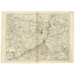
Antique Map of the Region of Liege by Coronelli, 1690
Located in Langweer, NL
Antique map titled 'Vescovato di Liege (..)'. Map of the Belgium area centered on Liege and the course of Meuse/Maas River. Also depicts the cities of Maastricht, Namur and Tienen. O...
Category
Antique 17th Century Maps
Materials
Paper
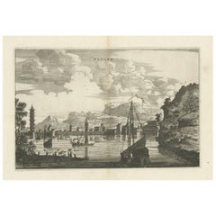
Antique Print of the City of Nangan in Fujian, China, 1668
Located in Langweer, NL
Antique print China titled 'Nangan'. Old print depicting a view on the city of Nangan with its ramparts and a Pagoda. This print originates from the Latin edition of Nieuhof's work t...
Category
Antique 17th Century Maps
Materials
Paper
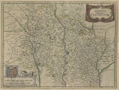
Antique Map of the French Province of Quercy, ca.1625
Located in Langweer, NL
Antique map titled 'Quercy Cadurcium'. Old map of the region of Quercy, France. Quercy is a former province of France, the present-day department of Lot, the northern half of the dep...
Category
Antique 17th Century Maps
Materials
Paper
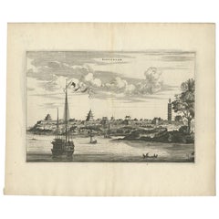
Antique Print of the City of Kinnungam in China, 1668
Located in Langweer, NL
Antique print China titled 'Kinnungam'. Old print depicting a view of the Chinese city of Kinnungam with its ramparts. This print originates from t...
Category
Antique 17th Century Maps
Materials
Paper
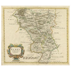
Original Antique County Map of Derbyshire, England
Located in Langweer, NL
Antique map titled 'Darbyshire'. Original antique map of the country of Derbyshire, England. Engraved by Robert Morden. Sold by Abel Swale, Awnsham and John Churchill...
Category
Antique 17th Century Maps
Materials
Paper
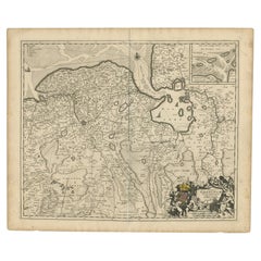
Antique Map of the Dutch Provinces Groningen and Drenthe, C.1660
Located in Langweer, NL
Antique map titled 'Dominii Groningae nec non maximae partis Drentiae (..)'. Map of Groningen and Drenthe in the north-east part of the Netherlands. Inset upper right corner of the "...
Category
Antique 17th Century Maps
Materials
Paper
Original Antique Map of Brecknockshire, Wales
Located in Langweer, NL
Antique map titled 'Brecknoc comitaus pars olim silurum'. Original old map of Brecknockshire, Wales. Engraved by R. Vaughan after Christopher Saxton. Published circa 1640.
Category
Antique 17th Century Maps
Materials
Paper
Original Antique Map of England and Wales with Large Cartouche
Located in Langweer, NL
Antique map titled 'Le Royaume d'Angleterre divisé en plusieurs Parties (..)'. Large and rare map of England and Wales by J.B. Nolin after Coronelli. With decorative cartouche, table...
Category
Antique 17th Century Maps
Materials
Paper
Antique Map of the Coastline Between Calais and Estaples and Northern France
Located in Langweer, NL
Antique map titled 'Caletensium et Bononiensium Ditionis Accurata Delinatio [on sheet with] Veromanduorum Eorumque Confinium Exactissima Discriptio'. Two maps on a folio sheet. Calentensium covers the coastline between Calais and Estaples based in part on a four-sheet map by Nicolas de Nicolay...
Category
Antique 17th Century Maps
Materials
Paper
Original Antique Poly-Olbion Map of Denbighshire and Flintshire, Wales
Located in Langweer, NL
Rare and original antique map of Denbighshire and Flintshire, Wales. From the 'Poly-Olbion,' an illustrated topographical poem describing Great Britain by Michael Drayton, 1622.
Category
Antique 17th Century Maps
Materials
Paper
Antique Map of Fortification of Bellingwolderschans, The Netherlands, 1673
Located in Langweer, NL
Antique map titled 'Bellingwolderschans'. Original map of the fortification of Bellingwolderschans, the Netherlands. This map originates from 'Teatro del Belgio', by G. Gualdo Priora...
Category
Antique 17th Century Maps
Materials
Paper
Antique Map of the Region of Le Mans 'France' by Blaeu, circa 1640
By Willem Blaeu
Located in Langweer, NL
Antique Map: Cenomanorum Galliae regionis typus vulgo le Mans – Blaeu, circa 1640
This beautifully engraved and hand-colored map depicts the historical province of Maine in northw...
Category
Antique 17th Century Maps
Materials
Paper
Stunning Decorative Antique Map of East Frisia with an Inset of Emden, c.1610
Located in Langweer, NL
Description: Antique map titled 'Typus Frisie Orientalis a Dullarto (..)'. One of the most decorative maps of East Frisia and its important shipping center of Emden and the Watten Is...
Category
Antique 17th Century Maps
Materials
Paper
Beautiful Antique Map of the Moluccas or Spice Islands, Indonesia, ca.1650
Located in Langweer, NL
Antique map titled 'Insularum Moluccarum Nova Descriptio.'
Beautiful map of the Moluccas. The famous Spice Islands, the cornerstone of the Dutc...
Category
Antique 17th Century Maps
Materials
Paper
Rare Original Miniature Map of Papua New Guinea and the Salomon Islands, 1600
Located in Langweer, NL
Very handsome original old coloured copper engraving of Papua and the Solomon Island. Title of the map 'Descriptio Novae Guneae et Inss. Salom.
On the reverse text in Latin.
Ve...
Category
Antique 17th Century Maps
Materials
Paper
Antique Map of the Region of Franche-Comté by Janssonius, circa 1650
Located in Langweer, NL
Antique map titled 'Burgundiae Comitatus Franche Comté'. Old map of the historical and former region of Franche-Comté, France. As a region, it encompasse...
Category
Antique 17th Century Maps
Materials
Paper
Encoloured Engraving of Cliff Kaloiero or Caloiero Island, Panaia, Greece, 1688
Located in Langweer, NL
Antique print Greece titled 'De Klip van Kaloiero'. Old print of the Island Kaloiero or Panaia, Greece. This print originates from 'Nauwkeurige Be...
Category
Antique 17th Century Maps
Materials
Paper
Antique Map of Northeastern Spain by Mercator, 1634
Located in Langweer, NL
Antique map titled 'Biscaia, Guipiscoa, Navarra et Asturias de Santillana'. Charming map of Northeastern Spain with the areas of Pamplona and Valladolid. This map originates from 'At...
Category
Antique 17th Century Maps
Materials
Paper
Antique Map of Switzerland by Janssonius, 1657
Located in Langweer, NL
Antique map of Switzerland titled 'Helvetiae Rhetiae & Valesiae'. Decorative and detailed map of Switzerland. This map originates from 'Atla...
Category
Antique 17th Century Maps
Materials
Paper
Original Antique Map of the Dutch Provinces of Overijssel and Drenthe, 1635
Located in Langweer, NL
Antique map titled 'Transiselania Dominium vernacule Over-Yssel.' - Map of the Dutch Provinces of Overijssel and Drenthe. Dedicated to Mr. Bartold Wich...
Category
Antique 17th Century Maps
Materials
Paper
Decorative Map of the Spice Islands in the Mollucas, Indonesia, ca.1640
Located in Langweer, NL
Antique map titled 'Moluccae Insulae Celeberrimae'.
Decorative map of the Spice Islands. Inset of the Island of Bachian (Batjan) in an elaborate frame as well as a Moluccan couple in the lower right corner in Europeanized native dress.
Artists and Engravers: Willem Janszoon Blaeu (1571-1638) was a prominent Dutch geographer and publisher. Born the son of a herring merchant, Blaeu chose not fish but mathematics and astronomy for his focus. He studied with the famous Danish astronomer Tycho...
Category
Antique 17th Century Maps
Materials
Paper
Charming 18th Century Miniature Map of Greece, 1685
Located in Langweer, NL
Antique map titled 'Graeciae Descriptio.' Charming miniature map of Greece from the pocket atlas 'Introductionis in Universam Geographiam tam Veterem qu...
Category
Antique 17th Century Maps
Materials
Paper
Old Print with a View on the City & Castle of Batavia 'Jakarta', Indonesia, 1668
Located in Langweer, NL
Antique print Indonesia titled ‘La ville de Batavie. De Stadt Batavia. Chateau de Batavia. ‘t Casteel van Batavia’.
Antique print with a view on the city of Djakarta, Indonesia. ...
Category
Antique 17th Century Maps
Materials
Paper
Antique Map of Part of Flanders 'Belgium' by F. de Wit 'circa 1680'
Located in Langweer, NL
Antique map titled 'Marchionatus Sacri Imperii et Dominii Mechelini Tabula'. Large folio size map of the region around Mechelen, Leuven, Brussels, Dendermonde and Antwerp. Published ...
Category
Antique 17th Century Maps
Materials
Paper
Antique Map of the Islands Near Batavia, Capital of the Dutch East Indies, 1682
Located in Langweer, NL
Antique map titled 'Caerte van de Eylanden voor Batavia.'
Map of the islands near Batavia, Indonesia. With scale, compass rose, cartouche and ships on the sea. Sheet with engraving...
Category
Antique 17th Century Maps
Materials
Paper
Antique Map of the County of Bentheim by Hondius, c.1630
Located in Langweer, NL
Antique map titled 'Comitatus Bentheimensis nova descriptio'. Engraved map of the County of Bentheim, showing Linge, Enschede, Bad Bentheim, Coevorden, Ne...
Category
Antique 17th Century Maps
Materials
Paper
Antique Map of the Region of Touraine in France by Janssonius, 1657
Located in Langweer, NL
Antique map titled 'Touraine - Turonensis Ducatus'.
Decorative map of the Touraine region. This map originates from 'Atlas Novus, Sive Theatrum Orbis Orbis Terrarum: In quo Galli...
Category
Antique 17th Century Maps
Materials
Paper
Original Old Bird's-eye View plan of Sneek, Friesland, The Netherlands, 1649
Located in Langweer, NL
Antique map titled: 'Sneeck.' Bird's-eye view plan of Sneek, Friesland, The Netherlands. Text in Latin on verso. This plan originates from the famous city Atlas: 'Toneel der Steeden'...
Category
Antique 17th Century Maps
Materials
Paper
Antique Map of Southern Italy by Janssonius, C.1650
Located in Langweer, NL
"Antique map titled 'Itala nam tellus Graecia Maior erat Ovid. IV. Fastor. Haec Italiae pars nunc primum de prica aerugine est abstersa (..)'. Beautiful map of Southern Italy...
Category
Antique 17th Century Maps
Materials
Paper
Antique Map of the Region of Lyon by Janssonius, 1657
Located in Langweer, NL
Antique map of France titled 'La Principaute de Dombes'. Detailed map of the area above Lyon. This map originates from 'Atlas Novus, Sive Theatrum Orbis Orbis Terrarum: In quo Gallia...
Category
Antique 17th Century Maps
Materials
Paper
Antique Map of the Maine Region by Janssonius, 1657
Located in Langweer, NL
Antique map of France titled 'Diocese du Mans vulgo le Mains'. Decorative map of the region of Maine, France. This map originates from 'Atlas Novus, Sive Theatrum Orbis Orbis Terraru...
Category
Antique 17th Century Maps
Materials
Paper
Antique Map of the County of Hainaut by Jaillot, 1692
Located in Langweer, NL
Antique map titled 'Le Comté de Haynaut divisé en Chateliensis, Balliages, Prevoste's (..)'. Large map of the county of Hainaut (France) with its most important cities, Mons (Bergen)...
Category
Antique 17th Century Maps
Materials
Paper
Antique Map of Gloucestershire in Britain by Camden, 1637
Located in Langweer, NL
Antique map titled 'Glocestriae comitatus olim sedes Dobunorum'. Map of Gloucestershire, England. This map originates from Camden?s 'Britannia' ...
Category
Antique 17th Century Maps
Materials
Paper
Two Maps of Asia on One Sheet, India, Bangladesh and Malaysia & Burma etc., 1617
Located in Langweer, NL
Antique map titled 'Tabula Asiae'.
Two maps of Asia on one sheet, recto and verso. The recto features an interesting map of India, Bangladesh and the Ganges River. On the verso, ...
Category
Antique 17th Century Maps
Materials
Paper
Rare Antique Engraving of Mount Fuji During an Earthquake in Tokyo, Japan, 1669
Located in Langweer, NL
Antique print, titled: 'Aertbeevinge tot Jedo.' - ('Earthquake in Edo').
A temple falls to ruins because of an earthquake in Yedo (or Edo, Jeddo; now Tokyo). Men and women lament...
Category
Antique 17th Century Maps
Materials
Paper
Original Antique Hand-Colored Map of The East Indies and Southeast Asia, c.1644
Located in Langweer, NL
Antique map titled 'India quae Orientalis dicitur, et Insulae adiacentes'.
Old map of the East Indies and Southeast Asia showing the area between India in the West and parts of J...
Category
Antique 17th Century Maps
Materials
Paper
Antique Map of Northern Jutland by Kaerius, 1628
Located in Langweer, NL
Antique map titled 'Iutia Septentrionalis'. Copper engraved map of Northern Jutland (Denmark) by P. Kaerius. This map originates from 'Atlas Minor (..)' by G. Mercator.
Category
Antique 17th Century Maps
Materials
Paper
Antique Map of the Duchy of Saxony by De Wit, c.1680
Located in Langweer, NL
Antique map titled 'Circuli Saxoniae Superior Pars Meridionalis in qua sunt Ducatus Saxoniae, Comitatus Mansfeldiae, et Voitlandiae, Landgraviat Thuringiae, Marchionatus Misniae Prin...
Category
Antique 17th Century Maps
Materials
Paper
Original Copper Engraving of the Indian City of Suratte 'Surat', 1672
Located in Langweer, NL
Antique print, titled: 'Suratte'
View of the Indian city of Suratte (Surat) showing a panoramic view of the city with figures, animals and a river wi...
Category
Antique 17th Century Maps
Materials
Paper
Antique Map of Prussia by Janssonius, 1628
Located in Langweer, NL
Antique map titled 'Prussia'. Original antique map of Prussia, a historically prominent German state that originated in 1525 with a duchy centered on th...
Category
Antique 17th Century Maps
Materials
Paper
Original Antique Print of the Chinese City of Kinnungam with its Ramparts, 1665
Located in Langweer, NL
Antique print, titled: 'Kinnungam'
View of the Chinese city of Kinnungam with its ramparts. Also depicted are ships and a pagoda can be seen as well.
...
Category
Antique 17th Century Maps
Materials
Paper
Antique Map of Southern Norway by Janssonius, c.1650
Located in Langweer, NL
"Antique map titled 'Nova et Accurata Tabula Episcopatuum Stavangriensis et Asloiensis'. Old map of the southern part of Norway, it covers the region around Bergen. Decorated with ma...
Category
Antique 17th Century Maps
Materials
Paper
Antique Map of Flanders and Zeeland by Merian, 1659
Located in Langweer, NL
Antique map titled 'Flandria et Zeelandia Comitatus'. Original antique map of Flanders, Belgium, and part of Zeeland, the Netherlands. This map originates from 'Topographia Germaniae...
Category
Antique 17th Century Maps
Materials
Paper
A Gold Highlighted Antique Map of Northamptonshire by Blaeu '1659'
Located in Langweer, NL
Antique map titled 'Comitatus Northantonensis vernacule Northamtonshire'. Original antique map of Northamptonshire, England. This map originates from 'Atlas Universal y Cosmographico...
Category
Antique 17th Century Maps
Materials
Paper
Antique Map of Hertfordshire in England by Speed, 1627
Located in Langweer, NL
Antique map titled 'Hartfordshire described the sittuations of Hartford (..)'.
Map of Hertfordshire, England. Includes inset maps of Hertford and the Roman settlement of Verolani...
Category
Antique 17th Century Maps
Materials
Paper
Antique Map of Flanders, Belgium, 1630
Located in Langweer, NL
Antique map titled 'Comitatus Flandria'. Original antique map of Flanders, Belgium. This map originates from 'Vyerige Colom verthonende de 17 Nederlandsche Provintien' published 1630...
Category
Antique 17th Century Maps
Materials
Paper
Portrait of Fernando Alvarez de Toledo y Pimentel, Grand duke of Alba, c.1690
Located in Langweer, NL
Antique print, titled: 'Ferdinand de Tolede. Duc d'Albe.'
Portrait of Fernando Alvarez de Toledo y Pimentel, Grand duke of Alba (1507-1582). Source un...
Category
Antique 17th Century Maps
Materials
Paper
Antique Map of the Region Between the Rhine and Elbe River by Cluver, 1685
Located in Langweer, NL
Antique map titled 'Populorum Germanium inter Rhenum et Albim descriptio, ut inter Caesaris aevum incolurant (…).' Miniature map of the area between the Rhine and the Elbe, Germany. ...
Category
Antique 17th Century Maps
Materials
Paper
17th Century Hand-Colored Map of a Region in West Germany by Janssonius
Located in Alamo, CA
This attractive highly detailed 17th century original hand-colored map is entitled "Archiepiscopatus Maghdeburgensis et Anhaltinus Ducatus cum terris adjacentibus". It was published ...
Category
Dutch Antique 17th Century Maps
Materials
Paper
Original Decorative Antique Map of Prussia, 1628
Located in Langweer, NL
Antique map titled 'Prussia'. Original antique map of Prussia, a historically prominent German state that originated in 1525 with a duchy centered on th...
Category
Antique 17th Century Maps
Materials
Paper
Antique Map of the City of Emden by Blaeu, 1649
Located in Langweer, NL
Antique map titled 'Emda'. Old map of the city of Emden, Germany. This map originates from 'Novum Ac Magnum Theatrum Urbium Belgicæ Liberæ ac Foederatæ' by J. Blaeu. Artists and Engr...
Category
Antique 17th Century Maps
Materials
Paper
Antique Plan of the Castle & City of Batavia 'Jakarta' on Java, Indonesia, c1669
Located in Langweer, NL
Antique map Batavia titled 'Ware Affbeeldinge wegens het Casteel ende Stadt Batavia'.
Antique print of the castle and city of Batavia on the Island of Java'. Rare edition with En...
Category
Antique 17th Century Maps
Materials
Paper
Antique Print of the Imperial Palace in Peking, China, 1668
Located in Langweer, NL
Antique print China titled ‘Interior aulae Imperatoriae facies'.
Antique print of the Imperial Palace in Peking, China. This print originates from ...
Category
Antique 17th Century Maps
Materials
Paper
Antique Map of the Rhine and Moselle River Region in Germany and France, c.1680
Located in Langweer, NL
Antique map titled 'Tabula Geographica qui Pars Meridionalis sive Superior Rheni, Mosae et Mosellae (..).'
Detailed map of the Rhine and Moselle River regions and contigous parts...
Category
Antique 17th Century Maps
Materials
Paper
Original Map with Bird's-Eye View of Zutphen in the Netherlands by Blaeu, 1649
Located in Langweer, NL
Antique print, titled: 'Zutphen.' - Bird's-eye view plan of Zutphen in The Netherlands, with key to locations and coats of arms. Text in Dutch on verso. This plan originates from the famous city Atlas: 'Toneel der Steeden' published by Joan Blaeu...
Category
Antique 17th Century Maps
Materials
Paper
Antique Map of the City of Enkhuizen by Guicciardini, 1625
Located in Langweer, NL
Antique map titled 'Die Stadt Enchuijsen, La ville denchuijsen'. Map of Enkhuizen, Noord-Holland, The Netherlands. Oiginates from the 1625 edition of 'Discrittione di tutti i Paesi B...
Category
Antique 17th Century Maps
Materials
Paper
Large 17th Century Hand Colored Map of England and the British Isles by de Wit
Located in Alamo, CA
A large hand colored 17th century map of England and the British Isles by Frederick de Wit entitled "Accuratissima Angliæ Regni et Walliæ Principatus", published in Amsterdam in 1680. It is a highly detailed map of England, Scotland, the Scottish Isles...
Category
Dutch Antique 17th Century Maps
Materials
Paper
Map of the Region of Basel and Northern Switzerland by Ortelius, circa 1603
Located in Langweer, NL
Two original antique maps on one sheet titled 'Basiliensis Territorii Descriptio Nova [with] Circulus sive Liga Sueviae'. The first centers on Basel, Switzerland, located on the Rhine River...
Category
Antique 17th Century Maps
Materials
Paper
