17th Century Maps
to
763
907
62
970
10
1
2,936
2,181
476
3
289
34
10
127
7
35
9
2
5
4
4
2
969
10
9
2
2
91
43
30
18
14
970
970
970
63
12
11
10
6
Period: 17th Century
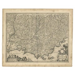
Original Antique Map of the Southern Coast of France by Janssonius, 1657
Located in Langweer, NL
Antique map of France titled 'Comté et Gouvernement de Provence'. Decorative map of the southern coast of France. This map originates from 'Atlas Novus,...
Category
Antique 17th Century Maps
Materials
Paper
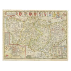
Antique Map of Kent with Inset Plans of Rochester & Canterbury, England, 1676
Located in Langweer, NL
Antique map titled 'Kent with her Cities and Earles described and observed'.
Map of Kent, England. Includes inset town plans of Rochester and Canterbury....
Category
Antique 17th Century Maps
Materials
Paper
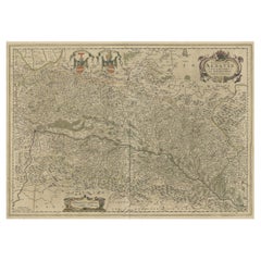
Map of the Alsace, France Incl the Rhine from Phillipsburg to South Basle, c1650
Located in Langweer, NL
Antique map titled 'Utriusquae Alsatiae Superioris Ac Inferioris Nova Tabula'.
Map of the Alsace region (France) including the Rhine from Phillipsburg to south of Basle. Two deco...
Category
Antique 17th Century Maps
Materials
Paper
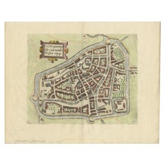
Antique Map of the City of Leeuwarden, The Netherlands, by Guicciardini, 1612
Located in Langweer, NL
Antique map titled 'Lewardum Occidentalis Frisia Opp'. Plan of the city of Leeuwarden, in the province of Friesland, the Netherlands. This map originates from 'Beschryvinghe van alle...
Category
Antique 17th Century Maps
Materials
Paper
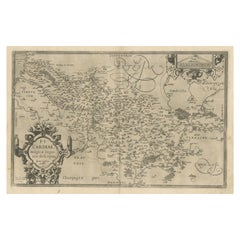
Original Antique Map of the Region of Picardy, France, ca.1602
Located in Langweer, NL
Antique map titled 'Picardiae Belgicae regionis descriptio'.
Original antique map of the region of Picardy, France. Superb example of the decorative style of Ortelius and filled ...
Category
Antique 17th Century Maps
Materials
Paper
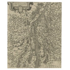
Original Antique Map of the Rhine, South and North of Strasbourg, Germany, 1608
Located in Langweer, NL
Antique map titled 'Argentoratensis agri descriptio'.
Original antique map of the Rhine, both south and north of Strasbourg, based on Daniel Specklin's three-sheet map of the Elz...
Category
Antique 17th Century Maps
Materials
Paper
Original Old Bird's-Eye View Plan of Sint-Winoksbergen or Bergen in France, 1649
Located in Langweer, NL
Antique map titled 'Berga Sti Winoci.' - Bird's-eye view plan of Sint-Winoksbergen in France, with key to locations and coats of arms. Text in Dutch on verso. This plan originates from the famous city Atlas: 'Toneel der Steeden' published by Joan Blaeu...
Category
Antique 17th Century Maps
Materials
Paper
Antique Map of the Region of Zutphen in Overijssel, The Netherlands, 1683
Located in Langweer, NL
Antique map titled 'Ducatus Gelriae pars prima Quae est Neomagensis'. Antique map of the region of Zutphen, Gelderland, the Netherlands. This map originates from 'The English Atlas' ...
Category
Antique 17th Century Maps
Materials
Paper
Antique Map of Drenthe, the Netherlands, with Original Hand Coloring
Located in Langweer, NL
Original antique map titled 'Illustribus ac Potentibus Comitatus Drentiae (..)'. Old map of the province of Drenthe, the Netherlands. Published by H. Hondius circa 1639.
Hendrik ...
Category
Antique 17th Century Maps
Materials
Paper
Old Map of the Empire of the Assyriens & the Tigres and Euphrates Rivers, 1683
Located in Langweer, NL
Antique map titled 'Empire des Assyriens' and 'Assyrie Chaldee et Mesopotamie selon les Anciens'.
Two maps on one sheet, the upper sheet showing the Empire of the Assyriens and the second showing the region of the Tigres and Euphrates Rivers. This map originates from Alain Manesson Mallet's 'Description de l 'Univers'.
Artists and engravers: Alain Manesson Mallet (1630–1706) was a French cartographer and engineer. He started his career as a soldier in the army of Louis XIV, became a Sergeant-Major in the artillery and an Inspector of Fortifications. He also served under the King of Portugal, before returning to France, and his appointment to the court of Louis XIV. His military engineering and mathematical background led to his position teaching mathematics at court. His major publications were Description de L'Univers (1683) in 5 volumes, and Les Travaux de Mars ou l'Art de la Guerre (1684) in 3 volumes.
His Description de L'Universe contains a wide variety of information, including star maps...
Category
Antique 17th Century Maps
Materials
Paper
Decorative Original Antique Print Depicting the Cavalry Marching in China, 1665
Located in Langweer, NL
Antique print titled ‘Kryghs-Ordre in het Marseren. L’Ordre de la Cavallerie en Marchant’.
Decorative print depicting the cavalry. This print originates from ‘Joan Nieuhof, Het G...
Category
Antique 17th Century Maps
Materials
Paper
Antique Map of the Region of Beauvais by Hondius, circa 1630
Located in Langweer, NL
Antique map titled 'Beauvaisis - Comitatus Belovacium'. Old map of the region of Beauvais, France. This map originates from a composite atlas and is signed by J. Hondius.
Category
Antique 17th Century Maps
Materials
Paper
Old Map by Blaeu of the City of Franeker, Friesland, The Netherlands, 1649
Located in Langweer, NL
Antique map titled 'Franekera'.
Old map of the city of Franeker, Friesland. Also shows two cartouches, coats of arms and legend. This map originates from a Latin edition of the t...
Category
Antique 17th Century Maps
Materials
Paper
Antique Engraving with a Description of the Monkey Temple in Japan, 1669
Located in Langweer, NL
Antique print, titled: 'Beschryving van de Japansche Apen-tempel.' - ('Description of the Japanese Monkey Temple').
Interior of a temple filled wit...
Category
Antique 17th Century Maps
Materials
Paper
Old Map of The Southern Part of Norway, Covering the Region Around Bergen, c1650
Located in Langweer, NL
Antique map titled 'Nova et Accurata Tabula Episcopatuum Stavangriensis et Asloiensis'.
Old map of the southern part of Norway, it covers the region around Bergen. Decorated with...
Category
Antique 17th Century Maps
Materials
Paper
Rare Engravings of Council of War in Bantam and Javanese Local Traders, 1614
Located in Langweer, NL
One leaf with an engraving on each site and text in old Dutch. One side shows the War Council of the locals in Bantam and the other side show some vegetables traders of Bantam.
B...
Category
Antique 17th Century Maps
Materials
Paper
Decorative Bird's-Eye View Plan of Ieper or Ypres in Belgium, 1649
Located in Langweer, NL
Antique print, titled: 'Ypra.'
Bird's-eye view plan of Ieper / Ypres in Belgium. With key to locations and coats of arms. Text in Latin on verso. This plan originates from the famous city Atlas: 'Toneel der Steeden' published by Joan Blaeu...
Category
Antique 17th Century Maps
Materials
Paper
Antique Engraving of Dutch and German North Sea Coast of Friesland, ca.1680
Located in Langweer, NL
Antique map titled 'Tabula Nova In qua accuratè demonstratur tota Navigatio ab Amstelodami Statione per Vada vulgo de Watten Hamburgum usq.' -
Two maps with the Dutch and German North Sea coast of Friesland, with West Frisian Islands and below East Frisian Islands with inset map of the Elbe around Hamburg. With title and a scale cartouche. Map by Henricus Hondius...
Category
Antique 17th Century Maps
Materials
Paper
Antique Engraving of Edo 'or Jeddo, Yedo, Now Tokyo', 1669
Located in Langweer, NL
Antique print, titled: 'Iedo'
A bird's eye view of Edo (or Jeddo, Yedo, now Tokyo) as seen from a nearby hill. 62 places are identified in a list (both in French and Dutch). Arno...
Category
Antique 17th Century Maps
Materials
Paper
Antique Map of the Island of Borneo by Janssonius, circa 1650
Located in Langweer, NL
Antique map titled 'Insula Borneo et Occidentalis pars Celebis cum adjacentibus Insulis'. Rare sea chart of the island of Borneo. Published by J. Janssonius, circa 1650.
Category
Antique 17th Century Maps
Materials
Paper
Decorative Antique Map of the Dutch Province of Noord-Brabant, ca.1640
Located in Langweer, NL
Antique map titled 'Quarta pars Brabantiae cujus Sylvaducis Willebordus vanderBurgt desrib'.
Highly detailed original antique map of the province of Noord-Brabant, the Netherlands. It shows the cities of 's-Hertogenbosch, Eindhoven and surroundings. Includes a decorative cartouche, 6 coats of arms, topped by winged cherubs and two larger coats of arms...
Category
Antique 17th Century Maps
Materials
Paper
Decorative Antique Map of the Quercy Region in France, 1657
Located in Langweer, NL
Antique map of France titled 'Quercy olim Cadurcium'.
Decorative map of the Quercy region. Quercy is a former province of France located in the country's southwest, bounded on th...
Category
Antique 17th Century Maps
Materials
Paper
Antique Map of the Ancient British Isles by Janssonius 'circa 1640'
Located in Langweer, NL
Antique map titled 'Insularum Britannicarum Acurata Delineatio'. Original antique map of the ancient British Isles. England and Wales are labelled as B...
Category
Antique 17th Century Maps
Materials
Paper
Detailed Antique Map of Northern Spanish Region of Aragon, c.1650
Located in Langweer, NL
Antique map titled 'Arragonia Regnum'.
Detailed map of northern Spanish region of Aragon. The map is centered on the city of Zaragoza, aka, Saragossa. Shows towns, rivers, castle...
Category
Antique 17th Century Maps
Materials
Paper
Old Map of the City of Franeker, Friesland by the Famous Mapmaker Blaeu, 1652
Located in Langweer, NL
Antique map titled 'Franekera'. Old map of the city of Franeker, Friesland. Also shows two cartouches, coats of arms and legend. This map originates from a Latin edition of the town ...
Category
Antique 17th Century Maps
Materials
Paper
Antique Map of the French Province Maine, Showing Le Mans, Alencon Etc., Ca1640
Located in Langweer, NL
Antique map titled 'Le Maine'.
Old map of the province of Maine, France. It shows the cities of Le Mans, Alencon and others. This map originates from a composite atlas.
Artis...
Category
Antique 17th Century Maps
Materials
Paper
Antique Print of the City of Jiangxi, formerly romanized as Kiangsi, China, 1668
Located in Langweer, NL
Antique print China titled 'Kiangsi'. Old print depicting a view on the Chinese city of Kiangsi with its ramparts. Behind the city wall a pagoda can be seen. This print originates fr...
Category
Antique 17th Century Maps
Materials
Paper
Beautiful Antique Map of Madagascar, The Comoros Islands & Reunion Island, 1667
Located in Langweer, NL
Antique map titled 'Isle d'Auphine, communement Nommée par les Europeens Madagascar, et St. Laurens, et par les Habitans du pays Madecase'.
Beautiful map of Madagascar...
Category
Antique 17th Century Maps
Materials
Paper
Old Decorative & Highly Detailed Sea Chart of the North Dutch-German Coast, 1681
Located in Langweer, NL
Antique map titled 'Paskaart van een gedeelte van Vriesland, Groeninger, en Emderland. Met zyn onderhoorige Eylanden; Strekkende van't Eylant der Schelling'.
Decorative and highl...
Category
Antique 17th Century Maps
Materials
Paper
Antique Bird's-eye View Plan of Zierikzee in Zeeland, The Netherlands, 1649
Located in Langweer, NL
Antique print, titled: 'Zirizea.' - A bird's-eye view plan of Zierikzee in The Netherlands, with key to locations and coats of arms. After Matheo Rollando and Stephano Bellemo. Latin tekst on verso. From the city Atlas: 'Toneel der Steeden' published by Joan Blaeu...
Category
Antique 17th Century Maps
Materials
Paper
Antique Map Covering Northern Italy, Austria, Slovenia & Croatia, ca.1690
Located in Langweer, NL
Antique map titled 'Exactissima Tabula, qua tam Danubii Fluvii Pars Superior'.
Detailed map covering the region of northern Italy, Austria, Slovenia and Croatia. The course of th...
Category
Antique 17th Century Maps
Materials
Paper
Small Map of Bantam with Dutch Ships and an Engraving of Portugese, 1614
Located in Langweer, NL
Two rare old miniature copper-engravings one one leaf. One showing the first arrival of the first Dutch in Indonesia, the so-called 'Houtman expedition' and on the reverse Portugese welcoming them with gifts.
The First Dutch Expedition to Indonesia was an expedition that took place from 1595 to 1597. It was instrumental in the opening up of the Indonesian spice trade...
Category
Antique 17th Century Maps
Materials
Paper
Antique Map of Thracia ‘Greece’ by J. Janssonius, circa 1650
Located in Langweer, NL
This antique map of Thracia is engraved and published by J. Janssonius after the cartographical sources by Abraham Ortelius. Ornated in the upper left corner with a title cartouche a...
Category
Antique 17th Century Maps
Materials
Paper
Antique Map of the Dutch Province of Gelderland with Zutphen as Capital, C.1650
Located in Langweer, NL
Antique map titled 'Ducatus Gelriae pars Tertia quae est comitatus Zutphaniensis'. Old map of the province of Gelderland, the Netherlands. The city of Zutphen can be found in the mid...
Category
Antique 17th Century Maps
Materials
Paper
Cartographic Treasures: A Journey Through the Gascogne and Guyenne Regions, 1680
Located in Langweer, NL
The antique map titled "Gouvernement de La Guienne & Gascogne" depicts the region of Gascogne and Guyenne, known for their wine production, in France.
This map is a rare edition, u...
Category
Antique 17th Century Maps
Materials
Paper
Antique Copper Engraved Map of Gloucestershire in England, 1637
Located in Langweer, NL
Antique map titled 'Glocestriae comitatus olim sedes Dobunorum'. Map of Gloucestershire, England. This map originates from Camden?s 'Britannia' ...
Category
Antique 17th Century Maps
Materials
Paper
Attractive Antique Map of Western Africa with Lots of Details on the Coast, 1655
Located in Langweer, NL
Title: "L'Afrique, ou Lybie ulterieure ou sont le Saara, ou Desert, le pays des negres, la Guinee, et les Pays circonv. Tirée en partie de Sanut, et de l'Arabe de Nubie; en partie de diverses Cartes veües jusques a present".
Handsome map of Western Africa filled with information, much of it spurious, in the Sahara Desert, the Niger River and the coast of Guinea. Of particular interest are several incomplete rivers in the desert regions that appear and then disappear. The map is beautifully engraved with a title cartouche fashioned in the form of an oriental carpet.
The map shows a fantastic level of detail near the coastlines, which extends into legend and Ptolemaic myth in the interior of the continent. Detail is particularly extensive in Guinea and the Gold and Ivory Coasts. The Niger River is traced to its Malian lakes. The Mediterranean is barely visible in the northern part of the map. This map incorporates the discoveries made by Samuel Blommaert, who was director of the Dutch West Indies Company, in addition to traveling extensively to Africa and settling the oldest land deed...
Category
Antique 17th Century Maps
Materials
Paper
Old Color Engraving of Blaeu's first Map of Brazil, North Oriented to the Right
By Willem Blaeu
Located in Langweer, NL
Antique map titled 'Novus Brasiliae Typus'. Fine old color example of Blaeu's first map of Brazil, with north oriented to the right. Includes inset map of Baya de todos Santos, elaborate cartouche, 2 compass roses and richly embellished vignettes of native Brazilian life and animals.
The interior of the map includes vignettes of indigenous animals and native scenes, including cannibalism. Inset within a decorative border is a small map of "Baya de todos Sanctos". In the sea are monsters, a galleon and two compass roses. The large title cartouche features a male and female Brazilian, both of whom are shown naked.
Willem Janszoon Blaeu (1571-1638) was a prominent Dutch geographer and publisher. Born the son of a herring merchant, Blaeu chose not fish but mathematics and astronomy for his focus. He studied with the famous Danish astronomer Tycho Brahe...
Category
Antique 17th Century Maps
Materials
Paper
Original Old Copper Engraved Map of the Region of Albi, Southern France, 1663
Located in Langweer, NL
Antique map titled 'Carte du Diocese d'Alby'.
Original antique map of the region of Albi in Southern France. This map originates from 'Topographia Galliae dat is eene algemeene e...
Category
Antique 17th Century Maps
Materials
Paper
Antique Uncommon Map of Bohemia, Moravia and Silesia, 1699
Located in Langweer, NL
Antique map titled 'B. V. Boleslaviensis in Bohemia, Moravia et Silesia (..).' Detailed uncommon map of the Bohemia, Moravia and Silesia. Source unknown, to be determined.
Artists...
Category
Antique 17th Century Maps
Materials
Paper
Antique Miniature Map of New Guinea by Bertius, '1618'
Located in Langweer, NL
Antique miniature map titled 'Nova Guinea et Ins. Salomonis'. Rare miniature map of New Guinea (Solomon Islands). This map originates from 'Tabularum Geo...
Category
Antique 17th Century Maps
Materials
Paper
Antique Print of Graves Near the City of Nanjing in China, 1665
Located in Langweer, NL
Antique print titled 'Graf-Steden'. Old print depicting graves near the city of Nanjing, China. This print originates from 'Het gezantschap der Nee^rlandtsche Oost-Indische Compagnie...
Category
Antique 17th Century Maps
Materials
Paper
Antique Map of France by Janssonius, c.1650
Located in Langweer, NL
Antique map titled 'Gallia Vetus'. Beautiful map of France based on Caesar's De Bello Gallico. In the columns to the left and right important tribes and people are described.
Art...
Category
Antique 17th Century Maps
Materials
Paper
Engravings of Harlingen, Stavoren and Sneek in Friesland, the Netherlands, 1680
Located in Langweer, NL
Antique print titled 'Harlingen, Staveren, Sneck'. Views of the cities of Harlingen, Stavoren and Sneek, Friesland, the Netherlands. This print originates from 'Thooneel der Steden e...
Category
Antique 17th Century Maps
Materials
Paper
Antique Print of the City of Kancheu in China, 1668
Located in Langweer, NL
Antique print China titled 'Kancheu'. Old print depicting a view on the Chinese city of Kancheu with its ramparts. This print originates from the L...
Category
Antique 17th Century Maps
Materials
Paper
Antique Map of Austria by Ortelius, c.1612
Located in Langweer, NL
Antique map titled 'Austriae Descrip. per Wolfgangum Lazium' Original antique map of Austria. Published by A. Ortelius, circa 1612.
Artists a...
Category
Antique 17th Century Maps
Materials
Paper
Antique Print of a Funeral on Ceylon 'Sri Lanka' is Asia, 1672
Located in Langweer, NL
Untitled print of the death of the prince heir, and his burial. Two prints, one with a long burial train including numerous horses, carrying the coffin, covered with cloth. The other...
Category
Antique 17th Century Maps
Materials
Paper
Antique Map of the Region of the Loire Valley by Janssonius, 1657
Located in Langweer, NL
Antique map of France titled 'Aniou'. Decorative map centered on the Loire valley, France. This map originates from 'Atlas Novus, Sive Theatrum Orbis Orbis Terrarum: In quo Galliae, ...
Category
Antique 17th Century Maps
Materials
Paper
Antique Print of the City of Nanking in China, 1668
Located in Langweer, NL
Antique print China titled ‘Nanking'. This plate shows a view on the Chinese city of Nanking with its ramparts. Also depicted are several pagodas and on the foreground there is a pal...
Category
Antique 17th Century Maps
Materials
Paper
Antique Map of the Vermandois Region 'Picardy' in France by Janssonius, C.1640
Located in Langweer, NL
Antique map titled 'Vermandois'. Old map of the Vermandois region, France. Vermandois was a French County that appeared in the Merovingian period. Its na...
Category
Antique 17th Century Maps
Materials
Paper
Antique Map of the City of Workum by Merian, 1654
Located in Langweer, NL
Antique map titled 'Worcum'. Old map of the city of Workum, Friesland. Originates from 'Topographia Germaniæ Inferioris' by C. Merian.
Artists and Engravers: Caspar Merian (1627-1...
Category
Antique 17th Century Maps
Materials
Paper
Antique Miniature Map of Ceylon 'Sri Lanka' and the Maldives by Bertius, 1618
Located in Langweer, NL
Antique map titled 'Descriptio Zeilan, et Maldivarum Inss'. Rare, original antique miniature map of Ceylon/Sri Lanka and the Maldives. This map originate...
Category
Antique 17th Century Maps
Materials
Paper
Antique Map of the Region of Salzburg by Ortelius 'circa 1606'
Located in Langweer, NL
Antique map titled 'Salisburgensis Iurisdictionis'. Original antique map of the region of Salzburg, Austria. Published by A. Ortelius, circa 1606.
Category
Antique 17th Century Maps
Materials
Paper
Cartographic Tapestry: Antique Map of Asia Minor, circa 1640
Located in Langweer, NL
Title: "Historical Tapestry: Antique Map of Asia Minor, circa 1640"
Description:
This authentic antique map, created by Willem Blaeu and published in Amsterdam circa 1640, is a capt...
Category
Antique 17th Century Maps
Materials
Paper
Antique Map of the City of Rotterdam by Guicciardini, C.1600
Located in Langweer, NL
Antique map titled 'Rotterdam'. Bird's eye view plan of Rotterdam in the province of Zuid-Holland, The Netherlands, Holland. This map originates from one of the editions of 'Discritt...
Category
Antique 17th Century Maps
Materials
Paper
Antique Map of the City of Franeker by Guicciardini, 1613
Located in Langweer, NL
Antique map titled 'Franicher'. Plan of the city of Franeker, Friesland, the Netherlands. This map originates from the 1613 edition of 'Discrittione di tutti i Paesi Bassi', by L. Gu...
Category
Antique 17th Century Maps
Materials
Paper
Antique Map of Northamptonshire by Speed, 1676
Located in Langweer, NL
Antique map titled 'Norhamtonshire'. Map of Norhamptonshire, England. Includes inset town plans of Peterborough and Northampton. This map originates from 'Theatre of Great Britaine' ...
Category
Antique 17th Century Maps
Materials
Paper
Antique Map of Friesland by Guicciardini, 1613
Located in Langweer, NL
Antique map titled 'Frisia Occidenta.' (Map of the province of Friesland, the Netherlands.) This original old antique print / plate originates from the scarse French edition of 'Desc...
Category
Antique 17th Century Maps
Materials
Paper
