17th Century Maps
to
763
907
62
970
10
1
2,936
2,181
476
3
289
34
10
127
7
35
9
2
5
4
4
2
969
10
9
2
2
91
43
30
18
14
970
970
970
63
12
11
10
6
Period: 17th Century
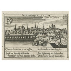
Rare Antique Engraving of the University City of Leiden, The Netherlands, c.1625
Located in Langweer, NL
Antique print titled 'Leijden in Hollandt'. Old print of the city of Leiden, the Netherlands. This print originates from 'Thesaurus philopoliticus oder Politisches Schatzkästlein'. T...
Category
Antique 17th Century Maps
Materials
Paper
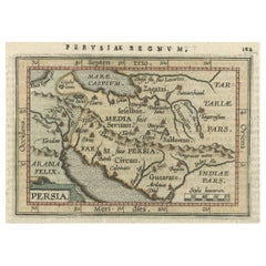
Original Antique Miniature Map of Persia, Published, ca.1601
Located in Langweer, NL
Antique miniature map titled 'Persia'. Small map of Persia published in the Epitome, or pocket-edition of the "Theatrum Orbis Terrarum".
Artists and e...
Category
Antique 17th Century Maps
Materials
Paper
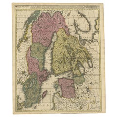
Antique Map of Scandinavia and the Baltic Region by Valk, circa 1690
Located in Langweer, NL
Antique map titled 'Sueciae Magnae, totius orbis regni antiquissimi (..)'. Map of Scandinavia and the Baltic region. It shows Norway, Sweden, Finla...
Category
Antique 17th Century Maps
Materials
Paper
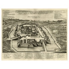
Original Antique Engraving of the Mighty Imperial Osaka Castle in Japan, 1669
Located in Langweer, NL
Antique print, titled: 'Afbeeldinge vant Maghtich Keyserlyck Casteel Osacca geleegen int groot Ryck Jappan besuyden de Stadt Osacce inde provinsie Qioo.' - ('Image of the Mighty Imperial Castle Osaka').
A bird's eye view of Osaka Castle, Japan. Arnoldus Montanus' "Gedenkwaerdige Gesantschappen der Oost-Indische Maatschappy in 't Vereenigde Nederland aan de Kaisaren van Japan […]. Amsterdam: Jacob Meurs, 1669.
Artists and Engravers: Made by an anonymous engraver after 'Arnoldus Montanus'.
Condition: Very good, given age. Original middle fold, as issued. Some faint browning of the margin edges. A few small spots in the margins (from paper making...
Category
Antique 17th Century Maps
Materials
Paper
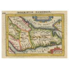
Colorful and Decorative Miniature Map of India, Ceylon by Bertius 1616
Located in Langweer, NL
Old 17th century miniature antique map of India - Ceylon from the 1616 edition of Jadocus Hondius Atlas by Petrus Bertius. Original copperplate engraving with hand coloring.
Carto...
Category
Antique 17th Century Maps
Materials
Paper
Antique Map of Central Sweden by J. Blaeu, 1662
Located in Langweer, NL
A striking, rare map with a cartouche dedicated to Gabriel Bengtsson Oxenstierna. Published by J. Bleau, Amsterdam, 1662. Contemporary coloring.
Category
Antique 17th Century Maps
Materials
Paper
Frisia Occidentalis, A Rare Antique Engraving of Friesland, The Netherlands
Located in Langweer, NL
Antique map titled 'Frisia Occidentalis.' - A very decorative map of the Dutch province Friesland, also showing the Wadden islands Terschelling and Ameland. With coats of arms of the...
Category
Antique 17th Century Maps
Materials
Paper
Print of Leopold I, Holy Roman Emperor, King of Hungary, Croatia & Bohemia, 1695
Located in Langweer, NL
Antique print, titled: 'Leopoldus Romanorum Imperator Semper Augustus.'
This original antique plate shows a portrait of Leopold I (9 June 1640 – 5 May 1705), he was Holy Roman Emperor...
Category
Antique 17th Century Maps
Materials
Paper
Very Rare Antique Print of the Valley of Terebinthus in Arabia, 1673
Located in Langweer, NL
Antique print titled 'Vallis Therebinthi'. Old print of the Valley of Terebinthus, below a decorative cartouche with lettered key and surrounded by 2 cherubins. This print originates...
Category
Antique 17th Century Maps
Materials
Paper
Old Map of the Western Part of Central Europe, c.1680
Located in Langweer, NL
Antique map titled 'Carta nova accurate del Passagio et strada dalli Paesi Bassi'. Old map of the western portion of Central Europe. Oriented to the Northeast.
Artists and Engrav...
Category
Antique 17th Century Maps
Materials
Paper
Antique Map of Denmark and Southern Sweden, c.1658
Located in Langweer, NL
Antique map titled 'Royaume de Danemarq.' Map centered on Sjaelland and covers all of Denmark and part of southern Sweden where a dramatic title cartouche obscures the interior. Sour...
Category
Antique 17th Century Maps
Materials
Paper
Antique Engraving of a Bird's-Eye Plan of Nagapattinam or Negapatam, India, 1672
Located in Langweer, NL
Antique map titled 'Negapatam.'
Bird's-eye plan of Nagapattinam or Negapatam, India. This map originates from 'Naauwkeurige Beschryvinge van Malabar en Choromandel…en het machtige ...
Category
Antique 17th Century Maps
Materials
Paper
Antique Map of the Region of Poitou by Ortelius, circa 1600
Located in Langweer, NL
Antique map titled 'Poictou'. Original antique map of the region of Poitou, a former province of west-central France whose capital city was Poitiers. Published by A. Ortelius, circa ...
Category
Antique 17th Century Maps
Materials
Paper
Antique Map of the Saxony Region 'Germany' by F. de Wit, circa 1680
Located in Langweer, NL
A detailed map of a region in eastern Germany. Cartouches depict coat of arms surrounded by cherubs. The map is fully engraved with towns, political boundaries, rivers and forests. P...
Category
Antique 17th Century Maps
Materials
Paper
Antique Map of Flanders 'Belgium' by F. de Wit, circa 1680
Located in Langweer, NL
Antique map titled 'Comitatus Flandriae Tabula, in Lucem Edita'. Large map of Flanders, Belgium. Published by F. de Wit, circa 1680.
Category
Antique 17th Century Maps
Materials
Paper
Antique Map of Belgium and Northern France by F. de Wit, circa 1680
Located in Langweer, NL
Antique map titled 'Belgii Regii Accuratissima Tabula Pluribus Locis Recens Emen'. Large map of Belgium and Northern France. Published by F. de Wit, circa 1680.
Category
Antique 17th Century Maps
Materials
Paper
Antique Map of the Region of Aiguillon by Janssonius, 1657
Located in Langweer, NL
Antique map 'Le Duche d'Aiguillon'. Decorative map of the Aiguillon region, France. Located at the confluence of the Lot and Garonne rivers. The map is based on the cartography of Pi...
Category
Antique 17th Century Maps
Materials
Paper
The Normandy Region of France: A 17th C. Hand-colored Map by Sanson and Jaillot
Located in Alamo, CA
This large hand-colored map entitled "Le Duché et Gouvernement de Normandie divisée en Haute et Basse Normandie en divers Pays; et par evêchez, avec le Gouvernement General du Havre ...
Category
French Antique 17th Century Maps
Materials
Paper
1630 Pierre Petit map "Description du Gouvernement de la Capelle" Ric0010
Located in Norton, MA
1630 Pierre Petit map entitled
"Description du Gouvernement de la Capelle,"
Ric0010
Pierre Petit was the son of a minor provincial official in Montluçon. The town, in the Auver...
Category
Dutch Antique 17th Century Maps
Materials
Paper
17th Century Nicolas Visscher Map of Southeastern Europe
Located in Hamilton, Ontario
A beautiful, highly detailed map of southeastern Europe by Nicolas Visscher. Includes regions of Northern Italy (showing the cities Bologna, Padua, and Venice), Bohemia, Austria (sho...
Category
Dutch Antique 17th Century Maps
Materials
Paper
The Holy Land at the Time of Jesus: A 17th Century Dutch Map by Visscher
Located in Alamo, CA
This detailed Dutch map entitled "Het Beloofe de Landt Canaan door wandelt van onsen Salichmaecker Iesu Christo, nessens syne Apostelen" by Nicolaes Visscher was published in Amsterd...
Category
Dutch Antique 17th Century Maps
Materials
Paper
Rare Antique Miniature Map of Pakistan, India and Cambaia, ca.1618
Located in Langweer, NL
Old 17th century miniature antique map of 'Cambaia' , from the 1616 edition of Jadocus Hondius Atlas by Petrus Bertius.
Original copperplate engraving with hand coloring.
Carto...
Category
Antique 17th Century Maps
Materials
Paper
Antique Print of the Chinese City of Anhing by Nieuhof, 1668
Located in Langweer, NL
Antique print China titled 'Anhing'. Old print depicting a view on the Chinese city of Anhing with its ramparts. This print originates from the Latin editio...
Category
Antique 17th Century Maps
Materials
Paper
Scare Map of Canaan, with Portraits of the Apostles of Matheaus and Others
Located in Langweer, NL
Antique map titled 'Geographische Beschreibung des Belobten Landes Canaan (..)'. Scarce map of Canaan, with portraits of the Apostles of Matheaus, S. Marcus, S. Lucas, S. Johannes. With Christ in lower part. The map extends along the coast of the eastern Mediterranean. Published by Georg Andreas...
Category
Antique 17th Century Maps
Materials
Paper
Map of Saintonge and Aunis with Cognac and Rochefort, France - 1665 Original
Located in Langweer, NL
Map of Saintonge and Aunis, with Charente Coast and Cognac, 1665
This beautifully hand-colored antique map, titled *Xaintonge, avec Le Pays D’Avlnis* (Saintonge, with the Country of...
Category
Antique 17th Century Maps
Materials
Paper
Handcolored Print of an Estate by Smallegange, Zeeland, The Netherlands, 1696
Located in Langweer, NL
Antique print titled 'Rynsburch'. Copper engraving of the estate of Rijnsburg, the Netherlands. This print originates from 'Nieuwe Cronyk van Zeeland' by Mattheus Smallegange.
Ar...
Category
Antique 17th Century Maps
Materials
Paper
Original Antique Map of Friesland in Decorative Hand-Colouring, 1600
Located in Langweer, NL
Antique map titled 'Frisiae antiquissima trans rhenu provinc et adiacentium regionum nova et exacta descriptio'. Original antique map of the province of Friesland, the Netherlands. T...
Category
Antique 17th Century Maps
Materials
Paper
Persia, Armenia & Adjacent Regions: A 17th Century Hand-colored Map by De Wit
Located in Alamo, CA
A large 17th century hand colored copperplate engraved map entitled "Novissima nec non Perfectissima Scandinaviae Tabula comprehendens Regnorum Sueciae, Daniae et Norvegiae distincte...
Category
Dutch Antique 17th Century Maps
Materials
Paper
1687 Engraved View of Rhodes by O. Dapper – Hand-Colored Island of Rhodus
Located in Langweer, NL
1687 Engraved View of Rhodes by O. Dapper – Hand-Colored Island of Rhodus
This original antique print is a beautifully detailed copper engraving titled "Het Eylant Rhodus" (The Isla...
Category
Antique 17th Century Maps
Materials
Paper
Beautiful 17th Century Map of Paris and Isle de France by Templeux, c.1650
Located in Langweer, NL
Map of Isle de France by D. de Templeux, ca. 1650, Hand-Colored and Decorative
This richly detailed antique map titled *Le Gouvernement de L'Isle de France* was engraved by Daniel d...
Category
Antique 17th Century Maps
Materials
Paper
Dutch City Plan of Sloten in Friesland by N. Van Geelkercken, hand-colored 1616
Located in Langweer, NL
Bird’s-Eye View of Sloten in Friesland by Nicolaes van Geelkercken, ca. 1616
This captivating hand-colored engraving presents an early 17th-century bird’s-eye view of the fortified ...
Category
Dutch Antique 17th Century Maps
Materials
Paper
Rare 1670 Map of Tartary by Richard Blome after Sanson, Hand-colored Engraving
Located in Langweer, NL
Rare 1670 Map of Tartary by Richard Blome after Sanson, hand-colored engraving
This striking and highly decorative map, titled *A Generall Mapp of the Kingdome of Tartaria*, was pub...
Category
Antique 17th Century Maps
Materials
Paper
Map of the Persian Empire by Nicolas Sanson, Hand-colored, circa 1683
Located in Langweer, NL
Map of the Persian Empire by Nicolas Sanson, hand-colored, circa 1683
This finely detailed and delicately hand-colored map titled *L'Empire du Sophy des Perses* presents a late 17th...
Category
Antique 17th Century Maps
Materials
Paper
Antique Map of the Region of Bouchain and Cambrai by Visscher 'circa 1680'
Located in Langweer, NL
Antique map titled 'Carte Nouvelle des Environs de Bouchain & Cambray'. Uncommon map of the region of Bouchain and Cambrai (Cambray, France) showing the camps of two armies.
Category
Antique 17th Century Maps
Materials
Paper
Antique Map of Romania and Bulgaria Centered on the Danube River
Located in Langweer, NL
Antique map titled 'Vetus descriptio Daciarum nec non Moesiarum'. Impressive map of the area of Romania and Bulgaria centered on the Danube River. The map is based on Ortelius' map o...
Category
Antique 17th Century Maps
Materials
Paper
Map Holy Promise Land Canaan Richard Palmer Richard Blome 1687 Joseph Moxon
Located in BUNGAY, SUFFOLK
Canaan comonly called the Holy Land or the Land of Promise, being the Possesion of the Israelites & travelled through by Our Lord & Saviour Iesus Christ and his Apostles. Engraven by Richard Palmer for Richard Blome. 1687
Blome, Richard, 1641-1705. London. 283 x 452 mm. Copperplate.
Probably from an English Bible...
Category
British Baroque Antique 17th Century Maps
Materials
Paper
Antique Map of Paraguay by A. Montanus, circa 1671
Located in Langweer, NL
Antique map titled 'Paraquaria Vulgo Paraguay Cum adjacentibus'. Antique map extending from Rio de Janiero to the Rio de la Plata basin. The map include...
Category
Antique 17th Century Maps
Materials
Paper
Antique Map of the City of Brielle 'The Netherlands' by L. Guicciardini, 1625
Located in Langweer, NL
Plan of Brielle, Briel, Den Briel in the Province of Zuid-Holland, The Netherlands, Holland. This map originates from the 1625 edition of 'Discrittione di tutti i Paesi Bassi', by L....
Category
Antique 17th Century Maps
Materials
Paper
Natives from Pegu, the Moluccan Islands, Penequais Indians and St Thomas, c.1605
Located in Langweer, NL
Antique print titled 'Provincie Pegu incola (..) - Incola ex Insulis Moluco (..) - Penequais familiae (..)'.
Old print showing various figures including a man from Pegu, a man fr...
Category
Antique 17th Century Maps
Materials
Paper
Map of Lake Geneva and Surroundings by Hondius, Geneva Region, circa 1612
Located in Langweer, NL
Map of Lake Geneva and Surroundings by Hondius, Geneva Region, 1606
This rare and intricately engraved map, titled *Chorographica Tabula Lacus Lemanni Locorumque Circumiacentium*, w...
Category
Dutch Antique 17th Century Maps
Materials
Paper
Map of Zurich and Basel Region by Mercator, Uncolored Engraving c.1600
Located in Langweer, NL
Map of Zurich and Basel Region by Mercator, Uncolored Engraving c.1600
This original uncolored copperplate engraving, titled *Zurichgow et Basiliensis Provincia*, was created by the...
Category
Antique 17th Century Maps
Materials
Paper
Original Antique 17th-Century Map of Shaangxi (Xensi) Province, China – by Blaeu
Located in Langweer, NL
Antique 17th-Century Map of Shaangxi Province, China – "Xensi" by Blaeu, Featuring Decorative Cartouches
Description: This exquisite 17th-century map of Shaangxi Province, historically known as Xensi Province, is an exceptional work by Johannes Blaeu, one of the most celebrated mapmakers of the Dutch Golden Age. Originally published in Blaeu's groundbreaking 'Novus Atlas Sinensis', this map is a masterful blend of geography and artistry. Blaeu's atlas was created in collaboration with Martino Martini, a Jesuit missionary whose insights into China provided European audiences with unprecedented geographical accuracy.
The map meticulously charts Shaangxi's mountains, rivers, mines, cities, and towns, with names rendered in Latin. It also features a detailed section of the Great Wall of China, a symbol of the region's historical significance. The artistry of this map is further enhanced by its elaborate cartouches. At the top, a Chinese warrior is beautifully illustrated, while the lower-left corner displays a deer, possibly a reference to the elusive Pere David deer...
Category
Antique 17th Century Maps
Materials
Paper
Gascogne and Guyenne Map - Hand-Colored 17th-Century Engraving by De Wit, c.1688
Located in Langweer, NL
Title: Gascogne and Guyenne Map - Hand-Colored 17th-Century Engraving by Frederik De Wit c. 1688
Description: This remarkable map, "Gouvernement de la Guyenne & Gascogne," captures ...
Category
Antique 17th Century Maps
Materials
Paper
Old Eastern Balkans Map, with Dalmatia, Croatia, Slavonia, Bosnia, Serbia, 1633
Located in Langweer, NL
Antique map titled 'Sclavonia, Croatia, Bosnia cum Dalmatiae Parte'. Old map of the Eastern Balkans with the geographical & political divisions of Dalmatia, Croatia, Slavonia, Bosnia, Serbia, etc. The map details the course of the Danube, Sauus, and Drauus Rivers. Originates from the 1633 German edition of the Mercator-Hondius Atlas Major, published by Henricus Hondius and Jan Jansson under the title: 'Atlas: das ist Abbildung der gantzen Welt, mit allen darin begriffenen Laendern und Provintzen: sonderlich von Teutschland, Franckreich, Niderland, Ost und West Indien: mit Beschreibung der selben.'
Artists and Engravers: Gerard Mercator (1512 - 1594) originally a student of philosophy was one of the most renowned cosmographers and geographers of the 16th century, as well as an accomplished scientific instrument maker. He is most famous for introducing Mercators Projection, a system which allowed navigators to plot the same constant compass bearing on a flat map...
Category
Antique 17th Century Maps
Materials
Paper
Decorative Original Antique Map of Normandy, France
Located in Langweer, NL
Original antique map titled 'Ducato D'Normandie Scala di Miglia d'Italia'. Very decorative map of Normandy, with a fine title cartouche featuring Leda ...
Category
Antique 17th Century Maps
Materials
Paper
Rare Hand-Colored Map of Franche-Comté and Burgundy by Frederik De Wit c. 1688
Located in Langweer, NL
Title: Rare Hand-Colored Map of Franche-Comté and Burgundy by Frederik De Wit c. 1688
Description: This stunning 17th-century map, titled "Comitatus Burgundiae vulgo La Franche Comt...
Category
Antique 17th Century Maps
Materials
Paper
Rare 1699 Map of the Failed Scottish Colony of Caledonia in Panama
Located in Langweer, NL
Rare 1699 Map of the Failed Scottish Colony of Caledonia in Panama
This scarce and historically fascinating map, titled 'The Scots Settlement in America or New Caledonia A.D. 1699',...
Category
English Antique 17th Century Maps
Materials
Paper
Antique Map of the City of Leeuwarden by Leti, 1690
Located in Langweer, NL
Antique map titled 'Leovardia.' A plan of Leeuwarden in Friesland, the Netherlands. With two coats of arms, the title in a scroll and an index of 30 buildings in the lower right. Fro...
Category
Antique 17th Century Maps
Materials
Paper
Road Map Britannia 1675/6 No 5 Road London to Barwick, London Stilton Grey Frame
By John Ogilby
Located in BUNGAY, SUFFOLK
John Ogilby (British 1600-1676) cosmographer and geographick printer to Charles II.
A road map from Britannia, 1675/6. No 5, The road from London to Barwick: London to Stilton
In a grey painted and gilded frame.
In a remarkable life John Ogilby pursued, several careers, each ending in misfortune, and yet he always emerged undeterred, to carry on. His modern reputation is based on his final career, started in his sixty-sixth year, as a publisher of maps and geographical accounts.
Ogilby was born outside Dundee, in 1600, the son of a Scottish gentleman. While he was still a child, the family moved to London. When the elder Ogilby was imprisoned for debt, the young John invested his savings in a lottery, won a minor prize, and settled his father's debts. Unfortunately, not enough money was left to secure John a good apprenticeship; instead, he was apprenticed to a dance master. Ogilby was soon dancing in masques at court but, one day, while executing a particularly ambitious leap, he landed badly. The accident left him with a permanent limp, and ended his dancing career. However, he had come to the attention of Thomas Wentworth, later Earl of Strafford, Charles I's most senior minister. Ever one to exploit his contacts, Ogilby became a dance instructor in Strafford's household.
When Strafford was sent to Ireland, Ogilby accompanied him as Deputy-Master of the Kings Revels, and then Master of Revels. In Dublin, he built the New Theatre, in St. Werburgh Street, which prospered at first, but the Irish Rebellion, in 1641, cost Ogilby his fortune, which he estimated at £2,000, and almost his life. After brief service as a soldier, he returned to England, survived shipwreck on the way, and arrived back penniless.
On his return, Ogilby turned his attention to the Latin classics, as a translator and publisher. His first faltering attempt, in 1649, was a translation of the works of Virgil, but after his marriage to a wealthy widow the same year, his publishing activities received a considerable boost. One means by which Ogilby financed these volumes was by subscription, securing advance payments from his patrons, in return for including their name and coats-of-arms on the plates of illustrations. Another approach was to secure a patron, preferably in the court circle. Ogilby's first patron was Strafford, who found out too late that all leading ministers are dispensable when Charles I assented to his execution in 1641. As he re-established himself, Ogilby sought a new patron, the King himself.
In 1661, Ogilby was approached to write poetry for Charles II's coronation procession; he later published 'The Relation of His Majesties Entertainment Passing Through the City of London', and a much enlarged edition the following year, which included a Fine set of plates depicting the procession. Royal favour was bestowed in 1674 when John Ogilby received the title of 'His Majesty's Cosmographer and Geographick Printer' with a salary of £13.6s.8d per annum.
In 1665, Ogilby left London to avoid the Plague then ravaging the capital. The following year, in the Great Fire of London, Ogilby claimed that he lost his entire stock of books valued at some £3,000, as well as his shop and house, leaving him worth just £5.
As he sought to restore his fortunes, Ogilby was already looking in new directions. The initial opportunity he seized on was the reconstruction of London's burnt-out centre. He secured appointment as a "sworn viewer", whose duty was to establish the property boundaries as they existed before the Fire. Ogilby was assisted in the project by his step-grandson, William Morgan, and by a number of professional surveyors. The result was an outstanding plan of London, on a scale of 100 feet to an inch, on 20 sheets, although it was not printed until after Ogilby's death.
Ogilby then turned his attention to publishing geographical descriptions of the wider-world. In 1667, he issued 'An Embassy from the East India Company of the United Provinces to the Grand Tartar Cham, Emperor of China.' Buoyed by the response to this volume, Ogilby conceived an ambitious project, a multi-volume description of the world. The volumes were joint collaborations, in conjunction with the Dutch publisher Jacob van Meurs. 'Africa', published in 1670, was the least original of the three, both in terms of the text, maps and illustrations. In a similar vein, he issued the 'Atlas Japannensis' (1670), the 'Atlas Chinensis' (1671), and 'Asia' (1673). In 1671, Ogilby published the 'America', translated from Arnold Montanus' Dutch text. The 'America' is certainly the most original, and most important, of Ogilby's various geographical volumes, and its influence and popularity was immediate.
With its completion, Ogilby turned to a project nearer his heart, the description of Britain. Ogilby originally intended to devote one volume to Britain, but as the project evolved, he became more ambitious, as revealed in a prospectus issued in about 1672:
"This having oblig'd our Author to take new Measures ... to compleat within the space of two Years a Work ... considering the Actual survey of the Kingdom, the Delineation and Dimensuration of the Roads, the Prospects and Ground plots of Cities, with other Ornamentals ... into six fair volumes. The Four first comprehending the historical and geographical description of England, with the County-Maps truly and actually survey'd. ... The fifth containing an Ichnographical and Historical Description of all the Principal Road-ways in England and Wales, in two hundred copper sculptures, after a new and exquisite method. The sixth containing a New and Accurate Description of the famous City of London, with the perfect Ichnography thereof ..."
In the proposals, Ogilby emphasised the scale of the undertaking; no-one before him had attempted such a vast project. He estimated the total costs would be £20,000, a staggering amount. The cost of the complete set of six volumes was to be £34. At that time, Wenceslas Hollar...
Category
British Charles II Antique 17th Century Maps
Materials
Paper
Copper-Engraved Map Showing the Algerian Coast of North Africa, Published 1683
Located in Langweer, NL
Antique map titled 'Partie de Barbarie, ou est le Royaume d'Alger (..)'.
Copper-engraved map showing the Algerian coast of North Africa. Published 1683.
Artists and Engravers:...
Category
Antique 17th Century Maps
Materials
Paper
Antique Map of the Holy Land, showing the travels of Abraham, Isaac and Jacob
Located in Langweer, NL
Antique map titled 'Tabula Itineraria Patriarcharum Abrahami, Isaaci et Iacobi'. Decorative regional map of the Holy Land, showing the travels of Abraham, Isaac and Jacob. Published ...
Category
Antique 17th Century Maps
Materials
Paper
Grand Map of Europe by Frederick de Wit, Circa 1690: A Baroque Era Masterpiece.
Located in Langweer, NL
This is an attractive historical map of Europe created by Frederick de Wit, published around 1690. Here's a detailed description of the map and additional context about its creation:...
Category
Antique 17th Century Maps
Materials
Paper
Antique Map of Silesia centered on Glogau
Located in Langweer, NL
Antique map titled 'Ducatus Silesiae Glogani vera delineatio'. This decorative map shows the Odra River valley based on the Silesian cartographer, Jonas Scultetus. The map is oriente...
Category
Antique 17th Century Maps
Materials
Paper
Buckingham Both Shyre and Shire John Speed 1610 Gilded Frame
Located in BUNGAY, SUFFOLK
Just purchased more information to follow.
In unrestored condition, the sheet can be cleaned.
Category
English Baroque Antique 17th Century Maps
Materials
Paper
Antique Map of Pannonia and Illyria by Cluver, 1685
Located in Langweer, NL
Antique map titled 'Pannonia et Illyricum.' Charming miniature map of Pannonia and Illyria, from the pocket atlas 'Introductionis in Universam Geographiam tam Veterem quam novam .. A...
Category
Antique 17th Century Maps
Materials
Paper
Old Map of the Margraviate of Brandenburg by Giacomo Cantelli da Vignola, 1687
Located in Langweer, NL
Historical Map of the Margraviate of Brandenburg by Giacomo Cantelli da Vignola - 1687
This magnificent map, titled Marchesato, et Elettorato di Brandeburgo con una gran Porzione ...
Category
Antique 17th Century Maps
Materials
Paper
Dutch City Plan of Workum in Friesland by N. Van Geelkercken, hand-colored 1616
Located in Langweer, NL
Workum in Friesland by Nicolaes van Geelkercken, hand-colored map ca. 1616
This beautifully hand-colored engraving titled 'Worcum' presents an early 17th-century bird’s-eye view of ...
Category
Dutch Antique 17th Century Maps
Materials
Paper
Île-de-France Map, including Paris - Hand-Colored Engraving by F. De Wit c. 1688
Located in Langweer, NL
Title: Hand-Colored 17th-Century Map of Île-de-France by Frederik De Wit c. 1688
Description: This striking map, "Le Gouvernement de l’Isle de France," showcases the Île-de-France r...
Category
Antique 17th Century Maps
Materials
Paper
