Engraved More Furniture and Collectibles

to
340
612
270
895
5
5
22
16
13
12
12
12
10
7
4
2
2
2
1
1
1
1
513
240
142
10
66
33
25
7
4
3
5
6
1
4
10
3
4
674
196
98
78
40
356
103
78
70
63
905
905
905
10
9
9
8
5
Technique: Engraved
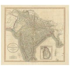
1806 John Cary Map of Hindoostan – Detailed British Cartography of India
Located in Langweer, NL
Title: 1806 John Cary Map of Hindoostan – Detailed British Cartography of India This highly detailed map, titled "A New Map of Hindoostan from the Latest Authorities," was engraved ...
Category

Early 1800s Antique Engraved More Furniture and Collectibles

Materials

Paper

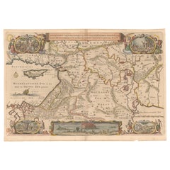
Circa 1686 Daniel Stoopendaal Map: Biblical Sites from Paradise to Canaan
Located in Langweer, NL
Circa 1686 Daniel Stoopendaal Map: Biblical Sites from Paradise to Canaan This circa 1686 hand-colored map by Daniel Stoopendaal, titled "De Gelegentheyt van 't Paradys en 't Landt Canaan," beautifully illustrates the Middle East, extending from the Mediterranean to the Persian Gulf. The map features numerous Biblical locations, such as the Garden of Eden, the wanderings of the Children of Israel, and the story of Jonas and the whale. It is adorned with elaborate decorations, including a banner-style title cartouche and four corner vignettes depicting scenes from Genesis: Paradise, the creation of Adam and Eve, Eve offering the apple, and their expulsion from Eden. The bottom center showcases a dramatic portrayal of Noah's Ark. Measuring 18.3 inches wide by 11.9 inches high, this first state map includes Dutch text on the reverse and is in good condition, with a crisp impression, light toning along the centerfold, and a small chip in the bottom margin. Keywords: - Daniel Stoopendaal map - Biblical map - Garden of Eden - Land of Canaan - Middle East historical map - Noah's Ark map - Adam and Eve - 17th-century Bible...
Category

1680s Antique Engraved More Furniture and Collectibles

Materials

Paper

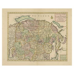
Map of Tartary by Isaak Tirion: Detailed Cartography of Northern Asia, ca.1740
Located in Langweer, NL
This is an antique map titled "Nieuwe Kaart van Tartarie," which translates to "New Map of Tartary." The map was created by Isaak Tirion, a prominent Dutch cartographer and publisher...
Category

1740s Antique Engraved More Furniture and Collectibles

Materials

Paper

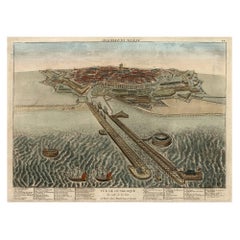
Spectacular 1770 Bird's-Eye View of Dunkirk Harbor by Basset, with 66 Landmarks
Located in Langweer, NL
This engraving, titled *Vue de Dunkerque du coté de la Mer*, is a spectacular bird's-eye view of Dunkirk from the sea, published by Basset around 1770. It provides a detailed panor...
Category

1770s Antique Engraved More Furniture and Collectibles

Materials

Paper

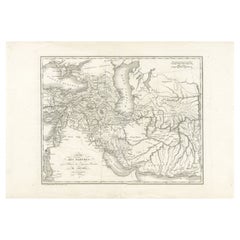
Empire of the Parthians: Historical Cartographic Masterpiece by d'Anville, 1819
Located in Langweer, NL
Description: Ancient map of the Parthian Empire (19th century), original engraving extracted from the atlas of the history of the emperors from 1819, based on the history of the Rom...
Category

1810s Antique Engraved More Furniture and Collectibles

Materials

Paper

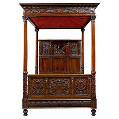
Oak and Walnut Tester Bed
Located in New Orleans, LA
This lavish American oak and walnut tester bed exhibits superior craftsmanship and detail. The design is embellished by elaborate carving throughout ...
Category

19th Century American Antique Engraved More Furniture and Collectibles

Materials

Silk, Mahogany, Oak, Walnut

The Seven Seas by Rudyard Kipling First Edition
Located in Dallas, TX
Presenting an extremely rare first edition hardback copy of The Seven Seas by Rudyard Kipling from 1897. This rare book is in fair to good condition for ...
Category

Late 19th Century American Art Nouveau Antique Engraved More Furniture and Collectibles

Materials

Paper

16th-Century Panoramic View of Worms: A Woodcut from Sebastian Münster's
Located in Langweer, NL
This is a woodcut city view of Worms, published in Sebastian Münster's *Cosmographia* around 1578. The image depicts a bird's-eye view of the city of Worms, located in Rheinland-Pfal...
Category

16th Century Antique Engraved More Furniture and Collectibles

Materials

Paper

Ancient Byzantine Bronze Double-Sided Engraved Reliquary Cross, 9th-12th Century
Located in New York, NY
Fine engraved double-sided Byzantine bronze reliquary cross, 9th-12th Century AD Excellent original patina Composed of two parts hinged at the top an...
Category

15th Century and Earlier European Medieval Antique Engraved More Furniture and Collectibles

Materials

Bronze

Antique Engraving - Crucifixion Christ - Silver Plated Copper - After Van Dyck
By Anthony van Dyck
Located in Casteren, Noord-Brabant
A late 19th century engraving, depicting the crucifixion of Jesus Christ and cherubs "Christ aux Anges". Engraved on a copper panel, silver plated. After Anthony Van Dyck (1599-1641)...
Category

1880s French Baroque Antique Engraved More Furniture and Collectibles

Materials

Silver Plate, Copper

French Pair of World War I Brass Engraved Shell Casings Trench Artillery, French
Located in Labrit, Landes
Antique French pair of shell casings from the World War I vases. Trench Artillery Brass engraved representing on each casing. This pair can also also be used as vases. Good condi...
Category

Early 20th Century French French Provincial Engraved More Furniture and Collectibles

Materials

Brass

Fine Carved German or Austrian 18th Century Stags Horn Powder Flask
Located in TEYJAT, FR
A FINE CARVED GERMAN OR AUSTRIAN 18TH CENTURY STAGS HORN POWDER FLASK - The front face expertly carved with two hunters in a wooded river bank scene with hounds and two flighting duc...
Category

Mid-18th Century European Antique Engraved More Furniture and Collectibles

Materials

Horn

Bird's-Eye View of Blâmont in Lorraine by Braun and Hogenberg, 1597
Located in Langweer, NL
Title: Bird's-Eye View of Blâmont in Lorraine by Braun and Hogenberg, 1597 This copperplate engraving, published in 1597 by Braun and Hogenberg, depicts a bird's-eye view of the t...
Category

16th Century Antique Engraved More Furniture and Collectibles

Materials

Paper

Biblical Journeys: Apostle Paul's Voyages and the Israelites' Exodus, 1856
Located in Langweer, NL
Two maps in matting board. From the Pictorial Bible Atlas, published in 1856. Title for Map 1: Voyages and Travels of Apostle Paul – Illustrated Antique...
Category

1850s Antique Engraved More Furniture and Collectibles

Materials

Paper

A 19th-Century Map of West Canada with Niagara Falls and Indigenous Scenes
Located in Langweer, NL
Decorative 19th-Century Map of West Canada with Niagara Falls and Indigenous Scenes This detailed 19th-century map of West Canada, drawn and engraved by J. Rapkin and published by...
Category

1850s Antique Engraved More Furniture and Collectibles

Materials

Paper

19th-Century Decorative Map of British America with Arctic and Pacific Vignettes
Located in Langweer, NL
19th-Century Decorative Map of British America with Arctic and Pacific Vignettes This 19th-century map of British America, drawn and engraved by J. Rapkin and published by J & F T...
Category

1850s Antique Engraved More Furniture and Collectibles

Materials

Paper

Large 1693 Maritime Map of Irish Sea, West Coasts of Ireland, England, Scotland
Located in Langweer, NL
This is a historical sea chart titled "Carte Generale des Costes d'Irlande, et des Costes Occidentales d'Angleterre avec une Partie de celles d'Ecosse," which translates to "General Map of the Coasts of Ireland and the Western Coasts of England with a Part of Scotland." The map was first published in 1693 in the atlas "La Neptune Francois," created by Jaillot and published by Pieter Mortier in Amsterdam. This initiative was started by the French minister Colbert to improve maritime navigation. Details of the Map: 1. **Geographical Coverage:** - The map primarily focuses on the Irish coast. - It also includes the west coast of England and Wales. - Parts of the west coast of Scotland are also depicted. 2. **Inset Map:** - There is a detailed inset map showing the area around Chester and the course of the River Dee. 3. **Features:** - **Depth Soundings:** The Irish Sea is detailed with depth soundings to assist in navigation. - **Coastal Towns and Islands:** Numerous coastal towns, islands, and geographical features are indicated. - **Rhumb Lines:** The map includes extensive rhumb lines, which are lines used by navigators to plot a straight-line course. - **Key:** There is a key describing the quality of the terrain along the coast, important for navigators to understand the nature of the coastal landscape. 4. **Labels and Annotations:** - **Coastal Settlements:** Ports, forts, and villages along the coast are labeled. - **Geographical Features:** Islands and other significant features are marked. 5. **Artistic and Practical Elements:** - The map is printed on thick paper and is hand-colored, reflecting contemporary coloring techniques. - Detailed lines and soundings are included to help ships navigate around the numerous small islands and narrow inlets safely. 6. **Historical Context:** - The map was part of a significant French maritime project aimed at improving navigation and charting European waters more accurately. - It reflects the high level of cartographic skill and knowledge of the late 17th century. This map would have been a valuable tool for mariners of the time, providing them with crucial information about the coastal features, depth soundings, and safe passage routes around the complex coastlines of Ireland, England, and Scotland. About the Makers and the Atlas **1. Alexis-Hubert Jaillot (1632-1712):** - **Background:** Jaillot was a prominent French cartographer and publisher in the 17th century. He was known for his detailed and accurate maps and atlases. - **Work:** He collaborated with other notable cartographers of his time and played a key role in improving and publishing detailed maps. Jaillot's work was characterized by its precision and artistic quality. - **Contribution:** He was instrumental in the creation of "La Neptune Francois," a maritime atlas aimed at improving French naval navigation. **2. Pieter Mortier (1661-1711):** - **Background:** Mortier was a Dutch engraver, publisher, and mapmaker based in Amsterdam. He was well-known for his high-quality prints and maps. - **Work:** Mortier published several important atlases and maps, often collaborating with other cartographers and engravers. His work was recognized for its detailed craftsmanship and accuracy. - **Contribution:** Mortier published "La Neptune Francois" in Amsterdam, making significant contributions to maritime navigation by providing highly detailed sea charts. About the Atlas "La Neptune Francois": **1. Purpose:** - The atlas was created as part of an initiative led by Jean-Baptiste Colbert, the French minister of finance under King Louis XIV. The goal was to enhance the accuracy and availability of maritime charts for French naval and commercial vessels. - "La Neptune Francois" was designed to be a comprehensive and detailed reference for navigators, covering various European waters with a focus on the French coast and adjacent regions. **2. Content:** - The atlas includes a series of sea charts, each providing detailed information on coastal regions, depth soundings, rhumb lines, and other navigational aids. - The maps were printed on high-quality paper and hand-colored, reflecting the artistic standards of the time. **3. Historical Significance:** - "La Neptune Francois" was a landmark in the history of cartography, representing a significant advancement in the accuracy and detail of maritime maps...
Category

1690s Antique Engraved More Furniture and Collectibles

Materials

Paper

An Original Antique Mid-17th Century Blaeu Map of Styria in Southeastern Austria
Located in Langweer, NL
This is an antique map of Styria (referred to as “Stiria” or “Steyrmarck”), published by the renowned Dutch cartographer Willem Janszoon Blaeu (often simply “Blaeu”). The first editi...
Category

1640s Antique Engraved More Furniture and Collectibles

Materials

Paper

Huy (Huum) Cityscape 1574: Historical Copper Engraving by Braun & Hogenberg
Located in Langweer, NL
Title: Huum opp. condrusorum caput (...) Anno partae salutis 1574. **Type:** Print (Colored Copper Engraving) **Year:** Circa 1580 **Technique:** Colored Copper Engraving **Medium:...
Category

16th Century Antique Engraved More Furniture and Collectibles

Materials

Paper

Val Saint Lambert Crystal W.W.F.C.G.A. Lidded Compote Trophy Cup
Located in Bridgeport, CT
Val St Lambert optic crystal lidded compote trophy cup from 1963 awarded from Women's Westchester Fairfield County Golf Assoc. Signed Val St Lambert on verso. Dimensions: 5 1/2" W x...
Category

20th Century French Hollywood Regency Engraved More Furniture and Collectibles

Materials

Crystal

Beautiful 17th Century Map of Paris and Isle de France by Templeux, c.1650
Located in Langweer, NL
Map of Isle de France by D. de Templeux, ca. 1650, Hand-Colored and Decorative This richly detailed antique map titled *Le Gouvernement de L'Isle de France* was engraved by Daniel d...
Category

1650s Antique Engraved More Furniture and Collectibles

Materials

Paper

Patinated Swan Magazine Rack /Stand after Maison Jansen
Located in West Palm Beach, FL
Maison Jansen Style Patinated Bronze Swan Magazine Rack/Stand Presenting an elegant Maison Jansen-style patinated bronze swan magazine rack/stand, crafted in France circa the 1960s....
Category

20th Century French Mid-Century Modern Engraved More Furniture and Collectibles

Materials

Bronze

A General View of Jerusalem in the Early Part of the 18th Century" (circa 1752)
Located in Langweer, NL
The print is signed by the artist "S. Mynde sc." in the lower right corner. This suggests that the maker of the print is Samuel Mynde, a known engraver from the 18th century. His wor...
Category

1750s Antique Engraved More Furniture and Collectibles

Materials

Paper

Original Antique Map of Dresden, Germany by J. Stockdale, 1800
Located in Langweer, NL
Vintage Map of Dresden, Germany by J. Stockdale, 1800 This vintage map titled "A Plan of the City of Dresden" was published by J. Stockdale in Piccadilly, London, in 1800. It provid...
Category

Early 1800s Antique Engraved More Furniture and Collectibles

Materials

Paper

Rare 1690 Map of England by Nicolaes Visscher II – Heptarchy Depicted
Located in Langweer, NL
Map of England 1690 by Nicolaes Visscher II – Heptarchy and Counties Shown Antique 1690 map of England by Nicolaes Visscher II, showing the Anglo-Saxon Heptarchy and detailed county...
Category

Late 17th Century Dutch Antique Engraved More Furniture and Collectibles

Materials

Paper

1684 Mallet Map of Amazon River & Kingdom of Amazons – Hand Colored, Miniature
Located in Langweer, NL
This map, titled 'Royaume des Amazones', was created by Alain Manesson Mallet and published in 1684 in a German edition of *Beschreibung des Gantzen Welt-Kreisses*, a renowned work d...
Category

1680s Antique Engraved More Furniture and Collectibles

Materials

Paper

Solid Oak Umbrella Stand, French Alps Folk Art, 1960s
Located in ROUEN, Normandie
Solid Oak Umbrella Stand, French Alps Folk Art, 1960s This solid oak umbrella stand, dating from the 1960s, evokes the rustic charm of a mountain chalet. Indeed, this one comes fr...
Category

Mid-20th Century French Mid-Century Modern Engraved More Furniture and Collectibles

Materials

Wood, Oak

Early Woodcut Bird's Eye View of Rouffach, France, by Sebastian Münster, 1554
Located in Langweer, NL
Early Woodcut Bird's Eye View of Rouffach, France, by Sebastian Münster, 1554 Description: This rare 1554 woodcut is a bird's eye view of Rouffach, a town in the Haut-Rhin departmen...
Category

16th Century Antique Engraved More Furniture and Collectibles

Materials

Paper

Detailed Antique Map of Hungary and Transylvania by Tirion, 1753
Located in Langweer, NL
Title: Nieuwe Kaart van’t Koninkryk Hongaryen en Zevenbergen by Isaak Tirion, 1753 – Antique Map of Hungary and Transylvania Description: This is an antique 1753 map titled *Nieuwe Kaart van’t Koninkryk Hongaryen en Zevenbergen*, created by the notable Dutch cartographer and publisher Isaak Tirion. The map showcases the Kingdom of Hungary and the region of Transylvania (referred to as "Zevenbergen") as they appeared in the mid-18th century. Tirion’s maps are well-known for their clarity, precision, and attention to geographic detail, making them highly sought after by collectors of antique maps. This map provides a detailed view of Hungary and Transylvania, including borders, towns, cities, rivers, and mountain ranges. It was created using the latest discoveries and updates of the time and reflects the political landscape of the region, which was part of the Habsburg Empire during a period of territorial changes and consolidations. The map’s borders are highlighted with color to distinguish different regions, and significant cities such as Buda, Pest, and Debrecen are clearly labeled. Isaak Tirion was one of the most prominent Dutch publishers of the 18th century, particularly known for his *Nieuwe en Beknopte Hand-Atlas* (New and Concise Hand Atlas) series, which included a wide range of maps of Europe and beyond. His works were appreciated for their cartographic accuracy and artistic quality. This map is a valuable piece for collectors interested in 18th-century European maps, particularly those that highlight Central Europe, Hungary, Transylvania, and the Habsburg Empire. It is a fine example of the craftsmanship of Isaak Tirion and offers insight into the historical geography of the region. Condition: Excellent for its age, with finely preserved hand-coloring and wide margins. Slight edge wear typical of maps from this period. Effective keywords that may help attract collectors or enthusiasts interested in historical maps of Hungary, Transylvania, and Central Europe: - Antique map of Hungary - Historical map of Transylvania - 18th-century map of Central Europe - Habsburg Empire map - Isaak Tirion map - Nieuwe Kaart van’t Koninkryk Hongaryen en Zevenbergen - Kingdom of Hungary map...
Category

1750s Antique Engraved More Furniture and Collectibles

Materials

Paper

Colored wall map of the WORLD
By Chambon
Located in ZWIJNDRECHT, NL
“Mappe Monde, contenant les Parties Connues du Globe Terrestre” CHAMBON, Gobert-Denis (France, 17.. - 1781) Paris, Longchamps et Janvier, 1754 Size H. 115 x W. 145 cm. Gobert-Denis Chambon made copper engraving after the work of Guillaume De L’Isle, published in 1754 by Jean Janvier and S.G. Longschamps. A huge wall map of the world in two hemispheres printed on two sheets, depicting the Eastern and Western hemispheres supported by two male figures, decorated at the bottom right and left with two celestial hemispheres (boreal and southern) and at the bottom in the middle with an armillary sphere, in addition. This map is most notable for its depiction of the Sea of Japan labeled "Mer de Corée" and of "Mer de L'Ouest" or Sea of the West - a great sea, easily the size of the Mediterranean, to flow from the then-known Strait of Juan de Fuca...
Category

Mid-18th Century French French Provincial Antique Engraved More Furniture and Collectibles

Materials

Wood, Paper

Colored wall map of the WORLD
$28,691 Sale Price
20% Off
Joe DiMaggio Silver Presentation Tray by Cartier
Located in New Orleans, LA
Made for one of the most celebrated sports figures of the 20th century, this incredible Cartier presentation tray was gifted to the baseball star Joe DiMaggio...
Category

20th Century French Other Engraved More Furniture and Collectibles

Materials

Silver

Antique Hand-Colored Map of France by J.B. Elwe, 1792
Located in Langweer, NL
Antique map titled 'Carte Nouvelle du Royaume de France'. Beautiful antique map of France, including the Southern part of England. Decorated with cartouche and 12 coats of arms.  
Category

Late 18th Century Antique Engraved More Furniture and Collectibles

Materials

Paper

Original Engraving of the West Indies, Gulf of Mexico, Antilles, Caribbean, 1780
Located in Langweer, NL
Rigobert Bonne and G. Raynal's 1780 map of the West Indies, Gulf of Mexico, Antilles, and the Caribbean stands as a remarkable cartographic piece, offering a detailed and expansive v...
Category

Late 18th Century Antique Engraved More Furniture and Collectibles

Materials

Paper

Frisia Occidentalis, A Rare Antique Engraving of Friesland, The Netherlands
Located in Langweer, NL
Antique map titled 'Frisia Occidentalis.' - A very decorative map of the Dutch province Friesland, also showing the Wadden islands Terschelling and Ameland. With coats of arms of the...
Category

1620s Antique Engraved More Furniture and Collectibles

Materials

Paper

Moullart-Sanson Map of the Holy Land and Sacred Geography of the Old Testament
Located in Langweer, NL
"1716 Moullart-Sanson Map of the Holy Land and Sacred Geography of the Old Testament" This engraved map, created by Pierre Moullart-Sanson and reissued by Robert de Vaugondy in 1740...
Category

1710s Antique Engraved More Furniture and Collectibles

Materials

Paper

Bird's-Eye Views of Dunkerque, Gravelines, and Bourbourg by Braun and Hogenberg
Located in Langweer, NL
Bird's-Eye Views of Dunkerque, Gravelines, and Bourbourg by Braun and Hogenberg, 1597 This antique print, published in 1597 by Braun and Hogenberg, showcases three detailed bird's...
Category

16th Century Antique Engraved More Furniture and Collectibles

Materials

Paper

Pocket Globe, Nicholas Lane, London, post 1779
By Nicholas Lane
Located in Milano, IT
Pocket Globe Nicholas Lane London, post 1779 The globe is contained in its original case, which is covered in leather. The sphere measures 2.75 in (6.9 cm) whereas the case measure...
Category

1780s English Other Antique Engraved More Furniture and Collectibles

Materials

Leather, Wood, Paper

Brampton Salt Glazed Jesus College Cambridge Presentation Pottery Tyg
Located in Bishop's Stortford, Hertfordshire
A large and impressive Jesus College, Cambridge University Rowing Presentation salt glazed pottery tyg by Brampton dated 1869. The large stoneware tyg is of cylindrical shape standin...
Category

1860s English High Victorian Antique Engraved More Furniture and Collectibles

Materials

Silver Plate

Maison Jansen Style Patinated Bronze Swan Magazine or Display Rack, C. 1960s
Located in West Palm Beach, FL
Maison Jansen Style Patinated Bronze Swan Magazine or Display Rack, Mid-20th Century A sculptural and elegant patinated bronze rack in the form of a stylized swan, attributed to the...
Category

20th Century French Modern Engraved More Furniture and Collectibles

Materials

Bronze

World Map in Two Hemispheres: Eastern & Western - 1802 Tardieu Atlas
Located in Langweer, NL
Antique Map with Title: "Mappemonde en Deux Hémisphères" Publication Details: - **Atlas Title:** Nouvel Atlas Universel de Géographie Ancienne et Moderne - **Purpose:** For the Nouvelle Edition de la Géographie de Guthrie - **Mapmakers:** P. F. Tardieu, with contributions from various geographical works - **Publisher:** Chez Hyacinthe Langlois, Libraire, quai des Augustins, n° 45 - **Year:** An X - 1802 (French Revolutionary Calendar) **Geographical Scope:** This antique map illustrates a double-hemisphere world map, showing both the Eastern (Old World) and Western (New World) hemispheres. It provides a global perspective, capturing the entire known world as understood in the early 19th century. **Map Features:** - **Hemispheres Displayed:** - **Western Hemisphere:** The Americas, labeled as "Hémisphère Occidental ou Nouveau Monde...
Category

Early 1800s Antique Engraved More Furniture and Collectibles

Materials

Paper

Colomba by Prosper Mérimée, Prosper - ILLUSTRATED
Located in Middletown, NY
Paris: Librairie L. Conquet, L.Carteret et Cie. 1904. Maurice Tourneux, preface, Daniel Vierge, illustrations LIMITED EDITION Large 8vo, 10 1/2 x 7 inches (270 x 177 mm); viii, 298 ...
Category

Early 20th Century French Engraved More Furniture and Collectibles

Materials

Leather, Wood, Paper

Antique Map of Jamaica and Hispaniola (Saint-Domingue and Santo Domingo), 1802
Located in Langweer, NL
This is an original antique map titled "Carte des Isles de la Jamaïque et de St. Domingue," depicting the islands of Jamaica and Saint-Domingue (modern-day Haiti and the Dominican Re...
Category

Early 1800s Antique Engraved More Furniture and Collectibles

Materials

Paper

Mercator's Ptolemaic Map of Ancient Assyria, Media, and Persia
Located in Langweer, NL
This map, "Asiae I Tab:", features the region corresponding to modern-day Iran and Iraq, intricately depicted in Gerard Mercator's edition of Claudius Ptolemy's "Tabulae Geographicae...
Category

16th Century Antique Engraved More Furniture and Collectibles

Materials

Paper

Hand-Colored Map of West India Islands: St. Christopher's, St. Lucia and Nevis
Located in Langweer, NL
This map, titled "West India Islands," was published by John Thomson & Co. in 1821 as part of *Thomson's New General Atlas.* The map offers detailed depictions of three key islands i...
Category

1820s Antique Engraved More Furniture and Collectibles

Materials

Paper

Dutch Conquest of Rio Grande, Brazil (1633) Under Prince Frederick Hendrick
Located in Langweer, NL
The image is an engraving titled “VEROVERINGE VAN RIO GRANDE IN BRASIL ANNO 1633.” This historical print depicts the Dutch conquest of Rio Grande in Brazil, known today as Natal, dur...
Category

1690s Antique Engraved More Furniture and Collectibles

Materials

Paper

French 18th Century Gold Mounted Walking Stick
Located in London, GB
French 18th century gold mounted walking stick French, 1769 Height 116cm, diameter 3cm Dating back to 1789, this walking stick exemplifies the remarkable craftsmanship of 18th cent...
Category

Mid-18th Century French Antique Engraved More Furniture and Collectibles

Materials

Metal, Gold

A Brass Equinoctial Dial French 1780ca
Located in Firenze, IT
Shipping policy No additional costs will be added to this order. Shipping costs will be totally covered by the seller (customs duties included). With hinged gnomon, hour ring and l...
Category

Late 18th Century French Louis XVI Antique Engraved More Furniture and Collectibles

Materials

Brass

Antique 1683 Map of Hispaniola and Puerto Rico in the Caribbean by Mallet
Located in Langweer, NL
Title: 17th Century Map of Hispaniola and Puerto Rico by Mallet (1683) This exquisite 17th-century map by Mallet, titled "I. d'Hispaniola et P.to Rico," showcases the islands of Hispaniola and Puerto Rico with remarkable detail. Published in Paris in 1683 as part of Mallet's monumental "Description de l'Univers," this map is a prime example of historical cartography from the era. Map Features: - Detailed depiction of Hispaniola and Puerto Rico - Nearby islands: Inagua islands, Mayaguana, Île-à-Vache, Saona, and Mona - Three illustrated naval battles surrounding the islands - Hand-colored illustrations typical of the period - Published in Paris, 1683, as part of the "Description de l'Univers" - Engraved with artistic and geographic precision Collectors and enthusiasts of antique maps will appreciate the historical significance and artistic detail of this rare print. Although small, the map is perfect for framing and this map serves as a captivating piece of history, reflecting the maritime exploration and territorial knowledge of the late 17th century. The maker of the map is Allain Manesson Mallet, a notable 17th-century cartographer, military engineer, and author. Born in Paris in 1630, Mallet served in the French army and worked as a military engineer under Louis XIV. He later became a professor of mathematics and military architecture. Mallet is best known for his monumental work, "Description de l'Univers," published in Paris in 1683. This extensive publication is considered one of the greatest works of its kind in the 17th century, providing detailed descriptions and maps of various parts of the world. Mallet's maps are renowned for their artistic quality, intricate details, and the inclusion of illustrative elements such as ships, sea creatures, and topographical features. Mallet's contributions to cartography and his work in "Description de l'Univers" have left a lasting impact on the field, making his maps highly valued by collectors and historians. Keywords: - 17th-century map - Mallet map 1683 - Hispaniola map - Puerto Rico map - Antique Caribbean map...
Category

1830s Antique Engraved More Furniture and Collectibles

Materials

Paper

1645 Blaeu Map of Westmorland, Northern England – Hand Colored, Decorative
Located in Langweer, NL
This map, "Westmoria Comitatus; Anglice Westmorland", was created by the esteemed Dutch cartographer Willem Blaeu and was published around 1645 in 'Le Theatre du Monde ou Nouvel Atlas'. It provides a detailed look at Westmorland, a historic county in northern England, based on John Speed’s earlier map. The map features numerous place names, parks, and estates, including Brigster Park, Colnhead Park, Crosbye, and Midleton, along with a detailed depiction of Windermere (spelled Wynandermere) and the surrounding regions. Additional Features: - Hand-colored map, with vibrant and detailed colors that bring out the topographical and decorative features. - Includes intricate cartouches, such as the royal coat of arms, a decorative title cartouche topped with putti (cherubic figures), and six coats of arms (two left blank). - Depicts the region’s rich landscape, including the rolling hills and mountainous terrain of northern England. - French text on the verso, indicative of the publication period from 1645-1648, part of Blaeu’s highly sought-after atlases. - Map shows precise details of small towns, estates, and parks, such as Brigster Park, Colnhead Park, Crosbye, and Wynandermere (now Windermere Lake). This map would be of particular interest to collectors of English county maps, antique maps of northern England, 17th-century cartography, and the decorative works of Willem Blaeu. Blaeu's maps are renowned for their accuracy, artistic beauty, and historical significance. Keywords: Willem Blaeu, Westmorland map, northern England, 17th-century map, antique map, English county map, John Speed, Windermere, decorative cartography, hand-colored map, rare map, antique cartography...
Category

1640s Antique Engraved More Furniture and Collectibles

Materials

Paper

"Africa Vetus": a 17th Century Hand-Colored Map by Sanson
Located in Alamo, CA
This original hand-colored copperplate engraved map of Africa entitled "Africa Vetus, Nicolai Sanson Christianiss Galliar Regis Geographi" was originally created by Nicholas Sanson d...
Category

Late 17th Century French Antique Engraved More Furniture and Collectibles

Materials

Paper

Large 1695 Hand-Colored Engraved Map of Gascony (Gascogna), France
Located in Langweer, NL
This map, created by Giacomo Cantelli da Vignola in 1695, represents the "General Government of Guyenne and Gascony" in southwest France. Cantelli da Vignola was a renowned Italian c...
Category

1690s Antique Engraved More Furniture and Collectibles

Materials

Paper

Luigi Del Monte Modern Aluminum Hanukkah Lamp
Located in New York, NY
The Hanukkah Lamp by Luigi Del Monte, created in 1999, is a striking reinterpretation of the traditional Hanukkah menorah. Constructed from brushed aluminum, the lamp embraces minima...
Category

Late 20th Century Italian Modern Engraved More Furniture and Collectibles

Materials

Aluminum

Vieille France by Roger Martin DuGard - Art Deco Binding - Henri Matisse cover
Located in Middletown, NY
Neuchatel & Paris: Ides et Calendes, 1946 Henri Matisse illustration Limited Edition. 8vo; 7 1/4 x 5 3/8 inches (182 x 136 mm); frontispiece reproducing a map of part of Paris, origi...
Category

Mid-20th Century French Engraved More Furniture and Collectibles

Materials

Gold Leaf

Map of Ancient Gaul & Roman Provinces: Early 19th Century - 1802 Tardieu Atlas
Located in Langweer, NL
### Antique Map Description **Title:** La Gaule et Ses Grandes Dignités Romaines au Temps des Empereurs **Publication Details:** - **Atlas Title:** Nouvel Atlas Universel de Géogra...
Category

Early 1800s Antique Engraved More Furniture and Collectibles

Materials

Paper

Decorative Antique Map of Cyprus and Asia Minor by Christoph Weigel, Circa 1720
Located in Langweer, NL
Title: Asiae Peninsula sive Asia Intra Taurum by Christoph Weigel, Circa 1720 – Decorative Antique Map of Cyprus and Asia Minor Description: Thi...
Category

1720s Antique Engraved More Furniture and Collectibles

Materials

Paper

Antique Map of Hungary and Transylvania by Isaak Tirion, Amsterdam c.1740
Located in Langweer, NL
Poland Map 1740s – Nieuwe Kaart van het Koninryk Poolen by Isaak Tirion This finely engraved and attractively hand-colored map of the Kingdom of Poland was published by Isaak Tirion...
Category

Mid-18th Century Dutch Antique Engraved More Furniture and Collectibles

Materials

Paper

Louis Vuitton Early 20th Century Luggage Suitcase Brown Leather Brass Locks
Located in Sacile, PN
Suitcase by Louis Vuitton, dated 1910 circa. Engraved latch, brown and camel leather.
Category

Early 20th Century French Engraved More Furniture and Collectibles

Materials

Brass

Switzerland Map 1778 – Striking Hand-Colored Copperplate of the Thirteen Cantons
Located in Langweer, NL
Switzerland Map 1778 – Faden’s Hand-Colored Copperplate of the Thirteen Cantons This striking copperplate engraving, published by William Faden in London in 1778, offers a detailed ...
Category

Late 18th Century European Antique Engraved More Furniture and Collectibles

Materials

Paper

Rare 1699 Map of the Failed Scottish Colony of Caledonia in Panama
Located in Langweer, NL
Rare 1699 Map of the Failed Scottish Colony of Caledonia in Panama This scarce and historically fascinating map, titled 'The Scots Settlement in America or New Caledonia A.D. 1699',...
Category

Late 17th Century English Antique Engraved More Furniture and Collectibles

Materials

Paper

1579 Ornate Map of Burgundy County by Ferdinand de Lannoy
Located in Langweer, NL
1579 Ornate Map of Burgundy County by Ferdinand de Lannoy Description of the Map: This is a beautifully detailed map of the Burgundy region, titled "Bvrgvndiae Comitatus Recentiss....
Category

16th Century Antique Engraved More Furniture and Collectibles

Materials

Paper

Read More

Medal-Worthy Memorabilia from Epic Past Olympic Games

Get into the games! These items celebrate the events, athletes, host countries and sporting spirit.

Ahoy! You’ve Never Seen a Collection of Sailor Art and Kitsch Quite Like This

French trendsetter and serial collector Daniel Rozensztroch tells us about his obsession with objects related to seafaring men.

39 Incredible Swimming Pools

It's hard to resist the allure of a beautiful pool. So, go ahead and daydream about whiling away your summer in paradise.

Pamela Shamshiri Shares the Secrets behind Her First-Ever Book and Its Effortlessly Cool Interiors

The sought-after designer worked with the team at Hoffman Creative to produce a monograph that beautifully showcases some of Studio Shamshiri's most inspiring projects.

Moroccan Artworks and Objects Take Center Stage in an Extraordinary Villa in Tangier

Italian writer and collector Umberto Pasti opens the doors to his remarkable cave of wonders in North Africa.

Montecito Has Drawn Royalty and Celebrities, and These Homes Are Proof of Its Allure

Hollywood A-listers, ex-pat aristocrats and art collectors and style setters of all stripes appreciate the allure of the coastal California hamlet — much on our minds after recent winter floods.

Whaam! Blam! Pow! — a New Book on Pop Art Packs a Punch

Publishing house Assouline and writer Julie Belcove have teamed up to trace the history of the genre, from Roy Lichtenstein, Andy Warhol and Yayoi Kusama to Mickalene Thomas and Jeff Koons.

The Sparkling Legacy of Tiffany & Co. Explained, One Jewel at a Time

A gorgeous new book celebrates — and memorializes — the iconic jeweler’s rich heritage.
Recently Viewed

View All