Engraved More Furniture and Collectibles

to
340
612
270
895
5
5
22
16
13
12
12
12
10
7
4
2
2
2
1
1
1
1
513
240
142
10
66
33
25
7
4
3
5
6
1
4
10
3
4
674
196
98
78
40
356
103
78
70
63
905
905
905
10
9
9
8
5
Technique: Engraved
A Stunning 1744 Bowen Map: South East Germany & Queen of Hungary’s Dominions
Located in Langweer, NL
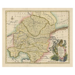
Title: A New and Correct Map of the South East part of Germany, 1744 This map by Emanuel Bowen, dating to around 1744, beautifully captures the southeastern part of Germany. The det...
Category

1740s Antique Engraved More Furniture and Collectibles

Materials

Paper

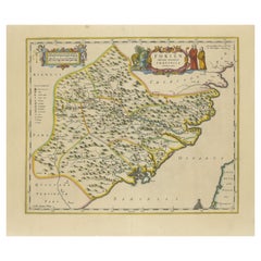
Original 17th-Century Antique Map of Fujian (Fokien) Province, China – by Blaeu
Located in Langweer, NL
17th-Century Antique Map of Fujian Province, China – "Fokien" by Blaeu, with Decorative Cartouches Description: This stunning 17th-century map of Fujian Province, historically ref...
Category

1650s Antique Engraved More Furniture and Collectibles

Materials

Paper

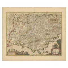
Map of the Provence in Southern France, Original Old Engraving by De Wit c. 1688
Located in Langweer, NL
Title: Provence Map - Hand-Colored 17th-Century Engraving by Frederik De Wit c. 1688 Description: This captivating map, "Gouvernement de Provence," depicts the Provence region of so...
Category

1680s Antique Engraved More Furniture and Collectibles

Materials

Paper

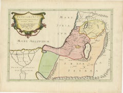
17th-Century Map of the Latin Patriarchate of Jerusalem by Melchior Tavernier
Located in Langweer, NL
Title: 17th-Century Map of the Latin Patriarchate of Jerusalem by Melchior Tavernier Description: This rare 17th-century map by Melchior Tavernier illustrates the geographical ext...
Category

1640s Antique Engraved More Furniture and Collectibles

Materials

Paper

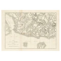
Circa 1802 Map of the Troad Region by Tardieu – From the Voyage de la Troade
Located in Langweer, NL
This is a large fold-out map titled *Carte de la Troade*, measuring approximately 53.5 x 68 cm, engraved by Tardieu, and extracted from the atlas of *Voyage de la Troade, fait dans l...
Category

Early 1800s Antique Engraved More Furniture and Collectibles

Materials

Paper

17th-Century Original Antique Map of Hunan and Hubei Provinces, China – by Blaeu
Located in Langweer, NL
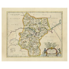
Title: 17th-Century Antique Map of Hunan and Hubei Provinces, China – "Hvqvang" by Blaeu, Richly Detailed and Illustrated Description: This beautiful 17th-century map of the regions that now comprise Hunan and Hubei Provinces, historically referred to as "Hvqvang," was created by Johannes Blaeu and published in 1655 as part of the *Novus Atlas Sinensis*. This map, drawn with input from Jesuit missionary Martino Martini, provides a meticulous representation of central China’s geography, capturing its rivers, towns, and mountainous terrain. The Yangtze River (Changjiang) is prominently featured, emphasizing the region’s importance as a vital waterway for trade and transportation. Wuhan, now a modern metropolis, and Changsha, the capital of Hunan Province, were historically significant cities that appear on the map. The area is also notable for its fertile lands and contributions to China’s agricultural prosperity, particularly in rice and tea production. The decorative cartouche in the lower-right corner features two figures in traditional Chinese attire standing amid bamboo, symbolizing the cultural and natural richness of the region. Blaeu’s map combines precision and artistry, with vibrant hand-coloring distinguishing boundaries and geographical features. The copperplate engraving ensures fine detail, making this map a remarkable historical artifact. Condition: Near excellent. Clean impression with vivid hand-coloring. Wide margins with minor age-toning appropriate for its age. Framing Tips: Use a neutral double mat and a gilt or dark wood frame to enhance the presentation. UV-protective glass is recommended to preserve the vivid hand-coloring and intricate engraving details. Hunan and Hubei, historically referred to as "Hvqvang," are known for their strategic location along the Yangtze River and their cultural and economic significance in Chinese history. The region’s fertile lands have supported extensive rice cultivation, earning it the title of one of China’s "breadbaskets." Hubei, with Wuhan at its center, has long been a hub of transportation and trade, owing to the convergence of the Yangtze and Han Rivers. Hunan, with Changsha as its capital, is known for its rich cultural heritage and contributions to Chinese literature and art. Important places in the region include Wuhan, an ancient trade center, and Changsha, known for its historical sites and cultural prominence. The Yangtze River, a key feature on the map, highlights the region’s historical importance as a major waterway for commerce and agriculture. Other notable features include Dongting Lake, a vital ecological and cultural landmark, and the surrounding mountainous areas that have shaped the region’s history and development. Keywords: antique map of Hunan, Hubei map, Hvqvang map, Yangtze River map, 17th-century Chinese map...
Category

1650s Antique Engraved More Furniture and Collectibles

Materials

Paper

1700 Guillaume Delisle Map: Western Mediterranean & Moorish North Africa
Located in Langweer, NL
1700 Guillaume Delisle Map: Western Mediterranean & Moorish North Africa This hand-colored map from 1700 by Guillaume Delisle, titled "In Notitiam Ecclesiasticam Africae Tabula Geographica," offers a detailed look at the regions under Moorish control during the later medieval period. It encompasses the northern African coast from Morocco to Libya, the Iberian Peninsula, and the western Mediterranean, including notable islands such as Sardinia, Corsica, Malta, the Balearics, and Sicily, where a smoking Mount Etna is depicted. The map is embellished with three decorative cartouches, adding artistic flair to the detailed geographical renderings. Engraved by Jean Baptiste Liebaux, the map measures 25.2 inches wide by 19.1 inches high. It features a sharp impression with contemporary outline color, later enhanced cartouches, and is printed on a bright sheet with a Society of Jesus watermark. The condition is very good, with an archivally repaired centerfold separation at the bottom and light toning along the edges. Keywords: - Guillaume Delisle map - Western Mediterranean historical map - Northern Africa map...
Category

Early 1700s Antique Engraved More Furniture and Collectibles

Materials

Paper

17th-Century Antique Map of Jiangxi (Kiangsi) Province, China – by Blaeu
Located in Langweer, NL
Title: 17th-Century Antique Map of Jiangxi Province, China – "Kiangsi" by Blaeu, Detailed and Vibrantly Colored Description: This detailed 17th-century map of Jiangxi Province, historically referred to as "Kiangsi," was created by Johannes Blaeu and published in 1655 as part of the *Novus Atlas Sinensis*. Jiangxi, located in southeastern China, is known for its cultural heritage, scenic landscapes, and significant contributions to Chinese history. The map meticulously charts Jiangxi’s geography, including mountain ranges, rivers, and cities, with place names rendered in Latin. Poyang Lake, one of the largest freshwater lakes in China, is prominently depicted, emphasizing the region’s ecological and economic importance. The map also highlights key cities such as Nanchang, the provincial capital, which has long been a cultural and political center, and Jingdezhen, globally famous as the center of Chinese porcelain production. The decorative cartouche in the lower-right corner features traditional Chinese figures, adding cultural depth to the map. Blaeu’s craftsmanship is evident in the precise copperplate engraving and the vibrant hand-coloring, which enhances the boundaries and natural features, making this map both a functional document and a work of art. Condition: Nearly excellent. Sharp impression with vivid hand-coloring. Wide margins with minor age-toning appropriate for its age. Framing Tips: Use a neutral double mat and an ornate gilt or dark wood frame to highlight the map’s historical and artistic value. UV-protective glass is recommended to preserve the hand-coloring and intricate details. Jiangxi, historically referred to as "Kiangsi," is famous for its rich cultural history, stunning landscapes, and economic contributions. It has been a key region for porcelain production, with Jingdezhen renowned as the "Porcelain Capital" of the world. Poyang Lake, featured prominently on the map, is vital for fishing, transportation, and its ecological significance. The province’s location along the Gan River has historically made it an important transportation corridor. Nanchang, the provincial capital, is noted for its historical landmarks and political significance in modern Chinese history. Keywords include: antique map of Jiangxi, Kiangsi map, Poyang Lake, Jingdezhen porcelain, 17th-century China map...
Category

1650s Antique Engraved More Furniture and Collectibles

Materials

Paper

Genuine Antique Map of European Turkey by Pierre Antoine Tardieu (1784-1869)
Located in Langweer, NL
This is an original antique map titled "Carte de la Turquie d'Europe," which depicts the European territories of the Ottoman Empire. The map features detailed geographical and political boundaries, showcasing various regions, cities, rivers, and mountains within the Ottoman European territories. The map was created by Pierre Antoine Tardieu, a renowned French engraver, steel engraver, and cartographer known for his high-quality work. Map Details: - **Title**: Carte de la Turquie d'Europe - **Creator**: Pierre Antoine Tardieu (1784-1869) - **Publication Date**: Early 19th century - **Dimensions**: Approximately 34.5 x 43.5 cm (13.5 x 17.25 inches) - **Features**: The map includes a detailed representation of the European territories of the Ottoman Empire, with place names, rivers, mountains, and regions clearly marked. The title cartouche is located in the upper left corner, and the mile scale is presented in the lower left. Around the year 1800, the region referred to as "European Turkey" or "Ottoman Europe" was a significant part of the Ottoman Empire, which was one of the most powerful empires in the world at the time. Here are some key aspects of European Turkey during this period: ### Geographic Scope European Turkey included a large part of Southeastern Europe, encompassing modern-day: - Greece - Bulgaria - Romania (specifically the regions of Dobruja and parts of Wallachia) - Serbia - Albania - Montenegro - Bosnia and Herzegovina - Parts of Croatia, Macedonia, and Hungary Political Structure - **Ottoman Administration**: The region was governed by the Ottoman administrative system, which divided territories into provinces (vilayets) and smaller administrative units (sanjaks). Each province was overseen by a governor (pasha) appointed by the Sultan. - **Autonomy and Vassal States**: Some areas within European Turkey had varying degrees of autonomy or were vassal states. For example, Wallachia and Moldavia (in modern-day Romania) were vassal principalities that retained local rulers under Ottoman suzerainty. Society and Demographics - **Ethnic Diversity**: The region was extremely diverse, home to numerous ethnic groups, including Turks, Greeks, Bulgarians, Serbs, Albanians, Vlachs (Romanians), and Jews, among others. - **Religious Diversity**: There was significant religious diversity, with Islam being the dominant religion due to Ottoman rule, but large Christian (Eastern Orthodox, Roman Catholic) and Jewish populations coexisted. Economy - **Agriculture**: The economy was largely agrarian, with agriculture being the primary occupation. Key crops included grains, tobacco, and cotton. - **Trade and Commerce**: European Turkey was strategically important for trade, connecting the Mediterranean with Central Europe and the Black Sea. Major cities like Constantinople (modern-day Istanbul), Thessaloniki, and Belgrade were key commercial hubs. Culture - **Cultural Influence**: The region was a melting pot of various cultures, influenced by Byzantine, Slavic, and Ottoman traditions. This mix was reflected in architecture, cuisine, music, and customs. - **Education and Language**: The official language of administration was Ottoman Turkish, but many local languages were spoken. Education was often conducted in religious institutions, with different communities maintaining their own schools. Challenges and Conflicts - **Internal Strife**: The Ottoman Empire faced numerous internal challenges, including administrative inefficiency, corruption, and local uprisings. - **External Threats**: The empire was also under pressure from external forces, particularly from the Habsburg Empire, Russia, and later from nationalist movements within the Balkans, which sought independence or autonomy from Ottoman rule. Decline of Ottoman Power By 1800, the Ottoman Empire was experiencing a gradual decline, which would intensify throughout the 19th century. This period saw increasing nationalist sentiments among various ethnic groups within European Turkey, leading to uprisings and eventual wars of independence, such as the Serbian Revolution (1804-1835) and the Greek War of Independence (1821-1829). Overall, European Turkey around 1800 was a complex and diverse region under the Ottoman Empire's waning control, characterized by a rich tapestry of cultures, economic activities, and political structures. Condition Overview: 1. **Paper Quality**: The map exhibits signs of aging, such as yellowing along the edges, which is typical for documents of this age. The paper remains in good condition without major tears or damage. 2. **Edges and Corners**: The edges are slightly worn, with minor fraying and a few small tears that do not significantly impact the map's readability or aesthetic value. 3. **Center Fold**: There is a visible center fold, common for maps that were folded for storage or publication. The fold is in good condition without significant wear but with splits on both sidess. 4. **Color and Print Quality**: The colors used to outline the boundaries remain vibrant and clear. The print quality is excellent, with sharp, legible text and detailed illustrations. 5. **Staining and Spots**: There are a few spots and stains, particularly near the edges and along the fold. These do not obscure any critical details of the map. Historical and Artistic Value: Pierre Antoine Tardieu was known for his meticulous craftsmanship and contributions to cartography. His work drew the attention of prominent figures such as Alexander von Humboldt...
Category

Early 1800s Antique Engraved More Furniture and Collectibles

Materials

Paper

Original Normandy Map by Frederick de Wit, 1705, with Inset of Channel Islands
Located in Langweer, NL
Normandy Map by Frederick de Wit, 1705, with Inset of Channel Islands Description: This beautifully engraved and hand-colored map, titled Duché et Gouvernement General de Normandie,...
Category

Early 1700s Antique Engraved More Furniture and Collectibles

Materials

Paper

Map of Le Maine by H. Hondius, 1633, Hand-Colored, Decorative and Historic
Located in Langweer, NL
Map of Le Maine by H. Hondius, 1633, Hand-Colored, Decorative and Historic This rare and beautifully executed antique map titled 'Le Maine' was published in 1633 by Henricus Hondius...
Category

1630s Antique Engraved More Furniture and Collectibles

Materials

Paper

1808 C. Smith Map of Hindoostan – British India with Intricate Details
Located in Langweer, NL
Title: 1808 C. Smith Map of Hindoostan – British India with Intricate Details This map, titled "Hindoostan," was published by C. Smith, a prominent London map seller, on January 6, ...
Category

Early 1800s Antique Engraved More Furniture and Collectibles

Materials

Paper

1773 John Blair Map of the Ancient Holy Land: Tribes, Journeys, and Empires
Located in Langweer, NL
Title: 1773 John Blair Map of the Ancient Holy Land: Tribes, Journeys, and Empires This exceptional map by John Blair, published in London in 1773, offers a richly detailed view o...
Category

1770s Antique Engraved More Furniture and Collectibles

Materials

Paper

Rare Hand-Colored Map of Champagne and Brie, France, by Frederik De Wit c. 1688
Located in Langweer, NL
Title: Rare Hand-Colored Map of Champagne and Brie by Frederik De Wit c. 1688 Description: This exquisite 17th-century map, "Champagne et Brie," beau...
Category

1680s Antique Engraved More Furniture and Collectibles

Materials

Paper

1748 Homann Heirs Double Map of the East Indies and Southeast Asia
Located in Langweer, NL
Title: 1774 Homann Heirs Double Map of the East Indies and Southeast Asia Description: This stunning 1774 double map by the Homann Heirs showcases the East Indies and Southeast ...
Category

1740s Antique Engraved More Furniture and Collectibles

Materials

Paper

18th Century Map of Upper Guinea: Kingdoms and Coastal Regions of West Africa
Located in Langweer, NL
This is an antique map depicting the coastal regions of West Africa, specifically the Gulf of Guinea and surrounding areas, including parts of what is now Senegal, Guinea, Sierra Leo...
Category

1780s Antique Engraved More Furniture and Collectibles

Materials

Paper

Map of Constantinople, Bosphorus, the Coasts of Greece and the Archipelago, 1785
Located in Langweer, NL
This is a large 1785 map titled "Carte de la Ville de Constantinople et du Bosphore de Thrace", which includes detailed maps of Constantinople (modern-day Is...
Category

1780s Antique Engraved More Furniture and Collectibles

Materials

Paper

Historical Map of the Black Sea and Surrounding Regions, 1705
Located in Langweer, NL
Title: "Map of Turcomania, Georgia, and Comania" This print presents an intricately detailed map of the Caucasus region, titled “Turcomania, Georgien Commanie,” by the esteemed cart...
Category

Early 1700s Antique Engraved More Furniture and Collectibles

Materials

Paper

1654 Nicolas Sanson Map of Southern India and Southeast Asia
Located in Langweer, NL
1654 Nicolas Sanson Map of Southern India and Southeast Asia - Partie Meridionale de L'Inde This 1654 map by Nicolas Sanson, titled "Partie Meridionale de L'Inde en deux Presqu'Is...
Category

1650s Antique Engraved More Furniture and Collectibles

Materials

Paper

1574 Sebastian Münster Woodcut Map of Europe: Early View of the Continent
Located in Langweer, NL
Title: Early Woodcut Map of Europe from Münster's Cosmographia, 1574 This is an original early woodcut map of Europe by the famed cartographer Sebastian Münster, printed in 1574 by ...
Category

16th Century Antique Engraved More Furniture and Collectibles

Materials

Paper

Friesland, Groningen and Overijssel – Rare Woodcut Map by Münster, c. 1550
Located in Langweer, NL
Frisia, Groningen and Overijssel – Rare Woodcut Map by Münster, c. 1550, Germany This highly decorative 16th-century woodcut map titled “Von dem Teutschen Land: Seelentfrie” was pub...
Category

16th Century Antique Engraved More Furniture and Collectibles

Materials

Paper

1756 Map of Brazil from Bahia to São Paulo by Bellin – French Colonial Engraving
Located in Langweer, NL
Antique Map of Brazil from Bahia to São Paulo – Bellin for L'Histoire des Voyages This elegant 18th-century French map titled "Suite du Bresil, Depuis la Baie de Tous les Saints jus...
Category

1750s Antique Engraved More Furniture and Collectibles

Materials

Paper

Antique Map of Greece from Ortelius's Theatrum Orbis Terrarum, 1595
Located in Langweer, NL
Original antique map titled "Graecia Sophiani." This is a very detailed and decorative engraved map, with two decorative cartouches and a hand-colored initial on the verso, from Abra...
Category

16th Century Antique Engraved More Furniture and Collectibles

Materials

Paper

Excellent Antique Map of America with Unusual Northwest Coast of America, c.1754
Located in Langweer, NL
Description: Antique map titled 'Nieuwe Kaart Van het Westelykste Deel Der Weereld, dienende tot aanwyzing an de Scheepstogten der Nederlanderne Naar West Indie.' Excellent map of America, featuring an unusual northwest coast of America, which includes Martin d'Aguilar's strait which provides for a Northwest Passage via the Great Lakes. The rest of the NW coast...
Category

1750s Antique Engraved More Furniture and Collectibles

Materials

Paper

1738 Map of the Philippines & Eastern Indonesia: Spice Islands by Tirion
Located in Langweer, NL
1738 Map of the Philippines & Eastern Indonesia: Spice Islands by Tirion/Albrizzi This beautifully hand-colored map from circa 1738, created by Tirion and Albrizzi, showcases the Philippines and the eastern part of Indonesia, reflecting the Dutch colonial interests in the region. The map features a detailed representation of the numerous islands, including the renowned Spice or Banda Islands, pivotal to the Dutch spice trade. Key regions include the Philippines (Isole Filippine), the Mariana Islands (Ladrones), with Guam, the Caroline and Palau Islands (Nieuwe Fillippynsche Eilenden), the Moluccas (Moluccos) known as the Spice Islands, the eastern tip of Java and Borneo, and a portion of Papua New Guinea. Measuring 12.8 inches wide by 11.1 inches high, the map is in excellent condition with a crisp impression, slight foxing, and minor printer's creases, printed on a bright sheet with a lion watermark. Keywords: - Philippines historical map - Eastern Indonesia map...
Category

1730s Antique Engraved More Furniture and Collectibles

Materials

Paper

1690 Frederick de Wit Sea Chart of Hudson Bay, Baffin Bay and Greenland
Located in Langweer, NL
Title: c. 1690 Frederick de Wit Sea Chart of Hudson Bay, Baffin Bay, and Greenland - Engraved by Romeyn de Hooghe This striking sea chart by Frederick de Wit, titled "Septemtrionali...
Category

1690s Antique Engraved More Furniture and Collectibles

Materials

Paper

1767 D’Anville Map of the Holy Land: Ancient Divisions and Biblical Geography
Located in Langweer, NL
Ancient Map of Palestine or the Holy Land by D'Anville (1767) This detailed map, created by the renowned French cartographer Jean Baptiste Bourguignon d'Anville in 1767, depicts the...
Category

1670s Antique Engraved More Furniture and Collectibles

Materials

Paper

Copper Engraved Grenada Map by John Thompson Published in 1810
Located in Langweer, NL
John Thomson's original antique map of Grenada, dating back to 1810 and hailing from Edinburgh, stands as a testament to meticulous cartography. This historical piece, adorned with o...
Category

Early 19th Century Antique Engraved More Furniture and Collectibles

Materials

Paper

1816 Large Southern Hindostan Map by J. Thomson – New General Atlas
Located in Langweer, NL
Title: 1816 Southern Hindostan Map by J. Thomson – New General Atlas This map, titled "Southern Hindostan," was published in 1816 as part of J. Thomson’s *New General Atlas*. The ma...
Category

1810s Antique Engraved More Furniture and Collectibles

Materials

Paper

Old Map of Anatolia, part of modern-day Turkey, Armenia and Syria, 1745
Located in Langweer, NL
Title: "Kaartje van Natolie en Syrie opgesteld door de Hr. Lucas en de Hr. Guil de L'Isle en andere auteuren" The title "Kaartje van Natolie en Syrie opgesteld door de Hr. Lucas en...
Category

1740s Antique Engraved More Furniture and Collectibles

Materials

Paper

Highly Decorative Map of The Eastern Mediterranean and The Middle East, ca.1700
Located in Langweer, NL
Antique map titled 'Byzondere Kaart van de Landen Daar de Apostelen Het Evangelium Gepredikt Hebben (..).' Highly decorative map of the eastern Mediterranean...
Category

Early 1700s Antique Engraved More Furniture and Collectibles

Materials

Paper

1864 Johnson's Map of the World on Mercator's Projection, Ric.B009
Located in Norton, MA
An 1864 Johnson's map of the World on Mercator's Projection Ric.b009 About this Item "This antique map came from Johnson's New Illustrated (Steel Plate) Family Atlas, publ...
Category

19th Century Dutch Antique Engraved More Furniture and Collectibles

Materials

Paper

Original Antique Map of Munich, Germany by J. Stockdale, 1800
Located in Langweer, NL
Title: Vintage Map of Munich, Germany by J. Stockdale, 1800 This vintage map, titled "A Plan of the City of Munich," was published by J. Stockdale in Piccadilly, London, in 1800. Th...
Category

Early 1800s Antique Engraved More Furniture and Collectibles

Materials

Paper

1606 Hand-Colored Woodcut Map of Sumatra from Ramusio’s Delle Navigationi
Located in Langweer, NL
This is a fascinating woodcut map titled *Taprobana*, depicting the island of Sumatra, hand-colored, and published in Venice in 1606. The map originates from Giovanni Battista Ramusi...
Category

Early 1600s Antique Engraved More Furniture and Collectibles

Materials

Paper

Highly Detailed Antique Map of the Holy Land Showing 12 Tribes of Israel, c.1720
Located in Langweer, NL
Antique map titled 'Heylige Land verdeeld in de Twaalf Stammen Israels (..).' Highly detailed map of the Holy Land divided into 12 tribes of Israel...
Category

1720s Antique Engraved More Furniture and Collectibles

Materials

Paper

Midcentury Era Sterling Silver Miniature Golf Trophy with Figural Club Handles
Located in Hamilton, Ontario
This vintage miniature trophy has no maker's mark, but is presumed to have originated from the United States and date to approximately 1959 and done in the period Mid-Century Modern style. The trophy is composed of sterling silver and features three cast figural golf...
Category

Mid-20th Century American Mid-Century Modern Engraved More Furniture and Collectibles

Materials

Sterling Silver

1584 Ortelius Map of Switzerland: A Cartographic Reversal
Located in Langweer, NL
This is a fine example of Ortelius' map of Switzerland from his *Theatrum Orbis Terrarum*, recognized as the first modern atlas of the world. The map is oriented with south at the top, which reverses the typical north-up orientation seen in most modern maps. It highlights significant geographical features such as Lake Geneva (Lemanus Lacus) to the right of the map and the Rhine river entering Switzerland near the center. The *Theatrum Orbis Terrarum*, first published in 1570 by Abraham Ortelius in Antwerp, was groundbreaking as it compiled uniform maps with supporting text in a single volume, marking a departure from earlier collections of maps that were custom-assembled on demand. This atlas included a wealth of sixteenth-century cartographic knowledge, reflecting the extensive global explorations occurring after the discovery of America...
Category

16th Century Antique Engraved More Furniture and Collectibles

Materials

Paper

Johannes Janssonius' 17th-Century Map of the Duchy of Bremen in Germany
Located in Langweer, NL
The map titled "Ducatus olim Episcopatus Bremensis et ostiorum Albis et Visurgis Fluviorum novissima Descriptio" by Johannes Janssonius provides a rich historical and geographical il...
Category

1650s Antique Engraved More Furniture and Collectibles

Materials

Paper

Detailed 18th-Century Map of Paris and Its Surrounding Regions by Johann Homann
Located in Langweer, NL
This map, titled “Agri Parisiensis Tabula particularis,” was created and published by the German cartographer Johann Baptist Homann (1664–1724), or his workshop, in Nuremberg. Homann...
Category

1720s Antique Engraved More Furniture and Collectibles

Materials

Paper

Exploring Ancient Persia: Ptolemaic Map of Iran and Iraq by Ptolemy and Mercator
Located in Langweer, NL
Claudius Ptolemy was a mathematician, astronomer and geographer who worked in Alexandria, then a part of the Roman Empire, in the 2nd century AD. One of the most learned and influent...
Category

1610s Antique Engraved More Furniture and Collectibles

Materials

Paper

Antique Map of the Electorate of Brandenburg by Georges-Louis Le Rouge, 1768
Located in Langweer, NL
Antique Map of the Electorate of Brandenburg by Georges-Louis Le Rouge, 1748 This 1748 map by Georges-Louis Le Rouge, titled "Le Marquisat et Electorat de Brandenbourg," depicts the...
Category

1760s Antique Engraved More Furniture and Collectibles

Materials

Paper

1616 Bertius Map of Sumatra, Singapore and the Straits of Malacca
Located in Langweer, NL
Title: "1616 Bertius Map of Sumatra and the Straits of Malacca" Description: This is an exquisite 1616 original antique map by Petrus Bertius, titled "Sumatra Insula," showcasing Su...
Category

Early 17th Century Antique Engraved More Furniture and Collectibles

Materials

Paper

Early Woodcut Map of the Rhine River Region in Germany and Holland, circa 1628
Located in Langweer, NL
Early Woodcut Map of the Rhine River Region, "Die Dritte Tafel des Rheinstroms," ca. 16th Century This early woodcut map, titled "Die Dritte Tafel des Rheinstroms Innhaltend das Nid...
Category

1620s Antique Engraved More Furniture and Collectibles

Materials

Paper

Map of Styria by William Blaeu, 1645: A Masterpiece of 17th-Century Cartography
Located in Langweer, NL
This 1645 map, created by Willem Janszoon Blaeu, represents Styria (Steyrmark), a historical region in present-day Austria, located in the Alpine regions. Blaeu, one of the most sign...
Category

1640s Antique Engraved More Furniture and Collectibles

Materials

Paper

Cartographic Elegance of the Mughal Dominion in a Hand-Colored Antique Map, 1705
Located in Langweer, NL
This original antique map titled “'T Ryk van den Grooten Mogol” by Nicolas Sanson from 1705 is an interesting historical artifact. It depicts the extent of the Mughal Empire in North...
Category

Early 1700s Antique Engraved More Furniture and Collectibles

Materials

Paper

Detailed Plan of the City of Zutphen, The Netherlands – Hendrik de Leth, c.1740
Located in Langweer, NL
Title: Detailed Plan of the City of Zutphen – Hendrik de Leth, ca. 1740 This hand-colored engraving, created by Hendrik de Leth and published around 1740, presents a detailed and ...
Category

1740s Antique Engraved More Furniture and Collectibles

Materials

Paper

Print of a Dutch VOC Fort on the Peninsula Trincomalee, Ceylon (Sri Lanka), 1726
Located in Langweer, NL
Dutch print with the title: Platte Grond van t'Fort Tricoen male met de daar aangelegen Pagoods-Berg (Trincomalee, Sri Lanka) The map is taken from: 'Oud en Nieuw Oost-Indiën' van...
Category

1720s Antique Engraved More Furniture and Collectibles

Materials

Paper

Bishopric of Hildesheim Map in Northern Germany by Willem & Joan Blaeu, 1645
Located in Langweer, NL
This beautifully hand-colored map, titled "Episcopatus Hildesiensis Descriptio Novissima," depicts the Bishopric of Hildesheim, a historical ecclesiastical territory in present-day L...
Category

1640s Antique Engraved More Furniture and Collectibles

Materials

Paper

Territorium Norimbergense - Antique Map of Nürnberg by Janssonius (1645-58)
Located in Langweer, NL
This is an antique map of Nürnberg, titled "Territorium Norimbergense," created by Johannes Janssonius and published between 1645 and 1658. It is a copperplate engraving printed on p...
Category

1650s Antique Engraved More Furniture and Collectibles

Materials

Paper

Map of Denmark, Norway & Iceland: Early 19th Century from the 1802 Tardieu Atlas
Located in Langweer, NL
Antique Map Description Title: Royaume de Danemarck: Première Carte. Danemarck, Norwege et Islande Publication Details: - **Atlas Title:** Nouvel Atlas Universel de Géographie Anc...
Category

Early 1800s Antique Engraved More Furniture and Collectibles

Materials

Paper

Decorative Map of Hanover, Lower Saxony by Lodge, ca. 1785
Located in Langweer, NL
Title: Decorative Map of Hanover, Lower Saxony by Lodge, ca. 1785 This decorative map, titled "A New & Correct Plan of Hanover, a City in the circle of Lower Saxony," was engraved b...
Category

1780s Antique Engraved More Furniture and Collectibles

Materials

Paper

Large Map of Russian Discoveries in Siberia, Alaska & the Bering Strait, 1784
Located in Langweer, NL
1784 Russian Discoveries in Siberia, Alaska & the Bering Strait - Gerhard Friedrich Muller "Nouvelle Carte des Decouvertes Faites par des Vaisseaux Russiens Aux Cotes Inconnues de L'Amerique Septentrionale avec Les Pais Adiacents" is a seminal map by Gerhard Friedrich Muller, showcasing Russian discoveries in Siberia, Alaska, and the Bering Strait region. Originally published in 1754, this map served as a direct counter to Guillaume de L'Isle's speculative "fantasy" map of the same area, which prominently featured the fictitious Mer de l'Ouest (Sea of the West). This edition, published in 1784 by the Imperial Academy of Sciences in St. Petersburg, reflects the substantial geographic knowledge gained through Russian explorations, particularly the voyages of Vitus Bering. It accurately depicts the northern Pacific coasts, focusing on Siberia, the Aleutian Islands, and the Alaskan coast. The hand-coloring remains vibrant, emphasizing key geographic details, and a richly decorated rococo cartouche adorns the upper right, indicating the map's origins. This map is a significant artifact, illustrating the progression of cartographic accuracy and the influence of Russian expeditions in shaping the early knowledge of the North Pacific and Arctic regions. The 1784 edition of Gerhard Friedrich Muller's map features the routes of key Russian voyages that explored the North Pacific, specifically those related to the exploration of Siberia, Alaska, and the Bering Strait. These include: 1. Vitus Bering's Voyages (1728 and 1741) - The map shows routes of Vitus Bering, a Danish explorer in the Russian Navy, who led two important expeditions: - During his first Kamchatka Expedition (1728), Bering navigated through what is now known as the Bering Strait, proving that Siberia and Alaska were separated by a sea. - His second Kamchatka Expedition (1741) extended further eastward to Alaska. This journey greatly expanded European knowledge of the northern Pacific and confirmed Alaska as part of the North American continent. 2. Aleksei Chirikov's Route (1741) - As part of the second Kamchatka Expedition, Aleksei Chirikov, who was Bering's second-in-command, led a separate ship and reached the Alaskan coast, discovering the southeastern parts of Alaska and providing further detailed knowledge of the area. 3. Russian Navigators in the Aleutian Islands - The map also shows the exploration routes in and around the Aleutian Islands, which were instrumental for Russian fur...
Category

1780s Antique Engraved More Furniture and Collectibles

Materials

Paper

German Globe by C. Abel-Klinger, Nuremberg, circa 1860
Located in Milano, IT
Terrestrial globe Artistic company C. Abel - Klinger Nuremberg, circa 1860 H cm 31 x 22 cm (12.20 x 8.66 in); sphere 14 cm (5.51 in) in diameter lb 2.30 (kg 1.04) State of conservation: good. On the sphere there are slight visible signs of accidental bumping at the poles, as well as on New Guinea and England (vertical and more visible); some ink stains, especially at the South Pole and on the meridian that crosses North America. The globe is composed of twelve whole gores of printed paper, juxtaposed and glued on a sphere made with a chalky base mixture. The circle of the meridian, made of brass...
Category

1860s German Other Antique Engraved More Furniture and Collectibles

Materials

Wood, Paper

Rare Engraved City Plan of Nuremberg, Bavaria by Christoph Weigel, 1718
Located in Langweer, NL
Title: Rare Engraved City Plan of Nuremberg, Bavaria by Christoph Weigel, 1718 Description: This detailed city plan of Nuremberg, Bavaria was crafted by Christoph Weigel in 1718 an...
Category

1710s Antique Engraved More Furniture and Collectibles

Materials

Paper

Hand-Colored City Plan of Cologne by Nicolas de Fer, 1705
Located in Langweer, NL
Title: Hand-Colored City Plan of Cologne by Nicolas de Fer, 1705 This hand-colored map, titled "Cologne Ville Considerable Situee sur le Bord Occidentale du Rhein Capit. de l'Electo...
Category

Early 1700s Antique Engraved More Furniture and Collectibles

Materials

Paper

Woodcut Map of the Rhine River Region Covering the Palatinate, Austria and Elsa
Located in Langweer, NL
Early Woodcut Map of the Rhine River Region Covering the Palatinate, Austria, and Elsass, ca. 1628 This early woodcut map, titled "Die ander Tafel des Rheinstromes/begriffen die Pfa...
Category

1620s Antique Engraved More Furniture and Collectibles

Materials

Paper

Decorative Hand-Colored Map of Germany by Nicolas Sanson, 1648
Located in Langweer, NL
Title: Hand-Colored Map of Germany by Nicolas Sanson, 1648 This hand-colored map, titled "Allemagne," was created by Nicolas Sanson, a prominent 17th-century French cartographer and...
Category

1640s Antique Engraved More Furniture and Collectibles

Materials

Paper

Antique Map of the Duchy of Westphalia, Germany
Located in Langweer, NL
Original antique map titled 'Westphalia Ducatus'. Fine map of the Duchy of Westphalia, Germany. The map is centered on Meschede and includes Arensberg, Beelick, and Brilon. Published...
Category

Mid-17th Century Antique Engraved More Furniture and Collectibles

Materials

Paper

Antique Map of Peru in South America by Blaeu, circa 1645
Located in Langweer, NL
Antique map titled 'Peru'. Original antique map of Peru. With cartouche, compass rose, ships and two sea-monsters. Published by W. Blaeu, circa 1645.
Category

Mid-17th Century Antique Engraved More Furniture and Collectibles

Materials

Paper

English 1953 Elizabeth II Coronation Glass Goblet by Webb
Located in Chapel Hill, NC
1953 Elizabeth II Coronation Glass Goblet by Webb, England. Rose & Thistle engraving. Hand-blown. Signed: Webb, England. Drawn trumpet form. St. Edward's Crown & the symbols of Engla...
Category

1950s English Vintage Engraved More Furniture and Collectibles

Materials

Glass

Read More

Medal-Worthy Memorabilia from Epic Past Olympic Games

Get into the games! These items celebrate the events, athletes, host countries and sporting spirit.

Ahoy! You’ve Never Seen a Collection of Sailor Art and Kitsch Quite Like This

French trendsetter and serial collector Daniel Rozensztroch tells us about his obsession with objects related to seafaring men.

39 Incredible Swimming Pools

It's hard to resist the allure of a beautiful pool. So, go ahead and daydream about whiling away your summer in paradise.

Pamela Shamshiri Shares the Secrets behind Her First-Ever Book and Its Effortlessly Cool Interiors

The sought-after designer worked with the team at Hoffman Creative to produce a monograph that beautifully showcases some of Studio Shamshiri's most inspiring projects.

Moroccan Artworks and Objects Take Center Stage in an Extraordinary Villa in Tangier

Italian writer and collector Umberto Pasti opens the doors to his remarkable cave of wonders in North Africa.

Montecito Has Drawn Royalty and Celebrities, and These Homes Are Proof of Its Allure

Hollywood A-listers, ex-pat aristocrats and art collectors and style setters of all stripes appreciate the allure of the coastal California hamlet — much on our minds after recent winter floods.

Whaam! Blam! Pow! — a New Book on Pop Art Packs a Punch

Publishing house Assouline and writer Julie Belcove have teamed up to trace the history of the genre, from Roy Lichtenstein, Andy Warhol and Yayoi Kusama to Mickalene Thomas and Jeff Koons.

The Sparkling Legacy of Tiffany & Co. Explained, One Jewel at a Time

A gorgeous new book celebrates — and memorializes — the iconic jeweler’s rich heritage.
Recently Viewed

View All