Engraved More Furniture and Collectibles

to
340
612
270
895
5
5
22
16
13
12
12
12
10
7
4
2
2
2
1
1
1
1
513
240
142
10
66
33
25
7
4
3
5
6
1
4
10
3
4
674
196
98
78
40
356
103
78
70
63
905
905
905
10
9
9
8
5
Technique: Engraved
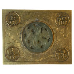
Asian Cigarette Box Center Serpentine Stone Hand Engraved
Located in New York, NY
An Asian brass cigarette box with serpentine stone and hand engraving, circa mid-20th century, China. This brass box has a teak wood lining, a round centre serpentine stone that rese...
Category

Mid-20th Century Chinese Engraved More Furniture and Collectibles

Materials

Stone, Brass

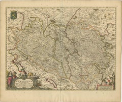
Rare Hand-Colored Map of Franche-Comté and Burgundy by Frederik De Wit c. 1688
Located in Langweer, NL
Title: Rare Hand-Colored Map of Franche-Comté and Burgundy by Frederik De Wit c. 1688 Description: This stunning 17th-century map, titled "Comitatus Burgundiae vulgo La Franche Comt...
Category

1680s Antique Engraved More Furniture and Collectibles

Materials

Paper

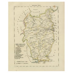
Antique 1830 Map of Leinster, Ireland with Dublin, Kilkenny, Wexford and Kildare
Located in Langweer, NL
Title: Antique 1830 Map of Leinster, Ireland with Dublin, Kilkenny, Wexford, and Kildare Description: This 1830 German-language map, titled Britisches Reich – C. Kon: Ireland, f...
Category

1830s Antique Engraved More Furniture and Collectibles

Materials

Paper

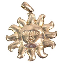
Attributed to Sergio Bustamante, Mexican Sterling Silver Sun Face Pendant, 1990s
Located in West Palm Beach, FL
Attributed to Sergio Bustamante, Mexican Sterling Silver Sun Face Pendant, 32g From a private collection of Sergio Bustamante jewelry, this substantial sterling silver sun pendant i...
Category

Late 20th Century American Modern Engraved More Furniture and Collectibles

Materials

Sterling Silver

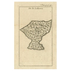
Isle de Ladrones: Early 18th-Century Map of the Mariana Islands by F. Bernard
Located in Langweer, NL
Isle de Ladrones: Early 18th-Century Map of the Mariana Islands by F. Bernard This intriguing copper engraving depicts the *Isle de Ladrones*, now known as the Mariana Islands, situated in the western Pacific Ocean. The map was published around 1722 in Amsterdam by F. Bernard as part of the influential travel compilation *Recueil des voyages qui ont servi a ...*. The map offers a simplistic yet stylized portrayal of the island, emphasizing its rugged and mountainous terrain, dotted with sparse vegetation and hills. The term *Isle de Ladrones* (Islands of Thieves) was given by the Spanish explorer Ferdinand Magellan in 1521 during his circumnavigation of the globe, as his crew encountered thefts from the native Chamorro people. The name later changed to *Mariana Islands* when they were named after Queen...
Category

1720s Antique Engraved More Furniture and Collectibles

Materials

Paper

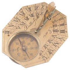
A Brass Butterfield Type Dial French Early 18th Century
Located in Firenze, IT
signed Buterfield A Paris., the octagonal dial with hinged gnomon and bird pointer, inset compass and engraved with hour scales, the reverse engraved with towns and their latitudes, ...
Category

Early 18th Century French Napoleon III Antique Engraved More Furniture and Collectibles

Materials

Brass

Europe Divided into Principal States by Jean Denis Janvier, Paris, 1782
Located in Langweer, NL
This is a historical map of Europe titled "L'Europe divisee en ses Principaux Etats," created by Jean Denis Janvier in 1782. This beautiful map depicts the political boundaries and...
Category

1780s Antique Engraved More Furniture and Collectibles

Materials

Paper

1771 Bonne Map of Poitou, Touraine and Anjou, France, Ric.a015
Located in Norton, MA
1771 Bonne Map of Poitou, Touraine and Anjou, France Ric.a015 1771 Bonne map of Potiou, Touraine and Anjou entitled "Carte des Gouvernements D'Anjou et du Saumurois, de la Touraine, du Poitou,du Pays d'aunis, Saintonge?Angoumois," Carte des gouvernements d'Anjou et du Saumurois, de la Touraine, du Poitou, du Pays d'Aunis, Saintonge-Angoumois. Projettee et assujettie au ciel par M. Bonne, Hyd. du Roi. A Paris, Chez Lattre, rue St. Jacques a la Ville de Bord(ea)ux. Avec priv. du Roi. 1771. Arrivet inv. & sculp., Atlas moderne ou collection de cartes sur toutes...
Category

17th Century Unknown Antique Engraved More Furniture and Collectibles

Materials

Paper

14-Karat Yellow Gold with Agate & Claw Set Citrine Quartz Brooch or Pendant
Located in Hamilton, Ontario
Presumed to be a Victorian brooch with a contemporary assay mark, this artisan made 14- karat yellow gold disc shaped pendant pin is heavily engraved and combined with an agate surro...
Category

Late 19th Century English Victorian Antique Engraved More Furniture and Collectibles

Materials

Gold

Map of Saint Helena Island: Early 18th-Century Copper Engraving by F. Bernard
Located in Langweer, NL
Map of Saint Helena Island: Early 18th-Century Copper Engraving by F. Bernard This rare and beautifully detailed copper engraving of Saint Helena Island dates from around 1722 and...
Category

1720s Antique Engraved More Furniture and Collectibles

Materials

Paper

Barados and St Christopher or St Kitts and Nevis Islands in the Caribbean, 1748
Located in Langweer, NL
This original map, a copperplate engraving by Le Rouge, presents two significant areas in the Caribbean. Titled "Isle St. Christophle une des Antilles aux anglois" and "La Barbade. d...
Category

Mid-18th Century Antique Engraved More Furniture and Collectibles

Materials

Paper

1616 Petrus Bertius Map of Arakan and Pegu in Southeast Asia
Located in Langweer, NL
Title: 1616 Petrus Bertius Map of Arakan and Pegu in Southeast Asia Description: This early seventeenth-century map, titled Descriptio Arachan et Pegu, was published in 1616 by P...
Category

1610s Antique Engraved More Furniture and Collectibles

Materials

Paper

Early Woodcut Map of Swabia and Bavaria in Germany, 1628
Located in Langweer, NL
Title: Early Woodcut Map of Swabia and Bavaria, 16th Century This early woodcut map titled "Schwaben und Bayernlande / Darbey auch begreiffen der Oenwaldt / Nordgaw / etc." provides...
Category

1620s Antique Engraved More Furniture and Collectibles

Materials

Paper

Ancient World Map: Europe, Africa & Asia - 1802 Tardieu Atlas
Located in Langweer, NL
Antique Map Description with title: "Monde Connu Des Anciens" Publication Details: - Atlas Title: Nouvel Atlas Universel de Géographie Ancienne et Moderne - Purpose: For the Nouvel...
Category

Early 1800s Antique Engraved More Furniture and Collectibles

Materials

Paper

King Edward VIII Abdication Cup
Located in New Orleans, LA
This limited edition glass cup memorializes the accession and imminent abdication of King Edward VIII. Titled the Prince of Wales on his 16th birthday, Edward was crowned King of England in January 1936, but famously and scandalously abdicated his throne after less than a year in order to marry the American divorcee and socialite Wallis Simpson...
Category

20th Century English Other Engraved More Furniture and Collectibles

Materials

Glass

Italia Antiqua Philippo Cluvero – 1603 Hondius Map of Ancient Italy, Handcolored
Located in Langweer, NL
Italia Antiqua Philippo Cluvero – 1603 Hondius Map of Ancient Italy with Hand Color This stunning early 17th-century map, *Italia Antiqua Philippo Cluvero Borusso Designatore*, wa...
Category

Early 1600s Antique Engraved More Furniture and Collectibles

Materials

Paper

Map of Denmark Proper & Jutland: Early 19th Century from the 1802 Tardieu Atlas
Located in Langweer, NL
Antique Map with Title: "Royaume de Danemarck: Deuxieme Carte. Danemarck Propre, le Jutland et les Isles" Publication Details: - **Atlas Title:** Nouvel Atlas Universel de Géograp...
Category

Early 1800s Antique Engraved More Furniture and Collectibles

Materials

Paper

Antique Hand-Colored Engraving of a Conceptionist Nun, 19th Century
Located in Langweer, NL
Title: Antique Hand-Colored Engraving of a Conceptionist Nun, 19th Century Description: This finely detailed nineteenth-century hand-colored engraving depicts a Conceptionist nu...
Category

19th Century Antique Engraved More Furniture and Collectibles

Materials

Paper

Antique Map of Northern India, Bengal, and Surrounding Regions by Tardieu, 1802
Located in Langweer, NL
This is an original antique map titled "Inde, Indostan Bengale &c. et Partie Septentrionale de la Presqu'isle en deça du Gange," depicting the northern part of the Indian subcontinen...
Category

Early 1800s Antique Engraved More Furniture and Collectibles

Materials

Paper

Old Ptolemaic Map of the Region Between the Persian Gulf and Caspian Sea, 1598
Located in Langweer, NL
"Tabula Asiae V", Ptolemy/Ruscelli Subject: Persia - Iran Period: 1598 (published) Publication: Geografia di Claudio Tolomeo Allessadrino… Claudius Ptolemy was a mathematician, ast...
Category

16th Century Antique Engraved More Furniture and Collectibles

Materials

Paper

Late 19th Century North-African Silver Torah Pointer
Located in New York, NY
Handmade gilt silver Torah pointer (Yad), probably Morocco, circa 1880. Engraved in Hebrew: "For the soul of the virgin Tova daughter of Erza Asher. Every item in Menorah Galleries...
Category

Late 19th Century African Antique Engraved More Furniture and Collectibles

Materials

Silver

18th C Baroque Style German G. von Gundlach Armorial Beer /Goblet/Kelchglas
Located in West Palm Beach, FL
18th C Baroque Style German G. von Gundlach Armorial Beer /Goblet/Kelchglas Engraved later with ancestors name 'G. von Gundlach' with corresponding Armorial Crest, Germany, Hesse or Saxony region, Circa 1790 An exceptional 18th century example of early German or Dutch craftsmanship in this traditional Kelchglas form. A finely engraved later armorial to the body reveals the Gundlach family heraldry which date back to as early as 1304. The crest and shield of arms...
Category

18th Century German Baroque Antique Engraved More Furniture and Collectibles

Materials

Blown Glass

Île-de-France Map, including Paris - Hand-Colored Engraving by F. De Wit c. 1688
Located in Langweer, NL
Title: Hand-Colored 17th-Century Map of Île-de-France by Frederik De Wit c. 1688 Description: This striking map, "Le Gouvernement de l’Isle de France," showcases the Île-de-France r...
Category

1680s Antique Engraved More Furniture and Collectibles

Materials

Paper

20th Century Italian Miniature Wooden Rack, 4 Hunting Rifles in Sterling Silver
Located in VALENZA, IT
Miniature wooden rack with 4 hunting rifles in 925 sterling silver. The rifles for hunting, in four different models, are in solid sterling silver casting ...
Category

1990s Italian Other Engraved More Furniture and Collectibles

Materials

Sterling Silver

17th-Century Original Antique Map of Guangxi Province, China – Qvangsii by Blaeu
Located in Langweer, NL
Title: Antique 17th-Century Map of Guangxi Province, China – "Qvangsii" by Blaeu, Richly Illustrated and Colored Description: This fascinating 17th-century map of Guangxi Province, historically referred to as "Qvangsii," was crafted by Johannes Blaeu and published in 1655 as part of the *Novus Atlas Sinensis*. Blaeu’s atlas, created in collaboration with Jesuit missionary Martino Martini, introduced European audiences to the geography of China in an unprecedented way. Guangxi Province, known for its striking karst landscapes and important historical trade routes, is depicted here in remarkable detail. The map highlights the province’s topography, including mountain ranges, rivers, and towns, all meticulously engraved and labeled in Latin. It also captures key trade connections and cultural significance, as Guangxi historically served as a bridge between China and Southeast Asia. The decorative cartouche at the top left is adorned with figures in traditional Chinese costumes, symbolizing the cultural richness of the region and adding artistic elegance to the map. This map was engraved using the copperplate technique, known for its ability to produce fine, detailed lines. The hand-coloring further enhances the visual impact, clearly distinguishing territorial divisions and natural features. Blaeu’s reputation for both accuracy and artistry is evident in this piece, making it a collector’s item of historical and aesthetic significance. Guangxi Province, historically referred to as "Qvangsii," is renowned for its breathtaking natural beauty, unique karst landscapes, and cultural diversity. It is famous for its dramatic limestone formations, verdant hills, and picturesque rivers, making it one of the most visually striking regions in China. Guangxi has historically been a significant trade corridor between China and Southeast Asia, contributing to its cultural and economic importance. It is also home to various ethnic minority groups, including the Zhuang, Miao, and Dong, whose traditions and festivals enrich the region's cultural tapestry. Important places in Guangxi include Guilin, known for its iconic karst mountains and the Li River, which has inspired poets and artists for centuries. Yangshuo, a town near Guilin, is celebrated for its stunning natural scenery and outdoor activities. Nanning, the provincial capital, is an important economic and cultural hub. The Longji Rice Terraces, also known as the Dragon’s Backbone, are an engineering marvel and a popular tourist destination. Beihai, a coastal city, is known for its silver beaches and maritime trade history. Keywords for this map include 17th-century China map, Guangxi Province, Qvangsii map, antique Chinese maps...
Category

1650s Antique Engraved More Furniture and Collectibles

Materials

Paper

18th-Century Map of Holstein and Surrounding Duchies by Homann Heirs
Located in Langweer, NL
18th-Century Map of Holstein and Surrounding Duchies by Homann Heirs Description: This finely detailed 18th-century map by the Homann Heirs (Homannische Erben) illustrates the Duc...
Category

1750s Antique Engraved More Furniture and Collectibles

Materials

Paper

Detailed Original Antique Map of the Turkish Empire with Arabia, 1778
Located in Langweer, NL
Title: Etats Due Grand-Seigneur En Asie, Empire De Perse, Pays Des Usbecs, Arabie et Egypte . . . 1753 Detailed map of the Turkish Empire, extending to the Black Sea, Georgia, the...
Category

1770s Antique Engraved More Furniture and Collectibles

Materials

Paper

Austria by Wolfgang Lazius – A Magnificent 16th-Century Map from Ortelius
Located in Langweer, NL
Title: Avstriae Descrip – Wolfgang Lazius’ Map of Austria, 16th Century Description: This extraordinary map of Austria pays homage to the Austrian humanist and cartographer Wo...
Category

16th Century Antique Engraved More Furniture and Collectibles

Materials

Paper

1621 Ptolemy & Magini Map of Taprobana (Sumatra) with Elephant Inset
Located in Langweer, NL
Title: 1620 Ptolemy and Magini Map of Taprobana (Sumatra) with Elephant Inset, Italian Edition Description: This rare and beautifully hand-colored 1620 map engraving, Tavola Duode...
Category

1620s Antique Engraved More Furniture and Collectibles

Materials

Paper

Pair of Silver Amulets of Two Fantastic Animals, Naples, 18th-19th Century
Located in Bruxelles, BE
Pair of silver amulets of two fantastic animals Naples, late 18th- early 19th century Silver, punches and the seal of the Kingdom of Naples Measures: ...
Category

Early 19th Century Italian Other Antique Engraved More Furniture and Collectibles

Materials

Silver

Iberian Peninsula & Mediterranean Map: Western Roman Empire, by Tardieu, 1802
Located in Langweer, NL
Antique Map with Title: "Partie Occidentale de l'Empire Romain ou du Monde connu des Anciens" Publication Details: - Atlas Title: Nouvel Atlas Universel de Géographie Ancienne et M...
Category

Early 1800s Antique Engraved More Furniture and Collectibles

Materials

Paper

18th-Century Map of Tyrol and Surrounding Regions by Johann Baptist Homann
Located in Langweer, NL
18th-Century Map of Tyrol and Surrounding Regions by Johann Baptist Homann Description: This striking 18th-century map by Johann Baptist Homann depicts the County of Tyrol (Tirol)...
Category

1720s Antique Engraved More Furniture and Collectibles

Materials

Paper

Northern Schleswig and Haderslev Map by Johannes Mejer and Johannes Blaeu, 1662
Located in Langweer, NL
The map shows the Duchy of Schleswig, which spans the area between the North Sea coast, Kolding, and Flensburg. The maps were originally published by Johannes Mejer in the regional a...
Category

1660s Antique Engraved More Furniture and Collectibles

Materials

Paper

Limburg Cityscape 1580: Historical Copper Engraving by Braun and Hogenberg
Located in Langweer, NL
Title: Limburgum Oppidum Galliae Belgicae, vulgo Lympurch, gallicè, Lembor Dr. Type: Print (Copper Engraving) Circa 1580 Technique: Colored Copper Engraving Medium: Handmade Paper S...
Category

16th Century Antique Engraved More Furniture and Collectibles

Materials

Paper

1710 Edward Wells Detailed Ancient Greece Map with Ornate Cartouche
Located in Langweer, NL
"1710 Edward Wells Map of Ancient Greece: A New Map of Antient Greece, Tirana, Morea, Ilyricum, Sicily, and Macedonia" Description of the Map: This map, produced around 1710 and en...
Category

1710s Antique Engraved More Furniture and Collectibles

Materials

Paper

Old Map of the Lower Bishopric of Münster (1726-1750) by Sanson & Ottens, c.1750
Located in Langweer, NL
Historical Map of the Lower Bishopric of Münster (1726-1750) by Sanson & Ottens – Hand-Colored Copperplate Engraving The map titled "BASSE PARTIE DE L'EVESCHE DE MUNSTER" is a detai...
Category

1750s Antique Engraved More Furniture and Collectibles

Materials

Paper

Early 20th Century Algerian Palace-Shaped Brass Hanukkah Lamp
Located in New York, NY
Hanukkah lamp shaped like a palace, surmounted by Islamic crescent. Made in Laghouat, Algeria. The Hanukkah lamp is made of two parts: a pierced and engraved brass in the shape of ...
Category

1930s Algerian Islamic Vintage Engraved More Furniture and Collectibles

Materials

Brass, Copper

Hand-Colored 17th-Century Map of Orléanais in France by Frederik De Wit c. 1688
Located in Langweer, NL
Title: Hand-Colored 17th-Century Map of Orléanais by Frederik De Wit c. 1688 Description: This beautifully crafted map, "Gouvernement General du Pays Orléanois," illustrates the Orl...
Category

1680s Antique Engraved More Furniture and Collectibles

Materials

Paper

Harvard Fraternal Medallion - Delta Kappa Epsilon DKE 1877 Robert P. Hastings
Located in Soquel, CA
Harvard Fraternal Medallion - Delta Kappa Epsilon DKE 1877 Robert P. Hastings Silver Medallion by the Delta Kappa Epsilon Fraternity to Robert P. Hastings Harvard College 1873-1877 The Hastings College of Law was founded by Serranus Clinton Hastings, a man of diverse and magnificent accomplishments. Schoolmaster, lawyer, legislator, member of Congress, Chief Justice...
Category

1870s American American Classical Antique Engraved More Furniture and Collectibles

Materials

Silver

Dutch City Plan of Workum in Friesland by N. Van Geelkercken, hand-colored 1616
Located in Langweer, NL
Workum in Friesland by Nicolaes van Geelkercken, hand-colored map ca. 1616 This beautifully hand-colored engraving titled 'Worcum' presents an early 17th-century bird’s-eye view of ...
Category

1610s Dutch Antique Engraved More Furniture and Collectibles

Materials

Paper

Antique 1830 Map of Ulster, Ireland with Armagh, Down, Antrim, Donegal, Tyrone
Located in Langweer, NL
Title: Antique 1830 Map of Ulster, Ireland with Armagh, Down, Antrim, Donegal, and Tyrone Description: This 1830 German-language map, titled Britisches Reich – C. Kon: Ireland, ...
Category

1830s Antique Engraved More Furniture and Collectibles

Materials

Paper

Territorium Francofurtens – Moses Pitt’s 17th-Century Map of Frankfurt
Located in Langweer, NL
Title: Territorium Francofurtens – Moses Pitt’s 17th-Century Map of Frankfurt Description: This rare 17th-century map, titled Territorium Francofurtens, was published by Moses ...
Category

1690s Antique Engraved More Furniture and Collectibles

Materials

Paper

Antique Map of Northern Germany and the Netherlands – circa 1806
Located in Langweer, NL
Title: Antique Map of Northern Germany and the Netherlands – circa 1806 Description: This finely engraved antique map, titled L'Allemagne 1re Feuille, depicts the northern regions...
Category

Early 1800s Antique Engraved More Furniture and Collectibles

Materials

Paper

Antique 1830 Map of Eastern England with Suffolk, Norfolk Cambridge, Huntingdon
Located in Langweer, NL
Title: Antique 1830 Map of Eastern England with Suffolk, Norfolk, Cambridge, and Huntingdon Description: This 1830 German-language map, titled Britisches Reich – A. Kon: England,...
Category

1830s Antique Engraved More Furniture and Collectibles

Materials

Paper

20th Century Italian Silver Portal "Marriage of the Virgin"
Located in VALENZA, IT
Portal in chiseled solid silver depicting the "Marriage of the Virgin". The Marriage of the Virgin is an oil painting on wood (170 × 117 cm) by ...
Category

1990s Italian Renaissance Engraved More Furniture and Collectibles

Materials

Silver

17th Century Cartographic Marvel: A Detailed Engraving of Guangzhou (Kanton)
Located in Langweer, NL
This engraving of Guangzhou ("Kanton") is from a French edition of Olfert Dapper's work. The French edition titled "Description de l’Empire de la Chine" was published in 1674. It is ...
Category

1670s Antique Engraved More Furniture and Collectibles

Materials

Paper

1720 Maps of the Holy Land: Ancient and Modern by De Fer and Danet
Located in Langweer, NL
1720 Maps of the Holy Land: Ancient and Modern by De Fer and Danet This set of two 1720 maps, published by Nicolas de Fer and Danet in Paris, presents a unique juxtaposition of t...
Category

1720s Antique Engraved More Furniture and Collectibles

Materials

Paper

1720 Johann Baptist Homann Map of the Austrian Circle and Surrounding Regions
Located in Langweer, NL
"1720 Johann Baptist Homann Map of the Austrian Circle and Surrounding Regions" Description of the Map: This map, crafted by the renowned cartographer Johann Baptist Homann around...
Category

1720s Antique Engraved More Furniture and Collectibles

Materials

Paper

Engraved Commemorative Surinam Plantation Glass, History of 18th Century Slavery
Located in Amsterdam, NL
A splendid commemorating glass with a fine engraving of a plantation house and coffee shrubs with a text reading: Het.Welvaaren.Van.De.Plantagie.Saxen (the prosperity of the Plantati...
Category

Mid-18th Century Surinamer Antique Engraved More Furniture and Collectibles

Materials

Glass

Germany and the Borders of Empire: Bodenehr’s Map of the Holy Roman World, 1710
Located in Langweer, NL
Title: Germany and Surrounding Realms by Gabriel Bodenehr, circa 1710 This striking copperplate engraving, titled "S. Imperium Romano-Germanicum, Teutschland mit Seinen Angräntzende...
Category

1710s Antique Engraved More Furniture and Collectibles

Materials

Paper

Engraved Pink Tinted Glass Panel, circa 1940
Located in Saint-Ouen, FR
Engraved pink tinted glass panel, circa 1940. Little splinter on the bottom (see picture) but not visible when assembled.
Category

1940s French Mid-Century Modern Vintage Engraved More Furniture and Collectibles

Materials

Glass

Rare 1770 Bellin Map of Sumatra with Stunning Decorative Cartouches
Located in Langweer, NL
Title: 1750 Bellin Map of Sumatra with Decorative Cartouches This exquisite 18th-century map of Sumatra, drawn by Jacques-Nicolas Bellin around 1750, is a testament to the artistr...
Category

1770s Antique Engraved More Furniture and Collectibles

Materials

Paper

Map of Europe Highlighting Ancient and Modern Geographical Divisions (1794)
Located in Langweer, NL
Map of Europe Highlighting Ancient and Modern Geographical Divisions (1794). Germany, France, Italy, Spain, and the British Isles – Map by D’Anville (1794). This detailed 18th-cent...
Category

1790s Antique Engraved More Furniture and Collectibles

Materials

Paper

Antique Map of the Location of the Garden of Eden and Travels of the Patriarchs
Located in Langweer, NL
Title: Map of the Location of the Garden of Eden and Travels of the Patriarchs Cartographer/Publisher: Pieter Mortier (1661–1711), published by Covens & Mortier (Amsterdam, 1725)...
Category

1720s Antique Engraved More Furniture and Collectibles

Materials

Paper

Bird’s-Eye View of Basel from Braun & Hogenberg’s Civitates Orbis Terrarum, 1575
Located in Langweer, NL
Bird’s-Eye View of Basel from Braun & Hogenberg’s "Civitates Orbis Terrarum" (Circa 1572-1617) This highly detailed map of Basel is a bird's-eye view, originally based on Sebastian Münster’s map...
Category

16th Century Antique Engraved More Furniture and Collectibles

Materials

Paper

Original Engraved Map of Saint Lucia in the West Indies by Bellin, 1758
Located in Langweer, NL
The "Carte de L’Isle de Sainte Lucie" by Jacques Nicolas Bellin, a prominent figure as the Royal Hydrographer and engineer of the French Navy, is a remarkable antique map showcasing ...
Category

1750s Antique Engraved More Furniture and Collectibles

Materials

Paper

Southern & Eastern Europe: A Large 17th C. Hand-colored Map by Sanson & Jaillot
Located in Alamo, CA
This large hand-colored map entitled "Estats de L'Empire des Turqs en Europe, ou sont les Beglerbeglicz our Gouvernements" was originally created by Nicholas Sanson d'Abbeville and t...
Category

1690s French Antique Engraved More Furniture and Collectibles

Materials

Paper

Rare Hand-Colored Map of of the Wine Region Burgundy in France by De Wit, c.1688
Located in Langweer, NL
Title: New Description of the Duchy of Burgundy - Frederik De Wit c. 1688 Description: This exquisite map of the Duchy of Burgundy, published after 1688, is a fascinating example of...
Category

1680s Antique Engraved More Furniture and Collectibles

Materials

Paper

Rare 18th-Century Hand-Colored Map of Southeast Asia and the East Indies, 1748
Located in Langweer, NL
1748 Homann Map of Southeast Asia and East Indies by Homann Heirs This original 1748 map, published by the renowned Homann Heirs, depicts Southeast Asia, the East Indies, and adjace...
Category

1740s Antique Engraved More Furniture and Collectibles

Materials

Paper

19th C Grand Tour Painting on Porcelain View of Vatican/St. Peter's Basilica
Located in West Palm Beach, FL
19th century Grand Tour Painting on Porcelain View of Vatican/St. Peter's Basilica Italy, circa 1880s Standing in rectangular gilt bronze engraved frame with applied stylized flo...
Category

Late 19th Century Grand Tour Antique Engraved More Furniture and Collectibles

Materials

Bronze

Read More

Medal-Worthy Memorabilia from Epic Past Olympic Games

Get into the games! These items celebrate the events, athletes, host countries and sporting spirit.

Ahoy! You’ve Never Seen a Collection of Sailor Art and Kitsch Quite Like This

French trendsetter and serial collector Daniel Rozensztroch tells us about his obsession with objects related to seafaring men.

39 Incredible Swimming Pools

It's hard to resist the allure of a beautiful pool. So, go ahead and daydream about whiling away your summer in paradise.

Pamela Shamshiri Shares the Secrets behind Her First-Ever Book and Its Effortlessly Cool Interiors

The sought-after designer worked with the team at Hoffman Creative to produce a monograph that beautifully showcases some of Studio Shamshiri's most inspiring projects.

Moroccan Artworks and Objects Take Center Stage in an Extraordinary Villa in Tangier

Italian writer and collector Umberto Pasti opens the doors to his remarkable cave of wonders in North Africa.

Montecito Has Drawn Royalty and Celebrities, and These Homes Are Proof of Its Allure

Hollywood A-listers, ex-pat aristocrats and art collectors and style setters of all stripes appreciate the allure of the coastal California hamlet — much on our minds after recent winter floods.

Whaam! Blam! Pow! — a New Book on Pop Art Packs a Punch

Publishing house Assouline and writer Julie Belcove have teamed up to trace the history of the genre, from Roy Lichtenstein, Andy Warhol and Yayoi Kusama to Mickalene Thomas and Jeff Koons.

The Sparkling Legacy of Tiffany & Co. Explained, One Jewel at a Time

A gorgeous new book celebrates — and memorializes — the iconic jeweler’s rich heritage.
Recently Viewed

View All