Engraved More Furniture and Collectibles

to
340
612
270
895
5
5
22
16
13
12
12
12
10
7
4
2
2
2
1
1
1
1
513
240
142
10
66
33
25
7
4
3
5
6
1
4
10
3
4
674
196
98
78
40
356
103
78
70
63
905
905
905
10
9
9
8
5
Technique: Engraved
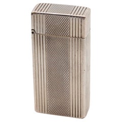
DUPONT 1945 Tall Roller Petrol Pocket Lighter In Plated Sterling
Located in Miami, FL
A Dupont roller petrol lighter made in France. This is a very rare pocket petrol lighter created in Paris France during the post war period, back in the 1945. The lighter has been p...
Category

1940s French Mid-Century Modern Vintage Engraved More Furniture and Collectibles

Materials

Silver Plate

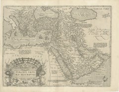
16th-Century Map of the Ottoman Empire and Near East: Turcici Imperii Descriptio
Located in Langweer, NL
Title: Original 16th-Century Map of the Ottoman Empire and Near East: *Turcici Imperii Descriptio* by Ortelius, 1571 This rare copperplate engraving, Turcici Imperii Descriptio, i...
Category

16th Century Antique Engraved More Furniture and Collectibles

Materials

Paper

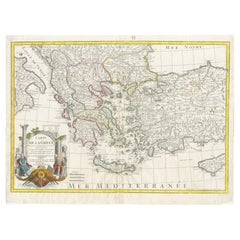
Historical Map of Greece and the Eastern Mediterranean by Delisle - 1780
Located in Langweer, NL
Historical Map of Greece and the Eastern Mediterranean by Guillaume Delisle - 1780 Reissue This captivating map titled "Carte de la Grèce" was originally crafted by the eminent Fr...
Category

1780s Antique Engraved More Furniture and Collectibles

Materials

Paper

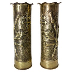
French Pair World War i Brass Thistle & Cross of Lorraine Shells Casing
Located in Labrit, Landes
Antique French pair of shell casings from the World War I Very typical of this war because the freedom of Alsace and Lorraine was one of the many issues at stake in this confrontati...
Category

Early 20th Century French French Provincial Engraved More Furniture and Collectibles

Materials

Brass

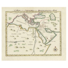
18th-Century Biblical Map of the Colonies of Ham: Africa, Middle East and Beyond
Located in Langweer, NL
This map, titled "A Map of the Colonies of the Descendants of Ham," dates to around 1790. It illustrates regions in Africa, the Middle East, and parts of Europe that were traditional...
Category

1790s Antique Engraved More Furniture and Collectibles

Materials

Paper

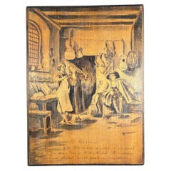
Italian Folk Art Stradivarius Violin Plaque Crafted for Cosimo de Medici 1690
Located in South Burlington, VT
Italian folk art Pyrography picture signed, H. Toscano This is an original and unusual detailed 1690 enactment , and hand incised work of art on wood pan...
Category

19th Century Italian Renaissance Antique Engraved More Furniture and Collectibles

Materials

Wood

Birks Sterling Silver Ladies Compact with Enamel Portrait & Guilloche Decoration
Located in Hamilton, Ontario
This sterling silver ladies compact was made for the Birks retailer in presumably France in circa 1950. This compact features an enamel portrait done in...
Category

Mid-20th Century French Renaissance Revival Engraved More Furniture and Collectibles

Materials

Sterling Silver

Mid-Century Chinese Coromandel Screen with Gold Cranes and Lacquered Floral Back
Located in Yonkers, NY
A striking six-panel Chinese Coromandel screen from the mid-20th century, adorned with intricately incised and gilded cranes in flight. Set against a warm, golden background with a t...
Category

Mid-20th Century Chinese Engraved More Furniture and Collectibles

Materials

Brass

1573 Ortelius Map: First to Name California, Spanning Tartary to North America
Located in Langweer, NL
"1573 Abraham Ortelius Map of Tartary, Japan, and Western North America" Description of the Map: This is an outstanding example of Abraham Ortelius' map titled "Tartariae Sive Magn...
Category

16th Century Antique Engraved More Furniture and Collectibles

Materials

Paper

Palermo – 1620 Braun & Hogenberg Bird’s-Eye Map of Palermo, Sicily
Located in Langweer, NL
Palermo – 1620 Braun & Hogenberg Bird’s-Eye Map of Palermo, Sicily This beautifully detailed bird’s-eye view of Palermo, Sicily, was created by Georg Braun and Frans Hogenberg aro...
Category

1620s Antique Engraved More Furniture and Collectibles

Materials

Paper

Sterling Silver Medallion reliquary – 18th Century
Located in Madrid, ES
Elegant 18th-century reliquary in solid silver, finely hand-engraved, with ornamental decoration typical of Baroque religious art. Its oval shape features floral and symbolic detail...
Category

18th Century European Baroque Antique Engraved More Furniture and Collectibles

Materials

Sterling Silver

1825 Buchon Map of Puerto Rico & Virgin Islands with Detailed Colonial History
Located in Langweer, NL
This map of Puerto Rico and the Virgin Islands, published by Jean Alexandre Buchon in 1825, offers a unique look at the Caribbean during a time of E...
Category

1820s Antique Engraved More Furniture and Collectibles

Materials

Paper

1616 Petrus Bertius Miniature Map of Cambay (Gujarat, India)
Located in Langweer, NL
Title: 1616 Petrus Bertius Map of Cambay and Gujarat, India Description: This early seventeenth-century map, titled Descriptio Cambaiæ, was published in 1616 by Petrus Bertius, a ...
Category

1610s Antique Engraved More Furniture and Collectibles

Materials

Paper

Ornate 1850s Map of South America: A Masterpiece of Exploration & Art by Rapkin
Located in Langweer, NL
Decorative 19th-Century Map of South America by J. Rapkin, Published by J & F Tallis Description: This beautifully detailed map of South America, drawn and engraved by J. Rapkin a...
Category

1850s Antique Engraved More Furniture and Collectibles

Materials

Paper

Antique Indo Persian Dhal Separ Shield
Located in Palm Beach, FL
Intriguing historical 19th Century Indo Persian shield handcrafted in steel and decorated with four floral protuberances and engraved figures, reta...
Category

Late 19th Century Indian Moorish Antique Engraved More Furniture and Collectibles

Materials

Steel

ALFRED DUNHILL Paris 1960 Short Automatique Rollalite Petrol Pocket Lighter
Located in Miami, FL
An automatic rollalite lighter designed by Alfred Dunhill. This is a very scarce petrol pocket lighter, created in Switzerland by La Nationale company for the Alfred Dunhill Company...
Category

1960s English Mid-Century Modern Vintage Engraved More Furniture and Collectibles

Materials

Silver, Sterling Silver

Pair Art Deco Silvered-Bronze 'Turkey' Bookends by G. Rischmann France, 1930s
Located in West Palm Beach, FL
Pair Art Deco Silvered-Bronze 'Turkey' Bookends by G. Rischmann France, 1930s Each one signed in script 'G. Rischmann France' By Gaston Rischmann (1907-1979) A unique pair of Art De...
Category

20th Century French Art Deco Engraved More Furniture and Collectibles

Materials

Marble, Bronze

Sterling Silver Medallion reliquary – 18th Century
Located in Madrid, ES
Elegant 18th-century reliquary in solid silver, finely hand-engraved, with an ornamental decoration typical of Baroque religious art. Its oval shape features floral and symbolic deta...
Category

18th Century European Baroque Antique Engraved More Furniture and Collectibles

Materials

Sterling Silver

Thomas F. Garvin Trophy, 1925 Aviation Trophy, by Wilcox Silver Plate Co.
Located in West Palm Beach, FL
Thomas F. Garvin Trophy, 1925 Aviation Trophy, by Wilcox Silver Plate Co. Measuring approximately 14 inches high by 11 inches wide and 11 inches deep, this silver-plated trophy stands...
Category

Early 20th Century American Neoclassical Engraved More Furniture and Collectibles

Materials

Silver Plate

Large 17th-Century Coronelli Map of Europe with Mythical Islands and Rich Detail
Located in Langweer, NL
Large 17th-Century Coronelli Map of Europe with Mythical Islands and Rich Detail This exceptional two-sheet map of Europe by Vincenzo Maria Coronelli, published in Venice in 1692,...
Category

1690s Antique Engraved More Furniture and Collectibles

Materials

Paper

Antique Map of Germany c.1830 by Thomas Kelly – Hand-Coloured Copper Engraving
Located in Langweer, NL
Antique Map of Germany by Thomas Kelly, London, circa 1830, with hand colouring Finely engraved map of Germany titled 'Germany', published by Thomas Kelly at 17 Paternoster Row, London, circa 1830. This historical map outlines the German states, duchies, and surrounding regions including parts of Austria, Switzerland, France, Poland, and Bohemia. Borders are hand-coloured by region, and major rivers, mountain ranges, and cities such as Berlin, Hamburg, Frankfurt, and Munich are clearly marked. Engraved by H. Cooper. This beautifully detailed copperplate engraving features original hand colouring and displays the political divisions of early 19th-century Germany, including Prussia, Bavaria, Saxony, and Württemberg, along with neighboring regions such as Austria, Switzerland, Bohemia, and parts of Poland and France. Major cities like Berlin, Munich, Hamburg, and Frankfurt are clearly marked, as well as rivers, mountain ranges, and regional borders. Engraved by H. Cooper. A fine historical map ideal for collectors, interior decorators, or anyone with an interest in European history or cartography. Technique and material: Copperplate engraving, original hand colouring Condition report : Good condition. Strong impression with hand colour. Small chips and edge wear to upper margin, not affecting image. Light age toning and minor handling marks. Tight on the left and right margins. Framing tip: Use a neutral or antique white mat to highlight the engraved detail. A dark wood or classic gilt frame complements the historical aesthetic. UV-filtering glass recommended to protect the original colouring. Keywords for SEO: antique map, map of Germany, 1830s map, hand-colored map, Thomas Kelly map, old Germany map, Prussia map...
Category

1830s Antique Engraved More Furniture and Collectibles

Materials

Paper

1817 Map of Puerto Rico and the Virgin Islands with Original Hand Coloring
Located in Langweer, NL
The title provided for this map is "Porto Rico and Virgin Isles," and it is an antique map from an early 19th century atlas, dated 1817, featuring original hand coloring. This histor...
Category

Early 19th Century Antique Engraved More Furniture and Collectibles

Materials

Paper

George Washington Praying At Valley Forge, Unique Historical Art Signed 19thc
Located in South Burlington, VT
Unique Historical Framed Account Dating to the Early 1800's , signed Quaker Potts This is an original and one-of-a-kind enactment artisticaly presented on wood of George Washington kneeling in prayer at Valley Forge...
Category

Early 19th Century American Antique Engraved More Furniture and Collectibles

Materials

Wood

History of India, edited by A.V.Williams Jackson (9volumes-leather bound)
Located in San Francisco, CA
This limited luxury edition has a issue of 200 copies, this set is number 98. Each book has a handcolored frontispiece, with tissue guards, each volumen averages 300 or more pages, ...
Category

Early 1900s Antique Engraved More Furniture and Collectibles

Materials

Leather

Authentic 1644 Janssonius Map of the Champagne Region (Campania) in France
Located in Langweer, NL
"1644 Janssonius Map of Champagne, France" This meticulously detailed original antique map, engraved in 1644, is a work by the esteemed cartographer Johannes Janssonius. It depicts the historic province of Champagne, situated in the northeastern part of France. The map is notable for its high level of detail, with meticulously drawn boundaries, city markers, and river courses. It features a beautifully rendered cartouche adorned with the provincial coat of arms, flanked by classical figures, indicative of the region's cultural significance. In the lower left corner, a pair of cherubs are engaged in surveying, symbolizing the scientific endeavor of cartography. The elaborate compass rose and the scale bar further complement the map's utility and artistic merit. Champagne is renowned globally for its viticultural heritage, being the birthplace of the eponymous Champagne sparkling wine. The region's unique terroir, with its chalky soil and cool climate, is ideal for the production of the grapes used in champagne-making. The historical significance of Champagne extends beyond winemaking; it has been the site of pivotal battles and royal coronations, which shaped the course of French and European history. This map is not only a navigational tool but also a snapshot of a region rich in history and tradition, an artifact that embodies the geographical and cultural prestige of Champagne. This description provides a detailed visual and contextual presentation of the map, suitable for a catalog entry, emphasizing both its artistic features and the historical and cultural importance of the Champagne region. THE WINE AREAS: The Champagne region, known primarily for its production of the sparkling wine that bears its name, encompasses several important cities and sites of historical and cultural significance: 1. **Reims**: Often considered the unofficial capital of the Champagne region, Reims is renowned for its grand cathedral, Notre-Dame de Reims, where French kings were historically crowned...
Category

1640s Antique Engraved More Furniture and Collectibles

Materials

Paper

Antique Print of the Malabar Coast of India showing the VOC establishments, 1726
Located in Langweer, NL
Dutch print with the title: Platte Grond van t'Fort Tricoen male met de daar aangelegen Pagoods-Berg (Trincomalee, Sri Lanka) The map is taken from: 'Oud en Nieuw Oost-Indiën' van François Valentyn. 1) Ottens, Frederik (engraver / etcher) 2) Braam, J. van (publisher) 3) Linden, Gerard onder de (publisher) MALABAR COAST...
Category

1720s Antique Engraved More Furniture and Collectibles

Materials

Paper

Original 17th-Century Antique Map of Nanjing Province, China – by Blaeu
Located in Langweer, NL
Title: 17th-Century Antique Map of Nanjing Province, China – "Nanking sive Kiangnan" by Blaeu, with Decorative Details Description: This captivating 17th-century map of Nanjing Pr...
Category

1650s Antique Engraved More Furniture and Collectibles

Materials

Paper

1705 Sanson Map of Southern India and Malabar with an Inset Map
Located in Langweer, NL
Title: 1705 Sanson Map of Southern India and Malabar with an Inset Map Description: This finely engraved and beautifully hand-colored antique map, published in 1705, depicts south...
Category

Early 1700s Antique Engraved More Furniture and Collectibles

Materials

Paper

Vintage Art Deco Japonisme 4 Panels Folding Screen or Room Divider 1970s
Located in Geneva, CH
Exquisite art deco screen or room divider. Light brown lacquered panels with gold-leafed heron motif engraved. Four panel folding configuration. Designer unknown; in the style of Do...
Category

1970s Vintage Engraved More Furniture and Collectibles

Materials

Wood

Leeuwarden Friesland City View – Antique Engraving by Jollain, c.1670
Located in Langweer, NL
Antique Bird’s Eye View of Leeuwarden, Friesland, by Jollain, circa 1670 This rare and decorative antique engraving presents a panoramic bird’s eye view of the fortified city of Lee...
Category

17th Century French Antique Engraved More Furniture and Collectibles

Materials

Paper

Very Large Double Page Detailed Map of Italy and Surrounding Regions, 1794
Located in Langweer, NL
This is a large (two seperate sheets) and detailed map of Italy, including the southern parts of Germany, Dalmatia, the adjacent countries, and the Illyric Islands. The map is titled...
Category

1790s Antique Engraved More Furniture and Collectibles

Materials

Paper

A Porter's Direction Sundial Germany Early 19th Century
Located in Firenze, IT
The printed and pivoted compass card and chapter ring centred by brass gnomon, in turned rosewood case with domed lid, (glass cover), 5cm (2in) diam.
Category

Early 19th Century German Neoclassical Antique Engraved More Furniture and Collectibles

Materials

Wood

1842 Wall Map of the United States by J. H. Young, Published by S. A. Mitchell
Located in Colorado Springs, CO
Presented is an 1842 hanging “Map of the United States,” engraved by J. H. Young and published by Samuel Augustus Mitchell, Philadelphia. This is a beautiful example of the rare 1842...
Category

1840s American Antique Engraved More Furniture and Collectibles

Materials

Paper

Antique Bird's-Eye View of Hangzhou (China) by Matthäus Merian, 1638
Located in Langweer, NL
This is an exquisite antique bird's-eye view map of Hangzhou, historically referred to as "Xuntien or Quinzay," from the first edition of Matthäus Merian's publication in 1638. This ...
Category

1630s Antique Engraved More Furniture and Collectibles

Materials

Paper

Chinese Silver & Leather Theatre Opera / Wedding Tiered Phoenix Headdress, 1920s
Located in West Palm Beach, FL
Chinese Silver & Leather Theatre Opera / Wedding Tiered Phoenix Headdress, 1920s Silvered Metal & leather and embroidered Mandarin hat This Chinese silv...
Category

Early 20th Century Chinese Chinese Export Engraved More Furniture and Collectibles

Materials

Metal

ALFRED DUNHILL Paris 1936 Art Deco Savory Petrol Pocket Lighter In .925 Sterling
Located in Miami, FL
The Savory lighter designed by Alfred Dunhill. This is a rare petrol pocket lighter, created in Switzerland by La Nationale for the Alfred Dunhill Company in Paris, back in the 1936. This semi-automatic full-size lighter is the iconic and popular Savory model, crafted with art deco patterns in solid .925/.999 sterling silver and decorated with engine turned barley patterns. This very early Dunhill lighter is highly collectible. This model was originally marketed with two names, The Savory in France and The Handy in the rest of the world Brand: Dunhill-Paris. Model: Savory Semi-automatic, full size. First Produced: 1936. Material: Solid .925 Sterling silver. Weight: 56.2 Grams, (36.03 Dwt). Measurements: 50 mm by 34 mm by 12 mm (1.97 x 1.34 x 0.47 Inches). Hallmarks: Stamped with the maker's mark, the mark for the assay of the silver and signed in full as follow, "ALFRED DUNHILL PARIS FAB. SUISSE STERLING MECAN AD SAVORY BREVETTE No-806949". Alfred Dunhill He inherited his father’s London saddlery in 1893. Following the increase in motor car ownership, Alfred developed the business to include motoring accessories, which he called ‘Dunhill’s Motorities’. This included goggles, timepieces, picnic sets, and leather coats, and it wasn’t long before the brand became associated with men’s general motoring attire. They opened two shops in Mayfair and had a catalogue of over 1300 items. Between the 1904 and 1905, Dunhill introduced their ‘Windshield Pipe’, to help drivers combat the effect of wind and travel on their ability to smoke. This marked both the end of the ‘motorities’ focus and their entry into the world of smoking ephemera, and they shortly opened their first tobacconist in 1907 on Duke Street. The proximity to several esteemed Private Members Clubs around the Mayfair, St James’ area ensured that the venture was a success. (From Nicholas Wells With Thanks). Literature: Blei-Bottoni, The Dunhill Petrol Lighter "A Unique Story", Unique SRL 2004 first edition. Figure-500 Pp-256-259 for this model illustrated in several materials and finishes. Note: This pocket lighter is empty of any flammable, gas or butane substances and is ready to be ship by any carrier. This lighter just need a new flint and proper lighter fluid. Was tested and is in working condition. Collateral: This lighter is accompanied by a presentation pouch. Condition: The overall condition of this Alfred Dunhill lighter...
Category

1930s French Art Deco Vintage Engraved More Furniture and Collectibles

Materials

Silver, Sterling Silver

17th Century Nautical Chart of Skagerrak and Øresund by Johannes van Keulen
Located in Langweer, NL
This map titled *Pascaret van Schager-Rack de Bælt en de Sondt* was created by the prominent Dutch cartographer Johannes van Keulen and published in Amsterd...
Category

Late 17th Century Antique Engraved More Furniture and Collectibles

Materials

Paper

West Coast of Africa, Guinea & Sierra Leone: An 18th Century Map by Bellin
Located in Alamo, CA
Jacques Bellin's copper-plate map entitled "Partie de la Coste de Guinee Dupuis la Riviere de Sierra Leona Jusquau Cap das Palmas", depicting the coast of Guinea and Sierra Leone in ...
Category

Mid-18th Century French Antique Engraved More Furniture and Collectibles

Materials

Paper

Antique Silver and Rock Crystal Walking Stick
Located in London, GB
Antique silver and rock crystal walking stick Continental, c. 1900 Height 90.5cm, width 7.5cm, depth 4.5cm This early 20th century walking stick showcases an extraordinary knigh...
Category

Early 20th Century European Engraved More Furniture and Collectibles

Materials

Rock Crystal, Metal, Silver

18th-Century Dutch Garden Design by Gijsbert van Laar, Published in 1802
Located in Langweer, NL
18th-Century Dutch Garden Design by Gijsbert van Laar – Magazijn van tuin-sieraaden, 1802 This exquisite hand-colored engraving is from the renowned work 'Magazijn van tuin-sieraa...
Category

Early 1800s Antique Engraved More Furniture and Collectibles

Materials

Paper

Table Cigar Lighter Four-Leaf Clover Malachite Stone Sterling Silver Salimbeni
Located in Firenze, FI
Table cigar lighter in the shape of a four-leaf clover with frames in 925/1000 sterling silvergold plated and real malachite stone. Piezoelectric m...
Category

1970s Italian Other Vintage Engraved More Furniture and Collectibles

Materials

Malachite, Gold Plate, Sterling Silver, Enamel

CARTIER 1970 Paris Linear-Oval Pocket Butane Gas Lighter In Plaqué d'Argent
Located in Miami, FL
A pocket lighter designed by Cartier. This is a beautiful butane pocket lighter, created in Paris France by the jewelry house of Cartier, back in the 1970's. The lighter is a classi...
Category

1970s French Mid-Century Modern Vintage Engraved More Furniture and Collectibles

Materials

Silver

Ornate 1850s Map of the United States: Featuring Iconic Landmarks and Portrets
Located in Langweer, NL
Ornate 1850s Map of the United States: Featuring Iconic Landmarks and Historical Portraits This decorative 19th-century map of the United States, created by J. Rapkin and publishe...
Category

1850s Antique Engraved More Furniture and Collectibles

Materials

Paper

Unique Lino Bersani Coatrack Hand Engraved by Franco Casoni, Italy, 1978
By Lino Bersani
Located in Milan, IT
Unique Lino Bersani coatrack hand engraved by Franco Casoni, Italy, 1978.
Category

1970s Italian Mid-Century Modern Vintage Engraved More Furniture and Collectibles

Materials

Wood

Map of French Colonies in the Americas: St. Martin, French Guiana and St. Pierre
Located in Langweer, NL
This is an intricately detailed map from 1852 titled *Colonies Françaises en Amérique*, depicting several key French colonies in the Americas. The map focuses on regions such as Fr...
Category

1850s Antique Engraved More Furniture and Collectibles

Materials

Paper

Antique Map of the Gulf of Mexico and Caribbean Islands by Tardieu, 1802
Located in Langweer, NL
This is an original antique map titled "Carte du Golfe du Mexique et des Isles Antilles," depicting the Gulf of Mexico and the Caribbean islands. Created by Pierre Antoine Tardieu, t...
Category

Early 1800s Antique Engraved More Furniture and Collectibles

Materials

Paper

French 18th Century Pewter Plate of Saints Peter and Paul
Located in Baton Rouge, LA
An exceptional example of the European pewter tradition, this ceremonial charger plate from France dates to the year 1735 and depicts an exchange between the Saints Peter and Paul th...
Category

18th Century French Other Antique Engraved More Furniture and Collectibles

Materials

Pewter

Pflueger Summit 1993-L Engraved and Jeweled Fishing Reel with Box, Bag & Papers
By Pflueger
Located in Hamilton, Ontario
This bait fishing reel was made by Pflueger of the United States in the period and style of the Art Deco era. The reel is plated with nickel silver and intricately engraved with jewe...
Category

Early 20th Century American Art Deco Engraved More Furniture and Collectibles

Materials

Silver Plate, Brass

Circa 1691 Frederick de Wit Map: Middle East with Arabia, Persia & More
Located in Langweer, NL
Circa 1691 Frederick de Wit Map: Middle East with Arabia, Persia & More This exquisite hand-colored map, circa 1691, by Frederick de Wit, illustrates the Middle East, spanning from Turkey and Egypt to Afghanistan, with a detailed representation of the Arabian Peninsula. The map's detailing in Arabia is based on Nicolas Sanson's influential 1654 map, which was one of the most accurate and detailed depictions of the region up to the mid-seventeenth century. The decorative title cartouche is richly adorned with images of exotic figures, animals, and a merchant ship, symbolizing the region's historical trade importance. Additionally, a mapmaker is shown working with traditional tools, adding a touch of authenticity to the cartographic art. This is the fourth state of the map, published between 1691 and 1696. The map measures 21.8 inches in width by 18.5 inches in height, featuring a sharp impression, with minimal staining and a carefully repaired centerfold separation at the bottom. Keywords: - Middle East historical map - Frederick de Wit map - 17th century maps - Arabian Peninsula map - Persia (Iran) map - Turkey and Egypt map...
Category

1690s Antique Engraved More Furniture and Collectibles

Materials

Paper

1640 Map of North Africa Nova Barbariae Descriptio or The Barbarian Coast
Located in Langweer, NL
1640 Antique Map of North Africa 'Nova Barbariae Descriptio' by Johannes Janssonius This antique map titled Nova Barbariae Descriptio*, published by Johannes Janssonius around 1640,...
Category

1640s Antique Engraved More Furniture and Collectibles

Materials

Paper

Antique 1830 Map of Southern Scotland with Edinburgh, Berwick, Ayr, and Dumfries
Located in Langweer, NL
Title: Antique 1830 Map of Southern Scotland with Edinburgh, Berwick, Ayr, and Dumfries Description: This 1830 German-language map, titled Britisches Reich – B. Kon Scotland, fo...
Category

1830s Antique Engraved More Furniture and Collectibles

Materials

Paper

Old World Map Featuring Captain Cook's Exploration Routes and Polar Views, 1787
Located in Langweer, NL
1786 World Map with Polar Projections - "Globo Terrestre" by Giovanni Maria Cassini This 1786 map titled "Globo Terrestre" by Giovanni Maria Cassini offers a fascinating and detai...
Category

1860s Antique Engraved More Furniture and Collectibles

Materials

Paper

Rare 1572 Map of Ancient Rome with Monuments by Ligorio, Braun & Hogenberg
Located in Langweer, NL
Rare 1572 Map of Ancient Rome with Monuments by Ligorio, Braun & Hogenberg This remarkable 16th-century map, *Urbis Romae Situs cum ils quae adhuc Conspiciuntur Veter. Monumet Rel...
Category

16th Century Antique Engraved More Furniture and Collectibles

Materials

Paper

Rare 1681 Map of Batavia: Detailed Dutch Colonial Era Cartography, 1681
Located in Langweer, NL
The map of Batavia (modern-day Jakarta) from 1681, attributed to Frederick de Wit holds significant historical importance for several reasons: Historical Context 1. Colonial Era: This map dates back to the Dutch colonial era when Batavia served as the administrative and commercial hub of the Dutch East India Company (VOC). The VOC was a powerful trading entity that played a crucial role in the global spice trade and colonization in Southeast Asia. 2. Strategic Importance: Batavia was strategically located on the northwestern coast of Java, providing the Dutch with a critical base for their maritime operations. The city became the center of Dutch political and military control in the region. Cartographic Significance 1. Detailed Urban Layout: The map meticulously details the layout of Batavia, including its fortifications, canals, streets, and significant buildings. This level of detail provides insights into the urban planning and architectural styles of the period. 2. Military Engineering: The fortifications shown on the map illustrate the advanced military engineering techniques used by the Dutch to protect their valuable colony. The walls, bastions, and moats indicate the strategic considerations taken to defend against potential invasions. 3. Maritime Activity: The depiction of ships in the harbor highlights Batavia's role as a major maritime center. The VOC's fleets were essential for trade routes connecting Europe, Africa, and Asia, making Batavia a crucial node in global commerce. Artistic and Cultural Value 1. Artistic Elements: The decorative elements, such as the lion holding a shield and the intricate cartouches, reflect the artistic trends of Dutch Golden Age cartography. These embellishments were not only informative but also served to display the cartographer's skill and the map's prestige. 2. Cultural Exchange: Maps like this one provide evidence of cultural exchange between the Dutch and the indigenous populations of Java. The blending of Dutch and local influences can be seen in various aspects of the map and the architecture of the city. Rarity and Preservation 1. Rarity: Maps from the 17th century, especially those in good condition, are relatively rare and highly valued by collectors and historians. Each map provides a unique snapshot of historical geography and urban development. 2. Preservation of History: This map serves as a historical document, preserving knowledge about Batavia's cityscape, infrastructure, and colonial governance. It helps historians and scholars understand the socio-economic and political dynamics of the period. Conclusion The map of Batavia from 1681 is special due to its detailed depiction of one of the most important colonial cities in Southeast Asia during the Dutch Golden Age. It reflects the strategic, economic, and cultural significance of Batavia, serving as a valuable resource for understanding the history of Dutch colonialism and its global impact. The map's artistry and precision make it an important artifact in the history of cartography. --------------- The map is an original and historical map of Batavia (present-day Jakarta) on the island of Java, dated 1681. There are several details to consider when evaluating its origins and possible authorship: 1. **Style and Detail**: The intricate details and style are reminiscent of maps created by Frederick de Wit, a prominent Dutch cartographer and engraver of the 17th century. He was known for his detailed city maps and sea charts. 2. **Lack of Signature**: The absence of "F. de Wit, Excudit" could indicate either an omission or a different engraver. However, it is essential to note that some maps from that period were reproduced or copied by other engravers and cartographers. This was not uncommon, as map-making was a collaborative effort, and copies of popular maps were frequently made. 3. **Map Characteristics**: - The depiction of ships and the detailed fortifications are typical of Dutch cartography in the late 17th century. - The decorative elements, such as the lion holding a shield, are also characteristic of Dutch map engravers. 4. **Other Possible Engravers**: While Frederick de Wit is a strong candidate, other notable Dutch engravers from that period include Joan Blaeu and Willem Janszoon Blaeu. They also produced highly detailed maps and could potentially be the creators or inspirers of this map. To determine the precise authorship, you might consider: - **Comparing** this map with other confirmed works of Frederick de Wit and his contemporaries to identify stylistic similarities and differences. - **Historical Records**: Consulting historical records or publications related to Dutch cartography in the 17th century might provide more context or even direct references to this particular map. If you have access to additional details or higher-resolution images of specific sections, it might help further pinpoint the map's origin and authorship. ------------- Frederick de Wit (1629–1706) was a prominent Dutch cartographer, engraver, and publisher known for his detailed and decorative maps, atlases, and globes. He played a significant role in the Dutch Golden Age of cartography, contributing to the wealth of geographic knowledge and artistic achievement during this period. Here are key aspects of his life and work: ### Biography - **Early Life**: Frederick de Wit was born in Gouda, Netherlands, in 1629. Little is known about his early years, but he moved to Amsterdam, the epicenter of Dutch cartography, in the mid-17th century. - **Career Beginnings**: De Wit began his career as an engraver and publisher, initially producing maps that were reissues of earlier works by other cartographers, such as Joan Blaeu and Willem Janszoon Blaeu. ### Contributions to Cartography - **Mapmaking**: De Wit was known for his meticulous attention to detail and artistic flair. He produced a wide range of maps, including world maps, regional maps, city plans, and maritime charts...
Category

1680s Antique Engraved More Furniture and Collectibles

Materials

Paper

1601 Miniature Map of Southeast Asia & Nova Guinea by Ortelius, Vrients Edition
Located in Langweer, NL
This miniature map of the East Indies and Nova Guinea was created by Abraham Ortelius and published in 1601 as part of the "Epitome" by Giovanni Battista Vrients. It is a finely hand...
Category

Early 1600s Antique Engraved More Furniture and Collectibles

Materials

Paper

Antique Map of the Kingdom of Hungary and Transylvania, circa 1780
Located in Langweer, NL
Antique Map of the Kingdom of Hungary and Surrounding Regions by S. Robert, circa 1780 This beautifully engraved map titled Royaume de Hongrie, Principauté de Transilvanie, Esclavon...
Category

Late 18th Century French Antique Engraved More Furniture and Collectibles

Materials

Paper

Map of Italy and Neighboring Regions by Delamarche – Antique Map, c.1800
Located in Langweer, NL
Antique Map of Italy and Surrounding Regions by Delamarche, circa 1800 This elegant and detailed antique map titled Carte Générale de l’Italie was drawn and engraved by the French g...
Category

Early 1800s French Antique Engraved More Furniture and Collectibles

Materials

Paper

Rare Antique Wall-Map of North America: French and Indian War Boundaries, 1793
Located in Langweer, NL
Rare 1793 Map of North America: French and Indian War Boundaries and Historical Notes This remarkable engraved map of North America, printed in 1793 by Emanuel Bowen and John Gibs...
Category

1790s Antique Engraved More Furniture and Collectibles

Materials

Paper

Antique Map of Egypt with Detailed Inset of the Nile Delta, ca. 1799
Located in Langweer, NL
Antique Map of Egypt with Detailed Inset of the Nile Delta, ca. 1799 This finely engraved antique map titled Carte Physique et Politique de l’Égypte presents a detailed and scientif...
Category

Early 1800s French Antique Engraved More Furniture and Collectibles

Materials

Paper

English Mahogany Steel Engraved Stick Barometer Signed F. Tarone, Circa 1780
Located in Charleston, SC
English mahogany stick Barometer with a broken arch pediment, brass urn finial, Satin wood string inlay, hinged glass door revealing a numeral steel engraved dial with original mounted thermometer and barometric pressure gauge. Signed F. Tarone. Late 18th Century Barometer...
Category

1780s English Sheraton Antique Engraved More Furniture and Collectibles

Materials

Steel

Read More

Medal-Worthy Memorabilia from Epic Past Olympic Games

Get into the games! These items celebrate the events, athletes, host countries and sporting spirit.

Ahoy! You’ve Never Seen a Collection of Sailor Art and Kitsch Quite Like This

French trendsetter and serial collector Daniel Rozensztroch tells us about his obsession with objects related to seafaring men.

39 Incredible Swimming Pools

It's hard to resist the allure of a beautiful pool. So, go ahead and daydream about whiling away your summer in paradise.

Pamela Shamshiri Shares the Secrets behind Her First-Ever Book and Its Effortlessly Cool Interiors

The sought-after designer worked with the team at Hoffman Creative to produce a monograph that beautifully showcases some of Studio Shamshiri's most inspiring projects.

Moroccan Artworks and Objects Take Center Stage in an Extraordinary Villa in Tangier

Italian writer and collector Umberto Pasti opens the doors to his remarkable cave of wonders in North Africa.

Montecito Has Drawn Royalty and Celebrities, and These Homes Are Proof of Its Allure

Hollywood A-listers, ex-pat aristocrats and art collectors and style setters of all stripes appreciate the allure of the coastal California hamlet — much on our minds after recent winter floods.

Whaam! Blam! Pow! — a New Book on Pop Art Packs a Punch

Publishing house Assouline and writer Julie Belcove have teamed up to trace the history of the genre, from Roy Lichtenstein, Andy Warhol and Yayoi Kusama to Mickalene Thomas and Jeff Koons.

The Sparkling Legacy of Tiffany & Co. Explained, One Jewel at a Time

A gorgeous new book celebrates — and memorializes — the iconic jeweler’s rich heritage.
Recently Viewed

View All