Europe Maps
to
4,291
5,353
243
5,352
1
70
33
9
9
3
2
1
1
1
2,830
2,104
418
1
269
14
3
120
3
30
3
3
3
1
5,290
75
35
21
17
409
274
161
66
54
5,353
5,353
5,353
104
59
29
20
15
Item Ships From: Europe
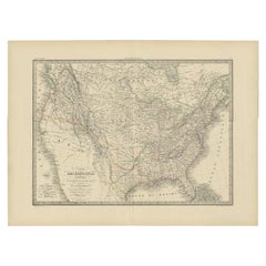
Antique Map of the United States of America by Lapie '1842'
Located in Langweer, NL
Antique map titled 'Carte des États-Unis d'Amérique'. Map of the United States of America (USA). This map originates from 'Atlas universel...
Category
Mid-19th Century Antique Europe Maps
Materials
Paper
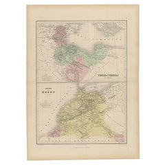
Antique Map of Tunis and Tripoli in Northern Africa, circa 1880
By J. Migeon
Located in Langweer, NL
Antique map titled 'Tunis et Tripoli & Empire de Maroc'. Old map of Tunis and Tripoli and the Empire of Morocco. This map originates from 'Géographie Universelle Atlas-Migeon' by J. ...
Category
19th Century Antique Europe Maps
Materials
Paper
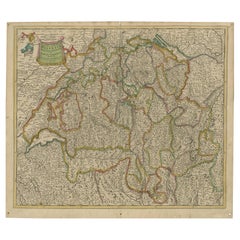
Map of Switzerland by Justus Danckerts, Hand-Colored Engraving ca. 1690
Located in Langweer, NL
Map of Switzerland by Justus Danckerts, Hand-Colored Engraving ca. 1690
This detailed and attractively hand-colored antique map titled *Helvetiae Rhaetiae et Valesiae, nec non parti...
Category
Late 17th Century Antique Europe Maps
Materials
Paper
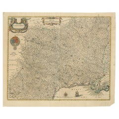
Map of Languedoc by Willem Blaeu, Antique French Copper Engraving 1635
Located in Langweer, NL
Map of Languedoc by Willem Blaeu, Antique French Copper Engraving 1635
This fine antique map titled "Langvedoc" depicts the historical province of Languedoc in southern France and w...
Category
1630s Antique Europe Maps
Materials
Paper
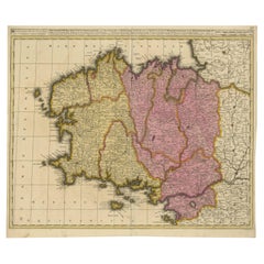
Map of Brittany and Western France by Gerard Valk, circa 1690
Located in Langweer, NL
Map of Brittany and Western France by Gerard Valk, circa 1700
This finely detailed antique map, titled *Praefectura Ducatus Britanniae, Quae Superior et Inferior*, was created aroun...
Category
Late 17th Century Dutch Antique Europe Maps
Materials
Paper
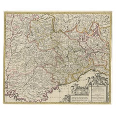
Antique Map of Piedmont, Savoy and Liguria by Justus Danckerts, Amsterdam c.1690
Located in Langweer, NL
Map of Piedmont, Savoy and Liguria by Justus Danckerts, Amsterdam c.1690
This richly detailed and decorative map, titled *Tabula Generalis Ducatus Sabaudiae Principatus Pedemontii C...
Category
Late 17th Century Antique Europe Maps
Materials
Paper
Map of Cape Verde and the Mouth of the River Niger by Coronelli, 1691
Located in Langweer, NL
Map of Cape Verde and the Mouth of the River Niger by Coronelli, 1691
This finely engraved map, titled "Bocche del Fiume Negro et Isole di Capo Verde," was created in 1691 by Vincen...
Category
Late 17th Century Antique Europe Maps
Materials
Paper
Antique Map of Paraguay by A. Montanus, circa 1671
By Arnoldus Montanus
Located in Langweer, NL
Antique map titled 'Paraquaria Vulgo Paraguay Cum adjacentibus'. Antique map extending from Rio de Janiero to the Rio de la Plata basin. The map include...
Category
Mid-17th Century Antique Europe Maps
Materials
Paper
Map of Gard France with Pont du Gard and Wine Regions by Vuillemin, 19th c
Located in Langweer, NL
Title: Map of Gard France with Pont du Gard and Wine Regions by Vuillemin, 19th c
Description:
This finely engraved 19th-century map of the department of Gard in southern France was...
Category
Mid-19th Century French Antique Europe Maps
Materials
Paper
Map of Finistère France with Brest, Quimper and Brittany Coastline, 19th Century
Located in Langweer, NL
Map of Finistère France with Brest, Quimper and Brittany Coastline, 19th Century
Description:
This richly engraved 19th-century map of Finistère, the westernmost department of mainl...
Category
Mid-19th Century French Antique Europe Maps
Materials
Paper
Map of Eure-et-Loir France with Chartres Cathedral and Marceau Portrait, c.1850
Located in Langweer, NL
Map of Eure-et-Loir France with Chartres Cathedral and Marceau Portrait, 19th c
This detailed and elegantly illustrated 19th-century map of the Eure-et-Loir department in north-cent...
Category
Mid-19th Century French Antique Europe Maps
Materials
Paper
Map of Eure France with Evreux, Poussin and Normandy Countryside, 19th Century
Located in Langweer, NL
Map of Eure France with Evreux, Poussin and Normandy Countryside, 19th Century
Description:
This 19th-century engraved map of the Eure department in the Normandy region of northern ...
Category
Mid-19th Century French Antique Europe Maps
Materials
Paper
Map of Doubs France with Besançon and Swiss Border Landscape, 19th Century
Located in Langweer, NL
Map of Doubs France with Besançon and Swiss Border Landscape, 19th Century
Description:
This decorative 19th-century map of the department of Doubs in eastern France was drawn by Al...
Category
Mid-19th Century French Antique Europe Maps
Materials
Paper
Map of Côtes-du-Nord France with Saint-Brieuc and Brittany Coastline, c.1850
Located in Langweer, NL
Map of Côtes-du-Nord France with Saint-Brieuc and Brittany Coastline, 19th c
Description:
This elegant 19th-century map of Côtes-du-Nord, the historic name for what is now known as ...
Category
Mid-19th Century French Antique Europe Maps
Materials
Paper
Map of Côte-d'Or France with Dijon and Burgundy Wine Region, 19th Century
Located in Langweer, NL
Map of Côte-d'Or France with Dijon and Burgundy Wine Region, 19th Century
Description:
This beautifully engraved 19th-century map of Côte-d'Or, located in the historic region of Bur...
Category
Mid-19th Century French Antique Europe Maps
Materials
Paper
Map of Corsica France with Ajaccio and Napoleon Portraits, 19th Century
Located in Langweer, NL
Map of Corsica France with Ajaccio and Napoleon Portraits, 19th Century
Description:
This finely engraved 19th-century map of Corsica, the Mediterranean island region of France, was...
Category
Mid-19th Century French Antique Europe Maps
Materials
Paper
Map of Corrèze France with Brive, Tulle and Dordogne River Landscape, c.1850
Located in Langweer, NL
Map of Corrèze France with Brive, Tulle and Dordogne River Landscape
Description:
This finely detailed 19th-century map of the Corrèze department in southwestern France was publish...
Category
Mid-19th Century French Antique Europe Maps
Materials
Paper
Map of Cher France with Bourges, Sancerre Vineyards and Engraved Vignettes, 1850
Located in Langweer, NL
Map of Charente-Inférieure France with La Rochelle and Coastal Vineyards, 19th c
Description:
This decorative 19th-century map of the former department of Charente-Inférieure, now k...
Category
Mid-19th Century French Antique Europe Maps
Materials
Paper
Map of Charente-Inférieure France with La Rochelle and Coastal Vineyards, c.1850
Located in Langweer, NL
Map of Charente-Inférieure France with La Rochelle and Coastal Vineyards, 19th c
Description:
This decorative 19th-century map of the former department of Charente-Inférieure, now k...
Category
Mid-19th Century French Antique Europe Maps
Materials
Paper
Antique Map of North America from an Old Dutch School Atlas, 1852
Located in Langweer, NL
Antique map titled 'Noord-Amerika'. Map of North America. This map originates from 'School-Atlas van alle deelen der Aarde' by Otto Petri. Artists and Engra...
Category
19th Century Antique Europe Maps
Materials
Paper
Ancient World Map: Europe, Africa & Asia - 1802 Tardieu Atlas
Located in Langweer, NL
Antique Map Description with title: "Monde Connu Des Anciens"
Publication Details:
- Atlas Title: Nouvel Atlas Universel de Géographie Ancienne et Moderne
- Purpose: For the Nouvel...
Category
Early 1800s Antique Europe Maps
Materials
Paper
Antique 1882 Antique Map of Peru and Bolivia: Andes Mountains and Amazon Rivers
Located in Langweer, NL
Antique 1882 Map of Peru and Bolivia: Andes Mountains, Amazon Rivers, Historic Borders
This map from 1882 provides a detailed representation of the countries of Peru and Bolivia in ...
Category
1880s Antique Europe Maps
Materials
Paper
Map of Charente France with Cognac Region and Château de La Rochefoucauld, 1850
Located in Langweer, NL
Map of Charente France with Cognac Region and Château de La Rochefoucauld, 19th c
Description:
This richly illustrated 19th-century map of the Charente department in southwestern Fr...
Category
Mid-19th Century French Antique Europe Maps
Materials
Paper
Map of Cantal France with Aurillac, Volcanic Peaks and Rural Life, 19th Century
Located in Langweer, NL
Map of Cantal France with Aurillac, Volcanic Peaks and Rural Life, 19th Century
Description:
This finely engraved and hand-colored 19th-century map of Cantal, a mountainous departme...
Category
Mid-19th Century French Antique Europe Maps
Materials
Paper
Map of Calvados France with Caen and Cider-Brandy Region, 19th Century
Located in Langweer, NL
Map of Calvados France with Caen and Cider-Brandy Region, 19th Century
Description:
This finely engraved 19th-century map of the Calvados department in Normandy, northwestern France...
Category
Mid-19th Century French Antique Europe Maps
Materials
Paper
Map of Bouches-du-Rhône France with Marseille and Rhône Delta, 19th Century
Located in Langweer, NL
Map of Bouches-du-Rhône France with Marseille and Rhône Delta, 19th Century
Description:
This finely engraved 19th-century map of the Bouches-du-Rhône department in southeastern Fra...
Category
Mid-19th Century French Antique Europe Maps
Materials
Paper
Map of Aude France with Carcassonne and Languedoc Vineyards, 19th Century
Located in Langweer, NL
Map of Aude France with Carcassonne and Languedoc Vineyards, 19th Century
Description:
This elegant 19th-century map of Aude, a department in southern France along the Mediterranean...
Category
Mid-19th Century French Antique Europe Maps
Materials
Paper
Map of Aube France with Troyes and Champagne Wine Region, 19th Century
Located in Langweer, NL
Map of Aube France with Troyes and Champagne Vineyards by Vuillemin, 19th c
Description:
This 19th-century map of the Aube department in the Grand Est region of northeastern France ...
Category
Mid-19th Century French Antique Europe Maps
Materials
Paper
Map of Ariège France with Foix and Pyrenees Landscape by Vuillemin, 19th c
Located in Langweer, NL
Map of Ariège France with Foix and Pyrenees Landscape by Vuillemin, 19th c
Description:
This beautifully detailed 19th-century map of the Ariège department in southwestern France wa...
Category
Mid-19th Century French Antique Europe Maps
Materials
Paper
Map of Ardennes France with Sedan and Military History by Vuillemin, c.1850
Located in Langweer, NL
Map of Ardennes France with Sedan and Military History by Vuillemin, 19th c
Description:
This detailed and decorative 19th-century map of the Ardennes department in northeastern Fra...
Category
Mid-19th Century French Antique Europe Maps
Materials
Paper
Map of Ardèche France with Annonay and Vineyards by Vuillemin, 19th c
Located in Langweer, NL
Map of Ardèche France with Annonay and Vineyards by Vuillemin, 19th c
This beautifully engraved 19th-century map of Ardèche, a department in southeastern France, comes from Alexandr...
Category
Mid-19th Century French Antique Europe Maps
Materials
Paper
Map of Hautes-Alpes France with Gap and Alpine Scenery by Vuillemin, c.1850
Located in Langweer, NL
Map of Hautes-Alpes France with Gap and Alpine Scenery by Vuillemin
Description:
This elegant 19th-century map of the Hautes-Alpes department in southeastern France was created by A...
Category
Mid-19th Century French Antique Europe Maps
Materials
Paper
Map of Basses-Alpes France with Digne and Lavender Region by Vuillemin, c.1850
Located in Langweer, NL
Map of Basses-Alpes France with Digne and Lavender Region by Vuillemin, 19th c
This finely engraved 19th-century map of the Basses-Alpes department of France (known today as Alpes-d...
Category
Mid-19th Century French Antique Europe Maps
Materials
Paper
Map of Allier France with Saint-Pourçain Wine Region by Vuillemin, 19th c
Located in Langweer, NL
Map of Allier France with Saint-Pourçain Wine Region by Vuillemin, 19th c
This decorative 19th-century map of Allier, a central department of France, comes from the celebrated Nouve...
Category
Mid-19th Century French Antique Europe Maps
Materials
Paper
Map of Aisne France with Soissons and Champagne Vineyards by Vuillemin, 19th c
Located in Langweer, NL
Map of Aisne France with Soissons and Champagne Vineyards by Vuillemin, 19th c
Description:
This richly detailed 19th-century engraved and hand-colored map of the department of Aisn...
Category
Mid-19th Century French Antique Europe Maps
Materials
Paper
Map of Ain France with Vineyards of Bugey and Notable Portraits, c.1850
Located in Langweer, NL
Map of Ain France with Portraits of Bichat and Joubert by Vuillemin, 19th c
This highly decorative 19th-century map of the French department of Ain is taken from the celebrated Nouv...
Category
Mid-19th Century French Antique Europe Maps
Materials
Paper
Antique Map of Northern India, Bengal, and Surrounding Regions by Tardieu, 1802
Located in Langweer, NL
This is an original antique map titled "Inde, Indostan Bengale &c. et Partie Septentrionale de la Presqu'isle en deça du Gange," depicting the northern part of the Indian subcontinen...
Category
Early 1800s Antique Europe Maps
Materials
Paper
1773 Map of Persia, Gujarat & Malabar Coasts – Arabia to India, Hand-Colored
Located in Langweer, NL
1773 Bellin map of Persia, Gujarat and Malabar coasts with Arabia and Maldives
Description:
This finely engraved and delicately hand-colored 18th-century map titled Kaart van de Kusten van Persië, Guzaratte en Malabar was produced by the eminent French cartographer Jacques-Nicolas Bellin and engraved by Jakob van der Schley. It was published in 1773 in Amsterdam by E. van Harrevelt and D. Changuion, as part of a Dutch edition of Bellin’s maritime atlas focused on the East Indies and the Indian Ocean.
The map presents the coastline bordering the Arabian Sea, extending from the Persian Gulf and parts of the Arabian Peninsula to the shores of Gujarat and the Malabar Coast in southwestern India. It provides a detailed representation of the coastlines of Persia (modern-day Iran), the western coast of India, and a portion of southern Arabia including the Oman Peninsula. Coastal towns, rivers, ports, and geographical landmarks are clearly labeled, including prominent trading centers like Surat, Goa, Calicut, Cochin, and Cape Comorin (now Kanyakumari).
Additionally, the map shows the Laccadive Islands (Laka Dives) and the Maldives (Maldivische Eilanden), with attention to navigational details such as shoals, sandbanks, and anchor points. A large compass rose and clear latitude and longitude markings enhance its utility as a navigational aid.
A highly decorative title cartouche at lower left features maritime iconography such as sea creatures, a fountain, and shells. An inset legend beneath the map provides explanations in Dutch for the symbols used to indicate bays, capes, ports, forts, islands, and towns.
This is a copperplate engraving printed on laid paper with full original hand coloring. It retains its original fold lines as issued. The condition is generally good, with minor age toning and a few light spots in the margins. No repairs or restoration are visible. The paper is strong, and the impression remains crisp and clear.
This historical map is a significant and attractive example of 18th-century European cartography, especially valued for its depiction of maritime trade regions and coastal geography during the age of exploration and colonial expansion.
To frame this 1773 Bellin map attractively and safely:
- Use acid-free matting in a neutral tone like cream or antique white
- Consider double matting with a subtle inner color that complements the map
- Choose a simple wooden frame in walnut, cherry, or aged oak for a classic look
- Use UV-protective glass or acrylic to prevent fading
- For a full display, consider float mounting to show the edges and fold lines
- Allow 2 to 3 inch mat margins to balance the composition and enhance presentation
Keywords:
Bellin map 1773, van der Schley, Persia coast map, Gujarat map, Malabar map...
Category
1780s Antique Europe Maps
Materials
Paper
Antique Map of the City of Brielle 'The Netherlands' by L. Guicciardini, 1625
Located in Langweer, NL
Plan of Brielle, Briel, Den Briel in the Province of Zuid-Holland, The Netherlands, Holland. This map originates from the 1625 edition of 'Discrittione di tutti i Paesi Bassi', by L....
Category
Early 17th Century Antique Europe Maps
Materials
Paper
Original Antique Map of Martinique Island In The West Indies by Bonne, circa1780
Located in Langweer, NL
Antique map titled 'Carte de l'Isle de la Martinique Colonie Francoise dans les Isles Antilles'. Detailed map of the French Island of Martinique.
Many towns and harbours, anchor pl...
Category
18th Century Antique Europe Maps
Materials
Paper
Antique Map of the Sunda Islands Including Sumatra, Java, and Borneo, 1705
Located in Langweer, NL
Title: “Antique Map of the Sunda Islands Including Sumatra, Java, and Borneo”
This print is a beautifully detailed and relatively rare map of Western Indonesia, encompassing the reg...
Category
Early 1700s Antique Europe Maps
Materials
Paper
Large Original Antique Map of the The Windward Islands. 1894
Located in St Annes, Lancashire
Superb Antique map of The Windward Islands
Published Edward Stanford, Charing Cross, London 1894
Original colour
Good condition
Unframed.
Free shipping
Category
1890s English Antique Europe Maps
Materials
Paper
Large Antique Map of Ceylon, Sri Lanka
Located in Langweer, NL
Antique map titled 'Nieuwe Kaart van het Eyland Ceylon opgestelt door Francois Valentyn'. Beautiful map of Sri Lanka. Originates from 'Oud en Nieuw Oost ...
Category
Mid-18th Century Antique Europe Maps
Materials
Paper
1788 Map of Europe - France, Italy, Spain, Germany, Great Britain & Ireland
Located in Langweer, NL
Title: "1788 Map of Europe - France, Italy, Spain, Germany, Great Britain & Ireland by D'Anville"
Description:
This detailed map of Europe, titled "First Part of the Map of Europe...
Category
1780s Antique Europe Maps
Materials
Paper
Venetian Trade Routes in the Levant – Antique Map by Pieter van der Aa, ca.1720
Located in Langweer, NL
Venetian Trade Routes in the Levant – Antique Map by Pieter van der Aa, Early 18th Century
This finely engraved map, published by Pieter van der Aa in Leiden, provides a detailed d...
Category
1720s Antique Europe Maps
Materials
Paper
Natives from Pegu, the Moluccan Islands, Penequais Indians and St Thomas, c.1605
Located in Langweer, NL
Antique print titled 'Provincie Pegu incola (..) - Incola ex Insulis Moluco (..) - Penequais familiae (..)'.
Old print showing various figures including a man from Pegu, a man fr...
Category
Early 1600s Antique Europe Maps
Materials
Paper
Large Original Antique Map of The Greek Islands. 1894
Located in St Annes, Lancashire
Superb Antique map of The Greek Islands
Published Edward Stanford, Charing Cross, London 1894
Original colour
Good condition
Unframed.
Free shipping
Category
1890s English Antique Europe Maps
Materials
Paper
Antique Map of the British Isles with Outline Coloring
Located in Langweer, NL
Antique map titled 'Iles Britanniques'. Attractive map of the British Isles. Details England, Scotland and Ireland as well as parts of neighboring France. Upper right corner features...
Category
Mid-19th Century Antique Europe Maps
Materials
Paper
Original Map of the East Indies Including Sumatra, Java, Borneo & Malaysia, 1747
Located in Langweer, NL
Antique map titled 'Carte des Isles Java, Sumatra, Borneo (..) - Kaart van de Eilanden van Iava, Sumatra, Borneo (..)'.
Map of the East Indies including Sumatra, Java, Borneo and...
Category
1740s Antique Europe Maps
Materials
Paper
Map of Avenches Region Switzerland by Mercator, Original 1585 Engraving
Located in Langweer, NL
Map of Wiflispurgergov by Gerardus Mercator, Avenches Region, 1585
This rare and finely engraved map, titled *Das Wiflispurgergov*, was produced by Gerardus Mercator and published i...
Category
16th Century Dutch Antique Europe Maps
Materials
Paper
Map of Lake Geneva and Surroundings by Hondius, Geneva Region, circa 1612
Located in Langweer, NL
Map of Lake Geneva and Surroundings by Hondius, Geneva Region, 1606
This rare and intricately engraved map, titled *Chorographica Tabula Lacus Lemanni Locorumque Circumiacentium*, w...
Category
Early 17th Century Dutch Antique Europe Maps
Materials
Paper
Map of Zurich and Basel Region by Mercator, Uncolored Engraving c.1600
Located in Langweer, NL
Map of Zurich and Basel Region by Mercator, Uncolored Engraving c.1600
This original uncolored copperplate engraving, titled *Zurichgow et Basiliensis Provincia*, was created by the...
Category
Early 17th Century Antique Europe Maps
Materials
Paper
Nautical Chart of Cape Verde Islands by J.W. Norie, 1824 Coastal Map
Located in Langweer, NL
Nautical Chart of Cape Verde Islands by J.W. Norie, 1824 Coastal Map
This beautifully engraved nautical chart, titled “A New Chart of the Cape Verde Islands,” was drawn by J.W. Nori...
Category
Early 19th Century English Antique Europe Maps
Materials
Paper
Map of Turkish Dominions in Europe, Ottoman Balkan Territories 1813
Located in Langweer, NL
Map of Turkish Dominions in Europe, Ottoman Balkan Territories 1814
This antique map titled "Turkish Dominions in Europe" provides a detailed depiction of the Balkan Peninsula and a...
Category
1810s Antique Europe Maps
Materials
Paper
Detailed Antique Map of the Southern Part of European Russia and Ukraine, 1752
Located in Langweer, NL
Antique map titled 'Partie meridionale de la Russie Européenne'.
Detailed map of the southern part of European Russia by Robert de Vaugondy. It covers from Moscow south to Georgia and from Poland east to the Volga River, including Crimea and Ukraine.
Artists and engravers: Gilles Robert de Vaugondy (1688-1766) was the head of a leading family of geographers in eighteenth century France. Gilles got his start when he jointly inherited the shop of Pierre-Moullart Sanson, grandson of the famous geographer Nicholas Sanson. The inheritance included the business, its stock of plates, and a roller press...
Category
1750s Antique Europe Maps
Materials
Paper
Original Antique Map of the American State of Massachusetts, 1903
Located in St Annes, Lancashire
Antique map of Vermont and New Hampshire
Published By A & C Black. 1903
Original colour
Good condition
Unframed.
Free shipping
Category
Early 1900s English Antique Europe Maps
Materials
Paper
Original Antique 17th-Century Map of Shaangxi (Xensi) Province, China – by Blaeu
Located in Langweer, NL
Antique 17th-Century Map of Shaangxi Province, China – "Xensi" by Blaeu, Featuring Decorative Cartouches
Description: This exquisite 17th-century map of Shaangxi Province, historically known as Xensi Province, is an exceptional work by Johannes Blaeu, one of the most celebrated mapmakers of the Dutch Golden Age. Originally published in Blaeu's groundbreaking 'Novus Atlas Sinensis', this map is a masterful blend of geography and artistry. Blaeu's atlas was created in collaboration with Martino Martini, a Jesuit missionary whose insights into China provided European audiences with unprecedented geographical accuracy.
The map meticulously charts Shaangxi's mountains, rivers, mines, cities, and towns, with names rendered in Latin. It also features a detailed section of the Great Wall of China, a symbol of the region's historical significance. The artistry of this map is further enhanced by its elaborate cartouches. At the top, a Chinese warrior is beautifully illustrated, while the lower-left corner displays a deer, possibly a reference to the elusive Pere David deer...
Category
1650s Antique Europe Maps
Materials
Paper
Rare Antique Map of the Dutch East Indies 'Indonesia', 1774
Located in Langweer, NL
Rare decorative engraved map of the Dutch East Indies, or nowadays Indonesia.
Title (in old Dutch): NIEUWE EN NAUKEURIGE KAART DER OOST-INDISCHE ...
Category
1770s Antique Europe Maps
Materials
Paper
