18th Century and Earlier Landscape Prints
to
31
635
274
75
28
2
Overall Width
to
Overall Height
to
365
100
3
1
1
121
84
46
43
24
1,016
2,097
9,952
4,107
117
119
689
516
588
1,111
1,475
1,737
1,302
599
657
759
209
40
589
293
252
124
115
87
81
75
73
70
66
54
52
51
47
47
44
44
43
41
589
435
103
58
41
132
461
465
378
Period: 18th Century and Earlier
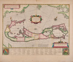
Bermuda: An Early 17th Century Hand-colored Map by Henricus Hondius
By Henricus Hondius
Located in Alamo, CA
This attractive and interesting map of Bermuda by Henricus Hondius in 1633 is entitled "Mappa Aestivarum Insularum, Alias Barmudas". It is based on a ...
Category
Old Masters 18th Century and Earlier Landscape Prints
Materials
Engraving
Veduta della Basilica di S. Paolo Fuor delle Mura - Etching
Located in Roma, IT
Etching on laid and watermarked paper (a double circles visible near the bell tower). 38 th Plate from the series " Views of Rome".
Signed on plate on lower-left margin "Piranesi F....
Category
18th Century and Earlier Landscape Prints
Materials
Etching
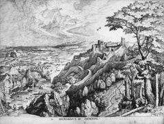
St. Jerome in the Desert
Located in Chicago, IL
Engraving by Joannes and Lucas van Doetecum (Deventer active by 1551 - circa 1569 Haarlem) in the manner of Peter Bruegel the Elder
Category
Old Masters 18th Century and Earlier Landscape Prints
Materials
Engraving
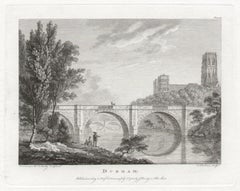
Durham. Paul Sandby C18th English landscape engraving
By Paul Sandby
Located in Melbourne, Victoria
'Durham'
Engraving by F Chesham after Paul Sandby (1731-1809).
From Paul Sandby's 'The Virtuosi's Museum, Containing Select Views in England, Scotland, and Ireland', published by G...
Category
Naturalistic 18th Century and Earlier Landscape Prints
Materials
Engraving
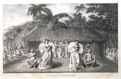
A Dance in Otaheite (Tahiti) 1784 James Cook Final Voyage by John Webber
By John Webber
Located in Paonia, CO
A Dance in Otaheite ( Tahiti ) is from the 1784 First Edition Atlas Accompanying Capt. James Cook and King; Third and Final Voyage of Captain James Cook. John Webber (1752-1793) who...
Category
Realist 18th Century and Earlier Landscape Prints
Materials
Engraving
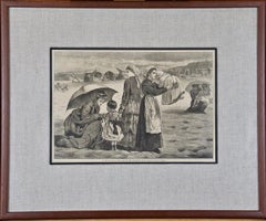
Winslow Homer Framed Original 19th Century Wood Engraving "On the Beach"
Located in Alamo, CA
This Winslow Homer wood engraving entitled "On the Beach at Long Branch, The Children's Hour", was published in Harper's Weekly in the August 15, 1874 ed...
Category
American Impressionist 18th Century and Earlier Landscape Prints
Materials
Engraving
Long-billed Curlew Bird: Original 1st Edition Audubon Hand Colored Lithograph
Located in Alamo, CA
An original rare and extremely collectible first edition John James Audubon hand colored lithograph entitled "Long-billed Curlew", No. 71, Plate 355, from Audubon's "Birds of America. It was lithographed, printed and colored by J. T. Bowen and published in Philadelphia between 1840-1844. It depicts a male and a female Long-billed Curlew standing on a grassy mound with water and the city of Charleston...
Category
Naturalistic 18th Century and Earlier Landscape Prints
Materials
Lithograph
Butterflies & Moths in a Landscape: 18th C. Hand-colored Engraving by M. Harris
By Moses Harris
Located in Alamo, CA
This is a rare, original first edition hand-colored engraving depicting the natural history of butterflies and moths, which is plate 10 from Moses Harris' publication "The Aurelian: ...
Category
18th Century and Earlier Landscape Prints
Materials
Engraving
Map of Nijmegen - Etching by G. Braun and F. Hogenberg - Late 16th Century
Located in Roma, IT
This map of Noviomagvs is an original etching realized by Georg Braun and Franz Hogenberg as part of the famous series "Civitates Orbis Terrarum".
The state of preservation of the ...
Category
18th Century and Earlier Landscape Prints
Materials
Etching
Palazzo Borghese - Etching by Giuseppe Vasi - 1747
Located in Roma, IT
Palazzo Borghese is original black and white etching realized by Giuseppe Vasi .
Beautiful etching representing Palazzo Borghese in Rome.
Signed and...
Category
Old Masters 18th Century and Earlier Landscape Prints
Materials
Etching
17th century etching black and white landscape scene forest sheep figures sky
Located in Milwaukee, WI
"Shepherd and Shepherdess Conversing in a Landscape (Berger et Bergere Conversant)" is an etching by Claude Gellee (Le Lorrain). This etching is in the collections of the Metropolita...
Category
Old Masters 18th Century and Earlier Landscape Prints
Materials
Etching
Spain and Portugal: A Hand-colored 17th/18th Century Map by Visscher
Located in Alamo, CA
This is an early 18th century map of Spain and Portugal, with attractive original hand-coloring, entitled "Hispaniae et Portugalliae Regna per Nicolaum Visscher cum Privilegio Ordinum Hollandiae et Westfrisiae" first published by Nicolaes Visscher II (1649-1702) in 1688, and later re-published from Visscher's original copper plate by Peter Schenk, Junior in Amsterdam in 1725. The cartouche in the right lower corner depicts a coat of arms representing one combined kingdom of Spain and Portugal before their break-up. Putti hold up the coat-of-arms of Phillip II on the right and a queen reaches for it on the left. There is a scale cartouche in the lower left corner surmounted by two putti and a wheel. This is an outstanding depiction of the Iberian peninsula, showing Spain and Portugal and Balearic Islands. The map includes portions of North Africa and the Strait of Gibralter.
This copperplate engraved map is presented in a cream-colored mat. It is printed on fine chain-linked, laid paper. The mat measures 26.5" high by 30" wide and the sheet measures 21.75" high by 26.375" wide. There is a central fold, as issued. The lower portion of the fold is reinforced on the verso. There is a small paper defect at the lower edge of the fold and another at the edge of the right corner, as well as a few small tears along the lower edge; none affecting the map and all covered by the mat. There are a few small faint spots in the upper margin and on the left. The map is otherwise in very good condition.
The Visscher family were one of the great art and cartographic printing families of the 17th century. Begun by Claes Jansz Visscher...
Category
Other Art Style 18th Century and Earlier Landscape Prints
Materials
Engraving
Vienna, Antique Map from "Civitates Orbis Terrarum" - Etching - Old Master
Located in Roma, IT
Braun G., Hogenberg F., "Vienna", from the collection "Civitates Orbis Terrarum", Cologne, T. Graminaeus, 1572-1617. Image Dim: cm 15 x 47, Dim: cm 20 x 53.
Wonderful B/W Aquatint r...
Category
Old Masters 18th Century and Earlier Landscape Prints
Materials
Etching, Aquatint
Veduta del Romano Camipidpglio con scalinata che va alla chisea d’Araceli (The C
Located in Fairlawn, OH
Veduta del Romano Camipidpglio con scalinata che va alla chisea d’Araceli (The Capitol and the Steps of S. Maria in Aracoeli)
Etching, 1775
Watermark: Double Circle Fleur de Lys
A lifetime impression with the price etching in the plate
Printed in Rome, before the plates are moved to Paris and the numerous posthumous editions
Reference: Hind 38 ii/IV
Robison 38 ii/V with the price
Wilton Ely 190
Condition: A fine Roman...
Category
Baroque 18th Century and Earlier Landscape Prints
Materials
Etching
The Flight into Egypt 17th century engraving after Rubens by Lucas Vorsterman
By Peter Paul Rubens
Located in London, GB
To see more, scroll down to "More from this Seller" and below it click on "See all from this Seller."
Lucas Vorsterman (1595 - 1675) after Peter Paul Rubens (1577 - 1640)
The Fligh...
Category
Realist 18th Century and Earlier Landscape Prints
Materials
Engraving
Greyhound
Located in Columbia, MO
Greyhound
1773-1802
Engraving
14 x 10 inches
Framed: 24 x 21 inches
Category
Naturalistic 18th Century and Earlier Landscape Prints
Materials
Engraving
Mexico City & Cusco Antique Map, Civitates Orbis Terrarum by Braun & Hogenberg
Located in Roma, IT
Etching black and white from Civitates Orbis Terrarum. View of the Old Mexico City, built over the ruins of the Aztec city of Tenochtitlán from 1520, and Cusco, ancient capital of th...
Category
18th Century and Earlier Landscape Prints
Materials
Etching
Chiesa e Monastero delle Vergini - Etching by Giuseppe Vasi - Late 18th Century
Located in Roma, IT
Chiesa e Monastero delle Vergini is an original black and white etching of the Late 18th century realized by Giuseppe Vasi.
Signed and titled on plate lower margin.
Good condition...
Category
Old Masters 18th Century and Earlier Landscape Prints
Materials
Etching
Rugen Island, Germany: An Early 17th Century Map by Mercator and Hondius
Located in Alamo, CA
This is an early 17th century map entitled "Nova Famigerabilis Insulae Ac Ducatus Rugiae Desciptio" (Map of Rugen Island, Germany) by Gerard Mercator and Henricus and Joducus Hondiu...
Category
Old Masters 18th Century and Earlier Landscape Prints
Materials
Engraving
A Falkland Island Quail: An 18th Century Hand-colored Engraving by Martinet
Located in Alamo, CA
This is a hand-colored engraving of a Falkland Island Quail ("Caille des Isles Malouines") by Francois Nicolas Martinet, plate 222 from 'Histoire Naturelle des Oiseaux' in associatio...
Category
Naturalistic 18th Century and Earlier Landscape Prints
Materials
Engraving
Christ Church, Oxford 1675 engraving by David Loggan
By David Loggan
Located in London, GB
To see our other views of Oxford and Cambridge, scroll down to "More from this Seller" and below it click on "See all from this seller" - or send us a message if you cannot find the ...
Category
Realist 18th Century and Earlier Landscape Prints
Materials
Engraving
Piranesi Etching of Hadrian's Ancient Roman Aqueduct and Baths, "Aquae Virginis"
Located in Alamo, CA
This is a framed Giovanni Battista Piranesi (1720-1778) etching entitled "Orthographia utriusque lateris arcuum ductus Aquae Virginis a specu principe ad Hadriani thermas, effossorum...
Category
Old Masters 18th Century and Earlier Landscape Prints
Materials
Etching
Flowering Dragonmouth: 18th Century Hand-colored Weinmann Botanical Engraving
Located in Alamo, CA
An 18th century hand colored botanical engraving by Johann Wilhelm Weinmann (1683-1741) depicting the following flowering sage plants:...
Category
Naturalistic 18th Century and Earlier Landscape Prints
Materials
Engraving, Mezzotint
Fountain - Etching - 16th Century
Located in Roma, IT
Fountain is an original etching realized in the late 16th century.
The State of preservation is very good.
Hand-watercolored.
The artwork represents t...
Category
18th Century and Earlier Landscape Prints
Materials
Etching
Veduta della Basilica di San Giovanni in Laterano by G.B.Piranesi - 1749
Located in Roma, IT
Veduta della Basilica di San Giovanni in Laterano, is an original etching realized by Giovanni Battista Piranesi in 1749.
S. Giovanni in Laterano with palace and Scala Santa on t...
Category
Modern 18th Century and Earlier Landscape Prints
Materials
Etching
Woodpeckers "Le Petit Pic" An 18th Century Hand-colored Engraving by Martinet
Located in Alamo, CA
This is a hand-colored engraving of male and female woodpeckers entitled "1. Le Petit Pie varie, 2. Sa Femelle" by Francois Nicolas Martinet, plate 598 from 'Histoire Naturelle des O...
Category
Naturalistic 18th Century and Earlier Landscape Prints
Materials
Engraving
17th century etching black and white landscape scene forest trees figures sky
Located in Milwaukee, WI
"Le Temps, Apollon, et les Saisons (Time, Apollo, and the Seasons)" is an etching by Claude Gellée (Le Lorrain). This etching is the Fifth state (A). This state is also in collections in Paris (BN, L, PP) and Washington; Mannocci cat. no. 43. The inscription reads: "Apollo in atto di obedire al tempo. La Primavera a cominciare il ballo. Lestate no manca del suo calore. L'aurunno colsuo licore / Seguita. Linvernno tiene la sua staggione, Claudio Gillee inven.Fec.Roma 1662 con licenza de super."
A powerful example of Claude's staging of landscape in the classical manner is the etching "Time,
Apollo, and the Seasons," done in 1662 after Poussin's painting of 1624-1636, "Dance to the Music of Time...
Category
Old Masters 18th Century and Earlier Landscape Prints
Materials
Etching
Spider Lily: An Original 18th C. Hand-colored Botanical Engraving by J. Weinmann
Located in Alamo, CA
This colored botanical mezzotint and line engraving finished with hand coloring by Johann Wilhelm Weinmann (1683-1741) is entitled "A. Ephemerum Virginianu flore Purpureo, B. Ephemer...
Category
Naturalistic 18th Century and Earlier Landscape Prints
Materials
Engraving, Mezzotint
Palazzi di Campidoglio - Etching by Giuseppe Vasi - 18th century
Located in Roma, IT
Palazzi di Campidoglio is an original etching of the Late 18th century realized by Giuseppe Vasi.
Signed and titled on plate lower margin.
Good conditions and aged margins with so...
Category
Modern 18th Century and Earlier Landscape Prints
Materials
Etching
A View at Bolcheretzko (Russia) 1784 Captains Cook Final Voyage by John Webber
By John Webber
Located in Paonia, CO
A View at Bolcheretzko (Russia) is from the 1784 First Edition Atlas Accompanying Capt. James Cook and King; Third and Final Voyage of Captain James Cook.John Webber (1752-1793) was ...
Category
Realist 18th Century and Earlier Landscape Prints
Materials
Engraving
The Loire Valley of France: A 17th C. Hand-colored Map by Sanson and Jaillot
Located in Alamo, CA
This large 17th century copper plate hand-colored engraved map entitled "Gouvernement D'Orleans et la Generalite divisee en ses Elections Par...
Category
18th Century and Earlier Landscape Prints
Materials
Engraving
Europa Myth and Centaur - Etching by Luigi Aloja - 18th Century
Located in Roma, IT
Europa Myth and Centaur from "Antiquities of Herculaneum" is an etching on paper realized by Luigi Aloja in the 18th Century.
Signed on the plate.
Good conditions with some folding...
Category
Old Masters 18th Century and Earlier Landscape Prints
Materials
Etching
Chiesa e Monastero di S. Chiara - Etching by G. Vasi - Late 18th Century
Located in Roma, IT
Chiesa e Monastero di S. Chiara is a black and white etching of the Late 18th century realized by Giuseppe Vasi.
Signed and titled on plate lower margin.
Good conditions and aged ...
Category
Old Masters 18th Century and Earlier Landscape Prints
Materials
Etching
Palazzo Pontificio - Etching by Giuseppe Vasi - Late 18th Century
Located in Roma, IT
Palazzo Pontificio is an original black and white etching of the Late 18th Century realized by Giuseppe Vasi.
The beautiful etching represents a glimpse of Rome.
Signed and titled ...
Category
Old Masters 18th Century and Earlier Landscape Prints
Materials
Etching
Letter of the Alphabet S - Original Etching - 18th Century
Located in Roma, IT
Letter of the Alphabet S, from the series "Antiquities of Herculaneum", is an etching on paper realized by Various Authors in the 18th century.
Good conditions.
The etching belong...
Category
Old Masters 18th Century and Earlier Landscape Prints
Materials
Etching
Thorsby House in the County of Nottingham /// "Vitruvius Britannicus" Engraving
Located in Saint Augustine, FL
Artist: Colen Campbell (Scottish, 1676-1729)
Title: "Thorsby House in the County of Nottingham" (Vol. 1, Plate 91)
Portfolio: Vitruvius Britannicus; or The British Architect, Contain...
Category
Old Masters 18th Century and Earlier Landscape Prints
Materials
Laid Paper, Engraving, Etching, Intaglio
Altra veduta della Chiesa di ... - Etching by G.B. Falda - Late 1600
Located in Roma, IT
Altra veduta della Chiesa di S. Ignatio de Papa della Compa di Giesu nel Rione della Pigna is an etching realized in the Late 17th Century by Giovan Battista Falda.
Good condition e...
Category
Old Masters 18th Century and Earlier Landscape Prints
Materials
Etching
Letter of the Alphabet S - Etching by Luigi Vanvitelli - 18th Century
Located in Roma, IT
Letter of the Alphabet S, from the series "Antiquities of Herculaneum", is an etching on paper realized by Various Authors in the 18th century.
Good conditions.
The etching belong...
Category
Old Masters 18th Century and Earlier Landscape Prints
Materials
Etching
Monastero delle Religiose Filippine-Etching by Giuseppe Vasi - Late 18th century
Located in Roma, IT
Monastero delle Religiose Filippine is an original etching of the Late 18th century realized by Giuseppe Vasi.
Signed and titled on plate lower margin.
Good conditions.
Giuseppe ...
Category
Modern 18th Century and Earlier Landscape Prints
Materials
Etching
Chiesa di S.Paolo alle tre Fontane - Etching by G. Vasi - 18th century
Located in Roma, IT
Chiesa di S.Paolo alle tre Fontane is an etching of the Late 18th century realized by Giuseppe Vasi.
Signed and titled on plate lower margin.
Good conditions except for consumed m...
Category
Old Masters 18th Century and Earlier Landscape Prints
Materials
Etching
Ancient Roman Fresco - Original Etching by Niccolò Vanni - 18th Century
Located in Roma, IT
Ancient Roman Fresco, from the series "Antiquities of Herculaneum", is an original etching on paper realized from a design by Niccolò Vanni in the 18th century.
Signed on the plate....
Category
Old Masters 18th Century and Earlier Landscape Prints
Materials
Etching
Chiesa di Paolo Primo Eremita - Etching by G. Vasi - Late 18th Century
Located in Roma, IT
Chiesa di Paolo Primo Eremita is an original black and white etching of the Late 18th century realized by Giuseppe Vasi.
Signed and titled on plate lower mar...
Category
Old Masters 18th Century and Earlier Landscape Prints
Materials
Etching
Letter of the Alphabet P - Etching by Luigi Vanvitelli - 18th Century
Located in Roma, IT
Letter of the Alphabet P, from the series "Antiquities of Herculaneum", is an etching on paper realized by Luigi Vanvitelli in the 18th century.
Good conditions.
The etching belon...
Category
Old Masters 18th Century and Earlier Landscape Prints
Materials
Etching
Collegio di Propaganda Fide - Etching by G. Vasi - Late 18th century
Located in Roma, IT
Collegio di Propaganda Fide is an etching on paper of the Late 18th century realized by Giuseppe Vasi.
Signed and titled on plate lower margin.
Good conditions except for consumed margins and Foxings.
Giuseppe Vasi (Corleone,1710 - Rome, 1782) was an engraver, architect, and landscape artist. Between 1746 and 1761, Vasi published 10 volumes with 240 engravings of the monuments of Rome...
Category
Old Masters 18th Century and Earlier Landscape Prints
Materials
Etching
Seascapes With Monument and Figures - Etching by Giuseppe Aloja - 18th Century
Located in Roma, IT
Seascapes With Monument and Figures is an Etching realized by Giuseppe Aloja (1783-1837).
The etching belongs to the print suite “Antiquities of Herculaneum Exposed” (original titl...
Category
Old Masters 18th Century and Earlier Landscape Prints
Materials
Etching
A View of London as it was in the Year 1647 pub. by Boydell 1756
Located in Paonia, CO
A View of London as it was in the Year 1647 is a hand colored copper engraving published by the well known British publisher and engraver John Boydell (1720-1804) and engraved by R.Benning sold at Cheapside London 1756. Panoramic view on two sheets conjoined as issued linen mounted. Lettered with title in French and English along the base of the image including a numbered key to the structures. In very good condition except for one 1/8 inch tear in the sky to the left of the middle seam that is barely noticeable. This is a large very detailed panorama of London...
Category
Other Art Style 18th Century and Earlier Landscape Prints
Materials
Etching
Seminario di S. Pietro in Vaticano - Etching by G. Vasi - Late 18th Century
Located in Roma, IT
Seminario di S. Pietro in Vaticano is an original black and white etching of the Late 18th century realized by Giuseppe Vasi.
Signed and titled on plate lower margin.
Good conditi...
Category
Old Masters 18th Century and Earlier Landscape Prints
Materials
Etching
Seminario Romano - Etching by Giuseppe Vasi - Late 18th Century
Located in Roma, IT
Seminario Romano is an original black and white etching of the Late 18th century realized by Giuseppe Vasi.
Signed and titled on plate lower margin.
Good conditions and aged margi...
Category
Old Masters 18th Century and Earlier Landscape Prints
Materials
Etching
Monastero e Chiesa di S. Apollonia-Etching by Giuseppe Vasi-Late 18th Century
Located in Roma, IT
Monastero e Chiesa di S. Apollonia is an original black and white etching of the Late 18th century realized by Giuseppe Vasi.
The beautiful etching represents a glimpse of Rome.
Si...
Category
Old Masters 18th Century and Earlier Landscape Prints
Materials
Etching
Bremen, Map from "Civitates Orbis Terrarum" - by F.Hogenberg - 1572-1617
Located in Roma, IT
Braun G. and Hogenberg F., Brema, from the collection "Civitates Orbis Terrarum", Cologne, T. Graminaeus, 1572-1617. Image dimensions: 10.5 x 23.5 cm. Dimensions: 15 x 26 cm.
Very f...
Category
18th Century and Earlier Landscape Prints
Materials
Etching, Aquatint
Letter of the Alphabet L - Etching by Luigi Vanvitelli - 18th Century
Located in Roma, IT
Letter of the Alphabet L, from the series "Antiquities of Herculaneum", is an etching on paper realized by Luigi Vanvitelli in the 18th centu...
Category
Old Masters 18th Century and Earlier Landscape Prints
Materials
Etching
Antonino Temple - Etching by Giuseppe Vasi - 18th century
Located in Roma, IT
Antonino Temple is an original etching of the Late 18th century realized by Giuseppe Vasi.
Signed and titled on plate lower margin.
Good conditions and aged margins with some foxi...
Category
Modern 18th Century and Earlier Landscape Prints
Materials
Etching
Ruins - Original Etching after Giuseppe Contenti - 1790s
Located in Roma, IT
Ruins is a original b/w etching on laid paper, realized around 1790s by an Italian old master, after Giuseppe Contenti.
Image Dimensions: 11.2 x 14 ...
Category
18th Century and Earlier Landscape Prints
Materials
Etching
Palazzo Altieri - Etching by Giuseppe Vasi - Late 18th Century
Located in Roma, IT
Palazzo Altieri is an original black and white etching of the Late 18th century realized by Giuseppe Vasi.
Signed and titled on plate lower margin.
Quite Good conditions and aged ...
Category
Old Masters 18th Century and Earlier Landscape Prints
Materials
Etching
Monastero dei Canonici Lateranensi - Chiesa di S.Maria della Pace - 18th century
Located in Roma, IT
Monastero dei Canonici Lateranensi - Chiesa di S.Maria della Pace is an original etching of the Late 18th century realized by Giuseppe Vasi.
Signed and titled on plate lower margin....
Category
Modern 18th Century and Earlier Landscape Prints
Materials
Etching
The Forest - Original Etching - 18th Century
Located in Roma, IT
"The Forest" is an original drawing in etching, realized by Jean Philippe Serrazin (1736-1793).
The state of preservation of the artwork is very good.
Sheet dimension: 21.9 x 27.6 ...
Category
Modern 18th Century and Earlier Landscape Prints
Materials
Etching
Roman Theater - Etching after Michelangelo Specchi - Mid-18th Century
Located in Roma, IT
Roman Theater is an original etching on paper realized after Michelangelo Specchi, the engraver is anonymous.
Signed on the plate, lower left.
With the description on the lower.
T...
Category
18th Century and Earlier Landscape Prints
Materials
Etching
John Harris After Thomas Badeslade - 18th Century Engraving, Deane House
Located in Corsham, GB
A delightful bird's eye view of Deane House Kent, engraved by John Harris after an original drawing by British illustrator Thomas Badeslade. The engraving shows a detailed view of th...
Category
18th Century and Earlier Landscape Prints
Materials
Engraving
Sedale e Chiesa di S. Spirito - Etching by Giuseppe Vasi - Late 18th Century
Located in Roma, IT
Sedale e Chiesa di S. Spirito is an original black and white etching of the Late 18th century realized by Giuseppe Vasi.
The beautiful etching represents a glimpse of Rome.
Signed...
Category
Old Masters 18th Century and Earlier Landscape Prints
Materials
Etching
"Pavillon with Distant Mountain" by Wang Yuan-chi, Printed in Italy.
Located in Chesterfield, MI
Published By New York Graphic Society, 1979.
Printed In Italy
In Good Condition
Measures 19 in x 21 in.
Category
18th Century and Earlier Landscape Prints
Materials
Lithograph
$144 Sale Price
20% Off
