18th Century and Earlier Landscape Prints
to
32
635
274
75
28
2
Overall Width
to
Overall Height
to
365
100
3
1
1
121
84
46
43
24
1,016
2,086
9,946
4,100
117
117
689
517
591
1,113
1,480
1,729
1,296
599
657
759
209
40
589
293
252
124
115
87
81
75
73
70
66
54
52
51
47
47
44
44
43
41
589
435
103
58
41
132
461
465
378
Period: 18th Century and Earlier
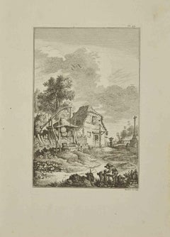
Landscape - Etching by Pierre Quentin Chedel - 1755
Located in Roma, IT
Landscape is an etching realized by Pierre Quentin Chedel in 1755.
Good conditions.
Signed on Plate.
The artwork is depicted through confident strokes.
The etching was realized f...
Category
18th Century and Earlier Landscape Prints
Materials
Etching
An Antique Engraved View of Copper Mining in Sweden in the 17th C. by Dahlberg
Located in Alamo, CA
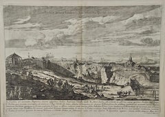
This is an antique engraved view entitled "Fodinae aerariae Falunenfis, qui orientem fpectat, delineatio" (Copper mining in Falun), Sweden in 1705 from "Sueciae Antiquae et Hodiernae"' published in Stockholm by Erik Dahlberg (1625-1703). The engraving was created by Johannes van den Aveelen (1650-1727), who was an accomplished copperplate engraver who emigrated to Sweden to work on Dahlberg's spectacular book, "Sueciae Antiquae et Hodiernae", which was focused on the views and architecture of Sweden, both in the ancient past and at the time of the publication.
This engraving depicts a very active 17th century working scene...
Category
Naturalistic 18th Century and Earlier Landscape Prints
Materials
Laid Paper, Engraving
Chiesa di S. Maria del Rosario- Etching by Giuseppe Vasi - Late 18th Century
Located in Roma, IT
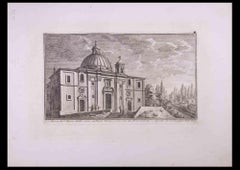
Chiesa di S. Maria del Rosario is an original black and white etching of the Late 18th century realized by Giuseppe Vasi.
Signed and titled on plate lower...
Category
Old Masters 18th Century and Earlier Landscape Prints
Materials
Etching
Adrian Collaert 17th Century Engraving Wedding at Cana Martin de Vos
Located in London, GB
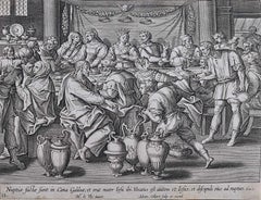
We have the full series of 52 prints (including title page) from Vita Passio et Resurrectio Iesu Christi listed. To find the others scroll down to "More from this Seller" and below i...
Category
Realist 18th Century and Earlier Landscape Prints
Materials
Engraving
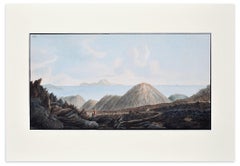
Landscape Campi Phlegraei - Plate XIII - View of Capri - By Hamilton-Fabris
Located in Roma, IT
Landscape Campi Phlegraei - Plate XIII - View of Capri is an original colored etching realized by Pietro Fabris between 1776 and 1779.
This beautiful ...
Category
Realist 18th Century and Earlier Landscape Prints
Materials
Etching
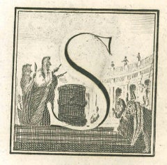
Letter of the Alphabet S - Etching by Luigi Vanvitelli - 18th Century
Located in Roma, IT
Letter of the Alphabet S, from the series "Antiquities of Herculaneum", is an etching on paper realized by Luigi Vanvitelli in the 18th century.
Good conditions.
The etching belon...
Category
Old Masters 18th Century and Earlier Landscape Prints
Materials
Etching
Sweden and Adjacent Portions of Scandinavia: A Hand-colored 18th C. Homann Map
Located in Alamo, CA
This hand-colored copper-plate map of Sweden and adjacent portions of Scandinavia entitled "Regni Sueciae in Omnes suas Subjacentes Provincias accurate divisi Tabula Generalis" was c...
Category
Old Masters 18th Century and Earlier Landscape Prints
Materials
Engraving
Veduta del Ponte Lugano sull'Anione - Etching by G. B. Piranesi
Located in Roma, IT
Image dimensions 45x65.6.
Veduta del Ponte Lugano su l'Anione is a superb black and white etching on laid paper realized by Giovan Battista Piranesi....
Category
18th Century and Earlier Landscape Prints
Materials
Etching
St. Christophe (St. Kitts): Bellin 18th Century Hand Colored Map
Located in Alamo, CA
Jacques Bellin's copper-plate map of the Caribbean island of Saint Kitts entitled "Carte De De l'Isle St. Christophe Pour servir á l'Histoire Genle. des V...
Category
Other Art Style 18th Century and Earlier Landscape Prints
Materials
Engraving
Palazzo Madama - Etching by Giuseppe Vasi - Late 18th Century
Located in Roma, IT
Palazzo Madama is an etching of the Late 18th century realized by the Artist Giuseppe Vasi.
Signed and titled on plate lower margin.
Good conditions.
Giuseppe Vasi (Corleone,1710 - Rome, 1782) was an engraver, architect, and landscape artist. Between 1746 and 1761, Vasi published 10 volumes with 240 engravings of the monuments of Rome...
Category
Modern 18th Century and Earlier Landscape Prints
Materials
Etching
Marvel of Peru Common, Mirabilis jalapa Plate 371
Located in Columbia, MO
Marvel of Peru Common, Mirabilis jalapa Plate 371
1797
Hand-colored etching
Ed. 1st ed.
9 x 5.25 inches
Category
Naturalistic 18th Century and Earlier Landscape Prints
Materials
Etching
An Antique Engraved View of "Romelborg", Sweden in the 17th C. by Erik Dahlberg
Located in Alamo, CA
An antique engraved view of "Romelborg", Sweden in 1705 from "Sueciae Antiquae et Hodiernae"' published in Stockholm by Erik Dahlberg (1625-1703). The engraving was created by Johan...
Category
Naturalistic 18th Century and Earlier Landscape Prints
Materials
Laid Paper, Engraving
17th century etching black and white landscape forest trees figures scene
Located in Milwaukee, WI
"La Danse Sous Les Arbes (The Country Dance)" is an etching by Claude Gellee (Le Lorrain). This etching is in the collections of the Metropolitan Museum and the Louvre. Publisher: Ma...
Category
Old Masters 18th Century and Earlier Landscape Prints
Materials
Etching
Le Busard - Etching by Carl Guttenberg - 1771
Located in Roma, IT
Le Busard is an etching realized by Carl Guttenberg in 1771.
The artwork Belongs to the suite "Histoire naturelle, générale et particulière avec la description du Cabinet du Roi". P...
Category
Modern 18th Century and Earlier Landscape Prints
Materials
Etching
Assassinat de Basseville à Rome - Original Etching by P.G. Berthault - 1793
Located in Roma, IT
Assassinat De Basseville à Rome is an original black and white etching realized by Pierre Gabriel Berthault, after Jacques François Joseph Swebach-Desfontaines in 1793.
Title with caption on plate on the lower center: "Assassinat de Basseville, à Rome/ le 13 Janvier 1793, ou 23 Nivose An Ier de la République".
Below the image on the lower margin, "Swebach Desfontaines onv. et del. / Berthault sculp." is etched on plate. This modern artwork is numbered "N. 76", because it is from the series Les Tableaux historiques de la Révolution française.
As a matter of fact, Pierre-Gabriel Berthault is well-known for having engraved plates from this collection with the collaboration of the engraver Jean Duplessis-Bertaux. A work - hanging in the balance between news and history - with illustrations of salient or minimal events occurred during the French Revolution. As a celebration of the new ideals of brotherhood, justice, and equality, Les Tableaux immediately became a point of reference for journalism at the time. Of traditional cut, namely showing a view with many human figures, the engraving simplified the lines to be immediately readable for the general public.
In our specific case, this original print represents the murder of Hugou de Bassville or Basseville (7 February, 1743 – 13 January, 1793), a French journalist and diplomatist, and protector of the radical Jacobins in Rome.
In excellent conditions, except for a usual yellowing of the paper on the edges and a light trace of oxidations on the lower and right margins, beyond the marginal line of the matrix.
Pierre-Gabriel Berthault (Saint-Maur-des-Fossés, 1737 - Paris, 1831) was a French master who made engravings from drawings by Jean-Claude Richard de Saint-Non (known as the Abbot of Saint-Non) and from paintings by Louis François Cassas. He depicted many views of Italy and created the collections Voyage à Naples and Voyage pittoresque de la Syrie, de la Palestine et de la basse-Egypte. Before the French Revolution, he was famous for being the author of the Vues intérieures de Paris and for tables with architectural elevations.
Category
Old Masters 18th Century and Earlier Landscape Prints
Materials
Etching
17th Century map of Cumberland, UK by Robert Morden
Located in Petworth, West Sussex
Robert Morden (British, circa 1650 – 1703)
A map of Cumberland with hand colouring
An engraving
14.1/4 x 16.5/8 in. (36.5 x 42.5 cm.)
Category
Academic 18th Century and Earlier Landscape Prints
Materials
Engraving
Danzig, Antique Map from "Civitates Orbis Terrarum" - 1572-1617
Located in Roma, IT
Braun G., Hogenberg F., Dantziat, from the collection Civitates Orbis Terrarum, Cologne, T. Graminaeus, 1572-1617.
Image dimensions: cm 32.8 x 47.9; dimensions: cm 42 x 55.3; passep...
Category
18th Century and Earlier Landscape Prints
Materials
Etching
Paysages (Landscapes)
Located in New York, NY
Franz Edmund Weirotter (1730-1771), Paysages (Landscapes), 1759, complete set of 6 (5 are illustrated on this site), [signed in the plates lower right Weirotter sc, and also signed a...
Category
Realist 18th Century and Earlier Landscape Prints
Materials
Etching
Letter of the Alphabet L - Etching by Luigi Vanvitelli - 18th Century
Located in Roma, IT
Letter of the Alphabet L, from the series "Antiquities of Herculaneum", is an etching on paper realized by Luigi Vanvitelli in the 18th century...
Category
Old Masters 18th Century and Earlier Landscape Prints
Materials
Etching
Countryside - Etching by Pierre-François Laurent - 18th Century
Located in Roma, IT
Countryside is an etching realized by Pierre-François Laurent in 18th Century.
Good conditions.
Signed on plate.
The artwork is depicted through confident strokes.
Category
Modern 18th Century and Earlier Landscape Prints
Materials
Etching
The Royal Militia District - Etching by Giuseppe Vasi - 1753
Located in Roma, IT
The architect is Paolo Posi, and the image is engraved by Giuseppe Vasi. Etching on paper.
Good condition.
The title: Celebratasi colla Machina della precedente sera la beneficenz...
Category
Modern 18th Century and Earlier Landscape Prints
Materials
Etching
Landscape "Campi Phlegraei - Plate XXXIII" Naples - By Hamilton-Fabris
Located in Roma, IT
Image dimensions: 21.5x39 cm.
Beautiful plate from the volume "Campi Flegrei" by William Hamilton including 59 plates by Pietro Fabris. This particular plate illustrates the eruptio...
Category
Realist 18th Century and Earlier Landscape Prints
Materials
Etching
$2,990 Sale Price
30% Off
Persiae, Armeniae, Natoliae et Arabiae Descriptio per Frederick deWit 1666 map
Located in Paonia, CO
Map of Persiae, Armeniae, Natoliae et Arabiae Descriptio per F de Wit 1688 engraving from: Atlas Contractus Orbis Terrarum Praecipuas ac Novissimas Complectens Tabulas. Amsterdam, N. Visscher, 1656-77. (Koeman III, Vis5-8) This highly decorative map of the Middle East is by the Dutch engraver, publisher, and map seller...
Category
Realist 18th Century and Earlier Landscape Prints
Materials
Engraving
Letter of the Alphabet Q - Etching by Luigi Vanvitelli - 18th Century
Located in Roma, IT
Letter of the Alphabet Q, from the series "Antiquities of Herculaneum", is an etching on paper realized by Luigi Vanvitelli in the 18th century.
Good conditions with some folding.
...
Category
Old Masters 18th Century and Earlier Landscape Prints
Materials
Etching
Palazzo Pio - Etching by Giuseppe Vasi - 18th Century
Located in Roma, IT
Palazzo Pio is an etching of the Late 18th century realized by Giuseppe Vasi.
Signed and titled on plate lower margin.
Good conditions except for consumed margins with some foxing...
Category
Old Masters 18th Century and Earlier Landscape Prints
Materials
Etching
Boxthorn Japanese, Lyciym japonicum Plate 361
Located in Columbia, MO
Boxthorn Japanese, Lyciym japonicum Plate 361
1797
Hand-colored etching
Ed. 1st ed.
9 x 5.25 inches
Category
Naturalistic 18th Century and Earlier Landscape Prints
Materials
Etching
Adrian Collaert 17th Century The Baptism of Christ Engraving Martin de Vos
Located in London, GB
We have the full series of 52 prints (including title page) from Vita Passio et Resurrectio Iesu Christi listed. To find the others scroll down to "More from this Seller" and below i...
Category
Realist 18th Century and Earlier Landscape Prints
Materials
Engraving
Letter V - Etching by Luigi Vanvitelli - 18th Century
Located in Roma, IT
Letter V is an Etching realized by Luigi Vanvitelli in 18th century.
The etching belongs to the print suite “Antiquities of Herculaneum Exposed” (ori...
Category
Old Masters 18th Century and Earlier Landscape Prints
Materials
Etching
The Inside of a Hippah in New Zealand from Captain Cooks Travels
By John Webber
Located in Paonia, CO
The Inside of a Hippah in New Zealand is from the 1784 First Edition Atlas Accompanying Capt. James Cook and King; Third and Final Voyage of Captain James Cook John...
Category
Realist 18th Century and Earlier Landscape Prints
Materials
Engraving
"Pendragon Castle" and "Lincoln Castle" from "Buck's Antiquities" /// British UK
Located in Saint Augustine, FL
Artist: Samuel and Nathaniel Buck (English, 1696-1779) and (?-1759/1774)
Title: "Pendragon Castle" (Plate 312) and "Lincoln Castle" (Plate 170)
Portfolio: Buck's Antiquities or Vener...
Category
Old Masters 18th Century and Earlier Landscape Prints
Materials
Laid Paper, Engraving, Intaglio
Le Faucon Hagard - Etching by Jacques Blanchon - 1771
Located in Roma, IT
Le Faucon Hagard is an etching realized in 1771 by Jacques Blanchon.
Signed in plate.
The artwork Belongs to the suite "Histoire naturelle, générale et particulière avec la descrip...
Category
Modern 18th Century and Earlier Landscape Prints
Materials
Etching
Ships - Etching by Charles-François Lacroix de Marseille - 18th Century
Located in Roma, IT
Ships is an etching realized by Charles-François Lacroix de Marseille in the 18th Century.
Good conditions with slight foxing.
The artwork is realized through deft expressive strokes.
Category
Modern 18th Century and Earlier Landscape Prints
Materials
Etching, Paper
Le Sacre - Etching by Bernard Baron - 1771
Located in Roma, IT
Le Sacre is an etching realized in 1771 by Bernard Baron.
Signed in plate.
The artwork Belongs to the suite "Histoire naturelle, générale et particulière avec la description du Cab...
Category
Modern 18th Century and Earlier Landscape Prints
Materials
Etching
Adrian Collaert Martin de Vos 17th Century Engraving Flight into Egypt print
Located in London, GB
We have the full series of 52 prints (including title page) from Vita Passio et Resurrectio Iesu Christi listed. To find the others scroll down to "More from this Seller" and below i...
Category
Realist 18th Century and Earlier Landscape Prints
Materials
Engraving
Obelisco Egizio (Egyptian Obelisk) - Etching by G. B. Piranesi
Located in Roma, IT
Obelisco Egizio (The Egyptian Obelisk in the Piazza di S. Giovanni), erected by Pope Sixtus V, is a wonderful black and white etching on fine laid and watermarked paper (with a lily inside a double circle, watermark n. 3 according to Hind) realized by Giovanni Battista Piranesi.
Signed on plate on the lower right margin "Piranesi Architetto fec." and with the address and price at lower left. Hind 53, second state of five. A lifetime Roman impression, before the Paris editions.
Excellent condition, with central fold, as issued, visible only on the left margin.
From one of the most important series of etchings by G.B. Piranesi, Views of Rome drawn and etched by Giambattista Piranesi...
Category
Old Masters 18th Century and Earlier Landscape Prints
Materials
Etching
Map of San Georgi - Etching by G. Braun/F. Hogenberg - 1575
Located in Roma, IT
Etching by Georg Braun and Frans Hogenberg, realized in 1575 and belonging to the Suite "Civitates Orbis Terrarum".
The first volume of the Civitates Orbis Terrarum was published in ...
Category
Modern 18th Century and Earlier Landscape Prints
Materials
Etching
Palazzo Marescotti - Etching by Giuseppe Vasi - Late 18th century
Located in Roma, IT
Palazzo Marescotti gia Estense is an etching of the Late 18th century realized by Giuseppe Vasi.
Signed and titled on plate lower margin.
Good conditions except for consumed margins.
Giuseppe Vasi (Corleone,1710 - Rome, 1782) was an engraver, architect, and landscape artist. Between 1746 and 1761, Vasi published 10 volumes with 240 engravings of the monuments of Rome...
Category
Old Masters 18th Century and Earlier Landscape Prints
Materials
Etching
Map of Oxfordshire by Joan Blaeu with college crests
Located in London, GB
To see our other original maps, scroll down to "More from this Seller" and below it click on "See all from this Seller" - or send us a message if you cannot find the poster you want....
Category
18th Century and Earlier Landscape Prints
Materials
Engraving
Theodoor Galle Martin de Vos 17th Century Engraving Jesus on the Cross
Located in London, GB
We have the full series of 52 prints (including title page) from Vita Passio et Resurrectio Iesu Christi listed. To find the others scroll down to "More from this Seller" and below it click on "See all from this Seller" and search for 'Collaert' - or message us as they may not all have been uploaded yet.
Theodoor Galle (1571 – 1633) after Maerten de Vos (1532 - 1603)
Jesus on the Cross...
Category
Realist 18th Century and Earlier Landscape Prints
Materials
Engraving
L'Autour - Etching by Carl Guttenberg - 1771
Located in Roma, IT
L'Autour is an etching realized by Carl Guttenberg in 1771.
The artwork Belongs to the suite "Histoire naturelle, générale et particulière avec la description du Cabinet du Roi". Pa...
Category
Modern 18th Century and Earlier Landscape Prints
Materials
Etching
Vue de Boston, American Realist Hand colored engraving by Franz Xavier Habermann
Located in Long Island City, NY
Franz Xavier Habermann, German (1721 - 1796) - Vue de Boston, Year: circa 1750, Medium: Hand colored engraving on laid paper, Image Size: 9.75 x 15.5 inches, Size: 13 x 17.5 in. (3...
Category
American Realist 18th Century and Earlier Landscape Prints
Materials
Engraving
The Passengers - Original Etching by A. M. de Ghuy - 1775
Located in Roma, IT
The Passenger is an original artwork realized by Antoine de Marcenay de Ghuy in 1775.
Original etching on paper. Titled on the lower margin at the center. The artwork is glued on ca...
Category
Old Masters 18th Century and Earlier Landscape Prints
Materials
Etching
Two Cavaliers (after Herman Swanevelt)
Located in Middletown, NY
Etching on cream laid paper with a large foolscap watermark, 5 5/8 x 7 7/8 (150 x 200 mm), thread margins. In excellent condition with a light pencil inscription and an inventory num...
Category
Old Masters 18th Century and Earlier Landscape Prints
Materials
Laid Paper, Etching
Chiesa dedicata a S. Gregorio... - Etching by G.B. Falda - Late 1600
Located in Roma, IT
Chiesa dedicata a S. Gregorio Papa de Monaci Camaldolesi sul' Monte Celio is an etching realized in the Late 17th Century by Giovan Battista Falda.
good condition except for some fo...
Category
18th Century and Earlier Landscape Prints
Materials
Etching
Le Bobak - Etching by Bernard Baron - 1771
Located in Roma, IT
Le Bobak is an etching realized in 1771 by Bernard Baron.
Signed in plate.
The artwork Belongs to the suite "Histoire naturelle, générale et particulière avec la description du Cab...
Category
Modern 18th Century and Earlier Landscape Prints
Materials
Etching
The Arch of Constantine and the Colosseum
Located in Fairlawn, OH
The Arch of Constantine and the Colosseum
Vedute dell' Arco di Costantino, e dell' Anfiteatro Flavio il Colosseo
From: "Vedute di Roma" (Roman Views), part II
An early Paris edition,...
Category
Old Masters 18th Century and Earlier Landscape Prints
Materials
Etching
View of Mausoleo of Cecilia Metella - Etching by G. B. Piranesi - 1773
Located in Roma, IT
View of Mausoleo of Cecilia Metella is an original etching realized by the italian artist Giovanni Battista Piranesi in 1773.
Precoius roman edition. Complete title on the lower ma...
Category
Old Masters 18th Century and Earlier Landscape Prints
Materials
Etching
Brielle Den Briel - Etching by G. Braun and F. Hogenberg - Late 16th Century
Located in Roma, IT
This View of Brilium is an original etching realized by George Braun and Franz Hogenberg as part of the famous series "Civitates Orbis Terrarum".
The “Civitates Orbis Terrarum” (At...
Category
18th Century and Earlier Landscape Prints
Materials
Etching
Landscape with Bridge - Etching by J. C. Richard de Saint-Non - 18th Century
Located in Roma, IT
Landscape with Bridge is a beautiful black and white etching realized by Jean-Claude Richard de Saint-Non at the end of 18th Century.
On lower margin under the image the inscriptio...
Category
Old Masters 18th Century and Earlier Landscape Prints
Materials
Etching
Landscape - Etching by Pierre Quentin Chedel - 1755
Located in Roma, IT
Landscape is an etching realized by Pierre Quentin Chedel in 1755.
Good conditions.
Signed on Plate.
The artwork is depicted through confident strokes.
The etching was realized f...
Category
18th Century and Earlier Landscape Prints
Materials
Etching
Franciscus de Neve C17 engravings: Landscape with Shepherdess/Echo & Narcissus
By Franciscus de Neve
Located in London, GB
Franciscus de Neve (c.1632-1704)
'Landscape with Shepherdess Playing a Tambourine' and
'Echo & Narcissus'
Engravings
Both signed in the lower margin: 'Franciscus de Neue In. e fecit' and 'Si Stampano in Roma da Gio: Iacomo de Rossi alla Paca'
Each 31.5 x 38.5cm (plate)
Franciscus (or Frans) de Neve was a Flemish painter and engraver, born in Antwerp in 1632. His father, also an artist, was called by the same name, resulting in some confusion for art historians. The younger de Neve was working in Rome from 1660-1670, producing paintings for the Palazzo Doria-Pamphili (alongside Pietro da Cortona) and was known for his religious subjects, mythological scenes and landscapes. He was part of a network of Dutch and Flemish artists in the city, who helped to promote and support his career. Many of his works are known only from the engravings which in Rome were produced by Giovanni Giacomo de Rossi alla Pace (including these examples). After 1670 he travelled to Augsburg and Munich, then to Austria and Moravia, where he completed numerous commissions for altarpieces. Towards the end of his life he returned to his native Flanders and became Master of the Guild of Saint Luke.
De Neve had a reputation as a gifted landscape painter, and these two engravings show his keen interest in the details of the natural world, as well as the influence of Claude Lorrain in the extensive vistas. The painting of ‘Narcissus and Echo...
Category
Realist 18th Century and Earlier Landscape Prints
Materials
Engraving
Map of Ancient Greece - Original Etching by Antonio Zatta - 1785
Located in Roma, IT
This Map of ancient Greek is an etching realized by Antonio Zatta in Venice in 1785.
The state of preservation of the artwork is good expect for the worn paper.
Mounted on a cardbo...
Category
18th Century and Earlier Landscape Prints
Materials
Etching
Ancient View of Oxonium - Etching by G. Braun and F. Hogenberg - 17th Century
Located in Roma, IT
Ancient view of Oxonium (Oxford) is an old master artwork realized by George Braun and Franz Hogenberg in the early 17th Century, as part of the famous Series "Civitates Orbis Terrar...
Category
Old Masters 18th Century and Earlier Landscape Prints
Materials
Etching
Veduta della Magnifica Sostruzione Fabricata - Etching by G. B. Piranesi -1760s
Located in Roma, IT
View of the magnificent substructure is an original etching realized by the italian artist Giovanni Battista Piranesi.
Very precoius and rare specimen. Roman edition.
Complete tit...
Category
18th Century and Earlier Landscape Prints
Materials
Etching
Letter S - Etching by Luigi Vanvitelli - 18th Century
Located in Roma, IT
Letter S is an Etching realized by Luigi Vanvitelli in 18th century.
The etching belongs to the print suite “Antiquities of Herculaneum Exposed” (ori...
Category
Old Masters 18th Century and Earlier Landscape Prints
Materials
Etching
Ancient monument - Etching by Luigi Vanvitelli - 18th Century
Located in Roma, IT
Ancient monument "Antiquities of Herculaneum", is an etching on paper realized by Luigi Vanvitelli of 18th Century.
Signed on plate.
Good conditions...
Category
Old Masters 18th Century and Earlier Landscape Prints
Materials
Etching
[Civitates Orbis Terrarum]Map of Cefal - Etching by G. Braun/F. Hogenberg - 1575
Located in Roma, IT
Etching by Georg Braun and Franz Hogenberg, belonging to the "Civitates Orbis Terrarum".
Good condition.
The first volume of the Civitates Orbis Terrarum was published in Cologne in ...
Category
Contemporary 18th Century and Earlier Landscape Prints
Materials
Etching
Set of Two Engravings from Nash's "History of Worcestershire" /// Landscapes Art
Located in Saint Augustine, FL
Artist: Treadway Russell Nash (English, 1724-1811)
Title: "Henbury Hall, late the Seat of Thomas Vernon, now of Henry Cecil Esq." and "Ombersley Court, the Seat of Lord Sandys"
Portfolio: Collections for the History of Worcestershire
Year: 1781-1782 (First edition)
Medium: Set of Two Original Engravings and Etching with Aquatint on watermarked laid paper
Limited edition: Unknown
Printer: John Nichols, London, UK
Publisher: T. Payne and Son, J. Robson, B. White, Leigh and Sotheby, London, UK; Fletcher, Oxford, UK; and Lewis, Worcester, UK
Reference: Upcott III, page 1330
Sheet size (each): approx. 10.13" x 16.88"
Image size (each): approx. 8.13" x 12.63"
Condition: "Henbury Hall, late the Seat of Thomas Vernon, now of Henry Cecil Esq." has scattered light foxmarks in margins. The top edge is unevenly trimmed and a small taped tear to lower right corner. "Ombersley Court, the Seat of Lord Sandys" has light toning to sheet and some faint discoloration in right margin. A small light water stain to lower left corner. Have been professionally stored away for decades. They are both otherwise strong impressions in good condition
Notes:
Provenance: private collection - Aspen, CO. "Henbury Hall, late the Seat of Thomas Vernon, now of Henry Cecil Esq." was likely engraved by English artist James Ross (1745-1821) after a drawing by himself. "Ombersley Court, the Seat of Lord Sandys" was engraved by English artist Valentine Green (1739-1813) and English artist Francis Jukes (1745-1812) after a drawing by an unknown, likely English artist. The first work is an engraving; the second work is an etching with aquatint. Comes from Nash's two volume "Collections for the History of Worcestershire", (1781-1782) (First edition), which consists of 75 engravings. Each work is printed from copper plates in one color: black. There was a (Second edition) "with Additions" bound in with Volume II of this portfolio published by John White in (1799). And both the First and Second editions of "Collections for the History of Worcestershire" are based off Thomas Sanders' 1779-1781 "Perspective Views of the Market Towns within the County of Worcester". "Ombersley Court, the Seat of Lord Sandys" has an unidentified watermark in the center of its sheet. "Henbury Hall" is actually incorrectly misnamed; its correct name is "Hanbury Hall".
"PLATES, Drawn and engraved by J. Ross, unless otherwise expressed." - "A Bibliographical Account of the Principal Works Relating to English Topography", (1818) - William Upcott.
Biography:
Treadway Russell Nash (24 June 1724 – 26 January 1811) was an English clergyman, now known as an early historian of Worcestershire and the author of Collections for the History of Worcestershire, an important source document for Worcestershire county histories. He was a fellow of the Society of Antiquaries of London.
Treadway Russell Nash was born on 24 June 1724 born at Clerkenleap, in Kempsey, Worcestershire. His family were from Ombersley. They had lands there and at Claines, and had later bought lands in the Reformation around St Peter's, Droitwich. He was related to James Nash and John Nash, both MPs for Worcester. His father Richard, a grandson of Sir Rowland Berkeley, died in 1740, and Richard's eldest son in 1757. As a result, Treadway Russell Nash inherited the Russells' Strensham estates from his brother, as well as the Nash estates, and took both names.
He was educated from the age of twelve at King's School, Worcester, and became a scholar at Worcester College, Oxford aged fifteen. In March 1749, he accompanied his brother on a trip to the continent, to aid Richard's health. They visited Paris for about six weeks, before spending the summer "on the banks of the Loire". They then visited "Bourdeaux, Thoulouse, Montpelier, Marseilles, Leghorn, Florence, Rome, Naples, Bologna, Venice, Padua, Verona, Milan, Lyons, and again Paris"; such expeditions are often known as the Grand Tour.
On his return in late summer 1751, Nash took up a post as Vicar of Eynsham through his friend and future brother-in-law, John Martin. He also had an income as a tutor at Oxford. He took his Doctor of Divinity degree and left Oxford, having "gone out grand compounder", following the death of his brother. He also left his benefice at Eynsham in 1757. While at Oxford he had proposed a road from there to Witney (now the A40 and B4022), and also stood for Parliament. Nash married Margaret Martin...
Category
Old Masters 18th Century and Earlier Landscape Prints
Materials
Laid Paper, Engraving, Intaglio, Etching, Aquatint
Vegel - Etching on Paper by George Braun - Early 17th Century
Located in Roma, IT
This Vegel is an original etching realized in 1616 by George Braun (1541 – 1622)
The state of preservation of the artwork is good but aged with trace of foxing that doesn't affect ...
Category
18th Century and Earlier Landscape Prints
Materials
Etching
View of Straubing - Etching by G. Braun and F. Hogenberg - Late 16th Century
Located in Roma, IT
The View of Strubing (ancient nam: Stravbinca) is an original etching realized by George Braun and Franz Hogenberg, as part of the "Civitates Orbis Terrarum"
The “Civitates Orbis Te...
Category
18th Century and Earlier Landscape Prints
Materials
Etching
