18th Century and Earlier Landscape Prints
to
31
635
274
75
28
2
Overall Width
to
Overall Height
to
365
100
3
1
1
121
84
46
43
24
1,016
2,096
9,953
4,108
117
119
689
516
588
1,112
1,476
1,736
1,302
599
657
759
209
40
589
293
252
124
115
87
81
75
73
70
66
54
52
51
47
47
44
44
43
41
589
435
103
58
41
132
461
465
378
Period: 18th Century and Earlier
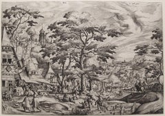
Kermess
By Hans Bol
Located in Chicago, IL
2nd State
Watermark: Hand with Cuff and Flower (close to Briquet 11467)
Category
18th Century and Earlier Landscape Prints
Materials
Etching
$3,500
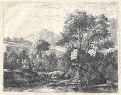
Two men standing ankle-deep in a body of water, rocky outcrop ... hilltop
Located in Middletown, NY
Etching on light, fibrous, laid Japon paper, 5 3/16 x 6 1/4 inches (132 x 158 mm), full margins. Scattered moderate foxing throughout, very minor printing creases (innate), and one s...
Category
Old Masters 18th Century and Earlier Landscape Prints
Materials
Handmade Paper, Etching
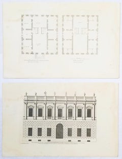
Set of Two Engravings from Campbell's "Vitruvius Britannicus" /// Architecture
Located in Saint Augustine, FL
Artist: Colen Campbell (Scottish, 1676-1729)
Titles: "The Plan of this New Design to the Earl of Islay" (Vol. 1, Plate 53) and "This New Design to the Earl of Islay" (Vol. 1, Plate 5...
Category
Old Masters 18th Century and Earlier Landscape Prints
Materials
Laid Paper, Engraving, Etching, Intaglio
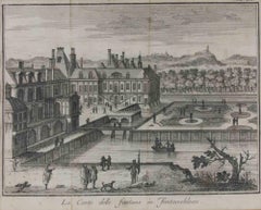
The Court of the Fountains in... - Etching by Giambattista Albrizzi - 1745 ca
Located in Roma, IT
Etching realized by Giambattista Albrizzi (1698-1777) for Thomas Salmon's Lo Stato presente di tutti i Paesi e Popoli do Mondo. Regno di Spagna.
Includes a contemporary wooden frame...
Category
Modern 18th Century and Earlier Landscape Prints
Materials
Etching
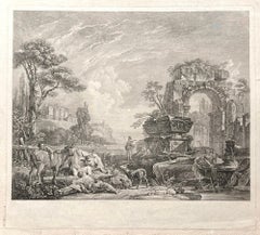
Les Bergers Romains, landscape with Roman ruins, 18th century engraving
Located in Melbourne, Victoria
Les Bergers Romains
Copper-line engraving by Jean Jacques Leveau (1729-1786) after Pierre Mettay (1728-1759). C1755.
Proof, before lettering. Laid, watermarked paper.
A landscap...
Category
French School 18th Century and Earlier Landscape Prints
Materials
Engraving
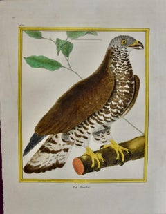
Bird of Prey: An 18th Century Hand-colored Bird Engraving by Martinet
Located in Alamo, CA
This is a hand-colored engraving of a parrot bird entitled "La Bondree (Bird of Prey)" by Francois Nicolas Martinet, plate 420 from 'Histoire Naturelle des Oiseaux' in association wi...
Category
Naturalistic 18th Century and Earlier Landscape Prints
Materials
Engraving
Gresham College
Located in Middletown, NY
Etching with engraving on cream laid paper with a Garden of Holland or Maid of Dort Pro Patria watermark, 11 x 14 1/4 inches (278 x 361 mm), thread margins. Lettered with the title in a cartouche at the top-center sheet, continuing "a Latere Occidentali Prospeus AD MDCCXXXIX," with numbers over the image at right that correspond to a key 1 to 29, and with publication details: "Georgius Vertue Londini delineavit et Sculpsit anno MDCCXXXIX". Multiple expert repairs, notably a Y-shaped, expert paper tape repair on the verso. Handling creases, toning. All issues are consistent with age. An impression of this work may be viewed in the permanent collection of the British Museum, registration No. 1880,1113.3963.
A bird's eye view of the college in Broad Street, London, showing the courtyard, adjoining stable yard to the right, and the buildings at the back.
This work was included in Frederick Crace...
Category
English School 18th Century and Earlier Landscape Prints
Materials
Handmade Paper, Engraving, Etching
Letter of the Alphabet S - Etching by Luigi Vanvitelli - 18th Century
Located in Roma, IT
Letter of the Alphabet S, from the series "Antiquities of Herculaneum", is an etching on paper realized by Luigi Vanvitelli in the 18th century.
Good conditions.
The etching belon...
Category
Old Masters 18th Century and Earlier Landscape Prints
Materials
Etching
William Chambers Georgian Architecture - Chimney Pieces
Located in Melbourne, Victoria
Copper-line engraving by Pierre Foudrinier (1698-1758) after Sir William Chambers (1723-1796), 1794.
Sir William Chambers (1723-1796) was a renown 18th century British architect. He traveled to China, France and Italy before establishing an architectural practice in London. He became Architect of the King's Works and worked for Augusta, Dowager Princess of Wales, making fanciful garden buildings...
Category
Victorian 18th Century and Earlier Landscape Prints
Materials
Engraving
Adrian Collaert Martin de Vos 17th Century Engraving Annunciation of Our Lady
Located in London, GB
We have the full series of 52 prints (including title page) from Vita Passio et Resurrectio Iesu Christi listed. To find the others scroll down to "More from this Seller" and below i...
Category
Realist 18th Century and Earlier Landscape Prints
Materials
Engraving
Campi Phlegraei - View of a section of a part of the cone of Astruni, Italy
Located in Melbourne, Victoria
Campi Phlegraei - View of a section of a part of the cone of Astruni taken at the entrance of this volcano
Copper-line engraving with gouache. 1776.
...
Category
Naturalistic 18th Century and Earlier Landscape Prints
Materials
Engraving
The City of Strasbourg, or Argentin - Etching by Giambattista Albrizzi - 1745 ca
Located in Roma, IT
Etching realized by Giambattista Albrizzi (1698-1777) for Thomas Salmon's Lo Stato presente di tutti i Paesi e Popoli do Mondo. Regno di Spagna.
Includes a contemporary wooden frame...
Category
Modern 18th Century and Earlier Landscape Prints
Materials
Etching
The city of Namur, capital of the...- Etching by Giambattista Albrizzi - 1745 ca
Located in Roma, IT
Etching realized by Giambattista Albrizzi (1698-1777) for Thomas Salmon's Lo Stato presente di tutti i Paesi e Popoli do Mondo. Regno di Spagna.
Includes a contemporary wooden frame...
Category
Modern 18th Century and Earlier Landscape Prints
Materials
Etching
II. e Vue d'un passage du Mont St Gothard, Switzerland, engraving, 1780
Located in Melbourne, Victoria
'II.e Vue d'un passage du Mont St Gothard'
French copper-line engraving by Duparc after Claude Louis Chatelet (1753-1794).
From 'The Scenery and Science of Switzerland illustrated'...
Category
Naturalistic 18th Century and Earlier Landscape Prints
Materials
Engraving
French pipe organ design, late 18th century engraving
Located in Melbourne, Victoria
'Elevation Geometralle d'Un Buffet D'Orgue d'Une Nouvelle Decoration'
Copper-line engraving. C1770.
380mm by 420mm (platemark) 460mm by 560mm (sheet)
From Roubo's 'L'Art du Menui...
Category
Rococo 18th Century and Earlier Landscape Prints
Materials
Engraving
Ancient Views of Paris - Etching - 1748
Located in Roma, IT
4 Etchings on paper realized in 1748. Each cm. 17x22.
Very good condition except for some minor foxing.
Includes a wooden frame cm. 27.5x41.5
Category
Modern 18th Century and Earlier Landscape Prints
Materials
Etching
Temples of Iside and Serapi - Etching by G. B. Piranesi - 1759
Located in Roma, IT
Temples of Iside and Serapi is an etching realized by the italian artist Giovanni Battista Piranesi in 1759.
Image dimensions: 41.5 x 55.5 cm.
Very precious lifetime impression. C...
Category
18th Century and Earlier Landscape Prints
Materials
Etching
Flowering Digitalis Plant: 18th C. Hand-colored Botanical Engraving by Weinmann
Located in Alamo, CA
This hand-colored botanical mezzotint and line engraving by Johann Wilhelm Weinmann (1683-1741) is entitled "Digitalis rubra floribus albis maculatis. Digitalis angustifolia flore fe...
Category
Naturalistic 18th Century and Earlier Landscape Prints
Materials
Engraving, Mezzotint
!6th c. VIEW OF FLORENCE
Located in Santa Monica, CA
SEBASTIAN MUNSTER (1488-1552)
FLORENCZ - -- FIGUR UND GELEGENHEIT DER EDLEN UND HOCH BERHÜMPTEN STATT FLORENTZ. . c 1550 (Fauser, #3925.)
Woodcut f...
Category
Old Masters 18th Century and Earlier Landscape Prints
Materials
Woodcut
Fountains of Rome
Located in Middletown, NY
A charming scene with romping dogs and spectators watching the cascading water play a trick on an unsuspecting man who is sprayed as he descends the steps, ...
Category
Old Masters 18th Century and Earlier Landscape Prints
Materials
Laid Paper, Engraving, Etching
Mediterranean and Adriatic Seas: Original 18th Century Hand-colored Map by Bowen
Located in Alamo, CA
This is an original 18th century hand-colored map entitled "An Accurate Chart of The Mediterranean and Adriatic Sea's; with the Archipelago & Part of the Black Sea. Exhibiting all th...
Category
Old Masters 18th Century and Earlier Landscape Prints
Materials
Engraving
Le Charlemagne (Foret de Fontainebleau)- 1991
By Eugene Blery
Located in Brooklyn, NY
This reproduction of Eugène Bléry's etching Le Charlemagne depicts the Forêt de Fontainebleau, a renowned forest located south of Paris. The print is produced by La Calcographie du L...
Category
Renaissance 18th Century and Earlier Landscape Prints
Materials
Etching
$248 Sale Price
38% Off
The Royal Exchange of London
Located in Middletown, NY
London: A. Churchill & J. Knapton, 1754
Engraving on fibrous laid paper with a "C" watermark, 9 3/4 x 11 3/4 inches (246 x 297 mm), full margins. Significant edge wear including mul...
Category
French School 18th Century and Earlier Landscape Prints
Materials
Handmade Paper, Engraving, Laid Paper
Charles Louis Balzac Engraving ca. 1809-1829 Thèbes. Karnak.
Located in Chicago, IL
An ca. 1809-1829 engraving on paper by Charles Louis Balzac, DESCRIPTION DE L'EGYPTE. Thèbes. Karnak. Vue des propylées prise du sud. (ANTIQUITES, volume III, planche 44). Artwork s...
Category
French School 18th Century and Earlier Landscape Prints
Materials
Paper, Engraving
Veduta delle Antiche Sostruzioni, Vintage Cityscape Etching by Giovanni Piranesi
Located in Long Island City, NY
Artist: Giovanni Battista Piranesi, Italian (1720 - 1788)
Title: Veduta delle Antiche Sostruzioni
Portfolio: Vedute di Roma
Year: 1776
Medium: Etching
...
Category
Old Masters 18th Century and Earlier Landscape Prints
Materials
Etching
The Inside of a Hippah in New Zealand from Captain Cooks Travels
By John Webber
Located in Paonia, CO
The Inside of a Hippah in New Zealand is from the 1784 First Edition Atlas Accompanying Capt. James Cook and King; Third and Final Voyage of Captain James Cook John...
Category
Realist 18th Century and Earlier Landscape Prints
Materials
Engraving
Captain Cook's Exploration of Tahiti: 18th C. Hand-colored Map by Bellin
Located in Alamo, CA
This beautiful 18th century hand-colored copper plate engraved map is entitled "Carte de l'Isle de Taiti, par le Lieutenant J. Cook" was created by Jacques Nicolas Bellin and publish...
Category
18th Century and Earlier Landscape Prints
Materials
Engraving
Flowering Cactus: A Framed 18th C. Hand-colored Engraving by Redoute
Located in Alamo, CA
This framed hand-colored stipple engraving entitled "Cactus Peruvianus Cierge du Pérou" by Pierre-Joseph Redouté, Plate 58 from his illustrated publication 'Plantarum Historia Succulentarum ou Histoire des Plantes Grasses', published in Paris in 1799. It depicts a branching limb of a cactus with a beautiful flower. There is a separate detail of the anatomy of a seed with early growth. Redoute was a pioneer of the stipple engraving technique, which he used to create this image. It involves utilizing a series of small dots worked into a copper plate rather than the more common lines. These dots can be made smaller or thicker depending on the degree of opacity the artist intends for various areas of the print. When inked and applied to paper, this allows for a greater portion of the paper to be seen, which accentuates the appearance of luminosity of the subject the artist is creating. Different color inks are used in the printing process, a time consuming technique known as "a la poupee". The engraving is then finished with watercolor to further enhance the beauty and realism of the print subject.
This engraving of a flowering cactus is presented in silver-colored ribbed wood frame and a double mat; cream-colored outer mat and heather green inner mat. The frame measures 21.25" high by 17.25" wide by 1.13" deep. The sheet measures 19.88" high by 14" wide. There are wide margins with a few short tears and chips along the the left, right and upper edges, which are all covered by the mat. There are small spots predominantly in the margins, with a few present in the image area. The print is otherwise in very good condition. There is another Redoute flowering cactus listed on 1stdibs, LU117326853392, which is framed and matted identically to this one. The pair would make an attractive display grouping.
Pierre-Joseph Redouté (1759-1840), was a painter and botanist originally from Belgium, who pursued his extremely successful artistic career in France. He is well known for his watercolor paintings of roses, lilies and other flowers and their subsequent folio-sized, color stipple engravings. Some believe him to be the greatest botanical illustrator of all time. Redouté was a favorite of the French royal court at the time and of the post French...
Category
Naturalistic 18th Century and Earlier Landscape Prints
Materials
Engraving
Italianate Landscape, mezzotint by Richard Earlom after Claude le Lorrain
Located in Melbourne, Victoria
Sepia mezzotint by Richard Earlom (1743-1822) After Claude Gellee ('Claude Lorrain') (1600-82).
From 'Liber Veritatis; or A Collection of Prints after the original designs of Claude le Lorrain...
Category
Italian School 18th Century and Earlier Landscape Prints
Materials
Engraving, Mezzotint, Etching
Pee-amerdu Plant: A Rare 17th Century Botanical Engraving by H. van Rheede
Located in Alamo, CA
This is a rare 17th century engraving of a plant entitled "Pee-amerdu" by the Dutch botanist Hendrik van Rheede tot Drakenstein, plate 19 from his 'Hortus Indicus Malabaricus' (Garden of Malabar), published in Amsterdam in 1686 by Johann van Someren. The engraving depicts the Pee-amerdu plant, a large leafed plant climbing plant off the Malabar Coast in India. The plant is noted for its medicinal uses. It may be related to Tinospora species. Rheede's 19th century publication featured illustrations of exotic plants and fruits labelled with script in the upper right corner in Latin, Malay, Arabic, and Sanskrit. Hortus Indicus Malabaricus is believed to be the earliest comprehensive published work on the flora of Asia and the tropics. The 17th century treatise featured important illustrations of 740 plants of the region, including Indian medicinal plants.
The engraving is printed on 17th century laid, chain-linked watermarked paper. The sheet measures 14.88" high by 18.75" wide. There is a central fold, as issued. There are a few faint smudges, a spot in the upper margin and there is minimal irregularity of the left edge of the paper where the print was previously bound in the 17th century publication. The print is otherwise in very good condition.
There are additional Rheede botanical engravings from his 'Hortus Indicus Malabaricus' publication that are listed on my 1stdibs storefront and online website. These would make for an impressive display grouping. A discount is available for purchase of two or more of the prints.
Hendrik Adriaan van Rheede tot Drakenstein...
Category
Naturalistic 18th Century and Earlier Landscape Prints
Materials
Engraving
Frontispiece with tomb in a rocky landscape.
By Allaert van Everdingen
Located in Middletown, NY
Etching on cream laid paper, 4 7/8 x 6 1/4 inches (123 x 160 mm), full margins. In good condition with some age tone around the sheet edges and an inscription in pencil on the verso.
Category
Flemish School 18th Century and Earlier Landscape Prints
Materials
Laid Paper, Etching
Veduta del Tempio della Fortuna Virile, from Raccolta delle più belle Vedute ...
Located in Middletown, NY
By Giuseppe Vasi after Giovanni Piranesi: Etching and engraving with hand coloring in watercolor on laid paper with an E and R watermark, full margins. Minor...
Category
Old Masters 18th Century and Earlier Landscape Prints
Materials
Watercolor, Laid Paper, Engraving, Etching
Palazzo Farnese - Etching by Giuseppe Vasi - Late 18th century
Located in Roma, IT
Palazzo Farnese is an original etching of the Late 18th century realized by Giuseppe Vasi.
Signed and titled on plate lower margin.
Good conditions except for foxing that doesn't ...
Category
Modern 18th Century and Earlier Landscape Prints
Materials
Etching
The New Bridge, On The River Dee, Wales. Paul Sandby C18th landscape engraving
By Paul Sandby
Located in Melbourne, Victoria
'The New Bridge, On The River Dee, Near Chirk Castle'
Engraving by Peter Mazell After Paul Sandby (1731-1809).
From Paul Sandby's 'The Virtuosi's Museum, Containing Select Views in...
Category
Naturalistic 18th Century and Earlier Landscape Prints
Materials
Engraving
Castle of Irrois in Champagne, French architecture, mid 17th century engraving
Located in Melbourne, Victoria
'Prosp. du Chasteau de Irrois en Champagne'
Copper-line engraving by Matthaeus Merian.
From 'Topographia Galliae', a fine series of engravings of 17th-century French landscapes, g...
Category
Rococo 18th Century and Earlier Landscape Prints
Materials
Engraving
Landscape - Etching by Pierre Quentin Chedel - 1755
Located in Roma, IT
Landscape is an etching realized by Pierre Quentin Chedel in 1755.
Good conditions.
Signed on Plate.
The artwork is depicted through confident strokes.
The etching was realized f...
Category
18th Century and Earlier Landscape Prints
Materials
Etching
Lemons "Limon Peretto": An Early 18th Century Volckamer Hand-colored Engraving
Located in Alamo, CA
This is an early 18th century hand-colored copperplate engraving of the anatomy of lemons by Johann Christoph Volkhamer, entitled "Limon Peretto" from his publication "Nurmbergische ...
Category
Naturalistic 18th Century and Earlier Landscape Prints
Materials
Engraving
Prague and Egra, Antique Map from "Civitates Orbis Terrarum"
Located in Roma, IT
Braun G. & Hogenberg F., Praga, Egra, from the collection Civitates Orbis Terrarum, Cologne, T. Graminaeus, 1572-1617. Image dimensions: 39.5 x 47.5 cm. Dimensions: 41 x 52.5 cm.
Wo...
Category
18th Century and Earlier Landscape Prints
Materials
Etching
Supplicium sceleri Fraenum - Etching by Jacques Callot - 1624/34
Located in Roma, IT
Supplicium sceleri Fraenum (Les Supplices) is an original Etching realized by Jacques Callot in 1624/34.
Lettered with name of etcher (bottom right), title and four columns of French verses: 'Voy, lecteur, comme la Justice... Des effectz de la forfaicture'.
Good condition included a cream colored cardboard passpartout (40x60 cm).
Jacques Callot (1592 – 1635) was a baroque printmaker and draftsman from the Duchy of Lorraine (an independent state on the north-eastern border of France, southwestern border of Germany and overlapping the southern Netherlands). He is an important person in the development of the old master print...
Category
Old Masters 18th Century and Earlier Landscape Prints
Materials
Etching
Letter of the Alphabet V - Etching by Luigi Vanvitelli - 18th Century
Located in Roma, IT
Letter of the Alphabet V, from the series "Antiquities of Herculaneum", is an etching on paper realized by Luigi Vanvitelli in the 18th century.
Good conditions with some folding.
...
Category
Old Masters 18th Century and Earlier Landscape Prints
Materials
Etching
Caunga Cucumber Plant: A 17th Century Botanical Engraving by Hendrik van Rheede
Located in Alamo, CA
This is a rare 17th century engraving of a plant entitled "Caunga" by the Dutch botanist Hendrik van Rheede tot Drakenstein, plate 6 from his 'Hortus Indicus Malabaricus' (Garden of Malabar), published in Amsterdam in 1686 by Johann van Someren. The engraving depicts the caunga plant, also known as Inca cucumber or horned squash, which is a climbing vine that produces edible, cucumber-like fruits. Rheede's 19th century publication featured illustrations of exotic plants and fruits labelled with script in the upper right corner in Latin, Malay, Arabic, and Sanskrit. Hortus Indicus Malabaricus is believed to be the earliest comprehensive published work on the flora of Asia and the tropics. The 17th century treatise featured important illustrations of 740 plants of the region, including Indian medicinal plants.
The engraving is printed on 17th century laid, chain-linked paper, watermarked with an elaborate crown design. The sheet measures 15.25" high by 18.88" wide. There is a central fold, as issued. There is a small dark spot on the left which appears to represent a paper inclusion which occurred when the hand-made paper was produced. The print is otherwise in excellent condition.
There are additional Rheede botanical engravings from his 'Hortus Indicus Malabaricus' publication that are listed on my 1stdibs storefront and online website. These would make for an impressive display grouping. A discount is available for purchase of two or more of the prints.
Hendrik Adriaan van Rheede tot Drakenstein...
Category
Naturalistic 18th Century and Earlier Landscape Prints
Materials
Engraving
Italianate Landscape, mezzotint by Richard Earlom after Claude le Lorrain
Located in Melbourne, Victoria
Sepia mezzotint by Richard Earlom (1743-1822) After Claude Gellee ('Claude Lorrain') (1600-82).
From 'Liber Veritatis; or A Collection of Prints after ...
Category
Italian School 18th Century and Earlier Landscape Prints
Materials
Engraving, Mezzotint, Etching
Citrus (Cedar Flower): An Early 18th C. Volckamer Hand-colored Engraving
Located in Alamo, CA
This is an early 18th century hand-colored copperplate engraving of the anatomy of a Cedar Flower citrus fruit by Johann Christoph Volkhamer, entitled "Cedro di fiore e Sugo doppia (...
Category
Naturalistic 18th Century and Earlier Landscape Prints
Materials
Engraving
Belgium and the Netherlands: A Hand-colored 17th Century Map by Visscher
Located in Alamo, CA
This is an original hand-colored 17th century map of Belgium by Nicolaus (Nicolas) Visscher II entitled "Belgium Foederatum emendate auctum et novissime editum", published in Amsterdam in 1678. The map shows the seven provinces comprising the Belgium federation or the Republic of the Seven United Netherlands or the Dutch Republic as it was also known. The republic was formed when an alliance of seven Dutch provinces in the Spanish Netherlands revolted against rule by Spain in 1579 (the Union of Utrecht) and declared their independence in 1581 (the Act of Abjuration). The seven provinces were Groningen, Frisia, Overijssel, Guelders, Utrecht, Holland and Zeeland. This was a predecessor state to the Netherlands and the first fully independent Dutch nation state. Amsterdam, Delft, Rouen, Utrecht, Brugge, Ghent, and Antwerp are all included on the map. A small inset map in the lower right depicts the course of the Maas River from Maastricht to Wessem. There is a decorative cartouche in the upper left corner and a distance scale cartouche in the lower right corner.
The map is presented in an attractive antiqued medium brown-colored wood frame with gold-colored inner and outer trim and a light tan-colored fabric mat. The frame measures 26.63" high by 30" wide by 0.75" deep. There is some darkening of the red areas in the map, presumably related to oxidation of the original iron containing pigment over time. There are also a few scattered spots. The map is otherwise in very good condition.
The Visscher family were one of the great cartographic families of the 17th century. Begun by Claes Jansz Visscher...
Category
Other Art Style 18th Century and Earlier Landscape Prints
Materials
Engraving
Hermes Oak, Windsor Park, late 18th century English sepia aquatint, 1799
Located in Melbourne, Victoria
'Hermes Oak, Windsor Park'
Aquatint published by Samuel Ireland. From his 'Picturesque Views on the River Thames'. Ireland was an author and engraver who p...
Category
Naturalistic 18th Century and Earlier Landscape Prints
Materials
Engraving, Etching, Aquatint
Piranesi 18th C. Etching "Reliquiae Theartri Pompejani" an Ancient Roman Theater
Located in Alamo, CA
This a framed Giovanni Battista Piranesi (1720-1778) etching entitled "Reliquiae Theartri Pompejani" (Remains of the Theatre of Pompey) from "Il Campo Marzio dell'Antica Roma" (The Campus Martius of Ancient Rome), published in Rome in 1762. It depicts the remains of an ancient theater in Rome with exposed seating and an arch still standing in the foreground. An inset shows an architectural side view of a portion of the structure.
The etching is presented in an antiqued silver-colored wood frame with a cream-colored French mat. The frame measures 24" x 20.75" x 1.25". The print is in excellent condition.
The Theatre of Pompey (Latin: Theatrum Pompeii, Italian: Teatro di Pompeo) was a structure in Ancient Rome built during the latter part of the Roman Republican era by Pompey the Great...
Category
Old Masters 18th Century and Earlier Landscape Prints
Materials
Etching
Venice: An 18th Century Etched View of the Grand Canal & Rialto Bridge by Lovisa
Located in Alamo, CA
This is an early 18th century etching of the Grand Canal and Rialto Bridge in Venice entitled "Altra Veduta del Ponte di Rialto" by Domenico Lovisa, f...
Category
18th Century and Earlier Landscape Prints
Materials
Etching
Landscape - Etching by Nicholas Cochin - 1755
Located in Roma, IT
Landscape is an etching realized by Nicholas Cochin in 1755.
Good conditions.
The artwork is depicted through confident strokes.
The etching was rea...
Category
Modern 18th Century and Earlier Landscape Prints
Materials
Etching
William Chambers Georgian Architecture - Chimney Pieces
Located in Melbourne, Victoria
Copper-line engraving by Pierre Foudrinier (1698-1758) after Sir William Chambers (1723-1796), 1794.
Sir William Chambers (1723-1796) was a renown 18th century British architect. He traveled to China, France and Italy before establishing an architectural practice in London. He became Architect of the King's Works and worked for Augusta, Dowager Princess of Wales, making fanciful garden buildings...
Category
Victorian 18th Century and Earlier Landscape Prints
Materials
Engraving
Alexandria, Egypt, copper-line engraving by Cornelius de Bruyn , 1690
Located in Melbourne, Victoria
'Alexandria'
A view of the great harbour from a little behind the shoreline.
Cornelis de Bruijn was a Dutch artist and traveler. He is best known for his drawings of the ruins of ...
Category
Naturalistic 18th Century and Earlier Landscape Prints
Materials
Engraving, Etching
Amolago (Aglaonema) Plant: 17th Century Botanical Engraving by H. van Rheede
Located in Alamo, CA
This is a rare 17th century engraving of a plant entitled "Amolago" by the Dutch botanist Hendrik van Rheede tot Drakenstein, plate 16 from his 'Hortus Indicus Malabaricus' (Garden of Malabar), published in Amsterdam in 1686 by Johann van Someren. The engraving depicts the Amolago plant, a large leafed plant, possibly corresponding to the present day aglaonema plant. Rheede's 19th century publication featured illustrations of exotic plants and fruits labelled with script in the upper right corner in Latin, Malay, Arabic, and Sanskrit. Hortus Indicus Malabaricus is believed to be the earliest comprehensive published work on the flora of Asia and the tropics. The 17th century treatise featured important illustrations of 740 plants of the region, including Indian medicinal plants.
The engraving is printed on 17th century laid, chain-linked paper. The sheet measures 14.75" high by 17.25" wide. There is a central fold, as issued. There are a few tiny spots and there is minimal irregularity of the left edge of the paper where the print was previously bound in the 17th century publication. The print is otherwise in very good condition.
There are additional Rheede botanical engravings from his 'Hortus Indicus Malabaricus' publication that are listed on my 1stdibs storefront and online website. These would make for an impressive display grouping. A discount is available for purchase of two or more of the prints.
Hendrik Adriaan van...
Category
Naturalistic 18th Century and Earlier Landscape Prints
Materials
Engraving
Ancient View of Lyon - Etching - 1748
Located in Roma, IT
Etching on paper realized in 1748.
Very good condition except for some minor foxing.
Includes a wooden frame cm. 27.5x41.5
Category
Modern 18th Century and Earlier Landscape Prints
Materials
Etching
Gardens of the Chateau Rueil, Paris, France, mid 17th century engraving
Located in Melbourne, Victoria
'Prosp. horti Auraicorum Pomorum a Ruel'
Copper-line engraving by Matthaeus Merian.
From 'Topographia Galliae', a fine series of engravings of 17th-century French landscapes, gard...
Category
Rococo 18th Century and Earlier Landscape Prints
Materials
Engraving
Glaucus, from "Le Temple des Muses" - Etching by B. Picart - 1742
Located in Roma, IT
Black and white etching on wire rod paper, representing the Greek myth of Glaucus.
Wonderful plate with very fresh impression and an elegant line, from the volume “Le Temple des Mus...
Category
Old Masters 18th Century and Earlier Landscape Prints
Materials
Etching
Northern Scotland: 16th Century Hand-colored Map by Mercator
Located in Alamo, CA
This is a framed hand-colored 16th century map of Northern Scotland by Gerard Mercator entitled "Scotiae pars Septentrionalis", published in Amsterdam in 1636. It is a highly detailed map of the northern part of Scotland, with the northwest Highlands and the cities Inverness and Aberdeen, as well as the Orkney Islands and the Hebrides. There is a decorative title cartouche in the upper left corner.
The map is presented in an antiqued brown wood...
Category
Other Art Style 18th Century and Earlier Landscape Prints
Materials
Engraving
Vue d'une partie du Lac de Geneve, Switzerland, engraving, circa 1780
Located in Melbourne, Victoria
French copper-line engraving depicting the Lake of Geneva, Switzerland.
From 'The Scenery and Science of Switzerland illustrated', by Antoine Baron de Zurlauben (1720-1795) & Jean B...
Category
Naturalistic 18th Century and Earlier Landscape Prints
Materials
Engraving
Kamtschatka, Russia: Engraving by J. Webber from Capt. Cook's 3rd Voyage Journal
By John Webber
Located in Alamo, CA
"A View of the Town and Harbour of St Peter and St Paul, in Kamtschatka" is an engraving created by Charles Grignion, from a drawing by John Webber (1752-1793), who was the artist on...
Category
18th Century and Earlier Landscape Prints
Materials
Engraving
Vue de la Bastille, Old Masters Hand-Colored Engraving after Hyacinthe Rigaud
Located in Long Island City, NY
Hyacinthe Rigaud, After, French (1659 -1743) - Vue de la Bastille, Year: of original: 1750, Medium: Hand-Colored Engraving, signed in the plate, Edition: ~1000, Image Size: 8.5 x...
Category
Old Masters 18th Century and Earlier Landscape Prints
Materials
Engraving
L'Hostel de Chevreuse, French town house in Paris, mid 17th century engraving
Located in Melbourne, Victoria
'L'Hostel de Chevreuse'
Copper-line engraving by Matthaeus Merian.
From 'Topographia Galliae', a fine series of engravings of 17th-century French landscapes, gardens, buildings an...
Category
Rococo 18th Century and Earlier Landscape Prints
Materials
Engraving
Roman Hills, Aqueducts and Roads: An Early 18th Century Map by Jan Goeree
Located in Alamo, CA
This richly engraved map of Rome and its environs entitled "Urbis Cum Vicis Seu Pagis Adiacentibus Dissertationi III De Aq et Aqueaed Veteris Promae Praemissa Authore Raph Fabretto G...
Category
Old Masters 18th Century and Earlier Landscape Prints
Materials
Engraving
