18th Century and Earlier Landscape Prints
to
27
639
268
74
28
3
Overall Width
to
Overall Height
to
371
101
3
1
1
121
83
46
42
24
1,014
2,154
10,002
3,999
116
116
718
512
594
1,139
1,468
1,656
1,322
630
660
760
206
40
589
295
249
124
115
87
82
74
73
69
66
54
51
47
47
47
44
43
42
40
593
431
105
61
41
132
459
464
377
Period: 18th Century and Earlier
Map of the East Indies: An Original 18th Century Hand-colored Map by E. Bowen
Located in Alamo, CA
This is an original 18th century hand-colored map entitled "An Accurate Map of the East Indies Exhibiting the Course of the European Trade both on the Continent and Islands" by Emanu...
Category
Old Masters 18th Century and Earlier Landscape Prints
Materials
Engraving
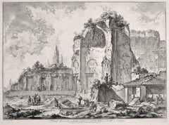
Temples of Iside and Serapi - Etching by G. B. Piranesi - 1759
Located in Roma, IT
Temples of Iside and Serapi is an etching realized by the italian artist Giovanni Battista Piranesi in 1759.
Image dimensions: 41.5 x 55.5 cm.
Very precious lifetime impression. C...
Category
18th Century and Earlier Landscape Prints
Materials
Etching
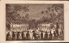
A Night Dance by Men in Tonga: An Original 18th C. Engraving, Cook's 3rd Voyage
By John Webber
Located in Alamo, CA
"A Night Dance by Men in Hapaee" is an original 18th century engraving from a drawing by John Webber (1751-1793), who was the artist who accompanied Captain Cook on his third voyage ...
Category
18th Century and Earlier Landscape Prints
Materials
Engraving
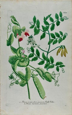
Flowering Garden Pea Plant: 18th C. Hand-colored Botanical Engraving by Weinmann
Located in Alamo, CA
This hand-colored botanical mezzotint and line engraving by Johann Wilhelm Weinmann (1683-1741) is entitled "Pisum Mapis flore pupureo". It is plate 818 in Weinmann's monumental publ...
Category
Naturalistic 18th Century and Earlier Landscape Prints
Materials
Engraving, Mezzotint
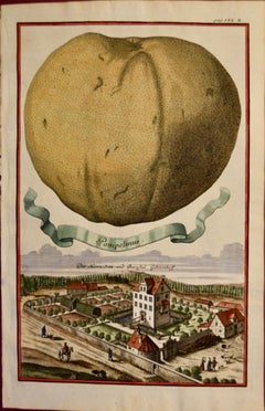
Pompelmus (Grapefruit): An Early 18th C. Hand-colored Engraving by Volckamer
Located in Alamo, CA
This is an early 18th century hand-colored copperplate engraving of the anatomy of grapefruit by Johann Christoph Volkhamer, entitled "Pompelmus (Grapefruit), Der Herra Sitz und Burg...
Category
Naturalistic 18th Century and Earlier Landscape Prints
Materials
Engraving
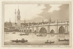
London Bridge, C18th English aquatint
Located in Melbourne, Victoria
'London Bridge'
Aquatint by JC Stadler after J Farmington.
Published c1795 for Boydell's 'History of the River Thames'. Joseph Constantine Stadler (fl London, 1780-1822) was an eng...
Category
Naturalistic 18th Century and Earlier Landscape Prints
Materials
Engraving
West Africa: A 17th Century Hand-Colored Map by Mercator/Hondius
Located in Alamo, CA
A 17th century hand-colored map entitled "Guineae Nova Descriptio" by Gerard Mercator and Jodocus Hondius, published in their 'Atlas Minor' in Amsterdam in 1635. It is focused on the...
Category
18th Century and Earlier Landscape Prints
Materials
Engraving
View of the Capitoline Hill - Etching by G. B. Piranesi - 1775
Located in Roma, IT
View of the Capitoline Hill is an original etching realized by the italian artist Giovanni Battista Piranesi in 1775.
Very precious and rare lifetime impression. Roman edition. II ...
Category
18th Century and Earlier Landscape Prints
Materials
Etching
Asia Declineatio: A 17th Century Hand-colored Map of Asia by Justus Danckerts
Located in Alamo, CA
This is a scarce 17th century beautifully hand-colored copperplate engraved map of Asia entitled “Exactissima Asiae Delineatio in Praecipuas Regiones Caerterasque Partes divisa et de...
Category
Old Masters 18th Century and Earlier Landscape Prints
Materials
Engraving
'Vue des Montagnes du Val-Travers, Neuchatel, Switzerland, engraving, 1780
Located in Melbourne, Victoria
'Vue des Montagnes du Val-Travers, d'ou aperçoit le Lac de Neuchatel'
French copper-line engraving by Duparc after Claude Louis Chatelet (1753-1794).
From 'Th...
Category
Naturalistic 18th Century and Earlier Landscape Prints
Materials
Engraving
"Africa Vetus": A 17th Century Hand-colored Map By Sanson
Located in Alamo, CA
This original hand-colored copperplate engraved map of Africa entitled "Africa Vetus, Nicolai Sanson Christianiss Galliar Regis Geographi" was originally created by Nicholas Sanson d...
Category
18th Century and Earlier Landscape Prints
Materials
Engraving
Falda Giovanni Battista and De Rossi Giovanni Giacomo Plan of Villa Farnesina
Located in Roma, IT
A very interesting and important Engraving, framed between two glasses and two colors natural and gilded wood frame of the Plan of the palace of Caprarola that inspired the American ...
Category
18th Century and Earlier Landscape Prints
Materials
Paper
Piranesi Etching of Hadrian's Ancient Roman Aqueduct and Baths, "Aquae Virginis"
Located in Alamo, CA
This is a framed Giovanni Battista Piranesi (1720-1778) etching entitled "Orthographia utriusque lateris arcuum ductus Aquae Virginis a specu principe ad Hadriani thermas, effossorum...
Category
Old Masters 18th Century and Earlier Landscape Prints
Materials
Etching
An Inland View; in Atooi ( Hawaii ) 1784 Captain Cook engraving by John Webber
By John Webber
Located in Paonia, CO
An Inland View in Atooi ( Hawaii ) is from the 1784 First Edition Atlas Accompanying Capt. James Cook and King; Third and Final Voyage of Captain James Cook. This engraving depicts ...
Category
Realist 18th Century and Earlier Landscape Prints
Materials
Engraving
VEDUTA del SEPOLCRO della Famiglia PLAUZIA per la strada che Conduce da Roma....
Located in Santa Monica, CA
GIOVANNI BATTISTA PIRANESI (Italian 1720-1778)
VEDUTA del SEPOLCRO della Famiglia PLAUZIA per la strada che Conduce da Roma a Tivoli vicino a Ponte Lugan...
Category
Old Masters 18th Century and Earlier Landscape Prints
Materials
Etching
Arcadian riverscape with different figures by a tree [Arcadisch rivierlandschap]
Located in Middletown, NY
A beautiful Arcadian landscape after Johannes Glauber.
Amsterdam: 1721.
Etching on handmade laid paper with an intact fleur-de-lis watermark. 203 x 275 mm; 8 x 10 7/8 inches, trimm...
Category
Old Masters 18th Century and Earlier Landscape Prints
Materials
Handmade Paper, Laid Paper, Etching
Surrender of Tahiti to Captain Wallis: An Original 18th C. Engraving
By John Webber
Located in Alamo, CA
"A Representation of the Surrender of the Island of Otaheite to Capt.n Wallis, by the Supposed Queen of Oberea" is an original 18th century engraving created by Sparrow, from a drawi...
Category
18th Century and Earlier Landscape Prints
Materials
Engraving
Christ Church, Oxford 1675 engraving by David Loggan
By David Loggan
Located in London, GB
To see our other views of Oxford and Cambridge, scroll down to "More from this Seller" and below it click on "See all from this seller" - or send us a message if you cannot find the ...
Category
Realist 18th Century and Earlier Landscape Prints
Materials
Engraving
Flowering Medlar Tree: An 18th C. Hand-colored Botanical Engraving by Weinmann
Located in Alamo, CA
This hand-colored botanical mezzotint and line engraving by Johann Wilhelm Weinmann (1683-1741) is entitled "A. Mespilus Aronia Azarolie B. Mespilus Vulgaris Neflier". It is plate 7...
Category
Naturalistic 18th Century and Earlier Landscape Prints
Materials
Engraving, Mezzotint
Seascapes With Monument and Figures - Etching by Giuseppe Aloja - 18th Century
Located in Roma, IT
Seascapes With Monument and Figures is an Etching realized by Giuseppe Aloja (1783-1837).
The etching belongs to the print suite “Antiquities of Herculaneum Exposed” (original titl...
Category
Old Masters 18th Century and Earlier Landscape Prints
Materials
Etching
Christ Church, Oxford 1675 hand-coloured engraving by David Loggan
By David Loggan
Located in London, GB
To see our other views of Oxford and Cambridge, scroll down to "More from this Seller" and below it click on "See all from this Seller" - or send us a message if you cannot find the ...
Category
Realist 18th Century and Earlier Landscape Prints
Materials
Engraving
Lemons "La parte interiore": An Early 18th C. Volckamer Hand-colored Engraving
Located in Alamo, CA
This is an early 18th century hand-colored copperplate engraving of the anatomy of lemons by Johann Christoph Volkhamer, entitled "La parte interiore del Cedro di fio e Sugo doppio" ...
Category
Naturalistic 18th Century and Earlier Landscape Prints
Materials
Engraving
Piazza Navona allagata solito farsi nelle Feste di Agosto
Located in Fairlawn, OH
Piazza Navona allagata solito farsi nelle Feste di Agosto
Etching, 1752
Signed in the plate lower right (see photo)
From: Della Magnificenze di Roma Antica e Moderna ( The Magnificense of Ancient and Modern Rome) , (1747-1761)
Volume II, The Main Squares and Obelisks, columns and other ornaments, 1752, Plate No. 26
Della Magnificenze di Roma Antica e Moderna_ (1747-61), a collection of 238 plates that was published in ten volumes. Vasi recorded all types of architecture and organized these images of contemporary Rome by subject, with each volume representing a different category of architecture. This comprehensive project provides one of the most complete views of eighteenth-century Rome
Condition: Excellent
Image/Plate size: 8 .25 x 12.63 inches
Sheet size: 11 x 15 7/8 inches
Vasi was Giovanni Battista Piranesi’s teacher. Piranesi (1720-1778) entered Vasi’s studio as an apprentice at age 20 c. 1740. Piranesi left Vasi’s employment after stabbing Vasi over the perception that Vasi was withholding secrets of the etching process.
Giuseppe Vasi was an Italian engraver and painter born and trained in Sicily. He received a classical education in his hometown of Corleone and trained as a printmaker in nearby Palermo, perhaps under the tutelage of the etchers Antonino Bova and Francesco Cichè. He moved to Rome in 1736, already an established printmaker, and spent most of his career documenting the urban landscape of the city in engravings. Through his patron, the politically and culturally influential Cardinal Troiano Acquaviva d’Aragona, Vasi met other artists working in Rome, such as Sebastiano Conca, Ferdinando Fuga, and Luigi Vanvitelli. He was also influenced by his predecessors, including Giovanni Paolo Panini, Giovanni Battista Falda...
Category
Old Masters 18th Century and Earlier Landscape Prints
Materials
Etching
Durham. Paul Sandby C18th English landscape engraving
By Paul Sandby
Located in Melbourne, Victoria
'Durham'
Engraving by F Chesham after Paul Sandby (1731-1809).
From Paul Sandby's 'The Virtuosi's Museum, Containing Select Views in England, Scotland, and Ireland', published by G...
Category
Naturalistic 18th Century and Earlier Landscape Prints
Materials
Engraving
New Map of the Terraqueous Globe - WORLD MAP - CALIFORNIA AS AN ISLAND
By Edward Wells
Located in Santa Monica, CA
EDWARD WELLS (British 1667- 1727)
A NEW MAP of the TERRAQUEOUS GLOBE - according to the latest Discoveries and most general Divisions of it into CONTINENTS and OCEANS, 1700-01 (Shirley 609)
Engraved by Michael Burghers, Oxford. Hand-colored, Platemark 14 1/4 x 20 1/8 inches. Central cartouche flanked by figures representing the continents with dedication to William, Duke of Gloucester...
Category
Old Masters 18th Century and Earlier Landscape Prints
Materials
Engraving
Flowering Carnation Plant: 18th C. Hand-colored Botanical Engraving by Weinmann
Located in Alamo, CA
This hand-colored botanical mezzotint and line engraving by Johann Wilhelm Weinmann (1683-1741) is entitled "Caryophyllus Anglicus flore". It is plate 326 in Weinmann's monumental pu...
Category
Naturalistic 18th Century and Earlier Landscape Prints
Materials
Engraving, Mezzotint
Column of Antoninus Pius, Rome Italy. Jacobs Lauro 17th century engraving
Located in Melbourne, Victoria
Lauro produced a series of engravings of the ancient monuments of Classical Rome with detailed descriptions in Latin below.
180mm by 240mm (plate mark)...
Category
Old Masters 18th Century and Earlier Landscape Prints
Materials
Engraving, Etching
North and South America: An 18th Century Hand-colored Map by Johann Homann
Located in Alamo, CA
This early 18th century hand-colored copperplate map of North and South America entitled "Totius Americae Septentrionalis Et Meridionalis Novissima Repraesentatio" was created by Johann Baptist Homann and published in Nuremberg, Germany, between 1710 and 1731. The map details cities, forts, mountains, forests and lakes, as well as districts. There is a decorative cartouche in the lower left which depicts a volcano, scenes representing the people in their native costumes, as well as animals and plants of the Americas. A village is seen in the background on the left. A second smaller decorative cartouche in the upper right includes text and a series of allegorical figures. A large portion if the north central and western portions of North America is left without detail, because the region was largely unexplored at the time this map was created. The map also shows "Terra Esonis Incognita", representing a mythical continuous land bridge from North America to Asia, a northwest passage. The map preceded the French and...
Category
Old Masters 18th Century and Earlier Landscape Prints
Materials
Engraving
Banana Plant: An 18th Century Hand-colored Botanical Engraving by J. Weinmann
Located in Alamo, CA
This is an original antique colored botanical mezzotint and line engraving of banana plants, which is finished with hand-coloring. It is entitled "Banana 2. Mauze, Baradis-feigen", p...
Category
Naturalistic 18th Century and Earlier Landscape Prints
Materials
Engraving, Mezzotint
Chiesa di Paolo Primo Eremita - Etching by G. Vasi - Late 18th Century
Located in Roma, IT
Chiesa di Paolo Primo Eremita is an original black and white etching of the Late 18th century realized by Giuseppe Vasi.
Signed and titled on plate lower mar...
Category
Old Masters 18th Century and Earlier Landscape Prints
Materials
Etching
Italianate Landscape, mezzotint by Richard Earlom after Claude le Lorrain
Located in Melbourne, Victoria
Sepia mezzotint by Richard Earlom (1743-1822) After Claude Gellee ('Claude Lorrain') (1600-82).
From 'Liber Veritatis; or A Collection of Prints after the original designs of Claude le Lorrain...
Category
Italian School 18th Century and Earlier Landscape Prints
Materials
Engraving, Mezzotint, Etching
Cliveden spring, Bucks, Thames, late 18th century English sepia aquatint, 1799
Located in Melbourne, Victoria
'Cliveden Spring, Bucks'
Aquatint published by Samuel Ireland. From his 'Picturesque Views on the River Thames'. Ireland was an author and engraver who published several series of a...
Category
Naturalistic 18th Century and Earlier Landscape Prints
Materials
Engraving, Etching, Aquatint
Hungary & Eastern Europe: A Large 17th C. Hand-colored Map by Sanson & Jaillot
Located in Alamo, CA
This large hand-colored map entitled "Le Royaume De Hongrie et les Estats qui en ont este sujets et qui font presentement La Partie Septentrionale de la Turquie en Europe" was origin...
Category
18th Century and Earlier Landscape Prints
Materials
Engraving
Caernarfon Castle, Wales. Paul Sandby C18th landscape engraving
By Paul Sandby
Located in Melbourne, Victoria
'Caernarvon Castle'
Engraving by William Watts (1752-1851) after Paul Sandby (1731-1809).
From Paul Sandby's 'The Virtuosi's Museum, Containing Select Views in England, Scotland, ...
Category
Naturalistic 18th Century and Earlier Landscape Prints
Materials
Engraving
Cultivated Pea Plants: An 18th C. Hand-colored Botanical Engraving by Weinmann
Located in Alamo, CA
This hand-colored botanical mezzotint and line engraving by Johann Wilhelm Weinmann (1683-1741) is entitled "a. Pisum Minus sine Putamine, b. Pisa Indicum". It is plate 819 in Weinma...
Category
Naturalistic 18th Century and Earlier Landscape Prints
Materials
Engraving, Mezzotint
Woodpeckers "Le Petit Pic" An 18th Century Hand-colored Engraving by Martinet
Located in Alamo, CA
This is a hand-colored engraving of male and female woodpeckers entitled "1. Le Petit Pie varie, 2. Sa Femelle" by Francois Nicolas Martinet, plate 598 from 'Histoire Naturelle des O...
Category
Naturalistic 18th Century and Earlier Landscape Prints
Materials
Engraving
Greyhound
Located in Columbia, MO
Greyhound
1773-1802
Engraving
14 x 10 inches
Framed: 24 x 21 inches
Category
Naturalistic 18th Century and Earlier Landscape Prints
Materials
Engraving
Henley-bridge, Oxon, Thames, late 18th century English sepia aquatint, 1799
Located in Melbourne, Victoria
'Henley-bridge, Oxon'
Aquatint published by Samuel Ireland. From his 'Picturesque Views on the River Thames'. Ireland was an author and engraver who published several series of aqua...
Category
Naturalistic 18th Century and Earlier Landscape Prints
Materials
Engraving, Etching, Aquatint
Vue d'une partie du Lac de Geneve, Switzerland, engraving, circa 1780
Located in Melbourne, Victoria
French copper-line engraving depicting the Lake of Geneva, Switzerland.
From 'The Scenery and Science of Switzerland illustrated', by Antoine Baron de Zurlauben (1720-1795) & Jean B...
Category
Naturalistic 18th Century and Earlier Landscape Prints
Materials
Engraving
Flowering Sweet William Plant: 18th C. Hand-colored Weinmann Botanical Engraving
Located in Alamo, CA
This hand-colored botanical mezzotint and line engraving by Johann Wilhelm Weinmann (1683-1741) is entitled "a. Caryophyllus Arborescens, b. Caryophyllus Barbatus". It is plate 327 i...
Category
Naturalistic 18th Century and Earlier Landscape Prints
Materials
Engraving, Mezzotint
“Haughton in the County of Nottingham” (Near Newark Upon Trent)
By Johannes Kip
Located in Southampton, NY
An original hand colored engraving by Johannes 'Jan' Kip (1653-1722) of Haughton in the County of Nottinghamshire, one of the seats of Prince John Duke of ...
Category
Academic 18th Century and Earlier Landscape Prints
Materials
Engraving
$960 Sale Price
20% Off
Rare Hand Colored "Cabane Des Hold" - 1st Ed "Description de l’Univers" C. 1683
Located in Soquel, CA
Rare Engraving "Cabane Des Hold, Terres Artiques, Fig CII," 1st edition "Description de l’Univers, page 281
This rare image depicts the Willem Barentsz expedition of 1597 to Novaya Zemlya, Russia. The engraving, with later hand-coloring, shows the cabin and ship of the Dutch arctic expedition of Barentsz on Novaya Zemlya (Nova Zembla), with the party being attacked (and in some cases apparently eaten) by bears and wolves. Dutch explorer, Willem Barentsz, reached the west coast of Novaya Zemlya in 1594, and in a subsequent expedition of 1596 rounded the northern point and wintered on the northeast coast. Barentsz died during the expedition, and may have been buried on the northern island.
This artwork is a page from a book by 17th century cartographer and engineer, Allain Manesson Mallet (French, 1630-1706), "Description de L'Univers, contenant les differents systêmes du monde, les cartes générals et particulières de la géographie ancienne et modern." Paris: Denys Thierry, 1683.
Presented in an cream colored mat.
Text on verso shown in images.
Mat Size: 11.5"H x 9.07"W
Paper Size: 8.25"H x 5.44"W
Image Size: 5.63"H x 3.75"W
Alain Manesson Mallet (French, 1630-1706) was a 17th century cartographer and military engineer. He started his career as a musketeer in the army of Louis XIV, became a Sergeant-Major in the artillery and an Inspector of Fortifications. He later served under Alfonso VI, King of Portugal...
Category
Realist 18th Century and Earlier Landscape Prints
Materials
Paper, Ink, Gouache
Palazzo Borghese - Etching by Giuseppe Vasi - 1747
Located in Roma, IT
Palazzo Borghese is original black and white etching realized by Giuseppe Vasi .
Beautiful etching representing Palazzo Borghese in Rome.
Signed and...
Category
Old Masters 18th Century and Earlier Landscape Prints
Materials
Etching
PERU
By Johannes Jansson
Located in Santa Monica, CA
JOHANNES JANSSON (1588 - 1664)
PERU, engraving with early coloring. Platemark 15 1/8 x 19 3/8 inches, sheet 17 x 20 1/2
A nice example of one of the earliest maps of Peru. From the ...
Category
Old Masters 18th Century and Earlier Landscape Prints
Materials
Engraving
Obelisco Egizio (Egyptian Obelisk) - Etching by G. B. Piranesi
Located in Roma, IT
Obelisco Egizio (The Egyptian Obelisk in the Piazza di S. Giovanni), erected by Pope Sixtus V, is a wonderful black and white etching on fine laid and watermarked paper (with a lily inside a double circle, watermark n. 3 according to Hind) realized by Giovanni Battista Piranesi.
Signed on plate on the lower right margin "Piranesi Architetto fec." and with the address and price at lower left. Hind 53, second state of five. A lifetime Roman impression, before the Paris editions.
Excellent condition, with central fold, as issued, visible only on the left margin.
From one of the most important series of etchings by G.B. Piranesi, Views of Rome drawn and etched by Giambattista Piranesi...
Category
Old Masters 18th Century and Earlier Landscape Prints
Materials
Etching
Veduta in Prospettiva della gran Fontana dell'Acqua Vergine detta di Trevi
Located in New York, NY
Etching, 1773.
From the Vedute di Roma.
Framed dimensions 25.5 x 34.5 inches.
Category
Old Masters 18th Century and Earlier Landscape Prints
Materials
Etching
A Dance in Otaheite (Tahiti) 1784 James Cook Final Voyage by John Webber
By John Webber
Located in Paonia, CO
A Dance in Otaheite ( Tahiti ) is from the 1784 First Edition Atlas Accompanying Capt. James Cook and King; Third and Final Voyage of Captain James Cook. John Webber (1752-1793) who...
Category
Realist 18th Century and Earlier Landscape Prints
Materials
Engraving
Africa: A Large 17th Century Hand-colored Map By Sanson and Jaillot
Located in Alamo, CA
This large original hand-colored copperplate engraved map of Africa entitled "L'Afrique divisee suivant l'estendue de ses principales parties ou sont distingues les uns des autres, L...
Category
18th Century and Earlier Landscape Prints
Materials
Engraving
Veduta della Basilica di San Giovanni in Laterano by G.B.Piranesi - 1749
Located in Roma, IT
Veduta della Basilica di San Giovanni in Laterano, is an original etching realized by Giovanni Battista Piranesi in 1749.
S. Giovanni in Laterano with palace and Scala Santa on t...
Category
Modern 18th Century and Earlier Landscape Prints
Materials
Etching
Genip Tree & Fruit: An 18th C. Hand-colored Botanical Engraving by J. Weinmann
Located in Alamo, CA
This hand-colored botanical mezzotint and line engraving by Johann Wilhelm Weinmann (1683-1741) is entitled "A. Geniculata Wieder Kraief, B. Genipa seu Ganipaba". It is plate 531 in...
Category
Naturalistic 18th Century and Earlier Landscape Prints
Materials
Engraving, Mezzotint
Flowering Burning Bush: 18th Century Hand-colored Weinmann Botanical Engraving
Located in Alamo, CA
This is an original antique colored botanical mezzotint and line engraving of flowering Gas Plants or Burning Bush and Fraxinella, which is finished with hand-coloring. It is entitle...
Category
Naturalistic 18th Century and Earlier Landscape Prints
Materials
Engraving, Mezzotint
Naples and S. Italy: A Large 17th C. Hand-colored Map by Sanson and Jaillot
Located in Alamo, CA
This large hand-colored map entitled "Le Royaume de Naples Divisé en Douze Provinces. sur les Memoires les plus Nouveaux. Par le Sr. Sanson Presenté" was originally created by Nicholas Sanson d'Abbeville and published by Hubert Jaillot in "Atlas Nouveau" in Paris in 1692. It depicts central and southern Italy, as well as Corfu, Albania, Mediterranean Sea and the Adriatic Sea. Naples, Sorrento, the Isle of Capri, Rome in the upper left corner of the map, as well as many other landmarks.
This striking original hand-colored map of Italy is printed on antique hand-made laid, chain-linked paper with wide margins. The sheet measures 20" high and 24.88" wide. There is one spot on the left, it is otherwise in very good to excellent condition.
Nicholas Sanson d'Abbeville (1600-1667) was one of the greatest French cartographather of French cartography. Sanson opened his first printing business in Paris in 1638. The king recognized his skill and knowledge and made him the official geographer to the court. He eventually served two kings in this capacity. Sanson was succeeded by his sons and son...
Category
18th Century and Earlier Landscape Prints
Materials
Engraving
Galleria grande di Statue
Located in Fairlawn, OH
Galleria grande di Statue
Etching, 1743
Signed lower left corner of the plate
From: Prima Parte, 1743
Second edition: 1750-1778
Watermark: R 37-39
A lifetime impression printed during Piranesi’s life, before the plates are moved to Paris by his sons in the 1790’s
Condition: Excellent
Image size: 14 5/8 x 9 3/4 inches
Reference: Robison 2 iii/V
Piranesi In Rome: Prima Parte di Architetture e Prospettive
"Although Piranesi studied architecture in Venice, he never was able to find work in the field other than a few jobs involving remodeling in Rome. While Piranesi was struggling to support his architectural endeavors upon his arrival in Rome in 1740, he spent a short period of time in the studio of master painter Giovanni Battista Tiepolo (1696-1770) in addition to his apprenticeship with Giuseppe Vasi. The first production of Piranesi’s early years in Rome and a culmination of his training under Vasi, Tiepolo, and his uncle, was the Prima Parte di Architetture e Prospettive (1743). The Prima Parte was a collection of twelve etchings of imaginary temples, palaces, ruins, and a prison. During this time, Piranesi was still developing the unique style of etching he is known for today, and as such the Prima Parte differs significantly in technique compared to later works. In the Frontispiece of the Prima Parte, Piranesi’s lines are definite and exact with very little flow to them, designed in the form of traditional etching. The detail is immaculate, and yet perspective of the piece is oddly simple and familiar to the viewer. Piranesi’s technique employs miniscule markings and lines, intricately woven together to create a stippling effect. The Prima Parte, described as “rigid” by art historian Jonathan Scott, came to be seen as a stark contrast to his later sketches, which were much lighter and freer. Influenced by the style of Tiepolo, which epitomized the lightness and brightness of the Rococo period, Piranesi adopted some of the more painterly techniques of the masters he apprenticed under. Piranesi made the medium of etching appear as though it was a sketch or a painting, hence a “freer” and more fluid design in his later works. For example, the frontispiece of the Prima Parte read as an etching to Piranesi’s audience, but in his later vedute, the style of etching almost appears to be made of brushstrokes. Moreover, at the same time Piranesi was working on the Prima Parte, he aided the artist Giambattista Nolli. There is a small section of Nolli’s map...
Category
Old Masters 18th Century and Earlier Landscape Prints
Materials
Etching
Veduta della Basilica di S. Paolo Fuor delle Mura - Etching
Located in Roma, IT
Etching on laid and watermarked paper (a double circles visible near the bell tower). 38 th Plate from the series " Views of Rome".
Signed on plate on lower-left margin "Piranesi F....
Category
18th Century and Earlier Landscape Prints
Materials
Etching
Vue d'un Village près de la Ville de Berne, Switzerland, engraving, 1780
Located in Melbourne, Victoria
'Vue d'un Village près de la Ville de Berne'
French copper-line engraving by Masquelier after Claude Louis Chatelet (1753-1794).
From 'The Scenery and Science of Switzerland illust...
Category
Naturalistic 18th Century and Earlier Landscape Prints
Materials
Engraving
Vue de la Ville et du Lac de Geneve, Switzerland, copper-line engraving, c1780
Located in Melbourne, Victoria
French copper-line engraving depicting the Town and Lake of Geneva, Switzerland.
Claude-Louis Chatelet was a distinguished French painter, draftsman an...
Category
Naturalistic 18th Century and Earlier Landscape Prints
Materials
Engraving
Castle and Town of Tanlay, French architecture, mid 17th century engraving
Located in Melbourne, Victoria
'Prosp du Chasteau et Bourg de Tanlay'
Copper-line engraving by Matthaeus Merian.
From 'Topographia Galliae', a fine series of engravings of 17th-century French landscapes, garden...
Category
Rococo 18th Century and Earlier Landscape Prints
Materials
Engraving
Rugen Island, Germany: An Early 17th Century Map by Mercator and Hondius
Located in Alamo, CA
This is an early 17th century map entitled "Nova Famigerabilis Insulae Ac Ducatus Rugiae Desciptio" (Map of Rugen Island, Germany) by Gerard Mercator and Henricus and Joducus Hondiu...
Category
Old Masters 18th Century and Earlier Landscape Prints
Materials
Engraving
Festival Procession Of A Daimyo - Original Woodblock Print
Located in Soquel, CA
Procession Of A Daimyo - Original Woodblock Print
Original woodblock print depicting the procession of a Daimyo. Ten Japanese soldiers are seen as they aid in transporting the Daimy...
Category
Edo 18th Century and Earlier Landscape Prints
Materials
Ink, Wood Panel, Rice Paper
$720 Sale Price
20% Off
Landscape with Roman Ruins
By (After) Peter Paul Rubens
Located in Chicago, IL
Engraving after Peter Paul Rubens (Siegen 1577 - 1640 Antwerp), executed by Schelte Adams Bolswert (Bolsward c. 1586 -1659 Antwerp).
Bolswert was one of the major printmakers in the ...
Category
Old Masters 18th Century and Earlier Landscape Prints
Materials
Engraving

