Astronomical Maps

2
to
26
84
34
60
49
45
28
11
11
10
10
6
5
5
4
4
3
3
2
2
2
2
2
2
2
1
1
1
1
1
1
1
1
1
5
4
4
4
2
Sort By
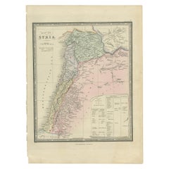
Antique Map of Syria by Wyld '1845'
Located in Langweer, NL
Antique map titled 'Map of Syria'. Original antique map of Syria. This map originates from 'An
Category

Antique Mid-19th Century Maps

Materials

Paper

Antique Map of Syria by Wyld '1845'
H 14.18 in W 10.24 in D 0.02 in
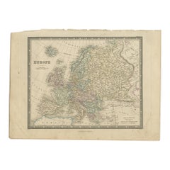
Antique Map of Europe by Wyld '1845'
Located in Langweer, NL
Antique map titled 'Europe'. Original antique map of Europe. This map originates from 'An Atlas of
Category

Antique Mid-19th Century Maps

Materials

Paper

Antique Map of Europe by Wyld '1845'
H 10.24 in W 14.18 in D 0.02 in
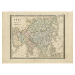
Antique Map of Asia by Wyld '1845'
Located in Langweer, NL
Antique map titled 'Asia'. Original antique map of Asia. This map originates from 'An Atlas of the
Category

Antique Mid-19th Century Maps

Materials

Paper

Antique Map of Asia by Wyld '1845'
H 10.24 in W 14.18 in D 0.02 in
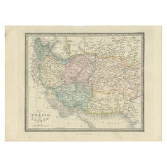
Antique Map of Afghanistan and Surroundings, '1845'
Located in Langweer, NL
Antique map titled 'Map of Persia and Caubul'. Original antique map of Afghanistan and surroundings
Category

Antique Mid-19th Century Maps

Materials

Paper

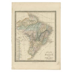
Antique Map of Brazil by Wyld, '1845'
Located in Langweer, NL
Antique map titled 'Empire of Brazil'. Original antique map of Brazil. This map originates from 'An
Category

Antique Mid-19th Century Maps

Materials

Paper

Antique Map of Brazil by Wyld, '1845'
H 14.18 in W 10.24 in D 0.02 in
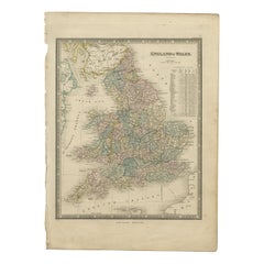
Antique Map of England & Wales by Wyld '1845'
Located in Langweer, NL
Antique map titled 'England & Wales'. Original antique map of England & Wales. This map originates
Category

Antique Mid-19th Century Maps

Materials

Paper

Antique Map of England & Wales by Wyld '1845'
H 14.18 in W 10.24 in D 0.02 in
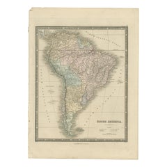
Antique Map of South America by Wyld, '1845'
Located in Langweer, NL
Antique map titled 'South America'. Original antique map of South America. This map originates from
Category

Antique Mid-19th Century Maps

Materials

Paper

Antique Map of South America by Wyld, '1845'
H 14.18 in W 10.24 in D 0.02 in
Antique Map of North America by Wyld '1845'
Located in Langweer, NL
Antique map titled 'North America'. Original antique map of North America. This map originates from
Category

Antique Mid-19th Century Maps

Materials

Paper

Antique Map of North America by Wyld '1845'
H 14.18 in W 10.24 in D 0.02 in
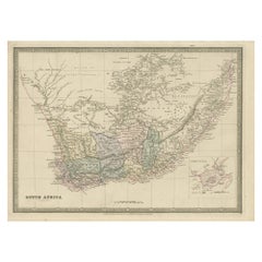
Antique Map of South Africa by Wyld '1845'
Located in Langweer, NL
Antique map titled 'South Africa'. Original antique map of South Africa. This decorative original
Category

Antique Mid-19th Century Maps

Materials

Paper

Antique Map of South Africa by Wyld '1845'
H 10.24 in W 14.18 in D 0.02 in
Antique Map of the Circle of Franconia, 1757
Located in Langweer, NL
and corrected the latitude and longitude of many regional maps in the atlas with astronomical
Category

Antique 18th Century Maps

Materials

Paper

Antique Map of England with French Title, 1806
Located in Langweer, NL
Antique map titled 'L'Angleterre.' Map of England by Robert de Vaugondy, revised and published by
Category

Antique 19th Century Maps

Materials

Paper

Antique Map of Northern Asia by Mallet, 1719
Located in Langweer, NL
Antique map titled 'Das Mitternächtige Theil des Alten Asien'. This sheet of five miniature maps
Category

Antique 18th Century Maps

Materials

Paper

Antique Map of Turkey in Asia by Wyld '1845'
Located in Langweer, NL
Antique map titled 'Map of Turkey in Asia'. Original antique map of Turkey in Asia. This map
Category

Antique Mid-19th Century Maps

Materials

Paper

Antique Map of Turkey in Asia by Wyld '1845'
H 10.24 in W 14.18 in D 0.02 in
Antique Map of the Eastern Hemisphere by Wyld '1845'
Located in Langweer, NL
Antique map titled 'Eastern Hemisphere'. Original antique map of the eastern hemisphere. This map
Category

Antique Mid-19th Century Maps

Materials

Paper

Antique Map of the Western Hemisphere by Wyld '1845'
Located in Langweer, NL
Antique map titled 'Western Hemisphere'. Original antique map of the western hemisphere. This map
Category

Antique Mid-19th Century Maps

Materials

Paper

Antique Map of France in Departments by Wyld '1845'
Located in Langweer, NL
Antique map titled 'France in Departments'. Original antique map of France. This map originates
Category

Antique Mid-19th Century Maps

Materials

Paper

Antique Map of China and Japan by Wyld '1845'
Located in Langweer, NL
Antique map titled 'Map of the Empires of China and Japan'. Original antique map of China and Japan
Category

Antique Mid-19th Century Maps

Materials

Paper

Antique Map of China and Japan by Wyld '1845'
H 10.24 in W 14.18 in D 0.02 in
Antique Map of Turkey in Europe by Wyld, '1845'
Located in Langweer, NL
Antique map titled 'Turkey in Europe'. Original antique map of Turkey in Europe. This map
Category

Antique Mid-19th Century Maps

Materials

Paper

Antique Map of Russia in Asia by Wyld, '1845'
Located in Langweer, NL
Antique map titled 'Russia in Asia'. Original antique map of Russia in Asia. This map originates
Category

Antique Mid-19th Century Maps

Materials

Paper

Antique Map of Russia in Asia by Wyld, '1845'
H 10.24 in W 14.18 in D 0.02 in
Antique Map of the Burmese Empire by Wyld, '1845'
Located in Langweer, NL
Antique map titled 'Map of Burman Empire, Siam, Cochin China and Ton-King'. Original antique map of
Category

Antique Mid-19th Century Maps

Materials

Paper

Antique Map of the East Indies by Wyld '1845'
Located in Langweer, NL
Antique map titled 'Archipelago of the Indian Ocean'. Original antique map of the East Indies. This
Category

Antique Mid-19th Century Maps

Materials

Paper

Antique Map of the East Indies by Wyld '1845'
H 10.24 in W 14.18 in D 0.02 in
Antique Map of the West Indies by Wyld '1845'
Located in Langweer, NL
Antique map titled 'Map of the West India Islands'. Original antique map of the West Indies
Category

Antique Mid-19th Century Maps

Materials

Paper

Antique Map of the West Indies by Wyld '1845'
H 10.24 in W 14.18 in D 0.02 in
Antique Bible World Map by R. & J. Wetstein, 1743
Located in Langweer, NL
polar hemisphere maps and astronomical diagrams. The information about Australia, Tasmania and New
Category

Antique Mid-18th Century Maps

Materials

Paper

Antique Bible World Map by R. & J. Wetstein, 1743
Free Shipping
H 15.52 in W 21.26 in D 0.02 in
Antique Map of the World, Mercator Projection, by Wyld, '1845'
Located in Langweer, NL
Antique map titled 'The World'. Original antique world map, on Mercator's projection. This map
Category

Antique Mid-19th Century Maps

Materials

Paper

Antique Map of the Kingdom of Denmark by Wyld '1845'
Located in Langweer, NL
Antique map titled 'Kingdom of Denmark'. Original antique map of the Kingdom of Denmark. This map
Category

Antique Mid-19th Century Maps

Materials

Paper

Antique Map of New South Wales 'Australia' by Wyld '1845'
Located in Langweer, NL
Antique map titled 'British Settlements in New South Wales'. Original antique map of New South
Category

Antique Mid-19th Century Maps

Materials

Paper

Antique Map of the Circle of Bavaria by Vaugondy, 1757
Located in Langweer, NL
latitude and longitude of many regional maps in the atlas with astronomical observations. The older
Category

Antique 18th Century Maps

Materials

Paper

Antique Map of Russia in Europe and Poland by Wyld '1845'
Located in Langweer, NL
Antique map titled 'Russia in Europe including Poland'. Original antique map of Russia in Europe
Category

Antique Mid-19th Century Maps

Materials

Paper

Antique Map of the Kingdom of the Netherlands by Wyld '1845'
Located in Langweer, NL
Separate Maps of its Various Countries, constructed and drawn from the latest Astronomical and Geographical
Category

Antique Mid-19th Century Maps

Materials

Paper

Nicely Colored Original Antique Map of Upper Saxony, Middle Germany, 1756
Located in Langweer, NL
many regional maps in the atlas with astronomical observations. The older material was revised with the
Category

Antique 1750s Maps

Materials

Paper

Antique Map of the Empire of the Assyriens by Mallet, 1683
By Alain Manesson Mallet
Located in Langweer, NL
Antique map titled 'Empire des Assyriens' and 'Assyrie Chaldee et Mesopotamie selon les Anciens
Category

Antique 17th Century Maps

Materials

Paper

Antique Map of the British Possessions in North America by Wyld '1845'
Located in Langweer, NL
Separate Maps of its Various Countries, constructed and drawn from the latest Astronomical and Geographical
Category

Antique Mid-19th Century Maps

Materials

Paper

Antique Map of the United States of North America by Wyld '1845'
Located in Langweer, NL
Antique map titled 'Map of The United States of North America'. Original antique map of the United
Category

Antique Mid-19th Century Maps

Materials

Paper

Antique Map of the Kingdoms of Spain and Portugal by Wyld '1845'
Located in Langweer, NL
Antique map titled 'Kingdoms of Spain and Portugal'. Original antique map of the Kingdoms of Spain
Category

Antique Mid-19th Century Maps

Materials

Paper

Antique Map of the Kingdoms of Sweden and Norway by Wyld '1845'
Located in Langweer, NL
Antique map titled 'Kingdoms of Sweden and Norway'. Original antique map of the Kingdoms of Sweden
Category

Antique Mid-19th Century Maps

Materials

Paper

Antique Map of the Islands in the Pacific Ocean by Wyld, '1845'
Located in Langweer, NL
Antique map titled 'Islands in the Pacific Ocean'. Original antique map of the islands in the
Category

Antique Mid-19th Century Maps

Materials

Paper

Map, Exploring The World
Located in New York City, NY
from navigation and surveys to astronomical maps, satellite and digital maps, as well as works of art
Category

21st Century and Contemporary Hong Kong Books

Materials

Paper

Map, Exploring The World
H 11.38 in W 9.88 in D 1.5 in
Antique Map of Germany with the Empire of Austria by Wyld '1845'
Located in Langweer, NL
Antique map titled 'The Confederated States of Germany with the Empire of Austria, and The Kingdoms
Category

Antique Mid-19th Century Maps

Materials

Paper

Antique Map of the World in Hemispheres by Keizer & de Lat, 1788
Located in Langweer, NL
. Australia and New Zealand are shown with incomplete coastlines. The map contains six smaller astronomical
Category

Antique Late 18th Century Maps

Materials

Paper

Map of the Circle of Franconia, Germany Bamberg, Wurtzburg and Nuremberg, 1757
Located in Langweer, NL
verified and corrected the latitude and longitude of many regional maps in the atlas with astronomical
Category

Antique 1750s Maps

Materials

Paper

Map of Guatemala or the Former United Provinces of Central America, 1845
Located in Langweer, NL
The image is an antique map titled "Guatemala or United States of Central America," which is drawn
Category

Antique Mid-19th Century Maps

Materials

Paper

Antique Map of Northern India and the Bengal Gulf by Mallet, 1686
Located in Langweer, NL
Antique map titled "Partie Orientale de la Terre Ferme de l'Inde Moderne". Original antique map of
Category

Antique 17th Century Maps

Materials

Paper

1630 Pierre Petit map "Description du Gouvernement de la Capelle" Ric0010
Located in Norton, MA
1630 Pierre Petit map entitled "Description du Gouvernement de la Capelle," Ric0010 Pierre
Category

Antique 17th Century Dutch Maps

Materials

Paper

Antique Map of the World with Polar Projections by Keizer & de Lat, 1788
Located in Langweer, NL
are shown with incomplete coastlines. The map contains six smaller astronomical spheres including the
Category

Antique Late 18th Century Maps

Materials

Paper

Antique Map of India and the Gulf of Bengal by Mallet, c.1686
Located in Langweer, NL
Antique map titled ?Partie Orientale de la Terre Ferme de l'Inde Moderne. Small map of India and
Category

Antique 17th Century Maps

Materials

Paper

Old Map of the Empire of the Assyriens & the Tigres and Euphrates Rivers, 1683
Located in Langweer, NL
Antique map titled 'Empire des Assyriens' and 'Assyrie Chaldee et Mesopotamie selon les Anciens
Category

Antique 1680s Maps

Materials

Paper

Islands of Fire and Whispers: The Canary Islands in 1902
Located in Langweer, NL
This is a authentic historical map of the Canary Islands, specifically the "1A HOJA" or first sheet
Category

Antique Early 1900s Maps

Materials

Paper

Islands of Fire and Whispers: The Canary Islands in 1902
Free Shipping
H 14.77 in W 20.08 in D 0 in
Original Antique Engrving of Chinese Tartary in the 18th Century, 1737
Located in Langweer, NL
The antique map titled " Ozieme feuille particuls de la Tartarie Chinoise, qui contient un pays
Category

Antique 1730s Maps

Materials

Paper

Untitled (XXVI)
By Robert Flynt
Located in New York, NY
imagery (with source material as diverse as anatomy charts, first aid text books, astronomical maps, 19th
Category

2010s Contemporary Figurative Photography

Materials

Black and White

Four 18th Century Celestial Charts Engravings in Brass Frames by Doppelmayr
By Johann Gabriel Doppelmayr 1
Located in London, GB
. Homann, one of the main publishers of astronomical maps in 18th century Germany, settled in Nuremberg in
Category

Antique 18th Century German Prints

Materials

Brass

Napoleon III French Marble and Bronze Astronomical Sciences Clock
Located in Vancouver, British Columbia
Napoleon III figural astronomical sciences clock. The patinated bronze winged putto stands beside
Category

Antique Late 19th Century French Napoleon III Mantel Clocks

Materials

Bronze

Antique Brass Czech Orrery Astronomical Instruments Made by Jan Felkl in 1870
By Jan Felkl
Located in Milan, IT
the nineteenth century. Cast iron base, papier mâché´ globe, with detailed territorial map and oceanic
Category

Antique 1860s Czech Scientific Instruments

Materials

Iron

Map of the Russian Empire: An Original 18th Century Hand-colored Map by E. Bowen
Located in Alamo, CA
Improved Modern Maps and Regulated by Astronomical Observations" by Emanuel Bowen. It was published in 1744
Category

Mid-18th Century Old Masters Landscape Prints

Materials

Engraving

China: An Original 18th Century Hand-colored Map by E. Bowen
Located in Alamo, CA
This is an original 18th century hand-colored map entitled "A New & Accurate Map of China, Drawn
Category

Mid-18th Century Old Masters Landscape Prints

Materials

Engraving

Theories of Planetary Motion: An 18th C. Framed Celestial Map by Doppelmayr
By Johann Gabriel Doppelmayr 1
Located in Alamo, CA
This 18th century hand-colored copperplate celestial map by Johann Doppelmayr entitled "Theoria
Category

Early 18th Century Landscape Prints

Materials

Engraving

Theories of Planetary Orbits: A Framed 18th C. Celestial Map by Doppelmayr
By Johann Gabriel Doppelmayr 1
Located in Alamo, CA
This 18th century hand-colored copperplate celestial map by Johann Doppelmayr entitled "Astronomia
Category

Early 18th Century Landscape Prints

Materials

Engraving

The Orbits of Venus and Mercury: An 18th C. Framed Celestial Map by Doppelmayr
By Johann Gabriel Doppelmayr 1
Located in Alamo, CA
This 18th century hand-colored copperplate celestial map by Johann Doppelmayr entitled "Phænomena
Category

Early 18th Century Landscape Prints

Materials

Engraving

Collection of 18th and 19th Century Arabic Astrolabes and Quadrant
Located in London, GB
excellent set of antique astronomical instruments is a selection of five Persian brass astrolabes and a
Category

Antique Early 19th Century Persian Islamic Scientific Instruments

Materials

Brass

“Merry-Go-Round”, Carousel Astrolabe Univers&Humanity Symbolist Oil Painting
By Andrée Bars
Located in Clermont-Ferrand, Auvergne-Rhône-Alpes
and astounding. The background features a planetary orbit map, With several objects from different
Category

2010s Symbolist Figurative Paintings

Materials

Oil

Rare Hand Colored "Cabane Des Hold" - 1st Ed "Description de l’Univers" C. 1683
By Alain Manesson Mallet
Located in Soquel, CA
publication which contains maps of all parts of the then-known world (both ancient and modern), star maps
Category

1680s Realist Landscape Prints

Materials

Paper, Ink, Gouache

  • 1
Get Updated with New Arrivals
Save "Astronomical Maps", and we’ll notify you when there are new listings in this category.

Astronomical Maps For Sale on 1stDibs

At 1stDibs, there are several options of astronomical maps available for sale. Each of these unique astronomical maps was constructed with extraordinary care, often using paper, metal and wood. Astronomical maps have been made for many years, and versions that date back to the 18th Century alongside those produced as recently as the 21st Century. There are many kinds of astronomical maps to choose from, but at 1stDibs, Georgian, mid-century modern and Louis XVI astronomical maps are of considerable interest. Many astronomical maps are appealing in their simplicity, but Jan Felkl, Asa Smith and Cary’s produced popular astronomical maps that are worth a look.

How Much are Astronomical Maps?

Prices for astronomical maps can differ depending upon size, time period and other attributes — at 1stDibs, astronomical maps begin at $60 and can go as high as $247,236, while the average can fetch as much as $393.

Read More

Pamela Shamshiri Shares the Secrets behind Her First-Ever Book and Its Effortlessly Cool Interiors

The sought-after designer worked with the team at Hoffman Creative to produce a monograph that beautifully showcases some of Studio Shamshiri's most inspiring projects.

Moroccan Artworks and Objects Take Center Stage in an Extraordinary Villa in Tangier

Italian writer and collector Umberto Pasti opens the doors to his remarkable cave of wonders in North Africa.

Montecito Has Drawn Royalty and Celebrities, and These Homes Are Proof of Its Allure

Hollywood A-listers, ex-pat aristocrats and art collectors and style setters of all stripes appreciate the allure of the coastal California hamlet — much on our minds after recent winter floods.

Whaam! Blam! Pow! — a New Book on Pop Art Packs a Punch

Publishing house Assouline and writer Julie Belcove have teamed up to trace the history of the genre, from Roy Lichtenstein, Andy Warhol and Yayoi Kusama to Mickalene Thomas and Jeff Koons.

The Sparkling Legacy of Tiffany & Co. Explained, One Jewel at a Time

A gorgeous new book celebrates — and memorializes — the iconic jeweler’s rich heritage.

What Makes a Gem-Encrusted Chess Set Worth $4 Million?

The world’s most opulent chess set, weighing in at 513 carats, is literally fit for a king and queen.

Tauba Auerbach’s Geometric Pop-Up Book Is Mighty Rare, Thanks to a Hurricane

This sculptural art book has an epic backstory of its own.

Step inside the Storied Mansions of Palm Beach’s Most Effervescent Architect

From Spanish-style courtyards to fanciful fountains, these acclaimed structures abound in surprising and elegant details.