Atlas East
17
to
88
306
148
223
124
107
85
75
51
44
43
43
39
31
29
27
24
22
18
17
16
14
12
12
10
8
8
8
7
6
6
5
5
5
5
5
5
5
4
4
3
3
3
3
2
2
2
2
2
2
2
2
1
1
1
1
1
66
8
7
5
5
Sort By
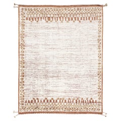
Mehraban Anamar, Atlas Collection
By Mehraban Rugs
Located in WEST HOLLYWOOD, CA
Rug Number
31514
Size
10' 4" X 13' 6"
Design
Anamar
Collection
Atlas
Material
Wool
Texture
Pile
Category
2010s Central Asian Chinese and East Asian Rugs
Materials
Wool
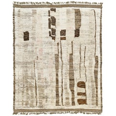
Talassemtane, Atlas Collection, Seasons
By Mehraban Rugs
Located in WEST HOLLYWOOD, CA
'Talassemtane' is a beautifully textured rug with irregular motifs inspired from the Atlas
Category
2010s Afghan Chinese and East Asian Rugs
Materials
Wool
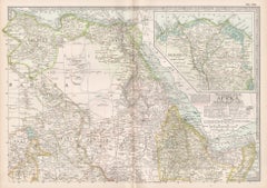
Africa. North-East Part. Century Atlas antique vintage map
Located in Melbourne, Victoria
'The Century Atlas. Africa. North-East Part'
Original antique map, 1903.
Inset map of 'Nile Delta
Category
Early 20th Century Victorian More Prints
Materials
Lithograph
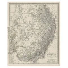
Antique Engraved Map of South East Australia from a German Atlas, 1848
Located in Langweer, NL
Antique map Australia titled 'Süd-Ost Australien'.
Detailed map of South East Australia
Category
Antique 19th Century Maps
Materials
Paper
Atlas
By Keith Carter b.1948
Located in Dallas, TX
new and unknown realities using East Texas natives as subjects. This population and background setting
Category
21st Century and Contemporary Contemporary Black and White Photography
Materials
Silver Gelatin
Blue Atlas Moth
By Keith Carter b.1948
Located in Dallas, TX
objects. He began photographing new and unknown realities using East Texas natives as subjects. This
Category
21st Century and Contemporary Contemporary Still-life Photography
Materials
Archival Pigment
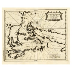
Extremely Rare Map of the East-Indies towards the South-East 'Indonesia', 1725
Located in Langweer, NL
(...).' (The part of the East-Indies towards the South-East, from Timor to Mindanao.) Extremely rare in this
Category
Antique 1720s Maps
Materials
Paper
H 14.97 in W 19.3 in D 0 in
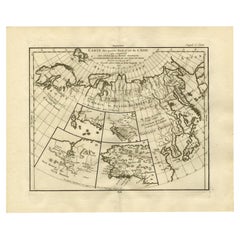
Antique Map of North and East Asia, 1751
Located in Langweer, NL
Map 2: 'Carte des parties nord et est de L'Asie'. (Map of the Northern parts and East Asia.) Five
Category
Antique 18th Century Maps
Materials
Paper
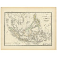
Antique Map of the East Indies by Levasseur, '1875'
Located in Langweer, NL
Antique map titled 'Carte de la Malaisie'. Large map of the East Indies. This map originates from
Category
Antique Late 19th Century Maps
Materials
Paper
Antique Map of the East Indies by Wyld '1845'
Located in Langweer, NL
Antique map titled 'Archipelago of the Indian Ocean'. Original antique map of the East Indies. This
Category
Antique Mid-19th Century Maps
Materials
Paper
Cedrus Libani ssp Atlantic - Glauca blue atlas cedar #1
By Jose Picayo
Located in Hudson, NY
unassuming highway just east of U.S. Route 1 in New Brunswick, New Jersey. Tucked amid Rutgers University is
Category
21st Century and Contemporary Contemporary Photography
Materials
Silver Gelatin
Cedrus Libani ssp Atlantica Glauca - Blue Atlas Cedar #2
By Jose Picayo
Located in Hudson, NY
unassuming highway just east of U.S. Route 1 in New Brunswick, New Jersey. Tucked amid Rutgers University is
Category
21st Century and Contemporary Contemporary Still-life Photography
Materials
Silver Gelatin
Antique Map of The German Empire (East Sheet), 1882
Located in Langweer, NL
Step into history with an authentic Antique Map of The German Empire (East Sheet) from the esteemed
Category
Antique 1880s Maps
Materials
Paper
Antique Map of the East Indies by Bonne '1776'
Located in Langweer, NL
Antique map titled 'Indes IVe Feuille'. Very decorative original antique map of the East Indies
Category
Antique Late 18th Century Maps
Materials
Paper
Antique Map of the East Indies by Dornseiffen, 1900
Located in Langweer, NL
of the various maps included in this atlas. Included are the Dutch East Indies and the Kingdom of the
Category
20th Century Maps
Materials
Paper
Antique Map of the East Indies by Dower, 1832
Located in Langweer, NL
Antique map titled 'East India Isles'. Old map of the East Indies. This map originates from 'A
Category
Antique 19th Century Maps
Materials
Paper
Antique Map of the Middle East by Smith, 1809
Located in Langweer, NL
Antique map titled 'Regiones inter Euphraten et Indum'. Old map of the Middle East showing the
Category
Antique 19th Century Maps
Materials
Paper
Antique Map of East Frisia by Ortelius, c.1595
Located in Langweer, NL
Antique print, titled: 'Frisia Orientalis.' Map of East Frisia originating from 'Theatrum Orbis
Category
Antique 16th Century Maps
Materials
Paper
Antique Map of South East Australia by Stieler, c.1848
By Thomas Kitchin
Located in Langweer, NL
Antique map Australia titled 'Süd-Ost Australien'. Detailed map of South East Australia. Orginates
Category
Antique 19th Century Maps
Materials
Paper
Tiffany & Co. 18k Yellow Gold Atlas Closed Bracelet Bangle Vintage 1995 41.6g
By Tiffany & Co.
Located in Aventura, FL
Atlas is style distilled to its very essence, bold enough to stand on its own, graceful and
Category
20th Century Unknown Romantic Bangles
Materials
Yellow Gold
Antique Map of the East Coast of Sumatra , Indonesia, 1900
Located in Langweer, NL
Antique map of the East Coast of Sumatra. Also depicting the Strait of Malacca. This map originates
Category
20th Century Maps
Materials
Paper
Large Antique County Map of the East Riding of Yorkshire, England
Located in Langweer, NL
Antique map titled 'A Map of the East Riding of Yorkshire from the best Authorities'. Original old
Category
Antique Early 19th Century Maps
Materials
Paper
Antique Map of the East Indies by W. G. Blackie, 1859
Located in Langweer, NL
Antique map titled 'The Indian Archipelago'. Original antique map of the East Indies. This map
Category
Antique Mid-19th Century Maps
Materials
Paper
Antique Map of the United States ' North East ' by Johnston '1909'
Located in Langweer, NL
America ( North East ). This map originates from the ‘Royal Atlas of Modern Geography’. Published by W
Category
Early 20th Century Maps
Materials
Paper
Antique Map of China and the East Indies by Lowry, 1852
Located in Langweer, NL
Antique map titled 'China & Indian Archipelago'. Two individual sheets of China and the East Indies
Category
Antique Mid-19th Century Maps
Materials
Paper
Antique Map of the United States ' South East ' by Johnston '1909'
Located in Langweer, NL
America ( South East Sheet ). With inset maps of New York, Washington and Cuba. This map originates from
Category
Early 20th Century Maps
Materials
Paper
Pieter van der Aa: Cambridge from the East, after David Loggan
By Pieter Van Der Aa
Located in London, GB
Pieter van der Aa (1659-1733), after David Loggan (1634–1692)
Cambridge from the East (1727
Category
Early 18th Century Prints and Multiples
Materials
Engraving
Antique Map of the East Indies by A & C. Black, 1870
Located in Langweer, NL
antique map of Indian Archipelago and Further India. This map originates from ‘Black's General Atlas of
Category
Antique Late 19th Century Maps
Materials
Paper
Finely Engraved Historical Map of Middle East and Asia, c.1745
Located in Langweer, NL
historical map with a profusion of details. It shows the Middle East and Asia. Decorative title cartouche and
Category
Antique 1740s Maps
Materials
Paper
Old Original Antique Map of the Islands of East Indonesia, 1756
Located in Langweer, NL
of Australia (Terre du Sud)
Origin: Atlas Nouveau Portatif à l'usage des militaires et du voyageur
Category
Antique 1750s Maps
Materials
Paper
Map of East Friesland, The Netherlands & the Area Emden & Norden, Germany, 1635
Located in Langweer, NL
Antique map titled 'Typus Frisiae Orientalis.'
Map of East Friesland and the area around Emden
Category
Antique 1630s Maps
Materials
Paper
H 20.48 in W 24.34 in D 0 in
Cadiz Island: A Framed 17th Century Hand-colored Map from Blaeu's Atlas Major
By Joan (Johannes) Blaeu
Located in Alamo, CA
(Joan) Blaeu's Atlas Maior, published in Amsterdam in 1662.
The map provides an excellent plan of Cadiz
Category
Mid-17th Century Old Masters Landscape Prints
Materials
Engraving
H 20 in W 24.88 in D 1.13 in
Antique Print of Batavia 'Jakarta', in the Dutch East Indies, 1744
Located in Langweer, NL
Engravers: Emmanuel Bowen (ca. 1694-1767), engraver and print seller. He was most well-known for his atlases
Category
Antique 18th Century Prints
Materials
Paper
Antique Map of the Dutch East Indies by Van den Bosch '1818'
Located in Langweer, NL
of the Dutch East Indies, it shows the Dutch possessions in the 19th century. This colony was one of
Category
Antique Early 19th Century Maps
Materials
Paper
Map of East Frisian Islands & Northwestern Tip of Germany, Ostfriesland, c.1595
Located in Langweer, NL
Antique map titled 'Frisia Orientalis'. Beautiful map of east Frisian islands and the northwestern
Category
Antique 16th Century Maps
Materials
Paper
No Reserve
H 15.75 in W 20.67 in D 0 in
Decorative Antique Map of the Malay Archipelago or East Indies Island, 1851
Located in Langweer, NL
Antique map Indonesia titled 'Malay Archipelago, or East India Islands'. With vignettes of Victoria
Category
Antique 1850s Maps
Materials
Paper
No Reserve
H 10.44 in W 14.18 in D 0 in
Original Antique Map of the Middle East, Published in Germany, c.1870
Located in Langweer, NL
Antique map titled 'Asia Citerior'. Old map of the Middle East. This map originates from 'Atlas
Category
Antique 19th Century Maps
Materials
Paper
Scarce Antique Map of the Middle East, Surrounded by Latin Text, 1624
Located in Langweer, NL
Antique map titled 'Lumen Historium per Orientem (..).'
Scarce map of the Middle East
Category
Antique 1620s Maps
Materials
Paper
Original 1859 Map of Asia from W.G. Blackie's Imperial Atlas of Modern Geography
Located in Langweer, NL
Atlas of Modern Geography’. Published by W. G. Blackie, 1859.
The "Classic Cartographic Masterpiece
Category
Antique Mid-19th Century Maps
Materials
Paper
H 14.57 in W 21.26 in D 0.02 in
Antique Map of Central and East Java by Van den Bosch, 1818
Located in Langweer, NL
'Atlas van Overzeesche bezittingen' (Atlas of Oversea Possessions) by J.S. van den Bosch. J.S. van den
Category
Antique Early 19th Century Maps
Materials
Paper
Antique Map of Friesland, Groningen and German East Friesland by Ortelius, 1603
Located in Langweer, NL
cosmographer, conventionally recognized as the creator of the first modern atlas, the Theatrum Orbis Terrarum
Category
Antique 17th Century Maps
Materials
Paper
H 17.52 in W 22.45 in D 0 in
London 1744 Published Watercolour Antique Map of East Africa by Eman Bowen
Located in GB
This is a decorative antique engraved map of East Africa, colored by kingdoms and provinces.
The map
Category
Antique 1740s English George III Maps
Materials
Paper
H 17.52 in W 21.07 in D 0.79 in
Bonne, Map of Middle East, Persia, Red Sea, Egypt, Nubia Hand Coloured
Located in Norwich, GB
et l’Abissinie
From Bonne's Atlas de toutes les parties connues du Globe Terrestre. Paris, 1780
Category
Antique 1780s French Prints
Materials
Paper
Detailed Original Antique Map of India, Southeast Asia and the Far East, 1719
Located in Langweer, NL
of India, Southeast Asia and the Far East, extending from Gujerat to the supposed "Terre De Yeco
Category
Antique 1710s Maps
Materials
Paper
H 26.38 in W 22.25 in D 0 in
Oxford from the East engraving by Pieter van der Aa after David Loggan
By Pieter Van Der Aa
Located in London, GB
Pieter van der Aa (1659-1733), after David Loggan (1634–1692)
Oxford from the East
Engraving
12 x
Category
Early 18th Century Realist Prints and Multiples
Materials
Engraving
Original Old Map East of Stockholm, the Island Ljusterö and Värmdö, Sweden, 1720
Located in Langweer, NL
Konigle Schwedisch Haupt und Residentz Stadt Stockholm.'
Map of the area east of Stockholm, embracing
Category
Antique 1720s Maps
Materials
Paper
H 21.11 in W 24.89 in D 0 in
Original Old Map of South East England Incl London, Oxford, Cambridge, Etc, 1633
Located in Langweer, NL
'.
Old map of south east England. Includes London, Salisbury, Oxford, Cambridge, Leicester and Norwich
Category
Antique 1630s Maps
Materials
Paper
H 16.15 in W 21.26 in D 0 in
Antique Print of Forts and Views of the East Indies by Chatelain (1719)
Located in Langweer, NL
outposts and fortified colonial possessions in the East Indies, including four harbour views Batavia
Category
Antique 18th Century Prints
Materials
Paper
Highly Decorative Map of The Eastern Mediterranean and The Middle East, ca.1700
Located in Langweer, NL
(..).'
Highly decorative map of the eastern Mediterranean and the Middle East features the tract of St. Paul
Category
Antique Early 1700s Maps
Materials
Paper
Free Shipping
H 16.74 in W 19.89 in D 0 in
Print of Makassar 'Ujung Pandang' in the Dutch East Indies 'Indonesia', c.1725
By Pieter Van Der Aa
Located in Langweer, NL
-1733) was a Dutch publisher best known for preparing maps and atlases. The Galerie Agreable contains
Category
Antique 18th Century Prints
Materials
Paper
H 13 in W 16.54 in D 0 in
Antique Map of the Province of Canada 'East' by A.K. Johnston, 1865
Located in Langweer, NL
Atlas of Modern Geography’ by Alexander Keith Johnston. Published by William Blackwood and Sons
Category
Antique Mid-19th Century Maps
Materials
Paper
Antique Map of Java in The Dutch East Indies, Now Indonesia, c.1690
Located in Langweer, NL
original maps, most of their atlases consisted of printings from revised and re-worked plates originally by
Category
Antique 17th Century Maps
Materials
Paper
Old Map of South East Asia Showing the Malay Archipelago, incl Borneo etc, 1922
Located in Langweer, NL
Antique map of South East Asia titled 'Malay Archipelago'.
Old map of South East Asia depicting
Category
Vintage 1920s Maps
Materials
Paper
H 17.92 in W 23.23 in D 0 in
Antique Map of the Coast of North and East Asia by Diderot, 1751
By Denis Diderot
Located in Langweer, NL
and East Asia.) Three maps on one sheet. Depicting three maps centered on mainland China, Hokkaido and
Category
Antique 18th Century Maps
Materials
Paper
Old Engraving of French Visiting Tomari, a Village in Far East Russia, 1797
Located in Langweer, NL
original old antique print / plate originates from: 'Atlas du Voyage de la Pérouse' (no.50).
Category
Antique 1790s Prints
Materials
Paper
H 11.62 in W 16.93 in D 0 in
Antique Print of Forts and Views of the East Indies or Nowadays Indonesia, 1719
Located in Langweer, NL
outposts and fortified colonial possessions in the East Indies, including four harbour views Batavia
Category
Antique 18th Century Prints
Materials
Paper
H 16.74 in W 19.49 in D 0 in
Intriguing Antique Map of Europe, the Middle East and Africa by Scherer, c.1703
Located in Langweer, NL
Antique map depicting part of Africa, Europe and the Middle East. Also showing various cities in
Category
Antique 18th Century Maps
Materials
Paper
H 10.63 in W 8.27 in D 0 in
Antique Map of Canada West and Part of Canada East by W. G. Blackie, 1859
Located in Langweer, NL
Part of Canada East with inset map of Montreal. This map originates from ‘The Imperial Atlas of Modern
Category
Antique Mid-19th Century Maps
Materials
Paper
H 14.57 in W 21.26 in D 0.02 in
Stunning Decorative Antique Map of East Frisia with an Inset of Emden, c.1610
Located in Langweer, NL
decorative maps of East Frisia and its important shipping center of Emden and the Watten Islands, from the
Category
Antique 1610s Maps
Materials
Paper
H 16.93 in W 20.87 in D 0 in
Antique Map of the Region of Twente, in The East of The Netherlands, 1884
Located in Langweer, NL
Oldenzaal, Delden and Hengelo. This map orginates from 'Atlas behoorende bij Wandelingen door Nederland met
Category
Antique 19th Century Maps
Materials
Paper
H 7.09 in W 10.48 in D 0 in
- 1
Get Updated with New Arrivals
Save "Atlas East", and we’ll notify you when there are new listings in this category.
Atlas East For Sale on 1stDibs
Surely you’ll find the exact atlas east you’re seeking on 1stDibs — we’ve got a vast assortment for sale. There are many contemporary, Old Masters and modern versions of these works for sale. If you’re looking for an atlas east from a specific time period, our collection is diverse and broad-ranging, and you’ll find at least one that dates back to the 18th Century while another version may have been produced as recently as the 21st Century. On 1stDibs, the right atlas east is waiting for you and the choices span a range of colors that includes beige, white, gray and orange. Creating an atlas east has been a part of the legacy of many artists, but those crafted by Stefanie Schneider, Frans Hogenberg, Pieter Van Der Aa, Keith Carter b.1948 and Henri-Abraham Chatelain are consistently popular. Artworks like these of any era or style can make for thoughtful decor in any space, but a selection from our variety of those made in polaroid, paper and c print can add an especially memorable touch.
How Much is a Atlas East?
The price for an atlas east in our collection starts at $60 and tops out at $135,000 with the average selling for $493.
More Ways To Browse
Tiffany Atlas Gold Bracelet
Tiffany Atlas Bracelet 18k
Tiffany Atlas Bangle Bracelets
Atlas Bangle
Tiffany Atlas Bangle
Tiffany Gold Atlas Bangle
Tiffany Atlas Collection Bracelet
Tiffany Atlas Yellow Gold Bracelet
Tiffany And Co Atlas Bangle
Vintage Wool Cloak Coat
Isle Royale
Bassett Furniture Antique
Hindeloopen Furniture
Antique Maps Singapore
Ethiopia Antique Map
Antique Map Of Iceland
Vietnam Map
Antique Map Iceland
