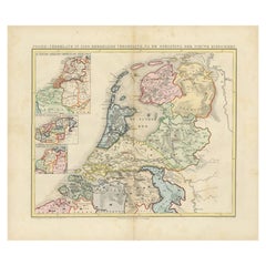
Green Map
2
to
45
562
322
471
306
270
172
135
68
47
47
47
44
40
31
30
29
25
23
20
19
16
14
14
13
13
13
13
8
6
6
6
5
5
5
4
3
3
2
2
2
2
2
1
1
1
1
1
1
1
52
42
42
30
29
Sort By
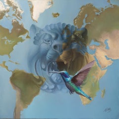
“The Lion Cries”, Hyper-realist Symbolist Blue and Green Map Oil Painting
By Andrée Bars
Located in Clermont-Ferrand, Auvergne-Rhône-Alpes
protective, proud and self-assured. In this painting, it is merged into a map, symbolizing the Earth, as our
Category
2010s Symbolist Figurative Paintings
Materials
Oil, Canvas
H 11.82 in W 11.82 in D 0.79 in
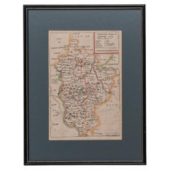
Map Bedfordshire General Framed
Located in BUNGAY, SUFFOLK
A general map of Bedfordshire with its hundreds
A scale of 5 miles
in the original green mount
Category
Antique 18th Century English Georgian Maps
Materials
Paper
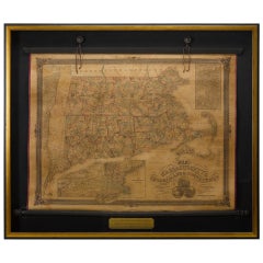
1854 Map of Massachusetts, Connecticut and Rhode Island, Antique Wall Map
Located in Colorado Springs, CO
This striking wall map was published in 1854 by Ensign, Bridgman & Fanning and has both full
Category
Antique 19th Century American Maps
Materials
Paper
H 38.13 in W 45 in D 3.5 in
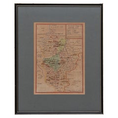
Map Bedfordshire No 3 General Framed
Located in BUNGAY, SUFFOLK
.
in the original green mount and traditional black and gold frame.
charming map with lovely detailing
Category
Antique 18th Century English Georgian Maps
Materials
Paper
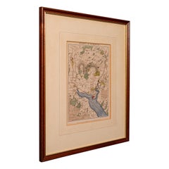
Antique Lithography Map, Environs of Southampton, English, Framed, Victorian
Located in Hele, Devon, GB
This is an antique lithography map 'The Environs of Southampton'. An English, framed town
Category
Antique Late 19th Century British Victorian Maps
Materials
Wood
H 13.98 in W 11.42 in D 0.6 in
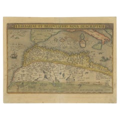
Antique Map of North Africa by Ortelius, c.1580
Located in Langweer, NL
Antique map titled 'Barbariae et Biledulgerid Nova Descriptio'. Original antique map of North
Category
Antique 16th Century Maps
Materials
Paper
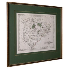
Antique County Map, Rutlandshire, Framed Atlas Cartography, John Cary, Georgian
Located in Hele, Devon, GB
, appealingly set within a quality, later frame
Green and red colour palette accentuates the map
Published by
Category
Antique Late 18th Century British Georgian Maps
Materials
Glass, Wood, Paper
H 14.57 in W 15.75 in D 0.6 in
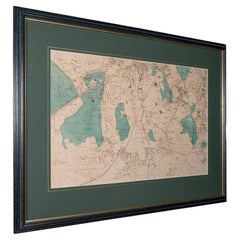
Large Antique Wimbledon Map, SW London, English, Framed Cartography, Victorian
Located in Hele, Devon, GB
This is an antique town map of Wimbledon, South West London. An English, framed atlas engraving of
Category
Antique Late 19th Century British Late Victorian Maps
Materials
Glass, Wood, Paper
H 23.04 in W 31.7 in D 0.79 in
Antique Map of the Netherlands in 1560 by Mees, 1853
Located in Langweer, NL
Antique map titled 'Noord-Nederland in 1560. Kerkelijke verdeeling, na de oprigting der nieuwe
Category
Antique 19th Century Maps
Materials
Paper
Antique Map of the Netherlands in 1811 by Mees, 1858
Located in Langweer, NL
Antique map titled 'Noord-Nederland in 1811. De inlijving bij het Fransche Keizerrijk'. Map of the
Category
Antique 19th Century Maps
Materials
Paper
Antique Map of the Netherlands in 1530 by Mees, 1852
Located in Langweer, NL
Antique map titled 'Noord-Nederland in 1530. De laatste tijden der Grafelijke Regering'. Map of the
Category
Antique 19th Century Maps
Materials
Paper
Antique Map of the Netherlands in 1839 by Mees, 1860
Located in Langweer, NL
Antique map titled 'Noord-Nederland in 1839. De scheiding van België'. Map of the Netherlands in
Category
Antique 19th Century Maps
Materials
Paper
Antique Map of the Netherlands in 1590 by Mees, 1854
Located in Langweer, NL
Antique map titled 'Noord-Nederland in 1590. De eerste tijden der Republiek'. Map of the
Category
Antique 19th Century Maps
Materials
Paper
Antique Map of the Netherlands in 1859 by Mees, 1861
Located in Langweer, NL
Antique map titled 'Noord-Nederland in 1859. De Straat- en Spoorwegen met de jaartallen der
Category
Antique 19th Century Maps
Materials
Paper
Antique Map of the Netherlands in 1648 by Mees, 1855
Located in Langweer, NL
Antique map titled 'Noord-Nederland in 1648. De gevestigde Republiek der Vereenigde Nederlanden
Category
Antique 19th Century Maps
Materials
Paper
Antique Map of the Netherlands in 1814 by Mees, 1858
Located in Langweer, NL
Antique map titled 'Noord-Nederland in 1814. De herstelling der onafhankelijkheid'. Map of the
Category
Antique 19th Century Maps
Materials
Paper
Antique Map of the Netherlands in 1798 by Mees, 1851
Located in Langweer, NL
Antique map titled 'Noord-Nederland in 1798. De Bataafsche Republiek verdeeld in departementen en
Category
Antique 19th Century Maps
Materials
Paper
Antique Map of the Netherlands in 1860 by Mees, 1862
Located in Langweer, NL
Antique map titled 'Noord-Nederland in 1860. Kerkelijke verdeeling der Gereformeerden'. Map of the
Category
Antique 19th Century Maps
Materials
Paper
Antique Map of the Netherlands in 1740 by Mees, 1857
Located in Langweer, NL
Antique map titled 'Noord-Nederland in 1740 met de Politieke veranderingen gedurende de 18e eeuw
Category
Antique 19th Century Maps
Materials
Paper
Antique Map of the Netherlands in 1808 by Mees, 1857
Located in Langweer, NL
Antique map titled 'Noord-Nederland in 1808. Het Koningrijk Holland na het tractaat van
Category
Antique 19th Century Maps
Materials
Paper
Antique Folding London Map, English, Cartography, Historic, Georgian, Dated 1783
Located in Hele, Devon, GB
This is an antique folding London map. An English, paper on linen cartographical study of the
Category
Antique Late 18th Century British Georgian Maps
Materials
Linen, Paper
H 6.3 in W 6.11 in D 0.6 in
1864 Johnson's Map of the World on Mercator's Projection, Ric.B009
Located in Norton, MA
An 1864 Johnson's map of
the World on Mercator's Projection
Ric.b009
About this Item
Category
Antique 19th Century Dutch Maps
Materials
Paper
17th Century Hand-Colored Map of West Africa by Mercator/Hondius
Located in Alamo, CA
in an archival heather green colored mat. The mat measures 14" wide x 12" high and the map measures
Category
Antique Mid-17th Century Dutch Maps
Materials
Paper
1840 Map of the City of Washington Published by William M. Morrison
Located in Colorado Springs, CO
This map, printed in 1840, is a detailed representation of Washington, D.C. in the mid-19th century
Category
Antique 1840s American Federal Maps
Materials
Paper
"Nova Barbariae Descriptio", a 17th Century Hand-Colored Map of North Africa
By Johannes Janssonius
Located in Alamo, CA
the verso.
The map is presented in a green mat, which pairs well with the colors of the map. The
Category
Antique Mid-17th Century Dutch Maps
Materials
Paper
H 22.38 in W 29 in D 0.13 in
Guadeloupe and Dependencies: 19th Century French Map and Inset of Pointe-à-Pitre
Located in Langweer, NL
This map titled "La Guadeloupe et ses Dépendances" (Guadeloupe and its Dependencies) is from a
Category
Antique 1820s Maps
Materials
Paper
H 9.45 in W 12.41 in D 0 in
The Lay of the Land: A 1901 Topographic Map of Oviedo, Asturias
Located in Langweer, NL
The province depicted on the historical map on offer, Oviedo, corresponds to the modern-day
Category
Antique Early 1900s Maps
Materials
Paper
Free Shipping
H 14.77 in W 20.08 in D 0 in
Antique Map of the French Province Maine, Showing Le Mans, Alencon Etc., Ca1640
Located in Langweer, NL
map, along the green border line. Latin text on verso, please study image carefully.
Category
Antique 1640s Maps
Materials
Paper
H 19.49 in W 23.04 in D 0 in
1837 Mitchell's "Tourist's Pocket Map of the State of Virginia" by J.H. Young
Located in Colorado Springs, CO
folding map and marketed towards travelers and tourists of the region, the map folds into a green cloth
Category
Antique 1830s American Maps
Materials
Paper
H 24.25 in W 25.75 in D 1.75 in
Prussia, Poland, N. Germany, Etc: A Hand-colored 17th Century Map by Janssonius
By Johannes Janssonius
Located in Alamo, CA
This is an attractive hand-colored copperplate engraved 17th century map of Prussia entitled
Category
Antique Mid-17th Century Dutch Maps
Materials
Paper
H 21.25 in W 24.63 in D 0.07 in
Old Map of the American Railroad Network and All Weather Roads on Verso, 1931
Located in Langweer, NL
This is the “New Census Edition” of Clason’s United States Green Guide. It features two large maps
Category
Vintage 1930s Maps
Materials
Paper
H 20.71 in W 32.8 in D 0 in
Dutch Map and City Plan of La Roche-sur-Foron, France, 17th Century Hand Colored
By Coenraet Decker
Located in Alamo, CA
pale green French mat with a cranberry-colored highlight band. There is a vertical center fold, as
Category
Antique Late 17th Century Dutch Maps
Materials
Paper
H 27.75 in W 32.5 in D 0.07 in
Imperii Persici Delineatio: A 1722 Cartographic Masterpiece of Persia by Schenk
Located in Langweer, NL
Cartographer: Petrus Schenk (Pieter Schenk), 1722
An original antique hand-colored engraved map that primarily
Category
Antique 1720s Maps
Materials
Paper
H 20.08 in W 23.43 in D 0.01 in
La Coruña 1901: A Cartographic View of Galicia's Maritime Province
Located in Langweer, NL
This antique map for sale showcases the province of La Coruña (in Galician, A Coruña), located in
Category
Antique Early 1900s Maps
Materials
Paper
Free Shipping
H 20.08 in W 14.77 in D 0 in
Minho: A Legacy of Lush Landscapes and Living Traditions in Portugal, 1903
Located in Langweer, NL
Ths authentic print is a historical map of the Minho region in the northwestern part of Portugal
Category
Antique Early 1900s Maps
Materials
Paper
Free Shipping
H 20.08 in W 14.77 in D 0 in
Lugo 1901: A Cartographic Chronicle of Galicia's Ancient Roman Walled City
Located in Langweer, NL
The map presents the province of Lugo, located in the autonomous community of Galicia in
Category
Antique Early 1900s Maps
Materials
Paper
Free Shipping
H 20.08 in W 14.77 in D 0 in
Atlantic Eden: The Azores and Madeira Archipelagos in 1903
Located in Langweer, NL
This original antique print is a historical map titled "PORTUGAL INSULAR," which translates to
Category
Antique Early 1900s Maps
Materials
Paper
"Map Voice #9, 10" Expressionist Abstract Green Colorful Gouache Modern Bold
By Susan Sharp
Located in Wellesley, MA
"Map Voice #9, 10"" 2020, Gouache and Spray Paint on Yupo (2 Panels, Diptych).
Abstraction in
Category
2010s Abstract Abstract Paintings
Materials
Mixed Media
H 40 in W 47 in D 0.5 in
"Spirit Map 1", contemporary, abstract, blue, green, white, acrylic painting
By Cheryl Clinton
Located in Natick, MA
"Sprit Map 1", is a 48 x 50 inches, acrylic on canvas painting, by contemporary Boston artist, C
Category
2010s Contemporary Abstract Paintings
Materials
Canvas, Acrylic
H 48 in W 50 in D 1.5 in
"MEMORY BOX", abstract watercolor, change, journey, family, map, green, mauve
By Fleur Thesmar
Located in Toronto, Ontario
is a striking composition in tones of rose, emerald green, mauve, blue and violet. It's a courageous
Category
21st Century and Contemporary Contemporary Abstract Drawings and Waterco...
Materials
Watercolor, Archival Paper
VF6, Contemporary Abstract Landscape Painting, Contemporary Map Art, Green Blue
By Jonathan Moss
Located in Deddington, GB
Inspired by the landscape, my new series of paintings present both a micro (snail's view) and macro (bird's eye aerial view) of nature revealing the textures and colours found in gra...
Category
21st Century and Contemporary Contemporary Landscape Paintings
Materials
Metal
H 19.3 in W 19.3 in D 0.79 in
VF4, Original Abstract Painting, Circular Map Painting, Green and Blue Artwork
By Jonathan Moss
Located in Deddington, GB
Inspired by the landscape, my new series of paintings present both a micro (snail's view) and macro (bird's eye aerial view) of nature revealing the textures and colours found in gra...
Category
2010s Contemporary Landscape Paintings
Materials
Metal
H 19.3 in W 19.3 in D 0.79 in
Natural Order - Abstract Landscape Light Green and Grey Map Line Painting
By Heny Steinberg
Located in Los Angeles, CA
Mexican artist Heny Steinberg’s abstract artworks invite us to travel from the map to the localized
Category
21st Century and Contemporary Abstract Abstract Paintings
Materials
Acrylic, Canvas, Mixed Media
Without a Map, Kennebunk, Painting, Oil on Canvas
By Gayle Fitzpatrick
Located in Yardley, PA
Without a Map, Kennebunk reflects the peace and calm of living in a rural area, surrounded by
Category
2010s Modern Paintings
Materials
Oil
Railway Map of India.
Located in London, GB
THUILLIER, Colonel Henry Ravenshaw.
Railway Map of India. Railways Brought up to October 1895
Category
1890s Other Art Style More Art
Materials
Lithograph
Mind Map Nine, Dark Indigo Blue, Olive Green, Ochre Pink Geometric Shapes, White
By Rebekah Andrade
Located in Kent, CT
Geometric shapes in dark indigo blue, olive green, orange, pink and teal are cheerful against a
Category
2010s Contemporary Abstract Paintings
Materials
Canvas, Oil, Acrylic, Tissue Paper
Mind Map One, Violet Blue, Olive Green, Pink Ochre Geometric Shapes on White
By Rebekah Andrade
Located in Kent, CT
Geometric shapes in olive green, yellow ochre, pink and teal are dynamic against a white background
Category
2010s Contemporary Abstract Paintings
Materials
Canvas, Oil, Acrylic, Tissue Paper
"Map Voice 1, 2" Abstraction on panels in blues, turquoise, green and red
By Susan Sharp
Located in Wellesley, MA
"Map Voice #1,2" Gouache on Yupo, 35 x 23 inches each panel, 35 x 46 inches.
Yupo is a thin
Category
2010s Abstract Abstract Paintings
Materials
Gouache
H 35 in W 46 in D 0.5 in
Hermès Rare Brown x Khaki Green Gender Fluid Map T-Shirt Tee Shirt 121h34
By Hermès
Located in Dix hills, NY
Hermès Rare Brown x Khaki Green Gender Fluid Map T-Shirt Tee Shirt 121h34
Made In: Italy
Category
21st Century and Contemporary T-Shirts
Original Vintage Drink Poster Amontillado Coquinero Osborne Sherry Map Bull Art
Located in London, GB
next to a glass on an outline of the map of Spain with the title text in bold stylised lettering below
Category
Vintage 1940s Spanish Posters
Materials
Paper
H 35.04 in W 24.02 in D 0.04 in
Original Vintage Travel Poster For La Normandie France Normandy Illustrated Map
Located in London, GB
Original vintage travel poster for Normandy - La Normandie France - featuring a pictorial map
Category
Vintage 1950s French Posters
Materials
Paper
H 24.02 in W 35.83 in D 0.04 in
Map of Paris, Yellow, Blue, Green & Red, Oil and ink on canvas by Shelter Serra
By Shelter Serra
Located in Brooklyn, NY
Map of Paris
2014
18.5”x20.5”x.75” inches
oil and ink on canvas
The painting, “Map of Paris”, is
Category
21st Century and Contemporary Contemporary Abstract Paintings
Materials
Canvas, Ink, Oil
Map Of The Island Of Antigua
Located in Bristol, CT
Classic colour plate depicting a 'Map of the Island of Antigua' by Eman Bowen
Print Sz: 13 1/2"H x
Category
19th Century Prints and Multiples
Materials
Lithograph
Original Vintage Poster Vignobles De France Vineyards Vins D'Alsace Wine Map Art
Located in London, GB
map of the Alsace region marking the river Rhine and the vineyards with bunches of grapes surrounded
Category
Vintage 1950s French Posters
Materials
Paper
H 26.78 in W 33.27 in D 0.04 in
Fabulous Sterling, Enamel Quartz Miniature Map Clock
Located in New York, NY
, with applied sterling continents.
The face its cobalt enamel with mint green guilloche enamel
Category
Vintage 1910s Swiss More Objets d'Art and Vertu
Materials
Quartz, Sterling Silver, Enamel
Framed Print of an Antique German Map of Morocco
Located in New York, NY
Antique German map (print) of Morocco (circa 1728) featuring a central map above two city views
Category
Mid-20th Century German Biedermeier Paintings
Materials
Wood
Vintage Central Oregon Geological Topographical State Map.Circa 1955.
Located in Seattle, WA
This Map was made by the US Department of the Interior as a Geological Survey. Green background
Category
Vintage 1950s Mid-Century Modern Contemporary Art
Materials
Paper
Four Reproduction Vintage Panels of Air France World Map
Located in Los Angeles, CA
Reproduction of a beautiful green and blue mid-century Air France world map on four individual
Category
21st Century and Contemporary French Prints
Materials
Wood, Paper
Original Vintage Illustrated Map Poster Afrique Equatoriale Francaise Cameroon
Located in London, GB
Original vintage illustrated map poster for Cameroun AOF Afrique Occidentale Francaise / Cameroon
Category
Vintage 1950s French Posters
Materials
Paper
H 47.25 in W 30.71 in D 0.04 in
Four Reproduction Vintage Panels of Air France World Map
Located in Los Angeles, CA
Reproduction of beautiful blue and green mid-century Air France world map on four individual panels
Category
21st Century and Contemporary French Prints
Materials
Paper, Wood
- 1
- ...
Get Updated with New Arrivals
Save "Green Map", and we’ll notify you when there are new listings in this category.
Green Map For Sale on 1stDibs
Surely you’ll find the exact green map you’re seeking on 1stDibs — we’ve got a vast assortment for sale. There are many abstract, modern and post-war versions of these works for sale. Making the right choice when shopping for a green map may mean carefully reviewing examples of this item dating from different eras — you can find an early iteration of this piece from the 18th Century and a newer version made as recently as the 21st Century. On 1stDibs, the right green map is waiting for you and the choices span a range of colors that includes gray, brown, beige and black. Finding an appealing green map — no matter the origin — is easy, but Nicholas Evans-Cato, (after) Henri Matisse, Henri Matisse, Stephen Walling and Elizabeth Lennie each produced popular versions that are worth a look. Artworks like these of any era or style can make for thoughtful decor in any space, but a selection from our variety of those made in paint, oil paint and fabric can add an especially memorable touch.
How Much is a Green Map?
The average selling price for a green map we offer is $1,850, while they’re typically $1 on the low end and $150,000 for the highest priced.
More Ways To Browse
Portraits 18th 19 Th Century
18 Th Century Oil On Canvas
Ed Gorman
Garrett Price
Jason Lewis
Religious18th Century
18th And 19 Th Century Portrait Paintings
19 Th C Portrait
Alan Thompson
Andree Bars
Jason Anderson
Kentucky Sellers
Map Of Piedmont
18 Th Century Europe Map
Adventure Consultants Merchandise
Alexandra Kohl
Antique Maps Of Lithuania
Arthur James Stark
