Old Nautical Maps
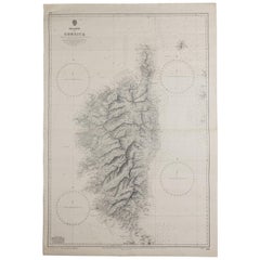
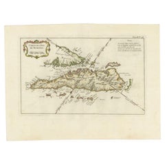
Old Nautical Map of Corsica
Located in Alessandria, Piemonte
ST/556/1 - Old map of Corsica isle, surveyed by Captain Hell, of the French Royal Navy in 1824
Category
Antique Early 19th Century English Other Prints
Materials
Paper
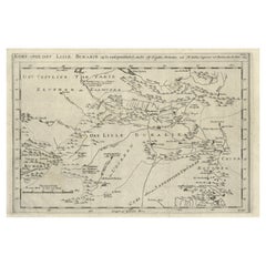
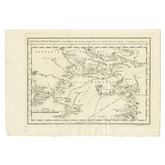
Old Map of Turkmenistan, Uzbekistan, Afghanistan, Tajikistan, Kyrgyzstan, 1757
Located in Langweer, NL
Antique map titled 'Kort over det Lille Bukarie og de naest graensende Lande. af Engelske
Category
Antique 1750s Maps
Materials
Paper
H 9.06 in W 13.78 in D 0 in
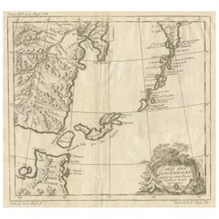
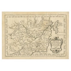
Old Map of The Kurile Islands, from Hokkaido, Japan to Kamchatka, Russia, c.1750
Located in Langweer, NL
Antique map titled 'Carte des Iles Kouriles'. Original antique map of the Kuril Islands.
The
Category
Antique 1750s Maps
Materials
Paper
Free Shipping
H 10.67 in W 11.89 in D 0 in
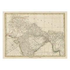
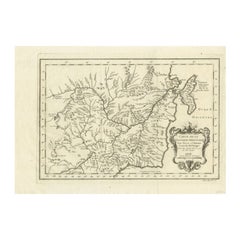
Old Map of North India From Kandahar East to Burma 'Pegu' and South to Goa, 1776
Located in Langweer, NL
Description: Antique map titled 'Indes Iere Feuille'.
Old map of northern India. Covers the
Category
Antique 1770s Maps
Materials
Paper
H 14.77 in W 19.1 in D 0 in
Antique Map of Sumatra by Bellin, 1764
Located in Langweer, NL
Antique map Sumatra titled 'Carte de l'Isle de Sumatra'. Old map of Sumatra, Malaysia and the
Category
Antique 18th Century Maps
Materials
Paper
Antique Map of the Bukhari and Surroundings by Bellin, 1749
Located in Langweer, NL
Antique map titled 'Carte de la Petite Bukharie et Pays Voisins'. Old map of the Bukhari (Sinkiang
Category
Antique 18th Century Maps
Materials
Paper
Antique Map of Northern China and Eastern Russia by Bellin, 1757
Located in Langweer, NL
Antique map titled 'Carte de la Tartarie Orientale (..)'. Original antique map of what is present
Category
Antique 18th Century Maps
Materials
Paper
Antique Map of Northern China and Eastern Russia by Bellin, 1754
Located in Langweer, NL
Antique map titled 'Carte De La Tartarie Orientale (..)'. A map for this far eastern portion of
Category
Antique 18th Century Maps
Materials
Paper
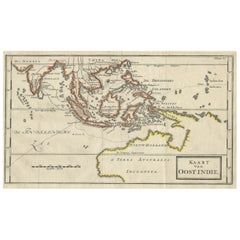
Map of The East Indies with the Route of Capt. William Dampier's Voyage, 1698
Located in Langweer, NL
Antique map titled 'Kaart van Oost Indie'.
Old map of the East Indies. It shows the routes of
Category
Antique 1690s Maps
Materials
Paper
H 7.88 in W 12.41 in D 0 in
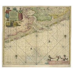
Old Decorative & Highly Detailed Sea Chart of the North Dutch-German Coast, 1681
Located in Langweer, NL
Antique map titled 'Paskaart van een gedeelte van Vriesland, Groeninger, en Emderland. Met zyn
Category
Antique 1680s Maps
Materials
Paper
H 21.38 in W 23.82 in D 0 in
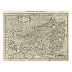
Old Original Engraving of Prussia on the Southeast Coast of the Baltic Sea, 1632
Located in Langweer, NL
Description: Antique map titled 'Prussia'.
Original map of Prussia, a historically prominent
Category
Antique 1630s Maps
Materials
Paper
H 8.47 in W 11.03 in D 0 in
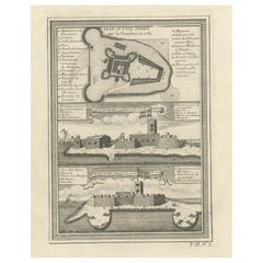
Old Print of Fort James on Kunta Kinteh Island on the Gambia River, Africa, 1746
Located in Langweer, NL
-Est, Vue de Fort James du côte de N.N. Ouest'.
Old print of Kunta Kinteh Island on the Gambia
Category
Antique 1740s Maps
Materials
Paper
H 10.08 in W 7.88 in D 0 in
Early Chart Identifying British Spice Trading Colony of Bencoolen, Sumatra, 1797
Located in Langweer, NL
Antique map titled 'A Chart of the West Coast of Sumatra'.
Early nautical chart identifying the
Category
Antique 1790s Maps
Materials
Paper
H 22.64 in W 27.96 in D 0 in
Charting Eastern Tartary: An 18th-Century Jesuit and English Collaboration, 1757
Located in Langweer, NL
Voyages Tiree des Cartes Levees par les P.P. Jesuites' is an original old map that covers the eastern part
Category
Antique Mid-18th Century Maps
Materials
Paper
Free Shipping
H 9.34 in W 13.12 in D 0.02 in
Antique Chart of The Spanish Coastline from Bilbao Eastwards, C.1720
Located in Langweer, NL
coast. Published by Mount and Page, London. Based on the map by Pieter Goos included in the nautical
Category
Antique 18th Century Maps
Materials
Paper
"Costa Del Sol XII" Multi Colored Target Painting with Luminous Effect
By Michael Hoffman
Located in Baltimore, MD
mixture and carve into before it sets. The geometrical markings bring to mind old nautical maps and
Category
2010s Abstract Abstract Paintings
Materials
Canvas, Oil, Panel
"Kyoto Snow" Geometric Abstract in Organic Neutrals with Playful Texture
By Michael Hoffman
Located in Baltimore, MD
mixture and carve into before it sets. The geometrical markings bring to mind old nautical maps and
Category
2010s Abstract Abstract Paintings
Materials
Paint, Oil, Panel
Map of the World: An Original 18th Century Hand-colored Map by E. Bowen
Located in Alamo, CA
example of a nautical chart, a type of map that was designed specifically for use by mariners. The map is
Category
Mid-18th Century Old Masters Landscape Prints
Materials
Engraving
Fort Hollandois De Paliacate Nommé Le Fort De Gueldre, Bellin, 1751
Located in Langweer, NL
quality nautical charts of practically everywhere in the world. A true child of the Enlightenment Era
Category
Antique 18th Century Prints
Materials
Paper
Wonderful and extremely rare Dutch pocketglobe
By Dementz Family DEUR Art Company
Located in ZWIJNDRECHT, NL
-mapped. The continent of Africa is much the same as South America, with a mixture of old regions and more
Category
Antique Early 18th Century Dutch Dutch Colonial Globes
Materials
Hardwood, Paper
Antique Colored Engraving of Madras 'Chennai' and Fort St. George in India, 1751
By Jacques-Nicolas Bellin
Located in Langweer, NL
la Marine resulted in hundreds of high quality nautical charts of practically everywhere in the world
Category
Antique 18th Century Prints
Materials
Paper
H 11.03 in W 16.93 in D 0 in
Black and White Abstract Mixed Media Drawing with Botanical Elements
Located in Houston, TX
, antique maps, and nautical charts to initiate a dialogue between conscious systems of order and the
Category
Early 2000s Abstract Animal Drawings and Watercolors
Materials
Found Objects, Mixed Media
H 17.88 in W 12.63 in D 1.5 in
People Also Browsed
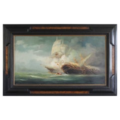
Naval Ship Combat Painting Framed Rudolf Claudus 1922
By Rudolf Claudus
Located in Sacile, PN
Rudolf Claudus is one of the most important European naval artist.
Born in 1893 in Austria, since his childhood cultivates a passion for visual art and the sea. At the end of the Fi...
Category
Vintage 1920s Italian Art Deco Paintings
Materials
Canvas, Wood
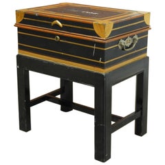
British Colonial Military Officer's Campaign Metal Field Desk
By Army & Navy CSL
Located in Rio Vista, CA
Rare British colonial officer's campaign field desk on stand. Constructed from metal and brass featuring a royal blue painted finish with gilt highlights. The top opens to a fitted i...
Category
Antique 19th Century English Campaign Desks
Materials
Metal, Brass
Pair of 18 Century Paintings of St Francis Xavier and St Carlo Borromeo
Located in Vancouver, British Columbia
A beautifully executed and rare complementary pair of oil on canvas paintings depicting two of the moist famous and important counter reformation catholic saints St Francis Xavier an...
Category
Antique Late 18th Century French Baroque Paintings
Materials
Canvas
Creamware Pottery Sailor's Farewell and Chinoiserie Punch Bowl
Located in Downingtown, PA
Creamware Pottery sailor's farewell punch bowl with Chinoiserie Scenes on Reverse,
Late 18th Century
The large polychrome creamware bowl has a scene to one side depicting a sailor'...
Category
Antique Late 18th Century English Georgian Serving Bowls
Materials
Creamware, Pottery
Pair of Large Lidded Royal Vienna Porcelain Vases
By Royal Vienna Porcelain
Located in London, GB
Pair of large lidded Royal Vienna porcelain vases
Austrian, 19th Century
Height 61cm, width 42cm, depth 19cm
This exceptional pair of vases combine an intriguing form with superb p...
Category
Antique 19th Century Austrian Neoclassical Vases
Materials
Porcelain
Antique Map of Gorée Island ‘Senegal’ by J.N. Bellin, 1764
Located in Langweer, NL
Nautical antique chart of Gorée Senegal including a letter key to the island's fortifications. Gorée is known as the location of the House of Slaves built by an Afro-French Métis fam...
Category
Antique Mid-18th Century Maps
Materials
Paper
Watercolor Painting of the Bellerophon, Dated 1855
Located in Downingtown, PA
The large watercolor picture depicts the Bellerophon sailing out to sea past South Sea Castle off Spithead. Figures can be seen on board. She flies the Blue Ensign, a Union Jack and ...
Category
Antique Mid-19th Century English Early Victorian Paintings
Materials
Paper
19th Century Nautical Chart of Martinique
Located in Norwell, MA
Original map of Martinique from 1887 with chartered waters around the island. Prepared from a French survey, completed in 1825, showing town, ports, rivers and tributaries. Published...
Category
Antique 19th Century Nautical Objects
Limoges 34 Pieces Tableware in Very Fine Porcelain by GOA
Located in Paris, FR
Limoges porcelain tableware by GOA. Very white fine porcelain decorated with small roses and basket weave motif with a gold rim.
Dinner plates (25 cm) - 12x
Soup plates (25 cm) - 9x...
Category
20th Century French Tableware
Materials
Porcelain
A silver Royal Navy racing cup presented by H.M.S. Curaçao
Located in Lymington, Hampshire
A silver Royal Navy racing cup presented by H.M.S. Curaçao, the spherical bowl with two square section handles, all raised on a knopped stem, inscribed on one side ‘Second Light Crui...
Category
Early 20th Century English Sterling Silver
Materials
Silver
Rainy Night in Rome
By Sir Muirhead Bone
Located in Fairlawn, OH
Rainy Night in Rome
Drypoint, 1913
Signed in pencil and titled in the lower margin by the artist
(see photo)
Provenance:
Kennedy Galleries, Stock # A6538
Reference; Doddgson 299 _/X
...
Category
1910s English School Landscape Prints
Materials
Drypoint
Seminal guide to the East and West Indies, with 42 coloured maps and plates
By Jan Huygen van Linschoten
Located in ZWIJNDRECHT, NL
Seminal guide to the East and West Indies, with 42 double-page and folding plates, including 6 maps, all engravings beautifully coloured by a contemporary hand
LINSCHOTEN, Jan Huygh...
Category
Antique Early 17th Century Dutch Dutch Colonial Books
Materials
Paper
Free Shipping
H 12.6 in W 8.27 in D 1.58 in
English Royal Navy Leather Gun Charge Carrier with Coat of Arms, Circa 1840
Located in Hollywood, SC
English Royal navy leather gun charge carrier with a centered coat of arms depicting lion and unicorn and the original tacked leather handle, Mid-19th century.
Category
Antique 1840s English William IV Arms, Armor and Weapons
Materials
Leather, Paint
British Sailor's Woolwork of Royal Navy Ship at Sea
Located in Downingtown, PA
British Sailor's Woolwork of Royal Navy Ship at Sea,
Circa 1870
The sailor's woolwork or woolie depicts a port side view of the Royal Navy frigate under full sail and flying the Whi...
Category
Antique 1860s English Folk Art Nautical Objects
Materials
Wool
Antique Print with Coastal Views of Goa, India, c.1775
Located in Langweer, NL
Antique print titled 'Vues diverses du Fort de l'Agouade pres de l'isle de Goa, sur la Côte de Malabar'. Beautiful print with nine coastal views near Goa in India and Sumatra.
Art...
Category
Antique 18th Century Prints
Materials
Paper
Original Antique Map showing Southern India, Northern Sri Lanka & Malabar, 1652
Located in Langweer, NL
Antique map titled 'Presqu'Isle de l'Inde deca le Gange (..)'.
Old map showing the southern part of India, including the northern part of Sri Lanka. With inset map of Southern In...
Category
Antique 1650s Maps
Materials
Paper
H 9.65 in W 13.19 in D 0 in
Recent Sales
Sea chart of Gulf of Saint Laurence and Belle Isle - Engraving - 18th century
Located in Zeeland, Noord-Brabant
detailed map of the Gulf of St. Laurence ...) Highly decorative sea chart / nautical map / maritime map of
Category
1750s Old Masters More Prints
Materials
Engraving
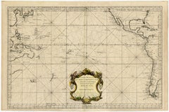
Highly decorative sea chart of the Pacific Ocean - Engraving - 18th century
By Jacques-Nicolas Bellin
Located in Zeeland, Noord-Brabant
apelees par les Navigateurs Mer du Sud ou Mer Pacifique [...]' - (Detailed map of Oceans between Asia and
Category
1750s Old Masters More Prints
Materials
Engraving
Sea chart of the Southern Atlantic Ocean - Engraving - 18th century
Located in Zeeland, Noord-Brabant
Southern Atlantic Ocean ...) Highly decorative sea chart / nautical map / maritime map of the South
Category
1750s Old Masters More Prints
Materials
Engraving
Sea chart of Santa Domingo and its surroundings - Engraving - 18th century
Located in Zeeland, Noord-Brabant
, to serve for the ships of the King.) Highly decorative sea chart / nautical map / maritime map of the
Category
1750s Old Masters More Prints
Materials
Engraving
View of the East River and Brooklyn Bridge, New York City, 1899
By Patrick O'Brien
Located in Stonington, CT
architecture and its growth. The artist consulted numerous old maps, prints, and photos, from sources such as
Category
21st Century and Contemporary American Realist Landscape Paintings
Materials
Oil
H 24 in W 36 in D 2 in
McKay's Ship Yard- The Launching of Clippership "Flying Cloud" in 1851
By Paul Garnett
Located in Stonington, CT
reproductions of old maps. There was the McKay Yard, and all the surrounding areas, in great detail as well as
Category
21st Century and Contemporary American Realist Landscape Paintings
Materials
Oil
H 24 in W 48 in D 2 in
Map of Nantucket by Austin Strong '1881-1952', circa 1925
Located in Nantucket, MA
Map of Nantucket by Austin Strong (1881 - 1952), circa 1925, an original print on paper whimsical
Category
Vintage 1920s American Folk Art Maps
Materials
Paper
"Costa Del Sol I" Multi Colored Target Painting with Luminous Effect
By Michael Hoffman
Located in Baltimore, MD
mixture and carve into before it sets. The geometrical markings bring to mind old nautical maps and
Category
2010s Abstract Abstract Paintings
Materials
Canvas, Oil, Panel
"Costa Del Sol IV" Multi Colored Target Painting with Luminous Effect
By Michael Hoffman
Located in Baltimore, MD
mixture and carve into before it sets. The geometrical markings bring to mind old nautical maps and
Category
2010s Abstract Abstract Paintings
Materials
Canvas, Oil, Panel
"Barcelona Summer Sun" Vibrant Red and Orange Abstract with Raised Texture
By Michael Hoffman
Located in Baltimore, MD
old nautical maps and celestial charts. I then apply multiple rounds of color washes (oil paints
Category
2010s Abstract Mixed Media
Materials
Mixed Media, Panel
"Oceanside Confluence" Multi Color Linear Abstract Painting
By Michael Hoffman
Located in Baltimore, MD
old nautical maps and celestial charts. I then apply multiple rounds of color washes (oil paints
Category
2010s Abstract Abstract Paintings
Materials
Canvas, Oil, Panel
"Costa Del Sol VII" Luminous Target Painting in Magenta, Orange and Blues
By Michael Hoffman
Located in Baltimore, MD
old nautical maps and celestial charts. I then apply multiple rounds of color washes (oil paints
Category
2010s Abstract Abstract Paintings
Materials
Canvas, Oil, Panel
"Web Target" Luminous Abstract with Raised Texture and Depth
By Michael Hoffman
Located in Baltimore, MD
old nautical maps and celestial charts. I then apply multiple rounds of color washes (oil paints
Category
2010s Abstract Mixed Media
Materials
Mixed Media, Panel
"Costa Del Sol VIII" Glowing Target Painting in Tranquil Blue Hues
By Michael Hoffman
Located in Baltimore, MD
mixture and carve into before it sets. The geometrical markings bring to mind old nautical maps and
Category
2010s Abstract Abstract Paintings
Materials
Canvas, Oil, Board
"Costa Del Sol X" Multi Colored Target Painting with Luminous Effect
By Michael Hoffman
Located in Baltimore, MD
mixture and carve into before it sets. The geometrical markings bring to mind old nautical maps and
Category
2010s Abstract Abstract Paintings
Materials
Canvas, Oil, Panel
"Costa Del Sol III" Luminous Target Painting in Orange, Green, Blue and Magenta
By Michael Hoffman
Located in Baltimore, MD
mixture and carve into before it sets. The geometrical markings bring to mind old nautical maps and
Category
2010s Abstract Abstract Paintings
Materials
Canvas, Oil, Board
"Summer Waves" Multi Colored Target Painting with Luminous Effect
By Michael Hoffman
Located in Baltimore, MD
mixture and carve into before it sets. The geometrical markings bring to mind old nautical maps and
Category
2010s Abstract Mixed Media
Materials
Mixed Media, Panel
Old Map of the Mariana Island, Guam and Saipan, 1752
Located in Langweer, NL
Générale des Voyages par le Sr. Bellin Ingr. de la Marine 1752'. A map of the northern Pacific Ocean
Category
Antique 1750s Maps
Materials
Paper
"Watercolor 1921 Map of Nantucket"
Located in Bristol, CT
1940s. He designed a map of Nantucket in 1921, the sale of which generated substantial funds for the
Category
1920s Landscape Drawings and Watercolors
Materials
Watercolor
Antique Print of the Island Brulante or Manam Motu Volcano, New Guinea, 1759
By Jacques-Nicolas Bellin
Located in Langweer, NL
Antique print titled 'Isle Brulante'. Old print of the volcano Island Brulante in the Indian Ocean
Category
Antique 18th Century Prints
Materials
Paper
H 10.08 in W 7.17 in D 0 in
Folk Art Sailfish
Located in West Palm Beach, FL
Fantastic folk art sailfish decoupaged in old maps, with aluminum fin.
Category
Vintage 1970s American Folk Art Nautical Objects
Get Updated with New Arrivals
Save "Old Nautical Maps", and we’ll notify you when there are new listings in this category.
More Ways To Browse
Mens Ring Nautical
Samoan Club
Whale Harpoon
Clipboard For Paper
Antique Map Of Puerto Rico
Antique Maps Of Puerto Rico
Antique Puerto Rico Map
Fish Diorama
Antique Cabinet 1750
Antique Maps Singapore
Taiwan Antique Map
Taiwan Map
Fulton Fish
Gambia Antique Map
Map Of Puerto Rico
Yacht Cannon
Revenue Cutter
Yacht Club Cannon
