Washington Antique Map

6
to
11
117
22
111
55
34
25
24
24
12
12
12
10
9
6
6
6
6
5
5
4
4
4
4
2
1
7
3
2
2
1
Sort By
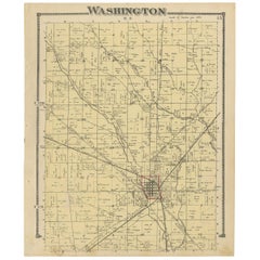
Antique Map of Washington County 'Ohio' by Titus, 1871
Located in Langweer, NL
Antique map titled 'Washington'. Original antique map of Washington, Ohio. This map originates from
Category

Late 19th Century Washington Antique Map

Materials

Paper

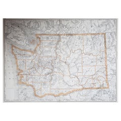
Large Original Antique Map of Washington, 'State', USA, 1894
By Rand McNally & Co.
Located in St Annes, Lancashire
Fabulous map of Washington. Original color. By Rand, McNally & Co. Published, 1894
Category

1890s American Washington Antique Map

Materials

Paper

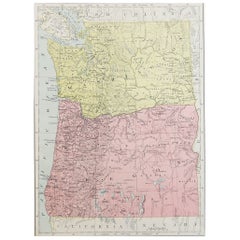
Original Antique Map of the American State of Washington, 1889
Located in St Annes, Lancashire
Great map of Washington Drawn and Engraved by W. & A.K. Johnston Published By A & C Black
Category

1880s Scottish Victorian Washington Antique Map

Materials

Paper

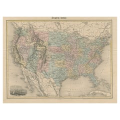
Antique Map of the United States with Vignette of Washington
Located in Langweer, NL
Antique map titled 'États-Unis'. A very attractive and detailed late 19th century map of the United
Category

Late 19th Century Washington Antique Map

Materials

Paper

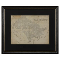
1840 Map of the City of Washington Published by William M. Morrison
Located in Colorado Springs, CO
This map, printed in 1840, is a detailed representation of Washington, D.C. in the mid-19th century
Category

1840s American Federal Washington Antique Map

Materials

Paper

1864 Map of North America, Antique Hand-Colored Map, by Adolphe Hippolyte Dufour
Located in Colorado Springs, CO
Offered is a map of North America entitled Amerique du Nord from 1864. This rare, separately
Category

1860s French Washington Antique Map

Materials

Paper

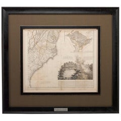
1812 United States Map, by Pierre Tardieu, Antique French Map Depicting the U.S.
By Pierre François Tardieu
Located in Colorado Springs, CO
Map by Tardieu This attractive map, published in Paris in 1812, is one of the most rare large
Category

1810s French Washington Antique Map

Materials

Paper

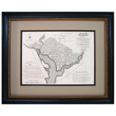
Plan for the City of Washington by Andrew Ellicott, Antique Print, 19th Century
Located in Colorado Springs, CO
Washington. Published by Thackara & Vallance, Philadelphia, 1792. Later impression printed on 19th century
Category

Late 19th Century American Washington Antique Map

Materials

Paper

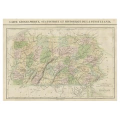
French Geographical, Statistical and Historical Map of Pensylvania, 1825
Located in Langweer, NL
and bottom. Prime meridians: Washington and Paris. A very interesting 1825 French hand-colored map
Category

1820s Washington Antique Map

Materials

Paper

Cortesi's Masterpiece: A Comprehensive and Authoritative Map of Uruguay, 1903
Located in Langweer, NL
Antique map titled 'Mapa de la Republica Oriental del Uruguay'. Large and detailed folding map of
Category

Early 20th Century Washington Antique Map

Materials

Paper

America "Amérique Septentrionale": A 19th Century French Map by Delamarche
By Maison Delamarche 1
Located in Alamo, CA
This framed mid 19th century map of North America entitled "Amérique Septentrionale" by Felix
Category

Mid-19th Century American Other Washington Antique Map

Materials

Paper

Antique Map of the United States ' South East ' by Johnston '1909'
Located in Langweer, NL
America ( South East Sheet ). With inset maps of New York, Washington and Cuba. This map originates from
Category

Early 20th Century Washington Antique Map

Materials

Paper

"The United States from the Latest Authorities" Antique Wall Map, 1835
Located in Colorado Springs, CO
This is a 1835 map of “The United States from the Latest Authorities” by Ezra Strong. A hand
Category

1830s American Washington Antique Map

Materials

Paper

1847 Ornamental Map of the United States & Mexico by H. Phelps
Located in Colorado Springs, CO
Offered is an original 1847 ornamental map of the U.S. entitled "Ornamental Map of the United
Category

1840s American Washington Antique Map

Materials

Paper

Antique Map of The United States of North America, Pacific States, 1882
Located in Langweer, NL
The map is from the same 1882 Blackie Atlas and focuses on the Pacific States of the United States
Category

1880s Washington Antique Map

Materials

Paper

1859 "Map of the United States of America..." by J. H. Colton
By J.H. Colton
Located in Colorado Springs, CO
includes the Washington Territory, Kansas Territory, and the new state of Minnesota. The map was updated
Category

1850s American Washington Antique Map

Materials

Paper

1847 “World at One View” Antique Hand-Colored Wall Map of the World
Located in Colorado Springs, CO
This is a highly desirable hanging wall map of the "World at One View", published in 1847 by Ensign
Category

19th Century American Washington Antique Map

Materials

Paper

1842 Wall Map of the United States by J. H. Young, Published by S. A. Mitchell
Located in Colorado Springs, CO
city map insets of the vicinities around Boston, New York, Philadelphia, Baltimore and Washington
Category

1840s American Washington Antique Map

Materials

Paper

1889 "The Pacific States and Territories"
Located in Colorado Springs, CO
Territories.” The vertical map depicts the Western states at the time: Washington, Oregon, California, Montana
Category

1880s American Washington Antique Map

Materials

Paper

1889 "The Pacific States and Territories"
H 16.25 in W 14.25 in D 1 in
1879 "United States of America, Western Part" by O. J. Stuart
Located in Colorado Springs, CO
This colorful original map, titled “United States of America, Western Part,” was issued in Volume
Category

1870s American Washington Antique Map

Materials

Paper

Mariners Chart of Quicks Hole and Tarpaulin Cove by George Eldridge 1901
Located in Norwell, MA
Washington Eldridge (1845-1912) were leading sea chart and sailing guide publishers from the mid 19th to the
Category

Early 1900s North American Washington Antique Map

Materials

Paper

Civil War Panorama of the Seat of War by John Bachmann, Antique Print circa 1864
Located in Colorado Springs, CO
of the Confederacy, and the southernmost areas of the Union, including Washington. This third issue
Category

1860s American Washington Antique Map

Materials

Paper

Original 1917 Railroad Map of Washington State railway map
Located in Spokane, WA
This is an Original Lithograph Vintage Railroad Map of Washington State; it is not a reproduction
Category

1910s Academic Washington Antique Map

Materials

Lithograph

Washington. USA. Century Atlas state antique vintage map
Located in Melbourne, Victoria
'The Century Atlas. Washington' Original antique map, 1903. Central fold as issued. Map name and
Category

Early 20th Century Victorian Washington Antique Map

Materials

Lithograph

American Revolution Map Drawn For John Marshall's "Life Of Washington" First Acc
Located in Bristol, CT
antique map from Marshall's Life of Washington, published 1846. Includes Cape Ann, the St. Lawrence River
Category

Early 1800s Washington Antique Map

Materials

Paper, Engraving

1861 Topographical Map of the District of Columbia, by Boschke, Antique Map
Located in Colorado Springs, CO
Washington D.C. by D. McClelland, Blanchard and Mohun. Boschke’s map is known for its highly accurate details
Category

1860s American Washington Antique Map

Materials

Paper

George Washington after the Painting by Rembrandt Peale, circa 1856
Located in Colorado Springs, CO
Presented is an original lithograph of George Washington, shown in three-quarter pose with formal
Category

1850s Washington Antique Map

Materials

Paper

Panorama of Washington Hand- Colored Engraving pub. by Charles Magnum 1860
Located in Paonia, CO
1860 Hand -colored engraving "Panorama of Washington D. C. published by Charles Magnus This is a
Category

1860s Other Art Style Washington Antique Map

Materials

Engraving

North America: A Framed Hand-colored 19th Century German Map by Adolph Stieler
By Adolf Stieler
Located in Alamo, CA
This framed early 19th century map of North America entitled "Nord-Amerika" is plate No. LIV (No
Category

1830s Washington Antique Map

Materials

Engraving

Plan Of The Northern Part Of New Jersey Showing The Positions Of The American &
By Richard Phillips
Located in Bristol, CT
After Crossing The North River in 1776 Map Sz: 9 7/8"H x 7 1/4"W Frame Sz: 18 5/8"H x 15 3/4"W
Category

Early 1800s Washington Antique Map

Materials

Lithograph

Antique Print of the World's Time Zones by Johnson, 1872
Located in Langweer, NL
& Washington'. Original print of the World's time zones. This map originates from 'Johnson's New Illustrated
Category

Late 19th Century Washington Antique Map

Materials

Paper

19th Century Nautical Chart of Martinique
Located in Norwell, MA
Original map of Martinique from 1887 with chartered waters around the island. Prepared from a
Category

19th Century Washington Antique Map

McClellan's Own Story by George B. McClellan, First Edition, 1887
Located in Colorado Springs, CO
. Illustrated with steel plate engravings and maps. Rebound in quarter navy leather and cloth boards, with
Category

1880s American Washington Antique Map

Materials

Leather, Paper

"Portrait of an Italian Fencer, " John Frederick Kensett, Hudson River School
By John Frederick Kensett
Located in New York, NY
engraver of labels, banknotes and maps and was employed part of that time by the American Bank Note Company
Category

1840s Hudson River School Washington Antique Map

Materials

Watercolor, Paper

Ecce Homo VII
By Werner Drewes
Located in Fairlawn, OH
career at Washington University in St. Louis. As an artist for over sixty five years, he employed
Category

1920s Expressionist Washington Antique Map

Materials

Woodcut

Ecce Homo Plate X
By Werner Drewes
Located in Fairlawn, OH
painting at Columbia and held two other positions: director of the WPA/FAP Graphic Arts Project and map
Category

1920s Bauhaus Washington Antique Map

Materials

Woodcut

'Lieutenant Crovers Despatch – Return of Governor Stevens to Fort Benton'
By John Mix Stanley
Located in Milwaukee, WI
Washington, DC: Baltimore, New York and London, but it has been lost. More than 200 of his paintings, maps
Category

1850s Romantic Washington Antique Map

Materials

Lithograph

'Victor's Camp - Hell Gate Ronde' original John Mix Stanley lithograph
By John Mix Stanley
Located in Milwaukee, WI
: to produce topographical maps, to document flora and fauna, and to document natural resources to
Category

1850s Romantic Washington Antique Map

Materials

Lithograph

'Kettle Falls, Columbia River' original color lithograph by John Mix Stanley
By John Mix Stanley
Located in Milwaukee, WI
: to produce topographical maps, to document flora and fauna, and to document natural resources to
Category

1850s Romantic Washington Antique Map

Materials

Lithograph

'Maple River' original color lithograph by John Mix Stanley
By John Mix Stanley
Located in Milwaukee, WI
: to produce topographical maps, to document flora and fauna, and to document natural resources to
Category

1850s Romantic Washington Antique Map

Materials

Lithograph

Harness Racer at Belmont Park 1884, Philadelphia
Located in Wiscasett, ME
and began working for the Haas firm in Washington D.C. producing lithographs. By 1840 Kollner had
Category

1880s Folk Art Washington Antique Map

Materials

Oil

"Harness Racer at Belmont Park 1884, Philadelphia" by Agustus Kollner
Located in Wiscasset, ME
States and began working for the Haas firm in Washington D.C. producing lithographs. By 1840 Kollner had
Category

1880s American Folk Art Washington Antique Map

Materials

Paint, Paper

'Camp Red River Hunters' original lithograph by John Mix Stanley
By John Mix Stanley
Located in Milwaukee, WI
: to produce topographical maps, to document flora and fauna, and to document natural resources to
Category

1850s Romantic Washington Antique Map

Materials

Lithograph

'Distribution of Goods to the Assiniboines' original John Mix Stanley lithograph
By John Mix Stanley
Located in Milwaukee, WI
: to produce topographical maps, to document flora and fauna, and to document natural resources to
Category

1850s Romantic Washington Antique Map

Materials

Lithograph

'Distribution of Goods to the Gros Ventres' lithograph by John Mix Stanley
By John Mix Stanley
Located in Milwaukee, WI
: to produce topographical maps, to document flora and fauna, and to document natural resources to
Category

1850s Romantic Washington Antique Map

Materials

Lithograph

Spring 69
By Nancy Genn
Located in San Francisco, CA
incorporates collaged fragments of maps and undecipherable scripts. Meanwhile, she continued to make use of a
Category

Early 20th Century Abstract Expressionist Washington Antique Map

Materials

Lithograph

Spring 69
Spring 69
H 23.75 in W 34.65 in D 0.01 in
Washington D.C. Map, 1795
By John Russell
Located in Houston, TX
This map is based on the 1792 plan published by Andrew Ellicott. This is one of nine maps published
Category

1790s Great Britain (UK) Washington Antique Map

Washington D.C. Map, 1795
H 25 in W 30 in D 1.5 in
Bird's-Eye View of Chicago, 1893
By Peter Roy
Located in Houston, TX
places including Washington Park, Chicago River and Grand Boulevard. The reverse side of the map displays
Category

1890s American Washington Antique Map

Bird's-Eye View of Chicago, 1893
H 16.53 in W 33.6 in D 0.2 in
1887 Engraving of Old World Buildings Framed
By George F. Cram
Located in Pataskala, OH
19th century side by side. The Washington Monument is the tallest one and many are places of worship
Category

1880s American Mid-Century Modern Washington Antique Map

Materials

Paper

Pair of American Globes on Cast Iron Stands
Located in London, Middlesex
/ Boston/ Josiah Loring, 136 Washington st. 1841' made up of twelve hand-colored engraved gores and two
Category

1830s American American Classical Washington Antique Map

Materials

Iron

Historic British Map of Fort Washington
By William Faden
Located in New York, NY
Revolutionary Wary, this map covers upper Manhattan, including the area now known as Washington Heights. Fort
Category

19th Century Other Art Style Washington Antique Map

Materials

Engraving

Map of Washington City District of Columbia Seat of the Federal Government
By Albert Boschke
Located in La Jolla, CA
Albert Boschke’s suppressed wall map of Washington City, District of Columbia. One of the most
Category

1850s American American Empire Washington Antique Map

Materials

Paper

"George Washington and His Family", circa 1864 Framed Lithograph
Located in Billerica, MA
entering on the far right. On the table is a map showing the plan for the city of Washington at the
Category

Mid-19th Century American American Colonial Washington Antique Map

Materials

Paper

Map of the American Revolution Siege of Yorktown
By Julius Bien
Located in New York, NY
Rare, original 1863 map by famous American lithographer Julius Bien entitled "A Plan of Yorktown
Category

1860s Realist Washington Antique Map

Materials

Lithograph

Rare Civil War Map of Part of South Eastern Virginia
Located in New York, NY
.) A damaged copy of this map is in the the Library of Congress Geography and Map Division Washington
Category

19th Century Realist Washington Antique Map

Materials

Lithograph

Map of City of New York and Island of Manhattan
By George Hayward
Located in New York, NY
"This Map of the City of New York and Island of Manhattan, as laid out by the Commissioners
Category

1850s Realist Washington Antique Map

Materials

Lithograph

Fortress Monroe, Old Point Comfort and Hygeia Hotel, VA
Located in New York, NY
encampments and hospitals in Baltimore and Washington, DC. Charles Magnus (1826 – 1900) was a printebased in
Category

1860s Realist Washington Antique Map

Materials

Lithograph

Spring in Central Park, Landscape by Laura Trevitte Horne (1891-1958, American)
Located in New York, NY
the Chinese Embassy in Washington DC. [1] This scene captures the idyllic serenity of a warm spring
Category

Early 20th Century American Impressionist Washington Antique Map

Materials

Oil

Painting of a Cotton Picker by William Aiken Walker
By William Aiken Walker
Located in Alexandria, VA
mainly of drawing maps and sketches of Charleston's defenses, until he was mustered out at the end of
Category

1870s American Washington Antique Map

Materials

Composition

1852 Magnus Map New York City, Brooklyn & Williamsburg, Hand-Colored Engraving
By Charles Magnus
Located in Vineyard Haven, MA
Magnus, C. [New York, 1852] Complete Map of the Cities of New York, Brooklyn and Williamsburgh. 18
Category

1850s American American Colonial Washington Antique Map

Materials

Paper

  • 1
Get Updated with New Arrivals
Save "Washington Antique Map", and we’ll notify you when there are new listings in this category.

Washington Antique Map For Sale on 1stDibs

Find many varieties of an authentic washington antique map available at 1stDibs. A washington antique map — often made from paper — can elevate any home. Whether you’re looking for an older or newer washington antique map, there are earlier versions available from the 18th Century and newer variations made as recently as the 20th Century. Many designers have produced at least one well-made washington antique map over the years, but those crafted by Rand McNally & Co. are often thought to be among the most beautiful.

How Much is a Washington Antique Map?

Prices for a washington antique map start at $195 and top out at $49,500 with the average selling for $2,895.

Read More

Pamela Shamshiri Shares the Secrets behind Her First-Ever Book and Its Effortlessly Cool Interiors

The sought-after designer worked with the team at Hoffman Creative to produce a monograph that beautifully showcases some of Studio Shamshiri's most inspiring projects.

Moroccan Artworks and Objects Take Center Stage in an Extraordinary Villa in Tangier

Italian writer and collector Umberto Pasti opens the doors to his remarkable cave of wonders in North Africa.

Montecito Has Drawn Royalty and Celebrities, and These Homes Are Proof of Its Allure

Hollywood A-listers, ex-pat aristocrats and art collectors and style setters of all stripes appreciate the allure of the coastal California hamlet — much on our minds after recent winter floods.

Whaam! Blam! Pow! — a New Book on Pop Art Packs a Punch

Publishing house Assouline and writer Julie Belcove have teamed up to trace the history of the genre, from Roy Lichtenstein, Andy Warhol and Yayoi Kusama to Mickalene Thomas and Jeff Koons.

The Sparkling Legacy of Tiffany & Co. Explained, One Jewel at a Time

A gorgeous new book celebrates — and memorializes — the iconic jeweler’s rich heritage.

What Makes a Gem-Encrusted Chess Set Worth $4 Million?

The world’s most opulent chess set, weighing in at 513 carats, is literally fit for a king and queen.

Tauba Auerbach’s Geometric Pop-Up Book Is Mighty Rare, Thanks to a Hurricane

This sculptural art book has an epic backstory of its own.

Step inside the Storied Mansions of Palm Beach’s Most Effervescent Architect

From Spanish-style courtyards to fanciful fountains, these acclaimed structures abound in surprising and elegant details.