Word Map
to
9
197
111
134
94
82
78
74
50
34
32
30
25
22
21
21
17
17
15
11
8
6
6
5
4
4
3
3
2
2
2
2
2
2
1
1
1
1
1
1
1
1
42
42
33
23
13
Sort By
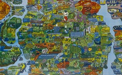
Section of Word Map-A Puzzle
By Oyvind Fahlstrom
Located in New York, NY
This lithograph by Oyvind Fahlstrom, produced in an edition of 100, is offered by CLAMP in New York City.
Category
1970s Contemporary Prints and Multiples
Materials
Lithograph
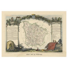
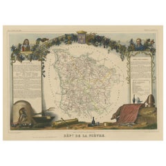
Old Map of the French Department of Nièvre, France
By Victor Levasseur
Located in Langweer, NL
Antique map titled 'Dept. de la Nièvre'. Map of the French department of Nievre, France. Part of
Category
Antique Mid-19th Century Maps
Materials
Paper
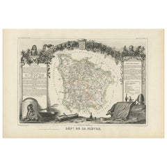
Antique Map of Nièvre ‘France’ by V. Levasseur, 1854
Located in Langweer, NL
Antique map titled 'Dépt. de la Nièvre'. Map of the French department of Nievre, France. Part of
Category
Antique Mid-19th Century Maps
Materials
Paper
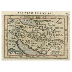
Original Antique Miniature Map of Persia, Published, ca.1601
Located in Langweer, NL
Antique miniature map titled 'Persia'. Small map of Persia published in the Epitome, or pocket
Category
Antique Early 1600s Maps
Materials
Paper
Hand Colored Antique Map of the Department of Nièvre, France
By Victor Levasseur
Located in Langweer, NL
Antique map titled 'Dept. de la Nièvre'. Map of the French department of Nievre, France. Part of
Category
Antique Mid-19th Century Maps
Materials
Paper
Antique Map of the French Province of Quercy, ca.1625
Located in Langweer, NL
3 volume collection of maps to which the word "Atlas" was applied the first time. The first volume
Category
Antique 17th Century Maps
Materials
Paper
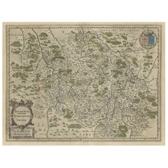
Old Map of the Bourbonnais Region of France, ca.1630
Located in Langweer, NL
collection of maps to which the word "Atlas" was applied the first time. The first volume was published 1585
Category
Antique 1630s Maps
Materials
Paper
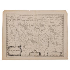
1627 Map Entitled "Loudunois, " Signed on the Back, Ric.a013
Located in Norton, MA
1627 map entitled
"Loudunois,"
Signed on the Back
Ric.a013
cartography close up double
Category
Antique 17th Century Dutch Maps
Materials
Paper
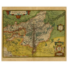
Antique Map of the Namen or Namur Region in Wallonia, Belgium
Located in Langweer, NL
first used the word "Atlas" as a name for a collection of maps, it is Ortelius who is remembered as the
Category
Antique 1610s Maps
Materials
Paper
Original Antique Map of the Region of Picardy, France, ca.1602
Located in Langweer, NL
the word "Atlas" as a name for a collection of maps, it is Ortelius who is remembered as the creator
Category
Antique Early 1600s Maps
Materials
Paper
Antique Map of The Dutch Provinces of Gelderland and Overijssel, 1623
Located in Langweer, NL
3 volume collection of maps to which the word "Atlas" was applied the first time. The first volume
Category
Antique 17th Century Maps
Materials
Paper
Antique Map of the Southern Lorraine Region by Mercator, c.1625
By Gerard Mercator
Located in Langweer, NL
major work, a 3 volume collection of maps to which the word "Atlas" was applied the first time. The
Category
Antique 17th Century Maps
Materials
Paper
Original Antique Map the Imperial States of the Habsburg Netherlands, 1609
Located in Langweer, NL
collection of maps to which the word "Atlas" was applied the first time. The first volume was published 1585
Category
Antique Early 1600s Maps
Materials
Paper
H 20.08 in W 25.2 in D 0 in
Early Antique Map of Gelderland and Overijssel in the Netherlands, c.1625
Located in Langweer, NL
3 volume collection of maps to which the word "Atlas" was applied the first time. The first volume
Category
Antique 17th Century Maps
Materials
Paper
H 15.75 in W 21.46 in D 0 in
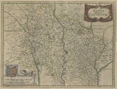
1625 Mercator Map of the Provenience of Quercy, "Quercy Cadvrcivm Ric.0013
Located in Norton, MA
1625 Mercator map of the provenience of Quercy, entitled
"Quercy Cadvrcivm,"
Ric.0013
Category
Antique 17th Century French Maps
Materials
Paper
H 18.9 in W 22.45 in D 0.4 in
Early Antique Map of the Dutch Provinces of Friesland and Groningen, 1604
Located in Langweer, NL
Ptolemy's Geographia. Followed by his major work, a 3 volume collection of maps to which the word "Atlas
Category
Antique Early 1600s Maps
Materials
Paper
H 16.93 in W 21.07 in D 0 in
One of the Earliest Maps of Gelderland and Overijssel in the Netherlands, 1623
Located in Langweer, NL
Antique map titled 'Geldria et Transysulana'.
One of the earliest maps of Gelderland and
Category
Antique 1620s Maps
Materials
Paper
H 18.31 in W 22.05 in D 0 in
Antique Map of the Region of Calais and The Vermandois Region by Ortelius
Located in Langweer, NL
Antique map titled 'Caletensium et Bononiensium (..) - Veromandorum eorum que confinium (..)'. Two
Category
Antique 17th Century Maps
Materials
Paper
H 17.33 in W 22.84 in D 0 in
Very Old Original Hand-Colored Map of the Basel Region, Switzerland, Ca.1578
Located in Langweer, NL
France. Although it is Mercator who first used the word "Atlas" as a name for a collection of maps, it is
Category
Antique 16th Century Maps
Materials
Paper
H 39 in W 27.3 in D 0.002 in
1948 "A Hysterical Map of Yellowstone National Park" by Jolly Lindgren, 2nd Ed.
Located in Colorado Springs, CO
the word “hysterical” in the title, over “historical,” as historical maps were also common souvenirs
Category
Vintage 1940s American Maps
Materials
Paper
H 20 in W 20 in D 0.75 in
Old Map of the Dutch Provinces of Friesland and Groningen, The Netherlands, 1604
Located in Langweer, NL
. Followed by his major work, a 3 volume collection of maps to which the word "Atlas" was applied the first
Category
Antique Early 1600s Maps
Materials
Paper
H 17.05 in W 21.15 in D 0 in
Antique Map - Map of Greece - Etching by Johannes Janssonius - 1650s
By Johannes Janssonius
Located in Roma, IT
Antique Map of Greece - Graecia Vniversa is an antique map realized in 1650 by Johannes Janssonius
Category
1650s Modern Figurative Prints
Materials
Etching
H 19.3 in W 23.23 in D 0.04 in
Ancient Map-Poli Arctici (Map of the Poles)-Etching by Johannes Janssonius-1650s
By Johannes Janssonius
Located in Roma, IT
Poli Arctici is an ancient map realized in 1650 by Johannes Janssonius (1588-1664).
The Map is a
Category
1650s Modern Figurative Prints
Materials
Etching
H 19.3 in W 23.23 in D 0.04 in
Map of the North of Scotland 17th century hand-coloured map by Gerardus Mercator
Located in London, GB
the word Atlas in reference to a book of maps. However, Mercator used it as a neologism for a treatise
Category
1680s Prints and Multiples
Materials
Engraving
Southerlandia Map - Etching by Johannes Janssonius - 1650
By Johannes Janssonius
Located in Roma, IT
Southerlandia Map is an ancient map realized in 1650 by Johannes Janssonius (1588-1664).
The Map
Category
1650s Modern Figurative Prints
Materials
Etching
H 18.9 in W 24.02 in D 0.04 in
Thesssalia Map - Etching by Johannes Janssonius - 1650s
By Johannes Janssonius
Located in Roma, IT
Thessalia Map is an ancient map realized in 1650 by Johannes Janssonius (1588-1664).
The Map is
Category
1650s Modern Figurative Prints
Materials
Etching
H 19.3 in W 23.23 in D 0.04 in
Ancient Map - Zeilan - Etching by Johannes Janssonius - 1650s
By Johannes Janssonius
Located in Roma, IT
Ancient Map - Zeilan is an ancient map realized in 1650 by Johannes Janssonius (1588-1664).
The
Category
1650s Modern Figurative Prints
Materials
Etching
H 19.3 in W 23.23 in D 0.04 in
Antique Map - Gallia - Etching by Johannes Janssonius - 1650s
By Johannes Janssonius
Located in Roma, IT
Antique Map - Gallia is an antique map realized in 1650 by Johannes Janssonius (1588-1664).
The
Category
1650s Modern Figurative Prints
Materials
Etching
H 19.3 in W 23.23 in D 0.04 in
Ancient Map - Macedonia - Etching by Johannes Janssonius - 1650s
By Johannes Janssonius
Located in Roma, IT
Macedonia is an ancient map realized in 1650 by Johannes Janssonius (1588-1664).
The Map is Hand
Category
1650s Modern Figurative Prints
Materials
Etching
H 19.3 in W 23.23 in D 0.04 in
Ancient Map - Dalmatia - Etching by Johannes Janssonius - 1650s
By Johannes Janssonius
Located in Roma, IT
Dalmatia is an ancient map realized in 1650 by Johannes Janssonius (1588-1664).
The Map is Hand
Category
1650s Modern Figurative Prints
Materials
Etching
H 19.3 in W 23.23 in D 0.04 in
Cambridgeshire map 17th century engraving by John Speed
By John Speed
Located in London, GB
."
John Speed (1551 or 1552 - 1629)
Map of Cambridgeshire
Engraving with later hand colouring
39 x 53 cm
Category
1610s Landscape Prints
Materials
Engraving
Cambridge map 17th century engraving after John Speed
By John Speed
Located in London, GB
."
Pieter van den Keere (1571 - circa 1646) after John Speed (1551 or 1552 - 1629)
Map of Cambridgeshire
Category
1620s Landscape Prints
Materials
Engraving
Antique Map - Archipela Meridionalis - Etching by Johannes Janssonius - 1650s
By Johannes Janssonius
Located in Roma, IT
Antique Map - Archipela Meridionalis is an antique map realized in 1650 by Johannes Janssonius
Category
1650s Modern Figurative Prints
Materials
Etching
H 19.3 in W 23.23 in D 0.04 in
Antique Map - Mare Pacificum - Etching by Johannes Janssonius - 1650s
By Johannes Janssonius
Located in Roma, IT
Mare Pacificum is an antique map realized in 1650 by Johannes Janssonius (1588-1664).
The Map is
Category
1650s Modern Figurative Prints
Materials
Etching
H 23.63 in W 19.3 in D 0.04 in
Map of Mar Del Nort - Etching by Johannes Janssonius - 1650s
By Johannes Janssonius
Located in Roma, IT
Antique Map -Mar Del Nort is an antique map realized in 1650 by Johannes Janssonius (1588-1664
Category
1650s Modern Figurative Prints
Materials
Etching
H 19.3 in W 23.23 in D 0.04 in
Antique Map - Mar Di Athiopia - Etching by Johannes Janssonius - 1650s
By Johannes Janssonius
Located in Roma, IT
Antique Map - Mar Di Athiopia is an antique map realized in 1650 by Johannes Janssonius (1588-1664
Category
1650s Modern Figurative Prints
Materials
Etching
H 19.3 in W 23.23 in D 0.04 in
Mare Mediterra - Neum (Map of Malta) - Etching by Johannes Janssonius - 1650s
By Johannes Janssonius
Located in Roma, IT
Mare Mediterra - Neum is an ancient map realized in 1650 by Johannes Janssonius (1588-1664).
Good
Category
1650s Modern Figurative Prints
Materials
Etching
H 18.71 in W 23.23 in D 0.04 in
Untitled Geneviève Seillé Contemporary art outsider art drawing animal color map
By Geneviève Seillé
Located in Paris, FR
, the word, like a sign, reigns supreme. An object of fascination, only its visual appearance counts and
Category
2010s Outsider Art Figurative Drawings and Watercolors
Materials
Paper, Color Pencil, Graphite
Untitled Geneviève Seillé Contemporary art outsider art drawing animal color map
By Geneviève Seillé
Located in Paris, FR
, the word, like a sign, reigns supreme. An object of fascination, only its visual appearance counts and
Category
Early 2000s Outsider Art Figurative Drawings and Watercolors
Materials
Paper, Color Pencil, Graphite
Rugen Island, Germany: An Early 17th Century Map by Mercator and Hondius
By Gerard Mercator
Located in Alamo, CA
word" atlas" was used to describe a collection of maps published in book form. His engraved title-page
Category
Early 17th Century Old Masters Landscape Prints
Materials
Engraving
Purple Perkins Over St. Croix - Octopus on Nautical Map, Gyotaku Style Print
By Jeff Conroy
Located in Chicago, IL
Japanese word translated from "gyo" meaning fish and "taku" meaning stone impression and is believed to get
Category
21st Century and Contemporary Contemporary Animal Drawings and Watercolors
Materials
Watercolor, Sumi Ink, Color Pencil
Floating Landscape 5362
Located in BARCELONA, ES
Floating landscapes (interdimensional maps)
I use the word landscape in a broad sense that
Category
2010s Abstract Paintings
Materials
Acrylic
Floating Landscape 5361
Located in BARCELONA, ES
Floating landscapes (interdimensional maps)
I use the word landscape in a broad sense that
Category
2010s Abstract Paintings
Materials
Acrylic
Floating Landscape 5500
Located in BARCELONA, ES
Floating landscapes (interdimensional maps)
I use the word landscape in a broad sense that
Category
2010s Abstract Paintings
Materials
Acrylic
Floating Landscape 5649
Located in BARCELONA, ES
Floating landscapes (interdimensional maps)
I use the word landscape in a broad sense that
Category
2010s Abstract Paintings
Materials
Acrylic
Floating Landscape 5652
Located in BARCELONA, ES
Floating landscapes (interdimensional maps)
I use the word landscape in a broad sense that
Category
2010s Abstract Paintings
Materials
Acrylic
Oceanus - Etching by Johannes Janssonius - 1650s
By Johannes Janssonius
Located in Roma, IT
Antique Map - Oceanus is an antique map realized in 1650 by Johannes Janssonius (1588-1664).
The
Category
1650s Modern Figurative Prints
Materials
Etching
H 19.3 in W 23.23 in D 0.04 in
Attica - Etching by Johannes Janssonius - 1650s
By Johannes Janssonius
Located in Roma, IT
Antique Map - Attica is an antique map realized in 1650 by Johannes Janssonius (1588-1664).
The
Category
1650s Modern Figurative Prints
Materials
Etching
H 23.63 in W 19.3 in D 0.04 in
Orbis Terrarum - Etching by Johannes Janssonius - 1650s
By Johannes Janssonius
Located in Roma, IT
Antique Map - Orbis Terrarum is an antique map realized in 1650 by Johannes Janssonius (1588-1664
Category
1650s Modern Figurative Prints
Materials
Etching
H 19.3 in W 23.23 in D 0.04 in
Golf of Benngala - Etching by Johannes Janssonius - 1650s
By Johannes Janssonius
Located in Roma, IT
Golfo De Benngala is an antique map realized in 1650 by Johannes Janssonius (1588-1664).
The Map
Category
1650s Modern Figurative Prints
Materials
Etching
H 19.3 in W 23.23 in D 0.04 in
Peloponnesvs (Greece) - Etching by Johannes Janssonius - 1650s
By Johannes Janssonius
Located in Roma, IT
Peloponnesvs is an antique map realized in 1650 by Johannes Janssonius (1588-1664).
The Map is
Category
1650s Modern Figurative Prints
Materials
Etching
H 19.3 in W 23.23 in D 0.04 in
Maris Mediterranei - Etching by Johannes Janssonius - 1650s
By Johannes Janssonius
Located in Roma, IT
Maris Mediterranei is an ancient map realized in 1650 by Johannes Janssonius (1588-1664).
The Map
Category
1650s Modern Figurative Prints
Materials
Etching
H 19.3 in W 23.23 in D 0.04 in
Anemogra Phica - Etching by Johannes Janssonius - 1650s
By Johannes Janssonius
Located in Roma, IT
Anemogra Phica is a rare ancient map realized in 1650 by Johannes Janssonius (1588-1664). First
Category
1650s Modern Figurative Prints
Materials
Etching
H 18.71 in W 23.23 in D 0.04 in
Antique Print of Haere Castle in Olst en Wijhe, Overijsel, The Netherlands, 1888
Located in Langweer, NL
pen en potlood (..)', by Jacobus Craandijk, published 1875-1888. This work is a description in word
Category
Antique 19th Century Prints
Materials
Paper
H 10.24 in W 7.09 in D 0 in
Intervened photography, art, Mexican design " Primera Derrota" by Sumie García
Located in Ciudad de México, CDMX
." Interestingly, in English, a literal translation of this word is "defeat." However, delving deeper, this
Category
2010s Mexican Decorative Art
Materials
Gold, Brass
H 19.69 in W 13.78 in D 3.94 in
Antique Print of a Landscape in Drenthe with Sheep and a Hunnebed, 1880
Located in Langweer, NL
, published 1875-1888. This work is a description in word and image of 73 walks Craandijk made in the
Category
Antique 19th Century Prints
Materials
Paper
Old Print of Castles & Other Views between Zwolle & Deventer, The Netherlands
Located in Langweer, NL
pen en potlood (..)', by Jacobus Craandijk, published 1875-1888. This work is a description in word
Category
Antique 19th Century Prints
Materials
Paper
H 10.24 in W 7.09 in D 0 in
CARTE - Large rectangular wall sculpture
By ENNAIA
Located in Weslaco, TX
“Carte” is the French word for map. This piece, light in appearance as a large sheet of paper
Category
2010s Contemporary Sculptures
Materials
Steel, Stainless Steel
Amstelredam - Etching by Johannes Janssonius - 1650s
By Johannes Janssonius
Located in Roma, IT
Amstelredam is an ancient map realized in 1650 by Johannes Janssonius (1588-1664).
Good conditions
Category
1650s Modern Figurative Prints
Materials
Etching
H 18.71 in W 23.23 in D 0.04 in
- 1
Get Updated with New Arrivals
Save "Word Map", and we’ll notify you when there are new listings in this category.
Word Map For Sale on 1stDibs
You are likely to find exactly the word map you’re looking for on 1stDibs, as there is a broad range for sale. In our selection of items, you can find modern examples as well as a contemporary version. Making the right choice when shopping for a word map may mean carefully reviewing examples of this item dating from different eras — you can find an early iteration of this piece from the 18th Century and a newer version made as recently as the 21st Century. When looking for the right word map for your space, you can search on 1stDibs by color — popular works were created in bold and neutral palettes with elements of gray, beige, black and purple. There have been many interesting word map examples over the years, but those made by (after) Henri Matisse, Henri Matisse, David Burdeny, Gerard Mercator and Marc Quinn are often thought to be among the most thought-provoking. Artworks like these — often created in lithograph, paper and pigment print — can elevate any room of your home.
How Much is a Word Map?
The price for an artwork of this kind can differ depending upon size, time period and other attributes — a word map in our inventory may begin at $13 and can go as high as $80,000, while the average can fetch as much as $1,404.
More Ways To Browse
Caucasus Map
Congo Antique Map
Filigree Judaica
Gum Ball Machine
Frontier Map
Holy English Bible
Wisconsin Map
King Saud
Catholic Candelabra
Idaho Map
Laughing Boy
Antique Middle Eastern Daggers
Grayson Perry Plate
Russian Orthodox Christian
Ancient Map Of Jerusalem
Modern Turkish Tea Set
Marcel Bever
Gold Letter M Brooch
