Maps Of Venice
3
to
23
235
94
138
123
92
81
63
38
35
28
27
19
16
16
14
13
13
13
10
9
9
7
7
7
6
5
5
5
3
3
2
2
2
2
2
1
1
1
1
1
1
1
1
1
1
1
54
42
42
16
5
Sort By
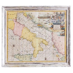
Antique Hand-Coloured Map of Venice with Vintage Frame, Italy, Late 18th Century
Located in Copenhagen K, DK
Italy, late 18th Century
Antique hand-coloured map of Venice.
Measures: H 52 x W 59 cm.
Category
Antique Late 18th Century Italian Decorative Art
Materials
Other
H 23.23 in W 20.48 in D 1.19 in
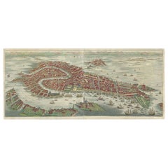
Stunning Decorative Antique Map of Venice in Italy, ca.1787
Located in Langweer, NL
Title: Piano elevato dell'inclita città di Venezia
Bird's-eye view (etching) of Venice.
Print
Category
Antique Late 18th Century Maps
Materials
Paper
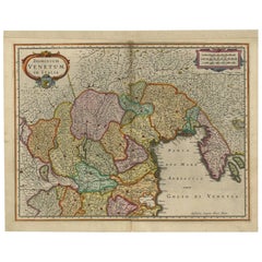
Antique Map of the Region of Venice, Italy by F. De Wit, circa 1700
Located in Langweer, NL
Antique map of the Dominion of Venice, extending from Stato di Milano and Genoa to Istria
Category
Antique Early 18th Century Maps
Materials
Paper
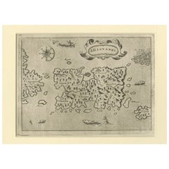
Early Map of Puerto Rico Printed in Venice by G. F. Camocio in 1571
Located in Langweer, NL
Title: S.Giovanni
Publication Info: Venice
Date: 1572
Place created: Venice
Marvelous example of
Category
Antique 16th Century Maps
Materials
Paper
Free Shipping
H 4.34 in W 5.91 in D 0.01 in
Antique Map of the Area Around Venice in Italy by H. Hondius, circa 1606
By Gerard Mercator, Jodocus Hondius
Located in Langweer, NL
Attractive and early map of the area around Venice, Italy. With South-Tirol in the North, areas of
Category
Antique Early 17th Century Maps
Materials
Paper
H 16.93 in W 21.26 in D 0.02 in
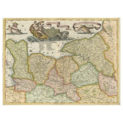
Decorative Original Antique Map of Normandy, France
Located in Langweer, NL
Original antique map titled 'Ducato D'Normandie Scala di Miglia d'Italia'. Very decorative map of
Category
Antique Late 17th Century Maps
Materials
Paper
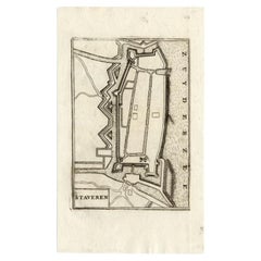
Antique Map of Stavoren by Coronelli, 1706
Located in Langweer, NL
Antique map titled 'Staveren'. Rare antique map of the city of Stavoren, Friesland, the Netherlands
Category
Antique 18th Century Maps
Materials
Paper
Antique Map of the Province of Limburg by Coronelli, 1692
Located in Langweer, NL
Antique map titled 'Ducea di Limburgo (..)'. Beautiful map of the Dutch province of Limburg
Category
Antique 17th Century Maps
Materials
Paper
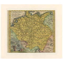
Antique Map of Germany by Hederichs 'circa 1740'
Located in Langweer, NL
Venice and from Holland and Belgium to Poland. This map originates from 'Anleitung Zu den fürnehmsten
Category
Antique Mid-18th Century Maps
Materials
Paper
Antique Map of the Region of Dauphiné by Zatta, 1779
Located in Langweer, NL
publisher of the late 18th and early 19th century. His firm, based in Venice, produced maps that mark an
Category
Antique 18th Century Maps
Materials
Paper
Antique Map of the Region of Liege by Coronelli, 1690
By Vincenzo Coronelli
Located in Langweer, NL
Antique map titled 'Vescovato di Liege (..)'. Map of the Belgium area centered on Liege and the
Category
Antique 17th Century Maps
Materials
Paper
17th Century Nicolas Visscher Map of Southeastern Europe
Located in Hamilton, Ontario
A beautiful, highly detailed map of southeastern Europe by Nicolas Visscher. Includes regions of
Category
Antique 17th Century Dutch Maps
Materials
Paper
Antique Map of Northern Italy by Cluver, 1685
Located in Langweer, NL
Antique map titled 'Histri, Carni, Veneti item Rhaetiae Pars.' Charming miniature map of northern
Category
Antique 17th Century Maps
Materials
Paper
Antique Map of the Basin of the Mediterranean by Johnston '1909'
Located in Langweer, NL
Mediterranean. With inset maps of the Strait of Gibraltar, Morocco, Maltese Islands, Valetta, Venice and
Category
Early 20th Century Maps
Materials
Paper
Decorative Original Antique Map of the North of Flanders, Belgium, 1697
Located in Langweer, NL
Antique map titled 'Fiandra Parte Occidentale (..)'.
Depicts northern part of Flanders, from
Category
Antique 1690s Maps
Materials
Paper
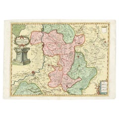
Antique Map of the Province of Overijssel by Coronelli, c.1692
Located in Langweer, NL
Antique map titled 'Tran-siselana' Splendid detailed and decorative map of the province of
Category
Antique 17th Century Maps
Materials
Paper
Antique Map of Madagascar by N. Sanson, circa 1680
By Nicolas Sanson
Located in Langweer, NL
Antique map titled 'Isle de Madagascar ou de St. Laurens. Tiree de Sanutu &c'. Antique map of
Category
Antique Late 17th Century Maps
Materials
Paper
Original Copper Engraving of a Map of Syria and Lebanon, 1698
Located in Langweer, NL
Antique map titled 'Syriae, sive Soriae, Nova et Accurata Descriptio.'
Map of Syria and Lebanon
Category
Antique 1690s Maps
Materials
Paper
Free Shipping
H 12.41 in W 14.45 in D 0 in
Antique Map of the Province of Zeeland, The Netherlands by Coronelli, 1692
Located in Langweer, NL
Antique map titled 'Contado di Zelanda'. Beautiful map of the Dutch province of Zeeland. With the
Category
Antique 17th Century Maps
Materials
Paper
H 18.9 in W 26.78 in D 0 in
Antique Map of the Region of Brie and Champagne by Zatta, 1779
Located in Langweer, NL
19th century. His firm, based in Venice, produced maps that mark an important transition from 18th to
Category
Antique 18th Century Maps
Materials
Paper
Antique Map of the Region of Poitou and Saintonge by Zatta (1779)
Located in Langweer, NL
in Venice, produced maps that mark an important transition from 18th to 19th century cartographic
Category
Antique 18th Century Maps
Materials
Paper
Antique Map of India and Ceylon, along with the Maldives
Located in Langweer, NL
Antique map titled 'Stato del Mogol con l'Isole di Ceilan e Maldive'. Beautiful map of India and
Category
Antique Late 18th Century Maps
Materials
Paper
Antique Map of Northern England and Wales by Zatta, 1784
Located in Langweer, NL
Italian map publisher of the late 18th and early 19th century. His firm, based in Venice, produced maps
Category
Antique 18th Century Maps
Materials
Paper
Antique Map of Southern England and Wales by Zatta, 1784
Located in Langweer, NL
publisher of the late 18th and early 19th century. His firm, based in Venice, produced maps that mark an
Category
Antique 18th Century Maps
Materials
Paper
Antique Map of the course of the Rhine from Lahnstein to Rheinkassel, Germany
Located in Langweer, NL
Antique map titled 'Parte meridionale degli Stati dell 'Elet di Colonia'. This map shows the course
Category
Antique Late 17th Century Maps
Materials
Paper
H 18.78 in W 25.71 in D 0.02 in
Antique Map of Northern Italy by J. Tallis, circa 1851
Located in Langweer, NL
A highly decorative mid-19th century map of Northern Italy which was drawn and engraved by John
Category
Antique Mid-19th Century Maps
Materials
Paper
Antique Map of Northern Italy by Homann Heirs, c.1730
Located in Langweer, NL
map of northern Italy by J. B. Homann. This map shows Venice and its adjacent states Parma, Modena
Category
Antique 18th Century Maps
Materials
Paper
Antique Map of the Region of Languedoc, Foix, Roussillon and Rouergue by Zatta
By Antonio Zatta
Located in Langweer, NL
Italian map publisher of the late 18th and early 19th century. His firm, based in Venice, produced maps
Category
Antique 18th Century Maps
Materials
Paper
H 20.67 in W 14.97 in D 0 in
Splendid Detailed Map of the Province of Overijssel in the Netherlands, ca.1692
Located in Langweer, NL
Antique map titled 'Tran-siselana'. Splendid detailed and decorative map of the province of
Category
Antique 1690s Maps
Materials
Paper
H 18.63 in W 25.6 in D 0 in
Original Antique Map of Brasil, Published in the 16th Century, 1561
Located in Langweer, NL
This important Ruscelli map of Brazil, from his work La Geografia di Claudio Tolomeo Alessandrino
Category
Antique 1660s Maps
Materials
Paper
No Reserve
H 8.67 in W 11.82 in D 0 in
Original Antique Map of the Philippines, Malaysia, Indonesia, Singapore, c.1690
Located in Langweer, NL
Antique map titled 'Isole dell' Indie, diuise in Filippine, Molucche e della Sonda'.
Old map of
Category
Antique 1690s Maps
Materials
Paper
Free Shipping
H 19.49 in W 27.56 in D 0 in
Antique Map of Italy, North Part, by W. G. Blackie, 1859
Located in Langweer, NL
The "Antique Map of Italy, North Part" by W. G. Blackie, dated 1859, is a historically significant
Category
Antique Mid-19th Century Maps
Materials
Paper
Antique Map of the Cape Verde Islands and Part of Senegal, West Africa, 1690
Located in Langweer, NL
Antique map titled 'Bocche del Fivme Negro et Isole di Capo Verde'. Beautiful double-page map of
Category
Antique 17th Century Maps
Materials
Paper
No Reserve
H 18.9 in W 25.99 in D 0 in
Detailed Antique Map of Western Belgium and Eastern France by Coronelli, 1690
By Vincenzo Coronelli
Located in Langweer, NL
Antique map titled 'Contado d'Hannonia (..)'. Map of western Belgium and eastern France, from south
Category
Antique 17th Century Maps
Materials
Paper
H 18.9 in W 26.58 in D 0 in
Antique Map of the Namur Region in France by Coronelli, c.1695
By Vincenzo Coronelli
Located in Langweer, NL
Antique map titled 'Contado di Namur (..)'. Old map of the Namur region in central Belgium
Category
Antique 17th Century Maps
Materials
Paper
Very Old Antique Map of the Persian Empire by Magini, c.1597
Located in Langweer, NL
Antique map titled 'Persiae Regnum sive Sophorum Imperium'. Old map of the Persian Empire. This map
Category
Antique 16th Century Maps
Materials
Paper
Antique Map of the Banda Islands or Spice Islands, Moluccas, Indonesia, 1697
Located in Langweer, NL
Antique map titled 'Isole di Banda Nelle Molucche'.
Engraved map of Isola di Banda, Nelle
Category
Antique 17th Century Maps
Materials
Paper
H 18.9 in W 13 in D 0 in
Stunning Antique Map of Northern Italy by J.B. Homann, circa 1745
By Johann Baptist Homann
Located in Langweer, NL
Mirandol. The map depicts the Veneto region and its vicinity during the decline of the Republic of Venice
Category
Antique Mid-18th Century Maps
Materials
Paper
Antique Copper Engraved Map of Germany in the Early 18th Century, c.1740
Located in Langweer, NL
Antique map Germany titled 'Allemagne'.
Rare miniature map of Germany and surroundings. Also
Category
Antique 18th Century Maps
Materials
Paper
Antique Map of Oceania and the Pacific Ocean, Australia and New Zealand, 1826
Located in Langweer, NL
Geneva, Venice, and Rome. Walch published several atlases and sheet maps. As with his atlases, many of
Category
Antique 19th Century Maps
Materials
Paper
H 8.47 in W 9.85 in D 0 in
Antique Detailed Map of Jerusalem in Israël with Extensive Key and Scale, 1698
Located in Langweer, NL
Antique map titled 'Jerusalem.'
Plan of the ancient city of Jerusalem. With extensive key and
Category
Antique 17th Century Maps
Materials
Paper
H 15.16 in W 12.01 in D 0 in
Italy, Sicily, Sardinia, Corsica and Dalmatian Coast: A 17th Century Dutch Map
By Theodorus Danckerts
Located in Alamo, CA
This hand colored 17th century Dutch map entitled "Novissima et Accuratissima totius Italiae
Category
Antique Late 17th Century Dutch Maps
Materials
Paper
H 18.13 in W 31.25 in D 1.38 in
Southern Greece: A Large 17th C. Hand-colored Map by Sanson and Jaillot
By Nicolas Sanson
Located in Alamo, CA
This large original hand-colored copperplate engraved map of southern Greece and the Pelopponese
Category
Antique 1690s French Maps
Materials
Paper
Late 16th Century Sheet with Copper Engravings of India, Pakistan, etc, 1598
Located in Langweer, NL
Undecicima Asiae (11)
Published in: Venice
Date: 1598
Measurements:
Map size: Ca. 12,5 x 17 cm (ca. 4.9
Category
Antique 16th Century Maps
Materials
Paper
H 11.82 in W 8.08 in D 0 in
Atlas of Fernão Vaz Dourado / One-Time Only Limited Edition Facsimile
Located in BARCELONA, ES
tanned leather.
In the mid-16th century, while Rome, Venice, Leuven and Antwerp printed hundreds of
Category
2010s Portuguese Renaissance Maps
Materials
Leather
Free Shipping
H 23.23 in W 16.54 in D 2.37 in
Panoramic Antique View of Bandar-Abbas 'Formerly Gamron, Persia' in Iran, 1714
Located in Langweer, NL
Westerners. After an eight-year stay in Venice, Le Bruyn returned to The Hague in 1693 to publish this first
Category
Antique 1710s Maps
Materials
Paper
H 6.7 in W 15.16 in D 0 in
21st Century Venezia Cabinet Lacquered Wood Brass by Malabar
Located in RIO TINTO, PT
canals, this piece shares the mysterious map of Venice, full of hidden treasures and breathtaking places
Category
21st Century and Contemporary Portuguese Cabinets
Materials
Brass
Venice, Italy. Antique Map City Plan Chromolithograph, circa 1895
Located in Melbourne, Victoria
plan of Venice, Italy. Three vertical folds as issued. Street index printed on the reverse of the sheet
Category
Late 19th Century Victorian More Prints
Materials
Lithograph
Huge Mid 19th century Six Panels Venice Map Engraving
Located in IT
Perspective view of Venice in the 1500s by Jacopo de Barbari. Re-edition of the original . this is
Category
Antique Mid-19th Century Italian Prints
Materials
Paper
A Series of Historical Maps of Italian Cities
Located in New York, NY
interesting. Each is a charming reinterpretation of historical city maps (Rome, Venice and Florence). We love
Category
20th Century Italian Prints
Materials
Paper
Map of Ancient Greece - Original Etching by Antonio Zatta - 1785
Located in Roma, IT
This Map of ancient Greek is an etching realized by Antonio Zatta in Venice in 1785.
The state of
Category
1770s Landscape Prints
Materials
Etching
H 16.54 in W 12.8 in D 0.04 in
Map of Nubia and Abissinia - Original Etching by Antonio Zatta - 1784
Located in Roma, IT
This Map of Nubia and Abissinia is an etching realized by Antonio Zatta in Venice in 1784.
The
Category
1770s Landscape Prints
Materials
Etching
H 12.84 in W 16.54 in D 0.04 in
Map of Lymosin-Perigord-Quercye - Original Etching by Antonio Zatta - 1776
Located in Roma, IT
This Map of Lymosin-Perigord-Quercy is an etching realized by Antonio Zatta in Venice in 1776.
The
Category
1770s Figurative Prints
Materials
Etching
H 16.54 in W 12.6 in D 0.04 in
Tar Paint Map, Orev-Raven
By Ken Goldman
Located in Surfside, FL
Biennial of Jewish art Jerusalem Israel
2013 - Golden Ghetto of Venice - competition- second prize
2013
Category
21st Century and Contemporary Contemporary Photography
Materials
Digital
17th Century Dutch Map of Italy, Sicily, Sardinia, Corsica and Dalmatian Coast
By Theodorus Danckerts
Located in Alamo, CA
This hand colored 17th century Dutch map entitled "Novissima et Accuratissima totius Italiae
Category
1690s Prints and Multiples
Materials
Engraving
H 18.13 in W 31.25 in D 1.38 in
Li Governi di Borgogna - Ancient Map - 1777
Located in Roma, IT
Venice, 1777.
Original Title: Li Governi di Borgogna della Franca Contea e del Lyonois di nuova
Category
1770s Modern Landscape Prints
Materials
Etching
View of Seravalle, Italy: A 16th Century Hand-colored Map by Braun & Hogenberg
By Franz Hogenberg
Located in Alamo, CA
.
The map depicts a view of Seravalle, now Vittorio Veneto, in San Marino, Italy, north of Venice, in a
Category
16th Century Old Masters Landscape Prints
Materials
Engraving
Map Tabula Asiae IX Pakistan Afghanistan Iran Indian Ocean
Located in Florham Park, NJ
“Tabula Asiae IX
Pakistan, Afghanistan, E. Iran”
Girolamo Ruscelli (1504 – 1566)
Venice, 1561
V
Category
16th Century Realist Prints and Multiples
Materials
Copper
H 16.75 in W 19 in D 2 in
Tar Paint Map Etrog, Large Scale Contemporary Judaica Photograph
By Ken Goldman
Located in Surfside, FL
Biennial of Jewish art Jerusalem Israel
2013 - Golden Ghetto of Venice - competition- second prize
2013
Category
21st Century and Contemporary Contemporary Photography
Materials
Digital
Southern Greece: A Large 17th Century Hand-colored Map By Sanson and Jaillot
By Nicholas Sanson d'Abbeville
Located in Alamo, CA
This large original hand-colored copperplate engraved map of southern Greece and the Pelopponese
Category
1690s Landscape Prints
Materials
Engraving
- 1
Get Updated with New Arrivals
Save "Maps Of Venice", and we’ll notify you when there are new listings in this category.
Maps Of Venice For Sale on 1stDibs
At 1stDibs, there are many versions of the ideal maps of venice for your home. Each maps of venice for sale was constructed with extraordinary care, often using paper, metal and wood. There are 42 variations of the antique or vintage maps of venice you’re looking for, while we also have 1 modern editions of this piece to choose from as well. Whether you’re looking for an older or newer maps of venice, there are earlier versions available from the 18th Century and newer variations made as recently as the 21st Century. Each maps of venice bearing neoclassical hallmarks is very popular. Many designers have produced at least one well-made maps of venice over the years, but those crafted by Antonio Zatta, Nicolas Sanson and Vincenzo Coronelli are often thought to be among the most beautiful.
How Much is a Maps Of Venice?
Prices for a maps of venice can differ depending upon size, time period and other attributes — at 1stDibs, they begin at $59 and can go as high as $21,945, while the average can fetch as much as $975.
More Ways To Browse
Antique Small Wooden Chest
Large Iron Bell
1940s French Wooden Table
Antique Wood Bed Side Table
Side Table White Wood Sculptural
Maison Charles Flower
Italian Antique Bed Frame
German Industrial Clock
Metal Base Recliner
Hand Painted Japanese Tea Set
Antique Spanish Armchair
Mid 20 Century Night Stands
Drum Table Blue
Japanese Hand Painted Tea Sets
Fragment Side Table
Sea Glass Mirror
Auguste Jean Glass
Design Within Reach Table
