Vintage Map
19
to
184
1,686
1,436
3,202
1,928
775
509
385
356
314
297
158
151
59
46
40
40
39
Sort By
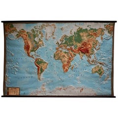
World Relief Map
Located in Antwerp, BE
Large world relief map.
Measures: Width 232 cm.
Height 158 cm.
Category
Mid-20th Century German Mid-Century Modern Vintage Map
Materials
Acrylic
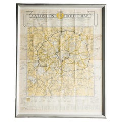
London AA Map
Located in Alton, GB
London AA map.
Category
20th Century Vintage Map
Materials
Paper
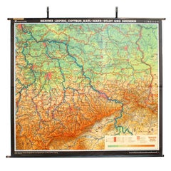
East German Map
By VEB Hermann Haack
Located in Baltimore, MD
A brilliantly colourful map of the Leipzig, Karl Marx Stadt and Dresden area in the former German
Category
1970s German Vintage Map
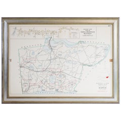
Map of Harwich, Massachusetts
Located in Norwell, MA
Turn of the century map of Harwich, Massachusetts. Plate from a Cape Cod County Map book showing
Category
20th Century Vintage Map
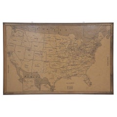
Vintage Framed United States Map
Located in New York, NY
Vintage aged paper map of the United States mounted on particle board and framed in a simple wooden
Category
20th Century American Mid-Century Modern Vintage Map
Materials
Wood, Paper
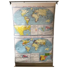
1967 World Exploration School Map
Located in Tarrytown, NY
Pull down world exploration map from 1967.
Category
1960s Vintage Map
Materials
Paper
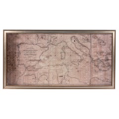
Large Framed Map of the Mediterranean
Located in New York, NY
Large map/chart chart of The Mediterranean and the Grecian Archipelago showing Italy, Sardinia
Category
20th Century French Mid-Century Modern Vintage Map
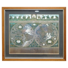
World Map Silver Leaf Print Based on Original Willem Blaeu Wall Map 1571-1638
Located in GB
We are delighted to offer for sale this lovely Antique style pictorial plan map of the globe based
Category
20th Century English Campaign Vintage Map
Materials
Silver Leaf
H 22.05 in W 25.6 in D 0.99 in
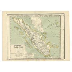
Antique Map of West Sumatra, Indonesia, 1900
Located in Langweer, NL
Antique map titled 'Sumatra, Bangka, Blitoeng en de Riouw-Archipel'. Old map of West Sumatra
Category
20th Century Vintage Map
Materials
Paper
Eason's War Map of Europe, circa 1914
Located in Langweer, NL
Antique map titled 'Eason's War Map of Europe'. Printed in Ireland. Source unknown, to be
Category
20th Century Vintage Map
Materials
Paper
Antique Political Map of Eastern China, 1922
Located in Langweer, NL
Antique map of China titled 'Eastern China - Political Map'. Old map of eastern China depicting
Category
20th Century Vintage Map
Materials
Paper
Huge Europe and Asia Vintage Wall Map
Located in San Diego, CA
A huge Europe and Asia vintage wall map, circa 1950s. The map is in fair vintage condition and
Category
Mid-20th Century American Vintage Map
Materials
Paper
French School Map of Uk, Double-Sided
Located in Alton, GB
Map of the UK in french made for schools from the 20th century.
Category
20th Century Vintage Map
Materials
Paper
Antique Folding Map of Kyoto, Japan, 1920
Located in Langweer, NL
Antique folding map of Kyoto, Japan. On the verso of this map photos of buildings, other structures
Category
20th Century Vintage Map
Materials
Paper
Vintage Road Map of the Netherlands '1928'
Located in Langweer, NL
Vintage map titled 'Volgens het vijfjarig Werkplan te verbeteren Rijkswegen en nieuw aan te leggen
Category
20th Century Vintage Map
Materials
Paper
Antique Map of Padang, Sumatra, Indonesia, 1900
Located in Langweer, NL
Antique map titled 'De Padangsche Beneden-en Bovenlanden van de Koninginnedbaai tot Fort de Kock
Category
20th Century Vintage Map
Materials
Paper
Antique Map of Korea by Kozaki, 1903
Located in Langweer, NL
Old map of Korea by S. Kozaki. Restored and mounted.
Category
20th Century Vintage Map
Materials
Paper
German Antique Map of Southeastern Australia, 1904
Located in Langweer, NL
This large antique map is taken from; 'Andrees Allgemeiner Handatlas in 126 Haupt-Und 139
Category
20th Century Vintage Map
Materials
Paper
Antique Map of West Kalimantan, Borneo, Indonesia, 1900
Located in Langweer, NL
Antique map titled 'Borneo en Belitoeng'. Old map of West Kalimantan, Borneo. This map originates
Category
20th Century Vintage Map
Materials
Paper
Antique Map of Part of Java, Indonesia, 1900
Located in Langweer, NL
Antique map of West Java. This map originates from 'Atlas van Nederlandsch Oost- en West-Indië' by
Category
20th Century Vintage Map
Materials
Paper
Antique Political Map of the Japanese Empire, 1922
Located in Langweer, NL
Antique map of Japan titled 'Japanese Empire - Political Map'. Old map of Japan depicting Japan
Category
20th Century Vintage Map
Materials
Paper
Antique Map of the Mentawai Islands, Sumatra, 1900
Located in Langweer, NL
Antique map of the Mentawai Islands, Sumatra. Also depicting the region of Padang. This map
Category
20th Century Vintage Map
Materials
Paper
Antique Map of Aceh in Sumatra, Indonesia, 1900
Located in Langweer, NL
Antique map titled 'Groot-Atjeh en aangrenzende Kuststaten'. Old map of Aceh, with surrounding
Category
20th Century Vintage Map
Materials
Paper
Antique Map of Central Asia and India, 1904
Located in Langweer, NL
Antique map titled 'Zentralasien und Vorderindien'. Map of Central Asia and India. This large
Category
20th Century Vintage Map
Materials
Paper
Antique Map of New Zealand and Tasmania, 1904
Located in Langweer, NL
This large antique map is taken from; 'Andrees Allgemeiner Handatlas in 126 Haupt-Und 139
Category
20th Century Vintage Map
Materials
Paper
Antique Map of Southern India by Andree, 1904
Located in Langweer, NL
"Antique map titled 'Vorderindien, sudlicher Teil'. Map of India, southern part. This map
Category
20th Century Vintage Map
Materials
Paper
Antique Map of Northwest Africa by Bartholomew, 1922
Located in Langweer, NL
Antique map of Africa titled 'North-West Africa'. Old map of north-west Africa depicting Morocco
Category
20th Century Vintage Map
Materials
Paper
Vintage Map of the Greater Antilles and Lesser Antilles
Located in Langweer, NL
Vintage map titled 'Antilles'. Original map of the Antilles. Shows the Cayman Islands, Cuba
Category
20th Century Vintage Map
Materials
Paper
Antique Map of the Region of Bussum, c.1910
Located in Langweer, NL
Antique map titled 'Bussum'. Map of the region of Bussum, the Netherlands. Published by the 'ANWB
Category
20th Century Vintage Map
Materials
Paper
Antique Map of the Region of Banjarmasin, Indonesia 1900
Located in Langweer, NL
Antique Map of the Region of Banyuasin, Sumatra. Also depicting Bangka/Banka island. This map
Category
20th Century Vintage Map
Materials
Paper
Antique Map of the Nias Archipelago, Sumatra, Indonsia, 1900
Located in Langweer, NL
Antique map of Nias Island and surrounding islands including the Banyak islands, Pini island and
Category
20th Century Vintage Map
Materials
Paper
Antique Map of the Java Sea by Dornseiffen, 1900
Located in Langweer, NL
Antique map of the Java Sea. Also depicts Bilitung, the Karimata Islands and Sukadana, Borneo. This
Category
20th Century Vintage Map
Materials
Paper
Antique Map of the East Indies by Dornseiffen, 1900
Located in Langweer, NL
of the various maps included in this atlas. Included are the Dutch East Indies and the Kingdom of the
Category
20th Century Vintage Map
Materials
Paper
Vintage Map of the Frisian City of Harlingen, 1930
Located in Langweer, NL
Vintage map titled 'Harlingen'. Original map of the city of Harlingen, Friesland, the Netherlands
Category
20th Century Vintage Map
Materials
Paper
Antique Map of Sulawesi by Winkler Prins, c.1900
Located in Langweer, NL
Antique map titled 'Celebes.' (Sulawesi .) This map shows the Indonesian island of Sulawesi, one of
Category
20th Century Vintage Map
Materials
Paper
Antique Map of the Batu Islands by Dornseiffen, 1900
Located in Langweer, NL
Antique map of the Batu Islands with the large title 'Soematra, Bangka en de Riouw-Lingga Archipel
Category
20th Century Vintage Map
Materials
Paper
Vintage Reproduction 17th Century Map of Europe, American, Cartography, Blaeuw
Located in Hele, Devon, GB
This is a vintage reproduction map of Europe. An American, paper stock cartography print in frame
Category
Late 20th Century Central American Mid-Century Modern Vintage Map
Materials
Glass, Wood, Paper
H 30.32 in W 38.39 in D 1.38 in
Antique Map of West Kalimantan (Schwaner Mountains), Borneo, Indonesia, 1900
Located in Langweer, NL
Antique map of West Kalimantan, Borneo. It shows the region of the Schwaner Mountains. This map
Category
20th Century Vintage Map
Materials
Paper
H 15.32 in W 20.6 in D 0 in
Vintage Map of Nantucket Town by Ruth Haviland Sutton, 1946
Located in Nantucket, MA
Vintage Map of Nantucket Town by Ruth Haviland Sutton, 1946, a classic vintage tourist map of
Category
1940s American Other Vintage Map
Materials
Paper
Antique Map of Walcheren in Zeeland, the Netherlands, c.1910
Located in Langweer, NL
Antique map of Walcheren, part of the province of Zeeland, the Netherlands. Shows the cities of
Category
20th Century Vintage Map
Materials
Paper
Antique Map of the West Indies in Full Color, 1922
Located in Langweer, NL
Antique map titled 'The West Indies.' A map of the West Indies, the Carribean region. This includes
Category
20th Century Vintage Map
Materials
Paper
XL Old School Map of Belgium 'Printed by Procure', 1950s
Located in Oostende, BE
XL Old school map of Belgium (Printed by Procure). Presumably from around 1950-1960.
Category
1950s Belgian Mid-Century Modern Vintage Map
Materials
Metal
Antique Map of the Region of Lampung, Sumatra, Indonesia, 1900
Located in Langweer, NL
Antique map of the region of Lampung, Sumatra. Also depicting part of Palembang and Java. This map
Category
20th Century Vintage Map
Materials
Paper
Antique Map of the East Coast of Sumatra , Indonesia, 1900
Located in Langweer, NL
Antique map of the East Coast of Sumatra. Also depicting the Strait of Malacca. This map originates
Category
20th Century Vintage Map
Materials
Paper
Antique Map of the Region of Bengkulu in Indonesia, 1900
Located in Langweer, NL
Antique map of the region of Benkulu, Sumatra. Also depicting Enggano Island. This map originates
Category
20th Century Vintage Map
Materials
Paper
Large Detailed Map of Australia Wint Inset of Tasmania, 1937
Located in Langweer, NL
Antique map titled 'Australia'. Large folding map of Australia. With inset map of Tasmania. Printed
Category
20th Century Vintage Map
Materials
Paper
Antique Map of the Dutch Provinces Groningen and Friesland, 1902
Located in Langweer, NL
Antique map titled 'Groningen en Friesland'. Lithographed map of the provinces of Groningen and
Category
20th Century Vintage Map
Materials
Paper
German Antique Map of China And Japan by Meyer, 1902
Located in Langweer, NL
Antique map titled 'China und Japan.' (Map of China and Japan). This attractive original old
Category
20th Century Vintage Map
Materials
Paper
Old Decorative Pictorial Map of the United States, circa 1953
Located in Langweer, NL
Antique map titled 'A Pictorial Map of the United States of America Showing Principal Regional
Category
20th Century Vintage Map
Materials
Paper
Very Large Vintage Map of Canada, German, Education, Institution, Cartography
Located in Hele, Devon, GB
This is a very large vintage map of Canada. A German, quality printed educational or institution
Category
Mid-20th Century German Vintage Map
Materials
Paper
H 77.56 in W 85.04 in D 1.19 in
Antique Map of Noord-Holland, Province of The Netherlands, 1902
Located in Langweer, NL
Antique map titled 'Noord-Holland'. Lithographed map of the province of Noord-Holland, the
Category
20th Century Vintage Map
Materials
Paper
Antique Elevation Map of the Netherlands by Beekman & Schuiling, 1927
Located in Langweer, NL
Antique map titled 'Nederland Hoogtekaart'. This map originates from 'Schoolatlas der Geheele Aarde
Category
20th Century Vintage Map
Materials
Paper
Antique Map of Batavia and Surabaya by Winkler Prins, 1905
Located in Langweer, NL
Antique map titled 'Batavia en Soerabaja'. Detailed plan of Batavia (Jakarta) and Soerabaja
Category
20th Century Vintage Map
Materials
Paper
Antique Map of Zuid-Holland and Utrecht in The Netherlands, 1902
Located in Langweer, NL
Antique map titled 'Zuid-Holland en Utrecht'. Lithographed map of the provinces of Zuid-Holland and
Category
20th Century Vintage Map
Materials
Paper
Antique Map of the West Indies and Ambon in Indonesia, 1900
Located in Langweer, NL
Two maps on one sheet titled 'De West-Indische Eilanden (Nederlandsch Gedeelte)' and 'Ambon, Leasi
Category
20th Century Vintage Map
Materials
Paper
Antique Map of the Region of Utingeradeel by Meijer & Schaafsma, 1906
Located in Langweer, NL
Antique map titled 'Gemeente Friesland. Gemeente Utingeradeel'. This map illustrates part of
Category
20th Century Vintage Map
Materials
Paper
Antique Map of Central Java Depicting The Karimun Islands, Indonesia, 1900
Located in Langweer, NL
Antique map of Central Java, also depicting the Karimun Islands. This map originates from 'Atlas
Category
20th Century Vintage Map
Materials
Paper
H 20.52 in W 15.32 in D 0 in
Old Map of the Dutch City of Megen in Holland, 1916
Located in Langweer, NL
Antique map Megen titled 'Megen'. Antique map depicting the city of Megen, Noord-Brabant, The
Category
20th Century Vintage Map
Materials
Paper
Original Old Map of Eastern China, Also Depicting Taiwan 'Formosa', 1922
Located in Langweer, NL
Large map of China titled 'China - Peking'. Old map of eastern China depicting Kiangsi, Chekiang
Category
20th Century Vintage Map
Materials
Paper
H 23.23 in W 17.92 in D 0 in
Vintage Oversized New York City Lower Manhattan 1840s Map Print
Located in Dayton, OH
Vintage late 20th century reproduction print of New York City featuring lower Manhattan in 1840.
Category
Late 20th Century Victorian Vintage Map
Materials
Paper
- 1
- ...
Get Updated with New Arrivals
Save "Vintage Map", and we’ll notify you when there are new listings in this category.
Vintage Map For Sale on 1stDibs
Find many varieties of an authentic vintage map available at 1stDibs. A vintage map — often made from paper, wood and fabric — can elevate any home. Your living room may not be complete without a vintage map — find older editions for sale from the 20th Century and newer versions made as recently as the 20th Century. A vintage map is a generally popular piece of furniture, but those created in Mid-Century Modern, Art Deco and Folk Art styles are sought with frequency. Many designers have produced at least one well-made vintage map over the years, but those crafted by Lucien Boucher, Kerry Lee and Denoyer-Geppert are often thought to be among the most beautiful.
How Much is a Vintage Map?
The average selling price for a vintage map at 1stDibs is $1,037, while they’re typically $50 on the low end and $14,500 for the highest priced.
More Ways To Browse
Maison Jansen On Sale
Large Nesting Coffee Table
Barware Glassware Vintage
Stacked Brass Coffee Table
Mexico City Map
Vintage Wine Trolley
Retro Bombay Furniture
Rigid Choker Necklace
Indian Boat
German Atomic
Port Wine
Bear Lake
Thai Wooden Vintage
English Sailing Paintings
Cows Mountains
Retro White Serving Tray
Old World Vintage Maps
Old World Map Vintage
