Items Similar to 1855 "New-York City & County Map" by Charles Magnus


Video Loading
Want more images or videos?
Request additional images or videos from the seller
1 of 10
1855 "New-York City & County Map" by Charles Magnus
$9,500
£7,202.31
€8,302.35
CA$13,379.23
A$14,836.57
CHF 7,795.52
MX$181,277.69
NOK 97,532.56
SEK 91,550.97
DKK 61,978.69
About the Item
This is a beautiful hand-colored map titled “New York City & County Map with Vicinity entire Brooklyn, Williamsburgh, Jersey City &c.” The work was published in 1855 by Charles Magnus and is presented in a wooden archival frame.
Published by one of the best known and most prosperous printers in the mid to late 19th century, this map is wonderfully detailed. Turned clockwise so that cardinal west is at the top of the map, this is an unusual and attractive depiction of the city. The map shows the entirety of Manhattan as well as nearby neighborhoods. The map lends special attention to individual streets, blocks, parks and even important buildings. Magnus shows important ferry crossings, canals, and railroads as well with steamships navigating the Hudson River.
Centered on Manhattan, the map identifies additional districts including Manhattanville, Yorkville, and Harlem. Several areas have changed since the 1855 map was completed and some of the planned landfill is visible around Hoboken and Jersey City. Other sites have notably changed such as New York Lunatic Asylum that is in place of the modern site of Columbia University. At the bottom center of the map an alphanumerically keyed legend notes 'Universities, Colleges and Scientific and Literary, Benevolent-Institutions,' 'Public Buildings' and 'Places of Amusement.' An illustration of the New York City Hall adorns the bottom left of the map and is balanced by the full text of the Declaration of Independence surrounded by an elaborate medallion at the bottom right. The map is beautifully decorated with acanthus leaf motif border. Overall, this map is an appealing example of Magnus printing and New York City in the mid-19th century.
Condition:
Overall good condition. The map has some foxing throughout from age and mild color loss. One crease runs down the middle of the once-folded map. Otherwise, the colors are still vibrant and the map is free of any tears. A publisher's mark, Charles Magnus 12, is visible at the bottom left corner as well as directly underneath the text of the Declaration of Independence. The map is framed according to archival standards and sits behind UV protective glass.
- Creator:Charles Magnus (Maker)
- Dimensions:Height: 36 in (91.44 cm)Width: 49 in (124.46 cm)Depth: 2.5 in (6.35 cm)
- Materials and Techniques:
- Place of Origin:
- Period:
- Date of Manufacture:1855
- Condition:Wear consistent with age and use.
- Seller Location:Colorado Springs, CO
- Reference Number:Seller: M2781stDibs: LU909717754532
About the Seller
4.9
Vetted Professional Seller
Every seller passes strict standards for authenticity and reliability
Established in 2010
1stDibs seller since 2011
464 sales on 1stDibs
- ShippingRetrieving quote...Shipping from: Colorado Springs, CO
- Return Policy
Authenticity Guarantee
In the unlikely event there’s an issue with an item’s authenticity, contact us within 1 year for a full refund. DetailsMoney-Back Guarantee
If your item is not as described, is damaged in transit, or does not arrive, contact us within 7 days for a full refund. Details24-Hour Cancellation
You have a 24-hour grace period in which to reconsider your purchase, with no questions asked.Vetted Professional Sellers
Our world-class sellers must adhere to strict standards for service and quality, maintaining the integrity of our listings.Price-Match Guarantee
If you find that a seller listed the same item for a lower price elsewhere, we’ll match it.Trusted Global Delivery
Our best-in-class carrier network provides specialized shipping options worldwide, including custom delivery.More From This Seller
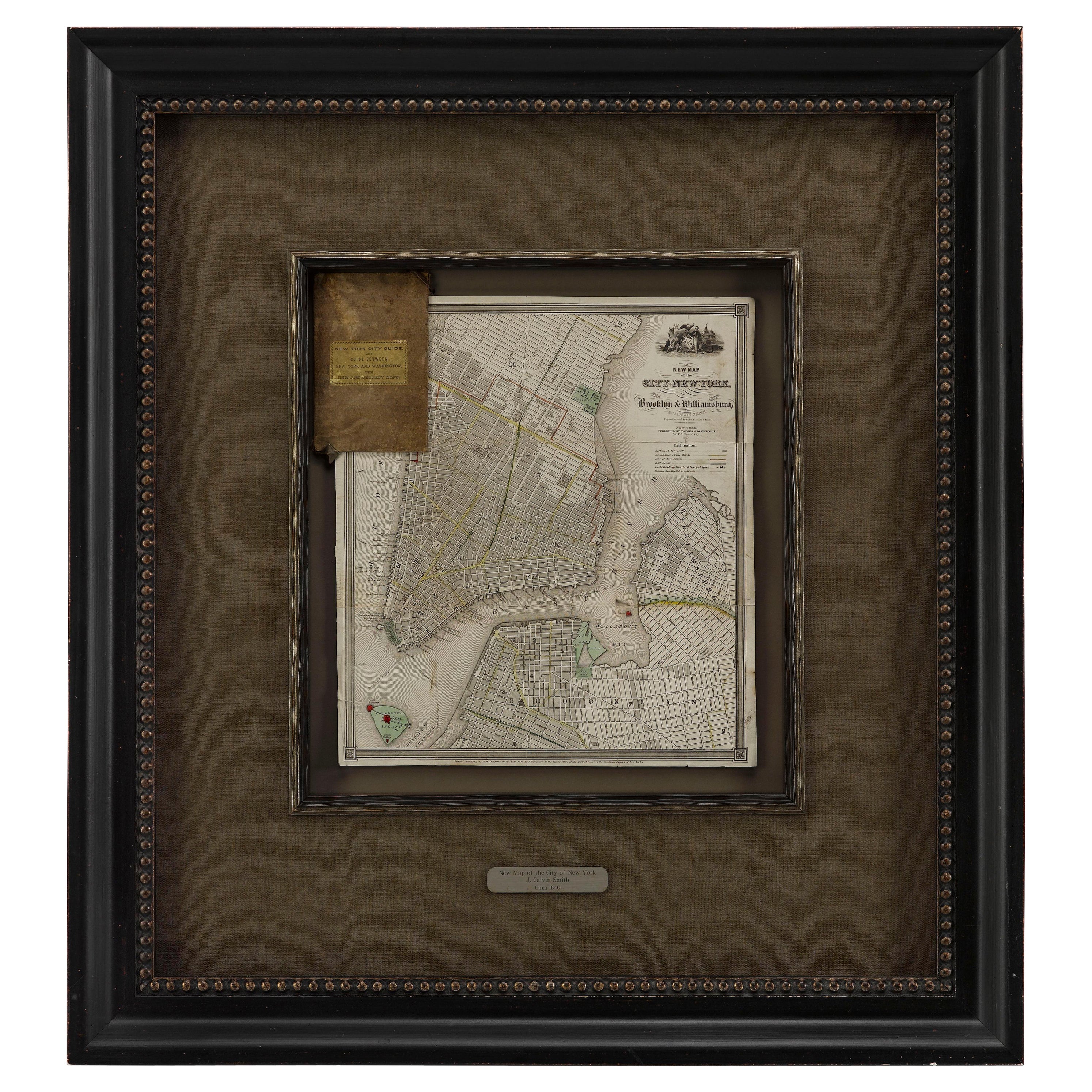
View All1840 "New Map of the City of New York With Part of Brooklyn & Williamsburg"
Located in Colorado Springs, CO
Presented is a hand-colored, engraved folding map titled "New Map of the City of New York With Part of Brooklyn & Williamsburg" by J. Calvin Smith. The map was issued bound in the bo...
Category
Antique 1840s American Maps
Materials
Paper

1859 "Map of the United States of America..." by J. H. Colton
By J.H. Colton
Located in Colorado Springs, CO
Presented is an 1859 “Map of the United States of America, the British Provinces, Mexico, the West Indies and Central America with Part of...
Category
Antique 1850s American Maps
Materials
Paper

1854 Map of Massachusetts, Connecticut and Rhode Island, Antique Wall Map
Located in Colorado Springs, CO
This striking wall map was published in 1854 by Ensign, Bridgman & Fanning and has both full original hand-coloring and original hardware. This impression is both informative and highly decorative.
The states are divided into counties, outlined in red, green, and black, and subdivided into towns. Roads, canals, and railroad lines are prominently depicted, although they are not all labeled. The mapmakers also marked lighthouses, banks, churches, and prominent buildings, with a key at right. The map is an informative and comprehensive overview of the infrastructural development of New England prior to the Civil War. Physical geographies depicted include elevation, conveyed with hachure marks, rivers and lakes. The impression features an inset map of Boston...
Category
Antique 19th Century American Maps
Materials
Paper

1864 Map of North America, Antique Hand-Colored Map, by Adolphe Hippolyte Dufour
Located in Colorado Springs, CO
Offered is a map of North America entitled Amerique du Nord from 1864. This rare, separately published wall map was produced by Adolphe Hippolyte Dufour. This map includes vibrant an...
Category
Antique 1860s French Maps
Materials
Paper

1847 Ornamental Map of the United States & Mexico by H. Phelps
Located in Colorado Springs, CO
Offered is an original 1847 ornamental map of the U.S. entitled "Ornamental Map of the United States & Mexico" by Humphrey Phelps. The map was issued as an act of Congress by Phelps on Fulton Street, New York. The broadside is elaborately hand-colored.
This is a very detailed and graphic propaganda map of the United States expressing U.S. dominance of the North American continent. The hand-colored map proclaims the Manifest Destiny, with the recent acquisition of Upper California and Texas at the conclusion of the Mexican-American War. The newly acquired land is boldly colored, standing in stark contrast to the rest of the U.S. The map details a potential route for a railroad running from New York City, to Buffalo, to Chicago, then west along the Oregon Trail to Oregon City. This route anticipates the construction of the transcontinental railroad by nearly 20 years.
The map includes elaborately detailed renderings of George Washington, Hernan Cortez, and Montezuma at top to represent European expansion to the Americas. At bottom are four inset designs with text showing the following: a chronological history of the U.S. beginning from settlement to the U.S. victory in the Mexican-American war; an illustration of General Zachary Taylor with details on the Oregon Territory; an illustration of the Aztec Temple of the Sun in Tenochtitlan and a chronology of the Conquest of the Aztec Empire under Cortez; a portrait of General Antonio Lopez de Santa Anna...
Category
Antique 1840s American Maps
Materials
Paper

1863 "Lloyd's New Map of the United States, the Canadas, and New Brunswick"
Located in Colorado Springs, CO
Presented is “Lloyd's New Map of the United States, the Canadas and New Brunswick, From the latest Surveys, Showing Every Railroad & Station Finished to June 1863, and the Atlantic and Gulf Coasts.” A large, Civil War-era hanging map of the United States and adjacent territories, this map covers the area from the Atlantic Ocean and extends as far west as the 103 meridian, to “Dacotah,” Nebraska, Kansas, "Indian Territory," and Texas. The southern continuation of Florida is shown in an inset map along the right margin. This map was published by J. T. Lloyd, in New York, in 1863. According to the publisher’s marking at lower right, this map was originally issued in two states: "in Sheets, Colored" for 50 cents, and "Varnished nicely, with Rollers" for $1.
Throughout the map, the counties are colored and the towns and cities well labeled. A reference key in the bottom margin provides symbols for railroads, turnpikes and wagon roads, state capitals, cities and towns, and village post offices. As emphasized in the map’s title, this map is especially notable for the countless railway lines and stations depicted, with distances noted between points, listing “every railroad and finished station to June 1863.” Additionally, two shipping agents and their routes are drawn out of New York City. The map includes details of the steamship routes into New York and Philadelphia from Liverpool and on to California and Oregon via an overland Nicaraguan trek, presumably to assist gold rush emigrants.
This expansive and impressive map depicts the eastern half of the United States in the third year of the Civil War. In order not to recognize the legitimacy of the Confederate States of America, each state is shown in the same manner as the Union states. The only indication that the American Civil War was in progress when this map was published is a printed notice that Gideon Wells, Secretary of the Navy, wishes to acquire a quote on 100 copies of Lloyd’s Mississippi River map...
Category
Antique 1860s American Maps
Materials
Linen, Wood, Paper

You May Also Like
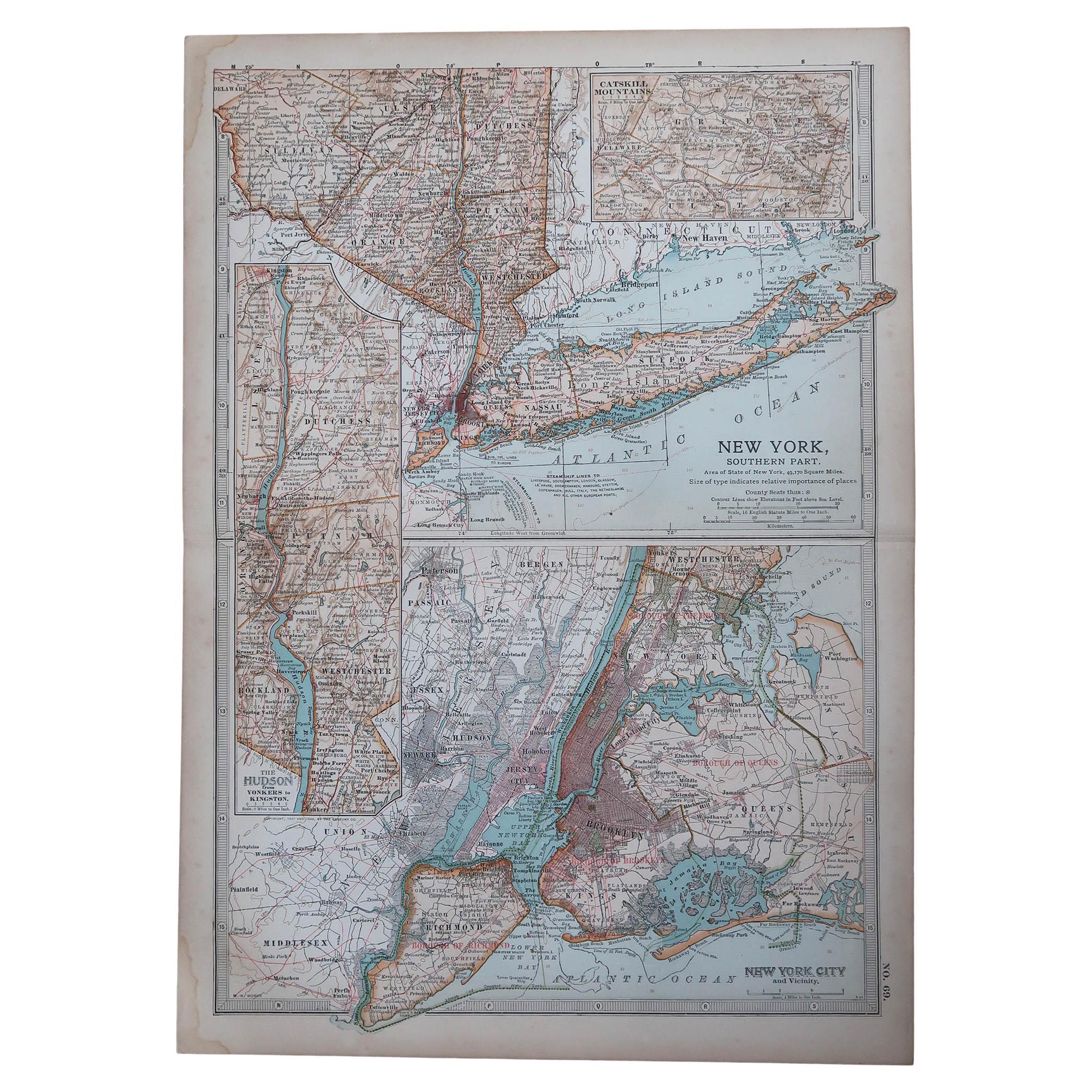
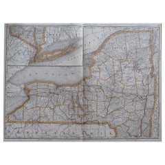
Original Antique Map of the American State of New York ( Southern Part ) 1903
Located in St Annes, Lancashire
Antique map of New York ( Southern Part )
Published By A & C Black. 1903
Original colour
Good condition
Unframed.
Free shipping
Category
Antique Early 1900s English Maps
Materials
Paper

Vintage Oversized New York City Lower Manhattan 1840s Map Print
Located in Dayton, OH
Vintage late 20th century reproduction print of New York City featuring lower Manhattan in 1840.
Category
Late 20th Century Victorian Maps
Materials
Paper

$750 Sale Price
25% Off
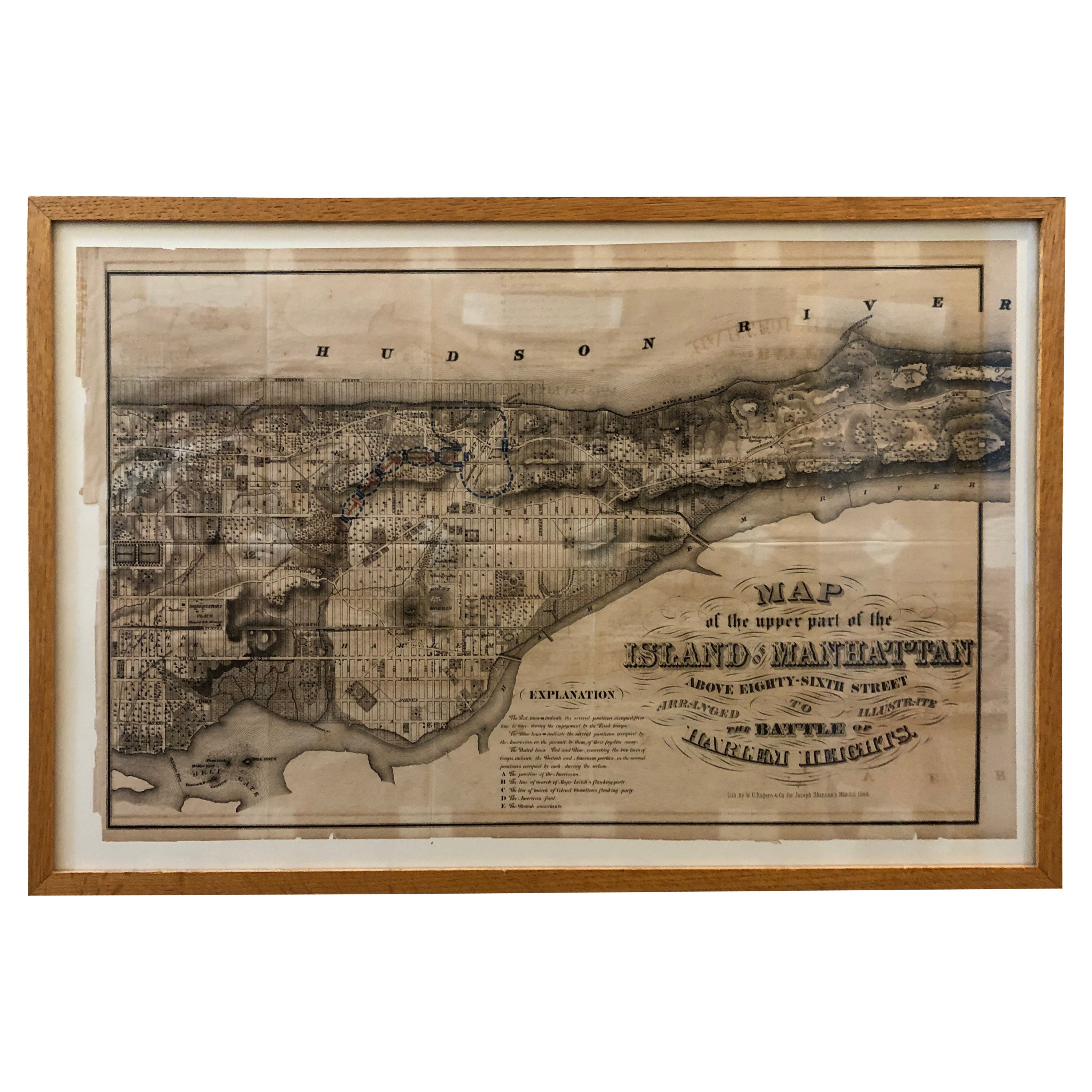
1868 Map of the Upper Part of the Island of Manhattan Above 86th Street
By Wm. Rogers Mfg. Co.
Located in San Francisco, CA
This wonderful piece of New York City history is over 150 years old. It depicts 86th street and above. It was lithographed by WC Rogers and company. It was made to show what was the Battle of Harlem during the Revolutionary war...
Category
Antique 1860s American American Colonial Maps
Materials
Paper
Original Antique Map of the American State of New York ( Western Part ) 1903
Located in St Annes, Lancashire
Antique map of New York ( Western Part )
Published By A & C Black. 1903
Original colour
Good condition
Unframed.
Free shipping
Category
Antique Early 1900s English Maps
Materials
Paper

Large Original Antique Map of New York, USA, 1894
By Rand McNally & Co.
Located in St Annes, Lancashire
Fabulous map of New York.
Original color.
By Rand, McNally & Co.
Published, 1894
Unframed
Free shipping.
Category
Antique 1890s American Maps
Materials
Paper
1872 Map of Hudson, Union and Essex Counties, New Jersey
Located in Savannah, GA
A hand-colored topographical map of New Jersey’s Hudson, Union and Essex Counties from the Atlas of New Jersey by F.W. Beers, published in 1872.
sight 15 by 22½ inches
frame 20 by...
Category
Antique 1870s American Prints
Materials
Glass, Wood, Paper

More Ways To Browse
New Jersey 19th Century
Antique Map New York
Railroad Collectibles
Antique Railroad Collectibles
Antique Railroad Maps
Map Railroad
Antique Maps Of New York City
Harlem Furniture
Antique Amusement Park
Antique Map Of Brooklyn
Antique Maps Of Italy
Antique Map India
Antique Topographic Maps
Antique Railroad
Antique Maps Of Africa
Railroad Furniture
Antiques Compasses
Antique House Plans