Maps
to
2,381
2,817
115
2,936
26
12
5
1
1
1
2,926
2,181
476
3
289
34
10
127
7
35
9
2
5
3
4
2
2,916
33
22
7
3
202
72
64
34
31
2,936
2,936
2,936
63
24
16
13
13
Maps For Sale
Period: Late 20th Century
Period: 18th Century and Earlier
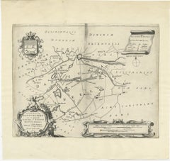
Antique Map of the Region of Dantumadeel by Schotanus, 1664
Located in Langweer, NL
Antique map titled 'De Grietenye van Dantumadeel (..)'. Map of the Grietenij of Dantumadeel, Friesland, The Netherlands. Originates from "Beschrijvinge ende nieuwe caerten van de Hee...
Category
17th Century Antique Maps
Materials
Paper
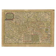
Antique Map of the Region of Plauen by Schreiber '1749'
By Schreiber
Located in Langweer, NL
Antique map titled 'Die Aemter Plauen und Pausa (..)'. Map of the region of Plauen, Germany. This map originates from 'Atlas Selectus von allen Konigreichen und Landern der Welt' by ...
Category
18th Century Antique Maps
Materials
Paper
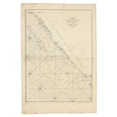
Antique Map of the South-Western Coast of Sumatra by De la Haye, c.1780
Located in Langweer, NL
Antique map titled 'Carte de la Côte Occidentale de l'Isle Sumatra'. Sea chart of the part of the south-western coast of Sumatra with the Nassau (Nias) and Fortune isles.
Artists ...
Category
18th Century Antique Maps
Materials
Paper
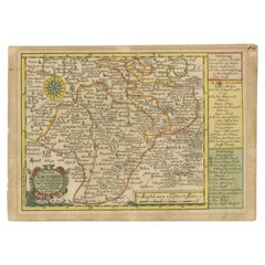
Antique Map of the Region of Voigtsberg by Schreiber, 1749
By Schreiber
Located in Langweer, NL
Antique map titled 'Das Amt Voigtsberg (..)'. Map of the region of Voigtsberg, Germany. This map originates from 'Atlas Selectus von allen Konigreichen und Landern der Welt' by Johan...
Category
18th Century Antique Maps
Materials
Paper
Antique Map of the Roadstead of Bantam by Van der Aa, 1725
Located in Langweer, NL
Antique map titled 'La rade de Bantam'. (The roadstead of Bantam.) This map shows the Indonesian city of Banten / Bantam on Java, Indonesia and its roadstead. With compass rose and s...
Category
18th Century Antique Maps
Materials
Paper
Antique Map of the Rhineland and Lotharingen by Tirion, c.1740
By Isaak Tirion
Located in Langweer, NL
Antique map titled 'Nieuwe Kaart van de Opper en Neder Rhynse Kreits nevens het Hertogdom Lotharingen.' Attractive detailed map showing the Rheinland (Rhineland) and Lotharingen, Ger...
Category
18th Century Antique Maps
Materials
Paper
Antique Map of the Dongeradeel Township in Friesland, The Netherlands, 1718
Located in Langweer, NL
Antique map Friesland titled 'Donger Deel West Zyde der Pasens (..)'. Old map of Friesland, the Netherlands. This map depicts the region of Dongeradeel and includes cities and villag...
Category
18th Century Antique Maps
Materials
Paper
Antique Map of the Region Around the Baltic Sea by Cordier, c.1670
Located in Langweer, NL
Antique map titled 'Illyricum Orientis: In quo Partes II Moesia et Thracia'. Engraved map of the area west of the Baltic Sea, present day Bulgaria, Romania, and Turkey. The map is ba...
Category
17th Century Antique Maps
Materials
Paper
Antique Map of the Province of Overijssel by Janssonius, c.1650
Located in Langweer, NL
Antique map titled 'Ditio Trans-isulana'. Original antique map of the province of Overijssel, the Netherlands. With coat of arms and two decorative cartouches. Published by J. Jansso...
Category
17th Century Antique Maps
Materials
Paper
Antique Map of the Coromandel Peninsula, 1754
Located in Langweer, NL
Antique map titled 'A map of Coromandel shewing the Seat of War on that coast'. Rare map of Coromandel printed for the London Magazine.
Artists and Engr...
Category
18th Century Antique Maps
Materials
Paper
Antique Map of the Dongeradeel Township 'Friesland' by Halma, 1718
Located in Langweer, NL
Antique map Friesland titled 'Donger Deel West Zyde der Pasens (..)'. Old map of Friesland, the Netherlands. This map depicts the region of Dongeradeel and includes cities and villag...
Category
18th Century Antique Maps
Materials
Paper
Antique Map of the Region of Beauvais by Janssonius, 1657
Located in Langweer, NL
Antique map of France titled 'Beauvaisis Comitatus Belovacium'. Detailed map of the region centered on Beauvais. This map originates from 'Atlas Novus, Sive Theatrum Orbis Orbis Terr...
Category
17th Century Antique Maps
Materials
Paper
Comore Island Original Antique Engraving by Van Schley, 1749
Located in Langweer, NL
Antique map titled 'Carte des Isles de Comore Johanna ou Anouan Mohilla ou Moaly et Mayote (..) - Kaart van de Eilanden Komoro, Anjuan, Moelia, en Mayotta (..)'. Copper engraving of ...
Category
18th Century Antique Maps
Materials
Paper
Antique Map of the German Empire by De Leth, 1749
Located in Langweer, NL
Antique map Germany titled 'L'Empire d'Allemagne divisé en ses dix cercles et Autres Estats'. Detailed map of the German Empire divided in the ten ...
Category
18th Century Antique Maps
Materials
Paper
Antique Print of the Rhine River, Leiden, The Netherlands, c.1800
Located in Langweer, NL
Antique print titled 'Rhyn gesigt langs de Tuynen by de Hoogewoerts Poort'. Old print depicting with a view on the Rhine river, the Netherlands. This print...
Category
18th Century Antique Maps
Materials
Paper
Antique Map of the Ooststellingwerf Township Friesland by Halma, 1718
Located in Langweer, NL
Antique map titled 'Stellingwerf Oost-Eynde, de negende Grietenije van de Sevenwolden'. This regional map of the Oost Stellingwerf Grietenij, part of the Province of Friesland, The N...
Category
18th Century Antique Maps
Materials
Paper
Antique Map of the Region of Batavia by Conrade, 1782
Located in Langweer, NL
Antique map titled 'Carte des environs de Batavia.' (Map of Batavia and its surroundings.) Map of the Batavia area (Jakarta) in Indonesia. With cartouche, scale and compass rose. Thi...
Category
18th Century Antique Maps
Materials
Paper
Antique Map of the Malabar Coast by Baldaeus, 1744
Located in Langweer, NL
Antique map titled 'Descriptio Nova Imperii Malabar (..).' Nice map of the Malabar Coast. This map was published in 'The True and Exact Description of th...
Category
18th Century Antique Maps
Materials
Paper
Antique Map of the Course of the Elbe River by Janssonius, c.1650
Located in Langweer, NL
Antique map titled 'Nobilis Flubius Albis (..)'. Old map of the course of the Elbe river, large inset view of the city of Hamburg. Source unknown, to be determined.
Artists and En...
Category
17th Century Antique Maps
Materials
Paper
Antique Map of the Franekeradeel Township 'Friesland' by Halma, 1718
Located in Langweer, NL
Antique map Friesland titled 'De Grietenije van Franeker Deel (..) '. Old map of Friesland, the Netherlands. This map depicts the region of Franekeradeel and includes cities and vill...
Category
18th Century Antique Maps
Materials
Paper
Antique Map of the Huguang Province of China by Du Halde, 1738
Located in Langweer, NL
Antique map titled 'Province VI Hu-Quang'. Old map depicting the Huguang province of China. Originates from 'A description of the Empire of China and Chinese-Tartary' by by J.B. du H...
Category
18th Century Antique Maps
Materials
Paper
Antique Map of the Region of Annaburg by Schreiber, 1749
By Schreiber
Located in Langweer, NL
Antique map titled 'Die Aemter Annaburg, Schweinitz (..)'. Map of the region of Annaburg, Germany. This map originates from 'Atlas Selectus von allen Konigreichen und Landern der Wel...
Category
18th Century Antique Maps
Materials
Paper
Antique Map of the Region of Batavia by Van Schley, c.1750
Located in Langweer, NL
Antique map titled 'Carte des environs de Batavia - Kaart van de Buitenstreken van Batavia'. Map of the Batavia area (Jakarta) in Indonesia. With cartouche, scale and compass rose. P...
Category
18th Century Antique Maps
Materials
Paper
Antique Map of the Region of Beauvais in France, 1737
Located in Langweer, NL
Untitled map of the region of Beauvais, France. This map originates from 'Nieuw en beknopt Kaart-Boekje vertoonende de XVII. Nederlandse Provintien (..)'.
Artists and Engravers: Au...
Category
18th Century Antique Maps
Materials
Paper
Antique Map of the Establishment of the French Monarchy by Zannoni, 1765
Located in Langweer, NL
Antique map France titled 'Carte de l'Etablissement de la Monarchie Francoise (..)'. Beautiful old map of France. This map originates from 'Atlas Historique de la France Ancienne et ...
Category
18th Century Antique Maps
Materials
Paper
Antique Map of the Fortifications of Demak and Jepara by Valentijn, 1726
Located in Langweer, NL
Antique print titled 'Kaarte van de Nieuw ontworpen Pagger op de Qual of Cawala. Kaarte van de Oude en Nieuwe ontworpen Pagger tot Japara'. Plans of the newly designed fortifications...
Category
18th Century Antique Maps
Materials
Paper
Antique Map of the Hennaarderadeel Township 'Friesland' by Halma, 1718
Located in Langweer, NL
Antique map of Friesland titled 'Hennaardera Deel de Vyfde Grietenije van Wester Goo (..)'. Old map of Friesland, the Netherlands. This map depicts the region...
Category
18th Century Antique Maps
Materials
Paper
Antique Map of the Gaasterland Township 'Friesland' by Halma, 1718
Located in Langweer, NL
Antique map Friesland titled 'Gaasterland de Zevende Grietenije van de Zevenwolden (..)'. Old map of Friesland, the Netherlands. This map depicts the region of Gaasterland and includ...
Category
18th Century Antique Maps
Materials
Paper
Antique Map of the Island of Java by Van Der Aa, 1725
Located in Langweer, NL
Antique map titled 'Map: 'L'Ile de Java'. (The island of Java.) This map shows the Indonesian island of Java. With compass rose and scale. This plate originates from the very scarse:...
Category
18th Century Antique Maps
Materials
Paper
Antique Map of the Islands of Schiatti and Scopoli, Greece, 1687
Located in Langweer, NL
Antique map titled 'Schiatti - Scopoli.' This original antique map shows the islands Schiatti and Scopoli in Greece. Source unknown, to be determined.
Artists and Engravers: Made by...
Category
17th Century Antique Maps
Materials
Paper
Antique Map of the Old Lands of Friesland by Halma, 1718
Located in Langweer, NL
Antique map Friesland titled 'Descriptio Agri Frisii (..)'. Old map of Friesland, the Netherlands. This map depicts the old lands of Friesland. Originates from 'Uitbeelding van de He...
Category
18th Century Antique Maps
Materials
Paper
Antique Map of the Northern Part of Brazil by Raynal, 1784
Located in Langweer, NL
Antique map titled 'Kaart van het Noordlijk gedeelte van Bresil'. Rare antique map of the northern part of Brazil, with the basin of the Amazon and the cities of Manaus, Recife and S...
Category
18th Century Antique Maps
Materials
Paper
Antique Map of the Netherlands and Belgium by Bowen, 1747
Located in Langweer, NL
Antique map Belgium titled 'A New and Accurate Map of the Netherlands or Low Countries'. Detailed map of South of the Netherlands and Belgium. With large inset of the city of Mons, B...
Category
18th Century Antique Maps
Materials
Paper
Antique Map of the Empire of the Assyriens by Mallet, 1683
Located in Langweer, NL
Antique map titled 'Empire des Assyriens' and 'Assyrie Chaldee et Mesopotamie selon les Anciens'. Two maps on one sheet, the upper sheet showing the Empire of the Assyriens and the second showing the region of the Tigres and Euphrates Rivers. This map originates from Alain Manesson Mallet's 'Description de l 'Univers'.
Artists and Engravers: Alain Manesson Mallet (1630–1706) was a French cartographer and engineer. He started his career as a soldier in the army of Louis XIV, became a Sergeant-Major in the artillery and an Inspector of Fortifications. He also served under the King of Portugal, before returning to France, and his appointment to the court of Louis XIV. His military engineering and mathematical background led to his position teaching mathematics at court. His major publications were Description de L'Univers (1683) in 5 volumes, and Les Travaux de Mars ou l'Art de la Guerre (1684) in 3 volumes. His Description de L'Universe contains a wide variety of information, including star maps...
Category
17th Century Antique Maps
Materials
Paper
Antique Map of the Province of Quang-Si by Du Halde, 1738
Located in Langweer, NL
Antique map titled 'Province XIII Quang-Si. Drawn on the spot by ye Peres de Tartre & Cordoso in the year 1714'. Old map of the Chinese province Quang-Si. Originates from the Edward ...
Category
18th Century Antique Maps
Materials
Paper
Antique Map of the Netherlands by Zannoni, 1765
Located in Langweer, NL
Antique map titled 'Carte Historique, Geographique et Militaire des Campagnes de Louis XIV dans les Pays Bas (..)'. Beautiful old map of the Netherlands...
Category
18th Century Antique Maps
Materials
Paper
Antique Map of the Province of Quey-Chew by Du Halde, 1738
Located in Langweer, NL
Antique map titled 'Province XV Quey-Chew drawn on the spot by the Peres Fridelli and Regis in the year 1716'. Old map of the Chinese province Quey-Chew. Originates from the Edward C...
Category
18th Century Antique Maps
Materials
Paper
Antique Map of the Region of Bolsward and Sneek by Von Reilly, 1791
Located in Langweer, NL
Antique map titled 'Der Provinz Westergo drey mittlere Grietenyen mit der Stadt Bolsward und Sneek'. Map of the region of Bolsward and Sneek, Friesland, the Netherlands. This map org...
Category
18th Century Antique Maps
Materials
Paper
Antique Map of the Old Land of Batavia and Friesland by Halma, 1718
Located in Langweer, NL
Antique map Friesland titled 'Descriptio veteris Agri Batavi et Frisii (..)'. Old map of Friesland, the Netherlands. This map depicts the old land of Batavia and Friesland. Originate...
Category
18th Century Antique Maps
Materials
Paper
Antique Map of the Maluku Islands by Le Rouge, c.1750
By George Louis Le Rouge
Located in Langweer, NL
Antique map Moluccas/Spice Islands titled 'Isles Moluques'. Detailed map of the famous Spice Islands (Maluku Islands or the Moluccas). Includes also Sulawesi, Bali, Timor, part of Bo...
Category
18th Century Antique Maps
Materials
Paper
Antique Map of the Low Countries and Surroundings in Europe, 1685
By Philipp Clüver
Located in Langweer, NL
Antique map titled 'Germaniae Cisrhenanae ut ineter I Caesaris et Traiani Suit imperia Scaldis Item Mose ac Rheni.' Miniature map of the Low Countries and part of Germany and France....
Category
17th Century Antique Maps
Materials
Paper
Antique Map of the Hennaarderadeel Township 'Friesland' by Halma, 1718
Located in Langweer, NL
Antique map Friesland titled 'Hennaardera Deel de Vyfde Grietenije van Wester Goo (..)'. Old map of Friesland, the Netherlands. This map depicts the region of...
Category
18th Century Antique Maps
Materials
Paper
Antique Map of the Haskerland Township 'Friesland' by Halma, 1718
Located in Langweer, NL
Antique map Friesland titled 'Haskerland, de vierde Grietenije van de Zevenwolden (..)'. Old map of Friesland, the Netherlands. This map depicts the region of Haskerland and includes...
Category
18th Century Antique Maps
Materials
Paper
Antique Map of the Region Between the Caspian and the Sea of China by Toms, 1799
Located in Langweer, NL
Antique map titled 'Scythia et Serica'. Old map of the region between the Caspian and the Sea of China. Originates from 'Geographia Antiqua (..)'.
Artists and Engravers: Engraved ...
Category
18th Century Antique Maps
Materials
Paper
Antique Map of the Jiangxi Province of China by Du Halde, 1738
Located in Langweer, NL
Antique map titled 'Province III Kyang-Si'. Old map depicting the Jiangxi province of China. Originates from 'A description of the Empire of China and Chinese-Tartary' by J.B. du Hal...
Category
18th Century Antique Maps
Materials
Paper
Antique Map of the Old Land of Batavia and FriesLand, The Netherlands, 1697
Located in Langweer, NL
Antique map Friesland titled 'Descriptio veteris Agri Batavi et Frisii (..)'. Old map of Friesland, the Netherlands. Depicts the old land of Batavia and Friesland. This map originate...
Category
17th Century Antique Maps
Materials
Paper
Antique Map of the Old Land of Batavia and Friesland by Halma, 1718
Located in Langweer, NL
Antique map Friesland titled 'Descriptio veteris Agri Batavi et Frisii (..)'. Old map of Friesland, the Netherlands. This map depicts the old land of Batavia and Friesland. Originate...
Category
18th Century Antique Maps
Materials
Paper
Antique Map of the Netherlands and Belgium by Lapie, 1842
Located in Langweer, NL
Antique map titled 'Carte des Royaumes de Belgique et de Hollande'. Map of the Netherlands and Belgium. This map originates from 'Atlas universel de géographie ancienne et moderne (....
Category
18th Century Antique Maps
Materials
Paper
Antique Map of the Menaldumadeel Township 'Friesland' by Halma, 1718
Located in Langweer, NL
Antique map Friesland titled 'Menalduma Deel Wesentlyk vertoont (..)'. Old map of Friesland, the Netherlands. This map depicts the region of Menaldumadeel and includes cities and vil...
Category
18th Century Antique Maps
Materials
Paper
Antique Map of the Island of Kyra Panagia by Dapper, 1688
Located in Langweer, NL
Antique map titled 'Pelagnisi.' Map of the island of Kyra Panagia, Pelagnisi (Pelagos), Greece. This map originates from 'Nauwkeurige Beschrijving der eilanden in de Archipel der Mid...
Category
17th Century Antique Maps
Materials
Paper
Antique Map of the Region of Bolsward and Sneek by Von Reilly, 1791
Located in Langweer, NL
Antique map titled 'Der Provinz Westergo drey mittlere Grietenyen mit der Stadt Bolsward und Sneek'. Map of the region of Bolsward and Sneek, Friesland, the Netherlands. This map org...
Category
18th Century Antique Maps
Materials
Paper
Antique Map of the Province of Overijssel by Keizer & De Lat, 1788
Located in Langweer, NL
Antique map titled 'Seigneurie d'Over-Ysel'. Uncommon antique map of the province of Overijssel, the Netherlands. This map originates from 'Nieuwe Natuur- Geschied- en Handelkundige ...
Category
18th Century Antique Maps
Materials
Paper
Antique Map of the Province of Groningen by Keizer & De Lat, 1788
Located in Langweer, NL
Antique map titled 'Groningen en Ommelanden'. Uncommon antique map of the province of Groningen, the Netherlands. This map originates from 'Nieuwe Natuur- Geschied- en Handelkundige ...
Category
18th Century Antique Maps
Materials
Paper
Antique Map of the Hainaut Region by Visscher, c.1690
Located in Langweer, NL
Antique map titled 'Comitatus Hannoniae et Archiepiscopatus Cameracensis Tabula'. Large map of the Hainaut region, France.
Artists and Engravers: Nicolaes Visscher II (1649, Amst...
Category
17th Century Antique Maps
Materials
Paper
Antique Map of the Hennaarderadeel Township 'Friesland' by Halma, 1718
Located in Langweer, NL
Antique map Friesland titled 'Hennaardera Deel de Vyfde Grietenije van Wester Goo (..)'. Old map of Friesland, the Netherlands. This map depicts the region of...
Category
18th Century Antique Maps
Materials
Paper
Antique Map of the Provinces of Gelderland and Overijssel by Kaerius, 1617
Located in Langweer, NL
Antique map titled 'Geldria et Transysulana'. Scarse map by Kaerius of the provinces Gelderland and Overijssel in the Netherlands. Large cartouche with coat of arms and sailing ship ...
Category
17th Century Antique Maps
Materials
Paper
Antique Map of the Region of Aire-sur-L'Adour by Janssonius, 1657
Located in Langweer, NL
Antique map of France titled 'L'Evesche d'Aire'. Decorative map of the Aire-sur-L'Adour region, a commune in the Landes department in Nouvelle-Aquitaine in southwestern France. This ...
Category
17th Century Antique Maps
Materials
Paper
Antique Map of the Northern Part of the Netherlands by Jaeger, 1784
Located in Langweer, NL
Antique print, titled: 'Carte topographique d'Allemagne contenant une partie des Provinces Unies, savoir la province de Friesland occidentale : une partie d'Overyssel, de Gueldre, d'...
Category
18th Century Antique Maps
Materials
Paper
