Maps
76
2,896
to
582
2,785
108
2,896
2,896
2,896
21
9
1
1
2,897
2,121
414
5
229
32
11
85
7
57
7
3
3
4
5
2
2,880
15
5
4
3
189
69
55
36
28
63
26
16
13
13
Maps For Sale
Period: 18th Century
Period: 17th Century
Period: 15th Century and Earlier
Period: 16th Century
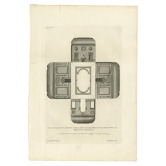
Antique Print of the New Garden Room of Hall Barn by Campbell, 1725
Located in Langweer, NL
Antique print titled 'Section of a New Garden Room at Hall Barn (..)'. Plan of the garden room for Hall Barn, near Beaconsfield, Buckinghamshire. This print originates from 'Vitruvius Britannicus...
Category
18th Century Antique Maps
Materials
Paper
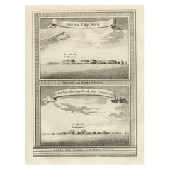
Antique Print of Cape or Cabo Verde, Africa, c.1750
Located in Langweer, NL
Antique print titled 'Gezigt van Kabo Verde' and 'Zydelings Gezigt van Kabo Verde'. Old print of Cabo Verde with a double view of the island coast. Engraved...
Category
18th Century Antique Maps
Materials
Paper
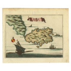
Antique Map of the Island of Tinos by Dapper, 1687
Located in Langweer, NL
Antique map titled 'Tino.' This original antique map shows the island of Tinos, Greece. Source unknown, to be determined.
Artists and Engravers: Made by 'Olfert Dapper' after an a...
Category
17th Century Antique Maps
Materials
Paper
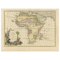
Original Antique Map of Africa with large decorative cartouche
Located in Langweer, NL
Original antique map titled 'L'Afrique divisée en ses principaux États'. Attractive and precise map of Africa, with large decorative cartouche. Engraved by Janvier. Published by Dela...
Category
Late 18th Century Antique Maps
Materials
Paper
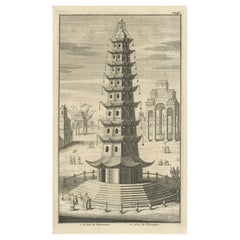
Antique Print of the Porcelain Pagoda in Nanjing, China, 1736
Located in Langweer, NL
Antique print titled 'La Tour de Porcelaine, Arc de Triomphe'. Old print depicting the Porcelain Pagoda in the Chinese city of Nanjing. It no longer ...
Category
18th Century Antique Maps
Materials
Paper
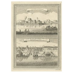
Antique Print of two Chinese Village Pau Ing Hyen with Windmills, China, 1748
Located in Langweer, NL
Antique print titled 'Village Flottant - Ville de Pau Ing Hyen avec ses Moulins a Vent'. View of two Chinese villages. This print originates from Prevo...
Category
18th Century Antique Maps
Materials
Paper
Antique Print of Batavia 'Jakarta', in the Dutch East Indies, 1744
Located in Langweer, NL
Two views on one plate titled 'A Prospect of The Town of Batavia (and) A View of the Citadel of Batavia'. Beautiful views of Batavia (Jakarta), Indonesia. The upper view shows the ci...
Category
18th Century Antique Maps
Materials
Paper
Nicely Colored Antique Print of Surat in India, 1751
Located in Langweer, NL
Antique print titled 'Vuë de Surate du côté de la Riviere'. View of Surat, a city in the state of Gujarat, India. This print originates from 'Histoire générale des voyages' by A. Pré...
Category
18th Century Antique Maps
Materials
Paper
Antique Print of the City of Leeuwarden, Friesland in The Netherlands, 1680
Located in Langweer, NL
Antique print titled 'Leeuwaerd'. Old bird's eye view of the city of Leeuwarden, Friesland. This print originates from 'Thooneel der Steden ende Sterckten van 't Vereenight Nederland...
Category
17th Century Antique Maps
Materials
Paper
Antique Print of the City of Rome, Italy by Münster, C.1580
Located in Langweer, NL
Antique print titled 'Abbildung der Statt Rom/wie sie under Keyser Vespasiano und zu Plinii zeiten gewesen'. Woodcut of ancient Rome. This print originates from Munster's Cosmographi...
Category
16th Century Antique Maps
Materials
Paper
Gorgeous Antique World Map by the Dutch Mapmaker Visscher, published circa 1679
Located in Langweer, NL
Antique map titled 'Novissima Totius Terrarum Orbis Tabula, Auctore Nicolao Visscher'. Gorgeous example of Nicholas Visscher's World map, which appeared...
Category
Late 17th Century Antique Maps
Materials
Paper
Original Antique Map of Malabar, Coromandel 'India' and Ceylon
Located in Langweer, NL
Antique map titled 'Peninsula Indiae citra Gangem, hoc est Orae celeberrimae Malabar & Coromandel (..)'. Large and attractive original hand colored map of Sri Lanka and the Southern ...
Category
Mid-18th Century Antique Maps
Materials
Paper
Antique Map of Arabia including Nubia and Abyssinia, also shows the Red Sea
Located in Langweer, NL
Antique map titled 'Nubie et Abissinie'. Original antique map of Nubia, a region along the Nile river, and Abyssinia or the Ethiopian Empire. This map o...
Category
Late 18th Century Antique Maps
Materials
Paper
Rare Antique Engraving of the City of Copenhagen, Denmark, ca.1720
Located in Langweer, NL
Antique print titled 'Copenhagen. Die Königl. Residenz und Haupt Stadt in Dänemark'. Panoramic view of the city of Copenhagen, Denmark. This print, most likely, originates from the s...
Category
18th Century Antique Maps
Materials
Paper
Antique Print of the Death of Emperor Cubo at Kyoto, Japan, ca. 1725
Located in Langweer, NL
Antique print titled 't Vermoorden vande Keyser Cubus. / Massacre de l'Empereur Cubo, dans Meaco.' Engraving of the killing of Emperor Cubo at Kyoto, Japan. The city Kyoto was known ...
Category
18th Century Antique Maps
Materials
Paper
Antique Print of Brittenburg 'Near Katwijk' in the Netherlands by Blaeu, 1649
Located in Langweer, NL
Antique print titled 'Arx Britannica'. View of De Brittenburg, a Roman ruin on the Dutch coast near Katwijk, The Netherlands. Originates from 'Toneel der Steeden' published by Joan B...
Category
17th Century Antique Maps
Materials
Paper
Antique Print of the Old University Town Franeker in the Netherlands '1786'
Located in Langweer, NL
Antique print titled 'Franeker van den kant van Schalsum te zien'. Old print with a view on the city of Franeker, as seen from Schalsum. This print originates from 'Hedendaagsche His...
Category
18th Century Antique Maps
Materials
Paper
Antique Print of Batavia or nowadays Jakarta, Indonesia, c.1755
Located in Langweer, NL
Antique print titled 'Vue de l'Isle et de la ville de Batavia appartenant aux Hollandois'. Beautiful view of the island and the city of Batavia belonging to the Dutch, for the India ...
Category
18th Century Antique Maps
Materials
Paper
Very Attractive Antique Map of the World as Planisphere, Shows Cook's Voyages
Located in Langweer, NL
Antique map titled 'Chart of the World, according to Mercators Projection'. This world map shows the various discoveries of Captain James Cook during his 3 voyages between 1768 and 1780, and the English and French Explorers who followed immediately thereafter, including Vancouver and La Perouse. This edition of the map is significantly revised from the editions issued immediately after the official report of Cook's Voyages were integrated into the map, showing better detail in New Zealand, Australia, the Northwest Coast of America and North East coast of Asia, along with Greenland. A new large lake also appears for the first time in the Western part of North America, shortly before the commencement of the Lewis...
Category
Late 18th Century Antique Maps
Materials
Paper
Old Copper Engraving of the City of Kajutsiu in China, 1668
Located in Langweer, NL
Antique print China titled ‘Kajutsiu'. This plate shows a view on the Chinese city of Kajutsiu. This print originates from the Latin edition of Nie...
Category
17th Century Antique Maps
Materials
Paper
Antique Print of the City of Kancheu in China, 1668
Located in Langweer, NL
Antique print China titled 'Kancheu'. Old print depicting a view on the Chinese city of Kancheu with its ramparts. This print originates from the L...
Category
17th Century Antique Maps
Materials
Paper
Antique Map of Tartary and Northeast Asia, c.1750
Located in Langweer, NL
Antique map titled 'Carte de la tartarie occidentale'. An interesting map of Tartary and northeast Asia, from Lake Baykal, Partie du Siberia in the north, Pays des Kalkas at the cent...
Category
18th Century Antique Maps
Materials
Paper
Antique Plan of Plan of St. Julian's Harbour on the Coast of Patagonia
Located in Langweer, NL
Antique map titled 'Plan des Hafens St. Iulian auf der Küste von Patagonien'. Plan of St. Julian's Harbour on the Coast of Patagonia. This map originates from a German edition of 'Voyage around the World...
Category
Mid-18th Century Antique Maps
Materials
Paper
Antique Print of the Region of the Hayes river, Northern Manitoba, Canada, 1759
Located in Langweer, NL
Two images on one sheet titled 'Quartier d'Hyver dans la Riviere de Hayes' and 'Maison de Montagu'. The Dobbs Galley (William Moor) and California (Francis Smith...
Category
18th Century Antique Maps
Materials
Paper
Antique Map of Germany by T. Kitchin, circa 1770
Located in Langweer, NL
Antique map titled 'An Accurate Map of Germany (..) '. Drawn from the best Authorities by T.Kitchin Geogr." Rare edition, drawn and etched by Thomas Kitchin, published, circa 1770.
Category
Mid-18th Century Antique Maps
Materials
Paper
Antique Print with Views of Shiraz, Southwest Central Iran, 1711
Located in Langweer, NL
Antique print titled 'Gezicht van 't lant Zji-Raes - Gesicht buiten Zji-Raes'. Old print with views of Shiraz outside the city gates, and one view of the mountainous Shiraz region. This print originates from 'Cornelis de Bruins...
Category
18th Century Antique Maps
Materials
Paper
Antique Map of the region between Bergen op Zoom, Sandvliet, Hulst and Antwerp
Located in Langweer, NL
Original antique map titled 'Tabula Castelli ad Sandflitam (..)'. Detailed map of the region between Bergen op Zoom, Sandvliet, Hulst and Antwerp. Published by J. Janssonius, circa 1...
Category
Mid-17th Century Antique Maps
Materials
Paper
Antique Print with Coastal Views of Goa, India, c.1775
Located in Langweer, NL
Antique print titled 'Vues diverses du Fort de l'Agouade pres de l'isle de Goa, sur la Côte de Malabar'. Beautiful print with nine coastal views near Goa in India and Sumatra.
Art...
Category
18th Century Antique Maps
Materials
Paper
Detailed Antique Map of the Windward Islands in the Caribbean
Located in Langweer, NL
Antique map titled 'Carte des Antilles Francoises et des Isles Voisines'. Original antique map of the French Antilles, covering an area stretching from Guadeloupe in the north to Gre...
Category
Early 18th Century Antique Maps
Materials
Paper
Antique Map of the Northern Part of Biblical Palestine by Lindeman, c.1763
Located in Langweer, NL
Antique map titled 'De 8ste en 9de Landkaarte Geheel Palestina (..).' Map of the northern part of Biblical Palestine. With large title cartouche. Published by A. van Paddenburg, Neth...
Category
18th Century Antique Maps
Materials
Paper
Antique Print of Franeker, Friesland, the Netherlands by Guicciardini, 1616
Located in Langweer, NL
Antique print titled 'Franicker'. View of the city of Franeker, Friesland, the Netherlands. This print originates from 'Omnium Belgii sive Inferioris Germaniae (..)' by L. Guicciardi...
Category
17th Century Antique Maps
Materials
Paper
Antique Print of Büdingenin Germany by Braun & Hogenberg, 1617
Located in Langweer, NL
Antique map titled 'Bingen'. Bird's eye-view of Büdingen, Germany. The view shows a city surrounded by vineyards and well fortified with walls and moats. On the right is the castle w...
Category
17th Century Antique Maps
Materials
Paper
Antique Map of Italy by R. Bonne, circa 1780
Located in Langweer, NL
Beautiful map of Italy, Corsica, Sardinia and Sicily. Highly detailed, showing towns, rivers, some topographical features and political boundaries. Published by R. Bonne, circa 1780.
Category
Late 18th Century Antique Maps
Materials
Paper
Antique Print of the Monuments of Herculaneum by Bayardi, 1762
Located in Langweer, NL
Antique print originating from 'Le Antichita di Ercolano Esposte'. A vast survey of the bronzes, statues, wall-paintings, and monuments of Herculaneum. This monumental work was the f...
Category
18th Century Antique Maps
Materials
Paper
Beautiful Antique Map of the Northern Hemisphere with California as an Island
By Isaak Tirion
Located in Langweer, NL
Antique map titled 'Nieuwe Kaart van de Noord Pool na de alderlaatste ontdekking int licht gebracht tot Amsterdam door Isaak Tirion'. Beautiful map of the Northern Hemisphere and Nor...
Category
Mid-18th Century Antique Maps
Materials
Paper
Antique Map of India, the East Indies and the Philippines
Located in Langweer, NL
Antique map titled 'Les Indes Orientales et leur Archipel'. Original antique map of India, the East Indies and the Philippines. Source unknown, to be determined. Published circa 1760.
Category
Mid-18th Century Antique Maps
Materials
Paper
Original Antique Ptolemaic Map of the Region of Thailand and Malaysia
Located in Langweer, NL
Antique map titled 'Tabula Asiae XI'. Based on the interpretations of Solinus and Munster, this Ptolemaic map covers the region roughly of Thailand and Malaysia. An oddly shaped (Mal...
Category
16th Century Antique Maps
Materials
Paper
Antique Print of Gibraltar, c.1720
Located in Langweer, NL
Antique print titled 'Gibraltar verovert door de Pr. van Hessen Darmstadt (..)'. Copper engraving of the capture of the fortified town of Gibraltar in 1704 during the War of the Span...
Category
18th Century Antique Maps
Materials
Paper
Antique Map of Celtic Europe by Cluver, 1678
Located in Langweer, NL
Antique map Europe titled 'Europam sive Celticam Veterem'. Rare map of Celtic Europe. Made after A. Ortelius, originates from 'Introductionis in uni...
Category
17th Century Antique Maps
Materials
Paper
Antique Map of the Region of Leeuwarden and Dokkum in The Netherlands, 1791
Located in Langweer, NL
Antique map titled 'Der Provinz Oostergo fünf nördliche Grietenyen mit der Stadt Leeuwaarden und Dokkum'. Map of the region of Leeuwarden and Dokkum, Friesland, the Netherlands. This...
Category
18th Century Antique Maps
Materials
Paper
Antique Print of a Stove Chimney, 1766
Located in Langweer, NL
Antique print titled 'A new invented Stove Chimney'. Print of various elements of a new invented stove chimney. This print originates from 'The Gentleman's Magazine'. Artists and Eng...
Category
18th Century Antique Maps
Materials
Paper
Antique Map of Europe with Elaborate Title Cartouche, c.1750
Located in Langweer, NL
Antique map of Europe titled 'Europa Secundum legitimas Projectionis Stereographicae regulas et juxta recentissimas observationes aeque ac relationes… - L'Europe, dessinee suivant le...
Category
18th Century Antique Maps
Materials
Paper
Antique Map of Drenthe, the Netherlands, with Original Hand Coloring
Located in Langweer, NL
Original antique map titled 'Illustribus ac Potentibus Comitatus Drentiae (..)'. Old map of the province of Drenthe, the Netherlands. Published by H. Hondius circa 1639.
Hendrik ...
Category
Mid-17th Century Antique Maps
Materials
Paper
Rare Antique Engraving with Views of Qom and Kashan in Iran, 1711
Located in Langweer, NL
Antique print titled 'Kohm - Kasjan'. Old print with two views: one is Qom, the other Kashan. Both are in Iran (then known as Persia). This print originates from 'Cornelis de Bruins...
Category
18th Century Antique Maps
Materials
Paper
1640 Willem Blaeu Map Entitled "Contado di molise et principato vltra, " Ric.a003
By Willem Blaeu
Located in Norton, MA
1640 Willem Blaeu map entitled
"Contado di molise et principato vltra,"
Colored
Ric. a003
Measures: 38 x 49.6 cm and wide margins
DBLAEU.
Cou...
Category
17th Century Dutch Antique Maps
Materials
Paper
Early Original Antique Map of South East Asia with Large Parts Still Unknown
Located in Langweer, NL
Antique map titled 'Insulae Indiae Orientalis'. Original antique map of Southeast Asia. Shows towns, villages, landmarks, mountains, and rivers. Relief shown pictorially. This map or...
Category
Late 17th Century Antique Maps
Materials
Paper
Antique Map of Senegal, West Africa
Located in Langweer, NL
Original antique map titled 'Carta del Senegal'. Antique map of Senegal, West Africa. This map originates from 'Compendio della storia generale dei viaggi (..)'. Published by De la Harpe...
Category
Mid-18th Century Antique Maps
Materials
Paper
Antique Optica Print of Huis ten Bosch, The Netherlands, c.1760
Located in Langweer, NL
Antique print titled 'Gesigt van het Huys de Oranje Zaal'. View of Huis ten Bosch, a royal palace in The Hague, the Netherlands. This is an optical print, also called 'vue optique' o...
Category
18th Century Antique Maps
Materials
Paper
Old Antique Map of the Sumbawa, Flores, Timor in the Banda Region of Indonesia
By F. Valentijn
Located in Langweer, NL
Original antique map titled 'Kaart der Zuyd-Wester Eylanden van Banda'. A fascinating map of the islands in the southwestern part of the Banda Sea including Sumba, Flores and Timor. Published 1724-1726 by Joannes van Braam...
Category
Early 18th Century Antique Maps
Materials
Paper
Original Antique Print of a Procession of Monks in Ceylon 'Sri Lanka', 1672
Located in Langweer, NL
Antique print, untitled. This original antique print shows a procession of monks in Ceylon. A group of dancing monks, beating drums, in front of the abbot, seated on an elephant. Dut...
Category
1670s Antique Maps
Materials
Paper
Panoramic Antique View of Bandar-Abbas 'Formerly Gamron, Persia' in Iran, 1714
Located in Langweer, NL
Antique print titled 'Gamron'. Panoramic view of the city of Bandar-Abbas (formerly Gamron) in Iran / Persia. This print originates from 'Reizen over Moskovie, door Persie en Indie' ...
Category
1710s Antique Maps
Materials
Paper
Old Antique Map of the Banda Islands (Southeast), Indonesia & Northern Australia
By F. Valentijn
Located in Langweer, NL
Original antique map titled 'Kaart van de Zuyd-Ooster Eylanden van Banda'. Important map of the seas and islands surrounding the Banda Islands, Indonesia, extending south to northern Australia, east to Papua New Guinea and north to Ceram. Published 1724-1726 by Joannes van Braam...
Category
Early 18th Century Antique Maps
Materials
Paper
Antique Map of Saxony, Germany
Located in Langweer, NL
Original antique map titled 'Circulus Saxoniae Superioris'. Original antique map of Saxony, Germany. The cities of Leipzig, Freiburg and many others are highlighted in gold. This map originates from 'Atlas Novus Terrarum Orbis...
Category
Early 18th Century Antique Maps
Materials
Paper
Original Copper Engraving with View of the Palace and Chinese Emperor, ca.1700
Located in Langweer, NL
Title: "The Station used by the great Mandaryns Staetsie der groote Mandarijns / The Station used by the great Mandaryns Staetsie der groote Mandarijns. 1665.
The richly illustrat...
Category
Early 1700s Antique Maps
Materials
Paper
Coloured Antique Map of Sicily, Sardinia, Corfu, Elba, Malta and Zerbi (Jerba)
Located in Langweer, NL
Antique map titled 'Insularum Aliquot Maris Mediterranei Descriptio'. A very attractive example of Ortelius' map combining, on one page, maps of the islands of Sicily, Sardinia, Corfu, Elba, Malta and Zerbi (Jerba, off the coast of Tunisia.) The maps detail fortifications on the islands and other major features. (Jerba, for instance, is shown connected to the mainland by a causeway.) The waters are attractively engraved and are sailed by ships. A shipwreck, north of Malta, indicates the point at which St. Paul is thought to have shipwrecked. Volcanoes are indicated in the Sicily map...
Category
16th Century Antique Maps
Materials
Paper
Antique Print of Forts and Views of the East Indies by Chatelain (1719)
Located in Langweer, NL
Antique print titled 'Vue et Description de Quelques-Uns des Principaux Forts des Hollandois dans les Indes'. Interesting sheet with seven detailed views illustrating the most import...
Category
18th Century Antique Maps
Materials
Paper
Antique Map of Switzerland by N. Visscher, circa 1690
Located in Langweer, NL
Beautifully detailed map of Switzerland and surrounding regions in present-day France, Germany, and Italy. This map features two decorative cartouches: the larger is flanked by two p...
Category
Late 17th Century Antique Maps
Materials
Paper
Antique Print of Inhabitants of Arakan in Southern Myanmar 'Burma', 1738
Located in Langweer, NL
Antique print titled 'Il mode nel quale si vestono gti abilanti di Arakan'. Engraving of inhabitants of Arakan, a historic coastal region in Southeast Asia. This print originates fro...
Category
18th Century Antique Maps
Materials
Paper
Recently Viewed
View AllMore Ways To Browse
Antique Sailing Map
Antique Sailing Maps
Bay Area Antique Furniture
West Coat Of Arms
Greek Asia Minor
Hemisphere World Map
Speed Map
Antique Maps Canada
Antique Map Canada
Canada Antique Map
Malaysian Antique
West Indies Map
Blaeu World Map
Charing Cross
Antique Maps Of Canada
Bali Map
Antique Portuguese Plates
Map Of Brazil
