Maps
to
2,379
2,814
111
2,928
26
12
2
1
2,926
2,181
476
3
289
34
10
127
7
35
9
2
5
3
4
2
2,914
30
20
3
3
199
72
63
34
31
2,928
2,928
2,928
63
24
16
13
13
Maps For Sale
Period: 18th Century and Earlier
Period: 1940s
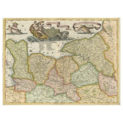
Decorative Original Antique Map of Normandy, France
Located in Langweer, NL
Original antique map titled 'Ducato D'Normandie Scala di Miglia d'Italia'. Very decorative map of Normandy, with a fine title cartouche featuring Leda ...
Category
Late 17th Century Antique Maps
Materials
Paper
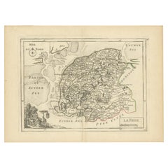
Map of Friesland (La Frise), from a French Atlas - circa 1756
Located in Langweer, NL
Title: Map of Friesland (La Frise), from "Atlas Nouveau Portatif" (1756)
This is an 18th-century map of Friesland (Frise), a northern province of the Netherlands, engraved by *Georg...
Category
1750s Antique Maps
Materials
Paper
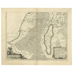
Antique Map of Southern Palestine by Bachiene, 1763
Located in Langweer, NL
"Antique map of the south part of Palestine. This simplified map shows the most important cities of the Jewish Land. Source unknown, to be determined. Artists and Engravers: Made by ...
Category
18th Century Antique Maps
Materials
Paper
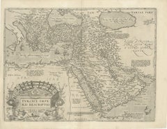
16th-Century Map of the Ottoman Empire and Near East: Turcici Imperii Descriptio
Located in Langweer, NL
Title: Original 16th-Century Map of the Ottoman Empire and Near East: *Turcici Imperii Descriptio* by Ortelius, 1571
This rare copperplate engraving, Turcici Imperii Descriptio, i...
Category
16th Century Antique Maps
Materials
Paper
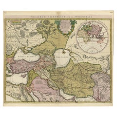
Finely Engraved Historical Map of Middle East and Asia, c.1745
Located in Langweer, NL
Description: Antique map titled'Theatrum Historicum pars Orientalis.'
Finely engraved historical map with a profusion of details. It shows the Middle East and Asia. Decorative ti...
Category
1740s Antique Maps
Materials
Paper
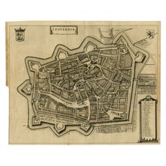
Antique Map of the City of Leeuwarden by Leti, 1690
Located in Langweer, NL
Antique map titled 'Leovardia.' A plan of Leeuwarden in Friesland, the Netherlands. With two coats of arms, the title in a scroll and an index of 30 buildings in the lower right. Fro...
Category
17th Century Antique Maps
Materials
Paper
Antique Map of the Port of Zihuatanejo in Mexico, c.1740
Located in Langweer, NL
Antique map titled 'Plan du Port de Chequetan ou Seguataneo'. Map of the Mexican port of Zihuatanejo. This area was originally named Cihuatlán in Aztec, which means 'Place of Women,'...
Category
18th Century Antique Maps
Materials
Paper
Highly Detailed Antique Map of the Holy Land Showing 12 Tribes of Israel, c.1720
Located in Langweer, NL
Antique map titled 'Heylige Land verdeeld in de Twaalf Stammen Israels (..).'
Highly detailed map of the Holy Land divided into 12 tribes of Israel...
Category
1720s Antique Maps
Materials
Paper
Rare Hand-Colored Map of Franche-Comté and Burgundy by Frederik De Wit c. 1688
Located in Langweer, NL
Title: Rare Hand-Colored Map of Franche-Comté and Burgundy by Frederik De Wit c. 1688
Description: This stunning 17th-century map, titled "Comitatus Burgundiae vulgo La Franche Comt...
Category
1680s Antique Maps
Materials
Paper
The Antient City of Jerusalem and Places Adjacent, Hand-Colored Map, 1699
Located in Langweer, NL
Title: "1699 Hand-Colored Bird's-Eye Plan of Jerusalem with Ancient and Biblical Landmarks"
This beautifully hand-colored, imaginary bird's-eye plan of Jerusalem, published in 1699,...
Category
1690s Antique Maps
Materials
Paper
1782 Map of the East Indies – India, Siam, Philippines, Java, Borneo, Ganges
Located in Langweer, NL
1782 Bayly Map of the East Indies – India, Siam, Philippines, Java, Borneo, Ganges
This finely engraved and vibrantly hand-colored map titled 'A New Map of the East Indies' was dr...
Category
1780s Antique Maps
Materials
Paper
Antique Map of the Coast of Southern France, 1793
Located in Langweer, NL
Antique map titled '14th Chart of the Coast of France, from Port Vendres to the Petit Rhône'. Original map with later hand coroling of the coast of Southern France.
The "14th Chart of the Coast of France, from Port Vendres to the Petit Rhône" is an antique map that offers a detailed depiction of the southern coast of France, specifically highlighting the Mediterranean coastline. This map, which dates back to 1793, was originally part of "Le Petit Neptune Français; Or, French Coasting Pilot," a publication designed for maritime navigation along the French coastlines.
Key Features of the Map:
1. **Geographic Coverage**:
- The map covers the southern French coastline from Port Vendres in the west to the Petit Rhône in the east.
- It includes notable regions such as Languedoc, the Gulf of Lyon, and parts of Catalonia (Spain).
2. **Notable Places**:
- **Montpellier**: A major city in the Diocese of Montpellier, an important cultural and economic center.
- **Narbonne**: Located in the Diocese of Narbonne, a historical city with Roman heritage.
- **Agde**: Situated in the Diocese of Agde, known for its ancient Greek colony origins.
- **Béziers**: Part of the Diocese of Béziers, another city with deep historical roots dating back to Roman times.
- **Port Vendres**: A critical port near the Spanish border.
- **Catalonia**: Including parts of northeastern Spain, emphasizing the coastal connection between France and Spain.
3. **Dioceses and Regions**:
- The map is marked with various dioceses such as Montpellier, Agde, Narbonne, and Béziers, indicating ecclesiastical boundaries.
- It highlights the broader region of Languedoc, a historical province known for its wine production and medieval history.
4. **Navigational Aids**:
- The map features a compass rose with radiating lines, a common navigational aid in maritime maps...
Category
Late 18th Century Antique Maps
Materials
Paper
Map of Tartary by Isaak Tirion: Detailed Cartography of Northern Asia, ca.1740
Located in Langweer, NL
This is an antique map titled "Nieuwe Kaart van Tartarie," which translates to "New Map of Tartary." The map was created by Isaak Tirion, a prominent Dutch cartographer and publisher...
Category
1740s Antique Maps
Materials
Paper
Large Antique Map of the German Empire
Located in Langweer, NL
Antique map titled 'A Map of Germany (..)'. Large antique map of the German Empire, highly detailed. Engraved by T. Kitchin. Published J. Blair, cir...
Category
Late 18th Century Antique Maps
Materials
Paper
Original Antique Map of Greece and part of Turkey
Located in Langweer, NL
Original antique map titled 'La Grece ou partie meridionale de la Turquie d'Europe'. Small map of Greece and part of Turkey. This map originates from 'Le nouveau et curieux Atlas Geo...
Category
Early 18th Century Antique Maps
Materials
Paper
Antique Map of the Middle East with a Large Arabia, 1799
Located in Langweer, NL
Antique map titled 'Perse, Turquie Asiatique et Arabie (..)'. Map of the Middle East with a large Arabia, extending from the Black Sea to the In...
Category
Late 18th Century Antique Maps
Materials
Paper
Antique Map of Flanders, France Incl the Cities Lille, Tournai, Douai, c.1730
Located in Langweer, NL
Antique map titled 'Flandriae comitatus pars Australis'. Decorative antique map of the southern portion of Flanders, France. It shows the cities of Lille (Rijsel), Douai, Tournai (Do...
Category
18th Century Antique Maps
Materials
Paper
Antique Engraving of Malaysia, Brunei, Singapore, Java, Borneo, Sumatra, c.1750
Located in Langweer, NL
Nice decorative and detailed map from the Gulf of Siam and Mindoro to Timo, Java and Sumatra Borneo and Roy de Siam. Large compass rose and nice cartouche.
Title: Carte des Isles ...
Category
Mid-18th Century Antique Maps
Materials
Paper
French Antique Map of France and Western Europe, 1765
Located in Langweer, NL
Antique map titled 'Carte de tous les Lieux, célébres dans l'Histoire (..)'. Beautiful old map of France and western Europe. This map originates from 'Atlas Historique de la France A...
Category
18th Century Antique Maps
Materials
Paper
Map of the Vietnamese Coast, Centered on Turon Harbor 'Da Nang Area', 1796
Located in Langweer, NL
Antique map titled 'A chart of part of the coast of Cochin-China including Turon Harbour and the Island Callao'.
Detailed map of the Vietnamese Coast, centered on Turon Harbor (D...
Category
1790s Antique Maps
Materials
Paper
Friesland, Groningen, Drenthe, Overijssel – Antique Map by Seb. Münster, 1574
Located in Langweer, NL
Friesland, Groningen, Drenthe, Overijssel – Antique Map by Sebastian Münster, 1574
This rare and finely colored woodcut map of Northern Netherlands depicts the provinces of Friesl...
Category
16th Century Antique Maps
Materials
Paper
18th-Century Map of the Eastern Roman Empire by Henri Chatelain, c. 1719
Located in Langweer, NL
Title: 18th-Century Map of the Eastern Roman Empire by Henri Chatelain, c. 1719
Description: This intricately detailed map, titled *Nouvelle Carte pour Servir à l'Histoire de l'Empi...
Category
1710s Antique Maps
Materials
Paper
Pl. 8 Antique Plan of the House of Mr. Morel by Le Rouge, c.1785
Located in Langweer, NL
Antique print titled 'Plan de la Maison de Ville et de Campagne de Mr. Morel'. Copper engraving showing a plan of the house of Mr. Morel. This print originates from 'Jardins Anglo-Ch...
Category
18th Century Antique Maps
Materials
Paper
Antique Print of Duncombe Park by Campbell, 1725
Located in Langweer, NL
Antique print titled 'Elevation of Duncomb Park in Yorkshire (..)'. Old engraving of Duncombe Park, Yorkshire. Duncombe Park is the seat of the Duncombe family whose senior members a...
Category
18th Century Antique Maps
Materials
Paper
Antique Map of Venezuela by Montanus, 1671
Located in Langweer, NL
Antique map titled 'Venezuela cum parte Australi Novae Andalusiae'. The map extends from Coquibocoa to the Orinoque River, centered on Bariquicemento and Cape de Curiacao. Large cart...
Category
Mid-17th Century English Antique Maps
Materials
Paper
Original Antique Map of Normandy, France
Located in Langweer, NL
Antique map titled 'Carte de Normandie (..)'. Attractive map of Normandy, France. it depicts the former French Duchy of Normandy, covers the region fro...
Category
Mid-18th Century Antique Maps
Materials
Paper
Old Map of the Spice Islands, Moluccas by Bellin, Published in 1771
Located in Langweer, NL
Title: 1771 Jacques-Nicolas Bellin Map of the Moluccas, the Spice Islands of Indonesia
Description: This finely engraved eighteenth-century map, titled Carte Particulière des Is...
Category
1770s Antique Maps
Materials
Paper
Antique Map of the Cities of the Qing Dynasty Provinces in China, 1738
Located in Langweer, NL
Antique print titled 'Cities of the Province of Kyang-si, Fo-kyen, Shan-Si & Yun-nan'. Old map depicting four walled cities of the Chinese Qing dynasty provinces Yunnan, Shanxi, Fuji...
Category
18th Century Antique Maps
Materials
Paper
Antique Map of Java, Madura, Bali and the Sunda Strait, Indonesia, c.1770
Located in Langweer, NL
Antique map Indonesia titled 'Nouvelle Carte de l'Isle de Java - Nieuwe kaart, van het Eiland Java'. Chart of the island of Java, depicting soun...
Category
18th Century Antique Maps
Materials
Paper
Large Antique Map of Asia including All of Southeast Asia, c.1792
Located in Langweer, NL
Antique map titled 'L' Asie Divisee en ses Empires, Royaumes, et Etats'. Attractive, large map of Asia including all of Southeast Asia. The cartography is archaic for the period with...
Category
18th Century Antique Maps
Materials
Paper
Copper-Engraved Map Showing the Algerian Coast of North Africa, Published 1683
Located in Langweer, NL
Antique map titled 'Partie de Barbarie, ou est le Royaume d'Alger (..)'.
Copper-engraved map showing the Algerian coast of North Africa. Published 1683.
Artists and Engravers:...
Category
1680s Antique Maps
Materials
Paper
Historical Map of the Black Sea and Surrounding Regions, 1705
Located in Langweer, NL
Title: "Map of Turcomania, Georgia, and Comania"
This print presents an intricately detailed map of the Caucasus region, titled “Turcomania, Georgien Commanie,” by the esteemed cart...
Category
Early 1700s Antique Maps
Materials
Paper
Antique Map of North Africa by Ortelius, c.1580
Located in Langweer, NL
Antique map titled 'Barbariae et Biledulgerid Nova Descriptio'. Original antique map of North Africa. The map covers the regions of Barbaria and Biledulgerid, essentially the territo...
Category
16th Century Antique Maps
Materials
Paper
Antique Map of Martinique, Showing Roads, Houses, Sugar Plantations, etc. c.1750
Located in Langweer, NL
Antique map titled 'Carte de l'Isle de la Martinique'.
Detailed map of Martinique. Shows hilly terrain, forests, roads, houses, and even the sugar plantations. The island was to ...
Category
18th Century Antique Maps
Materials
Paper
Antique Map of the Holy Land, showing the travels of Abraham, Isaac and Jacob
Located in Langweer, NL
Antique map titled 'Tabula Itineraria Patriarcharum Abrahami, Isaaci et Iacobi'. Decorative regional map of the Holy Land, showing the travels of Abraham, Isaac and Jacob. Published ...
Category
Mid-17th Century Antique Maps
Materials
Paper
Rare 1757 Jesuit Map of California and Baja, Dedicated to the King of Spain
Located in Langweer, NL
Title: Rare 1757 Jesuit Map of California and Baja, Dedicated to the King of Spain
This rare and detailed map, titled *Carte de la Californie Levee par la Société des Jésuites*, wa...
Category
1750s Antique Maps
Materials
Paper
Antique Map of Silesia centered on Glogau
Located in Langweer, NL
Antique map titled 'Ducatus Silesiae Glogani vera delineatio'. This decorative map shows the Odra River valley based on the Silesian cartographer, Jonas Scultetus. The map is oriente...
Category
Mid-17th Century Antique Maps
Materials
Paper
Antique Map of Pannonia and Illyria by Cluver, 1685
Located in Langweer, NL
Antique map titled 'Pannonia et Illyricum.' Charming miniature map of Pannonia and Illyria, from the pocket atlas 'Introductionis in Universam Geographiam tam Veterem quam novam .. A...
Category
17th Century Antique Maps
Materials
Paper
Large Decorative Antique Map of the Mediterranean, ca.1770
Located in Langweer, NL
Antique map titled 'Carte de la Mer Mediterranee en Douze Feuilles'.
First map out of twelve fine engraved double-page and folding maps that join to create a large wall map...
Category
1770s Antique Maps
Materials
Paper
Antique Map of of Bengal and the mouth of the Ganges River
Located in Langweer, NL
Antique map titled 'Carte du Bengale, avec la partie Septentrionale (..)'. Original antique map of Bengal and the mouth of the Ganges river. This map ori...
Category
Late 18th Century Antique Maps
Materials
Paper
16th Century Map of Saudi Arabia, the Persian Gulf and Red Sea, ca. 1574
Located in Langweer, NL
Ptolemaic map of the Arabian Peninsula based on the 1548 map of Giacomo Gastaldi. It covers nearly all of the peninsula, but does not include the head of the Red Sea. The coastlines ...
Category
16th Century Antique Maps
Materials
Paper
Antique Map of Greece from Ortelius's Theatrum Orbis Terrarum, 1595
Located in Langweer, NL
Original antique map titled "Graecia Sophiani." This is a very detailed and decorative engraved map, with two decorative cartouches and a hand-colored initial on the verso, from Abra...
Category
16th Century Antique Maps
Materials
Paper
Rare Original 16th Century Antique Map of Greece, 1598
Located in Langweer, NL
Beautiful and rare antique map of Greece with Albania, Mecedonia, Romania, Dalmatia and the peninsula of Salento to the Golf of Taranto. Also clearly shown the islands of the Aegaian...
Category
16th Century Antique Maps
Materials
Paper
Rare Unusual Antique Map of Asia with a Landbridge from Korea to America, 1717
Located in Langweer, NL
Antique map titled 'L'Asie Suivant les Nouvelles Decouvertes (..).' Interesting and very unusual map of the Asian continent.
The map is based primarily on Dutch sources, particular...
Category
18th Century Antique Maps
Materials
Paper
Antique Architectural Print of Pavilions for English Gardens by Le Rouge, 1776
Located in Langweer, NL
Antique print titled 'Pavillons Grottes pour les Jardins Anglais'. Copper engraving showing pavilions for English gardens. This print originates from 'J...
Category
18th Century Antique Maps
Materials
Paper
Antique Map of the Eastern Part of the World by Tirion, 1755
By Isaak Tirion
Located in Langweer, NL
Antique map titled 'Nieuwe Kaart van het Oostelykste Deel der Weereld, dienende tot Aanwyzing van de Scheepstogten der Nederlanderen naar Oostindië'. Australia (Nieuw Holland) shown ...
Category
Mid-18th Century Dutch Antique Maps
Materials
Paper
Large Antique Map of France by De Wit, c.1680
Located in Langweer, NL
Antique map titled 'Accuratissima Galliae Tabula vulgo Royaume de France'. Detailed map of France. Shows provinces, cities, rivers etc.
Artists and Engravers: Frederick de Wit (1...
Category
17th Century Antique Maps
Materials
Paper
Map of the Margraviate and Electorate of Brandenburg by de Beaurain - ca.1750
Located in Langweer, NL
Historical Map of the Margraviate and Electorate of Brandenburg by Chevalier de Beaurain - Circa 1750
This impressive historical map, titled "Carte du Marquisat et Electorat de Br...
Category
1750s Antique Maps
Materials
Paper
Antique Map of Romania and Bulgaria Centered on the Danube River
Located in Langweer, NL
Antique map titled 'Vetus descriptio Daciarum nec non Moesiarum'. Impressive map of the area of Romania and Bulgaria centered on the Danube River. The map is based on Ortelius' map o...
Category
Mid-17th Century Antique Maps
Materials
Paper
Antique Map of Scandinavia by T. Jefferys, circa 1750
Located in Langweer, NL
Antique map titled 'Sweden, Denmark, Norway & Finland'. An original mid-18th century copper engraved antique map of Scandinavia by Thomas Jefferys....
Category
Mid-18th Century Antique Maps
Materials
Paper
Antique Bird's Eye View of Scheveningen Near The Hague, the Netherlands, 1730
Located in Langweer, NL
Antique print titled 'Afbeeldinge van Schevelinge in den Jaare 1729'.
Bird's eye view of Scheveningen near The Hague / Den Haag, the Netherlands. This print originates from 'Beschr...
Category
1730s Antique Maps
Materials
Paper
Engraving of a Map of Florida, the Gulf Coast, Caribbean & Central America, 1728
Located in Langweer, NL
This exceptional antique map, titled "Nouvelle Carte Marine de Toute les Cotes de l´Amerique" and alternatively known as "Nieuwe groote en seer Curieuse Paskaart van Geheel-WestIndie...
Category
Mid-18th Century European Antique Maps
Materials
Paper
Antique Map of Persia with Dedication Cartouche
Located in Langweer, NL
Antique map titled 'Persia sive Sophorum Regnum'. Original old map of Persia. The map extends from the Eastern Mediteranian to Tacalistan and the Indus River and the Dalanguer Mounta...
Category
Mid-17th Century Antique Maps
Materials
Paper
Original Antique Map of Abyssinia, Sudan and the Red Sea, 1749
Located in Langweer, NL
Antique map titled 'Nubie, Abissinie et Cote d'Ajan'.
Map of Abyssinia, Sudan and the Red Sea by Robert Vaugondy. Covers from Arabia and Egypt south to M...
Category
1740s Antique Maps
Materials
Paper
Print of Garden Pavilions of the Earl of Tilney and Knight Stevenson, c.1785
Located in Langweer, NL
Antique print titled 'Pavillon pour les jardins (..)'. Copper engraving showing the pavilions of the Earl of Tilney and Knight Stevenson.
Earl Tylney, of Castlemaine in the Count...
Category
18th Century Antique Maps
Materials
Paper
Old Map of Anatolia, part of modern-day Turkey, Armenia and Syria, 1745
Located in Langweer, NL
Title: "Kaartje van Natolie en Syrie opgesteld door de Hr. Lucas en de Hr. Guil de L'Isle en andere auteuren"
The title "Kaartje van Natolie en Syrie opgesteld door de Hr. Lucas en...
Category
1740s Antique Maps
Materials
Paper
Large Antique Lithography Map of Kent, English, Cartography, Robert Morden, 1700
Located in Hele, Devon, GB
This is a large antique lithography map of Kent. An English, framed atlas engraving of cartographic interest by Robert Morden, dating to the early 18th century and later.
Superb li...
Category
Early 18th Century British Queen Anne Antique Maps
Materials
Glass, Wood, Paper
Map of The East Indies with the Route of Capt. William Dampier's Voyage, 1698
Located in Langweer, NL
Antique map titled 'Kaart van Oost Indie'.
Old map of the East Indies. It shows the routes of Captain William Dampier's voyage throughout the regio...
Category
1690s Antique Maps
Materials
Paper
