Maps
to
2,380
2,816
114
2,933
26
12
1
1
1
1
2,926
2,181
476
3
289
34
10
127
7
35
9
2
5
3
4
2
2,917
33
20
4
3
199
72
63
34
31
2,933
2,933
2,933
63
24
16
13
13
Maps For Sale
Period: 18th Century and Earlier
Period: 1910s
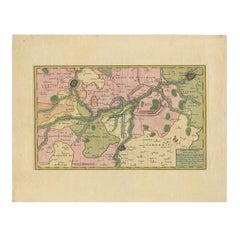
Antique Map of the Region of Bouchain and Cambrai by Visscher 'circa 1680'
Located in Langweer, NL
Antique map titled 'Carte Nouvelle des Environs de Bouchain & Cambray'. Uncommon map of the region of Bouchain and Cambrai (Cambray, France) showing the camps of two armies.
Category
Late 17th Century Antique Maps
Materials
Paper
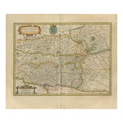
Antique Map of the Region of Lyon by Hondius, circa 1630
Located in Langweer, NL
Antique map titled 'Lionnois, Forest et Beauiolois'. Old map of the former region of Lyon, Vienne, Bresse, Rohan and the Rhône River. This map originates f...
Category
Mid-17th Century Antique Maps
Materials
Paper
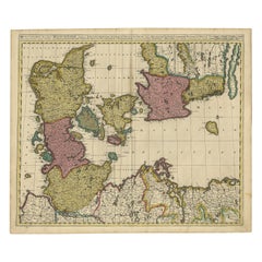
Antique Map of Denmark by Valk 'circa 1690'
Located in Langweer, NL
The map titled "Regnum Daniae, divisum in Dioeceses Arhusiam, Albergum, Viborgum, et Ripam (..)" is a meticulously detailed representation of the Kingdom of Denmark during a historic...
Category
Late 17th Century Antique Maps
Materials
Paper
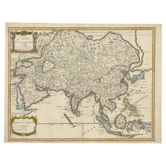
Antique Map of Asia by Pierre du Val, '1663'
Located in Langweer, NL
Antique map titled 'L'Asie'. Antique map of the Asian continent by Pierre Duval, dated 1663. Most place names represent geographical entities that currently exist or once existed. The rendition of the lower islands of Japan and the peninsula of Korea are improved over earlier studies. Details of the Great Wall of China...
Category
Mid-17th Century Antique Maps
Materials
Paper
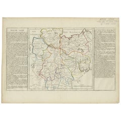
Antique Map of Lower Saxony by Clouet, 1787
Located in Langweer, NL
Antique map titled 'Basse Saxe'. Antique map of Lower Saxony, Germany. Originates from 'Geographie moderne avec une introduction' by J.B.L. Clouet.
Category
Late 18th Century Antique Maps
Materials
Paper
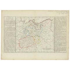
Antique Map of Upper Saxony in Germany by Clouet, 1787
Located in Langweer, NL
Antique map titled 'Du Cercle de Haute Saxe'. Antique map of Upper Saxony, Germany. Originates from 'Geographie moderne avec une introduction' by J.B.L. Clouet.
Category
Late 18th Century Antique Maps
Materials
Paper
Antique Map of the Region of Picardy by Janssonius, 1657
Located in Langweer, NL
Antique map of France titled 'Picardia vera et inferior'. Detailed map of the Picardy region of France. This map originates from 'Atlas Novus, Sive Theatrum Orbis Orbis Terrarum: In ...
Category
Mid-17th Century Antique Maps
Materials
Paper
City View of Nuremberg, Germany: An 18th Century Hand-Colored Map by M. Seutter
Located in Alamo, CA
An 18th century hand-colored city view of Nuremburg, Germany entitled "Geometrischer Grundris der des Heiligen Römischen Reichs Freyen Stadt Nürnberg" by Matthaus Seutter from his "A...
Category
Mid-18th Century German Antique Maps
Materials
Paper
Antique Map of the Journey from Zhe-Hol in Tartary to Beijing and Hang-Tchoo Foo
Located in Langweer, NL
Antique map of China titled 'A Sketch of a Journey from Zhe-Hol in Tartary by land to Pekin and from thence by water to Hang-Tchoo-Foo in China'. Detailed map showing the route taken...
Category
Late 18th Century Antique Maps
Materials
Paper
Antique Map of the Region of Sedan and Doncheri by Janssonius, 1657
Located in Langweer, NL
Antique map of France titled 'La Souveraineté de Sedan et de Raucourt, et la prevosté de Doncheri'. Lovely map centered on Sedan and Doncheri and the Meuze River from Charleville and...
Category
Mid-17th Century Antique Maps
Materials
Paper
Antique Map of the Region of Lyonnais by Janssonius, '1657'
Located in Langweer, NL
Antique map 'Lionnois, forest, beauviolois et masconnois'. Decorative map of the Lyonnais region, France. The Lyonnais is a historical province of France which owes its name to the c...
Category
Mid-17th Century Antique Maps
Materials
Paper
Antique Map of the Region of Charolais by Janssonius, 1657
Located in Langweer, NL
Antique map 'Les environs de L'Estang de Longpendu, comprenant une grande partie du Comté de Charolois'. Decorative map of the Charolais region. This map originates from 'Atlas Novus...
Category
Mid-17th Century Antique Maps
Materials
Paper
Antique Map of Three Cities of China's Hubei and Hunan Provinces by Bellin
Located in Langweer, NL
Antique print titled 'Plans de Quelques villes de la province de Hou-Quang.' Three bird's-eye view plans of walled cities in what are now China's Hubei (Hou-Quang) and Hunan Province...
Category
Mid-18th Century Antique Maps
Materials
Paper
Antique Map of Ambon and Surroundings by Valentijn '1726'
By F. Valentijn
Located in Langweer, NL
Antique map titled 'De landvoogdy van Amboina met de elf onderhoorige Eylanden'. Decorative map of the eastern tip of the islands of Ambon, Indonesia. This print originates from 'Oud...
Category
Early 18th Century Dutch Antique Maps
Materials
Paper
Antique Map of Asia by Dussy, 1778
Located in Langweer, NL
Antique map of Asia titled 'Indostan presqu'isles de l'Inde, Chine, Tartarie Independante'. Depicting South-East Asia including Hindustan, India an...
Category
Late 18th Century French Antique Maps
Materials
Paper
Antique Print of a River in Madagascar by Valentijn, 1726
By F. Valentijn
Located in Langweer, NL
Antique print titled 'Rivier van Maningaar op Madagascar'. Text on verso. This print originates from 'Oud en Nieuw Oost-Indiën' by F. Valentijn. According to Valentijn, there was a D...
Category
Early 18th Century Dutch Antique Maps
Materials
Paper
Antique Map of Java by Janssonius, circa 1650
Located in Langweer, NL
Antique map titled 'Insulae Iavae cum parte insularum Borneo Sumatrae, et circumjacentium insularum novissima delineatio'. Beautiful map of Java and parts of Bali, Borneo, Sumatra an...
Category
Mid-17th Century Antique Maps
Materials
Paper
Antique Map Normandy 'France' by Homann Heirs, Published in c.1740
By Homann Heirs
Located in Langweer, NL
Antique map France titled 'Normannia Galliae celebris Provincia in terras suas Ballisiatus (..)'.
Decorative regional map of Normandy, France, circa ...
Category
Mid-18th Century German Antique Maps
Materials
Paper
Antique Map of South America by G. Anson, 1749
Located in Langweer, NL
Antique map titled 'Kaart van het Zuidelykste Gedeelte van Zuider Amerika (..) - Carte de la Partie Meridionale de l'Amerique Meridionale (..)'. Detailed chart tracking the route of Capt. George Anson's ship The Centurion in 1745. The chart shows the tracks of Anson's ships around South America & Cape Horn to the Juan Fernandes Islands, with notes on currents and positions. This map originates from 'Reize rondsom de Werreld (..)' by George Anson, published 1749.
In 1740 Capt. George Anson (1697-1762) of the Royal Navy, was given command of a squadron of ships. As England was at war with France and Spain, Anson's task was to intercept and capture a Spanish treasure...
Category
Mid-18th Century Dutch Antique Maps
Materials
Paper
Antique Map of Herefordshire 'England' by R. Morden, 1708
Located in Langweer, NL
This antique County map of Herefordshire by Robert Morden was first published in 1701 in a work entitled 'The New Description and State of England'...
Category
Early 18th Century Antique Maps
Materials
Paper
Antique Map of the Russian Empire by R. Bonne, 1780
Located in Langweer, NL
Antique map titled 'Carte de l'Empire de Russie.' Drawn by R. Bonne for G. Raynal’s Atlas de Toutes les Parties Connues du Globe Terrestre, Dressé pour l'Histoire Philosophique et Po...
Category
Late 18th Century Antique Maps
Materials
Paper
Antique Map of Russia by N. Sanson, 1705
Located in Langweer, NL
A strongly engraved map of European Russia showing its political divisions, major topographical features, cities and towns. Extends to the Sea of Azov and the tip of the Caspian Sea ...
Category
Early 18th Century Antique Maps
Materials
Paper
Antique Map of the Moluques Islands, Part of Indonesia, circa 1750
Located in Langweer, NL
Map of the Moluques (also known as the Moluccas, Moluccan Islands or simply Maluku). Depicts the islands of Herij, Ternate, Tidor, Pottebackers, Timor, Machian and Bachian.
Category
Mid-18th Century Antique Maps
Materials
Paper
Antique Map of Sweden and Norway by H. Moll, circa 1715
Located in Langweer, NL
Beautiful and rare map of Sweden and Norway including English text. This map most likely originates from 'The Compleat geographer, or, The chorography and topography of all the known...
Category
Early 18th Century Antique Maps
Materials
Paper
Antique Map of Austria by F. de Wit, 1690
Located in Langweer, NL
Antique map titled 'Circuli Austriaci pars Septentrionalis in qua Archiducatus'. Decorative and detailed map of Austria by F. de Wit.
Category
Late 17th Century Antique Maps
Materials
Paper
Antique Map of Switzerland by N. Visscher, circa 1690
Located in Langweer, NL
Beautifully detailed map of Switzerland and surrounding regions in present-day France, Germany, and Italy. This map features two decorative cartouches: the larger is flanked by two p...
Category
Late 17th Century Antique Maps
Materials
Paper
Antique Map of Nova Zembla 'Russia' by J.N. Bellin, 1757
Located in Langweer, NL
Decorative map of Nova Zembla and environs in the Arctic Sea. Includes a large decorative title cartouche. One of the maps produced by Jacques-Nicolas Bellin for Prevost d'Exiles inf...
Category
Mid-18th Century Antique Maps
Materials
Paper
Antique Map of the Coast of Zanguebar and Madagascar 'Africa' by J. van Schley
Located in Langweer, NL
Decorative map of the area between the east coast of South Africa, the Seychelles, Mauritius and Madagascar. It was made by Jacob van der Schley for the Dutch edition of Histoire Gén...
Category
Mid-18th Century Antique Maps
Materials
Paper
Antique Print of the Bay of Sierra Leone by J. Van Der Schley, 1758
Located in Langweer, NL
Beautiful map and bird's-eye view of the Bay of Sierra Leone. While these maps by Van Schley after Bellin were initially made for 'Histoire Generale des Voyages' (Paris, 1746-1759), ...
Category
Mid-18th Century Antique Maps
Materials
Paper
Antique Map of the Coast of Cape Verde by J. Van Der Schley, circa 1750
Located in Langweer, NL
An early map of what is now the coast of the capital city of Dakar, Senegal. What is now a dense, bustling city was at this time a uninhabited coast. Shows the overall contours of th...
Category
Mid-18th Century Antique Maps
Materials
Paper
Antique Map: Friesland and Terschelling with Inset Isles, by Visscher II, 1670
Located in Langweer, NL
Antique Map: Friesland and Terschelling with Inset Isles, by Nicolaas Visscher II, 1670
This large copper-engraved map provides a detailed and visually stunning depiction of the coastline of Friesland and the island of Terschelling, along with portions of Groningen to the east. Originating from Nicolaas Visscher II’s *Germania Inferiorsive XVII Provinciarum Geographicae Generalis* (Kaert-Boeck van de XVII Nederlandtsche Provincien), this map was published in Amsterdam circa 1670.
The map highlights the main cities of Friesland, beautifully accented in red, and includes a decorative inset in the lower-right corner, illustrating the smaller isles belonging to the province. The finely engraved details make this map a remarkable artifact of 17th-century cartography, with its coastline features rendered with precision and artistic flair.
Adding to its charm, the map is adorned with elaborate decorative cartouches featuring putti (cherubs) and a coat of arms, hallmark elements of Nicolaas Visscher II’s cartographic artistry. Visscher was one of the most prominent Dutch mapmakers of the Golden Age of Cartography, known for his dedication to both geographical accuracy and artistic embellishment. His maps were highly sought after during his lifetime and remain prized by collectors today.
Keywords: antique map Friesland, Terschelling map, Nicolaas Visscher II, 17th-century Dutch cartography, Groningen coastline map, decorative map cartouches, Germania Inferiorsive XVII Provinciarum, Kaert-Boeck Nederlandtsche Provincien, historical Dutch maps, rare collectible maps, Golden Age cartography.
This map is a treasure for collectors of antique cartography...
Category
Late 17th Century Antique Maps
Materials
Paper
Antique Map of the Tonkin River ‘Vietnam’ by J.N. Bellin, 1764
Located in Langweer, NL
One of the maps produced by Bellin for Prevost d'Exiles' influential travel book, ‘L'Histoire Generale des Voyages’. This map depicts part of Southeast Asia, most likely northern Vie...
Category
Mid-18th Century Antique Maps
Materials
Paper
Antique Map of the City of Antwerpen ‘Belgium’ by A. Deur, 1729
Located in Langweer, NL
Copper-engraving by A. Deur. Published by I. van der Kloot in Den Haag, 1729. With French and Dutch title-cartouches and explanatory notes, several ships o...
Category
Early 18th Century Antique Maps
Materials
Paper
Antique Map 'Colored Cartouches' of the British Isles by Covens & Mortier ‘1761’
Located in Langweer, NL
Covens and Mortier's attractive double-page engraved map of the British Isles, based on the 1702 De L'Isle map. The map features a large car...
Category
Late 18th Century Antique Maps
Materials
Paper
Antique Map of Switzerland by J.B. Homann, 1751
Located in Langweer, NL
Decorative example of Homann's map of Switzerland, with decorative cartouche and the coat of arms of each of the 13 Cantons.
Category
Mid-18th Century Antique Maps
Materials
Paper
Antique Map: Estuaries of the Somme & Bresle, Northern France & Netherlands
By Jacobus Harrewijn
Located in Langweer, NL
Antique Map: Les Embouchures de la Somme et de Bresle (Estuaries of the Somme and Bresle)
This beautifully detailed antique map, titled *Les Embouchures de la Somme et de Bresle*, showcases the coastline of northern France, specifically focusing on the estuaries of the Somme and Bresle rivers. Part of a larger series of maps that collectively depict a significant portion of the Southern Netherlands, this engraving captures the intricate geography of the region with remarkable precision.
The map provides a detailed view of the coastal towns, rivers, and natural features that define the area. Notable locations such as Dieppe and St. Valery are highlighted, reflecting their historical significance as key port towns and hubs of trade and navigation. The surrounding rivers and estuaries are meticulously rendered, showing the natural waterways that played a crucial role in the development of the region.
This engraving is enhanced by the inclusion of charming decorative elements, such as sailing ships in the surrounding waters, adding a sense of movement and life to the map. The inclusion of forests and topographical details in the inland areas demonstrates the mapmaker's commitment to providing a comprehensive representation of the region.
The map's historical context lies in its origin as part of a series that aimed to document the territories of the Southern Netherlands and northern France during a period of significant political and geographical change in Europe. Such maps were invaluable tools for navigation, trade, and territorial administration, making them both functional and artistic.
Keywords: antique map of Northern France, Somme estuary map, Bresle estuary, Dieppe historical map, Southern Netherlands cartography, French coastline map, 17th-century map engraving, historical geography, decorative antique map, rare European maps, maritime history.
This map is an exceptional piece for collectors of antique cartography...
Category
Early 18th Century Antique Maps
Materials
Paper
1590 Mercator Map Entitled "France Picardie Champaigne, Ric.0001
Located in Norton, MA
Description: Published in Amsterdam by Mercator/Hondius ca. 1590.
Ric.0001
Artists and Engravers: Map : 'France Picardie Champaigne cum regionibus adiacentibus'. (Map of the french provinces of Picardie and Champagne.) Copper engraved map of the french provinces of Picardie and Champagne, showing the cities of Caen, Paris, Melun, Auxerre, Verdun, etc. Copperplate engraving on verge type hand laid paper with watermark. Description: Published in Amsterdam by Mercator/Hondius ca. 1600.Artists and Engravers: Mercator was born in Rupelmonde in Flanders and studied in Louvain under Gemma Frisius, Dutch writer, astronomer and mathematician. The excellence of his work brought him the patronage of Charles V, but in spite of his favor with the Emperor he was caught up in the persecution of Lutheran protestants and charged with heresy, fortunately without serious consequences. No doubt the fear of further persecution influenced his move in 1552 to Duisburg, where he continued the production of maps, globes and instruments. Mercator's sons and grandsons, were all cartographers and made their contributions in various ways to his atlas. Rumold, in particular, was responsible for the complete edition in 1595. The map plates...
Category
16th Century Dutch Antique Maps
Materials
Paper
Antique Lithography Map, Durham, English, Framed, Cartography, Early Georgian
Located in Hele, Devon, GB
This is an antique lithography map of Durham. An English, framed engraving of cartographic interest, dating to the early 18th century and later, circa 1720.
Superb lithography of Du...
Category
Early 18th Century British Georgian Antique Maps
Materials
Wood
1635 Willem Blaeu Map of Northern France"Comitatvs Bellovacvm" Ric.a08
Located in Norton, MA
1635 Willem Blaeu map of northern France, entitled.
"Comitatvs Bellovacvm Vernacule Beavvais,"
Colored
Ric.a008
“COMITATVS BELLOVACVM…” Amsterdam: W...
Category
17th Century Unknown Antique Maps
Materials
Paper
Antique Coaching Road Map, Devon, English, Regional Cartography, Georgian, 1720
Located in Hele, Devon, GB
This is an antique coaching road map of Devon. An English, framed lithograph engraving of regional interest, dating to the early 18th century and later.
Fascinating 18th century hig...
Category
Early 18th Century British Georgian Antique Maps
Materials
Wood
1636 Jansson Map of Ireland Entitled "Comitatus Lageniae, " Ric.a007
Located in Norton, MA
1646 Jansson map entitled
"Procinvia connactiae,"
Ric.a006
Description: The PROVINCE of CONNAVGT 490 x 380From vol 4 of Jansson's Atlas Novus 1646, published in Amsterdam with...
Category
17th Century Unknown Antique Maps
Materials
Paper
1620 Map of Artois Entitled "Artesia Comitatvs Artois, " by Bleau, Ric.a012
Located in Norton, MA
1640 map of Artois entitled
"Artesia Comitatvs Artois,"
by Bleau
Colored
A-012.
Detailed map of the northern province of Artois, France on the border with Belgium. Feature...
Category
17th Century Dutch Antique Maps
Materials
Paper
Antique Folding London Map, English, Cartography, Historic, Georgian, Dated 1783
Located in Hele, Devon, GB
This is an antique folding London map. An English, paper on linen cartographical study of the London metropolis and the surrounding area, published in the mid Georgian period, dated ...
Category
Late 18th Century British Georgian Antique Maps
Materials
Linen, Paper
Antique Coaching Road Map, South Devon, English, Framed, Cartography, Georgian
Located in Hele, Devon, GB
This is an antique coach road map of South Devon. An English, framed lithograph engraving of regional interest, dating to the early 18th century and later.
Delightful early 18th cen...
Category
Early 18th Century British Georgian Antique Maps
Materials
Wood
1640 Willem Blaeu Map Entitled "Contado di molise et principato vltra, " Ric.a003
By Willem Blaeu
Located in Norton, MA
1640 Willem Blaeu map entitled
"Contado di molise et principato vltra,"
Colored
Ric. a003
Measures: 38 x 49.6 cm and wide margins
DBLAEU.
Cou...
Category
17th Century Dutch Antique Maps
Materials
Paper
Italy, Sicily, Sardinia, Corsica and Dalmatian Coast: A 17th Century Dutch Map
By Theodorus Danckerts
Located in Alamo, CA
This hand colored 17th century Dutch map entitled "Novissima et Accuratissima totius Italiae Corsicae et Sardiniae Descriptio" by Theodore Danckerts depicts the Italian Peninsula in ...
Category
Late 17th Century Dutch Antique Maps
Materials
Paper
1594 Maurice Bouguereau Map of the Region Limoges, France, Ric0015
Located in Norton, MA
1594 Maurice Bouguereau map of the region Limoges, France, entitled
"Totivs Lemovici et Confinium Pro Uinciarum Quantum ad Dioecefin Lemo Uicenfen Fpectant,"
Hand Colored
Ric0015
Jean IV Le Clerc...
Category
16th Century Dutch Antique Maps
Materials
Paper
1643 Willem&Joan Blaeu Map NW Flanders "Flandriae Teutonicae Pars Prientalior
Located in Norton, MA
1643 Willem and Joan Blaeu map of northwest Flanders, entitled
"Flandriae Teutonicae Pars Prientalior,"
Ric0012
" Authentic" - Map of the northwest Fl...
Category
17th Century Dutch Antique Maps
Materials
Paper
1640 Joan Bleau Map Entitled"Diocecese de rheims et le pais de rethel, " Eic.a011
Located in Norton, MA
1640 Joan Bleau map entitled
"Diocecese de rheims et le pais de rethel,"
Ric.a011
OAN BLAEU
Diocecese de Rheims, et le pais de Rethel.
Handcolored engraving, c.1640.
...
Category
17th Century Dutch Antique Maps
Materials
Paper
A Detailed Mid-18th Century German Map of North-Central Europe
Located in Langweer, NL
This is an antique, hand-colored engraved map of north-central Europe (centered on the region of Brandenburg, Pomerania, and portions of what is now northern Poland) that was produce...
Category
1730s Antique Maps
Materials
Paper
1656 Jansson Map Metz Region of France Entitled "Territorium Metense" Ric0014
Located in Norton, MA
1656 Jansson map Metz Region of France entitled "Territorium Metense."
Ric0014
" Authentic" - Map of the historical region surrounding Metz, in Lorraine, France.
Oriented with ...
Category
17th Century Dutch Antique Maps
Materials
Paper
1590 Ortelius Map of Calais and Vermandois, France and Vicinity Ric.a014
Located in Norton, MA
1590 Ortelius map of
Calais and Vermandois, France and Vicinity
Ric.a014
Two rare regional Abraham Ortelius maps on a single folio sheet. Left map, entitled Caletensium, depic...
Category
16th Century Dutch Antique Maps
Materials
Paper
1633 Map "La Souverainete De Sedan Et De Raucourt, Et La Prevoste Ric0011
Located in Norton, MA
1653 map entitled
"La Souverainete de Sedan et de Raucourt, et la Prevoste de Doncheri,"
Ric0011
Description:
Lovely map centered on Sedan and Doncheri and the Meuze River fr...
Category
17th Century Dutch Antique Maps
Materials
Paper
1646 Jansson Map Entitled "Procinvia Connactiae, " Ric.a006
Located in Norton, MA
1646 Jansson map entitled
"Procinvia connactiae,"
Ric.a006
Description: The PROVINCE of CONNAVGT 490 x 380From vol 4 of Jansson's Atlas Novus 1646, published in Amsterdam with...
Category
17th Century Unknown Antique Maps
Materials
Paper
Dutch Map and City Plan of La Roche-sur-Foron, France, 17th Century Hand Colored
Located in Alamo, CA
"Rupes Allobrogum vulgo La Roche" by Dutch engraver Coenraet Decker (1650-1685) is from the atlas Theatrum Statuum Regiae Celestudinis Sabaudiae Ducis, published in 1682. This richly...
Category
Late 17th Century Dutch Antique Maps
Materials
Paper
1633 Map, Entitled "La Douche De Berry, " Original Hand Colored Ric.0005
Located in Norton, MA
1633 map, entitled.
"La douche de Berry,"
Hand Colored
Ric.0005
Description:
1633 map, entitled "La douche de Berry,".
Dimension: Paper: 23.3" W x 20.3" H (59 cm W x 51.7...
Category
17th Century Unknown Antique Maps
Materials
Paper
1633 map, entitled "La douche de Berry, " Original Hand Colored Ric.0005
Located in Norton, MA
1633 map, entitled
"La douche de Berry,"
Hand Colored
Ric.0005
Description:
1633 map, entitled "La douche de Berry,"
Dimension: Paper: 23.3" W x 20.3" H (59 cm W x 51.7 cm H) ; ...
Category
17th Century Dutch Antique Maps
Materials
Paper
1640 Flandriae Partes Duae Quarum Altera Proprietaria, Ric0016
Located in Norton, MA
1640 Willem and Joan Blaeu map entitled
"Flandriae Partes duae quarum altera Proprietaria, altera Imperialis vulgo dictur,"
Ric0016
(Mounted on Carboard)
Willem Janszoon Blaeu...
Category
17th Century Dutch Antique Maps
Materials
Paper
