Maps
to
764
906
66
973
10
3
2,926
2,181
476
3
289
34
10
127
7
35
9
2
5
3
4
2
968
11
9
4
2
91
43
29
17
14
973
973
973
63
12
11
10
6
Maps For Sale
Period: 1970s
Period: 17th Century
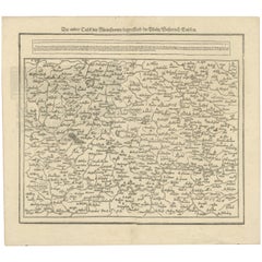
Woodcut Map of the Rhine River Region Covering the Palatinate, Austria and Elsa
Located in Langweer, NL
Early Woodcut Map of the Rhine River Region Covering the Palatinate, Austria, and Elsass, ca. 1628
This early woodcut map, titled "Die ander Tafel des Rheinstromes/begriffen die Pfa...
Category
1620s Antique Maps
Materials
Paper
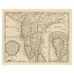
Original Antique Map showing Southern India, Northern Sri Lanka & Malabar, 1652
Located in Langweer, NL
Antique map titled 'Presqu'Isle de l'Inde deca le Gange (..)'.
Old map showing the southern part of India, including the northern part of Sri Lanka. With inset map of Southern India (Malabar). This map covers the subcontinent from the Bay of Bengal and the Gulf of Cambay to Ceylon. The Mogul Empire can be found in the north. Further south...
Category
1650s Antique Maps
Materials
Paper
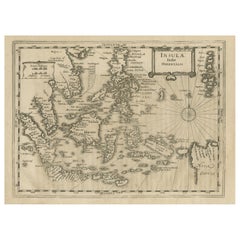
Early Original Antique Map of South East Asia with Large Parts Still Unknown
Located in Langweer, NL
Antique map titled 'Insulae Indiae Orientalis'. Original antique map of Southeast Asia. Shows towns, villages, landmarks, mountains, and rivers. Relief shown pictorially. This map or...
Category
Late 17th Century Antique Maps
Materials
Paper
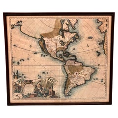
America Septentrionalis by Carroli Allard (1648-1709) Copper Plate Engraving
Located in San Francisco, CA
"Recentissuma Novi Orbis Sive Americae Septentrionale et Meriodionalis"
A hand-colored copper plate engraving of North and South America by Carel Allard depicting recent discoveries...
Category
Late 17th Century Dutch Antique Maps
Materials
Paper
Old Map of Ancient Times covering Egypt Towards Arabia and India to Java, c.1660
Located in Langweer, NL
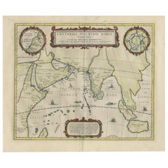
Description: Antique map titled 'Erythraei Sive Rubri Maris Periplus olim ab arriano descriptus nunc vero ab abrah ortelio ex eodem delineatus'. Map of the Indian Ocean, or Erythraea...
Category
1660s Antique Maps
Materials
Paper
Rare Small Antique Map of the Persian Empire, 1692
Located in Langweer, NL
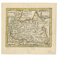
Antique map titled 'Perse'. Small engraved map of the Persian Empire, decorated with a simple cartouche and armorial shield. This map originates from 'L'Atlas en Abrege, ou Nouvelle ...
Category
17th Century Antique Maps
Materials
Paper
Antique Map of North Africa showing Egypt, Mauritania and Africa Minor, 1672
Located in Langweer, NL
Antique map titled 'Africa Minor, Mauritania , Aegyptus.' Charming miniature map of North Africa, showing Egypt, Mauritania and Africa Minor. This map originates from the pocket atla...
Category
17th Century Antique Maps
Materials
Paper
Antique Map of the City of Goch by Blaeu, 1649
Located in Langweer, NL
Antique map titled 'Gochum vernacule Goch'. Old map of the city of Goch, Germany. This map originates from 'Novum Ac Magnum Theatrum Urbium Belgicæ Liberæ ac Foederatæ' by J. Blaeu. ...
Category
17th Century Antique Maps
Materials
Paper
Rare Original Handcolored Miniature Map of Malaysia and Singapore, 1600
Located in Langweer, NL
Very handsome original old coloured copper engraving of Malaysia and Singapore, with parts of Sumatra, inc the island of Bangka and Bintam. Title of the map 'Description Malacca'. On...
Category
Early 1600s Antique Maps
Materials
Paper
Antique Map of North Africa by Ortelius, c.1600
Located in Langweer, NL
Antique map titled 'Barbariae et Biledulgerid nova descriptio'.
Old map of coastal North Africa and the Mediterranean. The map extends from Morocco and the Sahara to Libya and sh...
Category
17th Century Antique Maps
Materials
Paper
The 17th Century Map of Northern Dithmarschen and Its Towns in Germany
Located in Langweer, NL
This is a detailed colored copperplate engraving depicting northern Dithmarschen, accompanied by town plans of Weßlingburen (now Wesselburen), Lunden, and Heyde (now Heide) at the to...
Category
1640s Antique Maps
Materials
Paper
Orignal Hand-Colored Antique Map of Chili by W. Blaeu, 1658
By Willem Blaeu
Located in Langweer, NL
Very decorative antique map of Chili published by W. Blaeu, 1658. This map depicts Chile from Copiapo southward to the island of Chiloé with ships and sea monsters adorning the sea. ...
Category
Mid-17th Century Antique Maps
Materials
Paper
Bishopric of Hildesheim Map in Northern Germany by Willem & Joan Blaeu, 1645
Located in Langweer, NL
This beautifully hand-colored map, titled "Episcopatus Hildesiensis Descriptio Novissima," depicts the Bishopric of Hildesheim, a historical ecclesiastical territory in present-day L...
Category
1640s Antique Maps
Materials
Paper
Antique Map of Catalonia by Blaeu, circa 1650
Located in Langweer, NL
Antique map titled 'Catalonia'. Antique map of Catalonia, extending from C. De Romani on the Northern Coast to Alfachs and Panicola in Valencia on the southern end of the coast and s...
Category
Mid-17th Century Antique Maps
Materials
Paper
Antique Map of Cheshire, North West England
Located in Langweer, NL
Antique map titled 'Cestria comitatus Palatinus'. Original old map of Cheshire, Northwest England. Published circa 1665 by J. Blaeu. Willem Jansz. Blaeu and his son Joan Blaeu are th...
Category
Mid-17th Century Antique Maps
Materials
Paper
Decorative Hand-Colored Map of Germany by Nicolas Sanson, 1648
Located in Langweer, NL
Title: Hand-Colored Map of Germany by Nicolas Sanson, 1648
This hand-colored map, titled "Allemagne," was created by Nicolas Sanson, a prominent 17th-century French cartographer and...
Category
1640s Antique Maps
Materials
Paper
Antique Map of Greece by Allard (c.1698)
Located in Langweer, NL
Antique map titled 'Hellas seu Graecia Universa' Detailed map of Greece, with Crete, the Aegean Islands, and part of Turkey. With two cartouches, compass rose and scale. Carolus Alla...
Category
Late 17th Century Antique Maps
Materials
Paper
Antique Map of Madagascar by N. Sanson, circa 1680
Located in Langweer, NL
Antique map titled 'Isle de Madagascar ou de St. Laurens. Tiree de Sanutu &c'. Antique map of Madagascar, first published by Sanson in 1657. Sanson n...
Category
Late 17th Century Antique Maps
Materials
Paper
Rare 16th Century Original Handcolored Miniature Map of Java, Indonesia, 1616
Located in Langweer, NL
Very handsome original old coloured copper engraving by Bertius of the island of Java in the early days of the Dutch colonisation - at that time named The Dutch East Indies or nowada...
Category
1610s Antique Maps
Materials
Paper
Rare Antique Miniature Map of Pakistan, India and Cambaia, ca.1616
Located in Langweer, NL
Old 17th century miniature antique map of 'Cambaia' , from the 1616 edition of Jadocus Hondius Atlas by Petrus Bertius.
Original copperplate engraving with hand coloring.
Carto...
Category
17th Century Antique Maps
Materials
Paper
Antique Map of the Burgundy Region by Mallet, c.1683
Located in Langweer, NL
Antique map titled 'Cercle de Bourgogne'. Detailed miniature map of the Burgundy region, France. Also shows the Netherlands and Belgium. Originates from Mallet's 'Description de l'Un...
Category
17th Century Antique Maps
Materials
Paper
Historic Map of the Bishopric of Paderborn by Blaeu, a Masterpiece of 1645
Located in Langweer, NL
This hand-colored map, titled "Paderbornensis Episcopatus Descriptio Nova," depicts the Bishopric of Paderborn, a historical ecclesiastical territory within the Holy Roman Empire, lo...
Category
1640s Antique Maps
Materials
Paper
Old Print of Ascension Island with Ships, a Whale and Flying Fish, 1601
Located in Langweer, NL
Antique print, titled: 'Vera effigies et delineato Insulae Ascenstio …' - Bird's eye view of Ascension Island. Five large sailing ships in the background and flying fish and waterfowl in the foreground. On the rear an image of four ships sailing towards a whale, accompanied by fowl, flying fish and dolphins. From 'Indiae Orientalis', 1598-1604.
Artists and Engravers: Made by an anonymous engraver after 'Jean Theodore de Bry...
Category
Early 1600s Antique Maps
Materials
Paper
Original Antique Map of the Road from Marlborough to Huntspil
Located in Langweer, NL
Antique map titled 'The Continuation of the Road from London to Bristol (..)'. A strip map of the continuation of the road from London to Bristol, this particular sheet showing the r...
Category
Late 17th Century Antique Maps
Materials
Paper
Antique Map of Denmark by F. de Wit, 1680
Located in Langweer, NL
Antique map titled 'Dania Regnum'. Large, attractive map of Denmark, Sleschwig-Holstein and southern Sweden. Good detail throughout. Embellished with a title cartouche with the Danis...
Category
Late 17th Century Antique Maps
Materials
Paper
Battle of Wimpfen, 1622: Engraving by Matthäus Merian (ca. 1645)
Located in Langweer, NL
Title: Battle of Wimpfen, 1622: Engraving by Matthäus Merian (ca. 1645)
Description: This antique copper engraving, created by the renowned Swiss-German engraver Matthäus Merian aro...
Category
1640s Antique Maps
Materials
Paper
Antique Map of Madagascar by Mariette 'c.1670'
Located in Langweer, NL
Antique map titled 'Isle Dauphine communement nommée par les Europeens Madagascar, et St. Laurens (..)'. Original large-scale antique map of Madagascar...
Category
Mid-17th Century Antique Maps
Materials
Paper
Antique Map of Piedmonte and Savoie 'Italy' by N. Visscher, circa 1683
Located in Langweer, NL
Antique map titled 'Regiae Celsitudinis Sabaudicae Status consistens in Sabaudiae ac Montisferrati Ducatus, Pedemontii Principatum (..). This map originates from 'Atlas Minor Sive Ge...
Category
Late 17th Century Antique Maps
Materials
Paper
Original Antique Map of the Area of Bremen and Lower Saxony
Located in Langweer, NL
Antique map titled 'Ducatus olim Episcopatus Bremensis et ostiorum Albis et Visurgis Fluviorum novissima Descriptio'. Original old map of the area of ??Bremen and Lower Saxony. Uncom...
Category
Mid-17th Century Antique Maps
Materials
Paper
Old Map Focusing on the Wine Region of Metz, the Moselle Region of France, 1657
Located in Langweer, NL
Antique map of France titled 'Territorium Metense'.
Old map focusing on the wine region surrounding Metz, in the Moselle region of France. This map originates from 'Atlas Novus, ...
Category
1650s Antique Maps
Materials
Paper
Antique Map of the Islands Near Ceylon by Baldaeus, 1672
Located in Langweer, NL
Antique print, untitled. This original antique print shows the islands Leyden, Middelburg, Hammenhiel, Bramines, Dona Clara and Deserta near Ceylon / Sri Lanka, with their Dutch name...
Category
17th Century Antique Maps
Materials
Paper
Antique Print of Büdingenin Germany by Braun & Hogenberg, 1617
Located in Langweer, NL
Antique map titled 'Bingen'. Bird's eye-view of Büdingen, Germany. The view shows a city surrounded by vineyards and well fortified with walls and moats. On the right is the castle w...
Category
17th Century Antique Maps
Materials
Paper
Grand Map of Europe by Frederick de Wit, Circa 1690: A Baroque Era Masterpiece.
Located in Langweer, NL
This is an attractive historical map of Europe created by Frederick de Wit, published around 1690. Here's a detailed description of the map and additional context about its creation:...
Category
Late 17th Century Antique Maps
Materials
Paper
Antique Print of the City of Hukoen in China, 1668
Located in Langweer, NL
Antique print China titled 'Hukoen of ou Hukeu'. Old print depicting a view on the Chinese city of Hukoen with its ramparts. This print originates ...
Category
17th Century Antique Maps
Materials
Paper
Antique Map of the Region of Touraine by Janssonius 'circa 1650'
Located in Langweer, NL
Antique map of France titled 'Touraine - Turonensis Ducatus'. Decorative map of the Touraine region, France. It shows the cities of Tours, Amboise and others. Published by J. Jansson...
Category
Mid-17th Century Antique Maps
Materials
Paper
The 1649 Haderschleben Map of Western Jutland and North Sea Islands
Located in Langweer, NL
This is a beautiful example of an antique map, titled "Westertheil des Amptes Haderschleben Zusambt Rieben und dem Loehmcloster Anno 1649." It's a hand-colored copper etching by Matt...
Category
1640s Antique Maps
Materials
Paper
1645 Blaeu Map of Westmorland, Northern England – Hand Colored, Decorative
Located in Langweer, NL
This map, "Westmoria Comitatus; Anglice Westmorland", was created by the esteemed Dutch cartographer Willem Blaeu and was published around 1645 in 'Le Theatre du Monde ou Nouvel Atlas'. It provides a detailed look at Westmorland, a historic county in northern England, based on John Speed’s earlier map. The map features numerous place names, parks, and estates, including Brigster Park, Colnhead Park, Crosbye, and Midleton, along with a detailed depiction of Windermere (spelled Wynandermere) and the surrounding regions.
Additional Features:
- Hand-colored map, with vibrant and detailed colors that bring out the topographical and decorative features.
- Includes intricate cartouches, such as the royal coat of arms, a decorative title cartouche topped with putti (cherubic figures), and six coats of arms (two left blank).
- Depicts the region’s rich landscape, including the rolling hills and mountainous terrain of northern England.
- French text on the verso, indicative of the publication period from 1645-1648, part of Blaeu’s highly sought-after atlases.
- Map shows precise details of small towns, estates, and parks, such as Brigster Park, Colnhead Park, Crosbye, and Wynandermere (now Windermere Lake).
This map would be of particular interest to collectors of English county maps, antique maps of northern England, 17th-century cartography, and the decorative works of Willem Blaeu. Blaeu's maps are renowned for their accuracy, artistic beauty, and historical significance.
Keywords: Willem Blaeu, Westmorland map, northern England, 17th-century map, antique map, English county map, John Speed, Windermere, decorative cartography, hand-colored map, rare map, antique cartography...
Category
1640s Antique Maps
Materials
Paper
Antique Hand-Colored Map of Western Russia and Ukraine, c.1680
Located in Langweer, NL
Description: Antique map titled 'Novissima et Accuratissima Totius Russiae vulgo Muscoviae Tabula'.
Antique map of Western Russia and Ukraine, published by Justus Danckerts. The ma...
Category
1680s Antique Maps
Materials
Paper
Antique Detailed World Map Drawn on Mercator's Projection, 1700
Located in Langweer, NL
Antique world map titled 'Carte generale du monde, ou description du monde terrestre & Aquatique - Generale Waereld kaart, of beschryving van de land en water waereld'. This is Pierr...
Category
17th Century Antique Maps
Materials
Paper
Antique Map of Germany from a 17th Century Pocket Atlas, 1685
Located in Langweer, NL
Antique map titled 'Nova Totius Germaniae descriptio.' Miniature map of Germany, from the pocket atlas 'Introductionis in Universam Geographiam tam Veterem...
Category
17th Century Antique Maps
Materials
Paper
Antique Map of the Island of Psara by Dapper, 1688
Located in Langweer, NL
Antique map titled 'Sara.' Map of Psara ( Psyra or Ipsera) Island (North East Aegean Islands), Greece. This map originates from 'Nauwkeurige Beschrijving der eilanden in de Archipel ...
Category
17th Century Antique Maps
Materials
Paper
Large 1695 Hand-Colored Engraved Map of Gascony (Gascogna), France
Located in Langweer, NL
This map, created by Giacomo Cantelli da Vignola in 1695, represents the "General Government of Guyenne and Gascony" in southwest France. Cantelli da Vignola was a renowned Italian c...
Category
1690s Antique Maps
Materials
Paper
Very Rare Antique Print of the Kings Celebrations in Pegu, Myanmar, 1682
Located in Langweer, NL
Plate: 'Konings feesten tot Pegu.' (Kings celebrations in Pegu.)
On this plate: 1. The King. 2. And the Queen, sprinkling water on each other. 3. Their children. 4. Officers. 5. ...
Category
1680s Antique Maps
Materials
Paper
Antique Map of the West African Coast and the Cape Verde Islands, c.1680
Located in Langweer, NL
Antique map Africa titled 'Isles du Cap Verd Coste et Pays des Negres'. Antique map of the coast of Africa and the Cape Verde islands.
Artists and...
Category
17th Century Antique Maps
Materials
Paper
1608 Hispaniae Novae Sive Magnae Vera Descriptio Framed Mexico Map
Located in Stamford, CT
1608 Hispaniae Novae Sive Magnae Vera Descriptio Framed Mexico Map. As found custom black wooden frame/ matting.
This map is based on the work of Abraham Ortelius as is an example o...
Category
Early 1600s Mexican Spanish Colonial Antique Maps
Materials
Glass, Wood, Paper
Old Map of the Bourbonnais Region of France, ca.1630
Located in Langweer, NL
Antique map titled 'Bourbonois - Borbonium Ducatus'.
Old map of the Bourbonnais region of France. Bourbonnais was a historic province in the centre of France that corresponds to ...
Category
1630s Antique Maps
Materials
Paper
Rhine Splendor: Antique Map of the Lower Rhine Region, circa 1680
Located in Langweer, NL
The antique map titled 'Novissima et Accuratissima Archiepiscopatus et Electoratus Coloniensis Ducatuum Iuliancensis et Montensis et Meursiae Comitatus' is a handsome and detailed ma...
Category
1680s Antique Maps
Materials
Paper
Antique Map of the Island of Tinos by Dapper, 1687
Located in Langweer, NL
Antique map titled 'Tino.' This original antique map shows the island of Tinos, Greece. Source unknown, to be determined.
Artists and Engravers: Made by 'Olfert Dapper' after an a...
Category
17th Century Antique Maps
Materials
Paper
Map of Comitatus Marchia et Ravensberg: Historical Counties in Germany, c.1660
Located in Langweer, NL
Antique map titled 'Comitatus Marchia et Ravensberg'. This map depicts two historical counties of the Holy Roman Empire: Marks and Ravensberg. Major cities, towns, mountains, and riv...
Category
Mid-17th Century Antique Maps
Materials
Paper
Charming Miniature Map of Thrace or Thrake in Southeast Europe, 1685
Located in Langweer, NL
Antique map titled 'Thraciae Descriptio.'
Charming miniature map of Thrace, from the pocket atlas 'Introductionis in Universam Geographiam tam Veterem quam novam .. Acessit P. Be...
Category
1680s Antique Maps
Materials
Paper
Exquisite 1600 Ortelius Map of Artois, France: A Collector’s Piece
Located in Langweer, NL
Exquisite 1600 Ortelius Map of Artois, France: A Collector’s Piece with Rich Historical Detail
Description of the Map:
This map, titled "Atrebatum Regionis Vera Descriptio," create...
Category
Early 1600s Antique Maps
Materials
Paper
Original Antique Map the Imperial States of the Habsburg Netherlands, 1609
Located in Langweer, NL
Antique map titled 'Belgii inferioris descriptio (..)'.
Old map of the Seventeen Provinces, the Imperial states of the Habsburg Netherlands in the 16th century. They roughly cove...
Category
Early 1600s Antique Maps
Materials
Paper
1627 Hondius Map "La Principaute d'Orange et Comtat de Ve", Ric.0003
Located in Norton, MA
1627 Hondius map entitled
"La Principaute d'Orange et Comtat de Venaissin,"
Original Hand-Colored
Description: From Johannes Janssonius's Atlantis Maioris Appendix of 1630.
...
Category
17th Century Unknown Antique Maps
Materials
Paper
1638 Plancius Detailed Map of Sri Lanka or Ceylon with Decorative Cartouches
Located in Langweer, NL
"1638 Plancius Detailed Map of Sri Lanka with Decorative Cartouches"
This beautifully detailed map of Sri Lanka, titled "Ins. Ceilan," was engraved by P. Plancius from a design by C...
Category
1630s Antique Maps
Materials
Paper
Antique Map of the Strait of Malacca, Malay Peninsula & Dutch Indies, c.1670
Located in Langweer, NL
Antique map titled 'Indiae Orientalis, nec non Insularum Adiacentium Nova Descriptio.'
Map of Southeast Asia. The map centers on the Strait of Malacca and Malay Peninsula. It ext...
Category
1670s Antique Maps
Materials
Paper
Old Handcolored Antique Map of Pays De Caux in Normandy, France, ca.1640
Located in Langweer, NL
Antique map titled 'Le Pais de Caux'.
Old map of Pays de Caux, France. Pays de Caux is an area in Normandy occupying the greater part of the French département of Seine Maritime ...
Category
1640s Antique Maps
Materials
Paper
1663 Blaeu's Engraved Map of Frankfurt with Decorative Coats of Arms
Located in Langweer, NL
This map, titled "Novam Hanc Territorii Francofurtensis Tabulam," is an exquisite hand-colored engraved map from around 1663, created by the renowned cartographers J. and C. Blaeu of...
Category
1660s Antique Maps
Materials
Paper
Cartographic Depiction of Flensburg and Surrounding Territories, Anno 1648
Located in Langweer, NL
Title: Landtcarte Vonn dem Ambte Flensborg, ohne Nordgoeßherde. Anno 1648.
Description:
This exquisitely detailed and old coloured map of Flensburg was crafted by the noted cartogr...
Category
1640s Antique Maps
Materials
Paper
