Maps
to
1,831
2,372
95
2,470
78
9
5
4
3
3
2
2
1
1
2,926
2,181
476
3
289
34
10
127
7
35
9
2
5
3
4
2
2,422
74
28
24
19
301
219
137
106
95
2,470
2,470
2,470
104
29
9
8
7
Maps For Sale
Period: 19th Century
Period: Early 20th Century
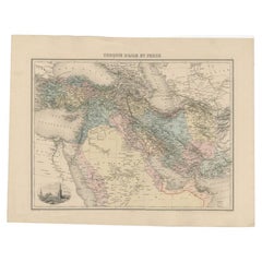
Antique Map of the Turkish Empire and Persia, circa 1890
By J. Migeon
Located in Langweer, NL
Antique map Turkish Emprie titled 'Turquie d'Asie et Perse'. Beautiful map depicting the Turkish Empire and Persia. With vignette depicting Damascus. This map originates from 'Nouvel...
Category
19th Century Antique Maps
Materials
Paper
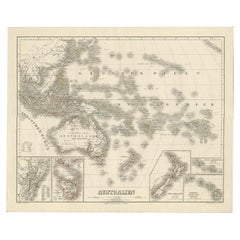
Map of Australia, New Zealand, Part of China, Japan and Southeast Asia, 1857
Located in Langweer, NL
German Antique map titled 'Australien'. Map of Australia, New Zealand, part of China, Japan and Southeast Asia. In the upper right is a bit of the California coast by San Francisco. ...
Category
19th Century Antique Maps
Materials
Paper
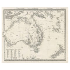
German Antique Map of Australia and New Zealand, 1857
Located in Langweer, NL
Antique map Australia titled 'Festland von Australien und benachbarte Inseln'. Detailed map of Australia and New Zealand, including excellent det...
Category
19th Century Antique Maps
Materials
Paper
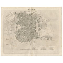
Antique Map of the City of Madrid by Balbi '1847'
Located in Langweer, NL
Antique map titled 'Madrid'. Original antique map of the city of Madrid, Spain. This map originates from 'Abrégé de Géographie (..)' by Adrien Balbi. Published 1847.
Category
Mid-19th Century Antique Maps
Materials
Paper
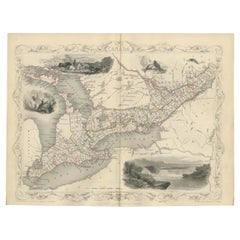
Antique Map of West Canada by Tallis 'c.1850'
Located in Langweer, NL
Antique map titled 'West Canada'. Original antique map of West Canada, with decorative vignettes titled Kingston and Falls of Niagara. This map originates from 'The History and Topog...
Category
Mid-19th Century Antique Maps
Materials
Paper
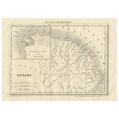
French Guiana and Cayenne: Mid-19th Century Map from France Pittoresque Series
Located in Langweer, NL
This map titled "Guyane" is part of the France Pittoresque series and provides a detailed view of French Guiana along with a plan of the city of Cayenne.
Features:
- The map showcases the broader region of French Guiana, indicating key rivers, settlements, and the coastline along the Atlantic Ocean.
- To the left, there's an inset labeled "Plan de la Ville de Cayenne", which shows the street layout, squares, and main buildings of the capital city, Cayenne. This inset provides a more detailed view of the urban area, highlighting its geometric grid layout near the coast.
- The larger map outlines geographical features such as rivers (e.g., Oyapock and Maroni), forests, and territories in the surrounding area, including the neighboring Brazilian Empire...
Category
1850s Antique Maps
Materials
Paper
Old Map of the Chinese Empire and Japan, 1882
Located in Langweer, NL
An original antique map titled "The Chinese Empire and Japan," dating from an 1882 atlas by Blackie & Son. It is a color map with geographical features such as mountain ranges, river...
Category
1880s Antique Maps
Materials
Paper
Antique Chart of the US Predominating Sex, 1874
Located in Langweer, NL
Antique chart titled 'Map of predominating sex showing the local excess of males or of females in the distribution of population over the territory of th...
Category
Late 19th Century Antique Maps
Materials
Paper
Decorative Antique Print of Nice Near Mont Boron in France, c.1865
Located in Langweer, NL
Antique print titled 'Nice, vue prise de l'extremité du Mont Boron'. View of the city of Nice, near Mont Boron, France. This print originates from 'Nice Et Savoie, Sites Pittoreques,...
Category
19th Century Antique Maps
Materials
Paper
1814 Map of "Russian Empire" Ric.r032
Located in Norton, MA
1814 Map of
"Russian Empire"
Ric.r032
Russian Empire. Description: This is an 1814 John Thomson map of the Russian Empire. The map depicts the region from the Baltic Sea, Prussia, and Sweden to the Aleutian Islands and from the Arctic Ocean to the Yellow River. Highly detailed, myriad cities, towns, and villages are labeled throughout, including St. Petersburg, Moscow, Minsk, Kiev, and Kharkov. Rivers and mountain ranges are also identified, as are islands and numerous locations along the coastlines. It is important to note that the long-disputed sea between Korea and Japan is identified as the 'Sea of Japan.
Historical Context:
In 1815, Tsarist Russia emerged from the Napoleonic Wars economically insolvent and politically fearful of the Revolutionary fervor that had just swept through Europe. In order to shore up Russia's economic position, the Tsars began an aggressive series of expansions into the Caucuses and Central Asia that would vastly increase the landmass of the Russian Empire.
Publication History
Thomson maps are known for their stunning color, awe inspiring size, and magnificent detail. Thomson's work, including this map, represents some of the finest cartographic art...
Category
19th Century Unknown Antique Maps
Materials
Paper
Large Original Vintage Map of Persia / Iran, circa 1920
Located in St Annes, Lancashire
Great maps of Persia.
Unframed.
Original color.
By John Bartholomew and Co. Edinburgh Geographical Institute.
Published, circa 1920.
Free shipping.
Category
1920s British Vintage Maps
Materials
Paper
Antique Map of Switzerland by J. Tallis, circa 1851
Located in Langweer, NL
A decorative and detailed mid-19th century map of Switzerland which was drawn and engraved by J. Rapkin (vignettes by A. H. Wray & J. B. Allen) and published in John Tallis's Illustr...
Category
Mid-19th Century Antique Maps
Materials
Paper
Large Original Vintage Map of The World, circa 1920
Located in St Annes, Lancashire
Great map of The World
Original color.
Good condition / minor foxing
Published by Alexander Gross
Unframed.
Category
1920s English Vintage Maps
Materials
Paper
Antique Map of Scandinavia: Norway, Sweden and Denmark
Located in Langweer, NL
Antique map titled 'Suède, Norwège & Danemark'. Attractive map of Scandinavia, with Sweden, Norway and Denmark. With an inset map of Iceland and th...
Category
Mid-19th Century Antique Maps
Materials
Paper
Large Antique County Map of the East Riding of Yorkshire, England
Located in Langweer, NL
Antique map titled 'A Map of the East Riding of Yorkshire from the best Authorities'. Original old county map of the East Riding of Yorkshire, England. Engraved by John Cary. Origina...
Category
Early 19th Century Antique Maps
Materials
Paper
Antique Map of the United States of America, also showing the Caribbean
Located in Langweer, NL
Antique map titled 'Verein-Staaten von Nord-America, Mexico, Yucatan u.a.'. Very detailed map of the United States of America showing the ...
Category
Mid-19th Century Antique Maps
Materials
Paper
Antique Map of Syria by Wyld '1845'
Located in Langweer, NL
Antique map titled 'Map of Syria'. Original antique map of Syria. This map originates from 'An Atlas of the World, Comprehending Separate Maps of its
Var...
Category
Mid-19th Century Antique Maps
Materials
Paper
The World in the Assyrian Empire's Era: A Historical Map, Published in 1880
Located in Langweer, NL
This map from the "Spruner-Menke Atlas Antiquus" is titled "ORBIS TERRARVM regni Assyrii tempore," which translates to "The World at the Time of the Assyrian Kingdom." It depicts the...
Category
1880s Antique Maps
Materials
Paper
Genuine Antique Map of European Turkey by Pierre Antoine Tardieu (1784-1869)
Located in Langweer, NL
This is an original antique map titled "Carte de la Turquie d'Europe," which depicts the European territories of the Ottoman Empire. The map features detailed geographical and political boundaries, showcasing various regions, cities, rivers, and mountains within the Ottoman European territories. The map was created by Pierre Antoine Tardieu, a renowned French engraver, steel engraver, and cartographer known for his high-quality work.
Map Details:
- **Title**: Carte de la Turquie d'Europe
- **Creator**: Pierre Antoine Tardieu (1784-1869)
- **Publication Date**: Early 19th century
- **Dimensions**: Approximately 34.5 x 43.5 cm (13.5 x 17.25 inches)
- **Features**: The map includes a detailed representation of the European territories of the Ottoman Empire, with place names, rivers, mountains, and regions clearly marked. The title cartouche is located in the upper left corner, and the mile scale is presented in the lower left.
Around the year 1800, the region referred to as "European Turkey" or "Ottoman Europe" was a significant part of the Ottoman Empire, which was one of the most powerful empires in the world at the time. Here are some key aspects of European Turkey during this period:
### Geographic Scope
European Turkey included a large part of Southeastern Europe, encompassing modern-day:
- Greece
- Bulgaria
- Romania (specifically the regions of Dobruja and parts of Wallachia)
- Serbia
- Albania
- Montenegro
- Bosnia and Herzegovina
- Parts of Croatia, Macedonia, and Hungary
Political Structure
- **Ottoman Administration**: The region was governed by the Ottoman administrative system, which divided territories into provinces (vilayets) and smaller administrative units (sanjaks). Each province was overseen by a governor (pasha) appointed by the Sultan.
- **Autonomy and Vassal States**: Some areas within European Turkey had varying degrees of autonomy or were vassal states. For example, Wallachia and Moldavia (in modern-day Romania) were vassal principalities that retained local rulers under Ottoman suzerainty.
Society and Demographics
- **Ethnic Diversity**: The region was extremely diverse, home to numerous ethnic groups, including Turks, Greeks, Bulgarians, Serbs, Albanians, Vlachs (Romanians), and Jews, among others.
- **Religious Diversity**: There was significant religious diversity, with Islam being the dominant religion due to Ottoman rule, but large Christian (Eastern Orthodox, Roman Catholic) and Jewish populations coexisted.
Economy
- **Agriculture**: The economy was largely agrarian, with agriculture being the primary occupation. Key crops included grains, tobacco, and cotton.
- **Trade and Commerce**: European Turkey was strategically important for trade, connecting the Mediterranean with Central Europe and the Black Sea. Major cities like Constantinople (modern-day Istanbul), Thessaloniki, and Belgrade were key commercial hubs.
Culture
- **Cultural Influence**: The region was a melting pot of various cultures, influenced by Byzantine, Slavic, and Ottoman traditions. This mix was reflected in architecture, cuisine, music, and customs.
- **Education and Language**: The official language of administration was Ottoman Turkish, but many local languages were spoken. Education was often conducted in religious institutions, with different communities maintaining their own schools.
Challenges and Conflicts
- **Internal Strife**: The Ottoman Empire faced numerous internal challenges, including administrative inefficiency, corruption, and local uprisings.
- **External Threats**: The empire was also under pressure from external forces, particularly from the Habsburg Empire, Russia, and later from nationalist movements within the Balkans, which sought independence or autonomy from Ottoman rule.
Decline of Ottoman Power
By 1800, the Ottoman Empire was experiencing a gradual decline, which would intensify throughout the 19th century. This period saw increasing nationalist sentiments among various ethnic groups within European Turkey, leading to uprisings and eventual wars of independence, such as the Serbian Revolution (1804-1835) and the Greek War of Independence (1821-1829).
Overall, European Turkey around 1800 was a complex and diverse region under the Ottoman Empire's waning control, characterized by a rich tapestry of cultures, economic activities, and political structures.
Condition Overview:
1. **Paper Quality**: The map exhibits signs of aging, such as yellowing along the edges, which is typical for documents of this age. The paper remains in good condition without major tears or damage.
2. **Edges and Corners**: The edges are slightly worn, with minor fraying and a few small tears that do not significantly impact the map's readability or aesthetic value.
3. **Center Fold**: There is a visible center fold, common for maps that were folded for storage or publication. The fold is in good condition without significant wear but with splits on both sidess.
4. **Color and Print Quality**: The colors used to outline the boundaries remain vibrant and clear. The print quality is excellent, with sharp, legible text and detailed illustrations.
5. **Staining and Spots**: There are a few spots and stains, particularly near the edges and along the fold. These do not obscure any critical details of the map.
Historical and Artistic Value:
Pierre Antoine Tardieu was known for his meticulous craftsmanship and contributions to cartography. His work drew the attention of prominent figures such as Alexander von Humboldt...
Category
Early 1800s Antique Maps
Materials
Paper
Antique Print of Reims Cathedral by Knight, 1835
Located in Langweer, NL
Antique print titled 'West Front of the Cathedral at Rheims'. Old print of Reims Cathedral, a Roman Catholic cathedral in the French city of the same n...
Category
19th Century Antique Maps
Materials
Paper
Newfoundland and St. Pierre & Miquelon: Uncoloured French Map of circa 1820
Located in Langweer, NL
The map is titled "Île et Banc de Terre-Neuve avec les Îles St. Pierre et Miquelon", depicting Newfoundland and the French islands of St. Pierre and Miquelon. It is from the Petit Atlas National series.
Features:
- The map is divided into two sections:
1. The left side shows Newfoundland (Terre-Neuve) and its surrounding waters, including important locations such as the Île du Cap Breton and Grand Bank fishing areas.
2. The right side focuses on St. Pierre and Miquelon, a French overseas territory near Newfoundland.
- Administrative divisions and key geographic features, such as capes, bays, and towns, are labeled on the map.
Historical Context:
- This map is part of a collection meant to showcase France's overseas colonies and territories, including the small but significant St. Pierre and Miquelon, which has been under French control for centuries and was a critical fishing and trading hub.
- The Petit Atlas National series was typically published in the early 19th century, and this map likely dates from the same period, around 1815–1820.
Here the text transalated:
Here is the translation of the text from French to English:
---
**NOTICE.**
The islands of St. Pierre and Miquelon, the only remaining French possession in this part of America since the loss of Canada, are located a few miles from the southern coast of Newfoundland, which belongs to the English. Their relatively fertile soil is broken up by hills that give rise to small streams.
**Grande Miquelon**, the northernmost of the two islands, has a circumference of about 9 to 10 leagues. It offers a convenient port for fishing boats.
**Petite Miquelon**, to the south of Grande Miquelon, has a circumference of about 6 leagues. It is well-watered and well-wooded.
**Saint Pierre**, to the south-southwest of the two other islands, presents a somewhat similar appearance but is devoid of trees. Although it is the smallest of the three islands, it is the most important due to the size of its harbor, which can accommodate 30 to 40 ships of various sizes, and because of its favorable coastline for the preparation, preservation, and export of cod. On its eastern coast, at the bottom of a beautiful bay, lies the town of Saint Pierre, the only notable settlement on the three islands. It is the residence of a naval officer who, under the title of Commander, governs the colony.
The permanent population is about 2,000 souls, of which 800 reside in Saint Pierre. However, sailors come to the islands from the coasts of Brittany and Normandy during the cod fishing season on the Grand Banks of Newfoundland and the Gulf of St. Lawrence. In 1833, it was estimated that about 14,000 sailors were employed in this fishery, and the purchase of supplies required by the colony was valued at over one million francs.
---
This translation reflects the original notice describing the French islands of St. Pierre and Miquelon, with details about their geography, population, and economic activities related to the fishing industry.
People searching for maps or information about Newfoundland and the French islands of St. Pierre and Miquelon use the following keywords:
1. Newfoundland map...
Category
1820s Antique Maps
Materials
Paper
Newfoundland and St. Pierre & Miquelon: Early 19th Century French Map
Located in Langweer, NL
The map is titled "Île et Banc de Terre-Neuve avec les Îles St. Pierre et Miquelon", depicting Newfoundland and the French islands of St. Pierre and Miquelon. It is from the Petit Atlas National series.
Features:
- The map is divided into two sections:
1. The left side shows Newfoundland (Terre-Neuve) and its surrounding waters, including important locations such as the Île du Cap Breton and Grand Bank fishing areas.
2. The right side focuses on St. Pierre and Miquelon, a French overseas territory near Newfoundland.
- Hand-colored outlines mark the territories, with color distinctions for the different islands.
- Administrative divisions and key geographic features, such as capes, bays, and towns, are labeled on the map.
Here the text translated:
Here is the translation of the text from French to English:
**NOTICE.**
The islands of St. Pierre and Miquelon, the only remaining French possession in this part of America since the loss of Canada, are located a few miles from the southern coast of Newfoundland, which belongs to the English. Their relatively fertile soil is broken up by hills that give rise to small streams.
**Grande Miquelon**, the northernmost of the two islands, has a circumference of about 9 to 10 leagues. It offers a convenient port for fishing boats.
**Petite Miquelon**, to the south of Grande Miquelon, has a circumference of about 6 leagues. It is well-watered and well-wooded.
**Saint Pierre**, to the south-southwest of the two other islands, presents a somewhat similar appearance but is devoid of trees. Although it is the smallest of the three islands, it is the most important due to the size of its harbor, which can accommodate 30 to 40 ships of various sizes, and because of its favorable coastline for the preparation, preservation, and export of cod. On its eastern coast, at the bottom of a beautiful bay, lies the town of Saint Pierre, the only notable settlement on the three islands. It is the residence of a naval officer who, under the title of Commander, governs the colony.
The permanent population is about 2,000 souls, of which 800 reside in Saint Pierre. However, sailors come to the islands from the coasts of Brittany and Normandy during the cod fishing season on the Grand Banks of Newfoundland and the Gulf of St. Lawrence. In 1833, it was estimated that about 14,000 sailors were employed in this fishery, and the purchase of supplies required by the colony was valued at over one million francs.
---
This translation reflects the original notice describing the French islands of St. Pierre and Miquelon, with details about their geography, population, and economic activities related to the fishing industry.
Historical Context:
- This map is part of a collection meant to showcase France's overseas colonies and territories, including the small but significant St. Pierre and Miquelon, which has been under French control for centuries and was a critical fishing and trading hub.
- The Petit Atlas National series was typically published in the early 19th century, and this map likely dates from the same period, around 1815–1820.
People searching for maps or information about Newfoundland and the French islands of St. Pierre and Miquelon use the following keywords:
1. Newfoundland map...
Category
1820s Antique Maps
Materials
Paper
Guadeloupe and Dependencies: 19th Century French Map and Inset of Pointe-à-Pitre
Located in Langweer, NL
This map titled "La Guadeloupe et ses Dépendances" (Guadeloupe and its Dependencies) is from a Petit Atlas National series, focusing on the French Caribbean islands of Guadeloupe, Ma...
Category
1820s Antique Maps
Materials
Paper
Oriental Realms: A Detailed Map of Persia, Afghanistan, and Beloochistan, 1882
Located in Langweer, NL
This historical map from the 1882 atlas published by Blackie & Son is a comprehensive depiction of Persia (modern-day Iran), Afghanistan, and Baluchistan (the region that includes pa...
Category
1880s Antique Maps
Materials
Paper
Mediterranean Encounters: From the Punic Wars to the Hannibalic War, 1880
Located in Langweer, NL
The map, with the title "MARE INTERNUM cum populis adiacentibus a bello Hannibalico usque ad Vespasiani M. princip," depicts the Mediterranean Sea and its surrounding territories, ex...
Category
1880s Antique Maps
Materials
Paper
Map of Polynesia Highlighting Cultural Landscapes and Maritime Activities, 1851
Located in Langweer, NL
John Tallis & Company was a London-based map publisher that flourished during the 19th century. Their maps, characterized by elaborate borders and decorative vignettes, are some of t...
Category
1850s Antique Maps
Materials
Paper
Gipuzkoa 1902: A Cartographic Snapshot of the Basque Coastline and Highlands
Located in Langweer, NL
The map showcases the province of Gipuzkoa (also known as Guipúzcoa in Spanish), which is part of the autonomous community of the Basque Country in northern Spain, as of the year 190...
Category
Early 1900s Antique Maps
Materials
Paper
Texas California Mexico Map – Antique Tallis Map with Gold Region, c.1850
Located in Langweer, NL
Texas California Mexico Map – Antique Tallis Map with Gold Region, c.1850
This highly decorative and historically rich map titled 'Mexico, California and Texas' was published around...
Category
Mid-19th Century Antique Maps
Materials
Paper
Asia Minor and Provinces: A Roman Empire Map from Spruner-Menke Atlas, 1880
Located in Langweer, NL
This authentic map of the 19th century, titled "PONTUS ET BITHYNIA, ASIA, LYCIA ET PAMPHYLIA, GALATIA, CAPPADOCIA, SYRIA, CRET, CYPRVS," details the regions of Asia Minor and surrounding territories during the Roman Empire.
The map is interesting for a number of reasons:
1. **Comprehensive Detail**: It covers a wide range of regions that played significant roles in ancient history, from the cultural crossroads of Asia Minor to the strategic island of Cyprus.
2. **Geographical Information**: It includes detailed topographical features such as mountain ranges, river systems, and coastlines, illustrating the complex geography that influenced ancient political and military strategies.
3. **Historical Context**: The map reflects the Roman administrative organization of these provinces, which were critical for trade, military campaigns, and cultural exchange within the empire.
4. **Inset Maps**: The presence of inset maps for Lycia, Ionia, and Asia Minor provides focused details on regions that had substantial historical significance due to their cultural heritage and geopolitical importance.
5. **Latin Labels**: The use of Latin in the map’s labels and descriptions adds to the historical authenticity and would have served as a scholarly reference for 19th-century academics.
6. **Ancient Civilizations**: This area was the cradle of numerous ancient civilizations and the map likely includes cities of ancient Greek...
Category
1880s Antique Maps
Materials
Paper
Antique County Map, Oxfordshire, English, Framed Cartography Interest, Victorian
Located in Hele, Devon, GB
This is an antique lithography map of Oxfordshire. An English, framed atlas engraving of cartographic interest, dating to the mid 19th century and later.
Superb lithography of Oxfo...
Category
Mid-19th Century British Mid-Century Modern Antique Maps
Materials
Wood
Persia Unveiled: Antique Map of Iran, Afghanistan, and Beyond, 1852
Located in Langweer, NL
The antique map titled 'Royaumes de Perse Herat & Kaboul' is an attractive map of Persia. Here are the key details and features of the map:
1. **Geographic Coverage**:
- The map ...
Category
Mid-19th Century Antique Maps
Materials
Paper
1882 Detailed Map of South America showing Political and Geographical Features
Located in Langweer, NL
This 1882 map of South America, published by Blackie and Son as part of the 'Comprehensive Atlas and Geography of the World,' showcases the continent in remarkable detail. It provide...
Category
1880s Antique Maps
Materials
Paper
Map of French Guiana, Suriname and Cayenne: Plan from Petit Atlas National, 1820
Located in Langweer, NL
This map, titled "Guyane" (French Guiana), is part of the Petit Atlas National series, focusing on French colonies. Here are the key elements of the map and its context:
Features:
-...
Category
1820s Antique Maps
Materials
Paper
Political Map of Europe: Early 19th Century, from the 1802 Tardieu Atlas
Located in Langweer, NL
Antique Map Description
Title: Carte Générale et Politique de l'Europe
Publication Details:
- **Atlas Title:** Nouvel Atlas Universel de Géographie Ancienne et Moderne
- **Purpose...
Category
Early 1800s Antique Maps
Materials
Paper
Antique Map of the Region of Georgia with Inset Maps of Florida and Texas
Located in Langweer, NL
Antique map of part of the United States showing Alabama, Georgia, North Carolina, South Carolina, Tennessee, Kentucky, Virginia and part of Florida. With inset maps of the southern ...
Category
Late 19th Century Antique Maps
Materials
Paper
Antique Map of Independent Tartary by W. G. Blackie, 1859
Located in Langweer, NL
Antique map titled 'Turkestan or Independent Tartary'. Original antique map of Turkestan or Independent Tartary. This map originates from ‘The Imperial Atlas of Modern Geography’. Pu...
Category
Mid-19th Century Antique Maps
Materials
Paper
Antique Print of the Rialto Bridge in Venice in Italy, 1835
Located in Langweer, NL
Antique print titled 'The Rialto at Venice'. Old print of the Rialto Bridge (or Ponte di Rialto) in Venice, Italy. This print originates from 'One Hundred and Fifty Wood Cuts selecte...
Category
19th Century Antique Maps
Materials
Paper
Southwestern U.S. Immigration Map for Texas, Arkansas, and Louisiana, 1881
Located in Langweer, NL
Southwestern U.S. Immigration Map - Published by The Southwestern Immigration Company, Austin, Texas. Detailed Railroad Routes and Regional Statistics for Texas, Arkansas, and Louisi...
Category
1880s Antique Maps
Materials
Paper
Antique Map of South Italy and the Island of Sardinia by Johnston (1909)
Located in Langweer, NL
Antique map titled 'South Italy and the Island of Sardinia'. Original antique map of South Italy and the Island of Sardinia. With inset map of Naples. Th...
Category
Early 20th Century Maps
Materials
Paper
1854 Map of Massachusetts, Connecticut and Rhode Island, Antique Wall Map
Located in Colorado Springs, CO
This striking wall map was published in 1854 by Ensign, Bridgman & Fanning and has both full original hand-coloring and original hardware. This impression is both informative and highly decorative.
The states are divided into counties, outlined in red, green, and black, and subdivided into towns. Roads, canals, and railroad lines are prominently depicted, although they are not all labeled. The mapmakers also marked lighthouses, banks, churches, and prominent buildings, with a key at right. The map is an informative and comprehensive overview of the infrastructural development of New England prior to the Civil War. Physical geographies depicted include elevation, conveyed with hachure marks, rivers and lakes. The impression features an inset map of Boston...
Category
19th Century American Antique Maps
Materials
Paper
Roman Frontiers Engraved: Germania, Raetia, and Noricum, Published in 1880
Located in Langweer, NL
The map, titled "GERMANIA, RAETIA, NORICUM," depicts the regions of Germania, Raetia, and Noricum, which correspond to parts of modern-day Central and Eastern Europe, including areas of Germany, Austria, Switzerland, and the Balkans.
Features of the map include:
1. **Regional Divisions**: The map is divided into the regions of Germania, Raetia, and Noricum, each likely differentiated by color or shading.
2. **Topography**: It details the mountain ranges, rivers, and other geographical features of the region. The Alps, which are central to Raetia, are prominently displayed.
3. **Roman Settlements and Roads**: The map likely marks Roman...
Category
1880s Antique Maps
Materials
Paper
Original Antique Map of Greece and Epirus after the Persian Wars, Published 1880
Located in Langweer, NL
The map titled "GRAECIA, EPIRUS post bella Persica," translates to "Greece and Epirus after the Persian Wars." It covers the regions of ancient Greece and Epirus following the Greco-Persian Wars, a series of conflicts between the Greek city-states and the Persian Empire during the 5th century BC.
What makes this map interesting:
1. **Historical Context**: The period after the Persian Wars was pivotal for ancient Greece, leading to the rise of Athens as a major power and the Golden Age of Athens.
2. **Inset Maps**: Detailed insets, such as the one showing the Acropolis of Athens, provide close-up views of historically significant locations.
3. **Topography**: It features the diverse terrain of Greece, from the rugged mountain ranges to the intricate coastlines and islands, influencing the development of Greek city-states.
4. **City-States**: The map likely details the various polis or city-states, such as Athens, Sparta, Thebes, and others, which played critical roles in the Persian Wars.
5. **Battle Sites**: It might mark important battle sites from the wars, like Marathon, Thermopylae, Salamis, and Plataea.
6. **Latin Labels**: The use of Latin for place names and descriptions adds to the map's scholarly quality.
7. **Cultural Landmarks**: The map may include locations of significant cultural and historical landmarks from the era, such as temples, theatres, and agoras.
This map is from the "Spruner-Menke Atlas Antiquus," compiled by Karl Spruner von Merz and edited by Theodorus Menke. The atlas, known for its detailed maps of historical and ancient geographies, was a significant educational tool in the 19th century.
The Greco-Persian Wars, which included famous battles such as Marathon and Salamis, were crucial for the preservation of Greek independence...
Category
1880s Antique Maps
Materials
Paper
Antique Map of Brazil by Wyld, '1845'
Located in Langweer, NL
Antique map titled 'Empire of Brazil'. Original antique map of Brazil. This map originates from 'An Atlas of the World, Comprehending Separate Ma...
Category
Mid-19th Century Antique Maps
Materials
Paper
Old Print of a Mosque in a Kampung Java or Village of Javanese, Indonesia, 1874
Located in Langweer, NL
Antique print titled 'Missigit in Kampong Djawa'.
Antique print depicting a scene in Indonesia. Originates from 'De Oorlog tusschen Nederland en Atchin' by G.L. Klepper.
Artis...
Category
1870s Antique Maps
Materials
Paper
Antique Map of the Southern United States with Inset Map of New Orleans
Located in Langweer, NL
Antique map titled 'Die Staaten von Arkansas Mississippi, Louisiana & Alabama'. Detailed map of the region, which includes the Florida Panhandle. Shows many roads, rivers, forts, etc...
Category
Mid-19th Century Antique Maps
Materials
Paper
Map of Tasmania with Illustrations of Local Fauna and Colonial Landmarks, 1851
Located in Langweer, NL
John Tallis & Company was renowned for their detailed and ornate maps during the 19th century. Their maps are distinguished by the intricate borders and vignettes that are as informa...
Category
1850s Antique Maps
Materials
Paper
Authentic Antique Map of India and Ceylon, '1875'
Located in Langweer, NL
Antique map titled 'Carte générale des Indes'. Large map of India and Ceylon. This map originates from 'Atlas de Géographie Moderne Physique et Politique' by A. Levasseur. Published ...
Category
Late 19th Century Antique Maps
Materials
Paper
Western Roman Empire Map: British Isles & Gaul - 1802 Tardieu Atlas
Located in Langweer, NL
Antique Map Description and title: "Partie Occidentale de l'Empire Romain ou du Monde connu des Anciens d'Après d'Anville"
Publication Details:
- **Atlas Title:** Nouvel Atlas Univ...
Category
Early 1800s Antique Maps
Materials
Paper
Original Antique Map of the American State of Missouri ( Northern part ), 1903
Located in St Annes, Lancashire
Antique map of Missouri ( Northern Part )
Published By A & C Black. 1903
Original colour
Good condition
Unframed.
Free shipping
Category
Early 1900s English Antique Maps
Materials
Paper
Antique Map of the Malay Archipelago with Images of Indigenous People, 1851
Located in Langweer, NL
John Tallis & Company, often simply known as Tallis, was renowned for the production of maps and illustrated geographical publications in the mid-19th century. Tallis maps, such as t...
Category
1850s Antique Maps
Materials
Paper
Original Hand-Colored Antique Costume Print of a Peasant from Hungary, 1804
Located in Langweer, NL
Old print of a Hungarian peasant. This print originates from 'The Costume of the Hereditary States of the House of Austria' by William Miller.
Artists and Engravers: Engraved by William Ellis.
Category
Early 1800s Antique Maps
Materials
Paper
Old Map of British Mediterranean Territories with Images of Historic Sites, 1851
Located in Langweer, NL
John Tallis & Company was a British map-making firm that gained widespread acclaim in the 19th century, particularly known for their detailed and artistically embellished maps. The f...
Category
1850s Antique Maps
Materials
Paper
Maritime and Terrestrial Survey of Spanish Santander in 1901, An Original Map
Located in Langweer, NL
This antique map is a historical map of the province of Santander (currently known as Cantabria) from the year 1901. Santander is located along the northern coast of Spain, bordering...
Category
Early 1900s Antique Maps
Materials
Paper
Antique Map of the region of Siberia, Mongolia and Manchuria
Located in Langweer, NL
Antique map titled 'Siberia and Chinese Tartary'. Detailed antique map of the region of Siberia, Mongolia and Manchuria. Engraved by J. & C. Walker. Published 1838.
Category
Mid-19th Century Antique Maps
Materials
Paper
Antique Map of Canada West and Part of Canada East by W. G. Blackie, 1859
Located in Langweer, NL
Antique map titled 'Canada West and Part of Canada East'. Original antique map of Canada West and Part of Canada East with inset map of Montreal. This ...
Category
Mid-19th Century Antique Maps
Materials
Paper
Large Original Antique Map of South Italy and Malta by Sidney Hall, 1847
Located in St Annes, Lancashire
Great map of South Italy and Malta
Drawn by Sidney Hall
Steel engraving by G.Aikman
Original color outline
Published by A & C Black. 1847
Un...
Category
1840s Scottish Antique Maps
Materials
Paper
Large Original Antique Map of The West Indies by Sidney Hall, 1847
Located in St Annes, Lancashire
Great map of The West Indies
Drawn and engraved by Sidney Hall
Steel engraving
Original colour outline
Published by A & C Black. 1847
Unframed
Free shipping.
Category
1840s Scottish Antique Maps
Materials
Paper
Original Antique Map of the American State of Washington, 1889
Located in St Annes, Lancashire
Great map of Washington
Drawn and Engraved by W. & A.K. Johnston
Published By A & C Black, Edinburgh.
Original colour
Unframed.
Category
1880s Scottish Victorian Antique Maps
Materials
Paper
