Maps
to
1,543
1,819
41
1,862
26
2
1
1
1
2,926
2,181
476
3
289
34
10
127
7
35
9
2
5
3
4
2
1,847
20
12
3
3
97
34
20
17
17
1,862
1,862
1,862
24
16
13
12
12
Maps For Sale
Period: 18th Century
Period: 1930s
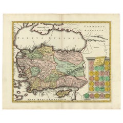
Decorative Antique Map of Cyprus and Asia Minor by Christoph Weigel, Circa 1720
Located in Langweer, NL
Title: Asiae Peninsula sive Asia Intra Taurum by Christoph Weigel, Circa 1720 – Decorative Antique Map of Cyprus and Asia Minor
Description: Thi...
Category
1720s Antique Maps
Materials
Paper
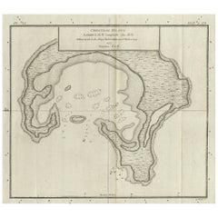
Antique Map of Christmas Island by Cook, C.1781
Located in Langweer, NL
Antique map Kiribati titled 'Christmas Island (..)'. Antique map of Christmas Island, also known as Kiritimati. Originates from an edition of Cook's Voyages.
Artists and Engravers: Engraved by Duff.
Condition: Good, some wear and age-related toning. Please study image carefully.
Date: c.1781
Overall size: 27.5 x 21.5 cm.
Image size: 20.5 x 18 cm.
We sell original antique maps to collectors, historians, educators and interior decorators all over the world. Our collection includes a wide range of authentic antique maps...
Category
18th Century Antique Maps
Materials
Paper
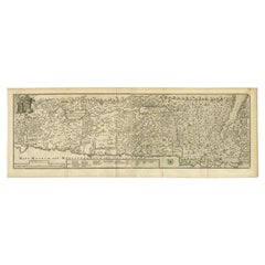
Antique Map of the Holy Land, c.1717
Located in Langweer, NL
Antique map Israel titled 'Tabula Geographica Terrae Sanctae'. Rare edition made after a map of the Holy Land by J. Bonfrerius. The map is oriented ...
Category
18th Century Antique Maps
Materials
Paper
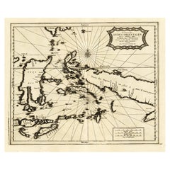
Extremely Rare Map of the East-Indies towards the South-East 'Indonesia', 1725
Located in Langweer, NL
Antique map titled 'La partie des Indes Orientales vers le Zud-Est, depuis Timor jusqu'a Midanao (...).' (The part of the East-Indies towards the South-East, from Timor to Mindanao.)...
Category
1720s Antique Maps
Materials
Paper
Impressive Decorative Engraved Map of the Red Sea and Arabian Peninsula, 1787
Located in Langweer, NL
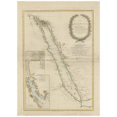
This map, titled "Karte des arabischen Meerbusens oder des Rothen Meeres," is an original engraving from 1787 created by F. A. Schraembl, based on the cartographic work of d'Anville.
It is a partially colored copper engraving.
Key features and notable details of the map include:
1. The title is prominently displayed within a large, ornate cartouche, enhancing the aesthetic appeal and indicating the map's subject as the Red Sea (Rothen Meeres).
2. The map covers the Red Sea and its surrounding regions, including significant portions of the Arabian Peninsula and northeastern Africa.
3. There are two detailed inset maps:
- The first inset map shows the roadstead of the port of Suez (Rheede des Hafen von Sues).
- The second inset map depicts Bahr el Kolsum, the northwestern arm of the Red Sea, based on a map by De la Rochette from 1785.
4. Geographical Features: The map meticulously details the coastline, islands, and notable port cities along the Red Sea. The cartography highlights both natural and man-made features, with elevations and mountains represented through hachures.
5. Condition and Preservation: The map has a horizontal centerfold and is partially backed to prevent tears. The edges of the map sheet show minor holes, tears, and faint brown spots, yet it remains in overall good condition considering its age.
6. Historical Importance: This map is a valuable historical document, reflecting the cartographic knowledge of the late 18th century. It serves as a significant piece for collectors interested in antique maps, particularly those focusing on the Arabian Peninsula and maritime navigation in the Red Sea region.
The map shows the coastline of the Red Sea and the Arabian Peninsula, detailing regions and places along the western coast of Saudi Arabia and Yemen, as well as the eastern coast of Egypt and Sudan. Here are some of the most important places identified on the map:
1. Jeddah (Gedda): A major city and port on the western coast of Saudi Arabia, significant for its role as a gateway for pilgrims traveling to Mecca.
2. Mecca (Mekka): A holy city in Islam, located inland from the Red Sea, important for being the site of pilgrimage (Hajj) for Muslims.
3. Medina (Medina): Another important Islamic city, known for the Prophet's Mosque and being a key pilgrimage site.
4. Suez (Suess): Located at the northern end of the Red Sea, near the Suez Canal, it's a crucial link between the Mediterranean Sea and the Red Sea.
5. Aden: A port city in Yemen, located at the southern tip of the Arabian Peninsula, historically significant as a trading hub.
6. Mocha (Mokka): A port city in Yemen, historically known for being a major marketplace for coffee.
7. Sana'a: The capital city of Yemen, noted for its historical and cultural significance.
8. Bab el Mandeb: The strait connecting the Red Sea to the Gulf of Aden, crucial for maritime navigation.
These locations are critical due to their historical, religious, and economic significance, especially in terms of trade routes and pilgrimage sites. The map also illustrates the mountainous terrain and coastal features of the region.
The condition and preservation status, which, despite minor imperfections, is considered well-preserved for its age.
Overall, this map is a rare and valuable artifact, offering both historical insights and aesthetic appeal for collectors and enthusiasts of antique cartography.
Category
1780s Antique Maps
Materials
Paper
Old Map of Ceylon 'Sri Lanka' with The North Oriented to The Left, 1731
Located in Langweer, NL
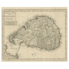
Description: Antique map Ceylon titled 'Nieuwe Kaart van t Eland Ceilon'.
Old map of present-day Sri Lanka with north oriented to the left. The ...
Category
1730s Antique Maps
Materials
Paper
Antique Map of Ukraine, Bulgaria, Romania, Servia & Surroundings by N. Visscher
Located in Langweer, NL
Antique map titled 'Exactissima Tabula qua tam Danubii Fluvii Pars Inferior, a Belgrado Urbe usq ad ejus ostia, et minores in eum influentes, Fluvii quam Regiones adjacentes, ut Tran...
Category
Early 18th Century Antique Maps
Materials
Paper
Antique Map of India as Described It Was before the 5th Century, 1744
Located in Langweer, NL
Antique map titled 'India, as described by all Authors before the fifth Century'. Detailed map of part of India, including Hyrcania, Parthia, Carmania, Gedorossii, Drangiana, Aria, M...
Category
18th Century Antique Maps
Materials
Paper
Old Map of Ancient Spain and Portugal – Hispania Antiqua Featuring Roman Cities
Located in Langweer, NL
Title: "Hispania Antiqua in Tres Praecipuas Partes Divisa: Tarraconensem, Lusitaniam, et Bæticam" by Robert de Vaugondy, 18th Century
Description:
This beautifully detailed map titl...
Category
Late 18th Century Antique Maps
Materials
Paper
Antique Map of the Province of Groningen in the Netherlands, c.1700
Located in Langweer, NL
Antique map titled 'Groningae et Omlandiae Dominium vulgo de Provincie van Stadt en Lande'.
Old map of the province of Groningen, the Netherlands. This map originates from 'Atlas C...
Category
18th Century Antique Maps
Materials
Paper
Original Antique Map of Malabar, Coromandel 'India' and Ceylon
Located in Langweer, NL
Antique map titled 'Peninsula Indiae citra Gangem, hoc est Orae celeberrimae Malabar & Coromandel (..)'. Large and attractive original hand colored map of Sri Lanka and the Southern ...
Category
Mid-18th Century Antique Maps
Materials
Paper
Old Map of the Arabian Peninsula with Parts of Egypt, Sudan, Eritrea & Ethiopia
Located in Langweer, NL
"Carte de l'Arabie, du Golfe Persique, et de la Mer Rouge, avec l'Egypte, la Nubie et l'Abissinie", Bonne, Rigobert
Subject: Arabia
Period: 1780 (circa)
Publication: Atlas de Toutes...
Category
1780s Antique Maps
Materials
Paper
Antique Map of Batavia 'Jakarta, Indonesia', the Dutch East-Indies, 1782
Located in Langweer, NL
Antique map titled 'Batavia zo als het was in den Jaare 1731.' (Batavia as it was in the year 1731.) Map of the city of Batavia (Jakarta) in Indonesia. With legend and scale. This pr...
Category
18th Century Antique Maps
Materials
Paper
18th Century Original Dutch Map of Martinique in The West Indies by Isaak Tirion
Located in Langweer, NL
This is an 18th-century Dutch map of Martinique, titled *Het Westindisch Eiland Martinique*. The map was produced by Isaak Tirion, a renowned Dutch cartographer and publisher known for his precise and beautifully crafted maps. The cartouche in the lower left corner, adorned with decorative elements, adds to the aesthetic appeal of the map.
### Key Features:
- Martinique: The map offers detailed topographical information of the island, including mountains, rivers, and settlements.
- Geographical Details: Locations such as Fort Royal, Bay de St. Pierre, and Point de Cloche are marked, showcasing significant features of the island.
- Cartouche: The ornate cartouche, featuring tropical plants, reflects the importance of the island's agricultural production during the colonial period, particularly its sugar plantations.
This map captures Martinique during its time as a French colony and provides valuable insight into the island’s layout and strategic significance in the Caribbean. The attention to coastal detail highlights the importance of Martinique as a hub of maritime activity.
The map’s combination of aesthetic elegance and cartographic precision makes it a remarkable piece for collectors and those interested in Caribbean colonial...
Category
1760s Antique Maps
Materials
Paper
Antique Map of the Pacific Ocean by Renneville, 1702
Located in Langweer, NL
Antique map, untitled. A map of the Pacific Ocean, with the coast of Peru in the right edge and the outline of New Guinea in the left edge. In betwe...
Category
18th Century Antique Maps
Materials
Paper
Pl. 4 Antique Print of Various Elements of the Kew Gardens by Le Rouge, c.1785
Located in Langweer, NL
Antique print titled 'Vue du Lac, de l'Orangerie et du Temple d'Eole à Kew (..)'. Copper engraving showing the lake, orangery, temple and pagoda of the Kew gardens. This print origin...
Category
18th Century Antique Maps
Materials
Paper
Antique Map of Brabant 'The Netherlands' by N. Visscher, circa 1690
Located in Langweer, NL
Antique map titled 'Brabantiae Batavae pars orientalis, comprehendens Tetrarchiam sive majoratum sylvaeducensem in ejusdem subjacentes ditiones (..)'. Map of the Dutch province 'Brab...
Category
Mid-18th Century Antique Maps
Materials
Paper
1720 Johann Baptist Homann Map of the Austrian Circle and Surrounding Regions
Located in Langweer, NL
"1720 Johann Baptist Homann Map of the Austrian Circle and Surrounding Regions"
Description of the Map:
This map, crafted by the renowned cartographer Johann Baptist Homann around...
Category
1720s Antique Maps
Materials
Paper
Rare Hand-Colored Antique Map of Asia, 1788
Located in Langweer, NL
Antique map titled 'Kaartje van Asia'.
Original antique map of Asia. This map originates from 'Nieuwe Natuur- Geschied- en Handelkundige Zak- en Reisatlas' by N.T. Gravius, 1788....
Category
1780s Antique Maps
Materials
Paper
Antique Map of Java 'Indonesia' by Chatelain, 1719
Located in Langweer, NL
Antique map titled 'Carte de l'Ile de Java: Partie Occidentale, Partie Orientale, Dressee tout Nouvellement Sur Les Memoires Les Plus Exacts (..)'. This beautiful map of Java exists ...
Category
Early 18th Century Antique Maps
Materials
Paper
Large 1750 Map of the Kingdoms of Spain and Portugal by Robert de Vaugondy
Located in Langweer, NL
1750 Map of the Kingdoms of Spain and Portugal by Robert de Vaugondy
Description:
This map, titled *"Royaumes d'Espagne et de Portugal,"* was created in 1750 by the esteemed French ...
Category
Mid-18th Century Antique Maps
Materials
Paper
Antique Map of France by T. Bowen, 1785
Located in Langweer, NL
Decorative antique map of France titled 'A new and accurate map of France, Drawn from the latest Authorities by T. Bowen'. Engraved for Moore’s new and complete collection of Voyages...
Category
Late 18th Century Antique Maps
Materials
Paper
Rare Map of South America of Chili, La Plata, Paraguay, Brazil, Peru, c.1775
Located in Langweer, NL
Antique map titled 'South America agreeable to the most approved maps and charts'.
Rare map of South America depicting Chili, La Plata, Paraguay, Brazil, ...
Category
1770s Antique Maps
Materials
Paper
Antique Map of Tracks of Anson's Ships around South America & Cape Horn, 1749
Located in Langweer, NL
Description: Antique map titled 'Kaart van het Zuidelykste Gedeelte van Zuider Amerika (..) - Carte de la Partie Meridionale de l'Amerique Meridionale (..)'.
Detailed chart tracking the route of Capt. George Anson's ship The Centurion in 1745. The chart shows the tracks of Anson's ships around South America & Cape Horn to the Juan Fernandes Islands, with notes on currents and positions.
In 1740 Capt. George Anson (1697-1762) of the Royal Navy, was given command of a squadron of ships. As England was at war with France and Spain, Anson's task was to intercept and capture a Spanish treasure...
Category
1740s Antique Maps
Materials
Paper
Old Sea Chart of Northern Norway, also depicting Part of Lapland & Russia, 1702
Located in Langweer, NL
Antique map titled 'The Coast of Norway and Lapland, from North kyn to the River Kola'.
Sea Chart of Northern Norway, also depicting part of Lapland and Russia. The map covers from the Kola river to what the map calls Fishers Island...
Category
Early 1700s Antique Maps
Materials
Paper
Pl. 1 Antique Print of the Stowe House by Le Rouge, 1776
Located in Langweer, NL
Antique print titled 'Chateau de Stowe, du Coté des Jardins'. Copper engraving showing the garden side of the Stowe House. This print originates from 'Jard...
Category
18th Century Antique Maps
Materials
Paper
Old Print of VOC Ships in the Sea Near Batavia (Jakarta, Indonesia), 1779
Located in Langweer, NL
Antique print Batavia titled 'De Reede van Batavia'.
Beautiful view of the sea near Batavia (Jakarta, Indonesia), with several ships lying at anchor.
Artists and Engravers: Ma...
Category
1770s Antique Maps
Materials
Paper
Original Antique Map of Africa with large decorative cartouche
Located in Langweer, NL
Original antique map titled 'L'Afrique divisée en ses principaux États'. Attractive and precise map of Africa, with large decorative cartouche. Engraved by Janvier. Published by Dela...
Category
Late 18th Century Antique Maps
Materials
Paper
Old Map of Part of France: Poitou, Berry, Bourbonnais, and Nivernais in 1768
Located in Langweer, NL
The map with text neatly mounted on both sides of the map on the plate, is a section of an old map with accompanying French text. The map mentions several historical French provinces...
Category
1760s Antique Maps
Materials
Paper
Antique Map of London by Tirion '1754'
Located in Langweer, NL
Antique map titled 'Kaart van Londen enz. en van het naby gelegen land ruim een Uur gaans rondsom dezelve Stad; getrokken uit de groote gemeeten Kaart van Hr. John Rocque'. In the se...
Category
Mid-18th Century Antique Maps
Materials
Paper
Old Print of the Garden of L'hotel De L'Orleans, Rue De Provence, France, 1785
Located in Langweer, NL
Antique print titled 'Plan idéal du Jardin et de l'Hotel d'Orléans'. Copper engraving of the garden design for a hotel. This print originates from 'Jardins Anglo-Chinois à la Mode' b...
Category
18th Century Antique Maps
Materials
Paper
Original Antique Map of the Empire of Japan, Centered on the Bay of Osaka, c1752
Located in Langweer, NL
Antique map titled 'Carte de L'Empire de Japon (..).'
Map of the Empire of Japan. Centered on the Bay of Osaka, this map covers from Hirado (here identified as I. Firando) and Na...
Category
1750s Antique Maps
Materials
Paper
Map of Kingdoms of Castile, León, Galicia, Asturias, Biscay and Navarre in Spain
Located in Langweer, NL
Antique map titled 'Partie Septentrionale de la Couronne de Castille (..)'. Decorative and highly detailed map of Northwestern Spain, including Gallicia...
Category
Mid-18th Century Antique Maps
Materials
Paper
Antique Map of Bonthain Bay, Sulawesi, Celebes
Located in Langweer, NL
Antique map titled 'Vue de la Baye de Bonthain (..)'. Map of the island Sulawesi (Celebes), Indonesia that Philip Carteret rested his crew and made repairs to his ship the Swallow fo...
Category
Late 18th Century Antique Maps
Materials
Paper
Antique Frontispiece by Tirion, Showing a Map of Africa, an Elephant Etc, 1731
Located in Langweer, NL
Antique frontispiece of the 3rd volume of 'Hedendaagsche historie of tegenwoordige staat van allen volkeren (..)' by Thomas Salmon. This volume describes Peg...
Category
18th Century Antique Maps
Materials
Paper
Rare Antique Copper Engraving of a Map of Pegu and Arakan, Burma (Myanmar), 1714
Located in Langweer, NL
Antique map Myanmar (Birma) titled 'Les Royaumes de Pegu et d'Aracan'.
Rare map of Pegu and Arakan made after a map engraved by Pieter van den Keere and published in the 1628 edi...
Category
1710s Antique Maps
Materials
Paper
Antique Map of Spain & Portugal 'Iberian Peninsula', Decorative Cartouche, c1755
Located in Langweer, NL
Antique map titled 'Spain and Portugal'.
Small, detailed antique map of Spain and Portugal (Iberian Peninsula). Decorative title cartouche.
Artists and Engravers: Thomas Jeff...
Category
1750s Antique Maps
Materials
Paper
Print of the Solemn Celebration Sapan Giacche in Pegu, Burma 'Myanmar', 1725
Located in Langweer, NL
Antique print, titled: 'Fete Solennelle de Pegu appelee Sapan Giacche'
This plate shows the Solemn celebration called Sapan Giacche in Pegu or Bago, the capital of the Bago Regio...
Category
1720s Antique Maps
Materials
Paper
Antique Map of Germany by Clouet, 1787
Located in Langweer, NL
Antique map titled 'L'Allemagne'. Antique map of Germany. Originates from 'Geographie moderne avec une introduction' by J.B.L. Clouet.
Category
Late 18th Century Antique Maps
Materials
Paper
Chile Coast Bay Map – Antique 1749 Chart by Anson from Voyage Around the World
Located in Langweer, NL
Antique map titled 'Plan van een Baai en Haven aan de Kust van Chili (..) - Plan d'une Baye de la Côte du Chili (..)'. Original antique map of a bay on the coast of Chile discovered ...
Category
18th Century Antique Maps
Materials
Paper
Antique Map of the Region of Zeitz in Germany, 1749
By Schreiber
Located in Langweer, NL
Antique map titled 'Das Stifft Zeitz (..)'. Map of the region of Zeitz, Germany. Zeitz is a town in the Burgenlandkreis district, in Saxony-Anhalt, Germany. It is situated on the riv...
Category
18th Century Antique Maps
Materials
Paper
Original Antique Plan of the Fortress of Charedsch in Persia or Iran, ca.1780
Located in Langweer, NL
Antique map, titled: 'Plan de la Citadelle de la Ville de Charedsch.'
Plan of the fortress of Charedsch, Iran / Persia. This original antique print originates from 'Reize naar Ar...
Category
1780s Antique Maps
Materials
Paper
Pl. 29 Antique Print of Garden Kiosks by Le Rouge, c.1785
Located in Langweer, NL
Antique print titled 'Differens Kiosques par Halfpenny'. Copper engraving showing various garden kiosks. This print originates from 'Jardins Anglo-Chinois à la Mode' by Georg Louis l...
Category
18th Century Antique Maps
Materials
Paper
Physical & Political Map of Switzerland: Late 18th Century - Mentelle Atlas
Located in Langweer, NL
Antique Map with Title: 'Carte Physique et Politique de la Suisse'
**Publication Details:**
- **Atlas Title:** Nouvel Atlas Universel de Géographie Ancienne et Moderne
- **Purpose:...
Category
1790s Antique Maps
Materials
Paper
Old Decorative Map of Austria, Centered on the Danube River and Vienna, Ca.1720
Located in Langweer, NL
Antique map titled 'Archiducatus Austriae inferioris (..).' Decorative map of Austria, centered on the course of the Danube River and Vienna. Shows the region from Enss and Steyr to ...
Category
1720s Antique Maps
Materials
Paper
Martinique Island in the Caribbean by Bellin Original Original Antique Map, 1780
Located in Langweer, NL
This mid-18th century map, "Carte de l'Isle de la Martinique pour servir a l'historie generale des voyages," was issued in 1780 by M. Bellin in Paris. It presents a detailed and visually captivating depiction of the Island of Martinique within the context of the Caribbean and the Lesser Antilles.
**Title:** Carte de l'Isle de la Martinique pour servir a l'historie generale des voyages
**Issuer:** M. Bellin
**Date:** 1780
**Location Coverage:** North America, Caribbean, Martinique, Lesser Antilles
This engraved map is notable for its pleasing aesthetics, featuring lovely hand coloring that enhances its visual appeal. The inclusion of a scroll cartouche, an ornamental frame, and measurement lines adds a distinctive and visually appealing quality to the map.
Martinique, situated within the Lesser Antilles in the Caribbean, is presented with meticulous detail, showcasing geographical features, coastlines, settlements, and other notable landmarks. Bellin, known for his accuracy in cartography, crafted this map to serve as a geographical reference within the broader context of historical voyages and exploration.
The combination of detailed cartographic information and artistic embellishments, such as hand coloring and decorative elements, makes this map not only a valuable geographical document but also a visually pleasing piece of cartographic art...
Category
Late 18th Century Antique Maps
Materials
Paper
Pl. 12 Antique Print of an Orangery and Garden Plan by Le Rouge, c.1785
Located in Langweer, NL
Antique print titled 'Jardins de Bessingen (..)'. Copper engraving showing a garden plan and orangery (or orangerie). This print originates from 'Jardins A...
Category
18th Century Antique Maps
Materials
Paper
Antique Map of the City of Ambon by Valentijn, 1726
By F. Valentijn
Located in Langweer, NL
Antique map titled 'De Platte Grond van Amboina zoo als het was in den Jaare, 1718'. Antique map depicting the City of Ambon, Indonesia. This print originates from 'Oud en Nieuw Oost...
Category
Early 18th Century Dutch Antique Maps
Materials
Paper
Antique Print of Batavia or nowadays Jakarta, Indonesia, c.1755
Located in Langweer, NL
Antique print titled 'Vue de l'Isle et de la ville de Batavia appartenant aux Hollandois'. Beautiful view of the island and the city of Batavia belonging to the Dutch, for the India ...
Category
18th Century Antique Maps
Materials
Paper
Antique Map of Germany by Hederichs 'circa 1740'
Located in Langweer, NL
Antique map titled 'Germania'. Rare miniature map of Germany and surroundings. This map covers the entirety of those lands traditionally occupied by Germanic peoples, from the Blatic...
Category
Mid-18th Century Antique Maps
Materials
Paper
Antique Map of the Holy Land, Showing the Location of the Various Tribes
Located in Langweer, NL
Antique map titled 'Judaea seu Terra Sancta quae Hebraeorum sive Israelitarum (..)'. Map of The Holy Land, showing the location of the various tribes, in two kingdoms, Judah and Isra...
Category
Early 18th Century Antique Maps
Materials
Paper
Nice Antique Map of Asia Minor, Turkey, circa 1718
Located in Langweer, NL
Antique map titled 'Antiquae Asiae Minoris & C. Tabula' by Philippo Talbor. This rare antique map is published by Edward Wells, circa 1718.
Category
Early 18th Century Antique Maps
Materials
Paper
Antique Print of Hagley Hall in Worcestershire, England, ca.1770
Located in Langweer, NL
Antique print titled 'Principal Front of Hagley'. Main facade of Hagley Hall, Worcestershire.
Hagley Hall is a Grade I listed 18th-century house in Hagley, Worcestershire, the ho...
Category
18th Century Antique Maps
Materials
Paper
Antique Map of Northern Germany by M. Seutter, circa 1730
Located in Langweer, NL
Antique map titled 'Saxoniae Inferioris Circulus'. Old map of the northern part of Germany by M. Seutter. Covering the area of Lower Saxony, Mecklenburg-Vorpommern and Schleswig-Hols...
Category
Mid-18th Century Antique Maps
Materials
Paper
Charting Eastern Tartary: An 18th-Century Jesuit and English Collaboration, 1757
Located in Langweer, NL
The antique map titled 'Carte de la Tartarie Orientale pour Servir a l'Histoire Generale des Voyages Tiree des Cartes Levees par les P.P. Jesuites' is an original old map that covers...
Category
Mid-18th Century Antique Maps
Materials
Paper
Antique Map of Northeastern India, Nepal, Bhutan, Assam and Bangladesh
Located in Langweer, NL
Antique map titled 'De Land-Reyse door Benedictus Goes, van Lahor gedaan, door Tartaryen na China'. Interesting map showing the region of northeastern India, Nepal, Bhutan, Assam and...
Category
Early 18th Century Antique Maps
Materials
Paper
Antique Print of a Chestnut by Knoop, 1758
Located in Langweer, NL
Antique print of a chestnut. Originates from 'Pomologia' by J. H. Knoop.
Artists and Engravers: Published by Johann Hermann Knoop (c.1700-1769).
Condition: Good, general age-re...
Category
18th Century Antique Maps
Materials
Paper
1718 Ides & Witsen Map "Route D'amsterdam a Moscow Et De La Ispahan Et Gamron
Located in Norton, MA
1718 Ides & Witsen map, entitled
"Route D'Amsterdam A Moscow Et De La Ispahan Et Gamron,"
Ric.b005
Subject: Eastern Europe and Central Asia
Period: 1718 (published)
Publicati...
Category
Early 18th Century Dutch Antique Maps
Materials
Paper
