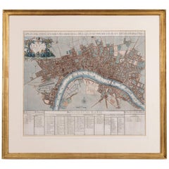
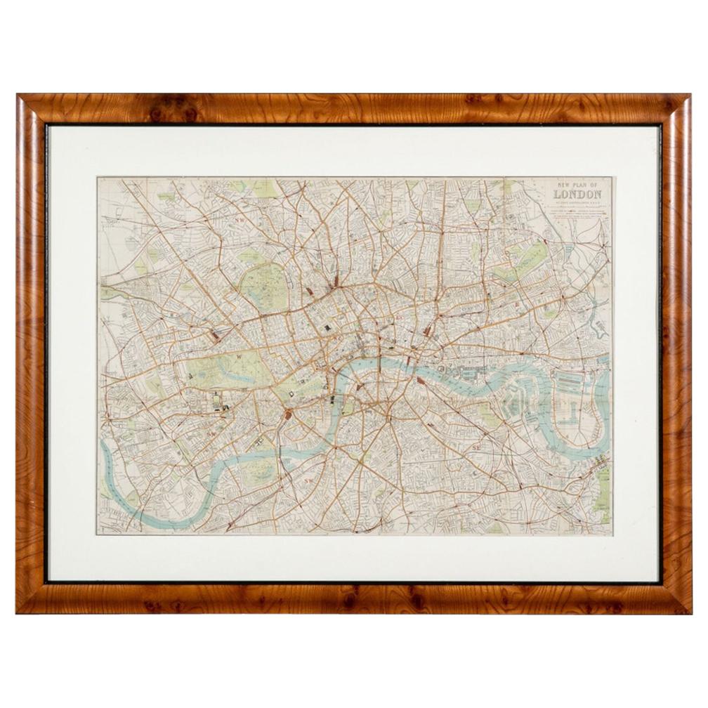
John Senex Map of London in 1720
View Similar Items


Want more images or videos?
Request additional images or videos from the seller
1 of 12
John Senex Map of London in 1720
About the Item
- Creator:John Senex (Illustrator)
- Dimensions:Height: 28.35 in (72 cm)Width: 31.11 in (79 cm)Depth: 1.19 in (3 cm)
- Style:George II (Of the Period)
- Place of Origin:
- Period:1720-1729
- Date of Manufacture:circa 1720
- Condition:Wear consistent with age and use. Later mounted and framed, ,the map with slight age related creases but overall in good original condition.
- Seller Location:London, GB
- Reference Number:Seller: p008711stDibs: LU984310232901
About the Seller
4.9
Vetted Seller
These experienced sellers undergo a comprehensive evaluation by our team of in-house experts.
Established in 1979
1stDibs seller since 2013
178 sales on 1stDibs
Typical response time: 1 hour
Associations
LAPADA - The Association of Arts & Antiques Dealers
More From This SellerView All
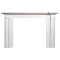
- George II Clipsham Stone Fire SurroundLocated in London, GBA George II Clipsham stone fire surround, of architectural form, the paneled header centred by fluted Keystone on stop-fluted jambs, on block feet....Category
Antique Mid-18th Century European George II Fireplaces and Mantels
MaterialsLimestone
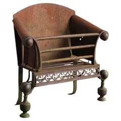
- A George II Iron and Steel Fire GrateLocated in London, GBA George II iron and steel fire grate, circa 1730, the swept and scrolled sides joined by straight wrought bars, with fine fretwork apron on baluster standards. Restoration/refinishi...Category
Antique Mid-18th Century English George II Fireplaces and Mantels
MaterialsSteel, Iron
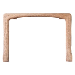
- Carved Oak Fire Surround by John MakepeaceBy John MakepeaceLocated in London, GB1970s Carved oak fire surround by John Makepeace OBE (b.1939), of naturalistic form. Opening width 117 cm x 91 cm high.Category
Vintage 1970s British Fireplaces and Mantels
MaterialsOak
- Sir John Soane Designed White Marble FireplaceBy Sir John SoaneLocated in London, GBA Regency style white marble fireplace, to a design by Sir John Soane, the inverted breakfront shelf above frieze with a band of anthemion carved in rel...Category
21st Century and Contemporary European Regency Fireplaces and Mantels
MaterialsMarble
- Unique Pair of French Floor LampsBy Maison CharlesLocated in London, GBA unique pair of 1970s French floor lamps, in the manner of Maison Charles, each gilt metal five light foliate plume issuing from classical twin-handled urn on pedestal base.Category
Vintage 1970s Modern Floor Lamps
 $7,327 / set
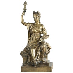
 - Gilt Bronze Model of CeresLocated in London, GBA gilt bronze model of Ceres, Roman goddess of agriculture, modeled seated holding torch aloft in one hand and with a sheaf of wheat in the other, on plin...Category
Antique 19th Century Italian Classical Roman Figurative Sculptures
You May Also Like
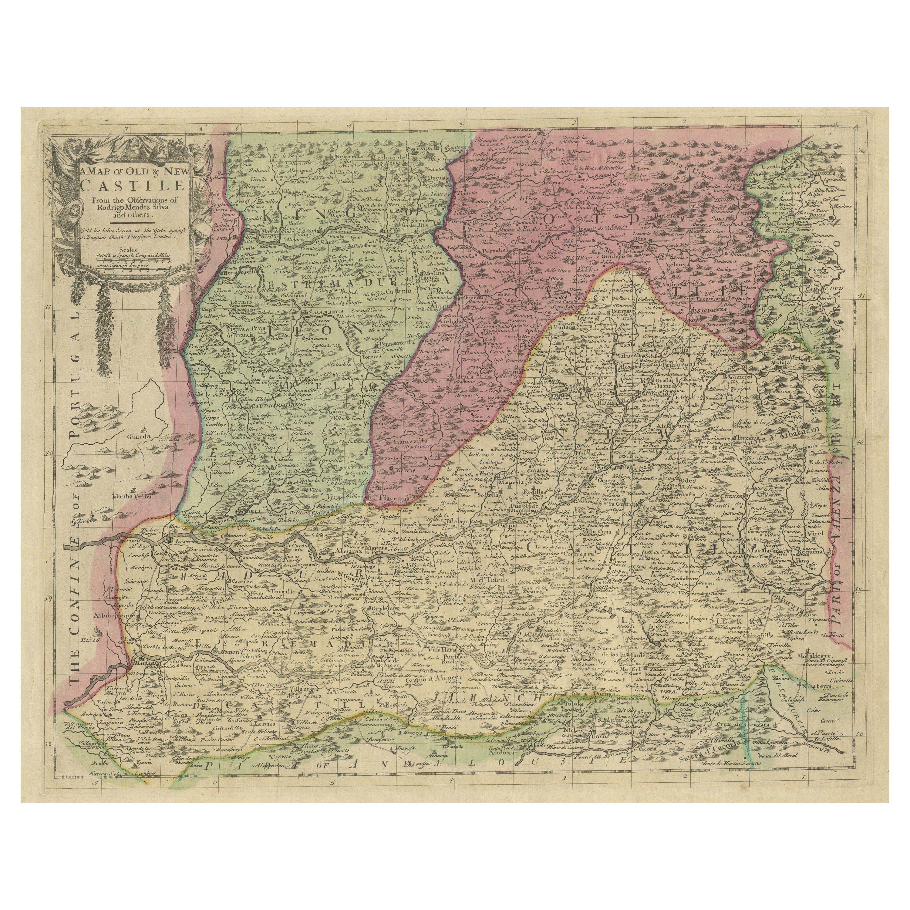
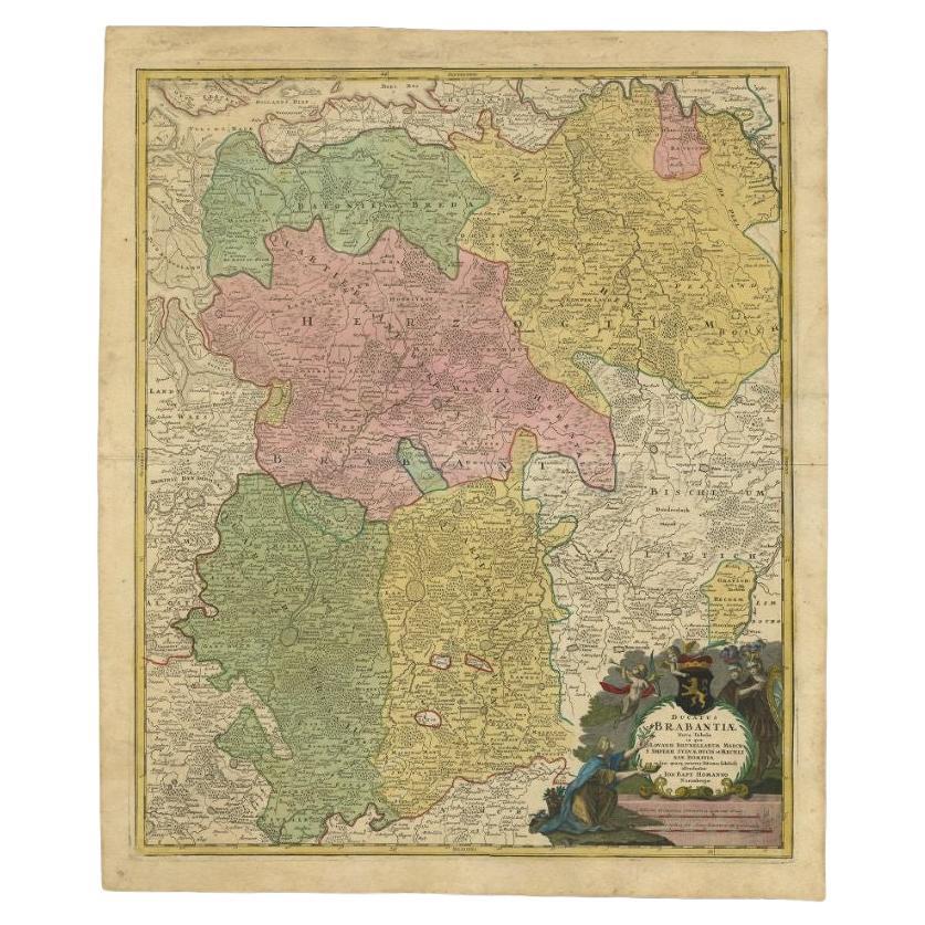
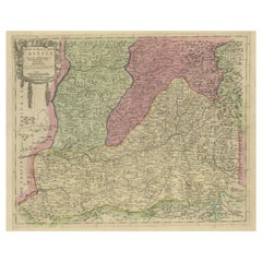
- Senex Map of Castile, Leon & La Mancha in The Spanish Heartland, 1714Located in Langweer, NLThis antique map, titled "A Map of Old & New Castile from the Observations of Rodrigo Mendes Silva and others," depicts the regions of Old Castile and New Castile in Spain, along wit...Category
Antique Early 18th Century Maps
MaterialsPaper
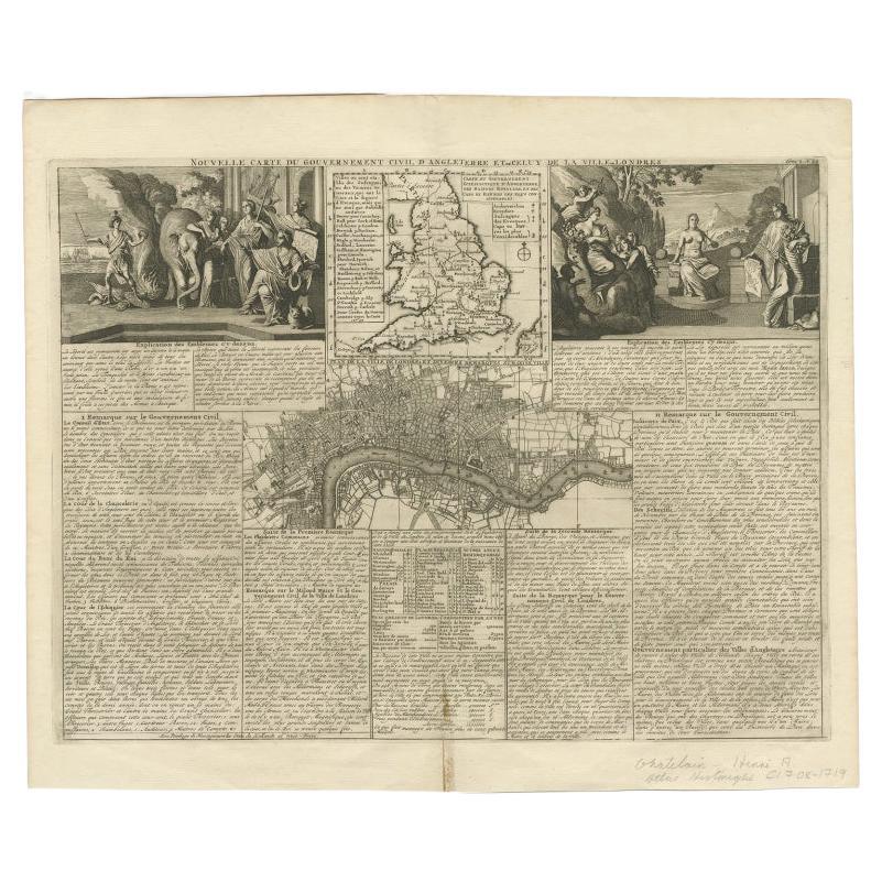
- Antique Map of England and London with Two Large Allegorical Views, c.1720Located in Langweer, NLAntique map titled 'Nouvelle Carte du gouvernement civil d'Angleterre (..)'. Old plan of London, with map of England and two large allegorical views. This map originates from Chatela...Category
Antique 18th Century Maps
MaterialsPaper
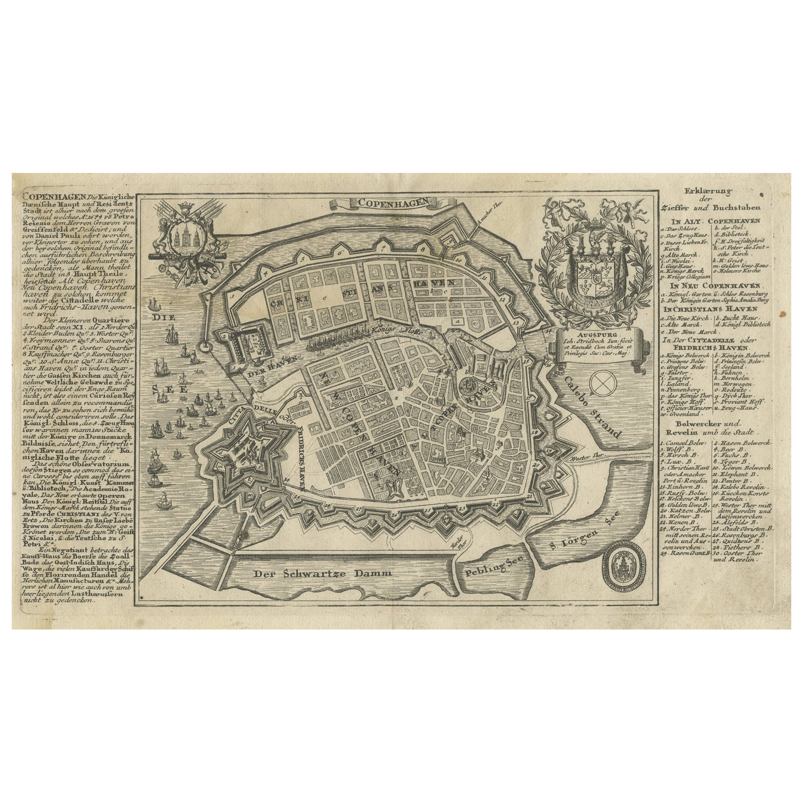
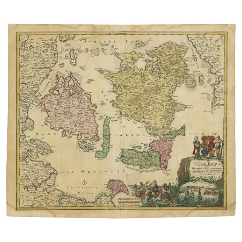
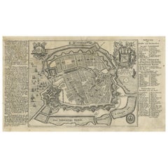
- Antique Map of the City of Copenhagen in Denmark c.1720Located in Langweer, NLAntique map titled 'Copenhagen'. Original antique map of the city of Copenhagen, Denmark. This map originates from 'Unterschiedliche dieser Zeit Beruffene Laender, Gegenden, Staedte ...Category
Antique 18th Century Maps
MaterialsPaper
- Antique Map of the Bay of Bantam, c.1720Located in Langweer, NLRare, untitled miniature map of the Bay of Bantam with various Islands including Pulo Dua and Pulo Batto. This map originates from a small travelogue and may originate from an editio...Category
Antique 18th Century Maps
MaterialsPaper
- Antique "New Plan of London" Map by John Bartholomew, 1900Located in Bridgeport, CTProduced for the W.H. Smith guide, folded in the original. The map here is unfolded and framed flat, with transportation routes shown and color details. sight 22 x 32" (original ful...Category
Antique Early 1900s English Victorian Maps
MaterialsPaper
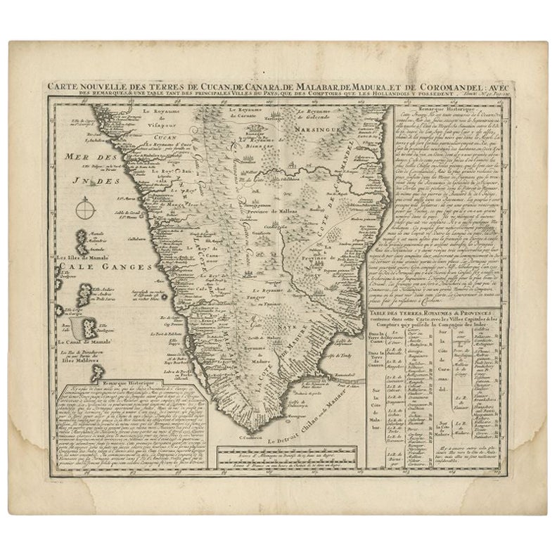
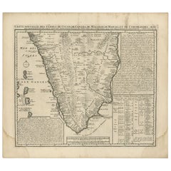
- Antique Map of Southern India by Chatelain, c.1720Located in Langweer, NL"Antique map titled 'Carte Nouvelle des Terres de Cucan, de Canara, de Malabar, de Madura, et de Coromandel'. Map of the southern portion of India, originating from Chatelain's 'Atla...Category
Antique 18th Century Maps
MaterialsPaper


Recently Viewed
View AllMore Ways To Browse
Dragon Sword
Antique Sheriff
Antique Whimsical
Copper Collectables
Antique Atlas Map
Provence Antiques
Antique Maps Prints
Antique Map Prints
Antique Map Print
Antique Prints Maps
Antique Prints And Maps
Antique Maps And Prints
Map 19th Century
Antique Atlas Furniture
Antique Lined Paper
Map Of France
Large Maps
Large Map