Antique Atlas Map

107
to
555
3,016
377
1,741
1,582
809
665
600
402
206
196
196
190
175
153
147
124
118
87
57
56
47
46
38
38
31
29
29
27
26
22
22
22
21
20
18
18
17
13
12
12
11
11
10
10
9
9
8
7
7
7
5
1
143
107
99
67
36
Sort By
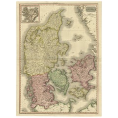
19th Century Large Original Antique Map of Denmark by J. Pinkerton, 1812
By Pinkerton
Located in Langweer, NL
Highly detailed map of Denmark. One of the best large format English atlas maps of the period
Category

Early 19th Century Antique Atlas Map

Materials

Paper

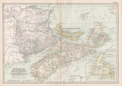
New Brunswick, Nova Scotia and Prince Edward Island, Canada. Century Atlas map
Located in Melbourne, Victoria
'The Century Atlas. New Brunswick, Nova Scotia and Prince Edward Island, Canada.' Original antique
Category

Early 20th Century Victorian Antique Atlas Map

Materials

Lithograph

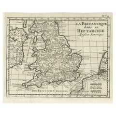
Small Antique Map of England and Wales as It Was During the Heptarchy
Located in Langweer, NL
after the departure of the Romans, from 500-850 AD. It is based on Sanson's pocket atlas map and
Category

Mid-18th Century Antique Atlas Map

Materials

Paper

1900s Stielers Hand Atlas 100 Maps
Located in Seguin, TX
Stielers Hand Atlas, Gotha: Justus Perthes, Germany, circa 1905. Linen covered wood box containing
Category

Early 20th Century German Victorian Antique Atlas Map

Materials

Paper

Antique 1900s Stielers Hand Atlas 100 Maps
1900s Stielers Hand Atlas 100 Maps
H 17.5 in W 12 in D 3 in
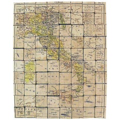
Puzzle Atlas with Maps, Italy, circa 1900
Located in Milan, IT
80 little wooden cubes covered with printed paper that depending on which side they form the maps
Category

Early 20th Century Italian Antique Atlas Map

Materials

Wood, Paper

Antique Puzzle Atlas with Maps, Italy, circa 1900
Puzzle Atlas with Maps, Italy, circa 1900
H 1.25 in W 10 in D 12.75 in
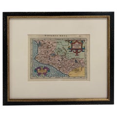
Framed Mercator Hondius Hispania Nova Atlas Minor Map
Located in Stamford, CT
reduced size version of Mercator’s “Atlas”, itself suitably titled “Atlas Minor”. The maps were copied
Category

17th Century Dutch Spanish Colonial Antique Atlas Map

Materials

Glass, Wood, Paper

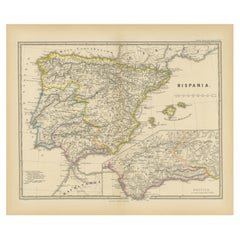
Ancient Iberia: Hispania Map from Spruner-Menke Atlas Antiquus, 1880
Located in Langweer, NL
original antique map from the "Spruner-Menke Atlas Antiquus," a 19th-century historical atlas. The maker of
Category

1880s Antique Atlas Map

Materials

Paper

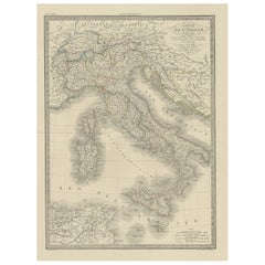
Antique Map of Italy from an Old French Atlas, 1842
Located in Langweer, NL
Antique map titled 'Carte de l'Italie'. Map of Italy. This map originates from 'Atlas universel
Category

19th Century Antique Atlas Map

Materials

Paper

Antique Map of Asia from a German School Atlas, c.1870
Located in Langweer, NL
Antique map titled 'Asien'. Old map of the Asian continent. This map originates from 'H. Kiepert's
Category

19th Century Antique Atlas Map

Materials

Paper

Antique Map of Germany from an Old English Atlas, c.1802
Located in Langweer, NL
Antique map titled 'Germany'. Antique map of Germany engraved for 'Atlas to Walker's Geography
Category

19th Century Antique Atlas Map

Materials

Paper

Antique Map of Northern Africa from a Rare Dutch Atlas, 1825
Located in Langweer, NL
Antique map titled 'Africa'. Old map of the African continent originating from 'Atlas der Oude
Category

19th Century Antique Atlas Map

Materials

Paper

Antique Map of France from an Old Dutch School Atlas, 1852
Located in Langweer, NL
Antique map titled 'Frankrijk'. Map of France. This map originates from 'School-Atlas van alle
Category

19th Century Antique Atlas Map

Materials

Paper

Antique Map of Europe from an Old Dutch School-Atlas, 1852
Located in Langweer, NL
Antique map titled 'Europa'. Map of Europe. This map originates from 'School-Atlas van alle deelen
Category

19th Century Antique Atlas Map

Materials

Paper

Antique Map of Groningen from a 19th Century Dutch Atlas, 1864
Located in Langweer, NL
. This map originates from 'F. C. Brugsma's Atlas van het Koninkrijk der Nederlanden (..)'. Artists and
Category

19th Century Antique Atlas Map

Materials

Paper

Antique Map of Greece from an Old French School Atlas, 1880
Located in Langweer, NL
Antique map titled 'Grèce Moderne '. Old map of Greece and surroundings. This map originates from
Category

19th Century Antique Atlas Map

Materials

Paper

Antique Map of Germany from a 17th Century Pocket Atlas, 1685
Located in Langweer, NL
Antique map titled 'Nova Totius Germaniae descriptio.' Miniature map of Germany, from the pocket
Category

17th Century Antique Atlas Map

Materials

Paper

Antique Map of Germany from an American 19th Century Atlas, 1846
Located in Langweer, NL
Antique map titled 'Germany'. Old map of Germany. This map originates from 'A New Universal Atlas
Category

19th Century Antique Atlas Map

Materials

Paper

Old Map of Russia Originating from the 'Weekly Dispatch Atlas', ca.1865
Located in Langweer, NL
Antique map titled 'Russia in Asia, E Sheet'. Old map of Russia originating from the 'Weekly
Category

1860s Antique Atlas Map

Materials

Paper

Original Antique Map of Austria from an Old Dutch School Atlas, 1852
Located in Langweer, NL
Antique map titled 'Het Keizerrijk Oostenrijk'. Map of the Austrian Empire. This map originates
Category

1850s Antique Atlas Map

Materials

Paper

Antique Map of North America from an Old Dutch School Atlas, 1852
Located in Langweer, NL
Antique map titled 'Noord-Amerika'. Map of North America. This map originates from 'School-Atlas
Category

19th Century Antique Atlas Map

Materials

Paper

Exploring South America's North: Antique Map from the Royal Atlas of 1909
Located in Langweer, NL
accuracy and detail. Maps from this atlas are valuable historical references. 5. **Educational Value
Category

Early 20th Century Antique Atlas Map

Materials

Paper

Antique Engraved Map of South East Australia from a German Atlas, 1848
Located in Langweer, NL
Antique map Australia titled 'Süd-Ost Australien'. Detailed map of South East Australia
Category

19th Century Antique Atlas Map

Materials

Paper

Original Antique Map of England and Wales from the 1909 Royal Atlas
Located in Langweer, NL
nations. This original antique map of England and Wales is sourced from the 'Royal Atlas of Modern
Category

Early 20th Century Antique Atlas Map

Materials

Paper

Charming Decorative Miniature Map of Russia, from an Old Pocket Atlas, 1685
Located in Langweer, NL
Antique map titled 'Russia cum Consinijs'.' Charming miniature map of Russia, from the pocket
Category

1680s Antique Atlas Map

Materials

Paper

Antique Map of the Asian Continent from a German School Atlas, 1862
Located in Langweer, NL
Antique map titled 'Asien Politische Ubersicht'. Old map of the Asian continent. Originates from
Category

19th Century Antique Atlas Map

Materials

Paper

1859 Detailed Map of North West Germany with Bavaria Inset - Blackie's Atlas
Located in Langweer, NL
'The Imperial Atlas of Modern Geography', published in 1859 by W. G. Blackie. This original antique map
Category

Mid-19th Century Antique Atlas Map

Materials

Paper

1859 Denmark and Schleswig-Holstein Map: A Historical View from Blackie's Atlas
Located in Langweer, NL
The "Antique Map of Denmark with Schleswig & Holstein" from 'The Imperial Atlas of Modern Geography
Category

Mid-19th Century Antique Atlas Map

Materials

Paper

Antique Map of Russia in Asia from An Old German Atlas, 1845
By Meyer
Located in Langweer, NL
Antique map titled 'Asiatisches Russland'. This map depicts Russia in Asia and originates from
Category

19th Century Antique Atlas Map

Materials

Paper

Asia Minor and Provinces: A Roman Empire Map from Spruner-Menke Atlas, 1880
Located in Langweer, NL
Theodorus Menke. The atlas is known for its detailed maps of historical geographic regions, rendered with
Category

1880s Antique Atlas Map

Materials

Paper

The Illustrated Map of the Var Department from the Atlas National Illustré, 1856
Located in Langweer, NL
This original hand-colored map is from the "Atlas National Illustré," a work by Victor Levasseur, a
Category

1850s Antique Atlas Map

Materials

Paper

Antique Map of Germany and Switzerland from an Old Dutch School Atlas, 1852
Located in Langweer, NL
Antique map titled 'Duitschland en Zwitersland'. Map of Germany and Switzerland. This map
Category

19th Century Antique Atlas Map

Materials

Paper

Antique Map of the Region of Athens from a German Atlas of 1893
Located in Langweer, NL
Antique map titled 'Umgebung von Athen'. Original antique map of the region of Athens, Greece. This
Category

19th Century Antique Atlas Map

Materials

Paper

Original 1859 Map of Asia from W.G. Blackie's Imperial Atlas of Modern Geography
Located in Langweer, NL
: 1859 Asia" is an original antique map from W. G. Blackie's esteemed collection, 'The Imperial Atlas of
Category

Mid-19th Century Antique Atlas Map

Materials

Paper

Antique Map of Germany and Switzerland from an Old Dutch School Atlas, c.1873
Located in Langweer, NL
map originates from 'School-Atlas van alle Deelen der Aarde'. Artists and Engravers: Published by O
Category

19th Century Antique Atlas Map

Materials

Paper

Large Antique Map of Asia The Royal Atlas of Modern Geography by Johnston, 1882
Located in Langweer, NL
Atlas of Modern Geography, Exhibiting, in a Series of Entirely Original and Authentic Maps, the Present
Category

19th Century Antique Atlas Map

Materials

Paper

Antique Map of Russia in Europe and Poland from an d Old Dutch Atlas, 1852
Located in Langweer, NL
Poland. This map originates from 'School-Atlas van alle deelen der Aarde' by Otto Petri. Artists and
Category

1850s Antique Atlas Map

Materials

Paper

Antique Map of Russia in Europe on Two Sheets from an Old German Atlas, Ca.1825
Located in Langweer, NL
Description: Antique map titled 'Europäisches Russland'. Two individuel sheets, joined together
Category

1820s Antique Atlas Map

Materials

Paper

18th Century Antique Map of the Virgin Islands and Caribbean Inset Maps
Located in Langweer, NL
Antilles," featuring inset maps of various islands in the Caribbean, is from the "Atlas Encyclopedique" by
Category

Late 18th Century Antique Atlas Map

Materials

Paper

Antique Map of Greece with an Inset Map of Corfu, 1854
Located in Langweer, NL
orginates from 'General Atlas Of The World: Containing Upwards Of Seventy Maps (..)' by Adam & Charles Black
Category

19th Century Antique Atlas Map

Materials

Paper

"Clason's Guide Map of Montana" by The Clason Map Company, Circa 1920s
Located in Colorado Springs, CO
Clason Map Company was the first to publish a modern road atlas of the United States. Their success
Category

1920s American Art Deco Antique Atlas Map

Materials

Paper

Antique Map of the Eastern United States with Inset Map of Texas
Located in Langweer, NL
Antique map titled 'Verein-Staaten von Nord-America mit Ausnahme Florida's und der Westlichen
Category

Mid-19th Century Antique Atlas Map

Materials

Paper

Antique Map of Friesland Also Know as the Peacock Map, C.1580
Located in Langweer, NL
Terrarum", the first modern "Atlas" with uniformly sized maps in a systematic collection. The term "Atlas
Category

18th Century Antique Atlas Map

Materials

Paper

Antique Map of Eastern Europe, Incl Montenegro & Serbia & a Budapest Map, 1890
Located in Langweer, NL
Antique map titled 'Osterreich-Ungarn in 4 Blattern, Blatt 4.' Map of Eastern Europe, with
Category

1890s Antique Atlas Map

Materials

Paper

Antique Map of New Jersey
Located in Langweer, NL
topographical features. This map originates from 'Colton's General Atlas Of The World'. Published 1855.
Category

Mid-19th Century Antique Atlas Map

Materials

Paper

Antique Map of New Jersey
H 17.52 in W 13.59 in D 0.02 in
Antique Map of Egypt, '1875'
Located in Langweer, NL
Antique map titled 'Carte des l'Égypte'. Large map of Egypt. This map originates from 'Atlas de
Category

Late 19th Century Antique Atlas Map

Materials

Paper

Antique Map of Egypt, '1875'
H 24.02 in W 18.71 in D 0.02 in
Antique Map of Eastern Canada with an inset Map of Newfoundland, 1882
Located in Langweer, NL
Newfoundland. This map originates from 'The Royal Atlas of Modern Geography, Exhibiting, in a Series of
Category

19th Century Antique Atlas Map

Materials

Paper

Antique Map of Algeria, 1880
Located in Langweer, NL
Antique map titled 'Algérie. Old map of Algeria. This map originates from 'Géographie Universelle
Category

19th Century Antique Atlas Map

Materials

Paper

Antique Map of Algeria, 1880
H 13.59 in W 18.71 in D 0 in
Antique Map of Saxony, Germany
Located in Langweer, NL
Original antique map titled 'Circulus Saxoniae Superioris'. Original antique map of Saxony, Germany
Category

Early 18th Century Antique Atlas Map

Materials

Paper

Antique Map of Saxony, Germany
H 19.49 in W 23.04 in D 0.02 in
Antique Map of China, 1874
Located in Langweer, NL
Antique map titled 'China'. Detailed map of China originates from Blackie's 'The Comprehensive
Category

19th Century Antique Atlas Map

Materials

Paper

Antique Map of China, 1874
H 21.26 in W 14.77 in D 0 in
Antique Map of Asia, 1846
Located in Langweer, NL
Antique map titled 'Asie'. Original antique map of Asia. Source unknown, to be determined
Category

19th Century Antique Atlas Map

Materials

Paper

Antique Map of Asia, 1846
H 9.85 in W 12.41 in D 0 in
Antique Map of Greece with Two Small Inset Maps of Athens, c.1870
Located in Langweer, NL
Antique map titled 'Graecia'. Old map of Greece with two small inset maps of Athens. This map
Category

19th Century Antique Atlas Map

Materials

Paper

Antique Map of England with Inset Maps of the Region of Liverpool and London
Located in Langweer, NL
Liverpool and London. This map originates from Tanner's 'Universal Atlas'. Published by Carey & Hart, 1842.
Category

Mid-19th Century Antique Atlas Map

Materials

Paper

1864 Map of North America, Antique Hand-Colored Map, by Adolphe Hippolyte Dufour
Located in Colorado Springs, CO
also appeared in Andriveau-Goujon's Atlas Choix. This map covers an extensive amount of land in the
Category

1860s French Antique Atlas Map

Materials

Paper

Antique Map of Scotland With an Inset Map of the Shetland Islands, 1854
Located in Langweer, NL
.' Map of Scotland. With an inset map of the Shetland Islands. From James Wyld's 'A New General Atlas of
Category

1850s Antique Atlas Map

Materials

Paper

Antique Map of Swabia, 1685
Located in Langweer, NL
Antique map titled 'Sueviae quae cis Codanum fuit finum Antiqua defcriptio.' Miniature map of
Category

17th Century Antique Atlas Map

Materials

Paper

Antique Map of Swabia, 1685
H 5.12 in W 5.79 in D 0 in
Antique Map of the Region of Georgia with Inset Maps of Florida and Texas
Located in Langweer, NL
Antique map of part of the United States showing Alabama, Georgia, North Carolina, South Carolina
Category

Late 19th Century Antique Atlas Map

Materials

Paper

Map Colonies Francaises Martinique, 1845
Located in BUNGAY, SUFFOLK
chez L'Editeur, Rue de la Parcheminerie, 15 Imp'ie de Tremercier Paris Atlas National Illustre
Category

19th Century French Antique Atlas Map

Materials

Paper

Map Colonies Francaises Martinique, 1845
H 14.97 in W 19.3 in D 0.4 in
1844 Map "Russia in Eurpoe, Part II to Part VIII", 7 Maps Ric.r023
Located in Norton, MA
1844, finally permitting the publication of a whole atlas. Many of the maps were actually drawn by
Category

19th Century Unknown Antique Atlas Map

Materials

Paper

Antique Map centered on Nuremberg, Germany
Located in Langweer, NL
Antique map titled 'Territorium Norimbergense'. Beautiful map centered on Nuremberg, Germany. With
Category

Mid-17th Century Antique Atlas Map

Materials

Paper

Antique Map centered on Nuremberg, Germany
H 16.42 in W 21.46 in D 0.02 in
Colourful Old Map of the Austrian Empire, with an Inset Map of Vienna, 1846
Located in Langweer, NL
Vienna. This map originates from 'A New Universal Atlas Containing Maps of the various Empires, Kingdoms
Category

1840s Antique Atlas Map

Materials

Paper

  • 1
  • ...
Get Updated with New Arrivals
Save "Antique Atlas Map", and we’ll notify you when there are new listings in this category.

Antique Atlas Map For Sale on 1stDibs

At 1stDibs, there are many versions of the ideal antique atlas map for your home. An antique atlas map — often made from paper, wood and oak — can elevate any home. Your living room may not be complete without an antique atlas map — find older editions for sale from the 18th Century and newer versions made as recently as the 20th Century. When you’re browsing for the right antique atlas map, those designed in Industrial and Victorian styles are of considerable interest. Many designers have produced at least one well-made antique atlas map over the years, but those crafted by Beers Atlas Co., G.W. & C.B. Colton and Meyer are often thought to be among the most beautiful.

Finding the Right collectibles-curiosities for You

Antique and vintage collectibles and curiosities can bring whimsy and wonder to any interior. 

Decorating with old scientific instruments, historical memorabilia and vintage musical instruments, as well as other authentic collectibles and curiosities that can be found on 1stDibs, presents an opportunity to create a unique, natural history museum-like atmosphere in your home that can provoke conversation as often as it pays tribute to how far we’ve come in understanding our world. 

And bringing collectibles and curiosities into your space is actually on trend — Wunderkammern, or curiosity cabinets, were all the rage in Europe during the 1500s and continued to have adherents there and in the U.S. in the following centuries. Today, however, they’re experiencing a real surge in popularity and influencing how many interior designers are furnishing and decorating homes — combining contemporary with antique, scientific with tribal, earthly with extraterrestrial, Les Lalanne tables with Flemish tapestries.

The original Wunderkammern were entire rooms filled with objects demonstrating their owners’ worldly knowledge: A proper one included artificiala or preciosa (objets d’art); naturalia (such as skeletons, shells, minerals); exotica (taxidermy or dried plants); and scientifica (scientific instruments), frequently alongside religious relics and ancient artifacts.

Pay tribute to a history of rich and diverse musical traditions that have taken shape all over the world by decorating your home with a collection of antique and vintage musical instruments — with a little help from strong hanging wire or some wall hooks, vintage brass instruments such as a gong, French horn or trumpet can help elevate a home office or complement the efforts you’ve made to ensure a welcoming vibe in your home’s entryway. Bells or antique wind instruments can add provocative metallic contrasts to dark woods as tabletop decorative objects.  

Create an intriguing focal point with Georgian scientific instruments, such as stick barometers with mahogany cases or lacquered brass telescopes. These items stem from an era named for the monarchies of the four King Georges, who ruled England in succession starting in 1714 (plus King William’s reign, which lasted until 1837). Just as there was beautiful jewelry produced during the period that today is coveted by collectors, there is much to be found in the collectibles and curiosities realm too.

Wanderlust, nostalgia and a shared love of good design are contributing factors to certain trends in decorating — just as vintage trunks and luggage have reappeared as furniture or home accents in a bedroom or foyer, decorating with globes, maps or nautical objects is similarly rooted in the allure of travel and a penchant for the stylish finishing touch that collectibles bring to our homes.

Find a wide range of antique and vintage collectibles and curiosities on 1stDibs.

Read More

Pamela Shamshiri Shares the Secrets behind Her First-Ever Book and Its Effortlessly Cool Interiors

The sought-after designer worked with the team at Hoffman Creative to produce a monograph that beautifully showcases some of Studio Shamshiri's most inspiring projects.

Moroccan Artworks and Objects Take Center Stage in an Extraordinary Villa in Tangier

Italian writer and collector Umberto Pasti opens the doors to his remarkable cave of wonders in North Africa.

Montecito Has Drawn Royalty and Celebrities, and These Homes Are Proof of Its Allure

Hollywood A-listers, ex-pat aristocrats and art collectors and style setters of all stripes appreciate the allure of the coastal California hamlet — much on our minds after recent winter floods.

Whaam! Blam! Pow! — a New Book on Pop Art Packs a Punch

Publishing house Assouline and writer Julie Belcove have teamed up to trace the history of the genre, from Roy Lichtenstein, Andy Warhol and Yayoi Kusama to Mickalene Thomas and Jeff Koons.

The Sparkling Legacy of Tiffany & Co. Explained, One Jewel at a Time

A gorgeous new book celebrates — and memorializes — the iconic jeweler’s rich heritage.

What Makes a Gem-Encrusted Chess Set Worth $4 Million?

The world’s most opulent chess set, weighing in at 513 carats, is literally fit for a king and queen.

Tauba Auerbach’s Geometric Pop-Up Book Is Mighty Rare, Thanks to a Hurricane

This sculptural art book has an epic backstory of its own.

Step inside the Storied Mansions of Palm Beach’s Most Effervescent Architect

From Spanish-style courtyards to fanciful fountains, these acclaimed structures abound in surprising and elegant details.