Antique Maps Prints
76
to
340
2,841
824
2,131
1,409
1,238
648
288
288
240
224
221
201
168
156
143
138
99
73
64
63
56
51
50
48
48
46
45
45
41
39
38
34
32
30
28
28
28
27
26
25
23
22
22
20
20
17
16
15
15
11
6
3
104
66
44
36
33
Sort By
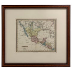
Framed 1838 Mexico & Gulf of Mexico Map
Located in Stamford, CT
Framed 1838 Mexico & Gulf of Mexico map. Printed by Fisher, Son & Co. of London in 1838. As found
Category
1830s English American Classical Antique Maps Prints
Materials
Glass, Wood, Paper
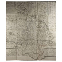
Large Original Antique Folding Map of Manchester, England, Dated 1793
Located in St Annes, Lancashire
Superb map of Manchester and Salford
Folding map. Printed on paper laid on to the original
Category
1790s English Georgian Antique Maps Prints
Materials
Canvas, Paper
Free Shipping
H 42 in W 36 in D 0.07 in
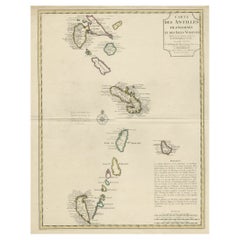
Detailed Antique Map of the Windward Islands in the Caribbean
By Covens & Mortier
Located in Langweer, NL
. This is the Amsterdam edition of the map, printed by Covens & Mortier. Published circa 1722.
Category
Early 18th Century Antique Maps Prints
Materials
Paper
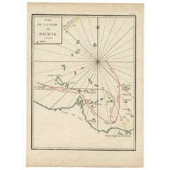
Interesting Map of the Thousand Islands in the Bay of Batavia 'Jakarta', ca.1740
Located in Langweer, NL
A single unfolded page border colored engraved map, printed no. 107 in top corner. This same map is
Category
1740s Antique Maps Prints
Materials
Paper
H 11.42 in W 8.27 in D 0 in
Antique Decorative Map of the Low Countries, '17 Provinces, Netherlands', c.1680
Located in Langweer, NL
the British Isles, but his first atlas consisted of maps printed from plates bought from van den Keere
Category
1680s Antique Maps Prints
Materials
Paper
H 21.26 in W 24.89 in D 0 in
Detailed Map of the Holy Land, Showing the Travels of Christ & Apostles, ca.1650
Located in Langweer, NL
one of the British Isles, but his first atlas consisted of maps printed from plates bought from van
Category
1650s Antique Maps Prints
Materials
Paper
H 44.2 in W 52.3 in D 0.002 in
Original Antique Detailed Map of the Rhine and Moselle River Regions, ca.1680
Located in Langweer, NL
his first atlas consisted of maps printed from plates bought from van den Keere and issued as they
Category
1680s Antique Maps Prints
Materials
Paper
H 20.87 in W 24.02 in D 0 in
1915 "San Francisco City and County" Hanging Map by W. Bashford Smith
Located in Colorado Springs, CO
-Pacific International Exposition, with a smaller guide to "Exhibit Palaces." The map is printed in black
Category
1910s American Art Deco Antique Maps Prints
Materials
Wood, Paper
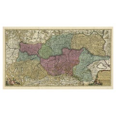
Spectacular Large Map of Upper and Lower Austria between Passau and Wien, c.1700
Located in Langweer, NL
consisted of maps printed from plates bought from van den Keere and issued as they stood with some additions
Category
Early 1700s Antique Maps Prints
Materials
Paper
H 21.15 in W 35.63 in D 0 in
1840 Map of the City of Washington Published by William M. Morrison
Located in Colorado Springs, CO
This map, printed in 1840, is a detailed representation of Washington, D.C. in the mid-19th century
Category
1840s American Federal Antique Maps Prints
Materials
Paper
Antique Map of the Rhine and Moselle River Region in Germany and France, c.1680
Located in Langweer, NL
his first atlas consisted of maps printed from plates bought from van den Keere and issued as they
Category
17th Century Antique Maps Prints
Materials
Paper
H 20.4 in W 23.94 in D 0 in
Antique Woodblock Print Map of Japan 'circa 1860'
Located in Langweer, NL
Original Japanese woodblock print map of Japan. Very large and fascinating map, rebacking with
Category
Late 19th Century Antique Maps Prints
Materials
Paper
Staffordshire 1645 Hand Colored Antique Print Staffordiensis Comitatvs Map
Located in GB
We are delighted to offer for sale this lovely antique Atlas page map of Staffordshire printed in
Category
Early 1800s English Georgian Antique Maps Prints
Materials
Paper
H 22.45 in W 25.32 in D 0.99 in
Original Antique Map of the Peninsula of India with Part of Ceylon by Wyld, 1844
Located in Langweer, NL
**Dimensions:** Each sheet approximately 590 x 850 mm
This map, printed across two sizable sheets but joined
Category
Mid-18th Century Antique Maps Prints
Materials
Paper
No Reserve
H 33.47 in W 23.23 in D 0 in
Double Sided Northamptonshire 1645 Hand Colored Antique Print Map Rare Find
Located in GB
We are delighted to this lovely antique Atlas page map of Northamptonshire printed in 1645
Category
Early 1800s English Georgian Antique Maps Prints
Materials
Paper
H 22.25 in W 25.6 in D 0.79 in
Antique Map of the Bay of Bengal Printed for Robert Sayer, 1787
Located in Langweer, NL
Antique map titled 'A Chart of the Eastern Coast of the Gulf of Bengal'. Original antique map of
Category
Late 18th Century Antique Maps Prints
Materials
Paper
Antique Map of Wisconsin with Inset Geological Map of Wisconsin
Located in Langweer, NL
geological map of Wisconsin. This print originates from 'Encyclopaedia Britannica', Ninth Edition. Published
Category
Late 19th Century Antique Maps Prints
Materials
Paper
17th Century Map of Cumberland County in Northwest England Printed by John Speed
By John Speed
Located in Middleburg, VA
Rare extremely early map of the county of Cumberland in the Northwest of England. Printed by John
Category
Early 17th Century English Antique Maps Prints
Materials
Paper
H 23 in W 27 in D 1 in
Double Sided and Glazed Cheshire 1645 Hand Colored Antique Print Map Rare Find
Located in GB
We are delighted to offer for sale this lovely antique Atlas page map of Cheshire printed in 1645
Category
Early 1800s English Georgian Antique Maps Prints
Materials
Paper
H 21.46 in W 25.6 in D 0.79 in
1907 Map of Colorado, Antique Topographical Map, by Louis Nell
Located in Colorado Springs, CO
along fold lines. Printed color is bold. Paper is healthy, with no tears.
The map has been framed
Category
Early 1900s American Antique Maps Prints
Materials
Paper
Antique Map of Oregon
Located in Langweer, NL
Antique map titled 'Oregon'. Original antique map of Oregon, United States. This print originates
Category
Late 19th Century Antique Maps Prints
Materials
Paper
Antique Map of Nebraska
Located in Langweer, NL
Antique map titled 'Nebraska'. Original antique map of Nebraska, United States. This print
Category
Late 19th Century Antique Maps Prints
Materials
Paper
Antique Map of Alabama
Located in Langweer, NL
Antique map titled 'Alabama'. Original antique map of Alabama, United States. This print originates
Category
Late 19th Century Antique Maps Prints
Materials
Paper
Antique Map of Vermont
Located in Langweer, NL
Antique map titled 'Vermont'. Original antique map of Vermont, United States. This print originates
Category
Late 19th Century Antique Maps Prints
Materials
Paper
Antique Map of Arkansas
Located in Langweer, NL
Antique map titled 'Arkansas'. Original antique map of Arkansas, United States. This print
Category
Late 19th Century Antique Maps Prints
Materials
Paper
Antique Map of Iowa
Located in Langweer, NL
Antique map titled 'Iowa'. Original antique map of Iowa, United States. This print originates from
Category
Late 19th Century Antique Maps Prints
Materials
Paper
Antique Map of Kentucky
Located in Langweer, NL
Antique map titled 'Kentucky'. Original antique map of Kentucky, United States. This print
Category
Late 19th Century Antique Maps Prints
Materials
Paper
Early Map of Puerto Rico Printed in Venice by G. F. Camocio in 1571
Located in Langweer, NL
Porcacchi's map of the Island of Puerto Rico. One of the earliest obtainable maps of the Island and one of the
Category
16th Century Antique Maps Prints
Materials
Paper
Free Shipping
H 4.34 in W 5.91 in D 0.01 in
Set of 2 Costume Prints and a Map of Spain and Portugal, circa 1720
Located in Langweer, NL
Set of two costume prints and a map of Spain and Portugal. The costume prints show costumes of
Category
Early 18th Century Antique Maps Prints
Materials
Paper
"Clason's Guide Map of Montana" by The Clason Map Company, Circa 1920s
Located in Colorado Springs, CO
condition overall, with only slight marginal wear and creases present. Color map, color is printed and
Category
1920s American Art Deco Antique Maps Prints
Materials
Paper
H 23.13 in W 33.88 in D 1.5 in
1854 Map of Massachusetts, Connecticut and Rhode Island, Antique Wall Map
Located in Colorado Springs, CO
map and print publisher based in New York during the middle part of the 19th century. Ensign was born
Category
19th Century American Antique Maps Prints
Materials
Paper
H 38.13 in W 45 in D 3.5 in
Print of Maps of Islands of the South Pacific, Incl. Pitcairn & Dusky Bay, 1788
Located in Langweer, NL
Antique map titled 'Esquisse de la Bay Dusky, Dans La Nouvelle Zeelande / I. Pitcairn / Isles de
Category
1780s Antique Maps Prints
Materials
Paper
No Reserve
H 12.21 in W 18.31 in D 0 in
Antique Map of Friesland Also Know as the Peacock Map, C.1580
Located in Langweer, NL
Antique map titled ?Frisia Occidentalis?. Original antique map of the province of Friesland, the
Category
18th Century Antique Maps Prints
Materials
Paper
Antique Map of Virginia, with Inset Map of the South Western Continuation
Located in Langweer, NL
Antique map titled 'Virginia'. Original antique map of Virginia, United States. With inset map of
Category
Late 19th Century Antique Maps Prints
Materials
Paper
H 8.27 in W 10.63 in D 0.02 in
Antique Map of Ohio, with Inset Maps of Cleveland, Columbus and Cincinnati
Located in Langweer, NL
Antique map titled 'Ohio'. Original antique map of Ohio, United States. With inset maps of
Category
Late 19th Century Antique Maps Prints
Materials
Paper
H 8.27 in W 10.63 in D 0.02 in
Antique Map of North Carolina, with inset map of the western part
Located in Langweer, NL
inset map of the western part of North Carolina. This print originates from 'Encyclopaedia Britannica
Category
Late 19th Century Antique Maps Prints
Materials
Paper
Antique Map of New Hampshire
Located in Langweer, NL
Antique map titled 'New Hampshire'. Original antique map of New Hampshire, United States. This
Category
Late 19th Century Antique Maps Prints
Materials
Paper
Antique Map of Swabia, 1685
Located in Langweer, NL
Antique map titled 'Sueviae quae cis Codanum fuit finum Antiqua defcriptio.' Miniature map of
Category
17th Century Antique Maps Prints
Materials
Paper
Antique Map of Virginia, with Inset Map of the Northern Part of West Viriginia
Located in Langweer, NL
Antique map titled 'West Virginia'. Original antique map of Virginia, United States. With inset map
Category
Late 19th Century Antique Maps Prints
Materials
Paper
H 8.27 in W 10.63 in D 0.02 in
Antique Map of New Zealand, 1895
Located in Langweer, NL
attractive original old antique print / plate / map originates from 1885-1907 editions of a famous German
Category
19th Century Antique Maps Prints
Materials
Paper
German Antique Map of Oceania, 1895
Located in Langweer, NL
Antique map titled 'Oceanie.' Map of Oceania. This attractive original old antique print / plate
Category
19th Century Antique Maps Prints
Materials
Paper
Antique Map of New Ireland, 1774
Located in Langweer, NL
Antique print titled 'Neu Irrland (..)'. Antique map of New Ireland with 7 coastal profiles, Papua
Category
18th Century Antique Maps Prints
Materials
Paper
Colored wall map of the WORLD
By Chambon
Located in ZWIJNDRECHT, NL
huge wall map of the world in two hemispheres printed on two sheets, depicting the Eastern and Western
Category
Mid-18th Century French French Provincial Antique Maps Prints
Materials
Wood, Paper
Pictorial Map of Chicago, circa 1926
Located in Colorado Springs, CO
architecture in the 1920s.
On the "Pictorial Map of Chicago" side, a declaration is printed from the
Category
1920s American Antique Maps Prints
Materials
Paper
The Happy Consultation, or Modern Match
Located in Santa Monica, CA
, published as
act directs, 13 August 1869 in London by Robt. Sayer, Map & Print Seller
Category
1760s Old Masters Antique Maps Prints
Materials
Engraving
Map of North and East coast of Asia with Japan & inset maps of Kamchatka, c1750
Located in Langweer, NL
east coast of Asia, showing an oddly shaped Japan and inset maps of Kamchatka. This old antique print
Category
1750s Antique Maps Prints
Materials
Paper
H 14.77 in W 17.45 in D 0 in
Original Antique Map of England and Wales
Located in Langweer, NL
Improvements'. Original antique map of England and Wales. Printed by Alex Hogg, London for George Henry
Category
Late 18th Century Antique Maps Prints
Materials
Paper
1875 "North America" Map by J. Bartholomew
Located in Colorado Springs, CO
.
CONDITION:
Very good condition. Color printed map. Color is original to the map and still vibrant. Minor
Category
1870s Scottish Antique Maps Prints
Materials
Paper
Antique Map of the Coromandel Peninsula, 1754
Located in Langweer, NL
Coromandel printed for the London Magazine.
Artists and Engravers: This map is not attributed, so it may
Category
18th Century Antique Maps Prints
Materials
Paper
Antique Map of Yemen by Schraembl, 1789
Located in Langweer, NL
map is the first printed map specifically of Yemen, and the earliest map based on actual exploration
Category
Late 18th Century Antique Maps Prints
Materials
Paper
Antique Map of Buckinghamshire in England, 1743
Located in Langweer, NL
tradition by using the prints of other publishers, notably the maps of Blaeu and Jansson. Only when these
Category
18th Century Antique Maps Prints
Materials
Paper
Antique Map of Sweden by Bowen, 1747
Located in Langweer, NL
Antique map titled 'A New & Accurate Map of Sweden'. This map covers Sweden and Finland (shown as
Category
18th Century Antique Maps Prints
Materials
Paper
Antique Map of Sneek by Kuyper, 1868
Located in Langweer, NL
Antique map titled 'Provincie Friesland - Gemeente Sneek'. Map of the township of Sneek, Friesland
Category
19th Century Antique Maps Prints
Materials
Paper
Antique Map of Stavoren by Kuyper, 1868
Located in Langweer, NL
Antique map titled 'Provincie Friesland - Gemeente Stavoren'. Map of the township of Stavoren
Category
19th Century Antique Maps Prints
Materials
Paper
Antique Map of Ooststellingwerf by Kuyper, 1868
Located in Langweer, NL
Antique map titled 'Provincie Friesland - Gemeente Oost-Stellingwerf'. Map of the township of
Category
19th Century Antique Maps Prints
Materials
Paper
Antique Map of Schoterland by Kuyper, 1868
Located in Langweer, NL
Antique map titled 'Provincie Friesland - Gemeente Schoterland'. Map of the township of Schoterland
Category
19th Century Antique Maps Prints
Materials
Paper
Antique Map of Oostdongeradeel by Kuyper, 1868
Located in Langweer, NL
Antique map titled 'Provincie Friesland - Gemeente Oost Dongeradeel'. Map of the township of
Category
19th Century Antique Maps Prints
Materials
Paper
Antique Map of Siberia by Reclus, 1881
Located in Langweer, NL
Antique map titled 'Itineraires en Siberie.' This map shows the itineraries of famous explorers in
Category
19th Century Antique Maps Prints
Materials
Paper
German Antique Map of Australia, Meyers, 1885
Located in Langweer, NL
original old antique print / plate / map originates from 1885-1907 editions of a famous German encyclopedia
Category
19th Century Antique Maps Prints
Materials
Paper
Antique Map of Overijssel by Brugsma, 1864
Located in Langweer, NL
Antique map titled 'De Provincie Overijssel'. Map of the province of Overijssel, the Netherlands
Category
19th Century Antique Maps Prints
Materials
Paper
- 1
- ...
Get Updated with New Arrivals
Save "Antique Maps Prints", and we’ll notify you when there are new listings in this category.
Antique Maps Prints For Sale on 1stDibs
Find a variety of antique maps prints available on 1stDibs. Today, if you’re looking for Surrealist editions of these works and are unable to find the perfect match for your home, our selection also includes Modern. These items have long been popular, with older editions for sale from the 18th Century and newer versions made as recently as the 20th Century. If you’re looking to add antique maps prints that pop against an otherwise neutral space in your home, the works available on 1stDibs include that feature elements of beige, gray, brown, black and more. There have been many well-done artworks of this subject over the years, but those made by Frans Hogenberg, Gerard Mercator, Victor Levasseur, Nicholas Sanson d'Abbeville and Isaac Slater are often thought to be among the most beautiful. Frequently made by artists working in engraving, etching and lithograph, all of these available pieces are unique and have attracted attention over the years.
How Much are Antique Maps Prints?
Antique maps prints can differ in price owing to various characteristics — the average selling price for items in our inventory is $612, while the lowest priced sells for $67 and the highest can go for as much as $250,000.
More Ways To Browse
Antique Portuguese Wood Furniture
Georgian Antique Furniture For Sale
Map Of Antique Province
Antique Province Map
Antique Province Map Of Antique
Wooden Cube
Antique Metal Carts
Historical Maps Germany
Maison Jean Charles
Small Triangle Table
Holland And Sons Table
Antique Map Blaeu
Victorian Celestial
Scientific Chart
Antique Furniture Cheshire
Maritime Cabinet
Terrestrial Celestial Globe
Pickle Table
