18th Century and Earlier Maps
to
2,338
2,862
64
2,929
26
12
1
1
2,929
2,257
475
3
290
34
10
126
10
37
9
2
5
4
3
3
2,915
30
20
3
3
288
109
71
52
42
2,929
2,929
2,929
59
21
13
12
12
Period: 18th Century and Earlier
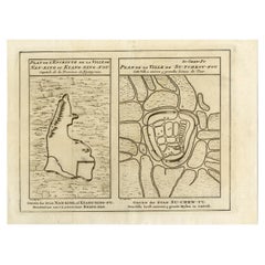
Antique Map of Cities Nanking and Suzhou in the Jiangsu Region, China, c.1758
Located in Langweer, NL
Antique map titled 'Plan de l' Enceinte de la Ville de Nan-King ou Kyang-Ning-Fou et plan de la ville de Su-Tcheou-Fou.' A map of the city of Nanking or Nanjing. A second map shows S...
Category
Antique 18th Century and Earlier Maps
Materials
Paper
$226 Sale Price
20% Off
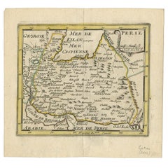
Rare Small Antique Map of the Persian Empire, 1692
Located in Langweer, NL
Antique map titled 'Perse'. Small engraved map of the Persian Empire, decorated with a simple cartouche and armorial shield. This map originates from 'L'Atlas en Abrege, ou Nouvelle ...
Category
Antique 18th Century and Earlier Maps
Materials
Paper
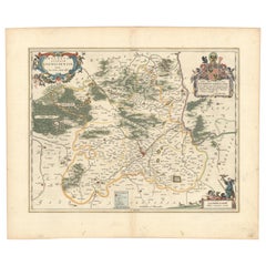
Circa 1659 Johannes Blaeu Map: Ducatus Silesiae Ligniciensis, Legnica Region
Located in Langweer, NL
Circa 1659 Johannes Blaeu Map: Ducatus Silesiae Ligniciensis, Legnica Region
This hand-colored map from circa 1659 by Johannes Blaeu, titled "Ducatus Silesiae Ligniciensis," depicts the region centered around Legnica (Lignitz) in southwestern Poland.
It extends to include the cities of Lublin, Jawor, and Lwówek Śląski.
The map features decorative elements such as a title cartouche adorned with a putto, garlands of fruit, and birds, and a distance scale cartouche that includes a hunter with his dogs.
This map is dedicated to Georgius Rodulfus, the Duke of Silesia, by Ionas Scultetus, reflecting the map's historical context and noble patronage.
It includes Spanish text on the verso, indicating publication between 1659 and 1672. Measuring 20.9 inches wide by 16.3 inches high, the map is in excellent condition with a sharp impression, full contemporary color, and a large watermark of the god Atlas. Minor details include a bit of printer's ink residue at the right and slight marginal soiling.
Keywords:
- Johannes Blaeu map
- Silesia historical map
- Legnica (Lignitz) map
- 17th-century Poland map...
Category
Antique 18th Century and Earlier Maps
Materials
Paper
$1,039 Sale Price
20% Off
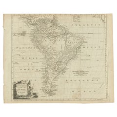
Antique Map of South America by Conder, c.1775
Located in Langweer, NL
Antique map titled 'South America agreeable to the most approved maps and charts'. Rare map of South America depicting Chili, La Plata, Paraguay, Brazil, Peru, the Amazon and surroun...
Category
Antique 18th Century and Earlier Maps
Materials
Paper
$327 Sale Price
20% Off
Sea Chart of Central America and the Northwest Coast of South America, ca.1745
Located in Langweer, NL
Antique map titled 'Novae Hispaniae, Chili, Peruviae et Guatamala Littorae.'
Sea chart of Central America and the northwest coast of South America, oriented to the east, by Reinier & Joshua Ottens (after Frederick de Wit - 1675) in 1745 ('Atlas van de Zeevaart'). The map shows all or parts of the coasts of Peru, Chili, Honduras, Costa Rica and Mexico as well as the western Caribbean and the Galapagos...
Category
Antique 18th Century and Earlier Maps
Materials
Paper
$2,315 Sale Price
20% Off
Antique Print of the Village of Loenen, The Netherlands, c.1790
Located in Langweer, NL
Antique print titled 't'Dorp Loenen'. View of the village of Loenen, the Netherlands. This print originates from 'Vaderlandsche gezigten'.
Artists and Engravers: Engraved by K.F....
Category
Antique 18th Century and Earlier Maps
Materials
Paper
Beautiful Antique Handcolored Map of Switzerland with 33 Coats of Arms, ca.1705
Located in Langweer, NL
Antique map Switerzland titled 'La Suisse Divisee en ses Treze Cantons, ses Alliez & ses Sujets (..)'.
Beautiful map of Switzerland with 33 coats of arms. The map is dedicated to t...
Category
Antique 18th Century and Earlier Maps
Materials
Paper
$1,511 Sale Price
20% Off
Old Map of North India From Kandahar East to Burma 'Pegu' and South to Goa, 1776
Located in Langweer, NL
Description: Antique map titled 'Indes Iere Feuille'.
Old map of northern India. Covers the subcontinent from Kandahar east as far as Burma (Pegu) and south to just past Goa. Names...
Category
Antique 18th Century and Earlier Maps
Materials
Paper
$349 Sale Price
20% Off
Antique Map of The Nile, Egypt and the Red Sea by Bachiene, 1765
Located in Langweer, NL
Antique map titled 'De XIde Landkaart verbeeldende Egypte en de Woestyne der Schelf-Zee (..).' Map of Biblical Egypt and the Red Sea. With title cartouche, compass rose and scale. Th...
Category
Antique 18th Century and Earlier Maps
Materials
Paper
$165 Sale Price
20% Off
Antique Map of Manchuria and the Northeast Portion of Tartary
Located in Langweer, NL
Antique map titled 'Carte de la Tartarie Orientale (..)'. Detailed map of Manchuria and the Northeast portion of Tartary, including Sagallan Anga Hata--Isle de la Bouche...
Category
Antique 18th Century and Earlier Maps
Materials
Paper
$274 Sale Price
20% Off
Antique Print of the Batavia Massacre 'Present-Day Jakarta', Indonesia
Located in Langweer, NL
Antique print titled 'Tableau de la Partie de Batavia, ou s'est fait proprement le terrible Massacre des Chinois (..)'. Original antique print of the Batavia massacre. The 1740 Batav...
Category
Antique 18th Century and Earlier Maps
Materials
Paper
$859 Sale Price
20% Off
Antique Map of the Kingdom of Hungary and Transylvania, circa 1780
Located in Langweer, NL
Antique Map of the Kingdom of Hungary and Surrounding Regions by S. Robert, circa 1780
This beautifully engraved map titled Royaume de Hongrie, Principauté de Transilvanie, Esclavon...
Category
French Antique 18th Century and Earlier Maps
Materials
Paper
Antique Map of North Europe and East Asia by Vaugondy, circa 1750
Located in Langweer, NL
Antique map titled 'Carte des parties nord et est de L'Asie'. Map of the Northern parts and East Asia. Five maps on one sheet, showing California, Alaska and Syberia, Korea and Japan...
Category
Antique 18th Century and Earlier Maps
Original Antique Map of the Road from Bristol to Weymouth
Located in Langweer, NL
Antique map titled 'The Road from Bristol to Weymouth (..)'. Original antique map of the road from Bristol to Weymouth. Plate 60 from Ogilby's 'Britannia', the first road atlas of En...
Category
Antique 18th Century and Earlier Maps
Materials
Paper
$207 Sale Price
20% Off
Map of Friesland (La Frise), from a French Atlas - circa 1756
Located in Langweer, NL
Title: Map of Friesland (La Frise), from "Atlas Nouveau Portatif" (1756)
This is an 18th-century map of Friesland (Frise), a northern province of the Netherlands, engraved by *Georg...
Category
Antique 18th Century and Earlier Maps
Materials
Paper
Stunning Decorative Antique Map of East Frisia with an Inset of Emden, c.1610
Located in Langweer, NL
Description: Antique map titled 'Typus Frisie Orientalis a Dullarto (..)'. One of the most decorative maps of East Frisia and its important shipping center of Emden and the Watten Is...
Category
Antique 18th Century and Earlier Maps
Materials
Paper
$3,071 Sale Price
20% Off
Old Map of the Kingdoms of Fez, Algiers, Segelmese, Tafilet and Morocco, ca.1760
Located in Langweer, NL
Antique map titled 'A Map of the Empire of Morocco Comprehending the Kingdoms of Fez, Morocco'.
Original antique map of the kingdoms of Fez, Algiers, Segelmese, Tafilet and Moroc...
Category
Antique 18th Century and Earlier Maps
Materials
Paper
Antique Map of the Province of Overijssel by Coronelli, c.1692
Located in Langweer, NL
Antique map titled 'Tran-siselana' Splendid detailed and decorative map of the province of Overijssel in the Netherlands by Vincenzo Coronelli. An elaborate title cartouche garlanded...
Category
Antique 18th Century and Earlier Maps
Materials
Paper
$509 Sale Price
20% Off
Authentic Old Map of Sumatra, Malaysia and Singapore, 1745
Located in Langweer, NL
Title: "Kaartje van't Eiland Sumatra en de Maleidse Kust gelegen na de stelling van de G. de L'Isle"
Published by Jacob Keizer and by Jan de Lat
Creator: Keizer, Jacob, active 1706...
Category
Antique 18th Century and Earlier Maps
Materials
Paper
$453 Sale Price
20% Off
Antique Map of the Region of Île-de-France by Hondius, circa 1630
Located in Langweer, NL
Antique map titled Gouvernement de l'Isle de France'. Old map of the region of Île-de-France, France. It is located in the north-central part of the country and often called the régi...
Category
Antique 18th Century and Earlier Maps
Materials
Paper
$519 Sale Price
20% Off
Antique Map of Greece, Turkey and surroundings with original coloring
Located in Langweer, NL
Antique map titled 'Nieuwe Kaart van Europisch Turkyen na de alderlaatste ontdekking in t licht gebracht'. Antique map of Greece with Crete and Cyprus, Turkey and the Black Sea. Publ...
Category
Antique 18th Century and Earlier Maps
Materials
Paper
$652 Sale Price
20% Off
Antique Map of the Pacific Ocean by Renneville, 1725
Located in Langweer, NL
Rare map of the Southern Pacific, illustrating Le Maire's tracks, extending from the La Maire Straits to Nova Guinea, with a large inset of the northern Coastline of New Guinea and a...
Category
Antique 18th Century and Earlier Maps
Materials
Paper
$425 Sale Price
20% Off
Antique Map of the Queen Charlotte Islands, Haida Gwaii
Located in Langweer, NL
Antique map titled 'Isles de la Reine Charlotte (..)'. Original old map of the Queen Charlotte Islands, based upon the explorations of James Cook, Juan Perez, and other contemporary European explorers. The map shows only partial coastal detail along the north end of the main island, and includes two insets of navigable bays and depth measurements.
Now called Haida Gwaii, after the local native population, the islands situated off Canada’s coast, south of Vancouver played an important role in the late 18th and early 19th century maritime...
Category
Antique 18th Century and Earlier Maps
Materials
Paper
$274 Sale Price
20% Off
Antique Map of the Congo, Gabon and Angola by N. Sanson, circa 1700
Located in Langweer, NL
Attractive map of Gabon, the Congo and Angola from Cape Lopez and Sao Tomé to approximately the border with present-day Namibia. The map is fully engraved with mountains, rivers, for...
Category
Antique 18th Century and Earlier Maps
Materials
Paper
$264 Sale Price
20% Off
Untitled Print of a Ruin, De Bruyn, c.1700
Located in Langweer, NL
This plate shows a ruin near the water. Source unknown, to be determined. Most likely engraved by C. de Bruijn, c.1700. Artists and Engravers: Cornelis de Bruijn (also spelled Cornel...
Category
Antique 18th Century and Earlier Maps
Materials
Paper
Rare 17th-Century Map of Dauphiné in Southeastern France by F. De Wit, ca.1688
Located in Langweer, NL
Title: Rare Hand-Colored 17th-Century Map of Dauphiné by Frederik De Wit c. 1688
Description: This captivating 17th-century map of Dauphiné, titled "Nova et Accurata Delphinatus Vul...
Category
Antique 18th Century and Earlier Maps
Materials
Paper
Antique Map of South West Germany with an Inset of Brisac or Brisach, France
Located in Langweer, NL
Antique map Germany titled 'A New and Accurate Map of the South West part of Germany. Comprehending the Archbishoprics of Mentz and Treves, the Ele...
Category
Antique 18th Century and Earlier Maps
Materials
Paper
1726 Valentyn's Map of Bali and Lombok, Original Engraving
Located in Langweer, NL
This antique map is a detailed 18th-century chart of the island of Bali, one of the many islands of Indonesia, with an inset of the neighboring island Lombok, attributed to François ...
Category
Antique 18th Century and Earlier Maps
Materials
Paper
$1,417 Sale Price
20% Off
Antique Print of a Fort on the Ivory Coast and Axim, Africa, 1748
Located in Langweer, NL
Antique print titled 'Vue de la Cote pres de Rio San Andero - Gezigt van de Kust van Rio San Andero' and 'Fort St. Antoine a Axim - Fort St. Antoni, te Axim'. View of the Ivory coast...
Category
Antique 18th Century and Earlier Maps
Materials
Paper
$274 Sale Price
20% Off
Antique Map of Novaya Zemlya by Bellin, 1758
Located in Langweer, NL
Antique map titled 'Partie de la Mer Glaciale Contenant la Nouvelle Zemle et le Pais des Samoiedes'. This map features Novaya Zemlya, the island off northern Russia in the Barents Se...
Category
Antique 18th Century and Earlier Maps
Materials
Paper
Very Attractive Handcolored Antique Plan of Cochin in India, 1744
Located in Langweer, NL
Antique map titled 'The City of Cochin (..).' Plan of Cochin, Malabar Coast, India, during the attack by Admiral van Goens in 1663. This map was published in 'The True and Exact Desc...
Category
Antique 18th Century and Earlier Maps
Materials
Paper
$793 Sale Price
20% Off
Original Hand-colored Antique Map of the Southern Part of India
Located in Langweer, NL
Antique map titled 'Orarum Malabariae, Coromandelae &c Tabula Accuratissima - Carte des Cotes de Malabar et de Coromandel'. Beautiful map of the southern part of India. It focuses on trade routes within India, as well as the Coromandel and Malabar Coasts...
Category
Antique 18th Century and Earlier Maps
Materials
Paper
$859 Sale Price
20% Off
Pl. 1 Antique Print of the Stowe House by Le Rouge, 1776
Located in Langweer, NL
Antique print titled 'Chateau de Stowe, du Coté des Jardins'. Copper engraving showing the garden side of the Stowe House. This print originates from 'Jard...
Category
Antique 18th Century and Earlier Maps
Materials
Paper
Original Antique 17th-Century Map of Shanxi (Xansi) Province, China – by Blaeu
Located in Langweer, NL
Antique 17th-Century Map of Shanxi Province, China – "Xansi" by Blaeu, with Artistic Cartouches
Description: This beautifully engraved map of Shanxi Province, historically referred to as "Xansi," was created by Johannes Blaeu in 1655 as part of his renowned *Novus Atlas Sinensis*. This atlas was the first comprehensive Western collection focused on Chinese geography, produced with the guidance of Jesuit missionary Martino Martini. Blaeu’s attention to detail and artistic flair are evident in this representation of Shanxi, highlighting mountains, rivers, cities, towns, and key geographic features. The Great Wall of China, an iconic landmark, is also depicted.
The map includes decorative cartouches that enhance its aesthetic appeal. The upper-left corner features the map's title framed in an ornate design, while the lower-right corner showcases a seated figure in traditional Chinese attire alongside a small globe, symbolizing the merging of European cartographic expertise and Chinese knowledge. Each city and geographic feature is labeled in Latin, making it a fascinating historical artifact of cross-cultural exploration.
This map was crafted using the copperplate engraving technique, prized for its ability to produce fine, precise details. It is further embellished with hand-coloring, which brings the landscape and decorative elements to life. Blaeu’s maps are highly regarded for their accuracy, artistry, and historical significance, making this piece a valuable collectible.
Shanxi Province, historically referred to as "Xansi," is renowned for its historical significance, natural landscapes, and rich cultural heritage. The region has been a crucial center of Chinese history and culture for centuries. Its name, meaning "West of the Mountains," refers to its location west of the Taihang Mountains. Shanxi has long been known for its coal resources, which have made it an important economic hub in modern times.
Important places in Shanxi include Pingyao, a UNESCO World Heritage Site known for its well-preserved ancient city walls and traditional Chinese architecture. The Yungang Grottoes, near Datong, are another UNESCO site, famous for their intricate Buddhist carvings and statues. Mount Wutai, one of China’s Four Sacred Buddhist Mountains, is a significant religious site that attracts pilgrims and tourists alike. Taiyuan, the provincial capital, is known for its historical sites, including the Jinci Temple. Shanxi is also known for its role in the early development of Chinese banking, particularly during the Ming and Qing Dynasties.
Keywords include antique map of Shanxi, Xansi map, Pingyao, Yungang Grottoes, Mount Wutai, 17th-century China map...
Category
Antique 18th Century and Earlier Maps
Materials
Paper
Antique Map of Cordes Bay, Port Famine, Woods Bay and Surroundings
Located in Langweer, NL
Antique map titled 'Baye et Havre de Cordes (..)'. Four maps on the one sheet of; Cordes Bay, Port Famine, Woods Bay, Port Gallant, Fortescue Bay, Chile based on the voyage of John B...
Category
Antique 18th Century and Earlier Maps
Materials
Paper
$311 Sale Price
20% Off
18th-Century Map of Holstein and Surrounding Duchies by Homann Heirs
Located in Langweer, NL
18th-Century Map of Holstein and Surrounding Duchies by Homann Heirs
Description: This finely detailed 18th-century map by the Homann Heirs (Homannische Erben) illustrates the Duc...
Category
Antique 18th Century and Earlier Maps
Materials
Paper
Antique Plan of Fort Mardyck Mardijk, France by S. Beaulieu, 1649
Located in Langweer, NL
Plan of Fort Mardyck (Fort Mardijk) and surroundings by Sébastian de Pontault Beaulieu. Mardyck is a former commune in the Nord department in northern France. It is an associated com...
Category
Antique 18th Century and Earlier Maps
Materials
Paper
$505 Sale Price
20% Off
17th Century Cartographic Marvel: A Detailed Engraving of Guangzhou (Kanton)
Located in Langweer, NL
This engraving of Guangzhou ("Kanton") is from a French edition of Olfert Dapper's work. The French edition titled "Description de l’Empire de la Chine" was published in 1674. It is ...
Category
Antique 18th Century and Earlier Maps
Materials
Paper
$1,039 Sale Price
20% Off
Antique Print of the House of John Waller by Campbell, 1725
Located in Langweer, NL
Antique print titled 'The Elevation of Iohn Waller Esqr. his house in Beaconsfield in Buckinghamshire (..)'. Old engraving of the house of John Waller in Beaconsfield. This print ori...
Category
Antique 18th Century and Earlier Maps
Materials
Paper
Original Italian Antique Map of Asia Minor and Cyprus and Neighboring Regions
Located in Langweer, NL
Antique map titled 'Natolia detta anticamente Asia Minor (..)'. Rare map of Asia Minor (Turkey) and Cyprus and neighboring regions. The map provides one of the most detailed and up t...
Category
Antique 18th Century and Earlier Maps
Materials
Paper
$614 Sale Price
20% Off
Antique Print of the House of Roger Hudson by Campbell, 1725
Located in Langweer, NL
Antique print titled 'The Elevation of Roger Hudson Esqr. his house at Sunbury (..)'. Old engraving of the house of Roger Hudson in Sunbury. This print originates from 'Vitruvius Bri...
Category
Antique 18th Century and Earlier Maps
Materials
Paper
Antique Map of the Region of Bresse by Hondius, circa 1630
Located in Langweer, NL
Antique map titled 'Bresse'. Old map of the former region of Bresse, France. It is located in the regions of Auvergne-Rhône-Alpes and Bourgogne-Franche-Comté of eastern France. This ...
Category
Antique 18th Century and Earlier Maps
Materials
Paper
$519 Sale Price
20% Off
Antique Map of part of Central and Southern Asia
Located in Langweer, NL
Antique map titled 'Carte de la Partie Superieure de l'Inde en deca du Gange. Comprise entre la Cote du Concan et celle d'Orixa, avec l'Empire du Mogol, le Bengale, le R. d'Asham, pa...
Category
Antique 18th Century and Earlier Maps
Materials
Paper
$368 Sale Price
20% Off
Original Map of the East Indies Including Sumatra, Java, Borneo & Malaysia, 1747
Located in Langweer, NL
Antique map titled 'Carte des Isles Java, Sumatra, Borneo (..) - Kaart van de Eilanden van Iava, Sumatra, Borneo (..)'.
Map of the East Indies including Sumatra, Java, Borneo and...
Category
Antique 18th Century and Earlier Maps
Materials
Paper
$425 Sale Price
20% Off
Antique Map of New England and Eastern Canada by Homann Heirs, circa 1755
Located in Langweer, NL
Antique map titled 'Partie Orientale de la Nouvelle France ou du Canada (..)'. Original antique map of New England and Eastern Canada made a...
Category
Antique 18th Century and Earlier Maps
Materials
Paper
$1,771 Sale Price
25% Off
16th Century Antique Map of Ven Framed in Gold
Located in Haddonfield, NJ
Ven (older Swedish spelling Hven), is a Swedish island in the Öresund strait laying between Skåne, Sweden and Zealand and Denmark. The island was historically under Danish rule. Dani...
Category
Danish Baroque Antique 18th Century and Earlier Maps
Materials
Wood, Paper
Antique Map of Germany from a 17th Century Pocket Atlas, 1685
Located in Langweer, NL
Antique map titled 'Nova Totius Germaniae descriptio.' Miniature map of Germany, from the pocket atlas 'Introductionis in Universam Geographiam tam Veterem...
Category
Antique 18th Century and Earlier Maps
Materials
Paper
$118 Sale Price
20% Off
Antique Map of Gloucestershire by Camden, c.1607
Located in Langweer, NL
Antique map titled 'Glocestriae comitatus olim sedes Dobunorum'. Map of Gloucestershire, England. This map originates from Camden?s 'Britannia' ...
Category
Antique 18th Century and Earlier Maps
Materials
Paper
$226 Sale Price
20% Off
Antique Engraved Map of Italy in Roman Times, ca.1730
Located in Langweer, NL
Plain engr. map of Italy according to the division of Emperor Augustus by G. Delisle.
Title: "Tabula Italiae Antiquae In Regiones XI Ab Augusto Divisae Et Tum Ad Mensuras Itinerari...
Category
Antique 18th Century and Earlier Maps
Materials
Paper
$642 Sale Price
20% Off
Antique Map of Leeuwarden, Capital of Friesland, the Netherlands, by Blaeu, 1649
Located in Langweer, NL
Antique map titled 'Leoverdia.'
Bird's-eye view plan of Leeuwarden, Friesland, the Netherlands. With key to locations and coats of arms. Text in Dutch on verso.
This plan origina...
Category
Antique 18th Century and Earlier Maps
Materials
Paper
$897 Sale Price
20% Off
Austria by Wolfgang Lazius – A Magnificent 16th-Century Map from Ortelius
Located in Langweer, NL
Title:
Avstriae Descrip – Wolfgang Lazius’ Map of Austria, 16th Century
Description:
This extraordinary map of Austria pays homage to the Austrian humanist and cartographer Wo...
Category
Antique 18th Century and Earlier Maps
Materials
Paper
Antique Print of the City of Nanking in China, 1668
Located in Langweer, NL
Antique print China titled ‘Nanking'. This plate shows a view on the Chinese city of Nanking with its ramparts. Also depicted are several pagodas and on the foreground there is a pal...
Category
Antique 18th Century and Earlier Maps
Materials
Paper
$396 Sale Price
20% Off
Original Rare Map of the Holy Land Showing the Twelve Tribes of Israel's, 1782
Located in Langweer, NL
Antique map titled 'Carte des Douze Tribus D'Israel (..).'
Map of the Holy Land showing the twelve tribes of Israel's. Tribes are all named...
Category
Antique 18th Century and Earlier Maps
Materials
Paper
$652 Sale Price
20% Off
Circa 1659 Blaeu Family Map: Glogau and the Odra River Valley, Silesia
Located in Langweer, NL
Circa 1659 Blaeu Family Map: Glogau and the Odra River Valley, Silesia
This hand-colored map from circa 1659 by the Blaeu Family, titled "Ducatus Silesiae Glogani Vera Delineatio," provides a detailed view of the Odra River valley in western Poland, centered around the city of Glogau.
The map, based on the work of Silesian cartographer Jonas Scultetus, is oriented with north to the left. It intricately details forests, rivers, lakes, and numerous small villages.
A large decorative title cartouche features an ornate coat of arms and a key to the map's symbols. The bottom right includes a finely crafted scale of miles cartouche, adorned with calipers and a pair of falcons.
Published between 1659 and 1672, the map has Spanish text on the verso.
Measuring 19.9 inches wide by 16.4 inches high, it is in good condition with full contemporary color on a bright sheet, a watermark of the god Atlas, some marginal soiling, and a few short tears along the edges.
Keywords:
- Blaeu Family map
- Silesia historical map
- Glogau map
- Odra River valley
- 17th-century Poland map
- Jonas Scultetus
- Decorative cartouches
- Historical cartography
- Antique maps of Poland...
Category
Antique 18th Century and Earlier Maps
Materials
Paper
$1,039 Sale Price
20% Off
Old Map Covering All of Southeast Asia from Persia to the Timor Island, 1712
Located in Langweer, NL
Description: Antique map titled 'A New Map of the East Indies'. Old map covering all of Southeast Asia from Persia to the Timor Island, inclusive of the modern day nations of India, ...
Category
Antique 18th Century and Earlier Maps
Materials
Paper
$1,417 Sale Price
20% Off
Original Antique 17th-Century Map of Shaangxi (Xensi) Province, China – by Blaeu
Located in Langweer, NL
Antique 17th-Century Map of Shaangxi Province, China – "Xensi" by Blaeu, Featuring Decorative Cartouches
Description: This exquisite 17th-century map of Shaangxi Province, historically known as Xensi Province, is an exceptional work by Johannes Blaeu, one of the most celebrated mapmakers of the Dutch Golden Age. Originally published in Blaeu's groundbreaking 'Novus Atlas Sinensis', this map is a masterful blend of geography and artistry. Blaeu's atlas was created in collaboration with Martino Martini, a Jesuit missionary whose insights into China provided European audiences with unprecedented geographical accuracy.
The map meticulously charts Shaangxi's mountains, rivers, mines, cities, and towns, with names rendered in Latin. It also features a detailed section of the Great Wall of China, a symbol of the region's historical significance. The artistry of this map is further enhanced by its elaborate cartouches. At the top, a Chinese warrior is beautifully illustrated, while the lower-left corner displays a deer, possibly a reference to the elusive Pere David deer...
Category
Antique 18th Century and Earlier Maps
Materials
Paper
Antique Map of India as Described It Was before the 5th Century, 1744
Located in Langweer, NL
Antique map titled 'India, as described by all Authors before the fifth Century'. Detailed map of part of India, including Hyrcania, Parthia, Carmania, Gedorossii, Drangiana, Aria, M...
Category
Antique 18th Century and Earlier Maps
Materials
Paper
$302 Sale Price
20% Off
Antique Colored Engraving of Madras 'Chennai' and Fort St. George in India, 1751
Located in Langweer, NL
Antique print titled 'Plan de Madras et du Fort St. Georges'. Plan of the city of Madras (or Chennai), the capital of the state of Tamil Nadu, India. Also shows a plan of Fort St. Ge...
Category
Antique 18th Century and Earlier Maps
Materials
Paper
$340 Sale Price
20% Off
Map of Japanese Coast from Osaka to Tokyo & the Kyushu and Shikoku Islands, 1669
Located in Langweer, NL
Antique map titled 'De Land Reyse van Osacca to Iedo. De Water eyse van Nangasacqui tot Osacca.'
Two maps on one sheet. The top map shows the Japanese coast from Osaka to Tokyo (Jedo). The lower map shows the strait between mainland Japan and the two large islands...
Category
Antique 18th Century and Earlier Maps
Materials
Paper
$1,370 Sale Price
20% Off
Antique Map of the West African Coast and the Cape Verde Islands, c.1680
Located in Langweer, NL
Antique map Africa titled 'Isles du Cap Verd Coste et Pays des Negres'. Antique map of the coast of Africa and the Cape Verde islands.
Artists and...
Category
Antique 18th Century and Earlier Maps
Materials
Paper
$340 Sale Price
20% Off
