Paper Collectibles and Curiosities

196
2,904
to
534
2,572
317
2,904
2,904
2,904
101
30
18
7
6
4
3
3
3
2
1
1
1
1
3,295
3,972
1,603
788
874
1,388
151
69
207
165
103
193
239
277
338
439
2,904
1,863
1,723
575
485
527
316
192
171
167
105
20
9
7
7
Period: 19th Century
Material: Paper
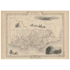
Antique Map of Victoria ‘Australia’ by J. Tallis, circa 1855
Located in Langweer, NL
A highly decorative and finely engraved mid-19th century map of Victoria, Australia which appeared in John Tallis & co.'s The Illustrated Atlas (London...
Category

Mid-19th Century Antique Paper Collectibles and Curiosities

Materials

Paper

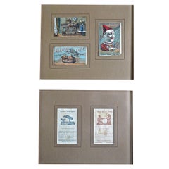
Five Mechanical Bank Trade Cards in Frame, circa 1880s
By J. & E. Steven's Company
Located in Incline Village, NV
Five mechanical bank trade cards are displayed in two separate frames. In one frame are three polychrome trade cards, which the salesmen typically carrie...
Category

19th Century American Folk Art Antique Paper Collectibles and Curiosities

Materials

Paper

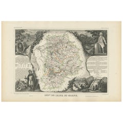
Antique Map of Seine et Marne 'France' by V. Levasseur, 1854
Located in Langweer, NL
Antique map titled 'Dépt. de Seine et Marne'. Map of the French department of Seine Et Marne, France. This region produces a wide variety of wines and h...
Category

Mid-19th Century Antique Paper Collectibles and Curiosities

Materials

Paper

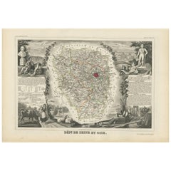
Antique Map of Seine et Oise 'France' by V. Levasseur, 1854
Located in Langweer, NL
Antique map titled 'Dépt. de Seine et Oise'. Map of the French department of Seine-et-Oise. Centred on Versailles, its administrative centre, Seine-et-Oise extends from Espernon to M...
Category

Mid-19th Century Antique Paper Collectibles and Curiosities

Materials

Paper

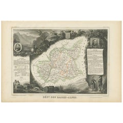
Antique Map of Basses-Alpes ‘France’ by V. Levasseur, 1854
Located in Langweer, NL
Antique map titled 'Dépt. des Basses-Alpes'. Map of the French department of Basses-Alpes, France. The whole is surrounded by elaborate decorative engravings designed to illustrate b...
Category

Mid-19th Century Antique Paper Collectibles and Curiosities

Materials

Paper

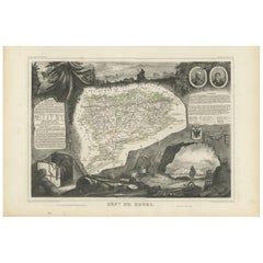
Antique Map of Doubs ‘France’ by V. Levasseur, 1854
Located in Langweer, NL
Antique map titled 'Dépt. du Doubs'. Map of the French department of Doubs, France. The whole is surrounded by elaborate decorative engravings designed to illustrate both the natural...
Category

Mid-19th Century Antique Paper Collectibles and Curiosities

Materials

Paper

Antique Map of Creuse ‘France’ by V. Levasseur, 1854
Located in Langweer, NL
Antique map titled 'Dépt. de la Creuse'. Map of the French department of Creuse, France. This region is well known for its apple cider made from Limousin apples and its international...
Category

Mid-19th Century Antique Paper Collectibles and Curiosities

Materials

Paper

Antique Map of Oise ‘France’ by V. Levasseur, 1854
Located in Langweer, NL
Antique map titled 'Dépt. de l'Oise'. Map of the French department of Oise, France. The map is surrounded by elaborate decorative engravings designed to illustrate both the natural b...
Category

Mid-19th Century Antique Paper Collectibles and Curiosities

Materials

Paper

Antique Map of Puy de Dôme ‘France’ by V. Levasseur, 1854
Located in Langweer, NL
Antique map titled 'Dépt. du Puy de Dôme'. Map of the French department of Puy De Dome, France. This mountainous department includes Auvergne, one of the l...
Category

Mid-19th Century Antique Paper Collectibles and Curiosities

Materials

Paper

Antique Map of Eure ‘France’ by V. Levasseur, 1854
Located in Langweer, NL
Antique map titled 'Dépt. de l'Eure'. Map of the French department of Eure, France. This region of France is home to Giverny, where impressionist Claude Monet’s home and garden can b...
Category

Mid-19th Century Antique Paper Collectibles and Curiosities

Materials

Paper

Antique Map of Eure Et Loir ‘France’ by v. Levasseur, 1854
Located in Langweer, NL
Antique map titled 'Dépt. d'Eure et Loir'. Map of the French department of Eure Et Loir, France. This area is home to the famous Chartres Cathedral....
Category

Mid-19th Century Antique Paper Collectibles and Curiosities

Materials

Paper

Antique Map of Cantal ‘France’ by V. Levasseur, 1854
Located in Langweer, NL
Antique map titled 'Dépt. du Cantal'. Map of the French department of Cantal, France. This area of France is known for its production of Cantal, a firm cheese, named after the region...
Category

Mid-19th Century Antique Paper Collectibles and Curiosities

Materials

Paper

Antique Map of Gard ‘France’ by V. Levasseur, 1854
Located in Langweer, NL
Antique map titled 'Dépt. du Gard'. Map of the French department of Gard, France. This area of France is known mainly for its red wine and production of Bleu des Causses, a soft and ...
Category

Mid-19th Century Antique Paper Collectibles and Curiosities

Materials

Paper

Antique Map of Tarn 'France' by V. Levasseur, 1854
Located in Langweer, NL
Antique map titled 'Dépt. du Tarn'. Map of the French department of Tarn, France. This area produces a variety of traditional wines, including Cahors, Mauzac, Loin de l'Oeil and Onde...
Category

Mid-19th Century Antique Paper Collectibles and Curiosities

Materials

Paper

Antique Map of the Hautes Pyrenees 'France' by V. Levasseur, 1854
Located in Langweer, NL
Antique map titled 'Dépt. des Htes. Pyrénées'. Map of the French department of Hautes Pyrenees, France. This area is home to the wine producing region, Madiran. Madrian is best known...
Category

Mid-19th Century Antique Paper Collectibles and Curiosities

Materials

Paper

Antique Map of Upper Vienne ‘France’ by V. Levasseur, 1854
Located in Langweer, NL
Antique map titled 'Dépt. de La Hte. Vienne'. Antique map of Department of Upper Vienne with capital city Limoges, in the region of Limousin. This map originates from ‘Atlas National...
Category

Mid-19th Century Antique Paper Collectibles and Curiosities

Materials

Paper

Antique Map of Isère ‘France’ by V. Levasseur, 1854
Located in Langweer, NL
Antique map titled 'Dépt. de l'Isère'. Map of the French department Isere. It is presented with a statistic description, information about the territory, curiosities and famous peopl...
Category

Mid-19th Century Antique Paper Collectibles and Curiosities

Materials

Paper

Antique Map of Tarn and Garonne in France, 1854
Located in Langweer, NL
Antique map titled 'Dépt. de Tarn et Garonne'. Map of the French department of Tarn et Garonne, France. This map is centered around the city of Moissac, which is known for its fine d...
Category

Mid-19th Century Antique Paper Collectibles and Curiosities

Materials

Paper

19th Century Large Original Antique Map of Denmark by J. Pinkerton, 1812
By Pinkerton
Located in Langweer, NL
Highly detailed map of Denmark. One of the best large format English atlas maps of the period. Pinkerton's maps reflect the fine copperplate engraving work being done in the Britain...
Category

Early 19th Century Antique Paper Collectibles and Curiosities

Materials

Paper

Antique Map of Italy by Andriveau-Goujon, 1843
By Andriveau-Goujon
Located in New York, NY
Antique Map of Italy by Andriveau-Goujon, 1843. Map of Italy in two parts by Andriveau-Goujon for the Library of Prince Carini at Palazzo Carini i...
Category

1840s French Antique Paper Collectibles and Curiosities

Materials

Linen, Paper

19th Century Papier Mâché Feet
Located in East Hampton, NY
Large pair of papier mâché Italian feet with sandals. Slightly restored but in very good antique condition.
Category

19th Century Italian Antique Paper Collectibles and Curiosities

Materials

Paper

Antique Map of Russia 'in Europe' by W. & A.K. Johnston, circa 1850
Located in Langweer, NL
Detailed map of the region with a decorative piano key border. This map shows towns, railroads, rivers, lakes, mountains, railroad lines, Sub-oceanic Telegraph lines, etc.
Category

Mid-19th Century Antique Paper Collectibles and Curiosities

Materials

Paper

Pottery and Porcelain of All Times, First Edition
By William C. Prime 1
Located in valatie, NY
Pottery and porcelain of All Times and Nations by Wm. Prime. NY: Harper and Bro., 1878. First edition hardcover. One of the first references on pottery and porcelain collecting. What...
Category

19th Century American Antique Paper Collectibles and Curiosities

Materials

Paper

“A Football Match, Scotland v. England” Antique Engraving, Proof Edition of 100
By Overend and Smythe
Located in Colorado Springs, CO
This is the 1889 William H. Overend (1851-1898) and Lionel Smythe (1839-1918) first edition, photogravure of the Calcutta Cup – a Rugby match between Scotland and England, that has been played over 100 times, the first match...
Category

19th Century English Antique Paper Collectibles and Curiosities

Materials

Paper

Pocahontas and John Smith, Chromo-Lithograph, Dated 1870, Rare
Located in Incline Village, NV
"Pocahontas Saving The Life of Captain John Smith" is a chromo-lithograph made by the "New Eng. Chromo Lith. Co. Boston" (printed on the lower left border). It is dated 1870...
Category

19th Century American Victorian Antique Paper Collectibles and Curiosities

Materials

Wood, Walnut, Paper

Large Historical Brighton Beach New York Railroad Bridge Photo
By Acme Photo
Located in Cincinnati, OH
A large original vintage historical builders photo of the Brighton Beach railroad bridge at Neptune Ave. Hand lettering on the mat are the names of the ...
Category

Late 19th Century American Industrial Antique Paper Collectibles and Curiosities

Materials

Paper

Antique Book Set, 13 Vols Charles Dickens Novels, English, Fiction, Victorian
Located in Hele, Devon, GB
This is an antique set of 13 Charles Dickens novels. An English language, comprehensive library of fiction books, dating to the Victorian period, published 1866 to 1868. Synonymous...
Category

Mid-19th Century British Victorian Antique Paper Collectibles and Curiosities

Materials

Paper

Antique Map of the City of Vienna by Balbi '1847'
Located in Langweer, NL
Antique map titled 'Vienne'. Original antique map of the city of Vienna, Austria. This map originates from 'Abrégé de Géographie (..)' by Adrien Balbi. Published 1847.
Category

Mid-19th Century Antique Paper Collectibles and Curiosities

Materials

Paper

Empires of the East: An Ornate Tallis Map of Tibet, Mongolia, and Manchuri, 1851
Located in Langweer, NL
This original - with hand-colored borders- map of Tibet, Mongolia, and Manchuria is an example of the intricate work produced by John Tallis & Company, who were known for their detailed and artistic maps in the mid-19th century. **The Maker - John Tallis & Company:** Tallis maps were distinctive for their ornamental borders and detailed vignettes. They often contained illustrations that provided a snapshot of the culture, geography, and significant landmarks of the region they represented. **The Map - Tibet, Mongolia, and Manchuria:** This map would have represented the regions of Central and East Asia, areas of great interest during the British Empire's expansion, though not directly controlled by the British. They would be significant for trade routes, exploration, and for the British understanding of global geography. **The Countries:** - **Tibet**: Known for its unique cultural heritage and as the home of Tibetan Buddhism, it's a region of high plateaus and significant religious landmarks. - **Mongolia**: Characterized by its vast steppes and as the homeland of the Mongol hordes that once conquered much of the known world. - **Manchuria**: Rich in natural resources, it has been a region contested by various powers due to its strategic importance. **The Tallis Series:** "The British Colonies" by Robert Montgomery Martin was intended to educate and inform the British public about the wide-reaching impact of the British Empire and to provide detailed information about regions that were important for British interests. While Tibet, Mongolia, and Manchuria were not British colonies, their inclusion in the series suggests a British interest in the wider geopolitical landscape of Asia. Collectors and enthusiasts today value these maps for their beauty, historical significance, and the insight they provide into the British perspective of the world during the era of their greatest colonial expansion. More details on the insets: The insets on this map are detailed illustrations depicting significant landmarks and cultural representations of Tibet, Mongolia, and Manchuria. They were a common feature in the Tallis maps, intended to provide a visual narrative to accompany the geographic information. Here's a description of the insets: 1. **Leh, Little Tibet**: A panoramic view of the cityscape of Leh, the capital of Ladakh in the region historically known as Little Tibet. The architecture is clearly influenced by Tibetan style, with multi-story white-washed buildings tightly packed together against a backdrop of rugged mountains. 2. **Chinese Wall**: This vignette depicts a section of the Great Wall of China, showcasing its massive fortifications and watchtowers. The wall snakes...
Category

1850s Antique Paper Collectibles and Curiosities

Materials

Paper

An Illustrated Map of Kabul, Punjab, and Baluchistan by Tallis, 1851
Located in Langweer, NL
This map, attributed to John Tallis and featuring the work of Robert Montgomery Martin, is part of a series created for the publication "The British Colonies." John Tallis & Company was known for its detailed and decorative maps in the mid-19th century, often including elaborate margins and vignettes that offer insight into the culture, landscape, and history of the region depicted. The map shows the regions of Cabul (an older spelling of Kabul, Afghanistan), the Punjab (a region of northern India and eastern Pakistan), and Beloochistan (an alternative spelling of Balochistan, a region in southwestern Pakistan). The illustrated margins are typical of Tallis maps, adorned with decorative elements and scenes that are likely representations of local landmarks, people, and ways of life. The vignettes are particularly interesting as they serve a dual purpose: they are ornamental and informative. They provide a visual narrative about the regions, complementing the geographical information with human interest. The scenes may depict local figures, architecture, landscapes, and activities that were thought to be characteristic of the area at the time. John Tallis maps...
Category

1850s Antique Paper Collectibles and Curiosities

Materials

Paper

Set of 22 Antique Les Grands Écrivains Books
Located in Baton Rouge, LA
A collection of twenty-two volumes of the works of Moliére and Saint-Simon. This set of books are bound in leather with gold lettering stating the author and respective volume. Writt...
Category

19th Century French Other Antique Paper Collectibles and Curiosities

Materials

Paper

Set of 16 French 19th Century History Books
Located in Baton Rouge, LA
A collection of sixteen volumes by French priest R. F. Dom Remy Ceillier. This set of books are bound in leather with gold lettering stating the author and respective volume. Writte...
Category

19th Century French Other Antique Paper Collectibles and Curiosities

Materials

Leather, Paper

Set of 16 French History Books by M. LeCount de Lacépede
Located in Baton Rouge, LA
A collection of sixteen French history volumes by M. LeCount de Lacépede. This set of books are bound in leather with gold lettering stating the author, title, and respective volume....
Category

19th Century French Other Antique Paper Collectibles and Curiosities

Materials

Leather, Paper

Balkan Convergence: A Map of Turkey and Greece with the Balkan States, 1882
Located in Langweer, NL
This map, "TURKEY AND GREECE including ROUMANIA, SERVIA, BULGARIA, BOSNIA & MONTENEGRO," extracted from Blackie & Son's 1882 atlas, captures the complex political and geographical la...
Category

1880s Antique Paper Collectibles and Curiosities

Materials

Paper

Antique Map of the Southern United States with Inset Map of New Orleans
Located in Langweer, NL
Antique map titled 'Die Staaten von Arkansas Mississippi, Louisiana & Alabama'. Detailed map of the region, which includes the Florida Panhandle. Shows many roads, rivers, forts, etc...
Category

Mid-19th Century Antique Paper Collectibles and Curiosities

Materials

Paper

Framed Race Horse Champions Original Chromolithographs Printed in 1882, Set /3
Located in Philadelphia, PA
A set of three framed original Race Horse Chromolithographs originally published in the “Illustrated Stock Doctor and Livestock Encyclopedia” in 1882. In hand-painted wood frames secured with small nails, with metal hanging rings. Captioned as follows: “Black’s Hambletonian” One of the finest and best blooded trotting stallions of the day. Property of S. Baxter Black, Compassville, Pa. Cost when a weanling colt $3500. Sired by “Rysdyk’s Hambletonion”; dam “Long Island Black Hawk” “Maud S." The Queen of the Turf. Record 2.10 1/4. The fastest trotter the world has yet known. Owned by William H. Vanderbilt Esq. who has refused a cash offer of $100.000 for her. Foaled at Woodburn Farm, Ky. March 28, 1874. Trainer and driver W.W. Bair. “Iroquois” Winner of the Derby. (Epsom Derby...
Category

Late 19th Century American American Classical Antique Paper Collectibles and Curiosities

Materials

Wood, Paper

Set of Old Bound Books 19th Century France
Located in Beuzevillette, FR
Set of old books dating from the 19th century. From an old protestant library near Le Havre in France. These books are called for example "Sermons". T...
Category

Mid-19th Century French Antique Paper Collectibles and Curiosities

Materials

Leather, Paper

The Federalist, on the New Constitution by Publius, Second Edition, 2 Vols, 1802
Located in Colorado Springs, CO
Hamilton, Alexander, James Madison, and John Jay. The Federalist, on the New Constitution. By Publius. Written in 1788. To Which is Added, Pacificus, on...
Category

Early 1800s American Antique Paper Collectibles and Curiosities

Materials

Leather, Paper

1889 Sea Chart Map of Delaware Bay by George Eldridge, Chart No. 11
Located in Colorado Springs, CO
Presented is an original Eldridge's Chart No. 11, Delaware Bay and River, from The United States Coast and George Eldridge's Surveys, published in 1889. The sea chart shows the Delaw...
Category

1880s Antique Paper Collectibles and Curiosities

Materials

Paper

Antique Map of Port Pallisers by Cook, 1803
Located in Langweer, NL
Antique map Kerguelen titled 'Schets van Pallisers Haven aan Kerguelens Land (..)'. Antique map of Port Pallisers & Kersmis, Kerguelen or Desolation Islands. Originates from 'Reizen ...
Category

19th Century Antique Paper Collectibles and Curiosities

Materials

Paper

Antique Decorative Map of Saone and Loire in France, 1854
Located in Langweer, NL
Antique map titled 'Dépt. de Saône et Loire'. Map of the French department of Saone et Loire, France. Part of France's important Burgundy or Bourgogne Wine Region. Produces Mercurey ...
Category

19th Century Antique Paper Collectibles and Curiosities

Materials

Paper

Antique Print of the Hut of King Tahofa by Brodtmann, c.1836
Located in Langweer, NL
Antique print titled 'Einaescherung der Hütten des Häuptlings Tahofa, auf der Insel Oneata'. Old print with a view of the hut of king Tahofa on the island Oneata. This print originat...
Category

19th Century Antique Paper Collectibles and Curiosities

Materials

Paper

Antique Map of the Gaasterland Township by Behrns, 1861
Located in Langweer, NL
Antique map titled 'Gemeente Gaasterland'. Old map depicting the Gaasterland township including cities and villages like Oudega, Nijega, Balk, Wijckel, Sondel, Sloten, Rijs, Mirns an...
Category

19th Century Antique Paper Collectibles and Curiosities

Materials

Paper

Pl. 93 Antique Print of Decorative Art in the 18th Century by Racinet, 1869
Located in Langweer, NL
Old print of decorative art in the 18th century. This print originates from 'L'Ornement polychrome'. A beautiful work containing about 2000 patterns of all the styles of Art old and ...
Category

19th Century Antique Paper Collectibles and Curiosities

Materials

Paper

Pl. 94 Antique Print of Decorative Art in the 17th and 18th Century by Racinet
Located in Langweer, NL
Old print of decorative art in the 17th and 18th century. This print originates from 'L'Ornement polychrome'. A beautiful work containing about...
Category

19th Century Antique Paper Collectibles and Curiosities

Materials

Paper

Four Fine Hand-Colored Engravings Depicting the Use of Elephants in India, 1813
Located in Langweer, NL
Set of four beautiful fine hand colored engravings, protected in acid free matting. Titles: 1) Hog hunters in India going out no.1 2) Shooting anecdote, Indian 2 3) Hindoo el...
Category

1810s Antique Paper Collectibles and Curiosities

Materials

Paper

Small Antique Hand-Colored Print of a Man Playing Tennis, c.1890
Located in Langweer, NL
Small antique print of a man playing tennis. Source unknown, to be determined. Published circa 1890. Artists and Engravers: Anonymous. Condi...
Category

1890s Antique Paper Collectibles and Curiosities

Materials

Paper

Attractive Antique Map of Italy with Inset of Maps Showing The Regions, c.1870
Located in Langweer, NL
Antique map titled 'Italia'. Old map of Italy, with a small inset map depicting the various regions. This map originates from 'Atlas Antiquus, tw...
Category

19th Century Antique Paper Collectibles and Curiosities

Materials

Paper

Antique Map of Asia by Ludolph, c.1850
Located in Langweer, NL
Antique map titled 'Azië'. Original antique map of Asia. Source unknown, to be determined. Published circa 1850. Artists and Engravers: Engraved by L.J.C. Ludolph. Condition: F...
Category

19th Century Antique Paper Collectibles and Curiosities

Materials

Paper

Antique Map of Asia with vignettes of Petra, Tartars, Sun-Birds of India, 1851
Located in Langweer, NL
Antique map of the Asian continent titled 'Asia'. Beautiful map with decorative vignettes of Petra, Tartars, Russian Peasants and Sun-Birds of India. Originates from 'The Illustrated...
Category

19th Century Antique Paper Collectibles and Curiosities

Materials

Paper

Edward S. Curtis by Barry Pritzker, 1993
Located in London, GB
Edward S. Curtis By Barry Pritzker Published by JG Press, North Dighton, Massachusetts, 1993. Hard Back in Dust Jacket. First edition. Black boards with gold lettering to spine...
Category

Late 19th Century American Mid-Century Modern Antique Paper Collectibles and Curiosities

Materials

Paper

1862 Civil War Playing Cards with Stars, Flag, Sheilds and Eagles
Located in York County, PA
1862 Civil War playing cards with stars, flags, shields, & eagles, and face cards illustrating civil war officers and lady, Columbia, ca 1862, Benjamin Hitchcock, New York 1862 Civil War playing cards with suits represented by stars, flags, shields, & eagles, in lieu of the traditional French suits of hearts, diamonds, clubs, and spades. The face cards feature Union Army officers and Lady Columbia [a.k.a. Lady Liberty, Goddess of Liberty]. Entitled “Union Playing Cards,” two versions of this deck were produced in New York by Benjamin W. Hitchcock’s “American Card Company.” This is the earlier of the two. The other was released in 1863. There are 52 cards in total with the ace of spades doubling as the title card, as was often the case during the 19th century. The telescoping box...
Category

1860s American Antique Paper Collectibles and Curiosities

Materials

Paper

Antique Map of the United States by Johnson, 1872
Located in Langweer, NL
Antique map titled 'Johnson's United States'. Original map of the United States. This map originates from 'Johnson's New Illustrated Family Atlas of the World' by A.J. Johnson. Publi...
Category

Late 19th Century Antique Paper Collectibles and Curiosities

Materials

Paper

19th Century North African Calligraphy Leaves, Set of Five, Double Sided
Located in Stamford, CT
Five leaves from a North African manuscript, probably on law or religion, 19th century. These are really cool, even the damaged edging adds something, making them unique abstract ...
Category

Mid-19th Century Egyptian Islamic Antique Paper Collectibles and Curiosities

Materials

Paper

Fin de Siecle de la Collection Silverman - Alastair Duncan
Located in London, GB
Alastair Duncan. Chefs d’Ouvre Fin de Siecle de la Collection Silverman. Published by Bordas, 1989 Paris. Masterpieces of the Fin de Siecle and Art...
Category

Late 19th Century French Art Deco Antique Paper Collectibles and Curiosities

Materials

Paper

Colorful Civil War Recruitment Broadside for the "Manhattan Rifles"
Located in York County, PA
MASSIVE & COLORFUL CIVIL WAR RECRUITMENT BROADSIDE FOR THE "MANHATTAN RIFLES,” WHICH MUSTERED INTO 43RD AND THE 57TH NEW YORK INFANTRY DIVISIONS ...
Category

1860s American Antique Paper Collectibles and Curiosities

Materials

Paper

Antique Map of the City of Zürich, 1889
Located in Langweer, NL
Antique map titled 'Grundriss und ussgemässne Verzeynuss der wyte Becirckh und Innhalts dess genanten Stadelhoffer Zehendens der Stifft S. Felix und Regula zum Grossen Münster alhie ...
Category

Late 19th Century Antique Paper Collectibles and Curiosities

Materials

Paper

1847 “World at One View” Antique Hand-Colored Wall Map of the World
Located in Colorado Springs, CO
This is a highly desirable hanging wall map of the "World at One View", published in 1847 by Ensign and Thayer, New York. This pictorial map was printed as a broadside and features...
Category

19th Century American Antique Paper Collectibles and Curiosities

Materials

Paper

Read More

Pamela Shamshiri Shares the Secrets behind Her First-Ever Book and Its Effortlessly Cool Interiors

The sought-after designer worked with the team at Hoffman Creative to produce a monograph that beautifully showcases some of Studio Shamshiri's most inspiring projects.

Moroccan Artworks and Objects Take Center Stage in an Extraordinary Villa in Tangier

Italian writer and collector Umberto Pasti opens the doors to his remarkable cave of wonders in North Africa.

Montecito Has Drawn Royalty and Celebrities, and These Homes Are Proof of Its Allure

Hollywood A-listers, ex-pat aristocrats and art collectors and style setters of all stripes appreciate the allure of the coastal California hamlet — much on our minds after recent winter floods.

Whaam! Blam! Pow! — a New Book on Pop Art Packs a Punch

Publishing house Assouline and writer Julie Belcove have teamed up to trace the history of the genre, from Roy Lichtenstein, Andy Warhol and Yayoi Kusama to Mickalene Thomas and Jeff Koons.

The Sparkling Legacy of Tiffany & Co. Explained, One Jewel at a Time

A gorgeous new book celebrates — and memorializes — the iconic jeweler’s rich heritage.

What Makes a Gem-Encrusted Chess Set Worth $4 Million?

The world’s most opulent chess set, weighing in at 513 carats, is literally fit for a king and queen.

Tauba Auerbach’s Geometric Pop-Up Book Is Mighty Rare, Thanks to a Hurricane

This sculptural art book has an epic backstory of its own.

Step inside the Storied Mansions of Palm Beach’s Most Effervescent Architect

From Spanish-style courtyards to fanciful fountains, these acclaimed structures abound in surprising and elegant details.
Recently Viewed

View All