Europe
to
410
857
379
344,823
250,348
157,871
141,020
103,856
77,196
50,735
50,110
44,000
35,268
28,315
27,354
22,600
20,015
15,983
15,567
14,754
14,179
11,694
10,737
10,459
7,580
5,840
5,749
4,976
4,407
4,314
3,594
2,817
2,608
2,117
2,112
1,939
1,552
1,468
1,277
1,188
1,135
1,005
954
931
857
715
683
523
500
393
302
281
228
221
197
195
168
165
154
115
109
99
60
45
39
54
6
4
4
4
Period: Mid-17th Century
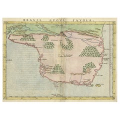
Original Antique Map of Brasil, Published in the 16th Century, 1561
Located in Langweer, NL
This important Ruscelli map of Brazil, from his work La Geografia di Claudio Tolomeo Alessandrino, is one of the earliest obtainable modern maps of the re...
Category
1660s Antique Europe
Materials
Paper
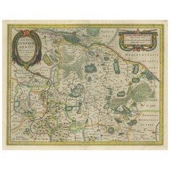
Antique Map of the Duchy of Lüneburg, Lower Saxony, Germany
Located in Langweer, NL
Antique map titled 'Ducatus Luneburgensis (..)'. Map of the Duchy of Lüneburg in Lower Saxony, Germany. Published by J. Janssonius, circa 1664.
Jan Janssonius (also known as Johann ...
Category
Mid-17th Century Antique Europe
Materials
Paper
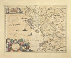
Epirus Albania - Etching by Johannes Janssonius - 1650s
By Johannes Janssonius
Located in Roma, IT
Epirus Albania is an ancient map realized in 1650 by Johannes Janssonius (1588-1664).
Good conditions.
From Atlantis majoris quinta pars, Orbem maritimum [Novus Atlas, volume V: ca...
Category
1650s Modern Europe
Materials
Etching
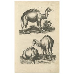
Antique Print of Dromedary by J. Jonston, 1657
Located in Langweer, NL
Tab. XLI: This print shows various Dromedary. This print originates from: 'Historiae Naturalis De Quadrupetibus Libri I' by John Johnston, published by Matthias Merian in 1657.
Category
Mid-17th Century Antique Europe
Materials
Paper
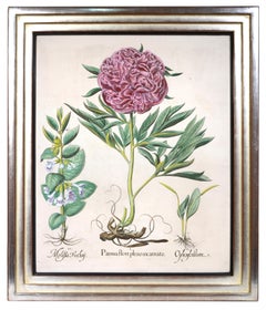
BESLER. A Group of Four Peonies.
Located in London, GB
Four magnificent copper engraved plates with hand-colour from "Hortus Eystettensis", one of the earliest and most famous works in the field.
[Nuremberg and Eichstatt, 1640].
The Hortus Eystettensis is a pictorial record of the flowers grown in the greatest German garden of its time, that of Prince Bishop of Eichstatt, Johann Conrad von Gemmingen.
The garden was begun by Joachim Camerarius in 1596 and, after his death in 1598, completed by Basil Besler...
Category
1640s Naturalistic Europe
Materials
Copper
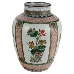
Porcelain Vase Painted with Wucai Enamel China Shunzhi Era (1644-1661)
Located in Milano, IT
Porcelain vase painted in wucai glazes within reserves with decoration of chrysanthemum plants and peonies on a dense background with fish scale pattern painted in red. Oggetto in bu...
Category
1640s Chinese Other Antique Europe
Materials
Porcelain
Print of the Temple of Sanjusangen-Do 'Thousand Armed Kannon' Kyoto, Japan, 1669
Located in Langweer, NL
Antique print, titled: 'Tempel met Duysent Beelden.'
The Temple of Sanjusangen-Do in Kyoto, dedicated to the Thousand Armed Kannon. The central statue is that of Kannon. In front...
Category
1660s Antique Europe
Materials
Paper
Antique Map of the Region of Blois by Janssonius, 'circa 1640'
By Johannes Janssonius
Located in Langweer, NL
Antique map titled 'Description du Blaisois'. Old map of the region of Blois, France. It shows the city of Blois, Amboise, the Loire River and more. Published by J. Janssonius, circa...
Category
Mid-17th Century Antique Europe
Materials
Paper
17th Century Tapestry Village Festival - n° 1048
Located in Paris, FR
1048 - 17th century Tapestry village festival.
Thanks to our Restoration-Conservation workshop and also Our know-how,
we are pleased to present to you works of art in fabric such as...
Category
1650s Belgian Louis XIV Antique Europe
Materials
Wool
Antique Map of Asia Minor, showing Turkey, Cyprus and the Islands in the Aegean
Located in Langweer, NL
Antique map titled 'Natolia, quae olim Asia Minor'. Decorative map of Asia Minor, showing Turkey, Cyprus and the Islands in the Aegean. This attractive map shows all of Turkey, Cyprus and the Aegean Islands to a relatively high degree of accuracy. At the time the entire region was under the rule of the Ottoman Empire (Cyprus was conquered in 1571 from the Venetians). A maritime battle...
Category
Mid-17th Century Antique Europe
Materials
Paper
Antique Map of Southeast Asia 'India, Indonesia' by N. Visscher, circa 1670
Located in Langweer, NL
Antique map titled 'Indiae Orientalis, nec non Insularum Adiacentium Nova Descriptio.' The map centers on the Strait of Malacca and Malay Peninsula. It extends from India and the Mal...
Category
Mid-17th Century Antique Europe
Materials
Paper
“Tuomas” Acrylic Pendant Light by Yki Nummi for Stockmann-Orno, Finland, 1950s
By Yki Nummi, Stockmann-Orno
Located in Steenwijk, NL
This nice grey and white acrylic pendant light was designed by Yki Nummi for Stockmann-Orno in the 1950's. The lamp is in a very good condition with some minor signs of age and use.
...
Category
1650s Finnish Mid-Century Modern Antique Europe
Materials
Metal
Great Antique Bird's-Eye View Plan of Brielle by Blaeu in The Netherlands, 1649
Located in Langweer, NL
Antique print, titled: 'Briela.'
Bird's-eye view plan of Brielle in The Netherlands. With key to locations and coats of arms. Text in Dutch on verso. This plan originates from the famous city Atlas: 'Toneel der Steeden' published by Joan Blaeu...
Category
1640s Antique Europe
Materials
Paper
Cartographic Elegance of Touraine: A 17th-Century Map Showing French Heritage
Located in Langweer, NL
"Ducatus Turonensis - Touraine," is a original antique historical map of the Touraine region, which is located in the heart of France, centered...
Category
1630s Antique Europe
Materials
Paper
Old Original Engraving of Prussia on the Southeast Coast of the Baltic Sea, 1632
Located in Langweer, NL
Description: Antique map titled 'Prussia'.
Original map of Prussia, a historically prominent German state that originated in 1525 with a duchy centered on the region of Prussia o...
Category
1630s Antique Europe
Materials
Paper
Loudun and Mirebeau: A Cartographic Masterpiece of 17th Century France by Blaeu
Located in Langweer, NL
Cartography, 17th century. Willem (1571-1638) and Joan Blaeu (1596-1673), Theatrum Orbis Terrarum sive Atlas Novus..., 1635. Figure: Loudonois. Laudunum (Loudun); Mirebalais (Mirebea...
Category
1650s Antique Europe
Materials
Paper
Antique Map of Northern Germany, showing the area of Mecklenburg-Vorpommern
Located in Langweer, NL
Antique map titled 'Meklenburg Ducatus'. Attractive map of northern Germany, showing the area of Mecklenburg-Vorpommern. Published by J. Janssonius, circa 1630.
Jan Janssonius (als...
Category
Mid-17th Century Antique Europe
Materials
Paper
Antique Map of the Northwestern Coast of Spain
Located in Langweer, NL
Antique map titled 'Gallaecia Regnum'. Original old map of the northwestern coast of Spain, extending from the Asturias de Oviedo region and Aviles in the Northeast to Bayona and the...
Category
Mid-17th Century Antique Europe
Materials
Paper
Grand Baroque Composition Made in Naples in the Mid-17th Century
Located in Budapest, HU
Grand Baroque composition made in Naples in the mid-17th century intended for the private chapel of a noble Neapolitan family. In the early nineteenth century on the finely executed ...
Category
Mid-17th Century Italian Baroque Antique Europe
Materials
Wood
Map of Scotland - Etching by Johannes Blaeu - 1650s
Located in Roma, IT
Map of Scotland is an geographic map realized by Johannes Blaeu.
Etching, printed in 1660 ca.
Copper engraving, colored (coeval coloring), on paper, with center fold;
Latin text. ...
Category
1650s Modern Europe
Materials
Etching
Antique Map of the Rhineland and Alsace Region with Original Hand Coloring
Located in Langweer, NL
Antique map titled 'Palitinat du Rhein, Alsace, et partie de Souabe de Franconie (..)'. Double-page engraved map of the Rhineland and Alsace with original/contemporary hand coloring....
Category
Mid-17th Century Antique Europe
Materials
Paper
Antique Engraving Showing Animals of the Guenon & Armadillo Species, 1657
Located in Langweer, NL
Antique print of various animals; Cercopithecus Sagovin Clusy (Guenon species) - Mapach (Racoon) - Cercopithecus Barbatus Clusy (Guenon species) - Iguavu sive Haut clusy - Armadillo ...
Category
1650s Antique Europe
Materials
Paper
Antique Map of the Region of Hauts-de-France by Hondius, circa 1630
Located in Langweer, NL
Antique map titled 'Description du Gouvernement de la Cappelle'. Old map of the region of Hauts-de-France including the cities of Vervins, Marle, Cappelle and others. This map origin...
Category
Mid-17th Century Antique Europe
Materials
Paper
Lyonnais, Beaujolais, Forez, Mâconnais: A 1644 Depiction of France's Provinces
Located in Langweer, NL
An original antique map from 1644, depicting the French provinces of Lyonnais, Beaujolais, Forez, and Mâconnais. In this map, north is oriented to the right, which is a cartographic ...
Category
1640s Antique Europe
Materials
Paper
Antique Map of the Vermandois Region by Janssonius, circa 1650
By Johannes Janssonius
Located in Langweer, NL
Antique map titled 'Vermandois'. Old map of the Vermandois region, France. Vermandois was a French County that appeared in the Merovingian period. Its na...
Category
Mid-17th Century Antique Europe
Materials
Paper
Antique Map of the Spice Islands 'Moluccas', Indonesia by W. Blaeu, circa 1640
By Willem Blaeu
Located in Langweer, NL
Antique map titled 'Moluccae Insulae Celeberrimae'. Highly decorative antique map of the Spice Islands (Moluccas) published by W. Blaeu (circa 1640). This map features a large inset ...
Category
Mid-17th Century Antique Europe
Materials
Paper
Set of 17th Century English Carved Oak Foliage Panels
Located in Wormelow, Herefordshire
A set of 3 antique English carved oak foliage panels, dating from the mid 17th century.
This charming set of decorative country wall panels will look beautiful in homes of any age o...
Category
Mid-17th Century English Tudor Antique Europe
Materials
Wood, Oak
Original 17th Century Hand-Colored Print of a Roach, Sea Snake and other Fish
Located in Langweer, NL
Antique print of illustrating several fish species including a roach and sea snake. These rare hand colored copperplate engraving has been selected from a work entitled "Historia Naturalis”, published in Amsterdam in 1657 under the supervision of John Jonston. John Jonston (or Johnstone), a descendant of a Scottish family...
Category
Mid-17th Century Antique Europe
Materials
Paper
17th Century Oil on Canvas Venetian Style Landscape with Characters Painting
Located in Vicoforte, Piedmont
Antique Italian painting from the 17th century. Oil on canvas artwork depicting a landscape with figures from the Venetian school, of good pictorial quality. We see four characters a...
Category
1640s Italian Antique Europe
Materials
Canvas
Antique Print of the Castle of Mongley, China by J. Nieuhof, 1665
Located in Langweer, NL
This print originates from a Dutch edition of: 'Gezandtschap der Nederlandtsche Oost-Indische Compagnie ... aan den grooten Tartarischen Cham, den tegenwoordigen keizer van China.' (...
Category
Mid-17th Century Antique Europe
Materials
Paper
Antique Map centered on Nuremberg, Germany
Located in Langweer, NL
Antique map titled 'Territorium Norimbergense'. Beautiful map centered on Nuremberg, Germany. With decorative title cartouche and inset plan of the city. Published by W. Blaeu, circa...
Category
Mid-17th Century Antique Europe
Materials
Paper
Decorative Antique Map of the Berry Region, France, 1657
Located in Langweer, NL
Antique map of France titled 'Bituricum Ducatus - Duche de Berri'.
Decorative map of the Berry region, France. Berry is a region located in the center of France. It was a provinc...
Category
1650s Antique Europe
Materials
Paper
Original Antique Map of the English counties Cornwall, Devon, Dorset, etc, 1633
Located in Langweer, NL
Antique map titled 'Cornubia, Devonia, Somersetus, Dorcestria, Wiltonia, Glocestria, Monumetha, Glamorgan, Caermarden, Penbrok, Cardigan, Radnor, Breknoke et Herfordia'.
Old map of the English counties of Cornwall, Devon, Somerset, Dorset, Wiltshire, Gloucestershire, Herefordshire, Worcestershire etc. Originates from the 1633 German edition of the Mercator-Hondius Atlas Major, published by Henricus Hondius and Jan Jansson under the title: 'Atlas: das ist Abbildung der gantzen Welt, mit allen darin begriffenen Laendern und Provintzen: sonderlich von Teutschland, Franckreich, Niderland, Ost und West Indien: mit Beschreibung der selben.'
Artists and Engravers: Gerard Mercator (1512 - 1594) originally a student of philosophy was one of the most renowned cosmographers and geographers of the 16th century, as well as an accomplished scientific instrument maker. He is most famous for introducing Mercators Projection, a system which allowed navigators to plot the same constant compass bearing on a flat...
Category
1630s Antique Europe
Materials
Paper
Antique Map of Chili by Montanus, circa 1671
By Arnoldus Montanus
Located in Langweer, NL
Antique map titled 'Chili'. A very attractive map covering the known coastal region of Chile. The Andes are shown prominently, with two live volcanoes in the vicinity of Villarrica. ...
Category
Mid-17th Century Antique Europe
Materials
Paper
17th Century Oil on Canvas Flemish Interior Scene Painting, 1660
Located in Vicoforte, Piedmont
Antique Flemish painting from the 17th century. Oil on canvas artwork depicting a tavern interior scene with characters of excellent pictorial quality. Refined painting, for antique ...
Category
1660s Dutch Antique Europe
Materials
Canvas
17th Century Old Master Religious Oil painting - Rest on the Flight into Egypt
By Pier Francesco Mola
Located in London, GB
Attributed to Pier Francesco MOLA, called Il TICINESE (1612-1666)
Rest on the Flight into Egypt
oil on canvas
25.5 x 27 inches including ...
Category
Mid-17th Century Baroque Europe
Materials
Oil
Antique Print of the City of Vannungam ‘China’ by J. Nieuhof, 1666
Located in Langweer, NL
Antique print titled 'Vannungam'. This plate shows a view on the Chinese city of Vannungam with its rampartss. Several ships are depicted. Behind the city wall palm...
Category
Mid-17th Century Antique Europe
Materials
Paper
Antique Map of the Holy Land Described in the Old and New Testament, ca.1660
Located in Langweer, NL
Antique map titled 'Geographiae Sacrae ex Veteri et Novo Testamento Desumptae Tabula Prima quae Totius Orbis Partes Continet.'
Map of the lands described in the Old and New Testame...
Category
1660s Antique Europe
Materials
Paper
Antique Map of Africa Made after Hondius, circa 1655
Located in Langweer, NL
Antique map titled 'Africa Nova Tabula Auct Jud. Hondio'. Beautiful and rare paneled map of Africa, Based Upon Hondius' map. The first derivative of the map was issued separately by ...
Category
Mid-17th Century Antique Europe
Materials
Paper
Antique Map of Northern Switzerland by Janssonius '1657'
By Johannes Janssonius
Located in Langweer, NL
Antique map 'Zurichgow et Basiliensis provincia'. Detailed map of northern Switzerland, including Zurich and Basel. This map originates from 'Atlas Novus, Sive Theatrum Orbis Orbis T...
Category
Mid-17th Century Antique Europe
Materials
Paper
Original Antique Engraving of a Statue of a Sabine Woman in Rome, Italy
Located in Langweer, NL
Antique print, titled: 'Sabina in Hortis Ludovisianis.' - Statue of a Sabine woman in Rome. The Sabines were an Italic tribe which lived in the central Apennines of ancient Italy.
From the 1660 Dutch edition of 'Icones et Segmenta Nobil. Signorum et Statuarum quae Romae extant' by Francois Perrier. This first Dutch edition was published by Nicolaas Visscher, printed in 1660 (Amsterdam). Although Perrier was French, he fell in love with Rome when he traveled there first in 1628 and then returning in 1635 and remaining for 10 years. While there, he completed this series of 100 views of Roman statuary in the various palaces and gardens, including the Medici and Vatican gardens and the Palazzo Farnese.
Artists and Engravers: Made by 'Cornelis van Dalen...
Category
1660s Antique Europe
Materials
Paper
Original Hand-Colored Antique Map of Ancient Germany, circa 1630
Located in Langweer, NL
Antique map titled 'Germaniae Veteris typus'. Very attractive map of ancient Germany. Published by G. Blaeu after A. Ortelius, circa 1630.
Willem Jans...
Category
Mid-17th Century Antique Europe
Materials
Paper
Original Antique Engraving of Sakai in the Osaka Prefecture, Japan, 1669
Located in Langweer, NL
Antique print, titled: 'De Stadt Saccai. La Ville de Saccai.' - ('The City Saccai').
This plate shows a view of Sakai in the Osaka Prefecture, Japan. Sakai has been one of the la...
Category
1660s Antique Europe
Materials
Paper
Antique Hand-colored Map of Brandenburg, Germany
Located in Langweer, NL
Antique map titled 'Marchionatus Brandenburgicus'. Original antique map of Brandenburg, with Königsberg and Stettin, Germany. Published by J. Janssonius, circ 1650.
Jan Janssonius ...
Category
Mid-17th Century Antique Europe
Materials
Paper
Golf of Benngala - Etching by Johannes Janssonius - 1650s
By Johannes Janssonius
Located in Roma, IT
Golfo De Benngala is an antique map realized in 1650 by Johannes Janssonius (1588-1664).
The Map is Hand-colored etching, with coeval watercoloring.
Good conditions with slight fox...
Category
1650s Modern Europe
Materials
Etching
Antique Map of the region between Bergen op Zoom, Sandvliet, Hulst and Antwerp
Located in Langweer, NL
Original antique map titled 'Tabula Castelli ad Sandflitam (..)'. Detailed map of the region between Bergen op Zoom, Sandvliet, Hulst and Antwerp. Published by J. Janssonius, circa 1...
Category
Mid-17th Century Antique Europe
Materials
Paper
Original Old Map of South East England Incl London, Oxford, Cambridge, Etc, 1633
Located in Langweer, NL
Antique map titled 'Warwicum, Northhamtonia, Huntingdonia, Cantabrigia, Suffolcia, Oxonium, Buckinghamia, Befordia, Harfordia, Essexia, Berceria, Middlesexia, Southhatonia, Surria, Catiu & Southsexia'.
Old map of south east England. Includes London, Salisbury, Oxford, Cambridge, Leicester and Norwich and the Isle of Wight. Originates from the 1633 German edition of the Mercator-Hondius Atlas Major, published by Henricus Hondius and Jan Jansson under the title: 'Atlas: das ist Abbildung der gantzen Welt, mit allen darin begriffenen Laendern und Provintzen: sonderlich von Teutschland, Franckreich, Niderland, Ost und West Indien: mit Beschreibung der selben.'
Artists and engravers: Gerard Mercator (1512 - 1594) originally a student of philosophy was one of the most renowned cosmographers and geographers of the 16th century, as well as an accomplished scientific instrument maker. He is most famous for introducing Mercators Projection, a system which allowed navigators to plot the same constant compass bearing on a flat map.
Category
1630s Antique Europe
Materials
Paper
Antique Map of the Region involved in the Conquest of Cyrus the Great
Located in Langweer, NL
Antique map titled 'Tabula Itineris Decies Mille (..)'. This historical map illustrates the region involved in the conquest of Cyrus the Great (558-528 BC), the founder of the Persia...
Category
Mid-17th Century Antique Europe
Materials
Paper
Antique Map of Berkshire, South East England
By Joan (Johannes) Blaeu
Located in Langweer, NL
Antique map titled 'Bercheria vernacule Barkshire'. Original old map of Berkshire, a historic county in South East England. Published circa 1665 by J. Blaeu. Willem Jansz. Blaeu and ...
Category
Mid-17th Century Antique Europe
Materials
Paper
La Perspective Pratique - Rare Ancient Illustrated Book by Jean Dubrenil - 1642
Located in Roma, IT
Complete title: La Perspective Pratique, necessaire a tous peintres, graveurs, sculpteurs, architectes, orfeures, brodeurs, tapissiers & autres fe fervans du Deffein, par un Parisien...
Category
1640s Modern Europe
Materials
Paper, Etching
Sergio Mazza for Artemide Midcentury Table Mirror Model Narciso, Italy 1960s
By Sergio Mazza, Artemide
Located in Reggio Emilia, IT
Italian Mid-Century Modern design swivel table mirror model Narciso designed by Sergio Mazza for Artemide with white marble base, 1960s.
Please note that the item is original of the...
Category
1660s Italian Mid-Century Modern Antique Europe
Materials
Marble, Metal
Antique Map of the region of Lennep, Blankenburg and Dortmund, Germany
Located in Langweer, NL
Antique map titled 'Berge Ducatus Marck Comitatus'. Original antique map of the region of Lennep, Blankenburg and Dortmund, Germany. Published by Hondius, circa 1644.
Category
Mid-17th Century Antique Europe
Materials
Paper
Arrival of the English King Charles II from Delft in The Hague, Holland, 1660
Located in Langweer, NL
Antique engraving with the title Arrival of the English King Charles II from Delft in The Hague, 25 May 1660. Episode during his tour through and departure from the Netherlands. Arrival at the Vijverberg and Het Groene Zoodje, salute shots are fired at the Hofvijver. In the air the fame and putti with the arms of the English king, Holland and The Hague. On the left part of the signs of the zodiac. Marked at the top: Page. 34.
In the top the Arms of the King with the text: Honi soit qui mal y pense. This a maxim in the Anglo-Norman language, a dialect of Old Norman French spoken by the medieval ruling class in England, meaning "shamed be whoever thinks ill of it", usually translated as "shame on anyone who thinks evil of it" It has been used as the motto of the British chivalric Order of the Garter. In current French usage, the phrase may be used ironically to insinuate the presence of a hidden agenda or a conflict of interest.
Makers (mentioned on the engraving): Pieter Philippe after a design of: Jacob...
Category
1660s Antique Europe
Materials
Paper
Antique Map of Holstein, Germany
Located in Langweer, NL
Antique map titled 'Holsatia Ducatus'. Original old map of Holstein, Germany. By Petrus Kaerius, published circa 1650. Pieter van den Keere (Latin: Petrus Kaerius 1571 – circa 1646) ...
Category
Mid-17th Century Antique Europe
Materials
Paper
Original Antique Map of the Duchy of Holstein
By Willem Blaeu
Located in Langweer, NL
Antique map titled 'Ducatus Holsatiae Nova Tabula'. Original old map of the Duchy of Holstein, the northernmost territory of the Holy Roman Empire, from the mid-17th Century. To the ...
Category
Mid-17th Century Antique Europe
Materials
Paper
Old Engraving of A Panoramic Bird's Eye View of Miaco 'Kyoto', Japan, 1669
Located in Langweer, NL
Description: Antique print, titled: 'Miako.' - A panaromic bird's eye view of Miaco (Kyoto). Arnoldus Montanus' "Gedenkwaerdige Gesantschappen der Oost-Indische Maatschappy in 't Ver...
Category
1660s Antique Europe
Materials
Paper
Detailed Regional Antique Map of Northwestern France and Catholic Belgium, 1648
Located in Langweer, NL
Antique map titled 'Picardie et les Pays Bas Catholiques (..)'.
Detailed regional map of Northwestern France and Catholic Belgium, from an early edition of Sanson's Atlas.
Art...
Category
1640s Antique Europe
Materials
Paper
Antique Map of Delfland, Schieland and Islands of Zuid-Holland, the Netherlands
Located in Langweer, NL
Antique map titled 'Delflandia, Schielandia, et Insulae (..)'. Original antique map of Delfland, Schieland and islands of Zuid-Holland, the Netherlands. The 'Zuid-Hollandse Eilanden'...
Category
Mid-17th Century Antique Europe
Materials
Paper
Original Rare Antique Map of the Ancient German Empire in Northern Europe, c1650
Located in Langweer, NL
Antique map titled 'Germaniae Veteris typus.'
Map of the ancient German Empire in Northern Europe, based upon an earlier map by Ortelius. Extends fr...
Category
1650s Antique Europe
Materials
Paper
Antique Print of the Dayro's court in Miaco or Miyako in Honshu, Japan
Located in Langweer, NL
Antique print titled 'Des Schlos des dairo zu Miaco - t Hof van den Dayro te Miako'. View of the Dayro's court in Miaco or Miyako in Honshu, Japan. This print originates from 'Denckw...
Category
Mid-17th Century Antique Europe
Materials
Paper
