Netherlands
to
286
405
1,136
490
25,957
13,572
12,548
9,544
8,807
6,877
6,174
5,636
4,557
4,281
3,846
3,405
3,258
2,667
2,313
1,813
1,277
1,182
1,130
793
780
665
649
645
547
529
442
436
413
405
391
375
332
309
278
248
218
183
176
169
169
167
163
148
141
139
118
115
90
90
77
76
72
70
68
48
48
36
35
34
25
20
3
3
2
2
2
Period: Late 17th Century
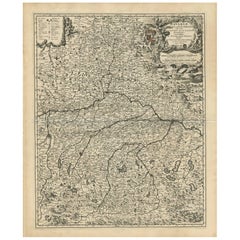
Antique Map of Bavaria with many details, Germany
Located in Langweer, NL
Antique map titled 'Bavariae Circulus atq Electoratus tam cum Adiacentibus quam insertis Regionibus (..)'. Dutch map of Bavaria, showing the many cities, towns, and other features of...
Category
Late 17th Century Antique Netherlands
Materials
Paper
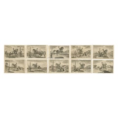
Set of 10 Antique Horse Riding Prints
Located in Langweer, NL
Set of 10 antique horse riding prints. Published circa 1680.
Category
Late 17th Century Antique Netherlands
Materials
Paper
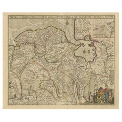
Antique Map of Groningen with Contemporary Hand Coloring
Located in Langweer, NL
Antique map titled 'Tabulae dominii Groeningae quae et complecititur maximam partem Dreniae Emendata a F. de Wit'. Original antique map of the province of Groningen, the Netherlands....
Category
Late 17th Century Antique Netherlands
Materials
Paper
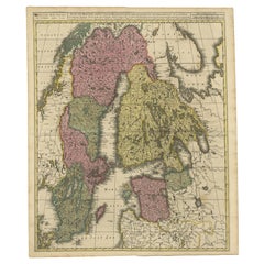
Antique Map of Scandinavia and the Baltic Region by Valk, circa 1690
Located in Langweer, NL
Antique map titled 'Sueciae Magnae, totius orbis regni antiquissimi (..)'. Map of Scandinavia and the Baltic region. It shows Norway, Sweden, Finla...
Category
Late 17th Century Antique Netherlands
Materials
Paper
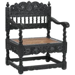
Dutch Colonial 17th Century Ebony Armchair, India/Indonesia/Sri Lanka
Located in Amsterdam, NL
An unusual Indian half-relief carved ebony armchair
Coromandel coast, 1680-1700
?
Throughout carved with floral and vine motifs, the back rail with a central peony and ...
Category
Late 17th Century Indian Dutch Colonial Antique Netherlands
Materials
Rattan, Ebony
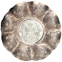
Dutch Colonial Silver Dish with the Von Pfeffel Coat-of-arms, 17th Century
Located in Amsterdam, NL
An unusual Indonesian lobbed silver dish
Jakarta (Batavia) or Coromandel coast, third quarter 17th century, apparently unmarked
The eight lobbed dish exuberantly decorated with floral motifs, with the middle section replaced, consisting of indistinctly marked German silver from the early 19th century, bearing the coat-of-arms of the Von Pfeffel family.
Diam. 30.5 cm
Weight 461 grams
Note:
Lobbed silver dishes with exuberant floral decorations were characteristic of the decorative arts in the Netherlands in the first half of the 17th century. This style of floral decoration was adopted by silversmiths as well as by furniture makers working on the Coromandel Coast and in Batavia, often by workers who had fled the Coromandel Coast because of war and famine. In Batavia this style was known as “Custwerck” (work from the Bengal coast).
These lobbed dishes are seldom marked. Only after 1667 the use of the town mark became obligatory in Batavia but only for silver made in Batavia not for silver imported in Batavia from other VOC settlements. The engraved coat of arms in the centre is a replacement of the original centre.
The coat of arms can be identified as those of Christian Hubert von Pfeffel (1765- 1834). As a diplomat, statesman, ambassador of Bavaria in London and Saxony and councillor to the King of Bavaria, he was made “Freiherr” in 1828 and since then used this coat of arms. His son Karl Maximilian Friederich Hubert Freiherr von Pfeffel (1811-1890) in 1836 married Karoline Adelheid Pauline von Rottenburg (1805-1872), the natural daughter of Prins Paul von Württemberg (1785-1852) and his mistress Margrethe Porth. Paul was the jounger brother of the King Wilhelm I of Württemberg (1781-1864). The heraldic motto of the von Pfeffels Vur Schande habe den Huot means as much as “Beware of Shame”. Christian Hubert Theodoor Marie Karl von Pfeffel Karl Maximilian’s grandson was the last male in the von Pfeffel line. His daughter, Marie Louise (Paris in 1882 - Cornwall 1944), born and grown-up in France, changed her name in de Pfeffel. She was the great grandmother of Boris Alexander de Pfeffel Johnson, the present British Secretary of State. None of the members of the von Pfeffel family had any direct links with the Dutch East Indies but indirectly by way of the Royal House of Württemberg they did.
Sophia Frederika Mathilda von Württemberg (1818-1877), daughter of Wilhelm I King of Württemberg, in 1839 married Willem III...
Category
Late 17th Century Indonesian Dutch Colonial Antique Netherlands
Materials
Silver
Antique French Fireplace Screen / Gate
Located in Haarlem, Noord-Holland
Happy to offer this very attractive and rare 17th century French firescreen or gate.
This amazingly crafted gate is in perfect condition and super...
Category
Late 17th Century French Antique Netherlands
Materials
Iron, Wrought Iron
Antique Print of a Naval Vessel by Mortier '1695'
Located in Langweer, NL
Antique print titled 'Vaisseau du premier rang portant pavillon d'Admiral'. Beautiful copper engraving of a naval vessel. From Mortier's famous maritime Atlas "Neptune François". Eng...
Category
Late 17th Century Antique Netherlands
Materials
Paper
Antique Hand-Coloured Engraving of Tarantula Spiders from Crete, 1688
Located in Langweer, NL
Antique print, titled: 'De Spinneweb Tarantula.' - This original antique print shows spiders of Crete. Dutch text on verso. Source unknown, to be determined.
Artists and Engravers...
Category
1680s Antique Netherlands
Materials
Paper
Original Antique County Map of Derbyshire, England
Located in Langweer, NL
Antique map titled 'Darbyshire'. Original antique map of the country of Derbyshire, England. Engraved by Robert Morden. Sold by Abel Swale, Awnsham and John Churchill...
Category
Late 17th Century Antique Netherlands
Materials
Paper
Original Antique Map of England and Wales with Large Cartouche
Located in Langweer, NL
Antique map titled 'Le Royaume d'Angleterre divisé en plusieurs Parties (..)'. Large and rare map of England and Wales by J.B. Nolin after Coronelli. With decorative cartouche, table...
Category
Late 17th Century Antique Netherlands
Materials
Paper
Antique Map of Japan and Korea by Sanson, 'c.1690'
Located in Langweer, NL
Antique map titled 'Les Iles du Iapon (..)'. Original antique map, with beautiful (later) hand coloring, of Japan and the Island of Corey (Korea). Uncommon edition, with '234' at top...
Category
Late 17th Century Antique Netherlands
Materials
Paper
Antique Map of Part of Flanders 'Belgium' by F. de Wit 'circa 1680'
Located in Langweer, NL
Antique map titled 'Marchionatus Sacri Imperii et Dominii Mechelini Tabula'. Large folio size map of the region around Mechelen, Leuven, Brussels, Dendermonde and Antwerp. Published ...
Category
Late 17th Century Antique Netherlands
Materials
Paper
Antique Print of a Religious Calendar, Depicting the Month January, 1680
Located in Langweer, NL
Antique print of a religious calendar, depicting the month January. With Zodiac sign in upper left corner. Originates from 'Acta Sanctorum', an encyclopedic text in 68 folio volumes ...
Category
1680s Antique Netherlands
Materials
Paper
Antique Print of the Churches of Paneteripoum, Manipay, Changane and Vanarpone
By Philip Baldaeus
Located in Langweer, NL
Antique print titled 'Paneteripou, Manipay, Changane, Vanarpone'. Antique print with four views of the churches of Paneteripoum, Manipay, Changane and Vanarpone (Ceylon/Sri Lanka). T...
Category
Late 17th Century Dutch Antique Netherlands
Materials
Paper
Original Copper Engraving of the Indian City of Suratte 'Surat', 1672
Located in Langweer, NL
Antique print, titled: 'Suratte'
View of the Indian city of Suratte (Surat) showing a panoramic view of the city with figures, animals and a river wi...
Category
1670s Antique Netherlands
Materials
Paper
Portrait of Fernando Alvarez de Toledo y Pimentel, Grand duke of Alba, c.1690
Located in Langweer, NL
Antique print, titled: 'Ferdinand de Tolede. Duc d'Albe.'
Portrait of Fernando Alvarez de Toledo y Pimentel, Grand duke of Alba (1507-1582). Source un...
Category
1690s Antique Netherlands
Materials
Paper
Antique Engraving After a Self Portrait of Dutch Painter Abraham Bloemaert, 1694
Located in Langweer, NL
Antique print, titled: 'Abraham Blomaert'
Portrait of Abraham Bloemaert after a self-portrait by Bloemaert, engraved by Hendrik Snijers. Abraham ...
Category
1690s Antique Netherlands
Materials
Paper
Antique Map of the Saxony Region 'Germany' by F. de Wit, circa 1680
Located in Langweer, NL
A detailed map of a region in eastern Germany. Cartouches depict coat of arms surrounded by cherubs. The map is fully engraved with towns, political boundaries, rivers and forests. P...
Category
Late 17th Century Antique Netherlands
Materials
Paper
Print of Leopold I, Holy Roman Emperor, King of Hungary, Croatia & Bohemia, 1695
Located in Langweer, NL
Antique print, titled: 'Leopoldus Romanorum Imperator Semper Augustus.'
This original antique plate shows a portrait of Leopold I (9 June 1640 – 5 May 1705), he was Holy Roman Emperor...
Category
1690s Antique Netherlands
Materials
Paper
Brass Low Bell Base Candlestick Spanish, circa 1680-1730
Located in Boven Leeuwen, NL
Large brass low bell base candlestick, Spanish, circa 1680-1730
Measures: 24 cm high diameter base 16 cm. Free shipping.
Category
Late 17th Century Spanish Louis XIV Antique Netherlands
Materials
Brass
Old Map of the Empire of the Assyriens & the Tigres and Euphrates Rivers, 1683
Located in Langweer, NL
Antique map titled 'Empire des Assyriens' and 'Assyrie Chaldee et Mesopotamie selon les Anciens'.
Two maps on one sheet, the upper sheet showing the Empire of the Assyriens and the second showing the region of the Tigres and Euphrates Rivers. This map originates from Alain Manesson Mallet's 'Description de l 'Univers'.
Artists and engravers: Alain Manesson Mallet (1630–1706) was a French cartographer and engineer. He started his career as a soldier in the army of Louis XIV, became a Sergeant-Major in the artillery and an Inspector of Fortifications. He also served under the King of Portugal, before returning to France, and his appointment to the court of Louis XIV. His military engineering and mathematical background led to his position teaching mathematics at court. His major publications were Description de L'Univers (1683) in 5 volumes, and Les Travaux de Mars ou l'Art de la Guerre (1684) in 3 volumes.
His Description de L'Universe contains a wide variety of information, including star maps...
Category
1680s Antique Netherlands
Materials
Paper
Rare Engraving of Mount Sinai with St. Catherine's Monastery and Bedouins, 1680
Located in Langweer, NL
Rare antique print titled ‘Bergh Sinai of Sint Catryn’.
This engraving shows Mount Sinai (also known as Mount Horeb) with St. Catherine's Monastery at the foot of the mountains a...
Category
1680s Antique Netherlands
Materials
Paper
Antique Engraving of Dutch and German North Sea Coast of Friesland, ca.1680
Located in Langweer, NL
Antique map titled 'Tabula Nova In qua accuratè demonstratur tota Navigatio ab Amstelodami Statione per Vada vulgo de Watten Hamburgum usq.' -
Two maps with the Dutch and German North Sea coast of Friesland, with West Frisian Islands and below East Frisian Islands with inset map of the Elbe around Hamburg. With title and a scale cartouche. Map by Henricus Hondius...
Category
1680s Antique Netherlands
Materials
Paper
Cartographic Treasures: A Journey Through the Gascogne and Guyenne Regions, 1680
Located in Langweer, NL
The antique map titled "Gouvernement de La Guienne & Gascogne" depicts the region of Gascogne and Guyenne, known for their wine production, in France.
This map is a rare edition, u...
Category
Late 17th Century Antique Netherlands
Materials
Paper
Old Print of Jews Eating on Beds like Assyrians, Persians, Romans, Greeks, 1690
Located in Langweer, NL
Description: Antique print religion titled 'Het aanliggen op de Tafel-Bedden; hoedanigen Eetwyse der Assyriers, Persen, Grieken en Romeinen, ook by de Joden in gebruyk geraakt is'.
...
Category
1690s Antique Netherlands
Materials
Paper
Old Decorative & Highly Detailed Sea Chart of the North Dutch-German Coast, 1681
Located in Langweer, NL
Antique map titled 'Paskaart van een gedeelte van Vriesland, Groeninger, en Emderland. Met zyn onderhoorige Eylanden; Strekkende van't Eylant der Schelling'.
Decorative and highl...
Category
1680s Antique Netherlands
Materials
Paper
Antique Map Covering Northern Italy, Austria, Slovenia & Croatia, ca.1690
Located in Langweer, NL
Antique map titled 'Exactissima Tabula, qua tam Danubii Fluvii Pars Superior'.
Detailed map covering the region of northern Italy, Austria, Slovenia and Croatia. The course of th...
Category
1690s Antique Netherlands
Materials
Paper
Antique Engraving of Archangel Michael and an Arab Moor Playing Instrument, 1698
Located in Langweer, NL
Untitled print of an Arab Moor man playing a stringed instrument 105: Mural in St. Marc's church: the left a painting of the Archangel Michael, said to be painted by S. Lucas.
Th...
Category
1690s Antique Netherlands
Materials
Paper
Antique Engraving of a Bird's-Eye Plan of Nagapattinam or Negapatam, India, 1672
Located in Langweer, NL
Antique map titled 'Negapatam.'
Bird's-eye plan of Nagapattinam or Negapatam, India. This map originates from 'Naauwkeurige Beschryvinge van Malabar en Choromandel…en het machtige ...
Category
1670s Antique Netherlands
Materials
Paper
Rare Antique Engraving of a Landscape with Two Horses and Horsemen, ca.1680
Located in Langweer, NL
Antique print of a landscape with two horses and horsemen.
Made after a painting by Philips Wouwerman. Source unknown, to be determined.
Artists and Engravers: Engraved by J....
Category
1680s Antique Netherlands
Materials
Paper
Copper-Line Engraving by Cornelius de Bruyn of Alexandria in Egypt, c.1690
Located in Langweer, NL
Artist: Cornelis de Bruijn (or de Bruyn); 1652 – 1726/7 was a Dutch artist and traveler. He made two large tours and published illustrated books with his observations of people, buil...
Category
Late 17th Century Antique Netherlands
Materials
Paper
The Iron Duke of Alva of Spain Planning the Atrocities Against the Dutch, c.1680
Located in Langweer, NL
Antique print titled ‘Afbeeldinge van de Spaansche Bloedraad in den Jaare 1567 door den Hartog van Alva aangestelt’.
The Duke of Alva and his entourage seated at a table planning...
Category
1680s Antique Netherlands
Materials
Paper
Detailed Map of Southern Holland, Incl the Hague, Rotterdam, Delft, Gouda, c1680
Located in Langweer, NL
Antique map titled 'Delflandia, Schielandia et circumjacentes Insulae ut Voorna, Overflackea, Goerea, Yselmonda et aliae.'
Detailed map of Southern Holland, which includes the ci...
Category
1680s Antique Netherlands
Materials
Paper
Antique Map of Upper Bavaria, Germany
Located in Langweer, NL
Antique map titled 'Bavariae pars superior cum insertis et adjacentibus regionibus non solum in ejusdem ditiones generales (..). Original antique map of upper Bavaria from Regensburg...
Category
Late 17th Century Antique Netherlands
Materials
Paper
Antique Botany Print of a Limonium Flowering Plant, circa 1680
Located in Langweer, NL
Antique botany print titled 'Limonium minus Bellidis (..)'. Original antique print of a limonium flowering plant. This print originates from 'Me´moires pour servir a' l'histoire des ...
Category
Late 17th Century Antique Netherlands
Materials
Paper
Antique Map of Flanders 'Belgium' by F. de Wit, circa 1680
Located in Langweer, NL
Antique map titled 'Comitatus Flandriae Tabula, in Lucem Edita'. Large map of Flanders, Belgium. Published by F. de Wit, circa 1680.
Category
Late 17th Century Antique Netherlands
Materials
Paper
Antique Map of the Namur Region 'France' by F. de Wit, circa 1680
Located in Langweer, NL
Antique map titled 'Comitatus Namurci Tabula in Lucem Edita'. Large map of the Namur region, France. Published by F. de Wit, circa 1680.
Category
Late 17th Century Antique Netherlands
Materials
Paper
Old Print of Vishnu and the Fifth Incarnation, 1672
Located in Langweer, NL
Antique print, untitled. This original antique print shows Vishnu in his fifth incarnation or avatar. Dutch text on verso. From: 'Naauwkeurige Beschryvinge van Malabar en Choromandel...
Category
1670s Antique Netherlands
Materials
Paper
Striking Antique Map of Luxembourg and Northern France 'Lotharingen', c.1680
Located in Langweer, NL
Description: Antique map titled 'Exactissima Lotharingia tam Regis Gallorum quam Ducis.' -
Striking map of Luxembourg and Northern France. Includ...
Category
1680s Antique Netherlands
Materials
Paper
Beautiful Map of Arnhem and the Veluwe Region, Gelderland, The Netherlands, 1690
Located in Langweer, NL
Antique map titled 'Ducatus Geldriae tetrachia Arnhemiensis sive Velavia'.
Beautiful map of the region of Arnhem and the Veluwe region, Gelderland, t...
Category
1690s Antique Netherlands
Materials
Paper
Antique Map of the Siege of Syracuse, Sicilia, Italy, 'ca.1675'
Located in Langweer, NL
Antique map titled 'Syracus beseeged by the Athenians.' This original uncommon antique map shows the siege of Syracuse, Italy, by the Athenians. Key top left.
The siege of Syracus...
Category
1670s Antique Netherlands
Materials
Paper
Original Antique Sea Chart of the Maas 'or Meuse' River with Neptunes, 1684
Located in Langweer, NL
Antique map titled 'Paskaerte van het inkoomen van de Maes (..)'.
Original antique sea chart of the Maas (or Meuse) river and part of the Dutch c...
Category
1680s Antique Netherlands
Materials
Paper
Original Copperplate Engraved Detailed Map of South Africa, ca.1680
Located in Langweer, NL
Antique map titled 'Pays et Coste des Caffres Empires de Monomotapa (..)'.
Detailed map of South Africa. Engraved by Antoine d'Winter for a Dutch edition of Sanson's pocket atlas...
Category
1680s Antique Netherlands
Materials
Paper
Old Original Miniature View of the Skyline of Miaco 'Kyoto, Japan', 1683
Located in Langweer, NL
Antique print titled 'De l'Asie Figure XXV, Miaco'.
Miniature view of the skyline of Miaco (Kyoto, Japan). This print originates from 'Description de l'Univers', published 1683.
...
Category
1680s Antique Netherlands
Materials
Paper
Antique Map of Austria by N. Visscher, circa 1690
Located in Langweer, NL
Antique map titled 'Austriae Archiducatus pars superior in omnes ejusdem'. Spectacular large map of Upper and Lower Austria between Passau and Wien with figurative cartouche and armo...
Category
Late 17th Century Antique Netherlands
Materials
Paper
Rare Engraving of The Opera about The Birth of The Archduchess of Austria, 1678
Located in Langweer, NL
Antique print titled 'Romanus Dictator coram populorem expediens'.
Engraving of a dictator who signs his orders. This engraving shows one of the stage sets for 'Il Fuoco Eterno C...
Category
1670s Antique Netherlands
Materials
Paper
Map of Region Near the Baltic Sea, Present Day Bulgaria, Romania & Turkey, c1670
Located in Langweer, NL
Antique map titled 'Illyricum Orientis: In quo Partes II Moesia et Thracia'.
Engraved map of the area west of the Baltic Sea, present day Bulgaria, Romania, and Turkey. The map i...
Category
1670s Antique Netherlands
Materials
Paper
Old Original Print Showing Arab People with Weapons Receiving Gifts, Ca.1680
Located in Langweer, NL
Antique print, untitled. This original antique print shows Arabian people. Source unknown, to be determined.
Artists and Engravers: Olfert Dapper (c. 1635 - 1689) was a Dutch phys...
Category
1680s Antique Netherlands
Materials
Paper
Coat of Arms of Theodorus Van Bleiswijk, Mayor of Schiedam, Netherlands, Ca.1680
Located in Langweer, NL
Antique print, titled: 'De Heer en Mr. Theodorus van Bleyswijk, Hoogheemraadt, Regerendt Borgermeester der Stad Schiedam.' -
Coat of arms of Theodorus van Bleiswijk, mayor of Sch...
Category
1680s Antique Netherlands
Materials
Paper
Antique Map of Zeeland 'The Netherlands' by N. Visscher, circa 1690
Located in Langweer, NL
Antique map titled 'Comitatus Zelandiae (..)'. Detailed chart of the province Zeeland, The Netherlands, with details shown pictorially. Published by N. Visscher.
Category
Late 17th Century Antique Netherlands
Materials
Paper
Rare Portrait of Flemish Baroque Printmaker of Pieter de Jode the Younger, 1694
Located in Langweer, NL
Antique print, titled: 'Petrus de Jode' -
Portrait of Pieter de Jode II or Pieter de Jode the Younger (1606–1674), a Flemish Baroque printmaker, draughtsman, painter and art deal...
Category
1690s Antique Netherlands
Materials
Paper
Beautiful Map of the Region Naters and Pancrasgors, The Netherlands, ca.1697
Located in Langweer, NL
Antique map titled ‘Caarte der Heerlyckheyt van Naters ende Pancras Gors’.
Beautiful map of the region Naters and Pancrasgors, The Netherlands. This ma...
Category
1690s Antique Netherlands
Materials
Paper
Antique Map of the Coast of Angola Up to Port Elizabeth in South Africa, 1675
Located in Langweer, NL
Antique map titled 'Cimbebas et Caffariae Littora a Catenbela ad Promontorium Bonae Spei'.
This map depicts the coast of Angola, South-West Africa and South Africa up to Port Elizabeth...
Category
1670s Antique Netherlands
Materials
Paper
Antique Decorative Map of the Low Countries, '17 Provinces, Netherlands', c.1680
Located in Langweer, NL
Description: Antique map titled 'Germaniae Inferioris XVII Provinciarum Accuratissima Tabula.'
Map of the low countries (17 provinces, Netherlands). The map is dedicated to Theod...
Category
1680s Antique Netherlands
Materials
Paper
Antique Map of Switzerland by N. Visscher, circa 1690
Located in Langweer, NL
Antique map titled 'Tabula Geogaphica qua Pars Meridionalis sive Superior Rheni, Mosae, et Mosellae (..)'. Published by N. Visscher, Amsterdam, circa 1690. Contemporary coloring.
Category
Late 17th Century Antique Netherlands
Materials
Paper
Antique Map of Portugal by J. De Ram, circa 1680
Located in Langweer, NL
A detailed map of Portugal. Embellished with beautiful cartouche, sailing vessels and many putti. Very rare edition by J. de Ram, circa 1680.
Category
Late 17th Century Antique Netherlands
Materials
Paper
Antique Map of Western Africa and the Cape Verde Islands by Coronelli, 1691
By Vincenzo Coronelli
Located in Langweer, NL
Antique map titled 'Bocche del Fiume Negro et Isole di Capo Verde'. Antique map of Western Africa with the Cape Verde Islands and an inset of Goree Island. Originates from 'Atlante V...
Category
Late 17th Century Italian Antique Netherlands
Materials
Paper
Antique Map of Central Europe "Centered on Germany" by F. de Wit, circa 1680
Located in Langweer, NL
A very detailed map of central Europe, centered on Germany. It extends from Belgium and The Netherlands through Pomerania in the north, and from eastern France to Croatia in the sout...
Category
Late 17th Century Antique Netherlands
Materials
Paper
Antique Map of Germany with Its Bordering Kingdoms and Provinces by N. Visscher
Located in Langweer, NL
Antique map covering the central part of Europe with Germany in the centre and the Netherlands in west. With one cartouche containing cherubs and coat of arms. Published in Amsterdam...
Category
Late 17th Century Antique Netherlands
Materials
Paper
