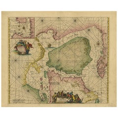
18th Century Map North America
1
to
15
67
65
94
84
31
26
19
12
7
7
6
6
4
2
2
2
2
2
1
1
1
1
1
1
1
1
1
1
1
19
6
3
3
2
Sort By
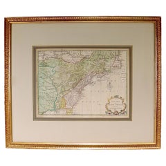
New Map of North America from the Latest Discoveries, 1763
Located in Philadelphia, PA
A fine antique 18th century map of the North American seaboard.
Entitled "A New Map of North
Category
Antique Mid-18th Century English Georgian Maps
Materials
Paper
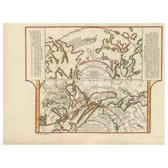
Antique Map of the West Coast of North America & North East Coast of Asia '1772'
Located in Langweer, NL
'. Map of the West Coast of North America and North-East Coast of Asia, based upon Buache's report of the
Category
Antique Late 18th Century Maps
Materials
Paper
H 13.78 in W 18.78 in D 0.02 in
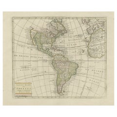
Original Antique Map of North and South America in Attractive Old Coloring
By Isaak Tirion
Located in Langweer, NL
Antique map titled 'Nieuwe Kaart van America'. Beautiful map of America. The fabled Quivira is used
Category
Antique Mid-18th Century Maps
Materials
Paper
H 16.15 in W 19.69 in D 0.02 in
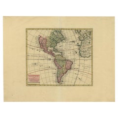
Very Attractive Map of North and South America and Western Part of Africa, 1744
Located in Langweer, NL
Antique map titled 'Nieuwe Kaart van America.' Very attractive map of North and South America, the
Category
Antique 18th Century Maps
Materials
Paper
H 16.34 in W 21.26 in D 0 in
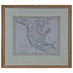
America "Amérique Septentrionale": A 19th Century French Map by Delamarche
By Maison Delamarche 1
Located in Alamo, CA
This framed mid 19th century map of North America entitled "Amérique Septentrionale" by Felix
Category
Antique Mid-19th Century American Other Maps
Materials
Paper
H 20 in W 22.63 in D 0.88 in
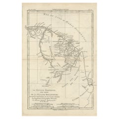
Antique Map of South America Depicting Guayana, c.1780
Located in Langweer, NL
Operations et les Cartes recentes des Ingenieurs-Geographes Francois'. Antique map of South America depicting
Category
Antique 18th Century Maps
Materials
Paper
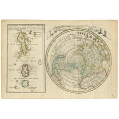
Antique Map of the North Pole & Sangihe Archipelago by Keizer & de Lat, 1788
Located in Langweer, NL
coastline labeled, Onbekend Land, nearly connecting Asia and North America. A second map that takes up
Category
Antique Late 18th Century Maps
Materials
Paper
H 8.08 in W 11.82 in D 0.02 in
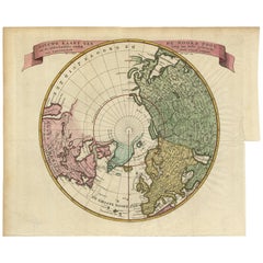
Antique Map of the Northern Hemisphere and North Pole by Tirion, circa 1754
Located in Langweer, NL
'. Map of the Northern Hemisphere and North Pole, which shows the NE Passage, but no definite NW Passage
Category
Antique Mid-18th Century Maps
Materials
Paper
H 12.8 in W 14.77 in D 0.02 in
Antique Sea Chart of North America by Ottens, circa 1745
Located in Langweer, NL
waters of North America, including the coast of Labrador and part of New Foundland, the west coast of
Category
Antique Mid-18th Century Maps
Materials
Paper
Free Shipping
H 21.46 in W 25.99 in D 0.02 in
California, Alaska and Mexico: 18th Century Hand-Colored Map by de Vaugondy
By Didier Robert de Vaugondy
Located in Alamo, CA
This an 18th century hand-colored map of the western portions of North America entitled "Carte de
Category
Antique 1770s French Maps
Materials
Paper
H 13.75 in W 16.63 in D 0.13 in
Authentic Antique Map of the Caribbean, Gulf Coast and Central America, 1787
Located in Langweer, NL
of the Caribbean, Gulf Coast, and Central America during the late 18th century.
2. **Cartographic
Category
Antique Late 18th Century Maps
Materials
Paper
Free Shipping
H 10.52 in W 16.38 in D 0.02 in
Antique Map of America with California as an Island by Homann '1710'
Located in Langweer, NL
understanding of the American continent during the early 18th century. It captures the geographical knowledge
Category
Antique Early 18th Century Maps
Materials
Paper
Map Silk Embroidered Western Eastern Hemisphere New Old World Asia America Afri
Located in BUNGAY, SUFFOLK
A rare, late-18th century, silk, embroidered, double hemisphere, world map, blackwork, sampler
Category
Antique 18th Century British Georgian Maps
Materials
Silk
H 0.4 in W 0.4 in D 0.4 in
Finely Engraved Antique Map of Europe with inset of America, c.1745
By Guillaume De L'Isle
Located in Langweer, NL
undefined Western coast in North America. Published in Amsterdam by Covens & Mortier.
Artists and
Category
Antique 18th Century Maps
Materials
Paper
Captain Cook's Exploration of Tahiti 18th C. Hand-Colored Map by Bellin
By Jacques-Nicolas Bellin
Located in Alamo, CA
This beautiful 18th century hand-colored copper plate engraved map is entitled "Carte de l'Isle de
Category
Antique Mid-18th Century French Maps
Materials
Paper
H 11.38 in W 17.5 in D 0.13 in
Rare Unusual Antique Map of Asia with a Landbridge from Korea to America, 1717
Located in Langweer, NL
cartographers of the late 17th and early 18th Century.
Condition: Good, given age. Neatly restored split of one
Category
Antique 18th Century Maps
Materials
Paper
H 9.65 in W 13.94 in D 0 in
Antique Map of South American, The West Indies & Most of Africa, Ca.1775
Located in Langweer, NL
du Commerce des Europeens dans les deux Indes'.
This map is roughly centered on South America
Category
Antique 1770s Maps
Materials
Paper
H 15.04 in W 19.77 in D 0 in
Antique Map of Tartary and Northeast Asia, c.1750
Located in Langweer, NL
events in the Americas. His maps and charts were finely engraved and produced, and set a high standard of
Category
Antique 18th Century Maps
Materials
Paper
Interesting Old Map of the Nw Coast of America and the Ne Coast of Asia, ca.1772
Located in Langweer, NL
map of the discoveries of Admiral de Fonte, showing the possibility of a north-west passage
Category
Antique 1770s Maps
Materials
Paper
H 13.78 in W 17.13 in D 0 in
Antique Map of Tartary and Northeast Asia with Hand Coloring
Located in Langweer, NL
issued maps, particularly reflecting continuing discoveries and political events in the Americas. His
Category
Antique Mid-18th Century Maps
Materials
Paper
Antique Bible World Map by R. & J. Wetstein, 1743
Located in Langweer, NL
stretched between eastern Asia and North America.
Information is presented on the orbit of planets
Category
Antique Mid-18th Century Maps
Materials
Paper
Antique Map of the Harbour of Samganoodha by Cook, c.1781
Located in Langweer, NL
Samganoodha, Oonalaska, North America. Originates from an edition of Cook's Voyages.
Artists and Engravers
Category
Antique 18th Century Maps
Materials
Paper
Martinique Island in the Caribbean by Bellin Original Original Antique Map, 1780
Located in Langweer, NL
This mid-18th century map, "Carte de l'Isle de la Martinique pour servir a l'historie generale des
Category
Antique Late 18th Century Maps
Materials
Paper
H 9.85 in W 13.39 in D 0 in
Antique Map of the Eastside of Coiba Island 'Quibo', Panama, 1749
Located in Langweer, NL
collection includes a wide range of authentic antique maps from the 16th to the 20th centuries. Buying and
Category
Antique 18th Century Maps
Materials
Paper
Very Attractive Antique Map of the World as Planisphere, Shows Cook's Voyages
Located in Langweer, NL
Northwest Coast of America and North East coast of Asia, along with Greenland. A new large lake also appears
Category
Antique Late 18th Century Maps
Materials
Paper
No Reserve
H 16.15 in W 20.08 in D 0.02 in
Beautiful Antique Map of the Northern Hemisphere with California as an Island
By Isaak Tirion
Located in Langweer, NL
tot Amsterdam door Isaak Tirion'. Beautiful map of the Northern Hemisphere and North Pole, which shows
Category
Antique Mid-18th Century Maps
Materials
Paper
H 13.98 in W 18.9 in D 0.02 in
Antique Map of the World in Hemispheres by Keizer & de Lat, 1788
Located in Langweer, NL
double hemisphere world map on polar projections. In North America, there is a large Island of California
Category
Antique Late 18th Century Maps
Materials
Paper
Antique Map of the World with Polar Projections by Keizer & de Lat, 1788
Located in Langweer, NL
polar projections. In North America, there is a large Island of California. Australia and New Zealand
Category
Antique Late 18th Century Maps
Materials
Paper
H 8.08 in W 11.03 in D 0.02 in
Antique Map of Juan Fernandez Island and Cumberland Bay, Chile - c. '1749'
Located in Langweer, NL
Antique map titled 'Plan de la Côte du N.E. de l 'Ile de Juan Fernandes - Schets van den Noord-Oost
Category
Antique Mid-18th Century Maps
Materials
Paper
H 10.63 in W 16.74 in D 0.02 in
Antique Map of the Harbour of Praia, Santiago Island, Cape Verde, c.1750
Located in Langweer, NL
range of authentic antique maps from the 16th to the 20th centuries. Buying and collecting antique maps
Category
Antique 18th Century Maps
Materials
Paper
Antique Map of France with a Nice Cartouche of a Distance Scale, c.1756
Located in Langweer, NL
atlases, especially of North America.
Condition: Very good. Folds as issued. Tape on top of verso
Category
Antique 18th Century Maps
Materials
Paper
North and South America: An 18th Century Hand-colored Map by Johann Homann
By Johann Baptist Homann
Located in Alamo, CA
This early 18th century hand-colored copperplate map of North and South America entitled "Totius
Category
Early 18th Century Old Masters Landscape Prints
Materials
Engraving
North America Map Economy Wall Chart Rollable Poster Vintage Mural
Located in Berghuelen, DE
A vintage pull-down map showing the economy of North America, published by Harms. Colorful print on
Category
Late 20th Century German Country Prints
Materials
Canvas, Wood, Paper
Vintage Map Wall Chart Countries of North America Rollable Mural Poster
Located in Berghuelen, DE
The vintage pull-down school map illustrates the countries / states of North America. Published by
Category
Late 20th Century German Country Prints
Materials
Canvas, Wood, Paper
H 51.19 in W 39.38 in D 0.79 in
North America Vintage Map Pull-Down Wall Chart Poster Countrycore Print
Located in Berghuelen, DE
A traditional vintage pull-down school map illustrating North America, published by Westermann
Category
Late 20th Century German Country Prints
Materials
Wood, Paper, Canvas
H 66.54 in W 61.42 in D 0.79 in
Vintage Mural Map Pull Down Wall Chart North America Economy Finances
Located in Berghuelen, DE
A classical rollable wall chart showing the economy of North America. Publishd by the Paul List
Category
Mid-20th Century German Country Prints
Materials
Canvas, Wood, Paper
H 53.55 in W 39.38 in D 0.79 in
Canada Greenland North America Map Vintage Mural Rollable Wall Chart Countrycore
Located in Berghuelen, DE
A classical pull-down map of Canada and Greenland (North American Continent). Used as teaching
Category
Vintage 1970s German Country Posters
Materials
Canvas, Wood
H 74.81 in W 79.14 in D 0.79 in
Land Use and Livestock North America Picture Map Wall Chart Poster Mural
Located in Berghuelen, DE
The vintage rollable picture map of North- and Middle America shows land use and livestock
Category
Late 20th Century German Country Prints
Materials
Canvas, Wood, Paper
H 47.25 in W 35.44 in D 0.79 in
Map of the World: An Original 18th Century Hand-colored Map by E. Bowen
Located in Alamo, CA
This is an original 18th century hand-colored map entitled "A New & Correct Chart of All The Known
Category
Mid-18th Century Old Masters Landscape Prints
Materials
Engraving
Map of the East Indies: An Original 18th Century Hand-colored Map by E. Bowen
Located in Alamo, CA
This is an original 18th century hand-colored map entitled "An Accurate Map of the East Indies
Category
Mid-18th Century Old Masters Landscape Prints
Materials
Engraving
Map of the Russian Empire: An Original 18th Century Hand-colored Map by E. Bowen
Located in Alamo, CA
the mid 18th century. The map extends from the Northern Ocean (Arctic Ocean) in the north to parts of
Category
Mid-18th Century Old Masters Landscape Prints
Materials
Engraving
Europe: An Original 18th Century Hand-colored Map by E. Bowen
Located in Alamo, CA
This is an original 18th century hand-colored map entitled "A New & Accurate Map of Europe Drawn
Category
Mid-18th Century Old Masters Landscape Prints
Materials
Engraving
China: An Original 18th Century Hand-colored Map by E. Bowen
Located in Alamo, CA
This is an original 18th century hand-colored map entitled "A New & Accurate Map of China, Drawn
Category
Mid-18th Century Old Masters Landscape Prints
Materials
Engraving
H 15.75 in W 19.75 in
Mediterranean and Adriatic Seas: Original 18th Century Hand-colored Map by Bowen
Located in Alamo, CA
This is an original 18th century hand-colored map entitled "An Accurate Chart of The Mediterranean
Category
Mid-18th Century Old Masters Landscape Prints
Materials
Engraving
California: 18th Century Hand-colored Map by de Vaugondy
By Didier Robert de Vaugondy
Located in Alamo, CA
This is an 18th century hand-colored map of the western portions of North America entitled "Carte
Category
1770s Landscape Prints
Materials
Engraving
Siberia as Explored by Behring: Original 18th Century Hand-colored Map by Bowen
Located in Alamo, CA
This is an original 18th century hand-colored map entitled "An Exact Chart of all the Countries
Category
Mid-18th Century Old Masters Landscape Prints
Materials
Engraving
Captain Cook's Exploration of Tahiti: 18th C. Hand-colored Map by Bellin
By Jacques-Nicolas Bellin
Located in Alamo, CA
This beautiful 18th century hand-colored copper plate engraved map is entitled "Carte de l'Isle de
Category
Late 18th Century Landscape Prints
Materials
Engraving
Bronze Box with a Map of Gronland ‘Greenland’ on the Lid
Located in NYC, NY
continent of North America, Greenland has been politically associated with Europe (specifically Denmark
Category
Early 20th Century Danish Boxes
Materials
Bronze
New France and Labrador - Graphite Drawing, Landscape, On Antiqued Map
By Don Pollack
Located in Chicago, IL
, canada
1999 Newzones Gallery, north american inheritance, Calgary,Alberta, canada
MarciaWood Gallery
Category
21st Century and Contemporary Contemporary Landscape Paintings
Materials
Canvas, Oil
Sir Francis Bacon: 18th C. Portrait of Philosopher, Scientist, Author, Statesman
By Jacobus Houbraken
Located in Alamo, CA
This is an 18th century copperplate engraved portrait of Sir Francis Bacon, Viscount St. Albans
Category
1730s Portrait Prints
Materials
Engraving
Captain James Cook: 18th C. Portrait by William Hodges After Cook's 2nd Voyage
By William Hodges
Located in Alamo, CA
This is an original 18th Century copper plate engraved portrait of Captain James Cook as a young
Category
1770s Portrait Prints
Materials
Engraving
Original Antique Print of a Sea Otter, a Quadruped and a White Bear, C.1780
Located in Langweer, NL
the 20th centuries. Buying and collecting antique maps is a tradition that goes back hundreds of years
Category
Antique 18th Century Prints
Materials
Paper
H 15.36 in W 9.45 in D 0 in
Antique Print of a City Near Canton, China circa 1745
Located in Langweer, NL
four volume work is an anthology of travel narratives. It contains maps and plates of the Americas
Category
Antique 18th Century Prints
Materials
Paper
Antique Print of Bunce Island an Island in the Sierra Leone River, 1748
By Jakob van der Schley
Located in Langweer, NL
Island was the departure point for thousands of slaves for the North American colonies of South Carolina
Category
Antique 18th Century Prints
Materials
Paper
Planiglobii Terrestris Mappa Universalis / Mappe Monde
By Homann Heirs
Located in New York, NY
late 18th century. This map is in good condition and backed on Japan paper.
Category
18th Century Other Art Style More Prints
Materials
Engraving
H 20.13 in W 23.88 in D 0.94 in
Hell Gate / Oyster Bay and Huntington / Huntington Bay
Located in New York, NY
HELL GATE / OYSTER BAY AND HUNTINGTON / HUNTINGTON BAY. This aquatint and line engraved map was
Category
18th Century Naturalistic More Prints
Materials
Engraving, Aquatint
Portrait of William Pitt, Earl of Chatham: Rare Framed Mezzotint after Brompton
By Edward Fisher
Located in Alamo, CA
subsisting between Great Britain and North America". This engraving is held by the British Museum and the
Category
Late 18th Century Old Masters Portrait Prints
Materials
Mezzotint
H 31.63 in W 26.63 in D 0.75 in
English Pocket Globe, London, Circa 1775-1798
By Herman Moll
Located in Milano, IT
in Central Asia; the Mogul kingdom in northern India; in North America only New England, Virginia
Category
Antique Late 18th Century English George III Globes
Materials
Shagreen, Paper
A truly delightful miniature terrestrial pocket globe
By Nathaniel Mills
Located in ZWIJNDRECHT, NL
). There is some slight loss to a portion of North America, and there is a crack to the northern portion of
Category
Antique Mid-18th Century British Dutch Colonial Globes
Materials
Other
William IV Terrestrial And Celestial Floor Globes By J. W. Cary
By John & William Cary
Located in New Orleans, LA
brass meridian rings and surmounted by hour rings.
Founded in the late 18th century by map publisher
Category
Antique 19th Century English Regency Globes
Materials
Mahogany
- 1
Get Updated with New Arrivals
Save "18 Th Century Map North America", and we’ll notify you when there are new listings in this category.
More Ways To Browse
Vintage Maps Of Hawaiian Islands
White Henry Link Table Set
English Mirror Feathers
Henry Link Full Bed Frame
Large Round Antiqued Mirrors
Traveling Drinks Case
Friendly Hunting
Singer Machine Antique
Wes Anderson Movie
1940s Fur Coat
Rex Fur Coat
Dog Chasing Pheasant
Dresden Porcelain Dancer
Paul Harding
Thomas Pheasant Mirror
Glyn Philpot
Joseph Wallace King
Spring Breakers
