Antique Original Maps Of Africa
11
to
38
258
9
122
98
88
83
50
30
26
19
18
16
13
13
11
9
9
8
7
5
4
4
4
3
3
2
2
2
2
2
2
2
2
1
1
1
1
1
1
1
1
1
42
42
5
2
2
Sort By
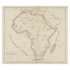
Original Antique Map of Africa
Located in Langweer, NL
Antique map titled 'Afrika'. Original antique map of Africa, drawn by Van Beusekom. Published by
Category
Antique Late 19th Century Maps
Materials
Paper
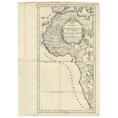
Uncoulored Original Antique Map of Western Africa, 1749
Located in Langweer, NL
Africa (..)'. Original antique map of Western Africa. This map originates from 'Neue Sammlung der
Category
Antique Mid-18th Century Maps
Materials
Paper
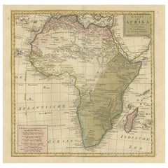
Antique Map of Africa with Original Hand Coloring
Located in Langweer, NL
Antique map titled 'Kaart van Afrika door den Heer d'Anville'. Detailed original old map of Africa
Category
Antique Mid-18th Century Maps
Materials
Paper
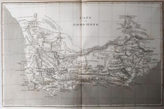
Original Antique Map of South Africa, Arrowsmith, 1820
Located in St Annes, Lancashire
Great map of South Africa.
Drawn under the direction of Arrowsmith.
Copper-plate engraving
Category
Antique 1820s English Maps
Materials
Paper
Original Antique Map of Africa with large decorative cartouche
Located in Langweer, NL
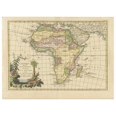
Original antique map titled 'L'Afrique divisée en ses principaux États'. Attractive and precise map
Category
Antique Late 18th Century Maps
Materials
Paper
Original Antique Hand- Map of Africa by Allard '1697'
Located in Langweer, NL
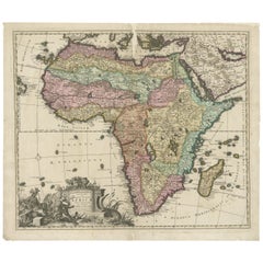
Antique map titled 'Novissima et Perfectissima Africae (..)'. Beautiful large map of Africa. This
Category
Antique Late 17th Century Maps
Materials
Paper
Antique Map of Senegal, West Africa
Located in Langweer, NL
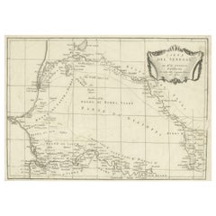
Original antique map titled 'Carta del Senegal'. Antique map of Senegal, West Africa. This map
Category
Antique Mid-18th Century Maps
Materials
Paper
Original Antique Map of Northern Africa by Van Dùren (1749)
Located in Langweer, NL
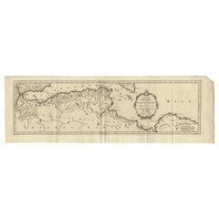
von Africa'. Original antique engraving of Northern Africa extending from the Strait of Gibraltar to
Category
Antique Mid-18th Century Maps
Materials
Paper
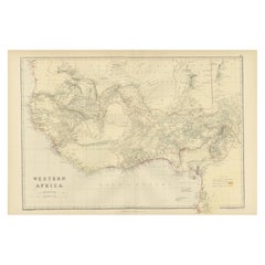
Original Antique Coloured Map of Western Africa, Published in 1882
Located in Langweer, NL
This is a map of Western Africa from the 1882 Blackie & Son atlas. The map details the West African
Category
Antique 1880s Maps
Materials
Paper
No Reserve
H 14.97 in W 22.45 in D 0 in
Original Detailed Antique Map of the East Coast of Africa, 1747
Located in Langweer, NL
'.
Original antique map of the east coast of Africa. Reaches from Cape of Good Hope and the land of the
Category
Antique 1740s Maps
Materials
Paper
Original Hand-Colored Antique Map of Africa by Elwe '1792'
Located in Langweer, NL
Antique map titled 'l'Afrique Divisée en ses Empires, Royaumes, et Etats'. Decorative large map of
Category
Antique Late 18th Century Maps
Materials
Paper
Antique Map of Africa by Johnston (1909)
Located in Langweer, NL
Antique map titled 'Africa'. Original antique map of Africa. This map originates from the ‘Royal
Category
Early 20th Century Maps
Materials
Paper
Antique Map of Africa by Delamarche, 1806
Located in Langweer, NL
Antique map titled 'L'Afrique'.
Decorative map of Africa by Robert de Vaugondy, revised and
Category
Antique 19th Century Maps
Materials
Paper
Old Original Map of Africa and Arabia, 1848
Located in Langweer, NL
Antique map titled 'Africa et Arabia'.
Old map of Africa and Arabia originating from 'Orbis
Category
Antique 1840s Maps
Materials
Paper
Antique Map of Africa by Homann Heirs, '1804'
Located in Langweer, NL
Antique map titled 'Charte von Africa'. Large, original antique map of Africa by Franz Ludwig
Category
Antique Early 19th Century Maps
Materials
Paper
Antique Map of South Africa by Wyld '1845'
Located in Langweer, NL
Antique map titled 'South Africa'. Original antique map of South Africa.
This decorative original
Category
Antique Mid-19th Century Maps
Materials
Paper
Antique Map of N.W. Africa & Central Africa by Johnston (1909)
Located in Langweer, NL
Antique map titled 'N.W. Africa & Central Africa'. Original antique map of N.W. Africa & Central
Category
Early 20th Century Maps
Materials
Paper
Antique Map of Africa by Levasseur 'c.1840'
Located in Langweer, NL
Antique map titled 'Afrique'. Original antique map of Africa. Decorative map of the continent
Category
Antique Mid-19th Century Maps
Materials
Paper
Antique Map of the Coast of Guinea, Africa, 1820
Located in Langweer, NL
Antique map Africa titled 'Carte de la Haute et de la Basse Guinée'. Map of the Coast of Guinea
Category
Antique 19th Century Maps
Materials
Paper
Antique Map of the West Coast of Africa, 1771
By Rigobert Bonne
Located in Langweer, NL
: 38 x 54 cm.
Image size: 31 x 42 cm.
We sell original antique maps to collectors, historians
Category
Antique 18th Century Maps
Materials
Paper
Antique Map of the Kingdom of Tunisia, Africa, 1773
Located in Langweer, NL
.
We sell original antique maps to collectors, historians, educators and interior decorators all over
Category
Antique 18th Century Maps
Materials
Paper
Antique Map of Africa by A & C, Black, 1870
Located in Langweer, NL
Antique map titled 'Africa'. Original antique map of Africa. This map originates from ‘Black's
Category
Antique Late 19th Century Maps
Materials
Paper
Antique Map of Africa by Keizer & de Lat, 1788
Located in Langweer, NL
Antique map titled 'Kaartje van Africa (..)'. Uncommon original antique map of Africa. This map
Category
Antique Late 18th Century Maps
Materials
Paper
Antique Map of North Africa showing Egypt, Mauritania and Africa Minor, 1672
Located in Langweer, NL
Antique map titled 'Africa Minor, Mauritania , Aegyptus.' Charming miniature map of North Africa
Category
Antique 17th Century Maps
Materials
Paper
H 5.63 in W 5.12 in D 0 in
Antique Map of the Coast of Guinea, Africa, c.1780
Located in Langweer, NL
Antique map Africa titled 'Carte de la Haute et de la Basse Guinée'. Map of the Coast of Guinea
Category
Antique 18th Century Maps
Materials
Paper
Antique Map of Africa with European Language Borders, 1852
Located in Langweer, NL
Antique map titled 'Afrika'. Map of Africa. This map originates from 'School-Atlas van alle deelen
Category
Antique 19th Century Maps
Materials
Paper
Antique Map of Africa and Arabia with Inset Map of Ethiopia and Eritrea, 1845
Located in Langweer, NL
Antique map titled 'Mittel- und Nord-Africa (östl. Theil) und Arabien'. This map depicts North and
Category
Antique 19th Century Maps
Materials
Paper
H 14.18 in W 17.33 in D 0 in
Antique Map of North Africa by Ortelius, c.1580
Located in Langweer, NL
Antique map titled 'Barbariae et Biledulgerid Nova Descriptio'. Original antique map of North
Category
Antique 16th Century Maps
Materials
Paper
Original Copperplate Engraved Detailed Map of South Africa, ca.1680
Located in Langweer, NL
Antique map titled 'Pays et Coste des Caffres Empires de Monomotapa (..)'.
Detailed map of
Category
Antique 1680s Maps
Materials
Paper
Antique Map of Africa with Mountain Ranges and other details
Located in Langweer, NL
Antique map titled 'Carte générale et Politique de l'Afrique'. Original antique map of Africa
Category
Antique Late 18th Century Maps
Materials
Paper
Free Shipping
H 19.06 in W 25.44 in D 0.02 in
Antique Map of the Coast of Northwest Africa by Dien, 1820
Located in Langweer, NL
Antique map Africa titled 'Partie Occidentale de l'Ancien Continent, depuis Lisbonne jusquá la
Category
Antique 19th Century Maps
Materials
Paper
Antique Map of Africa by Claude Buy de Mornas '1761'
Located in Langweer, NL
Antique map titled 'Afrique'. Original antique map of Africa flanked with descriptions containing
Category
Antique Mid-18th Century Maps
Materials
Paper
Antique Map of Europe and Part of Asia and Africa, 1848
Located in Langweer, NL
sell original antique maps to collectors, historians, educators and interior decorators all over the
Category
Antique 19th Century Maps
Materials
Paper
Remarkable Antique Map of Central Africa by Scherer, c.1703
Located in Langweer, NL
27.3 cm.
Image size: 34.5 x 23 cm.
We sell original antique maps to collectors, historians
Category
Antique 18th Century Maps
Materials
Paper
Antique Map of North and South Africa by Johnston, 1882
Located in Langweer, NL
Two antique maps on one sheet titled 'N.W. Africa, Marocco, Algeria & Tunis' and 'Southern Africa
Category
Antique 19th Century Maps
Materials
Paper
French Antique Map of Northern Africa and Libya, c.1840
Located in Langweer, NL
Antique map titled 'Marok, Alger et Tunis - Etat de Tripoli'. Map of Northern Africa and Libya
Category
Antique 19th Century Maps
Materials
Paper
Antique Map of South Africa showing the Travels of Truter and Somerville
Located in Langweer, NL
Antique map titled 'Charte von Süd-Afrika'. Original antique map of South Africa showing the
Category
Antique Early 19th Century Maps
Materials
Paper
H 12.6 in W 16.93 in D 0.02 in
Antique Map of Northern Africa from a Rare Dutch Atlas, 1825
Located in Langweer, NL
Antique map titled 'Africa'. Old map of the African continent originating from 'Atlas der Oude
Category
Antique 19th Century Maps
Materials
Paper
Antique Map of Western and Eastern Barbary in Africa, c.1744
Located in Langweer, NL
.1744
Overall size: 48 x 39 cm.
Image size: 42 x 34 cm.
We sell original antique maps to collectors
Category
Antique 18th Century Maps
Materials
Paper
Antique Map of Africa with French Cartouche and Scale, c.1780
Located in Langweer, NL
Antique map titled 'L'Afrique'. Original antique map of Africa. With beautiful title cartouche and
Category
Antique 18th Century Maps
Materials
Paper
Antique Map of Eastern Africa, Engraved by a German Missionary, 1858
Located in Langweer, NL
Original antique map of Eastern Africa. This map originates from 'Reisen in Ost-Afrika, ausgeführt
Category
Antique 19th Century Maps
Materials
Paper
Antique Map of Tunis and Tripoli in Northern Africa, circa 1880
By J. Migeon
Located in Langweer, NL
Antique map titled 'Tunis et Tripoli & Empire de Maroc'. Old map of Tunis and Tripoli and the
Category
Antique 19th Century Maps
Materials
Paper
Antique Map of West Africa, focused on the Congo and Angola
Located in Langweer, NL
Original antique map titled 'Regna Congo et Angola'. Decorative 17th Century English map of a
Category
Antique Late 17th Century Maps
Materials
Paper
Antique Map of Guinea in West Africa by Blaeu, c.1638
Located in Langweer, NL
Antique map titled 'Guinea'.
Decorative map of West Africa, including numerous animals in the
Category
Antique 17th Century Maps
Materials
Paper
Western Africa Antique Map by W. G. Blackie, 1859
Located in Langweer, NL
The antique map titled 'Western Africa' presents an original depiction of the region. Originating
Category
Antique Mid-19th Century Maps
Materials
Paper
Antique Map of the City of Algiers and Surroundings in Northern Africa, 1773
Located in Langweer, NL
.
We sell original antique maps to collectors, historians, educators and interior decorators all over
Category
Antique 18th Century Maps
Materials
Paper
H 10.44 in W 8.08 in D 0 in
Antique Map of Africa, Cartouche with Elephant Tusks and Horned Serpent, 1737
Located in Langweer, NL
Antique map of Africa titled 'Africa Secundum Legitimas Projectionis Stereographicae regulas
Category
Antique 18th Century Maps
Materials
Paper
H 21.26 in W 24.81 in D 0 in
Antique Map of Africa with Ocean Currents and Other Details, C.1780
Located in Langweer, NL
Antique map titled 'Afrique.' Detailed map of Africa, showing towns, rivers, some topographical
Category
Antique 18th Century Maps
Materials
Paper
Intriguing Antique Map of Europe, Asia and Africa by Scherer, c.1703
Located in Langweer, NL
23.5 cm.
We sell original antique maps to collectors, historians, educators and interior decorators
Category
Antique 18th Century Maps
Materials
Paper
Antique Map of Africa with a Decorative Dedication to the Dauphin, 1717
Located in Langweer, NL
Antique map titled 'L'Afrique, Dressée Selon les Dernieres Relat. et Suivant les Nouvelles
Category
Antique 18th Century Maps
Materials
Paper
Antique Map of Fort Mozambique and Mozambique Bay in Africa, c.1759
Located in Langweer, NL
Two antique maps on one sheet. The upper antique map is titled 'Plan du Fort de Mozambique tiré de
Category
Antique 18th Century Maps
Materials
Paper
London 1744 Published Watercolour Antique Map of East Africa by Eman Bowen
Located in GB
This is a decorative antique engraved map of East Africa, colored by kingdoms and provinces.
The map
Category
Antique 1740s English George III Maps
Materials
Paper
H 17.52 in W 21.07 in D 0.79 in
Antique Map of 'African' Islands in the Mediterranean Sea and The Atlantic, 1747
Located in Langweer, NL
Antique map titled 'Particular draughts of some of the chief African Islands in the Mediterranean
Category
Antique 18th Century Maps
Materials
Paper
H 19.49 in W 15.16 in D 0 in
Antique Map of Europe Stretching from Northern Africa to the Baltic Sea, 1719
Located in Langweer, NL
conquestes'. Original antique map of Europe stretching from northern Africa to the Baltic Sea. It shows the
Category
Antique 18th Century Maps
Materials
Paper
H 17.52 in W 20.28 in D 0 in
Antique Map of Saldanha Bay 'Near Cape Town, South Africa' by Bellin, 1750
By Jacques-Nicolas Bellin
Located in Langweer, NL
size: 29 x 22.5 cm
Image size: 27.6 x 21.4 cm
We sell original antique maps to collectors
Category
Antique 18th Century Maps
Materials
Paper
H 8.86 in W 11.42 in D 0.01 in
Antique Map of Gabon, Angola and the Congo Region in Africa c.1680
Located in Langweer, NL
age of French Cartography.
We sell original antique maps to collectors, historians, educators and
Category
Antique 17th Century Maps
Materials
Paper
Free Shipping
H 9.65 in W 14.57 in D 0 in
Antique Map of the West African Coast and the Cape Verde Islands, c.1680
Located in Langweer, NL
Antique map Africa titled 'Isles du Cap Verd Coste et Pays des Negres'. Antique map of the coast of
Category
Antique 17th Century Maps
Materials
Paper
Intriguing Antique Map of Europe, the Middle East and Africa by Scherer, c.1703
Located in Langweer, NL
Antique map depicting part of Africa, Europe and the Middle East. Also showing various cities in
Category
Antique 18th Century Maps
Materials
Paper
H 10.63 in W 8.27 in D 0 in
Original Antique Map of Leros and Kalimnos, and other islands, Greece, 1687
Located in Langweer, NL
Antique map titled 'Lero, Calamo, Zanara e Levita, Amorgo.'
heet with four maps on one page
Category
Antique 17th Century Maps
Materials
Paper
H 15.56 in W 12.09 in D 0 in
Ancient World Map of Europe, Asia & Northern Africa with Ancient Names, 1725
Located in Langweer, NL
Antique map titled 'Geografische Kaarte van de Oude Weereld (..).'
Original antique map of the
Category
Antique 1720s Maps
Materials
Paper
H 15.75 in W 18.51 in D 0 in
- 1
Get Updated with New Arrivals
Save "Antique Original Maps Of Africa", and we’ll notify you when there are new listings in this category.
Antique Original Maps Of Africa For Sale on 1stDibs
Find many varieties of an authentic antique original maps of africa available at 1stDibs. Frequently made of paper, fabric and linen, every antique original maps of africa was constructed with great care. There are many kinds of the antique original maps of africa you’re looking for, from those produced as long ago as the 18th Century to those made as recently as the 20th Century. When you’re browsing for the right antique original maps of africa, those designed in Georgian and Victorian styles are of considerable interest. You’ll likely find more than one antique original maps of africa that is appealing in its simplicity, but Jakob van der Schley, Johannes Nieuhof and Nicolas Sanson produced versions that are worth a look.
How Much is a Antique Original Maps Of Africa?
The average selling price for an antique original maps of africa at 1stDibs is $621, while they’re typically $25 on the low end and $7,564 for the highest priced.
