
Framed London Map

1
to
16
222
210
167
122
121
83
73
64
50
34
32
29
28
27
21
21
14
14
13
12
10
10
9
8
8
7
6
6
6
5
5
4
4
4
4
3
3
3
3
2
2
2
2
2
1
1
1
1
1
1
1
1
42
42
21
16
15
Sort By
Map Wiltshire Joshua Archer Pentonville London framed 35cm 14" high
Located in BUNGAY, SUFFOLK
Map of Wiltshire Drawn & Engraved by Joshua Archer Pentonville London Window Parts of Wiltshire in
Category

Antique 19th Century English Georgian Maps

Materials

Paper

Road Map, John Ogilby, London, Barwick, York, Chester, Darlington, Durham Framed
By John Ogilby
Located in BUNGAY, SUFFOLK
The continuation of the road from London to Barwick beginning at York and extending to Chester in
Category

Antique 1670s English Baroque Maps

Materials

Paper

Road Map Britannia 1675/6 No 5 Road London to Barwick, London Stilton Grey Frame
By John Ogilby
Located in BUNGAY, SUFFOLK
sixth volume, on London, only the general map appeared in print, and that after Ogilby's death. In fact
Category

Antique Late 17th Century British Charles II Maps

Materials

Paper

Road Map John Ogilby London St David's Britannia No 15 Abingdon Monmouth Framed
By John Ogilby
Located in BUNGAY, SUFFOLK
: purchased as pair from a collector with no 32 London to Barnstable. Framed as a pair. Measures: Sheet
Category

Antique 1670s English Baroque Maps

Materials

Paper

Road Map Britannia No 32 the Road from London to Barnstable John Ogilby Framed
By John Ogilby
Located in BUNGAY, SUFFOLK
collector with no 15 London to St Davids. Framed as a pair. Measures: Black Linear Border around Map
Category

Antique Late 17th Century English Charles II Maps

Materials

Paper

Road Map Britannia No 15 London to St Davids John Ogilby Brown Gilt Frame
By John Ogilby
Located in BUNGAY, SUFFOLK
: purchased as pair from a collector with no 25 London to Lands End. Framed as a pair. Sheet width 46.5cm
Category

Antique Late 17th Century British Charles II Maps

Materials

Paper

Road Map Britannia No 25 London to the Lands End, John Ogilby Brown Gilded Frame
By John Ogilby
Located in BUNGAY, SUFFOLK
). Of the sixth volume, on London, only the general map appeared in print, and that after Ogilby's death
Category

Antique Late 17th Century British Charles II Maps

Materials

Paper

Framed 1838 Mexico & Gulf of Mexico Map
Located in Stamford, CT
Framed 1838 Mexico & Gulf of Mexico map. Printed by Fisher, Son & Co. of London in 1838. As found
Category

Antique 1830s English American Classical Maps

Materials

Glass, Wood, Paper

Road Map, John Ogilby, No 54, London, Yarmouth, Britannia
By John Ogilby
Located in BUNGAY, SUFFOLK
& Maldon). Of the sixth volume, on London, only the general map appeared in print, and that after Ogilby's
Category

Antique 1670s English Baroque Maps

Materials

Paper

Antique Folding London Map, English, Cartography, Historic, Georgian, Dated 1783
Located in Hele, Devon, GB
This is an antique folding London map. An English, paper on linen cartographical study of the
Category

Antique Late 18th Century British Georgian Maps

Materials

Linen, Paper

Antique "New Plan of London" Map by John Bartholomew, 1900
Located in Bridgeport, CT
Produced for the W.H. Smith guide, folded in the original. The map here is unfolded and framed flat
Category

Antique Early 1900s English Victorian Maps

Materials

Paper

Map Shropshire Joseph Ellis Robert Sayer Carington Bowles Framed
Located in BUNGAY, SUFFOLK
London and was apprenticed to Richard William Seale in 1749. He is best know to county map collectors for
Category

Antique 18th Century English Georgian Maps

Materials

Paper

Map Road Strip Britannia Sheet 2 John Ogilby London Aberistwith Islip Bramyard
By John Ogilby
Located in BUNGAY, SUFFOLK
framer, print seller, Oxford. Annotated. The second of 100 sheets of strip maps made for John Ogilby
Category

Antique 17th Century English Baroque Maps

Materials

Paper

Road Map No43 London to Kings Lynn, Royston to Downham, John Ogilby, Britannia
By John Ogilby
Located in BUNGAY, SUFFOLK
). Of the sixth volume, on London, only the general map appeared in print, and that after Ogilby's death
Category

Antique Late 17th Century British Charles II Maps

Materials

Paper

South America: Hand-colored 18th Century Framed Map by Thomas Jefferys
By Thomas Jefferys
Located in Alamo, CA
This detailed hand-colored map of South America by Thomas Jefferys was published in London in 1750
Category

Antique Mid-18th Century English Maps

Materials

Paper

Road Map John Ogilby No 75 Kings Lyn Harwich, Britannia Framed Wallhanging
By John Ogilby
Located in BUNGAY, SUFFOLK
& Maldon). Of the sixth volume, on London, only the general map appeared in print, and that after Ogilby's
Category

Antique 1670s European Baroque Maps

Materials

Paper

Map Road John Ogilby Britannia No 74 Ipswich to Norwich Cromer Framed
By John Ogilby
Located in BUNGAY, SUFFOLK
mapped (Kent, Middlesex & Essex; and Canterbury, Ipswich & Maldon). Of the sixth volume, on London, only
Category

Antique 1670s English Baroque Maps

Materials

Paper

Antique Map of New South Wales with Inset Maps of Australia and Swan River, 1854
Located in Langweer, NL
. Condition: Good, minor foxing but more outside the image in the margins. In a frame this map will look great
Category

Antique 19th Century Maps

Materials

Paper

Map Huntingdonshire R Scott Archibald Fullarton & Co Glasgow
Located in BUNGAY, SUFFOLK
Folding Map of Huntingdonshire by R Scott with distances from London and reference to the hundreds
Category

Antique 19th Century English Victorian Maps

Materials

Paper

Map Turkey in Europe & Hungary Thomas Kitchin, 1783
Located in BUNGAY, SUFFOLK
Thomas Kitchen (1718 - 1784) : Map of Turkey in Europe & Hungary 1783 Visible sheet within the
Category

Antique 18th Century English Georgian Maps

Materials

Paper

Map Bedfordshire WilliamSchmollinger Dunstable Priory Woburn Abbey Moules Gothic
Located in BUNGAY, SUFFOLK
Artist William Schmollinger (1811-1869) London : George Virtue, 1832. A highly attractive map in
Category

Antique 19th Century English Victorian Maps

Materials

Paper

Map Bedfordshire WilliamSchmollinger Dunstable Priory Woburn Abbey Moules Gothic
Located in BUNGAY, SUFFOLK
ARTIST William Schmollinger (1811-1869) London : George Virtue, 1832. A highly attractive map in
Category

Antique 19th Century English Victorian Maps

Materials

Paper

New Map of North America from the Latest Discoveries, 1763
Located in Philadelphia, PA
shown. Publisher: London magazine, v. 32, 1763. Housed in a thin gilt wooden Neoclassical frame
Category

Antique Mid-18th Century English Georgian Maps

Materials

Paper

Antique 18th Century Map of the Province of Pensilvania 'Pennsylvania State'
Located in Philadelphia, PA
A fine antique of the colony of Pennsylvania. Noted at the top of the sheet as a 'Map of the
Category

Antique 18th Century British American Colonial Maps

Materials

Paper

Map Holy Promise Land Canaan Richard Palmer Richard Blome 1687 Joseph Moxon
Located in BUNGAY, SUFFOLK
Richard Blome. 1687 Blome, Richard, 1641-1705. London. 283 x 452 mm. Copperplate. Probably from an
Category

Antique 17th Century British Baroque Maps

Materials

Paper

Antique Map of the Provinces of Gelderland and Overijssel by Kaerius, 1617
Located in Langweer, NL
staining from handling. Original sheet from atlas, not shortened or cut. Map will look nice when framed
Category

Antique 17th Century Maps

Materials

Paper

Antique Copper Engraving of Folding Plan of London, Published in 1804
Located in Langweer, NL
London on strong paper. This authentic map will look stunning in a nice frame on your wall. Study the
Category

Antique Early 1800s Maps

Materials

Paper

Essex John Cary 1787 Cary's New & Correct English Atlas 40cm 16" long gilt frame
By John Cary
Located in BUNGAY, SUFFOLK
Map of Essex by John Cary Engraver London published as the act directs Sept 1st 1787 by J Cary
Category

Antique 18th Century English Georgian Maps

Materials

Paper

Original Antique Sea Chart of the Coastline from England to Gibraltar, ca.1700
Located in Langweer, NL
Antique map titled 'A Chart of the Sea-Coast from England to the Streights.' Original antique map
Category

Antique Early 1700s Maps

Materials

Paper

1865 Chart of the Islands of Madeira
Located in Norwell, MA
" drawn from the survey made by Captain Ate Vidal Royal Navy, London. Published by James Imray and Son 89
Category

Antique 1860s European Maps

Materials

Paper

Original Vintage Poster London Town Pictorial Map Southern Railway Underground
By Kerry Lee
Located in London, GB
Original vintage Travel By Train map poster for London Town by the British artist, illustrator and
Category

Vintage 1930s British Posters

Materials

Paper

London Map Tree (round, gold) - mixed media circular gold-leaf resin on board
By Gemma Harwood
Located in London, GB
and the locations are carefully chosen such as in her London Map Trees. Each artwork is also encased
Category

2010s Contemporary Mixed Media

Materials

Gold Leaf

Original Vintage Pictorial Travel Poster Children's Map Of London Fairytales Art
Located in London, GB
Original vintage fold-out pictorial travel map poster - Children's Map of London - featuring the
Category

Vintage 1950s British Posters

Materials

Paper

Persia & Afghanistan: A Framed Hand-colored 17th Century Map by John Cary
By John Cary
Located in Alamo, CA
are included. This hand-colored map is presented in a brown wood frame with a gold inner trim and a
Category

Early 19th Century Old Masters More Prints

Materials

Engraving

Original Vintage Travel By Train London Town Pictorial Map Poster Kerry Lee
By Kerry Lee
Located in London, GB
Original vintage Travel By Train map poster for London Town by the British artist, illustrator and
Category

Vintage 1950s British Posters

Materials

Paper

Crazy Town, Vibrant London Cityscape, Original Portrait Print, Framed Artwork
By Laura Jordan
Located in Deddington, GB
Crazy Town 2014 by Laura Jordan is a fun portrait of London. The work is a Limited Edition Print in
Category

21st Century and Contemporary Contemporary Landscape Prints

Materials

Archival Paper, Pencil, Watercolor

Canterbury: An Original 16th C. Framed Hand-colored Map by Braun & Hogenberg
By Franz Hogenberg
Located in Alamo, CA
This is a framed 16th century map and city view of Canterbury, England entitled "Cantuarbury" by
Category

16th Century Old Masters Landscape Prints

Materials

Engraving

Antique Map of the Royal Botanic Garden & Arboretum Kew in London, England
Located in San Diego, CA
A very nice antique map of the Royal Botanic Garden & Arboretum in London, England, circa 1880s
Category

Antique Late 19th Century English Prints

Materials

Paper

Theories of Planetary Motion: An 18th C. Framed Celestial Map by Doppelmayr
By Johann Gabriel Doppelmayr 1
Located in Alamo, CA
Mercator. This framed 18th century double page hand-colored engraved celestial map is printed on chain
Category

Early 18th Century Landscape Prints

Materials

Engraving

Theories of Planetary Orbits: A Framed 18th C. Celestial Map by Doppelmayr
By Johann Gabriel Doppelmayr 1
Located in Alamo, CA
This 18th century hand-colored copperplate celestial map by Johann Doppelmayr entitled "Astronomia
Category

Early 18th Century Landscape Prints

Materials

Engraving

A Hand Colored 18th Century Framed Map of South America by Thomas Jefferys
Located in Alamo, CA
This detailed hand colored map of South America by Thomas Jefferys was published in London in 1750
Category

Mid-18th Century Other Art Style Landscape Prints

Materials

Engraving

Cadiz Island: A Framed 17th Century Hand-colored Map from Blaeu's Atlas Major
By Joan (Johannes) Blaeu
Located in Alamo, CA
fisheries.” 
 This 17th century hand-colored map is framed in an ornate, partially textured bronze-colored
Category

Mid-17th Century Old Masters Landscape Prints

Materials

Engraving

The Orbits of Venus and Mercury: An 18th C. Framed Celestial Map by Doppelmayr
By Johann Gabriel Doppelmayr 1
Located in Alamo, CA
depicted above the vignette. This framed 18th century double page hand-colored engraved celestial map is
Category

Early 18th Century Landscape Prints

Materials

Engraving

London Underground
By Larry Rivers
Located in Lawrence, NY
Mixed media collage on London Underground map Larry Rivers was a painter, sculptor, printmaker
Category

1960s Pop Art Mixed Media

Materials

Mixed Media

Stanford's Portable Map of India
Located in London, GB
STANFORD, Edward Stanford's Portable Map of India. Shewing its Present Divisions and the Adjacent
Category

1870s Other Art Style Prints and Multiples

Materials

Watercolor, Engraving

Stanford's Portable Map of India
H 37.8 in W 34.06 in D 1.97 in
Broke - Mixed Media Credit Card Map Original Artwork
By Fabio Coruzzi
Located in Los Angeles, CA
one-of-a-kind original artwork on panel. This colorful 9-inch high by 11-inch wide artwork is framed
Category

21st Century and Contemporary Pop Art Mixed Media

Materials

Mixed Media, Spray Paint, Panel

Original WWII Illustrated Map Poster - Time And Tide Map Of The Atlantic Charter
By "Leslie MacDonald ""Max"" Gill"
Located in London, GB
Original vintage illustrated map poster in Spanish by the notable graphic designer, cartographer
Category

Vintage 1940s British Posters

Materials

Paper

Europe - mixed media passport map print hand painted
By Yanko Tihov
Located in London, GB
Yanko Tihov is a painter and printmaker who trained in Sofia and works in London. In his passport
Category

2010s Contemporary More Prints

Materials

Gold Leaf

Broke 2 - Mixed Media Credit Card Map Original Artwork
By Fabio Coruzzi
Located in Los Angeles, CA
one-of-a-kind original artwork on panel. This colorful 9-inch high by 11-inch wide artwork is framed
Category

21st Century and Contemporary Pop Art Mixed Media

Materials

Mixed Media, Spray Paint, Panel

New France and Labrador - Graphite Drawing, Landscape, On Antiqued Map
By Don Pollack
Located in Chicago, IL
Coeur d’Alenes trail in Northern Idaho. It is a place of rugged and stark beauty barely on the old maps
Category

21st Century and Contemporary Contemporary Landscape Paintings

Materials

Canvas, Oil

A Map of the Colne Valley Cloth District, West Yorkshire by Max Gill
Located in London, GB
entered maps into competitions in boys’ magazines. In 1903 he moved to London as assistant to the
Category

1940s Prints and Multiples

Materials

Lithograph

Geobond - Colorful Authentic Urban Map Currency Painting
By Fabio Coruzzi
Located in Los Angeles, CA
does not require framing. Free local Los Angeles delivery. Affordable U.S. and worldwide shipping
Category

21st Century and Contemporary Pop Art Figurative Paintings

Materials

Canvas, Oil Pastel, Mixed Media, Acrylic, Ink, Graphite

Europe 1960s Cold War - mixed media passport map print hand painted
By Yanko Tihov
Located in London, GB
Yanko Tihov is a painter and printmaker who trained in Sofia and works in London. In his passport
Category

2010s Contemporary More Prints

Materials

Gold Leaf

Pair of Road Maps of England by John Ogilby
Located in Essex, MA
The first road maps of England. London to Holyhead and London to Carlisle. Nicely framed and matted
Category

Antique 1690s English Prints

Materials

Paper

Platform Nine and Three Quarters and Current Affairs, London Cityscape Art
By Laura Jordan
Located in Deddington, GB
and Current Affairs Diptych are limited edition prints of London and Paris by Laura Jordan. This
Category

2010s Contemporary Landscape Prints

Materials

Watercolor, Pencil

[World War Two map] - Dunkirk to Berlin June 1940.
Located in London, GB
. London, George Philip & Son Ltd., 1947. The map provides a record of Winston Churchill's journeys in
Category

1940s Other Art Style More Art

Materials

Color

Pocket Globe, Nicholas Lane, London, post 1779
By Nicholas Lane
Located in Milano, IT
Pocket Globe Nicholas Lane London, post 1779 The globe is contained in its original case, which
Category

Antique 1780s English Other Models and Miniatures

Materials

Leather, Wood, Paper

Original Vintage Travel Poster Rhodesia Pictorial Map Southern Africa Zimbabwe
Located in London, GB
decorative compass point. A smaller framed map below marking the area and the South Atlantic Ocean and Indian
Category

Vintage 1930s British Posters

Materials

Paper

Original Vintage Poster Pictorial Map Of Yorkshire British Railways Train Travel
Located in London, GB
Original vintage train travel poster - Pictorial Map of Yorkshire by British Railways - featuring a
Category

Vintage 1950s British Posters

Materials

Paper

Scandal in the Background, London Landscape, Illustrative Contemporary Cityscape
By Laura Jordan
Located in Deddington, GB
ability to put pen to paper and map out complex, yet aesthetically pleasing and stimulating cityscapes, is
Category

2010s Contemporary Landscape Drawings and Watercolors

Materials

Paper, Ink

  • 1
Get Updated with New Arrivals
Save "Framed London Map", and we’ll notify you when there are new listings in this category.

Framed London Map For Sale on 1stDibs

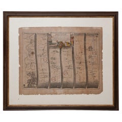
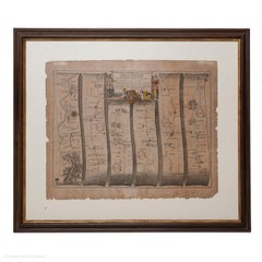
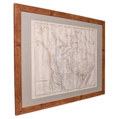
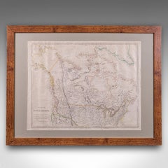
Find the exact framed london map you’re shopping for in the variety available on 1stDibs. In our selection of items, you can find modern examples as well as a contemporary version. If you’re looking for a framed london map from a specific time period, our collection is diverse and broad-ranging, and you’ll find at least one that dates back to the 18th Century while another version may have been produced as recently as the 21st Century. Adding a framed london map to a room that is mostly decorated in warm neutral tones can yield a welcome change — find a piece on 1stDibs that incorporates elements of gray, brown, black, beige and more. Creating a framed london map has been a part of the legacy of many artists, but those crafted by (after) Henri Matisse, Henri Matisse, Timothy Hogan, Nancy Newman Rice and Yanko Tihov are consistently popular. These artworks were handmade with extraordinary care, with artists most often working in lithograph, paint and paper.

How Much is a Framed London Map?

The average selling price for a framed london map we offer is $1,800, while they’re typically $300 on the low end and $275,000 for the highest priced.