Framed Sea Maps
4
to
21
149
103
147
119
53
47
41
29
29
28
24
19
17
13
13
12
10
9
7
6
5
5
5
4
4
4
4
3
3
3
3
2
2
2
2
2
2
1
1
1
1
1
1
1
1
1
1
1
1
1
1
1
1
42
42
7
4
4
Sort By
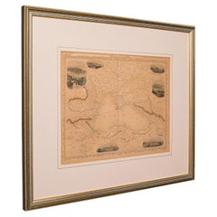
Antique Lithography Map, Black Sea, English, Framed, Cartography, Victorian
Located in Hele, Devon, GB
This is an antique lithography map of the Black Sea region. An English, framed atlas engraving of
Category
Antique Mid-19th Century British Early Victorian Maps
Materials
Wood
H 17.72 in W 20.48 in D 0.79 in
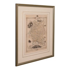
Antique Lithography Map, Western Russia, English, Framed, Cartography, Victorian
Located in Hele, Devon, GB
This is an antique lithography map of Western Russia. An English, framed atlas engraving of
Category
Antique Mid-19th Century British Early Victorian Maps
Materials
Wood
H 21.46 in W 17.33 in D 0.6 in
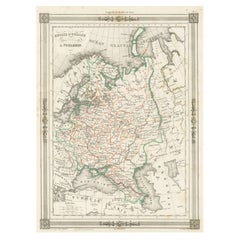
Antique Map of Russia in Europe, with Frame Style Border
Located in Langweer, NL
portions of Russia from the Arctic Sea south to the Black Sea and Caspian Sea. This map originates from
Category
Antique Mid-19th Century Maps
Materials
Paper
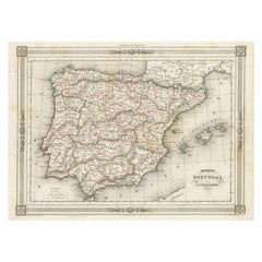
Antique Map of Spain and Portugal, with Frame Style Border
Located in Langweer, NL
Antique map titled 'Espagne et Portugal'. Attractive map of Spain and Portugal. The map covers all
Category
Antique Mid-19th Century Maps
Materials
Paper
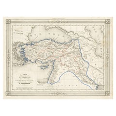
Antique Map of Turkey in Asia, with Frame Style Border
Located in Langweer, NL
Antique map titled 'Asie Ottomane ou Turquie d'Asie'. Attractive map of Turkey in Asia. The map
Category
Antique Mid-19th Century Maps
Materials
Paper
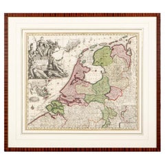
Matthaus Seutter, Framed 1730 Color Engraving Map of "Belgium Fonderatum"
Located in Bridgeport, CT
presentation inscription on the back as well as some signatures.
sight 19 1/4 x 22 1/4"
matted and framed in
Category
Antique 18th Century European Renaissance Maps
Materials
Brass
H 27.5 in W 31 in D 0.75 in
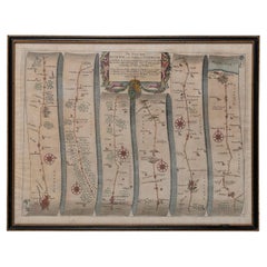
Map Road John Ogilby Britannia No 74 Ipswich to Norwich Cromer Framed
By John Ogilby
Located in BUNGAY, SUFFOLK
The Road from Ipswich com Suffolk to Norwich and thence to cromer on the sea coast com Norfolk. By
Category
Antique 1670s English Baroque Maps
Materials
Paper
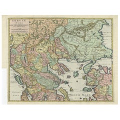
Antique Engraved Map of the Northern Part of Greece and the Aegean Sea, Ca.1730
Located in Langweer, NL
Title: "GRÆCIÆ PARS Septentrionalis".
Hand Coloured Engraved map by G. Delisle of the northern
Category
Antique 1730s Maps
Materials
Paper
H 16.93 in W 20.08 in D 0 in
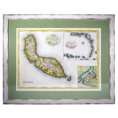
Curaçao map - C. van Baarsel en zoon
Located in UTRECHT, UT
van Cleef in The Hague in 1818. Later coloured in by hand. Size: 52,5 x 38 cm. Size including frame
Category
Antique 1810s Dutch Other Maps
Materials
Paper
17th Century Nicolas Visscher Map of Southeastern Europe
Located in Hamilton, Ontario
A beautiful, highly detailed map of southeastern Europe by Nicolas Visscher. Includes regions of
Category
Antique 17th Century Dutch Maps
Materials
Paper
Antique Map of the French Colony Guadeloupe by V. Levasseur, 1854
By Victor Levasseur
Located in Langweer, NL
the Caribbean Sea, with decorative frame containing views of the island. This map originates from
Category
Antique Mid-19th Century Maps
Materials
Paper
Hampshire County, Britain/England: A Map from Camden's" Britannia" in 1607
By John Norden
Located in Alamo, CA
part of the Isle of Wight.
The map is presented in a gold-colored wood frame with black trim and a
Category
Antique Early 17th Century English Maps
Materials
Paper
H 17.13 in W 18.75 in D 0.88 in
1899 Poole Brothers Antique Railroad Map of the Illinois Central Railroad
Located in Colorado Springs, CO
This is an 1899 railroad map of the Illinois Central and Yazoo and Mississippi Valley Railroads
Category
Antique 1890s American Maps
Materials
Paper
Imperial Splendor: Antique Map of the Ottoman Empire by Blaeu, circa 1640
Located in Langweer, NL
is a decorative element often used in maps to frame and highlight important information.
- In this
Category
Antique Mid-17th Century Maps
Materials
Paper
No Reserve
H 17.33 in W 21.54 in D 0.02 in
Italy, Sicily, Sardinia, Corsica and Dalmatian Coast: A 17th Century Dutch Map
By Theodorus Danckerts
Located in Alamo, CA
be seen sailing in the waters as a naval battle rages in the Tyrrhenian Sea.
The map is presented
Category
Antique Late 17th Century Dutch Maps
Materials
Paper
H 18.13 in W 31.25 in D 1.38 in
Antique Map of the Spice Islands 'Moluccas', Indonesia by W. Blaeu, circa 1640
By Willem Blaeu
Located in Langweer, NL
Antique map titled 'Moluccae Insulae Celeberrimae'. Highly decorative antique map of the Spice
Category
Antique Mid-17th Century Maps
Materials
Paper
H 19.69 in W 23.04 in D 0.02 in
1817 John Thomson's Handcolored Antique Map of St. Kitts, Nevis, and St. Lucia
Located in Langweer, NL
, including its mountains and natural harbors. Each island's map is framed within its own neat line border
Category
Antique Early 19th Century Maps
Materials
Paper
No Reserve
H 21.07 in W 29.34 in D 0 in
Persia, Armenia & Adjacent Regions: A 17th Century Hand-colored Map by De Wit
By Frederick de Wit
Located in Alamo, CA
attractive map of Scandinavia, which includes the Baltic Sea, Norway, Sweden, Finland, Denmark and portions
Category
Antique Late 17th Century Dutch Maps
Materials
Paper
H 23.5 in W 27 in D 1.325 in
1850 Old French Map Depicting the Entire Earth's Surface Divided into Two Parts
Located in Milan, IT
Geographical map depicting the entire earth's surface divided into two parts that correspond to the
Category
Antique Mid-19th Century French Maps
Materials
Glass, Wood, Paper
H 18.51 in W 25.99 in D 0.79 in
The Holy Land at the Time of Jesus: A 17th Century Dutch Map by Visscher
By Nicolaes Visscher II
Located in Alamo, CA
.
The map is presented in an ornate brown wood frame embellished by gold-colored leaves and gold inner
Category
Antique Mid-17th Century Dutch Maps
Materials
Paper
H 22.75 in W 28.5 in D 1.13 in
Flanders, Holland & Norfolk: Hand-Colored 17th Century Sea Chart by Collins
By Captain Greenvile Collins
Located in Alamo, CA
published until 1792.
We have 16 sea charts from this series that are all the same size and are framed
Category
Antique Late 17th Century English Maps
Materials
Paper
H 23 in W 27.75 in D 0.5 in
Dartmouth, England: A Hand-Colored 17th Century Sea Chart by Captain Collins
By Captain Greenvile Collins
Located in Alamo, CA
until 1792.
We have 16 sea charts from this series that are all the same size and are framed and
Category
Antique Late 17th Century English Maps
Materials
Paper
H 23 in W 27.75 in D 0.5 in
Plymouth, England: A Hand-Colored 17th Century Sea Chart by Captain Collins
By Captain Greenvile Collins
Located in Alamo, CA
until 1792.
We have 16 sea charts from this series that are all the same size and are framed and
Category
Antique Late 17th Century English Maps
Materials
Paper
H 23 in W 27.75 in D 0.5 in
Edinburgh, Scotland Coast: A 17th Century Hand-Colored Sea Chart by Collins
By Captain Greenvile Collins
Located in Alamo, CA
This hand-colored sea chart is entitled "Edinburgh Firth" from "Great Britain's Coasting Pilot
Category
Antique Late 17th Century English Maps
Materials
Paper
H 23 in W 27.75 in D 0.5 in
Map of the Holy Land "Carte de la Syrie et de l'Egypte" by Pierre M. Lapie
By Pierre M. Lapie
Located in Alamo, CA
An early 19th century map of ancient Syria and Egypt entitled "Carte de la Syrie et de l'Egypte
Category
Antique Early 19th Century French Maps
Materials
Paper
H 27 in W 21.38 in D 0.75 in
Original Antique Sea Chart of the Coastline from England to Gibraltar, ca.1700
Located in Langweer, NL
Antique map titled 'A Chart of the Sea-Coast from England to the Streights.'
Original antique map
Category
Antique Early 1700s Maps
Materials
Paper
No Reserve
H 18.47 in W 23.55 in D 0 in
Mediterranean Encounters: From the Punic Wars to the Hannibalic War, 1880
Located in Langweer, NL
The map, with the title "MARE INTERNUM cum populis adiacentibus a bello Hannibalico usque ad
Category
Antique 1880s Maps
Materials
Paper
Free Shipping
H 15.56 in W 18.51 in D 0 in
Mariners Chart of Quicks Hole and Tarpaulin Cove by George Eldridge 1901
Located in Norwell, MA
Washington Eldridge (1845-1912) were leading sea chart and sailing guide publishers from the mid 19th to the
Category
Antique Early 1900s North American Maps
Materials
Paper
Ireland: A Framed 17th Century Hand-colored Map by Jan Jannson
By Johannes Janssonius
Located in Alamo, CA
, augmented with two putti. The map is embellished with three sailing ships and a sea monster. Western
Category
Mid-17th Century Old Masters Landscape Prints
Materials
Engraving
H 17.88 in W 22 in D 0.75 in
Persia & Afghanistan: A Framed Hand-colored 17th Century Map by John Cary
By John Cary
Located in Alamo, CA
are included.
This hand-colored map is presented in a brown wood frame with a gold inner trim and a
Category
Early 19th Century Old Masters More Prints
Materials
Engraving
H 23.5 in W 25.75 in D 1 in
Vintage Map Print of Saint Martin Island in the Caribbean Sea, Written in Dutch.
Located in Seattle, WA
The Saint Martin island was originally St.Marthyn to the Dutch. This is a map of the island and
Category
Vintage 1970s Mid-Century Modern Prints
Materials
Metal
H 18 in W 24 in D 0.5 in
Italian modern Topographic geographical map in wood frame of Europe, 1950s-1990s
Located in MIlano, IT
Italian modern Topographic geographical map in wood frame of Europe, 1950-1990s
Three-dimensional
Category
Late 20th Century Italian Modern Decorative Art
Materials
Wood, Paper
H 28.94 in W 38.98 in D 0.79 in
Framed World Map print showing double hemisphere dating to 1642 originally, New
Located in Lincoln, Lincolnshire
This is a digitally remastered World Map Conjuring up the golden age of exploration, from an
Category
2010s British Charles II Prints
Materials
Glass, Wood, Paper
H 19.69 in W 27.56 in D 1.58 in
OLD MASTER OIL PAINTING High Quality 19th CENTURY Stormy Seas Gold Gilt Frame
By James Edward Meadows
Located in Ferndown, GB
MASTER OIL PAINTING
GOLD GILT FRAME
Description
( Mid 19th century )
Title: Stormy Sea Scene
Category
Mid-20th Century Realist Landscape Paintings
Materials
Oil
Railway Map of India.
Located in London, GB
in 1887.
The map also contains an early route highlighted in crayon showing a journey by sea to
Category
1890s Other Art Style More Art
Materials
Lithograph
Original WWII Illustrated Map Poster - Time And Tide Map Of The Atlantic Charter
By "Leslie MacDonald ""Max"" Gill"
Located in London, GB
Original vintage illustrated map poster in Spanish by the notable graphic designer, cartographer
Category
Vintage 1940s British Posters
Materials
Paper
H 44.89 in W 34.85 in D 0.04 in
Map of Hampshire County, Britain/England, from Camden's" Britannia" in 1607
By John Norden
Located in Alamo, CA
part of the Isle of Wight.
The map is presented in a gold-colored wood frame with black trim and a
Category
Early 1600s Prints and Multiples
Materials
Engraving
H 17.13 in W 18.75 in D 0.88 in
New France and Labrador - Graphite Drawing, Landscape, On Antiqued Map
By Don Pollack
Located in Chicago, IL
Coeur d’Alenes trail in Northern Idaho. It is a place of rugged and stark beauty barely on the old maps
Category
21st Century and Contemporary Contemporary Landscape Paintings
Materials
Canvas, Oil
17th Century Dutch Map of Italy, Sicily, Sardinia, Corsica and Dalmatian Coast
By Theodorus Danckerts
Located in Alamo, CA
seen sailing in the waters as a naval battle rages in the Tyrrhenian Sea.
The map is presented in a
Category
1690s Prints and Multiples
Materials
Engraving
H 18.13 in W 31.25 in D 1.38 in
Map Room, Caprarola, Italy by David Burdeny
By David Burdeny
Located in New York City, NY
x 55 inches - edition of 10
59 x 79.5 inches – edition of 5
Ask us for custom framing options
Category
2010s Contemporary Color Photography
Materials
Archival Pigment
Persia, Armenia & Adjacent Regions: A Hand-colored 17th Century Map by De Wit
By Frederick de Wit
Located in Alamo, CA
on a map.
This hand-colored map is presented in an antiqued gold-colored wood frame with an eggplant
Category
Late 17th Century Old Masters More Prints
Materials
Engraving
Frederick de WitPersia, Armenia & Adjacent Regions: A Hand-colored 17th Century Map by De Wit , 1680
H 23.5 in W 27 in D 1.325 in
[World War Two map] - Dunkirk to Berlin June 1940.
Located in London, GB
[World War Two map]
Dunkirk to Berlin June 1940 - July 1945 - A Map of the Journeys Undertaken by
Category
1940s Other Art Style More Art
Materials
Color
Original Vintage Illustrated Map Poster Afrique Equatoriale Francaise Cameroon
Located in London, GB
Original vintage illustrated map poster for Cameroun AOF Afrique Occidentale Francaise / Cameroon
Category
Vintage 1950s French Posters
Materials
Paper
H 47.25 in W 30.71 in D 0.04 in
17th Century Dutch Map of the Holy Land at the Time of Jesus by Visscher
By Nicolaus Visscher
Located in Alamo, CA
. The map depicts the Holy Land from the Mediterranean Sea to just beyond the Jordan River as it
Category
1660s Prints and Multiples
Materials
Engraving
H 22.75 in W 28.5 in D 1.13 in
Original Painting Undersea Whale Life Mag Published 1953 Illustration Ocean Sea
By Antonio Petruccelli
Located in New York, NY
Original Painting Undersea Whale Life Mag Published 1953 Illustration Ocean Sea
Antonio
Category
1950s American Realist Landscape Paintings
Materials
Gouache, Board
New Revised North America Map with Mythical Figures and Animals
Located in Houston, TX
Chez Pierre Mortier and the Creator was Guillaume de I'Isle. The map is framed in a gold wooden frame
Category
Early 1700s Naturalistic Landscape Prints
Materials
Engraving
Map of the Holy Land "Carte de la Syrie et de l'Egypte" by Pierre Lapie
By Pierre M. Lapie
Located in Alamo, CA
This is an early 19th century map of ancient Syria and Egypt entitled "Carte de la Syrie et de
Category
1830s Landscape Prints
Materials
Engraving
H 27 in W 21.38 in D 0.75 in
"Sea Goddess" Abstract Painting 16" x 16" inch by Amal Nasr
By Amal Nasr
Located in Culver City, CA
"Sea Goddess" Abstract Painting 16" x 16" inch by Amal Nasr
“New Horizon” series
There is a
Category
21st Century and Contemporary Abstract Expressionist Figurative Paintings
Materials
Canvas, Acrylic
Original Vintage Poster Illustrated Map Madagascar French Colony Industry Travel
Located in London, GB
illustrated map showing the various places on a road route, the cities and towns marked with the highlands and
Category
Vintage 1930s French Posters
Materials
Paper
H 47.25 in W 31.5 in D 0.04 in
Original Vintage Soviet Propaganda Poster Great Buildings Of Communism Map USSR
Located in London, GB
map design with an illustration of the Moscow Kremlin and skyscrapers in the capital city linked by
Category
Vintage 1950s Russian Posters
Materials
Paper
H 27.96 in W 37.01 in D 0.04 in
Original Vintage Poster Union Of South Africa Map Natural & Industrial Resources
Located in London, GB
image of a larger map of Africa marking South Africa in front of the Union flag of South Africa framing
Category
Vintage 1940s British Posters
Materials
Paper
H 19.69 in W 29.53 in D 0.04 in
Original Vintage Poster Pictorial Map Of Yorkshire British Railways Train Travel
Located in London, GB
Original vintage train travel poster - Pictorial Map of Yorkshire by British Railways - featuring a
Category
Vintage 1950s British Posters
Materials
Paper
H 40.16 in W 49.61 in D 0.04 in
Rare Set of 3 Map Samplers by A Charles. Italy, Spain & France
Located in Chelmsford, Essex
Set of 3 Map Samplers by A Charles. All depict countries, cities, seas and landmarks of the
Category
Antique Early 19th Century English Tapestries
Materials
Linen
Viking woman -Shield maiden- exotic daguerreotype reproduction Framed
By FPA Francis Pavy Artist
Located in Lafayette, LA
, Thor, and the mighty warriors who sailed the seas in search of glory and adventure. Her words painted
Category
2010s Surrealist Figurative Photography
Materials
Inkjet
Original Vintage Pictorial Map Poster Ceylon Tea And Other Industries Sri Lanka
By "Leslie MacDonald ""Max"" Gill"
Located in London, GB
Original vintage pictorial map poster for Ceylon Her Tea & Other Industries featuring artwork by
Category
Vintage 1940s British Posters
Materials
Paper
H 29.93 in W 18.9 in D 0.04 in
(Holyland-Canaan) A New Map Shewing...Places Mentioned in the New Testament.
By Edward Wells
Located in Florham Park, NJ
published.
In this map we clearly note the marvel of the many Greek islands in the vast Mediterranean Sea
Category
18th Century and Earlier Academic More Art
Materials
Engraving
'Map of Milwaukee' color lithograph published by George F. Cram of Chicago
Located in Milwaukee, WI
13.5 inches, map
30.63 x 24.13 inches, frame
Inscribed lower left "Map of Milwaukee; Published by
Category
1890s Other Art Style More Prints
Materials
Lithograph
Table Low Sofa Vintage 1950s Map Isle of Man John Speed 1610 Thomas Durham 1595
Located in BUNGAY, SUFFOLK
from 1610.
The map is inset within a fruitwood box frame with a glass top. Supported by tapering
Category
Antique 1610s English Mid-Century Modern Sofa Tables
Materials
Paper
H 16.54 in W 20.24 in D 16.54 in
Bamboo Forest, Acrylic , Caribbean, Rising from the Sea, 48 x 36, Colors
By Paddy Cohn
Located in Houston, TX
gentle winds that rise from the sea. This painting is 36" x 48" acrylic on canvas. Gallery wrapped so
Category
2010s Abstract Abstract Paintings
Materials
Acrylic, Mixed Media, Cotton Canvas
H 36 in W 48 in D 0.75 in
Blue & Grey Green Plan: Abstract Geometric Framed Painting in Cool Toned Palette
By Donise English
Located in Hudson, NY
black and white against a sea foam green colored acrylic wash background
"Blue and Grey Green Plan" made
Category
2010s Abstract Geometric Abstract Paintings
Materials
Canvas, Gouache, Archival Paper, Color Pencil, Graphite
- 1
Get Updated with New Arrivals
Save "Framed Sea Maps", and we’ll notify you when there are new listings in this category.
Framed Sea Maps For Sale on 1stDibs
An assortment of framed sea maps is available on 1stDibs. Browse a selection of modern, contemporary or Expressionist versions of these works for sale today — there are 86 modern, 26 contemporary, 14 abstract, 7 Old Masters and 5 Expressionist examples available. These items have been produced for many years, with earlier versions available from the 18th Century and newer variations made as recently as the 21st Century. You can search the framed sea maps that we have for sale on 1stDibs by color — popular works were created in bold and neutral palettes with elements of gray, blue, brown and black. (after) Henri Matisse, Henri Matisse, JOHN W. HATCH, Gregor Turk and Tiffany Blaise took a thoughtful approach to this subject that are worth considering. Frequently made by artists working in lithograph, paint and paper, all of these available pieces are unique and have attracted attention over the years.
How Much are Framed Sea Maps?
Prices for pieces in our collection of framed sea maps start at $133 and top out at $135,000 with the average selling for $1,559.
More Ways To Browse
L Pierre
Extreme Rolex
Rolex Air King Ii
Vintage Teas Sri Lanka
18th Century Sicily
Identify Rolex
Rolex Identifier
Copper Snail Sculpture
Rolex Things
Custom Engraved Rolex
Vintage Sheep Coat
Antique Furniture County Durham
Change Time On Rolex
Changing Time On A Rolex
Used Furniture Langford
Antique Office Furniture Perth
George Poole
No Time To Die Rolex
