Map Set
16
to
83
694
682
591
457
354
315
288
206
142
128
119
93
82
70
70
64
64
53
46
43
39
37
36
30
25
22
21
19
19
17
16
16
13
12
12
11
10
8
7
6
5
5
5
5
5
5
5
5
5
4
4
3
3
3
2
2
2
1
1
1
1
1
1
79
46
42
42
30
Sort By
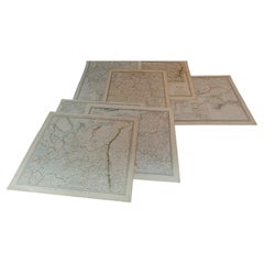
1844 Map "Russia in Eurpoe, Part II to Part VIII", 7 Maps Ric.r023
Located in Norton, MA
, the maps set a standard of excellence for commercial map-makers in England for decades to come
Category
Antique 19th Century Unknown Maps
Materials
Paper
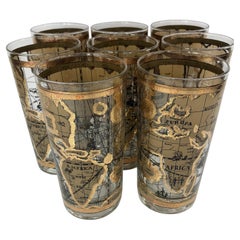
Vintage Cera Glass Highball Glasses With Old World Maps - Set of 8
By Cera
Located in Chapel Hill, NC
Set of 8 Vintage Cera Glass Highball Glasses With Old World Maps. Glasses measure 5 1/2" tall x 2 3
Category
Vintage 1970s Mid-Century Modern Barware
Materials
Glass
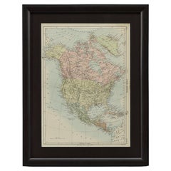
1875 "North America" Map by J. Bartholomew
Located in Colorado Springs, CO
the 9th edition there were thousands of quality illustrations and maps set into the text pages, in
Category
Antique 1870s Scottish Maps
Materials
Paper
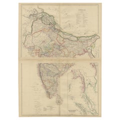
Vintage Cartographic Collection Set of India Explored - W. G. Blackie's 1859
Located in Langweer, NL
Antique Map Set" is a pair of detailed, historical maps crafted by W. G. Blackie in 1859. These maps
Category
Antique Mid-19th Century Maps
Materials
Paper
H 14.57 in W 21.26 in D 0.02 in
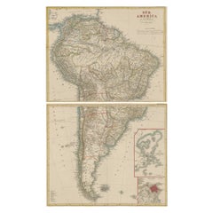
Set of Two Antique Maps of South America with Inset Maps of Rio de Janeiro
Located in Langweer, NL
Set of two antique maps titled 'Süd-America in zwei Blättern'. Two individual sheets of South
Category
Antique Mid-19th Century Maps
Materials
Paper
Free Shipping
H 14.57 in W 17.88 in D 0.02 in
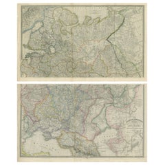
Set of 2 Antique Maps of Russia by Wyld, 1883
Located in Langweer, NL
Antique map titled 'The Russian Dominions in Europe (..)'. Two separate sheets of Russia
Category
Antique Late 19th Century Maps
Materials
Paper
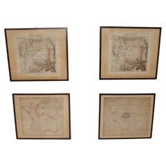
Set of 4 Antique Geographical Maps French-German War 1870-71
Located in Casale Monferrato, IT
Elegant late 19th century set of four antique geographical maps relating to the positioning of the
Category
Antique 1890s Italian Maps
Materials
Paper
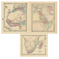
Set of Three Antique Maps of Africa by Colton (circa 1855)
Located in Langweer, NL
Set of three individual maps of Africa including 'North West Africa', 'North Eastern Africa' and
Category
Antique Mid-19th Century Maps
Materials
Paper
Set of 2 Antique Maps covering part of modern-day Czech Republic
Located in Langweer, NL
Set of two antique maps titled 'Marchionatus Moraviae circulus Preroviensis'. Two individual sheets
Category
Antique Early 18th Century Maps
Materials
Paper
Set of 2 Antique Maps of Scotland by W. G. Blackie, 1859
Located in Langweer, NL
Antique map titled 'Scotland'. Original antique map of Scotland. This map originates from ‘The
Category
Antique Mid-19th Century Maps
Materials
Paper
Set of Two Antique Maps of Northern Italy by Homann Heirs, 1754
Located in Langweer, NL
Set of two maps of northern Italy showing the position of troups during the war in April and March
Category
Antique Mid-18th Century Maps
Materials
Paper
Set of 10 Large Scale Vintage Maps of The United Kingdom, circa 1900
Located in St Annes, Lancashire
Great set of maps of the UK
Lithographs. By John Bartholomew & Co.
Published by The Edinburgh
Category
Antique Early 1900s English Maps
Materials
Paper
No Reserve
H 18 in W 23.5 in D 0.13 in
Set of 11 Antique Maps of Japan Originating from a Japanese Atlas, 1906
Located in Langweer, NL
Set of 11 antique maps depicting various regions of Japan. These maps originate from a Japanese
Category
20th Century Maps
Materials
Paper
H 12.01 in W 8.67 in D 0.02 in
Set of 4 Antique Maps of part of the United States of America
Located in Langweer, NL
Set of four individual antique maps of part of the United States. Published as part of a set of six
Category
Antique Mid-19th Century Maps
Materials
Paper
Set of Four Original Antique Maps of Asia by Bolton & Seale, circa 1770
Located in Langweer, NL
Set of four antique maps of Asia:
1) Asia plate 6, Part of China, Tibet and Tartary
2) Asia
Category
Antique Late 18th Century Maps
Materials
Paper
H 20.48 in W 16.74 in D 0.02 in
Set of two Antique Maps of the region of Oregon, Idaho, Wyoming, Nebraska & Iowa
Located in Langweer, NL
Set of two individual antique maps of part of the United States. It shows the region and
Category
Antique Late 19th Century Maps
Materials
Paper
H 15.12 in W 18.82 in D 0.02 in
Set of 2 Costume Prints and a Map of Spain and Portugal, circa 1720
Located in Langweer, NL
Set of two costume prints and a map of Spain and Portugal. The costume prints show costumes of
Category
Antique Early 18th Century Maps
Materials
Paper
Set of 2 Antique Maps of the United States by W. G. Blackie, 1859
Located in Langweer, NL
Antique map titled 'The United States of North America, Atlantic States and Valley of the
Category
Antique Mid-19th Century Maps
Materials
Paper
Set of 2 Antique Maps of Russia in Europe by W. G. Blackie, 1859
Located in Langweer, NL
Antique map titled 'Russia in Europe'. Original antique map of Russia in Europe with inset maps of
Category
Antique Mid-19th Century Maps
Materials
Paper
Antique Map of the Region of Georgia with Inset Maps of Florida and Texas
Located in Langweer, NL
southern part of Texas. This map was part of a set of six individual sheets with maps of the United States
Category
Antique Late 19th Century Maps
Materials
Paper
H 15.04 in W 18.63 in D 0.02 in
Antique Map centered on Nuremberg, Germany
Located in Langweer, NL
Antique map titled 'Territorium Norimbergense'. Beautiful map centered on Nuremberg, Germany. With
Category
Antique Mid-17th Century Maps
Materials
Paper
Antique Map of Silesia centered on Glogau
Located in Langweer, NL
skills. Blaeu set up shop in Amsterdam, where he sold instruments and globes, published maps, and edited
Category
Antique Mid-17th Century Maps
Materials
Paper
Antique Map of Persia with Dedication Cartouche
Located in Langweer, NL
set up shop in Amsterdam, where he sold instruments and globes, published maps, and edited the works
Category
Antique Mid-17th Century Maps
Materials
Paper
Antique Map of Buckinghamshire in England, 1743
Located in Langweer, NL
never possessed a complete set of county map plates and made up their atlases in the early Dutch
Category
Antique 18th Century Maps
Materials
Paper
Antique Map of Normandy by Janssonius, 1657
Located in Langweer, NL
cartographer Jodocus Hondius he also set up a business as book publisher in Amsterdam. His first map was
Category
Antique 17th Century Maps
Materials
Paper
University Chart “Black Map of North America
Located in Chillerton, Isle of Wight
Bacon,
This is a Black Physical map of North America, it is large lithograph set on Linen mounted on
Category
Early 20th Century Industrial Maps
Materials
Linen
Antique Map of Switzerland by Janssonius, 1657
Located in Langweer, NL
business as book publisher in Amsterdam. His first map was published in 1616. Around 15 years later he set
Category
Antique 17th Century Maps
Materials
Paper
Antique Map of Corsica and Sardini, 1729
Located in Langweer, NL
centuries, issued by several different publishers with many different sets of maps over nearly 200 years.
Category
Antique Early 18th Century Maps
Materials
Paper
Antique Lithography Map, Buckinghamshire, English, Framed Cartography, Victorian
Located in Hele, Devon, GB
This is an antique lithography map of Buckinghamshire. An English, framed atlas engraving of
Category
Antique Mid-19th Century British Victorian Maps
Materials
Wood, Paper
H 16.15 in W 13.19 in D 0.6 in
Antique Lithography Map, Bedfordshire, English, Framed Engraving, Cartography
Located in Hele, Devon, GB
This is an antique lithography map of Bedfordshire. An English, framed atlas engraving of
Category
Antique Mid-19th Century British Victorian Maps
Materials
Wood
H 15.75 in W 13.19 in D 0.6 in
Antique Lithography Map, Hertfordshire, English, Framed Engraving, Cartography
Located in Hele, Devon, GB
This is an antique lithography map of Hertfordshire. An English, framed atlas engraving of
Category
Antique Mid-19th Century British Victorian Maps
Materials
Wood
H 13.59 in W 15.75 in D 16.34 in
Antique Lithography Map, Lincolnshire, English, Framed, Engraving, Cartography
Located in Hele, Devon, GB
This is an antique lithography map of Lincolnshire. An English, framed atlas engraving of
Category
Antique Mid-19th Century British Victorian Maps
Materials
Wood
H 15.95 in W 13.39 in D 0.6 in
Antique Lithography Map, Gloucestershire, English, Framed Engraving, Cartography
Located in Hele, Devon, GB
This is an antique lithography map of Gloucestershire. An English, framed atlas engraving of
Category
Antique Mid-19th Century British Victorian Maps
Materials
Wood
H 15.75 in W 13 in D 0.6 in
Antique Lithography Map, Northumberland, English, Framed, Engraving, Cartography
Located in Hele, Devon, GB
This is an antique lithography map of Northumberland. An English, framed atlas engraving of
Category
Antique Mid-19th Century British Victorian Maps
Materials
Wood
H 16.74 in W 13.98 in D 0.6 in
Antique Map of Africa with Original Hand Coloring
Located in Langweer, NL
Antique map titled 'Kaart van Afrika door den Heer d'Anville'. Detailed original old map of Africa
Category
Antique Mid-18th Century Maps
Materials
Paper
Detailed Antique Map of Italy and surrounding Islands
Located in Langweer, NL
Antique map titled 'Italie volgens de allernieuwste Uitgave van den Heere d'Anville'. Very detailed
Category
Antique Mid-18th Century Maps
Materials
Paper
Antique Lithography Map, Worcestershire, English, Framed Engraving, Cartography
Located in Hele, Devon, GB
This is an antique lithography map of Worcestershire. An English, framed atlas engraving of
Category
Antique Early 19th Century British Regency Maps
Materials
Wood
H 15.95 in W 13.19 in D 0.6 in
Large Antique County Map of Leicestershire, England, 1805
Located in Langweer, NL
Explore Leicestershire's Past: Antique Map by John Cary
Step into the history of Leicestershire
Category
Antique Early 19th Century Maps
Materials
Paper
Antique Map of the Region of Oldenburg, Germany
By Willem Blaeu
Located in Langweer, NL
Antique map titled 'Oldenburg Comitatus'. Detailed old map of Oldenburg, Germany. The map also
Category
Antique Mid-17th Century Maps
Materials
Paper
Antique Map of the Northwestern Coast of Spain
Located in Langweer, NL
Antique map titled 'Gallaecia Regnum'. Original old map of the northwestern coast of Spain
Category
Antique Mid-17th Century Maps
Materials
Paper
Antique Map of Central Asia, Finely Engraved, 1841
Located in Langweer, NL
Magazine , some maps for Henry Fisher, and engraved a set for Thomas Dugdale's Curiosities of Great Britain
Category
Antique 19th Century Maps
Materials
Paper
Antique Map of France by Janssonius, c.1650
Located in Langweer, NL
Hondius he also set up a business as book publisher in Amsterdam. His first map was published in 1616
Category
Antique 17th Century Maps
Materials
Paper
Antique Map of France by Janssonius, c.1650
Located in Langweer, NL
Hondius he also set up a business as book publisher in Amsterdam. His first map was published in 1616
Category
Antique 17th Century Maps
Materials
Paper
1646 Jansson Map Entitled "Procinvia Connactiae, " Ric.a006
Located in Norton, MA
publisher in Amsterdam. His first map was published in 1616. Around 15 years later he set up a partnership
Category
Antique 17th Century Unknown Maps
Materials
Paper
Original Antique Map of the Duchy of Holstein
By Willem Blaeu
Located in Langweer, NL
Antique map titled 'Ducatus Holsatiae Nova Tabula'. Original old map of the Duchy of Holstein, the
Category
Antique Mid-17th Century Maps
Materials
Paper
17th Century Nicolas Visscher Map of Southeastern Europe
Located in Hamilton, Ontario
A beautiful, highly detailed map of southeastern Europe by Nicolas Visscher. Includes regions of
Category
Antique 17th Century Dutch Maps
Materials
Paper
Antique County Map, Norfolk, English, Framed Lithography, Cartography, Victorian
Located in Hele, Devon, GB
This is an antique lithography map of Norfolk. An English, framed atlas engraving of cartographic
Category
Antique Mid-19th Century British Victorian Maps
Materials
Glass, Wood
H 14.57 in W 16.93 in D 0.6 in
Antique County Map, Rutlandshire, English, Framed, Cartography, Victorian, 1860
Located in Hele, Devon, GB
This is an antique lithography map of Rutlandshire. An English, framed atlas engraving of
Category
Antique Mid-19th Century British Victorian Maps
Materials
Wood
H 15.75 in W 13.19 in D 0.6 in
Antique Lithography Map, County Durham, English, Framed Cartography, Victorian
Located in Hele, Devon, GB
This is an antique lithography map of County Durham. An English, framed atlas engraving of
Category
Antique Mid-19th Century British Mid-Century Modern Maps
Materials
Wood
H 13.98 in W 16.15 in D 0.6 in
Antique Lithography Map of Cheshire, English, Framed, Cartography, Victorian
Located in Hele, Devon, GB
This is an antique lithography map of Cheshire. An English, framed atlas engraving of cartographic
Category
Antique Mid-19th Century British Victorian Maps
Materials
Wood
H 13.59 in W 15.56 in D 0.6 in
Antique Lithography Map, Northamptonshire, English, Framed Cartography, C.1860
Located in Hele, Devon, GB
This is an antique lithography map of Northamptonshire. An English, framed atlas engraving of
Category
Antique Mid-19th Century British Victorian Maps
Materials
Wood
H 15.95 in W 13.19 in D 0.6 in
Antique Lithography Map, Cumbria, English, Framed Cartography Interest, Georgian
Located in Hele, Devon, GB
This is an antique lithography map of Cumbria. An English, framed engraving of cartographic
Category
Antique Early 18th Century British Georgian Maps
Materials
Wood
H 21.86 in W 25.2 in D 0.79 in
Antique Lithography Map, Durham, English, Framed, Cartography, Early Georgian
Located in Hele, Devon, GB
This is an antique lithography map of Durham. An English, framed engraving of cartographic interest
Category
Antique Early 18th Century British Georgian Maps
Materials
Wood
H 20.28 in W 21.86 in D 0.6 in
Antique Map of the Province of Overijssel, the Netherlands
Located in Langweer, NL
Hondius he also set up a business as book publisher in Amsterdam. His first map was published in 1616
Category
Antique Mid-17th Century Maps
Materials
Paper
Antique Map of the Maine Region by Janssonius, 1657
By Johannes Janssonius
Located in Langweer, NL
business as book publisher in Amsterdam. His first map was published in 1616. Around 15 years later he set
Category
Antique 17th Century Maps
Materials
Paper
Decorative and Detailed Original Antique Map of Switzerland, 1657
Located in Langweer, NL
set up a business as book publisher in Amsterdam. His first map was published in 1616. Around 15 years
Category
Antique 1650s Maps
Materials
Paper
Decorative Antique Map of the Berry Region, France, 1657
Located in Langweer, NL
Hondius he also set up a business as book publisher in Amsterdam. His first map was published in 1616
Category
Antique 1650s Maps
Materials
Paper
Original Antique Miniature Map of Persia, Published, ca.1601
Located in Langweer, NL
atlas. Theatrum Orbis Terrarum was the first systematically collated set of maps by different map makers
Category
Antique Early 1600s Maps
Materials
Paper
Antique Map of Nova Zembla by Janssonius, c.1650
Located in Langweer, NL
Hondius he also set up a business as book publisher in Amsterdam. His first map was published in 1616
Category
Antique 17th Century Maps
Materials
Paper
Antique Map of Tartary and Northeast Asia, c.1750
Located in Langweer, NL
events in the Americas. His maps and charts were finely engraved and produced, and set a high standard of
Category
Antique 18th Century Maps
Materials
Paper
- 1
- ...
Get Updated with New Arrivals
Save "Map Set", and we’ll notify you when there are new listings in this category.
Map Set For Sale on 1stDibs
Choose from an assortment of styles, material and more with respect to the map set you’re looking for at 1stDibs. A map set — often made from paper, glass and wood — can elevate any home. If you’re shopping for a map set, we have 25 options in-stock, while there are 2 modern editions to choose from as well. Your living room may not be complete without a map set — find older editions for sale from the 18th Century and newer versions made as recently as the 21st Century. When you’re browsing for the right map set, those designed in mid-century modern and modern styles are of considerable interest. You’ll likely find more than one map set that is appealing in its simplicity, but Timbur produced versions that are worth a look.
How Much is a Map Set?
The average selling price for a map set at 1stDibs is $495, while they’re typically $100 on the low end and $21,695 for the highest priced.
More Ways To Browse
Antique Furniture Worcester Ma
Antique Iowa Map
King Richard Service For 12
Wisconsin Map
Antique Maps Of Tennessee
Tunisia Antique Map
Idaho Map
Antique Alabama Map
Antique Wisconsin Maps
Alabama Map
Alabama Antique Map
Tennessee Map
Antique Map Of Alabama
Antique Map Kentucky
Cincinnati Map
Antique Map Tennessee
Antique Map Dordogne
J Beringer
