Maps
to
1,936
2,521
131
2,657
79
18
9
6
5
4
4
4
3
1
1
2,936
2,181
476
3
289
34
10
127
7
35
9
2
5
4
4
2
2,579
92
35
30
30
329
228
143
126
112
2,657
2,657
2,657
104
29
9
8
7
Maps For Sale
Period: 20th Century
Period: 19th Century
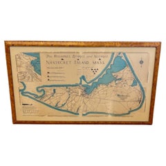
Nantucket High-Ways, By-Ways and Not-Ways Decorative Map by Tony Sarg, ca 1930
By Tony Sarg
Located in Nantucket, MA
Vintage Nantucket High-Ways, By-Ways and Not-Ways Decorative Map by Tony Sarg, (Nantucket: 1880 - 1942) circa 1930, a decorative tourist map of Nantucket Island with details of roadw...
Category
1930s American Other Vintage Maps
Materials
Paper
Pair of 19th Century English J & W Cary Celestial/Terrestrial Table Model Globes
Located in Milford, NH
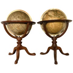
A fine assembled pair of 12-inch English table model globes on stands manufactured by J & W. Cary, the left globe with cartouche labeled “The New Celestial Globe, on which are correc...
Category
Early 19th Century English Antique Maps
Materials
Brass
Antique Map of Brazil Extending South to the Mouth of the Rio de la Plata
Located in Langweer, NL
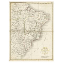
Antique map titled 'Carte du Brésil'. ?Beautiful map of Brazil extending south to the mouth of the Rio de la Plata and Buenos-Aires in Argentina. Published by Tardieu, 1821.
Pier...
Category
Early 19th Century Antique Maps
Materials
Paper
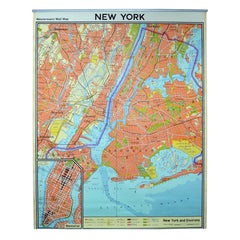
Vintage Wall Chart New York City Urban Map, USA 1950s
Located in Stockholm, SE
A classical wall chart showing a map of the city of New York. published by Westermann and with English text. Used as teaching material in Swedish schools. colorful print on paper rei...
Category
1950s German Vintage Maps
Materials
Metal
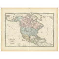
Antique Map of North America by Levasseur '1875'
Located in Langweer, NL
Antique map titled 'Carte générale de l'Amérique Septentrionale'. Large map of North America. This map originates from 'Atlas de Géographie Modern...
Category
Late 19th Century Antique Maps
Materials
Paper
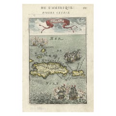
Antique 1683 Map of Hispaniola and Puerto Rico in the Caribbean by Mallet
Located in Langweer, NL
Title: 17th Century Map of Hispaniola and Puerto Rico by Mallet (1683)
This exquisite 17th-century map by Mallet, titled "I. d'Hispaniola et P.to Rico," showcases the islands of Hispaniola and Puerto Rico with remarkable detail. Published in Paris in 1683 as part of Mallet's monumental "Description de l'Univers," this map is a prime example of historical cartography from the era.
Map Features:
- Detailed depiction of Hispaniola and Puerto Rico
- Nearby islands: Inagua islands, Mayaguana, Île-à-Vache, Saona, and Mona
- Three illustrated naval battles surrounding the islands
- Hand-colored illustrations typical of the period
- Published in Paris, 1683, as part of the "Description de l'Univers"
- Engraved with artistic and geographic precision
Collectors and enthusiasts of antique maps will appreciate the historical significance and artistic detail of this rare print. Although small, the map is perfect for framing and this map serves as a captivating piece of history, reflecting the maritime exploration and territorial knowledge of the late 17th century.
The maker of the map is Allain Manesson Mallet, a notable 17th-century cartographer, military engineer, and author. Born in Paris in 1630, Mallet served in the French army and worked as a military engineer under Louis XIV. He later became a professor of mathematics and military architecture.
Mallet is best known for his monumental work, "Description de l'Univers," published in Paris in 1683. This extensive publication is considered one of the greatest works of its kind in the 17th century, providing detailed descriptions and maps of various parts of the world. Mallet's maps are renowned for their artistic quality, intricate details, and the inclusion of illustrative elements such as ships, sea creatures, and topographical features.
Mallet's contributions to cartography and his work in "Description de l'Univers" have left a lasting impact on the field, making his maps highly valued by collectors and historians.
Keywords:
- 17th-century map
- Mallet map 1683
- Hispaniola map
- Puerto Rico map
- Antique Caribbean map...
Category
1830s Antique Maps
Materials
Paper
1907 Chart of Nantucket Harbor by George Eldridge
Located in Norwell, MA
Chart of Nantucket Harbor from 1907 by cartographer George W. Eldridge. The chart shows the channel passing by the jetty into the harbor, by Brant Point to Steamboat Wharf. Also show...
Category
Early 1900s North American Antique Maps
Materials
Paper
Large Original Antique Map of Ohio, Usa, C.1900
Located in St Annes, Lancashire
Fabulous map of Ohio
Original color.
Engraved and printed by the George F. Cram Company, Indianapolis.
Published, C.1900.
Unframed.
Free shipping.
Category
1890s American Antique Maps
Materials
Paper
Antique Map of Chinese and Independent Tartary, Korea and Japan, 1806
Located in Langweer, NL
Antique map titled 'A New Map of Chinese & Independent Tartary'. Beautiful map of Chinese Tartary, Korea and Japan.
Artists and Engravers: John Cary (1755-1835) was a British car...
Category
19th Century Antique Maps
Materials
Paper
Vintage Oversized New York City Lower Manhattan 1840s Map Print
Located in Dayton, OH
Vintage late 20th century reproduction print of New York City featuring lower Manhattan in 1840.
Category
Late 20th Century Victorian Maps
Materials
Paper
Tony Sarg Map of Nantucket Town, 1937
By Tony Sarg
Located in Nantucket, MA
Tony Sarg Map of Residential Main Street, Nantucket, 1937, a black and white printed map of our historic downtown area, with images of each building, street names and whimsical figur...
Category
1930s American Other Vintage Maps
Materials
Paper
1862 Johnson's Map of the Vicinity of Richmond & Peninsular Campaign, Virginia
Located in Langweer, NL
Title: 1862 Johnson's Map of the Vicinity of Richmond & Peninsular Campaign, Virginia
Description: This 1862 map titled "Johnson's Map of the Vicinity of Richmond and Peninsular Cam...
Category
1860s Antique Maps
Materials
Paper
Antique Map of Egypt, '1875'
Located in Langweer, NL
Antique map titled 'Carte des l'Égypte'. Large map of Egypt. This map originates from 'Atlas de Géographie Moderne Physique et Politique' by A. Levasseur....
Category
Late 19th Century Antique Maps
Materials
Paper
1847 Ornamental Map of the United States & Mexico by H. Phelps
Located in Colorado Springs, CO
Offered is an original 1847 ornamental map of the U.S. entitled "Ornamental Map of the United States & Mexico" by Humphrey Phelps. The map was issued as an act of Congress by Phelps on Fulton Street, New York. The broadside is elaborately hand-colored.
This is a very detailed and graphic propaganda map of the United States expressing U.S. dominance of the North American continent. The hand-colored map proclaims the Manifest Destiny, with the recent acquisition of Upper California and Texas at the conclusion of the Mexican-American War. The newly acquired land is boldly colored, standing in stark contrast to the rest of the U.S. The map details a potential route for a railroad running from New York City, to Buffalo, to Chicago, then west along the Oregon Trail to Oregon City. This route anticipates the construction of the transcontinental railroad by nearly 20 years.
The map includes elaborately detailed renderings of George Washington, Hernan Cortez, and Montezuma at top to represent European expansion to the Americas. At bottom are four inset designs with text showing the following: a chronological history of the U.S. beginning from settlement to the U.S. victory in the Mexican-American war; an illustration of General Zachary Taylor with details on the Oregon Territory; an illustration of the Aztec Temple of the Sun in Tenochtitlan and a chronology of the Conquest of the Aztec Empire under Cortez; a portrait of General Antonio Lopez de Santa Anna...
Category
1840s American Antique Maps
Materials
Paper
Antique Map of the United States of North America, c.1882
Located in Langweer, NL
Antique map titled 'United States of North America'. Old map of the United States of North America. This map originates from 'The Royal Atlas of Modern Geography, Exhibiting, in a Se...
Category
1880s Antique Maps
Materials
Paper
Original Antique Map of Africa
Located in Langweer, NL
Antique map titled 'Afrika'. Original antique map of Africa, drawn by Van Beusekom. Published by 'Seyffardt's Boekhandel' in Amsterdam, circa 1870.
Category
Late 19th Century Antique Maps
Materials
Paper
Antique 19th Century Map of Ancient Syria & Assyria - Historical Regions, c.1802
Located in Langweer, NL
19th Century Map of Ancient Syria and Assyria: 'Tabula Regiones inter Syriam et Assyriam continens'"*
This beautifully detailed 18th-century map, titled...
Category
Early 1800s Antique Maps
Materials
Paper
World Map in Two Hemispheres: Eastern & Western - 1802 Tardieu Atlas
Located in Langweer, NL
Antique Map with Title: "Mappemonde en Deux Hémisphères"
Publication Details:
- **Atlas Title:** Nouvel Atlas Universel de Géographie Ancienne et Moderne
- **Purpose:** For the Nouvelle Edition de la Géographie de Guthrie
- **Mapmakers:** P. F. Tardieu, with contributions from various geographical works
- **Publisher:** Chez Hyacinthe Langlois, Libraire, quai des Augustins, n° 45
- **Year:** An X - 1802 (French Revolutionary Calendar)
**Geographical Scope:**
This antique map illustrates a double-hemisphere world map, showing both the Eastern (Old World) and Western (New World) hemispheres. It provides a global perspective, capturing the entire known world as understood in the early 19th century.
**Map Features:**
- **Hemispheres Displayed:**
- **Western Hemisphere:** The Americas, labeled as "Hémisphère Occidental ou Nouveau Monde...
Category
Early 1800s Antique Maps
Materials
Paper
English Mahogany Wooden Folio Stand, Map and Document Holder, circa 1820
Located in Hamilton, Ontario
Regency era mahogany wood folio stand rack, map, poster, document holder used in a library, office or den, circa 1820. Folds out to six positions ...
Category
Early 19th Century English Regency Antique Maps
Materials
Wood
End XIX century Small Terrestrial Globe Signed C.M.C Paris Papier Maché Sphere
Located in Milan, IT
Small terrestrial globe signed C.M.C. Paris, end of XIX century. Papier maché sphere and turned and ebonized wooden base. Height cm 13 - inches 5.1, diameter of sphere cm 6,5 - inche...
Category
1890s French Antique Maps
Materials
Paper
Antique Map of South East Australia by Stieler, c.1848
Located in Langweer, NL
Antique map Australia titled 'Süd-Ost Australien'. Detailed map of South East Australia. Orginates from 'Stieler's Hand Atlas', published in Germ...
Category
19th Century Antique Maps
Materials
Paper
English Engraved Hand Colored Map of the North Eastern United States, circa 1817
Located in Charleston, SC
English copper engraved hand colored map of the North Eastern United States matted under glass in a gilt frame, Early 19th Century. Drawn and Engraved for Thomson's New General Atlas...
Category
1810s English George III Antique Maps
Materials
Paper, Paint, Giltwood, Glass
Hand Colored Antique Map of the Department of Seine Et Marne, France
Located in Langweer, NL
Antique map titled 'Dépt. de Seine et Marne'. map of the French department of Seine Et Marne, France. This region produces a wide variety of wines and h...
Category
Mid-19th Century Antique Maps
Materials
Paper
Turkey in Asia: Biblical Regions and the Holy Land from The Royal Atlas (1856)
Located in Langweer, NL
This antique map titled "Turkey in Asia (Biblical Regions) The Holy Land and its Borders" comes from "The Royal Illustrated Atlas", which was published in 1856 by A. Fullarton & Co. ...
Category
Mid-19th Century Antique Maps
Materials
Paper
Antique Decorative Coloured Map Marocco, Algeria and Tunis, 1882
Located in Langweer, NL
The maps is from the 1882 atlas by Blackie & Son and offers a detailed view of the North African regions as understood in the late 19th century.
**Map of Morocco, Algeria, and Tun...
Category
1880s Antique Maps
Materials
Paper
Colonial Cartography: The Banda Islands - the Epicenter of the Spice Trade, 1818
Located in Langweer, NL
Antique map titled 'Kaart der Bandasche Eilanden' with a view titled 'Gezigt van het Eiland Neira en de Goening Api'. Rare and attractive map of the Banda Islands with a large view of Banda Neira and Gunung Api. One of 12 maps from ‘Atlas van Overzeesche bezittingen’ (Atlas of Oversea Possessions) by J.S. van den Bosch. J.S. van den Bosch (1780 – 1844), Major General, Knight of the 3rd Class of the Military William Order.
It is a rare and visually appealing representation of the Banda Islands, a group of ten small volcanic islands in the Banda Sea, part of present-day Indonesia.
The map is one of twelve from the “Atlas van Overzeesche bezittingen” (Atlas of Overseas Possessions) by J.S. van den Bosch, who was a Major General and a Knight of the Military William Order. Johannes van den Bosch, who lived from 1780 to 1844, had a significant military and administrative career, including serving as Governor-General of the Dutch East Indies. His works and collections are reflective of the Dutch colonial interest and administration in the region.
The Banda Islands, depicted in this map, are particularly famous for being the sole source of nutmeg and mace before the mid-19th century. Nutmeg was highly valued in European cuisine, as a preservative, and as a medicine. The monopoly on these spices made the Banda Islands extremely important during the age of spice trade, which also led to intense colonial competition and conflict, notably between the Dutch and the British.
The map itself provides a detailed topographical representation of the Banda Islands, possibly with depth soundings and navigational hazards indicated, which would have been essential information for the ships of the Dutch East India Company and other seafarers. The large view of Banda Neira and Gunung Api (literally "Fire Mountain...
Category
Early 19th Century Antique Maps
Materials
Paper
Antique Map of Jamaica and Hispaniola (Saint-Domingue and Santo Domingo), 1802
Located in Langweer, NL
This is an original antique map titled "Carte des Isles de la Jamaïque et de St. Domingue," depicting the islands of Jamaica and Saint-Domingue (modern-day Haiti and the Dominican Re...
Category
Early 1800s Antique Maps
Materials
Paper
Set of 2 Antique Maps of the United States by W. G. Blackie, 1859
Located in Langweer, NL
Antique map titled 'The United States of North America, Atlantic States and Valley of the Mississippi'. Original antique map of the United States of North America, Atlantic States an...
Category
Mid-19th Century Antique Maps
Materials
Paper
Early 19th Century Hand Colored Map of the United States and Caribbean Islands
Located in Hamilton, Ontario
Hand coloured early 19th century map by Giraldon of France titled "Etats Unis et Grandes Antilles" (United States and Greater Antilles).
Category
Early 19th Century French Antique Maps
Materials
Paper
Antique Map Depicting Burma, Siam, Annam (Vietnam) and Japan, 1882
Located in Langweer, NL
The image shows two maps side by side from the 1882 atlas by Blackie & Son. On the left, the map is titled "BURMAH SIAM AND ANAM," while the one on the right is labeled "JAPAN."
**B...
Category
1880s Antique Maps
Materials
Paper
20th Century Large Vintage Oval Wall Map of the World Globe Conference Table 13'
Located in Dayton, OH
Monumental oval classroom map of the world / wall globe from the second half of the 20th century. A two piece sculpture design made with heavy wood and metal trim paneling. Can be ...
Category
20th Century Maps
Materials
Metal
Old German Antique Map of Iran and Arabia, 1866
Located in Langweer, NL
Antique map titled 'Vorder-Asien oder Iran, Turan, Arabien, Kleinasien und die Kaukasus Länder'. Large map centered on Iran. It shows the area from Turkey to Mumbai in India. Include...
Category
19th Century Antique Maps
Materials
Paper
Map of Independent Tartary with Vignettes of the Region's Culture, 1851
Located in Langweer, NL
The map of Independent Tartary is part of the collection by John Tallis & Company, which were unique for their elaborate decorative elements and detailed illustrations.
**The Maker ...
Category
1850s Antique Maps
Materials
Paper
Original Antique Map of Ireland- Kerry. C.1840
Located in St Annes, Lancashire
Great map of Kerry
Steel engraving
Drawn under the direction of A.Adlard
Published by How and Parsons, C.1840
Unframed.
Category
1840s English Antique Maps
Materials
Paper
Biblical Journeys: Apostle Paul's Voyages and the Israelites' Exodus, 1856
Located in Langweer, NL
Two maps in matting board. From the Pictorial Bible Atlas, published in 1856.
Title for Map 1: Voyages and Travels of Apostle Paul – Illustrated Antique...
Category
1850s Antique Maps
Materials
Paper
Interesting Original Antique Map of South America, 1822
Located in Langweer, NL
Antique map titled 'South America'.
Map of South America with attractive topography, surrounded on three sides by text on the history, geography, and economy of the continent. Sh...
Category
19th Century Antique Maps
Materials
Paper
A 19th-Century Map of West Canada with Niagara Falls and Indigenous Scenes
Located in Langweer, NL
Decorative 19th-Century Map of West Canada with Niagara Falls and Indigenous Scenes
This detailed 19th-century map of West Canada, drawn and engraved by J. Rapkin and published by...
Category
1850s Antique Maps
Materials
Paper
Antique Print of Vietnamese Men, c.1830
Located in Langweer, NL
Antique print titled 'Cochinchine'. Two portaits of Vietnamese men one showing in military attire and the second in civilian dress. Originates from the series 'Voyage autour du monde par les mers...
Category
19th Century Antique Maps
Materials
Paper
Ornate 1850s Map of South America: A Masterpiece of Exploration & Art by Rapkin
Located in Langweer, NL
Decorative 19th-Century Map of South America by J. Rapkin, Published by J & F Tallis
Description: This beautifully detailed map of South America, drawn and engraved by J. Rapkin a...
Category
1850s Antique Maps
Materials
Paper
19th-Century Decorative Map of British America with Arctic and Pacific Vignettes
Located in Langweer, NL
19th-Century Decorative Map of British America with Arctic and Pacific Vignettes
This 19th-century map of British America, drawn and engraved by J. Rapkin and published by J & F T...
Category
1850s Antique Maps
Materials
Paper
Burnished brass earth globe - Circa 1930s
Located in Linkebeek, BE
Burnished brass earth globe - Circa 1930s
Globe - World map
Measures : 20x18cm H:25cm
Wear consistent with age and use
Category
20th Century Maps
Materials
Brass
1802 Map of Australasia and the South Pacific - European Exploration Routes
Located in Langweer, NL
1802 Johann Walch Map of Australasia and the South Pacific - European Exploration Routes
This 1802 map by Johann Walch provides a highly detailed view of Australasia and the South P...
Category
Early 1800s Antique Maps
Materials
Paper
Original Antique Map of Dresden, Germany by J. Stockdale, 1800
Located in Langweer, NL
Vintage Map of Dresden, Germany by J. Stockdale, 1800
This vintage map titled "A Plan of the City of Dresden" was published by J. Stockdale in Piccadilly, London, in 1800. It provid...
Category
Early 1800s Antique Maps
Materials
Paper
Madrid 1901: A Historical Map of Spain's Capital Province
Located in Langweer, NL
The map is of the province of Madrid, the capital region of Spain, as it appeared in 1901. Here are the key features it displays:
The map shows the central part of Spain, with the Guadarrama mountain range prominently visible, marking the natural border to the north of Madrid.
Blue lines likely indicate rivers, including the Manzanares River, which flows through Madrid, and the Jarama River, a tributary to the Tagus.
Red lines depict the roads and railways, outlining the infrastructure that connects Madrid's various towns and cities within the province and beyond.
Symbols and labels mark the locations of cities, towns, and villages, with Madrid itself likely being the focal point. Dotted lines may represent the administrative divisions within the province. The map includes a legend (Signos Convencionales) that explains the symbols used for provincial capitals, roads, railways, and other geographic features.
The coat of arms of Madrid, featuring a bear and a strawberry tree (madroño), is prominently featured, symbolizing the city's and the province's historical coat of arms.
About the province of Madrid:
Madrid is not only the capital of Spain but also the heart of the Iberian Peninsula, both geographically and politically. The city is renowned for its rich repositories of European art, including the Prado Museum's works by Goya, Velázquez, and other Spanish masters. The province of Madrid is characterized by a blend of historical and modern elements, with a rich cultural life that includes theater, opera, and flamenco, as well as gastronomy that features a mix of traditional Spanish dishes and international cuisine...
Category
Early 1900s Antique Maps
Materials
Paper
Original Antique Map of The Philippines. C.1900
Located in St Annes, Lancashire
Fabulous map of The Philippines
Original color.
Engraved and printed by the George F. Cram Company, Indianapolis.
Published, C.1900.
Unframed.
Free shipping.
Category
1890s American Antique Maps
Materials
Paper
Old Map of the American Railroad Network and All Weather Roads on Verso, 1931
Located in Langweer, NL
This is the “New Census Edition” of Clason’s United States Green Guide. It features two large maps of the United States on a single sheet.
The recto map shows the complete road net...
Category
1930s Vintage Maps
Materials
Paper
Antique Map of the Antilles by Meyer, 1878
Located in Langweer, NL
Antique map titled 'Die Antillen'. Old map of the Antilles, it shows Jamaica, Puerto Rico, the Bahamas and Cuba. With inset maps of the Lesser Antilles and Havana. This map originate...
Category
19th Century Antique Maps
Materials
Paper
Large Original Vintage Map of S.E Asia, with a Vignette of Singapore
Located in St Annes, Lancashire
Great map of South East Asia
Original color. Good condition
Published by Alexander Gross
Unframed.
Category
1920s English Vintage Maps
Materials
Paper
1948 "A Hysterical Map of Yellowstone National Park" by Jolly Lindgren, 2nd Ed.
Located in Colorado Springs, CO
Presented is a second edition printing of Jolly Lindgren’s “Hysterical Map of Yellowstone National Park.” This comical pictorial map h...
Category
1940s American Vintage Maps
Materials
Paper
Pl. 91 Antique Print of Decorative Art in the 18th Century by Racinet, 1869
Located in Langweer, NL
Old print of decorative art in the 18th century. This print originates from 'L'Ornement polychrome'. A beautiful work containing about 2000 patterns of all the styles of Art old and ...
Category
19th Century Antique Maps
Materials
Paper
Antique Decorative Coloured Map of North America, 1882
Located in Langweer, NL
This original antique map of North America is from the Blackie & Son Atlas published in 1882. Here are several points of interest about this map:
1. **Political Borders**: The map l...
Category
1880s Antique Maps
Materials
Paper
Mid-19th Century Decorative Map of India with Cultural and Natural Vignettes
Located in Langweer, NL
The Tallis maps, including the one of India, are known for their detailed and ornamental style. They were produced during the mid-19th century, a time when cartographic publishing became as much an art form as a means of geographic representation.
John Tallis & Company, founded by John Tallis, was known for creating maps with elaborate borders and vignettes surrounding the map itself. These maps often included illustrations that depicted scenes representative of the region's culture, significant local wildlife, architectural landmarks, and portraits of indigenous peoples...
Category
1850s Antique Maps
Materials
Paper
1851 Map of "Independent Tartary", Ric. R018
Located in Norton, MA
1851 Map of
Independent Tartary
"Russia"
Ric.r018
A highly decorative 1851 map of Independent Tartary by John Tallis and John Rapkin. Covers the regions between the Caspian Sea and Lake Bakquash and between Russia and Afghanistan. These include the ancient Silk Route kingdoms of Khiva, Tartaria, Kokand, and Bokhara. Today this region roughly includes Kazakhstan, Uzbekistan, Turkmenistan, Kyrgyzstan, and Tajikistan. This wonderful map offers a wealth of detail for anyone with an interest in the Central Asian portion of the ancient Silk Road. Identifies various caravan routes, deserts, wells, and stopping points, including the cities of Bokhara and Samarkand. Three vignettes by W. Bragg decorate the map, these including an image of Tartars on a Journey, a horseback Bride Chase, and a tartar camp site. Surrounded by a vine motif border. Engraved by J. Rapkin for John Tallis's 1851 Illustrated Atlas .
Tartary Antique Map...
Category
19th Century Unknown Antique Maps
Materials
Paper
Antique Map of The Nile, Egypt, Nubia and Abyssinia and Inset of Jerusalem, 1880
Located in Langweer, NL
Antique map titled 'Égypte Moderne'. Old map of Egypt, Nubia and Abyssinia (Ethiopia), Kordofan and Darfour (parts of Sudan), as well as part of Arabia. With decorative vignette of J...
Category
19th Century Antique Maps
Materials
Paper
Original Rare Antique Print of Two Ruins in Mexico, 1857
Located in Langweer, NL
Two images on one sheet depicting ruins in Mexico. This print originates from 'Die Kunstwerke vom Alterthum bis auf die Gegenwart, oder, Wegweiser durch das ganze Gebiet der bildende...
Category
19th Century Antique Maps
Materials
Paper
Pl. 81 Antique Print of Decorative Art in the 17th Century by Racinet, 1869
Located in Langweer, NL
Old print of decorative art in the 17th century. This print originates from 'L'Ornement polychrome'. A beautiful work containing about 2000 patterns of all the styles of Art old and ...
Category
19th Century Antique Maps
Materials
Paper
Hand-Colored Map of West India Islands: St. Christopher's, St. Lucia and Nevis
Located in Langweer, NL
This map, titled "West India Islands," was published by John Thomson & Co. in 1821 as part of *Thomson's New General Atlas.* The map offers detailed depictions of three key islands i...
Category
1820s Antique Maps
Materials
Paper
Large Original Vintage Map of Egypt, circa 1920
Located in St Annes, Lancashire
Great map of Egypt
Unframed
Original color
By John Bartholomew and Co. Edinburgh Geographical Institute
Published, circa 1920
Free shipping.
Category
1920s British Vintage Maps
Materials
Paper
