Maps
to
2,379
2,814
111
2,928
26
12
2
1
2,926
2,181
476
3
289
34
10
127
7
35
9
2
5
3
4
2
2,914
30
20
3
3
199
72
63
34
31
2,928
2,928
2,928
63
24
16
13
13
Maps For Sale
Period: 18th Century and Earlier
Period: 1940s
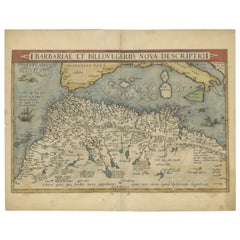
Antique Map of North Africa by Ortelius, c.1600
Located in Langweer, NL
Antique map titled 'Barbariae et Biledulgerid nova descriptio'.
Old map of coastal North Africa and the Mediterranean. The map extends from Morocco and the Sahara to Libya and sh...
Category
17th Century Antique Maps
Materials
Paper
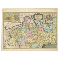
The 17th Century Map of Northern Dithmarschen and Its Towns in Germany
Located in Langweer, NL
This is a detailed colored copperplate engraving depicting northern Dithmarschen, accompanied by town plans of Weßlingburen (now Wesselburen), Lunden, and Heyde (now Heide) at the to...
Category
1640s Antique Maps
Materials
Paper
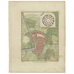
Antique Plan of the City of Damietta Egypt by C. Niebuhr, 1774
Located in Langweer, NL
Antique print titled 'Grundris der Stadt Damiât'. This print originates from 'Reisebeschreibung nach Arabien und andern umliegenden Ländern' by C. Niebuhr, 1774.
Category
Late 18th Century Antique Maps
Materials
Paper
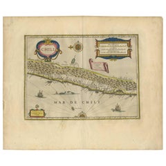
Orignal Hand-Colored Antique Map of Chili by W. Blaeu, 1658
By Willem Blaeu
Located in Langweer, NL
Very decorative antique map of Chili published by W. Blaeu, 1658. This map depicts Chile from Copiapo southward to the island of Chiloé with ships and sea monsters adorning the sea. ...
Category
Mid-17th Century Antique Maps
Materials
Paper
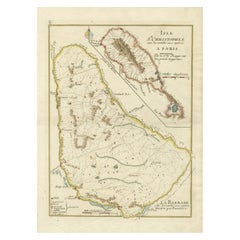
Barados and St Christopher or St Kitts and Nevis Islands in the Caribbean, 1748
Located in Langweer, NL
This original map, a copperplate engraving by Le Rouge, presents two significant areas in the Caribbean. Titled "Isle St. Christophle une des Antilles aux anglois" and "La Barbade. d...
Category
Mid-18th Century Antique Maps
Materials
Paper
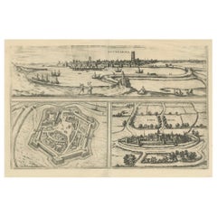
Bird's-Eye Views of Dunkerque, Gravelines, and Bourbourg by Braun and Hogenberg
Located in Langweer, NL
Bird's-Eye Views of Dunkerque, Gravelines, and Bourbourg by Braun and Hogenberg, 1597
This antique print, published in 1597 by Braun and Hogenberg, showcases three detailed bird's...
Category
16th Century Antique Maps
Materials
Paper
Antique Print of the Road Between Semarang and Kartosuro, Java, 1726
Located in Langweer, NL
Antique print titled 'Caarte Gemaakt ter Ordre van den Edelen Heer Herman de Wilde ..... Van de weg tusschen Samarang en Cartasoera.' This print shows a map of the road between Semar...
Category
18th Century Antique Maps
Materials
Paper
Decorative Map of Hanover, Lower Saxony by Lodge, ca. 1785
Located in Langweer, NL
Title: Decorative Map of Hanover, Lower Saxony by Lodge, ca. 1785
This decorative map, titled "A New & Correct Plan of Hanover, a City in the circle of Lower Saxony," was engraved b...
Category
1780s Antique Maps
Materials
Paper
Bishopric of Hildesheim Map in Northern Germany by Willem & Joan Blaeu, 1645
Located in Langweer, NL
This beautifully hand-colored map, titled "Episcopatus Hildesiensis Descriptio Novissima," depicts the Bishopric of Hildesheim, a historical ecclesiastical territory in present-day L...
Category
1640s Antique Maps
Materials
Paper
Beautiful Antique Handcolored Map of Switzerland with 33 Coats of Arms, ca.1705
Located in Langweer, NL
Antique map Switerzland titled 'La Suisse Divisee en ses Treze Cantons, ses Alliez & ses Sujets (..)'.
Beautiful map of Switzerland with 33 coats of arms. The map is dedicated to t...
Category
Early 1700s Antique Maps
Materials
Paper
Imperii Persici Delineatio: A 1722 Cartographic Masterpiece of Persia by Schenk
Located in Langweer, NL
Title: IMPERII PERCICI delineatio ex scriptis potissimum geographicis Arabum et Persarum
Cartographer: Petrus Schenk (Pieter Schenk), 1722
An original antique hand-colored engraved...
Category
1720s Antique Maps
Materials
Paper
Detailed Original Antique Map of the Turkish Empire with Arabia, 1778
Located in Langweer, NL
Title: Etats Due Grand-Seigneur En Asie, Empire De Perse, Pays Des Usbecs, Arabie et Egypte . . . 1753
Detailed map of the Turkish Empire, extending to the Black Sea, Georgia, the...
Category
1770s Antique Maps
Materials
Paper
Old Map of The Mughal Empire and the Indian Peninsula South of the Ganges, 1787
Located in Langweer, NL
This is a historical map titled "L'Empire Du Mogol, Et La Presqu Isle De L'Inde En Deca Du Gange."
An original authentic map, created by Rigobert Bonne (1727-1794), an influential ...
Category
1780s Antique Maps
Materials
Paper
Original and Decorative Antique Engraved Map of Finland and Sweden, ca.1720
Located in Langweer, NL
Antique map titled 'Ducatus Uplandiae cum Westmanniae Sudermanniae (..)'
This map shows parts of Finland and Sweden. Originally published by Frederick de Wit in the late 1600's. ...
Category
1720s Antique Maps
Materials
Paper
Antique Plan of the City of Bayonne, France
Located in Langweer, NL
Antique map titled 'Plan de Bayonne'. Original old plan of the city of Bayonne, France. This map originates from 'Le Petit Atlas Maritime (..)' by J.N. Bellin. Published 1764.
Be...
Category
Mid-18th Century Antique Maps
Materials
Paper
Antique Map of Guadelupe in the Caribbean, 1759
Located in Langweer, NL
Antique map titled 'Carte De L'Isle De La Guadeloupe'. Detailed map of Guadalupe, Mari-Galante and the Isles de Saintes. Produced by Nichlas Bellin for Prevost d'Exiles influential t...
Category
Mid-18th Century French Antique Maps
Materials
Paper
Antique Plan of Batavia, Nowadays Jakarta, Indonesia, 1780
Located in Langweer, NL
Antique map titled 'Plan der Stad en 't Kasteel Batavia'. A very rare late 18th century detailed plan of Batavia with an alpha-numeric key showing the main areas and buildings (only ...
Category
18th Century Antique Maps
Materials
Paper
Map of Northern India and Pakistan 'Mogol', Showing Kabul, Delhi Etc., 1758
Located in Langweer, NL
Antique map titled 'Mogol'.
Map of Northern India and Pakistan ('Mogol'), showing Kabul, Delhi and surroundings. This map originates from 'Kort begrip der Oude en Nieuwe Staatkun...
Category
1750s Antique Maps
Materials
Paper
Moullart-Sanson Map of the Holy Land and Sacred Geography of the Old Testament
Located in Langweer, NL
"1716 Moullart-Sanson Map of the Holy Land and Sacred Geography of the Old Testament"
This engraved map, created by Pierre Moullart-Sanson and reissued by Robert de Vaugondy in 1740...
Category
1710s Antique Maps
Materials
Paper
Antique Print of the Marketplace in Anamooka, Tonga Islands, c.1790
Located in Langweer, NL
Antique print titled 'View in Anamooka and the Inhabitants'. Depicts the marketplace that was established in a ring in front of the main house in Anamooka, Tonga - named the Friendly Islands because of his reception when James Cook's third Pacific voyage arrived there in May 1777.
Artists and Engravers: Engraved for Bankes's 'New System of Geography'. Published by Royal Authority.
Condition: Good, age-related toning. Please study image carefully.
Date: c.1790
Overall size: 38.6 x 23.2 cm.
Image size: 30.6 x 21.5 cm.
A View at Anamooka
This engraving after a drawing comes from the official account of Cook's third voyage, 'A voyage to the Pacific Ocean'.
Captain James Cook (1728-1779) made three separate voyages to the Pacific (with the ships Endeavour, Resolution, Adventure, and Discovery) and did more than any other voyager to explore the Pacific and Southern Ocean. Cook not only encountered Pacific cultures for the first time, but also assembled the first large-scale collections of Pacific objects to be brought back to Europe. He was killed in Hawaii in 1779.
Cook was in Nomuka (Annamooka), Tonga or Friendly Isles from May 1-14, 1777.
"On May 2 1777 the expedition reached Nomuka and anchored in the harbour on the north side of the island, which Cook had already used in June 1774. Both ships were in want of refreshments. A camp was erected on shore both as a trading post and a workshop for repairs. Watering, cutting wood...
Category
18th Century Antique Maps
Materials
Paper
Antique Map of Catalonia by Blaeu, circa 1650
Located in Langweer, NL
Antique map titled 'Catalonia'. Antique map of Catalonia, extending from C. De Romani on the Northern Coast to Alfachs and Panicola in Valencia on the southern end of the coast and s...
Category
Mid-17th Century Antique Maps
Materials
Paper
Antique Map of Switzerland by Homann Heirs, c.1732
Located in Langweer, NL
Antique map titled 'Potentissimae Helvetiorum Reipublicae (..)'. Beautiful detailed map of Switzerland, showing the 13 cantons. The large title cartouche showing 13 coat of arms of t...
Category
18th Century Antique Maps
Materials
Paper
Antique Map of the Bay of Bengal Printed for Robert Sayer, 1787
Located in Langweer, NL
Antique map titled 'A Chart of the Eastern Coast of the Gulf of Bengal'. Original antique map of the Bay of Bengal. The Bay of Bengal is the northeastern...
Category
Late 18th Century Antique Maps
Materials
Paper
Antique Map of Cheshire, North West England
Located in Langweer, NL
Antique map titled 'Cestria comitatus Palatinus'. Original old map of Cheshire, Northwest England. Published circa 1665 by J. Blaeu. Willem Jansz. Blaeu and his son Joan Blaeu are th...
Category
Mid-17th Century Antique Maps
Materials
Paper
Antique Print of the City of Ten-Tchoo-Foo, China, 1796
Located in Langweer, NL
Antique print titled 'View of the City of Ten-Tchoo-Foo from the Anchorage of the Hindostan in the Strait of Mi-a-Tau Bearing South-West'. Together on a sheet with 'Cape Maccartney and Cape Gower'.
The top two views depict coastal profile views of local islands named after important people in the Embassy, including Macartney, Staunton, and Gower. Below, a view of the city of Ten-Tchoo-Foo taken from aboard the Hindostan, one of the ships on the mission. These land approach views appeared in the account of George Macartney's travels to China, published by George Nicol. Macartney was Britain's first envoy to China, and was tasked with convincing Emperor Qianlong to ease restrictions on trade between Great Britain and China by allowing the British to have a permanent embassy in the country. Sir George Staunton prepared the official report, 'An Authentic Account of an Embassy from the King of Great Britain to the Emperor of China', which included charts and views based on manuscript sketches and drawings by Sir John Barrow...
Category
1790s Antique Maps
Materials
Paper
Engraving of Idols of Secotam Village in Virginia 'or now North Carolina', 1721
Located in Langweer, NL
Two religious images on one plate. Upper image 'Kiwasa idole des Virginiens'.
Kiwasa, this Idol is placed in the temple of the town of Secotam, as the keeper of the king's dead c...
Category
1720s Antique Maps
Materials
Paper
Antique Copper Engraving with a Panoramic View of Mexico City, ca.1760
Located in Langweer, NL
Description: Antique print titled 'Nouveau Mexico'.
Copper engraving with a panoramic view of Mexico city. Source unknown, to be determined.
Artists and Engravers: Engraved after ...
Category
1760s Antique Maps
Materials
Paper
Very Attractive Antique Map of the World as Planisphere, Shows Cook's Voyages
Located in Langweer, NL
Antique map titled 'Chart of the World, according to Mercators Projection'. This world map shows the various discoveries of Captain James Cook during his 3 voyages between 1768 and 1780, and the English and French Explorers who followed immediately thereafter, including Vancouver and La Perouse. This edition of the map is significantly revised from the editions issued immediately after the official report of Cook's Voyages were integrated into the map, showing better detail in New Zealand, Australia, the Northwest Coast of America and North East coast of Asia, along with Greenland. A new large lake also appears for the first time in the Western part of North America, shortly before the commencement of the Lewis...
Category
Late 18th Century Antique Maps
Materials
Paper
Rare Engraved City Plan of Nuremberg, Bavaria by Christoph Weigel, 1718
Located in Langweer, NL
Title: Rare Engraved City Plan of Nuremberg, Bavaria by Christoph Weigel, 1718
Description:
This detailed city plan of Nuremberg, Bavaria was crafted by Christoph Weigel in 1718 an...
Category
1710s Antique Maps
Materials
Paper
Hand-Colored City Plan of Cologne by Nicolas de Fer, 1705
Located in Langweer, NL
Title: Hand-Colored City Plan of Cologne by Nicolas de Fer, 1705
This hand-colored map, titled "Cologne Ville Considerable Situee sur le Bord Occidentale du Rhein Capit. de l'Electo...
Category
Early 1700s Antique Maps
Materials
Paper
Decorative Hand-Colored Map of Germany by Nicolas Sanson, 1648
Located in Langweer, NL
Title: Hand-Colored Map of Germany by Nicolas Sanson, 1648
This hand-colored map, titled "Allemagne," was created by Nicolas Sanson, a prominent 17th-century French cartographer and...
Category
1640s Antique Maps
Materials
Paper
Old Map of the Eastern Region of the Kingdom of Algiers, Algeria, 1773
Located in Langweer, NL
Antique map titled 'Kaart van het Oostelyke Deel van het Ryk van Algiers'.
Old map of the eastern region of the Kingdom of Algiers, Algeria. Originates from the first Dutch edito...
Category
1770s Antique Maps
Materials
Paper
Antique Map of Greece by Allard (c.1698)
Located in Langweer, NL
Antique map titled 'Hellas seu Graecia Universa' Detailed map of Greece, with Crete, the Aegean Islands, and part of Turkey. With two cartouches, compass rose and scale. Carolus Alla...
Category
Late 17th Century Antique Maps
Materials
Paper
Antique Colourful Map of the Island of Java and Madura, Indonesia, C.1760
Located in Langweer, NL
Antique map titled 'Nouvelle Carte de l'Isle de Java'.
Chart of the island of Java, depicting soundings around the coast, all principal harbors, rivers and elevations, bays and p...
Category
18th Century Antique Maps
Materials
Paper
Antique Map of Saldanha Bay 'Near Cape Town, South Africa' by Bellin, 1750
Located in Langweer, NL
Antique map titled ‘Carte De La Baye De Saldana ou Saldane Dressee sur les Remarques des Navigateurs’. Detailed plan of Saldanha Bay, northwest of Cape Town, South Africa. This map o...
Category
18th Century Antique Maps
Materials
Paper
1705 Golfe de Mexico and Florida Framed Map
Located in Stamford, CT
Framed map of Mexico & Florida circa 1705, Paris. Small map with Mexico and the Gulf Coast. Inset text indicating Panama, Acapulco, Mexico City and the Mississippi. Extends North to ...
Category
Early 1700s French Spanish Colonial Antique Maps
Materials
Glass, Wood, Paper
Antique Map of Madagascar by N. Sanson, circa 1680
Located in Langweer, NL
Antique map titled 'Isle de Madagascar ou de St. Laurens. Tiree de Sanutu &c'. Antique map of Madagascar, first published by Sanson in 1657. Sanson n...
Category
Late 17th Century Antique Maps
Materials
Paper
Senex Map of Castile, Leon & La Mancha in The Spanish Heartland, 1714
Located in Langweer, NL
This antique map, titled "A Map of Old & New Castile from the Observations of Rodrigo Mendes Silva and others," depicts the regions of Old Castile and New Castile in Spain, along with the Kingdom of Leon, Estremadura, La Mancha, among others. The map dates back to the early 18th century, a period marked by significant political shifts and territorial changes in Europe, particularly illustrated by the War of the Spanish Succession (1701–1714) that reshaped Spain’s governance and regional boundaries.
The map itself was published in 1714 by John Senex, a prominent English mapmaker, surveyor, globemaker, and geographer of the early eighteenth century. He was apprenticed as a young man to bookseller Robert Clavell and collaborated with notable mapmakers such as Jeremiah Seller and Charles Price. In 1728, Senex's contributions to geography and mapping were recognized when he was elected a Fellow of the Royal Society, an exceptional honor for a mapmaker, underlining his significant role as the Society's engraver and a publisher of maps by Edmund Halley and other notable figures.
John Senex is renowned for his English Atlas, first published in the same year as this map, 1714, and continued to be printed until the 1760s. Following his death in 1740, his widow Mary Senex managed the business until 1755. Afterward, the stock passed to William Herbert and Robert Sayer for maps, and to James Ferguson for globes.
The map serves not just as a geographical record but also as a historical document, reflecting the territorial divisions significant to Spain's political and economic structure at the time. The focus on Old and New Castile underscores their importance during a transformative era in Spanish history.
Here are some potentially significant places and features of this map:
1. **Old Castile (Castilla la Vieja)**: Historically significant as part of the former Kingdom of Castile, this region includes major cities such as Burgos and Valladolid. These cities could be popular search...
Category
Early 18th Century Antique Maps
Materials
Paper
Rare 16th Century Original Handcolored Miniature Map of Java, Indonesia, 1616
Located in Langweer, NL
Very handsome original old coloured copper engraving by Bertius of the island of Java in the early days of the Dutch colonisation - at that time named The Dutch East Indies or nowada...
Category
1610s Antique Maps
Materials
Paper
Antique Map of the North Sea and Dunkirk
Located in Langweer, NL
Untitled map of the North Sea, top left a large compass rose, bottom right Dunkirk (Duinkerke / Dunkerque), France. Part of a bundled collection of plans of battles and cities renown...
Category
Early 18th Century Antique Maps
Materials
Paper
Antique Map of Yemen by Schraembl, 1789
Located in Langweer, NL
Antique map titled 'Karte von dem groessten Theil des Landes Jemen'. Original map of Yemen, this map is the first printed map specifically of Yemen, and t...
Category
Late 18th Century Antique Maps
Materials
Paper
Attractive Hand-Tinted Antique Map of Japan, Published in 1752
Located in Langweer, NL
Nice decorative hand tinted map of Japan with the title (in French): Carte de L'Empire du Japon Bellin, 1752
This antique map is engraved with very attractive title cartouche.
...
Category
1750s Antique Maps
Materials
Paper
Antique Plan of Aigues-Mortes, France
Located in Langweer, NL
Antique map titled 'Plan d'Aiguesmortes et environs'. Original plan of the region of Aigues-Mortes, France. This map originates from 'Le Petit Atlas Maritime (..)' by J.N. Bellin. Pu...
Category
Mid-18th Century Antique Maps
Materials
Paper
Old Map of Tartary with Persia, Siberia, the Mogul Territories & China, ca.1717
Located in Langweer, NL
Antique map titled 'A Map of Independent Tartary, containing the territories of Usbeck, Gasgar, Tibet, Lassa & c'.
Old map depicting east of the Caspian Sea with parts of Persia, Siberia, the Mogul territories and on to western China...
Category
1710s Antique Maps
Materials
Paper
Antique Map of China, Korea, Japan and the Northern Philippines, circa 1780
Located in Langweer, NL
Antique map titled 'Carte de l'Empire de la Chine de la Tartarie Chinoise, et du Royaume de Corée'. Interesting and detailed map of China, Korea, Japan and the Northern Philippines. ...
Category
Late 18th Century Antique Maps
Materials
Paper
Map of Amersfoort and Surroundings by Covens & Mortier, published in 1747
Located in Langweer, NL
Map of Amersfoort and Surroundings by Covens & Mortier, published in 1747
Hand-coloured copper engraving titled *Carte Particulière des Environs de Amersfoort*, created by Jean Cove...
Category
1740s Antique Maps
Materials
Paper
Old Engraving of the Bairam Celebration, the Easter of the Muslims, 1737
Located in Langweer, NL
Antique print titled 'Le Bairam ou la Paque des Mahometans'.
Old print of the Bairam celebration, the Easter of the Muslims. Originates from 'Ceremonies et coutumes Religieuses.....
Category
1730s Antique Maps
Materials
Paper
Northern Scotland: A 16th Century Hand-colored Map by Mercator
Located in Alamo, CA
A framed hand-colored 16th century map of Northern Scotland by Gerard Mercator entitled "Scotiae pars Septentrionalis", published in Amsterdam in 1636. It is a highly detailed map of the northern part of Scotland, with the northwest Highlands and the cities Inverness and Aberdeen, as well as the Orkney Islands and the Hebrides. There is a decorative title cartouche in the upper left corner.
The map is presented in an antiqued brown wood...
Category
16th Century Dutch Antique Maps
Materials
Paper
Old Engraving of Volcano Piton de la Fournaise on Reunion Island, c.1750
Located in Langweer, NL
Antique print titled 'Eiland van St. Filippus, of van Fuego, met zyn vuurberg'. Old print of Piton de la Fournaise, a shield volcano on the eastern side of Reunion island...
Category
18th Century Antique Maps
Materials
Paper
Rare Antique Miniature Map of Pakistan, India and Cambaia, ca.1616
Located in Langweer, NL
Old 17th century miniature antique map of 'Cambaia' , from the 1616 edition of Jadocus Hondius Atlas by Petrus Bertius.
Original copperplate engraving with hand coloring.
Carto...
Category
17th Century Antique Maps
Materials
Paper
Antique Map of England by Mercator/Hondius, circa 1600
Located in Langweer, NL
Antique map titled 'Westmorlandia, Lancastria, Caernvan, Denbigh, Flint, Merionidh, Dalopia cum issulis Mania et Anglesey'. Original antique map of England...
Category
16th Century Antique Maps
Materials
Paper
Antique Frontispiece of an Old Dutch Book Depicting Globe Makers, 1717
Located in Langweer, NL
Antique frontispiece titled 'Iets voor Allen'. This print originates from 'Iets voor Allen, zijnde een Verhandeling en Verbeelding Van allerhande Standen, Studien, Konsten, Wetenscha...
Category
18th Century Antique Maps
Materials
Paper
Original Antique Map of Syria Phoenice by Van Dùren '1749'
Located in Langweer, NL
Interesting Antique map published in Germany titled 'Neue Vorstellung von Phoenice und Syrien (..)' This map is engraved with a lot of details. It is an original antique map of Syria...
Category
Mid-18th Century Antique Maps
Materials
Paper
Antique Map of the Middle East by Mortier, 1700
Located in Langweer, NL
Antique map titled 'Carte de la Situation du Paradis Terrestre (..)'. Detailed map of the Holy Land and the Middle East, centered on the Garden of Eden and including a large Cyprus. ...
Category
18th Century Antique Maps
Materials
Paper
Historic Map of the Bishopric of Paderborn by Blaeu, a Masterpiece of 1645
Located in Langweer, NL
This hand-colored map, titled "Paderbornensis Episcopatus Descriptio Nova," depicts the Bishopric of Paderborn, a historical ecclesiastical territory within the Holy Roman Empire, lo...
Category
1640s Antique Maps
Materials
Paper
Antique Map of the Burgundy Region by Mallet, c.1683
Located in Langweer, NL
Antique map titled 'Cercle de Bourgogne'. Detailed miniature map of the Burgundy region, France. Also shows the Netherlands and Belgium. Originates from Mallet's 'Description de l'Un...
Category
17th Century Antique Maps
Materials
Paper
Antique Plan of Meaco, Kyoto, Japan
Located in Langweer, NL
Antique map titled 'Plan de la Ville de Meaco - Platte-Grond van de Stad Miaco'. Detailed and unusual antique copper engraved plan of Kyoto, ancient named Meaco, when it was the capi...
Category
Mid-18th Century Antique Maps
Materials
Paper
Antique Map of Java and Madura Island, Indonesia, c.1760
Located in Langweer, NL
Antique map titled 'Idee de l'Isle de Java.'
Well engraved and attractive chart of the island shows all principal harbors and coastal details, plus rivers, mountains and volcanoe...
Category
18th Century Antique Maps
Materials
Paper
